Copper Brae

Downs, Moorland in Yorkshire Richmondshire

England

Copper Brae

Old limekiln at Middle Bank
Old limekiln at Middle Bank Credit: Chris Holifield

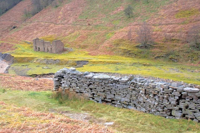
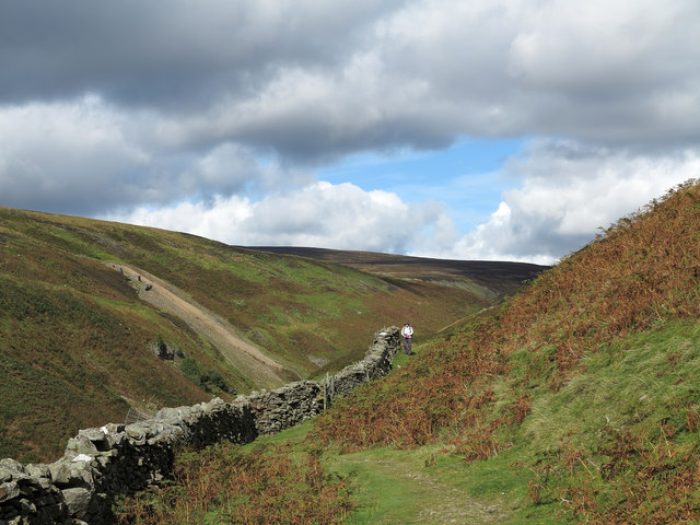
Copper Brae is a picturesque village located in the heart of Yorkshire, England. Nestled between the sprawling Yorkshire Downs and the vast Moorland, this small community boasts stunning natural beauty and a charming, idyllic atmosphere.

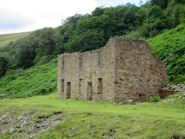
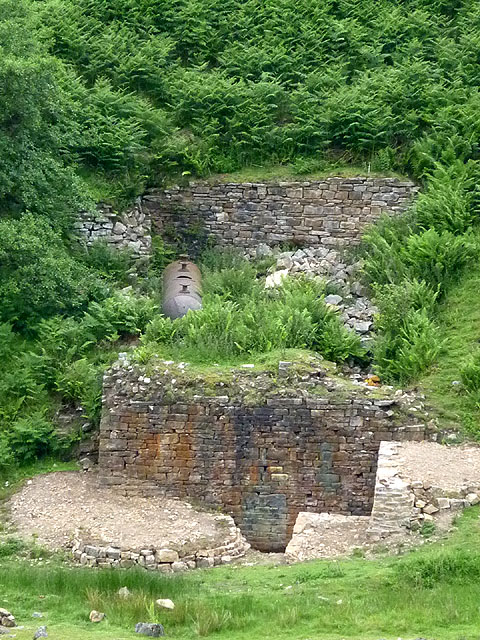
Surrounded by rolling hills and verdant countryside, Copper Brae offers visitors and residents alike a tranquil retreat from the hustle and bustle of city life. The village is dotted with quaint cottages made of local stone, adding to its traditional English countryside charm. The streets are lined with colorful flowers and well-manicured gardens, creating a visual feast for the eyes.

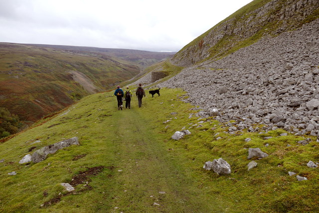
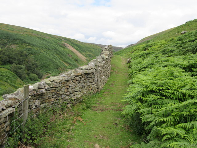
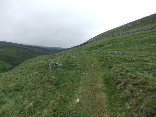
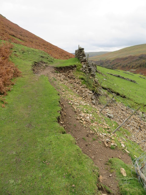
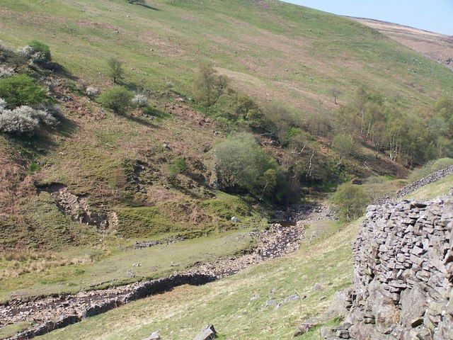
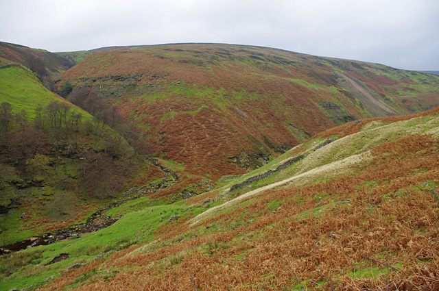
The Yorkshire Downs, which provide a stunning backdrop to Copper Brae, offer a wealth of outdoor activities for nature enthusiasts. Hiking and walking trails crisscross the landscape, leading adventurers to breathtaking viewpoints and hidden gems. The hills are also a popular spot for paragliding and cycling, attracting thrill-seekers from far and wide.

In contrast, the nearby Moorland presents a different kind of beauty. Stretching as far as the eye can see, the rugged terrain is covered in heather and ferns, creating a wild and untamed landscape. The Moorland is home to a variety of wildlife, including birds of prey and rare species such as the black grouse.

Copper Brae is also known for its warm and welcoming community. The village hosts regular events and festivals, where locals and visitors gather to celebrate and enjoy traditional Yorkshire fare. The village pub is a popular meeting spot, offering a cozy and friendly atmosphere for residents and visitors to socialize.

Overall, Copper Brae is a hidden gem in Yorkshire, offering a peaceful escape into nature and a slice of traditional English village life.

If you have any feedback on the listing, please let us know in the comments section below.
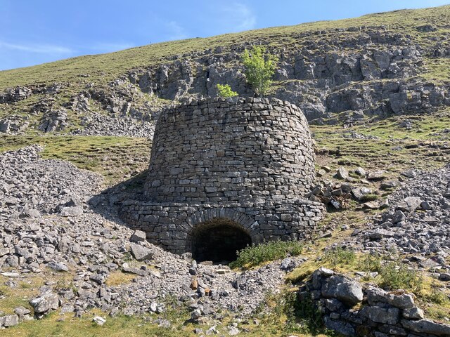
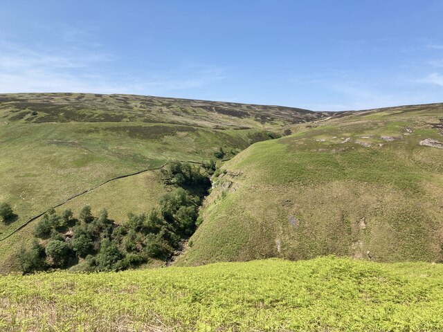
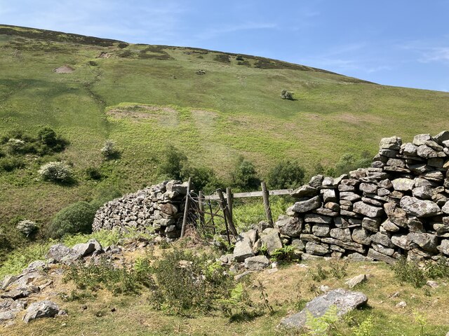
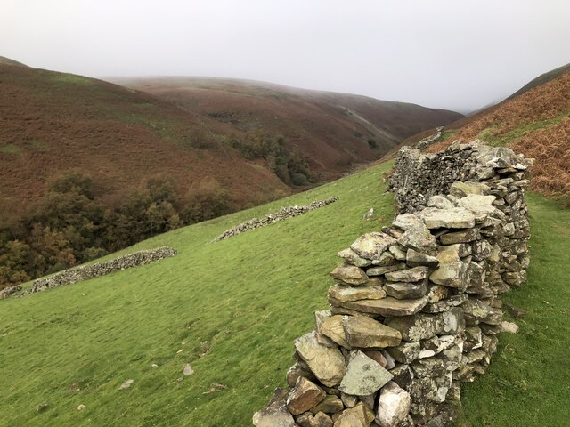
Copper Brae Images

Images are sourced within 2km of 54.383398/-2.0911627 or Grid Reference SD9498. Thanks to Geograph Open Source API. All images are credited.

Old limekiln at Middle Bank
Botcher Gill
Botcher Gill
Drystone wall at Middle Bank
Formerly enclosed pasture at Middle Bank
Gunnerside Gill track below Winterings Scar This bridleway from Blades into Gunnerside Gill is excellent going for a mountain bike, as well as on foot, but if one is doing a round trip over Melbecks Moor by bike, the track that ascends behind the lime kiln (technically only a public footpath) is a far safer option than the bridleway in the steep and rocky Bunton Hush that would be the legal way of doing it.
Gunnerside Gill track below Winterings Scar
This bridleway from Blades into Gunnerside Gill is excellent going for a mountain bike, as well as on foot, but if one is doing a round trip over Melbecks Moor by bike, the track that ascends behind the lime kiln (technically only a public footpath) is a far safer option than the bridleway in the steep and rocky Bunton Hush that would be the legal way of doing it.
Wall, footpath and bracken Above Gunnerside Beck
Wall, footpath and bracken
Above Gunnerside Beck
Ruined mine building Adjacent to Gunnerside Beck.
Ruined mine building
Adjacent to Gunnerside Beck.
Path on Winterings Pasture
Path erosion at Middle Bank At this point a minor landslip has taken out the wall and part of the path above it. Over the last five years this has developed from a minor gap of no more than a couple of metres to one that is now nearer 15m in length. The farmer has plugged the gap with mesh fencing, whilst the walked path is gradually moving uphill. Just one of several path problems in and around Gunnerside Gill.
Path erosion at Middle Bank
At this point a minor landslip has taken out the wall and part of the path above it. Over the last five years this has developed from a minor gap of no more than a couple of metres to one that is now nearer 15m in length. The farmer has plugged the gap with mesh fencing, whilst the walked path is gradually moving uphill. Just one of several path problems in and around Gunnerside Gill.
Gunnerside Beck
Gunnerside Beck
Restoration at the Sir Francis Mine The masonry at the air tank near the Sir Francis Mine remains seems to have been recently consolidated. This appears to be an ongoing project at Gunnerside Gill.
Restoration at the Sir Francis Mine
The masonry at the air tank near the Sir Francis Mine remains seems to have been recently consolidated. This appears to be an ongoing project at Gunnerside Gill.
Wall on Black Brae
Wall on Black Brae
Gunnerside Gill View from the east side of the gill, just south of the Barbara Level. 
Across the gill, Botcher Gill is on the left and the spoil from Dolly Lead Level can be seen on the right.
Gunnerside Gill
View from the east side of the gill, just south of the Barbara Level. Across the gill, Botcher Gill is on the left and the spoil from Dolly Lead Level can be seen on the right.
Dry Stone Wall Corner With Sir Francis Mine in the distance (<a href="https://www.geograph.org.uk/gridref/SD9499">SD9499</a>).
Dry Stone Wall Corner
With Sir Francis Mine in the distance (SD9499).
Dry stone wall on Middle Bank Middle Bank is a location below Winterings Edge on the east side of Gunnerside Gill. A public footpath runs alongside the wall.
Dry stone wall on Middle Bank
Middle Bank is a location below Winterings Edge on the east side of Gunnerside Gill. A public footpath runs alongside the wall.
Botcher Gill  Falls On the west side of Gunnerside Gill.
Botcher Gill Falls
On the west side of Gunnerside Gill.
Gunnerside Gill from Winterings End Close by a well graded path that leads towards the Barbara Mine and other old workings in the gill.
Gunnerside Gill from Winterings End
Close by a well graded path that leads towards the Barbara Mine and other old workings in the gill.
Limekiln near Winterings A rather fine limekiln at the junction of two paths on the eastern side of Gunnerside Gill.  As usual, the builders have chosen the site with care - close to a source of limestone, facing the prevailing wind, and next to a well graded track.
Limekiln near Winterings
A rather fine limekiln at the junction of two paths on the eastern side of Gunnerside Gill. As usual, the builders have chosen the site with care - close to a source of limestone, facing the prevailing wind, and next to a well graded track.
Show me another place!

Copper Brae is located at Grid Ref: SD9498 (Lat: 54.383398, Lng: -2.0911627)

Division: North Riding

Administrative County: North Yorkshire

District: Richmondshire

Police Authority: North Yorkshire

What 3 Words

///upward.porch.poets. Near Bowes, Co. Durham

Related Wikis

Ivelet

Ivelet is a hamlet in the Yorkshire Dales, North Yorkshire, England about a mile west of Gunnerside in Swaledale. Ivelet Bridge crosses the River Swale...

Satron

Satron is a hamlet in Swaledale, North Yorkshire, England. It lies 0.6 miles (1 km) south west of Gunnerside on the opposite bank of the River Swale. It...

Gunnerside

Gunnerside is a village in North Yorkshire, England. It is situated in Swaledale, on the B6270 road, 3 miles (5 km) east of Muker and 6 miles (10 km) west...

Gunnerside Gill

Gunnerside Gill (or Ghyll) is a small valley in the Yorkshire Dales, England, which branches off Swaledale into moorland to the north of Gunnerside. The...

Melbecks

Melbecks is a civil parish in North Yorkshire, England. It is located in upper Swaledale and covers the settlements of Gunnerside, Low Row, Feetham and...

Muker

Muker is a village and civil parish at the western end of Swaledale in North Yorkshire, England, within the Yorkshire Dales. The parish includes the hamlets...

Arn Gill (North Yorkshire)

Arn Gill is a ravine or gully containing a beck of the same name, near the village of Muker in Swaledale, North Yorkshire, England. The ravine and beck...

Crackpot, North Yorkshire

Crackpot is a village in Swaledale, North Yorkshire, England. Its name derives from the Old English kraka (crow) and the Viking word pot (usually a pit...

Nearby Amenities

Located within 500m of 54.383398,-2.0911627
Power: pole
Lat/Long: 54.3802543/-2.0904547
Power: pole
Lat/Long: 54.3801012/-2.0859916
Power: pole
Lat/Long: 54.3799477/-2.0867393
Power: pole
Lat/Long: 54.3800653/-2.0891297
Power: pole
Lat/Long: 54.3801622/-2.0898378
Power: pole
Lat/Long: 54.3799497/-2.0883117
Power: pole
Lat/Long: 54.3803606/-2.091093
Power: pole
Lat/Long: 54.3798345/-2.0874974
The data included in this document is from www.openstreetmap.org. The data is made available under ODbL.

Have you been to Copper Brae?

Leave your review of Copper Brae below (or comments, questions and feedback).