Rutter Wood

Wood, Forest in Yorkshire Richmondshire

England

Rutter Wood

Old limekiln at Middle Bank
Old limekiln at Middle Bank Credit: Chris Holifield

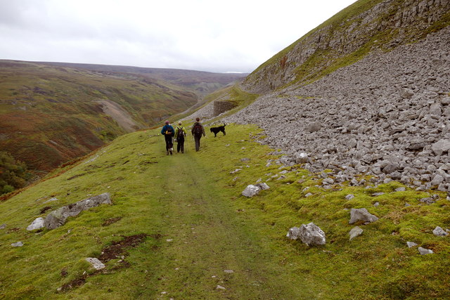
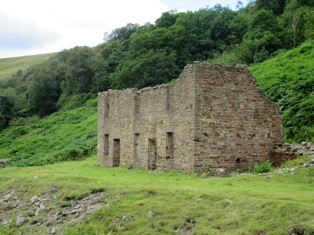
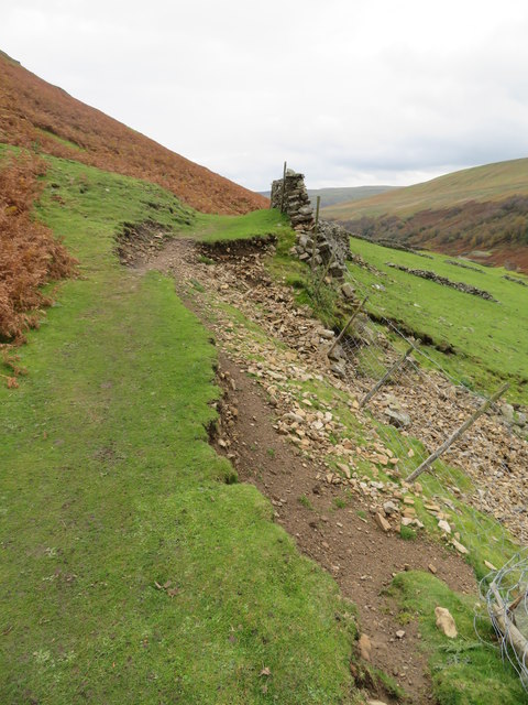
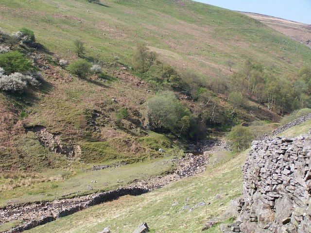
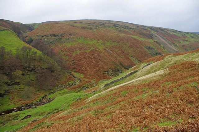
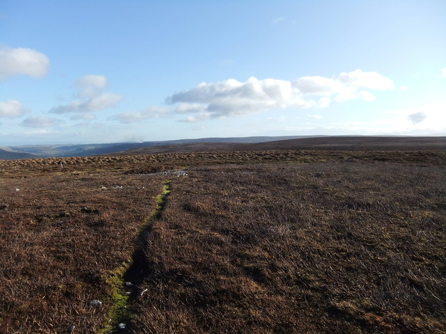
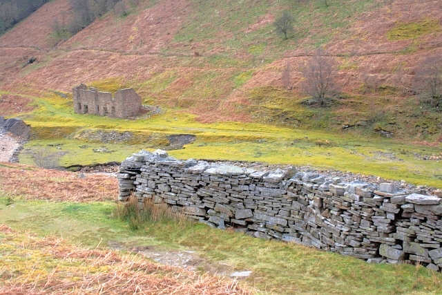
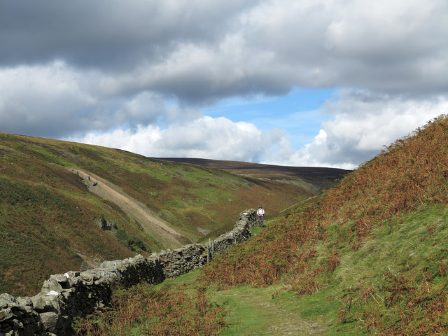
Rutter Wood is a quaint and picturesque woodland located in the county of Yorkshire, England. Situated near the village of Rutter, this forested area spans across an expansive 100 acres of land. Known for its natural beauty, Rutter Wood attracts numerous visitors throughout the year, including nature enthusiasts, hikers, and birdwatchers.

The woodland is characterized by its diverse range of tree species, including oak, birch, beech, and pine, which create a rich and vibrant ecosystem. The dense canopy formed by these trees provides a cool and tranquil environment, ideal for those seeking a peaceful retreat away from the hustle and bustle of urban life.

Rutter Wood is also home to an array of wildlife, making it a haven for animal lovers and nature photographers. Deer, foxes, and rabbits are commonly spotted within the woodland, adding to its charm and allure. Birdwatchers can also enjoy the melodious songs of various avian species, such as woodpeckers, owls, and thrushes.

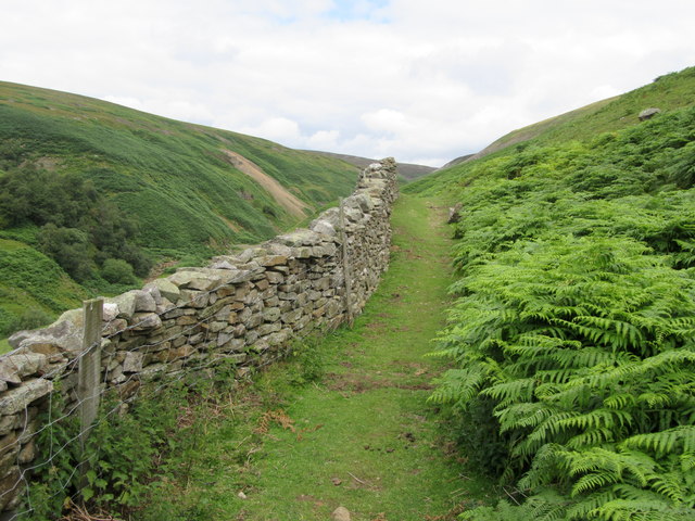
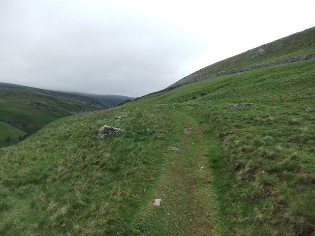
For outdoor enthusiasts, Rutter Wood offers a network of well-maintained footpaths and trails, providing opportunities for leisurely walks and invigorating hikes. These pathways wind through the forest, offering glimpses of stunning vistas and allowing visitors to fully immerse themselves in the natural beauty of the surroundings.

Overall, Rutter Wood in Yorkshire is a hidden gem, offering a serene escape into nature. Its enchanting woodland, diverse flora and fauna, and ample recreational opportunities make it a cherished destination for locals and tourists alike.

If you have any feedback on the listing, please let us know in the comments section below.
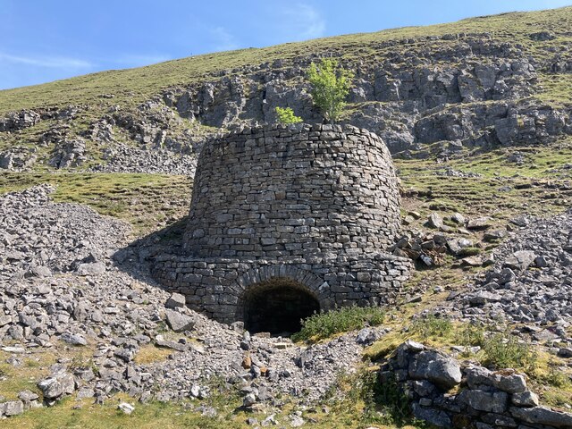
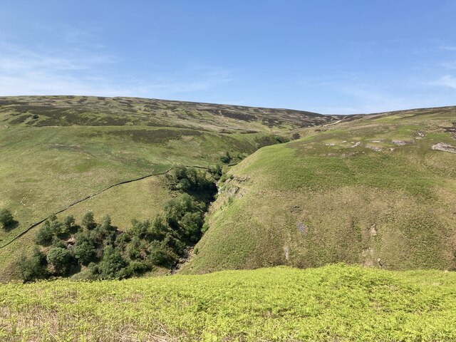
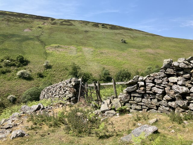
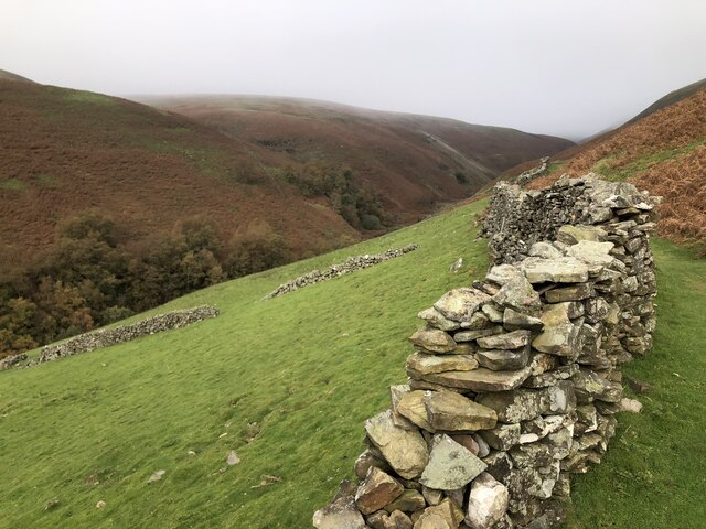
Rutter Wood Images

Images are sourced within 2km of 54.386002/-2.0807133 or Grid Reference SD9498. Thanks to Geograph Open Source API. All images are credited.

Old limekiln at Middle Bank
Botcher Gill
Botcher Gill
Drystone wall at Middle Bank
Formerly enclosed pasture at Middle Bank
Gunnerside Gill track below Winterings Scar This bridleway from Blades into Gunnerside Gill is excellent going for a mountain bike, as well as on foot, but if one is doing a round trip over Melbecks Moor by bike, the track that ascends behind the lime kiln (technically only a public footpath) is a far safer option than the bridleway in the steep and rocky Bunton Hush that would be the legal way of doing it.
Gunnerside Gill track below Winterings Scar
This bridleway from Blades into Gunnerside Gill is excellent going for a mountain bike, as well as on foot, but if one is doing a round trip over Melbecks Moor by bike, the track that ascends behind the lime kiln (technically only a public footpath) is a far safer option than the bridleway in the steep and rocky Bunton Hush that would be the legal way of doing it.
Wall, footpath and bracken Above Gunnerside Beck
Wall, footpath and bracken
Above Gunnerside Beck
Ruined mine building Adjacent to Gunnerside Beck.
Ruined mine building
Adjacent to Gunnerside Beck.
Bridge over Ashpots Gutter This very finely crafted bridge, over what is quite frankly a tiddler of a stream, has been built for grouse shooting parties on the Gunnerside Estate, but is handily placed at the point where a PROW crosses the moor.
Bridge over Ashpots Gutter
This very finely crafted bridge, over what is quite frankly a tiddler of a stream, has been built for grouse shooting parties on the Gunnerside Estate, but is handily placed at the point where a PROW crosses the moor.
Path on Winterings Pasture
Groove of Ash Pot Gutter Ash Pot Gutter is a minor stream feeding water into Mill Gill, itself a tributary of the River Swale. The pale twigs are stems of dead heather, probably burnt by the owning estate as part of their management of the grouse moor; new growth is coming through.
Groove of Ash Pot Gutter
Ash Pot Gutter is a minor stream feeding water into Mill Gill, itself a tributary of the River Swale. The pale twigs are stems of dead heather, probably burnt by the owning estate as part of their management of the grouse moor; new growth is coming through.
Path erosion at Middle Bank At this point a minor landslip has taken out the wall and part of the path above it. Over the last five years this has developed from a minor gap of no more than a couple of metres to one that is now nearer 15m in length. The farmer has plugged the gap with mesh fencing, whilst the walked path is gradually moving uphill. Just one of several path problems in and around Gunnerside Gill.
Path erosion at Middle Bank
At this point a minor landslip has taken out the wall and part of the path above it. Over the last five years this has developed from a minor gap of no more than a couple of metres to one that is now nearer 15m in length. The farmer has plugged the gap with mesh fencing, whilst the walked path is gradually moving uphill. Just one of several path problems in and around Gunnerside Gill.
Ash Pot Gutter draining east from the Melbecks Moor track This track is obviously still of importance to someone long after the demise of lead mining on the moor which was the original raison d'être for most of the rights of way up here, since Ash Pot Gutter crosses it by a recent-looking and substantial concrete ford. There's maybe a quarter square kilometre of catchment at this point where a number of small sikes have coalesced to form a single stream which has only one tributary, on its right bank, all the way down to its confluence with Old Gang Beck a little over a kilometre from this point.
Ash Pot Gutter draining east from the Melbecks Moor track
This track is obviously still of importance to someone long after the demise of lead mining on the moor which was the original raison d'être for most of the rights of way up here, since Ash Pot Gutter crosses it by a recent-looking and substantial concrete ford. There's maybe a quarter square kilometre of catchment at this point where a number of small sikes have coalesced to form a single stream which has only one tributary, on its right bank, all the way down to its confluence with Old Gang Beck a little over a kilometre from this point.
Gunnerside Beck
Gunnerside Beck
Restoration at the Sir Francis Mine The masonry at the air tank near the Sir Francis Mine remains seems to have been recently consolidated. This appears to be an ongoing project at Gunnerside Gill.
Restoration at the Sir Francis Mine
The masonry at the air tank near the Sir Francis Mine remains seems to have been recently consolidated. This appears to be an ongoing project at Gunnerside Gill.
Gunnerside Gill View from the east side of the gill, just south of the Barbara Level. 
Across the gill, Botcher Gill is on the left and the spoil from Dolly Lead Level can be seen on the right.
Gunnerside Gill
View from the east side of the gill, just south of the Barbara Level. Across the gill, Botcher Gill is on the left and the spoil from Dolly Lead Level can be seen on the right.
Near the 578m spot height on Melbecks Moor An unmarked hill
Near the 578m spot height on Melbecks Moor
An unmarked hill
Dry Stone Wall Corner With Sir Francis Mine in the distance (<a href="https://www.geograph.org.uk/gridref/SD9499">SD9499</a>).
Dry Stone Wall Corner
With Sir Francis Mine in the distance (SD9499).
Dry stone wall on Middle Bank Middle Bank is a location below Winterings Edge on the east side of Gunnerside Gill. A public footpath runs alongside the wall.
Dry stone wall on Middle Bank
Middle Bank is a location below Winterings Edge on the east side of Gunnerside Gill. A public footpath runs alongside the wall.
Show me another place!

Rutter Wood is located at Grid Ref: SD9498 (Lat: 54.386002, Lng: -2.0807133)

Division: North Riding

Administrative County: North Yorkshire

District: Richmondshire

Police Authority: North Yorkshire

What 3 Words

///gripes.alien.tastes. Near Bowes, Co. Durham

Related Wikis

Gunnerside

Gunnerside is a village in North Yorkshire, England. It is situated in Swaledale, on the B6270 road, 3 miles (5 km) east of Muker and 6 miles (10 km) west...

Melbecks

Melbecks is a civil parish in North Yorkshire, England. It is located in upper Swaledale and covers the settlements of Gunnerside, Low Row, Feetham and...

Satron

Satron is a hamlet in Swaledale, North Yorkshire, England. It lies 0.6 miles (1 km) south west of Gunnerside on the opposite bank of the River Swale. It...

Ivelet

Ivelet is a hamlet in the Yorkshire Dales, North Yorkshire, England about a mile west of Gunnerside in Swaledale. Ivelet Bridge crosses the River Swale...

Gunnerside Gill

Gunnerside Gill (or Ghyll) is a small valley in the Yorkshire Dales, England, which branches off Swaledale into moorland to the north of Gunnerside. The...

Crackpot, North Yorkshire

Crackpot is a village in Swaledale, North Yorkshire, England. Its name derives from the Old English kraka (crow) and the Viking word pot (usually a pit...

Low Row

Low Row is a village in Swaledale, in the Yorkshire Dales, North Yorkshire, England. It lies about 3 miles west of Reeth and is between Healaugh and Gunnerside...

Feetham

Feetham is a hamlet opposite Low Row in the Yorkshire Dales, North Yorkshire, England. The origin of the place-name is from Old Norse and means place at...

Nearby Amenities

Located within 500m of 54.386002,-2.0807133
Barrier: stile
Foot: yes
Lat/Long: 54.3837629/-2.0781224
Ford: yes
Lat/Long: 54.3843627/-2.0741277
Ford: yes
Lat/Long: 54.383596/-2.0778766
Power: pole
Lat/Long: 54.3827021/-2.0757696
Potting
Place: locality
Source: OS OpenData StreetView (April 2016)
Lat/Long: 54.3857996/-2.0748775
Moor Ings
Place: locality
Source: OS OpenData StreetView (April 2016)
Lat/Long: 54.3850924/-2.07565
The data included in this document is from www.openstreetmap.org. The data is made available under ODbL.

Have you been to Rutter Wood?

Leave your review of Rutter Wood below (or comments, questions and feedback).