Hill Coppice

Wood, Forest in Dorset

England

Hill Coppice

A signposted crossing of the ways on the Dorset downs
A signposted crossing of the ways on the Dorset downs Credit: John Welford

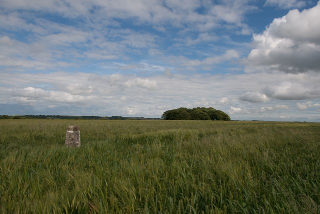
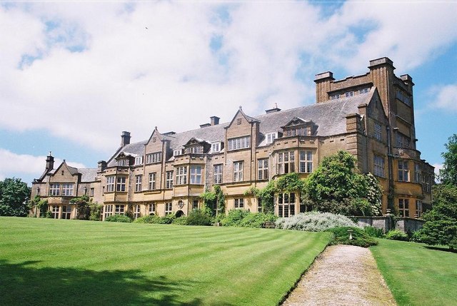
Hill Coppice, located in Dorset, England, is a picturesque wood or forest that spans over a vast area of land. This natural beauty spot is renowned for its stunning landscapes, diverse flora and fauna, and tranquil atmosphere.

The wood is characterized by its dense canopy of trees, predominantly consisting of oak, beech, and ash. These majestic trees provide ample shade and create a cool and refreshing environment, making Hill Coppice an ideal destination for nature lovers, hikers, and birdwatchers.

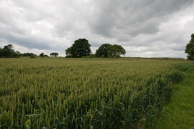
The forest floor is covered with a thick carpet of moss, ferns, and wildflowers, adding to the enchanting ambiance of the wood. It is also home to a wide range of wildlife, including deer, foxes, badgers, and numerous species of birds. Visitors can often spot these creatures going about their daily routines, adding an element of excitement to their exploration of the wood.

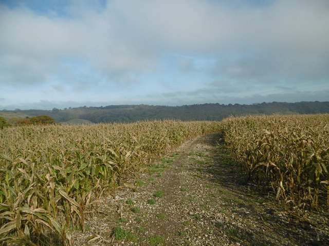
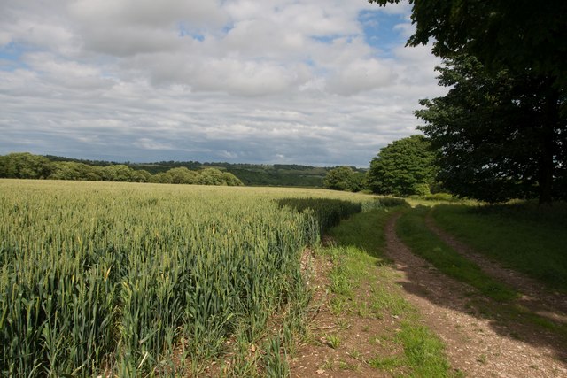
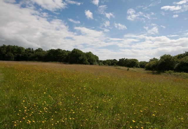
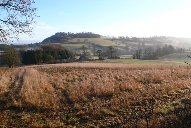
Hill Coppice offers various walking trails that wind through the forest, allowing visitors to fully immerse themselves in its natural beauty. The trails are well-maintained and provide breathtaking views of the surrounding countryside. Along these paths, visitors can discover hidden streams, charming clearings, and ancient trees, further enhancing the sense of adventure and discovery.

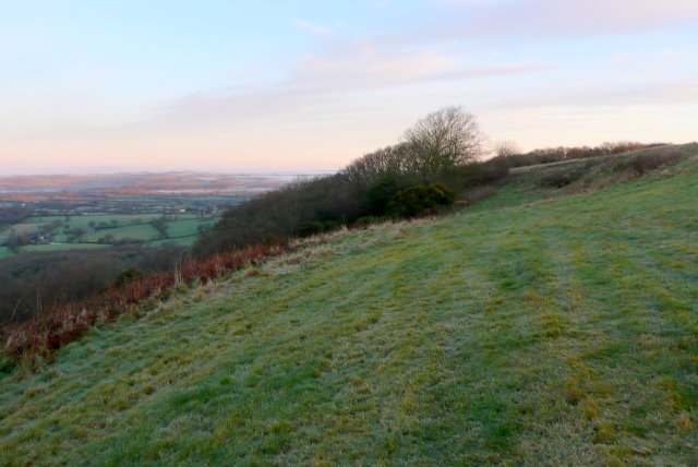
The wood is open to the public throughout the year, providing a peaceful retreat from the hustle and bustle of everyday life. Whether one is seeking solitude, a family outing, or a place for recreational activities such as picnics or photography, Hill Coppice is an idyllic destination that promises to leave a lasting impression on all who visit.

If you have any feedback on the listing, please let us know in the comments section below.

Hill Coppice Images

Images are sourced within 2km of 50.844985/-2.5090598 or Grid Reference ST6405. Thanks to Geograph Open Source API. All images are credited.

A signposted crossing of the ways on the Dorset downs
Benchmark on Remedy House, near Hermitage Ordnance Survey benchmark, described on database at <span class="nowrap"><a title="http://www.bench-marks.org.uk/bm71318" rel="nofollow ugc noopener" href="http://www.bench-marks.org.uk/bm71318">Link</a><img style="margin-left:2px;" alt="External link" title="External link - shift click to open in new window" src="https://s1.geograph.org.uk/img/external.png" width="10" height="10"/></span>. See also <a href="https://www.geograph.org.uk/photo/4723466">ST6405 : Remedy House gate, near Hermitage</a>.
Benchmark on Remedy House, near Hermitage
Ordnance Survey benchmark, described on database at LinkExternal link. See also ST6405 : Remedy House gate, near Hermitage.
Remedy House gate, near Hermitage There is an Ordnance Survey benchmark on the right-hand side of the gable end of this house. See <a href="https://www.geograph.org.uk/photo/4723461">ST6405 : Benchmark on Remedy House, near Hermitage</a>
Ordnance Survey benchmark, described on database at <span class="nowrap"><a title="http://www.bench-marks.org.uk/bm71318" rel="nofollow ugc noopener" href="http://www.bench-marks.org.uk/bm71318">Link</a><img style="margin-left:2px;" alt="External link" title="External link - shift click to open in new window" src="https://s1.geograph.org.uk/img/external.png" width="10" height="10"/></span>.
Remedy House gate, near Hermitage
There is an Ordnance Survey benchmark on the right-hand side of the gable end of this house. See ST6405 : Benchmark on Remedy House, near Hermitage Ordnance Survey benchmark, described on database at LinkExternal link.
Gore Hill, byway Leading to Redpost Hill.
Gore Hill, byway
Leading to Redpost Hill.
Gore Hill, cereal field Where is that path? Wherever, it does not seem to have been used since this large field was ploughed and seeded.
Gore Hill, cereal field
Where is that path? Wherever, it does not seem to have been used since this large field was ploughed and seeded.
Gore Hill, bridleway marker Across grazing land to Batcombe.
Gore Hill, bridleway marker
Across grazing land to Batcombe.
Gore Hill, footpath marker On the way to Telegraph Hill or Seldon Hill.
Gore Hill, footpath marker
On the way to Telegraph Hill or Seldon Hill.
Up Cerne, maize field On Bazon Hill.
Up Cerne, maize field
On Bazon Hill.
Up Cerne, farm track Left, Fernycombe Coppice; right, a young cereal crop.
Up Cerne, farm track
Left, Fernycombe Coppice; right, a young cereal crop.
Up Cerne, Wessex Ridgeway Farm track, and part of the Wessex Ridgeway: <span class="nowrap"><a title="https://www.ldwa.org.uk/ldp/members/show_path.php?path_name=Wessex+Ridgeway+Trail" rel="nofollow ugc noopener" href="https://www.ldwa.org.uk/ldp/members/show_path.php?path_name=Wessex+Ridgeway+Trail">Link</a><img style="margin-left:2px;" alt="External link" title="External link - shift click to open in new window" src="https://s1.geograph.org.uk/img/external.png" width="10" height="10"/></span>
Up Cerne, Wessex Ridgeway
Farm track, and part of the Wessex Ridgeway: LinkExternal link
Up Cerne, signpost Ahead to Redpost Hill, on the Wessex Ridgeway. The path does not appear to have been used since the field was ploughed and seeded. <span class="nowrap"><a title="https://www.ldwa.org.uk/ldp/members/show_path.php?path_name=Wessex+Ridgeway+Trail" rel="nofollow ugc noopener" href="https://www.ldwa.org.uk/ldp/members/show_path.php?path_name=Wessex+Ridgeway+Trail">Link</a><img style="margin-left:2px;" alt="External link" title="External link - shift click to open in new window" src="https://s1.geograph.org.uk/img/external.png" width="10" height="10"/></span>
Up Cerne, signpost
Ahead to Redpost Hill, on the Wessex Ridgeway. The path does not appear to have been used since the field was ploughed and seeded. LinkExternal link
Minterne Magna:  Minterne Gardens Entrance Garden gates and drive in this Dorset village.
Minterne Magna: Minterne Gardens Entrance
Garden gates and drive in this Dorset village.
Minterne Magna: Parish Church of St Andrew The Church of St Andrew's dates from late Medieval times but the north porch is of 17th Century design. In 1894 the tower was restored and heightened and in 1897 the church was reseated in oak.
Minterne Magna: Parish Church of St Andrew
The Church of St Andrew's dates from late Medieval times but the north porch is of 17th Century design. In 1894 the tower was restored and heightened and in 1897 the church was reseated in oak.
Minterne Magna: Leaning Telephone Box
Approaching Gore Hill
Gore Hill trigpoint
Gore Hill trigpoint
Crops at Telegraph Hill
Hillfield Hill nature reserve A local nature reserve of grassland, scrub and woodland with beautiful wild flower meadows.
Hillfield Hill nature reserve
A local nature reserve of grassland, scrub and woodland with beautiful wild flower meadows.
Show me another place!

Hill Coppice is located at Grid Ref: ST6405 (Lat: 50.844985, Lng: -2.5090598)

Unitary Authority: Dorset

Police Authority: Dorset

What 3 Words

///depth.crust.snooty. Near Yetminster, Dorset

Related Wikis

Telegraph Hill, Dorset

Telegraph Hill (267 metres, 876 feet high) is a hill about 1 mile northwest of Minterne Magna and about 10 miles north of Dorchester in the county of Dorset...

Cerne, Totcombe and Modbury Hundred

Cerne, Totcombe and Modbury Hundred was a hundred in the county of Dorset, England. Some of its tithings and parishes were exclaves which indicates that...

Hilfield

Hilfield is a small, scattered village and civil parish in west Dorset, England, situated under the scarp face of the Dorset Downs 7 miles (11 km) south...

Hermitage, Dorset

Hermitage is a small village and civil parish in the county of Dorset in southern England. It is situated in the Blackmore Vale under the scarp of the...

Minterne Magna

Minterne Magna is a village and civil parish in Dorset, England, situated midway between Dorchester and Sherborne. In the 2011 census the parish had a...

River Cerne

The River Cerne is a ten mile long river in Dorset, England, which rises in the Chalk hills of the Dorset Downs at Minterne Magna, between High Stoy and...

Dogbury Hill

At 248 metres (814 ft), Dogbury Hill is one of the highest hills in the county of Dorset, England. It is the site of a prehistoric hill fort. == Location... ==

Batcombe Down

Batcombe Down (grid reference ST623040) is an 18.6 hectare biological Site of Special Scientific Interest in Dorset, England: notified in 1952. == Sources... ==

Nearby Amenities

Located within 500m of 50.844985,-2.5090598
Telegraph Hill
Place: locality
Lat/Long: 50.8438539/-2.5071895
The data included in this document is from www.openstreetmap.org. The data is made available under ODbL.

Have you been to Hill Coppice?

Leave your review of Hill Coppice below (or comments, questions and feedback).