Machpelah
Settlement in Yorkshire
England
Machpelah

Machpelah is a small village located in the county of Yorkshire in northern England. Situated in the picturesque countryside, it is surrounded by rolling hills and lush green fields. The village is known for its peaceful and idyllic setting, making it a popular destination for those seeking a tranquil retreat.
Machpelah has a rich history that dates back centuries. It is believed that the village was established in the early medieval period and was originally a farming community. Today, remnants of the village's past can still be seen in the form of traditional stone cottages and buildings that line its quaint streets.
Despite its small size, Machpelah offers a range of amenities to its residents and visitors. The village is home to a local pub, which serves as a gathering place for locals and a welcoming spot for tourists to enjoy a pint of ale or a hearty meal. Additionally, there is a small convenience store that provides basic necessities to the community.
The surrounding countryside offers ample opportunities for outdoor activities. Hiking and walking trails crisscross the area, allowing visitors to explore the scenic beauty of the Yorkshire Dales National Park, which lies just a short distance from the village. The park is renowned for its rugged landscapes, picturesque valleys, and diverse wildlife, making it a haven for nature enthusiasts.
In conclusion, Machpelah is a charming village nestled in the Yorkshire countryside, offering a peaceful ambiance, a rich history, and access to stunning natural landscapes. It is a place where visitors can escape the hustle and bustle of city life and immerse themselves in the beauty of the English countryside.
If you have any feedback on the listing, please let us know in the comments section below.
Machpelah Images
Images are sourced within 2km of 53.739177/-2.0088165 or Grid Reference SD9926. Thanks to Geograph Open Source API. All images are credited.


Machpelah is located at Grid Ref: SD9926 (Lat: 53.739177, Lng: -2.0088165)
Division: West Riding
Unitary Authority: Calderdale
Police Authority: West Yorkshire
What 3 Words
///conceals.likes.proposals. Near Hebden Bridge, West Yorkshire
Nearby Locations
Related Wikis

Hebden Bridge railway station
Hebden Bridge railway station serves the town of Hebden Bridge in West Yorkshire, England. The station is on the Calder Valley Line, operated by Northern...
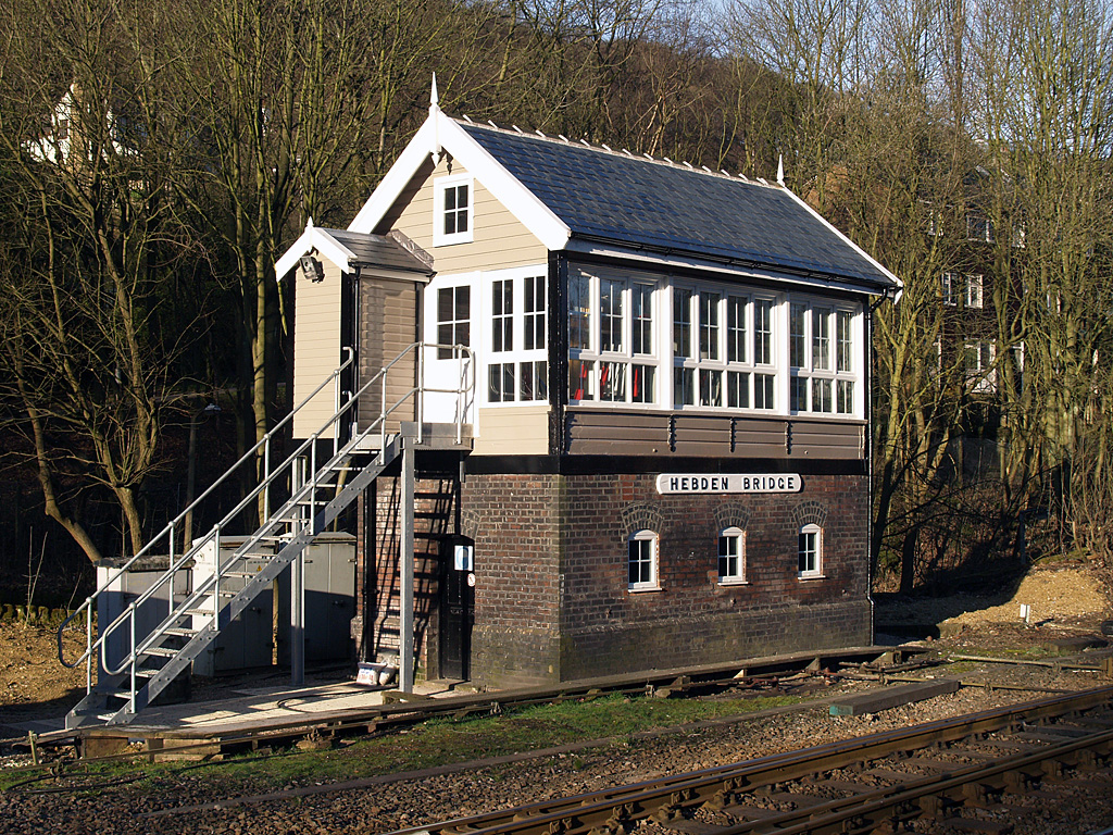
Hebden Bridge signal box
Hebden Bridge signal box is a Grade II listed former Lancashire and Yorkshire Railway signal box, located close to Hebden Bridge railway station in West...

Hebden Bridge Picture House
Hebden Bridge Picture House in Hebden Bridge, West Yorkshire, is one of the last remaining council-owned cinemas in Britain. Together with the adjacent...

Hebden Royd
Hebden Royd is a civil parish in the Metropolitan Borough of Calderdale in West Yorkshire, England. According to the 2001 census it had a population of...

Hebden Bridge
Hebden Bridge is a market town in the Calderdale district of West Yorkshire, England. It is in the Upper Calder Valley, 8 miles (13 km) west of Halifax...

Battle of Heptonstall
The Battle of Heptonstall occurred in November 1643 during the First English Civil War at Hebden Bridge and Heptonstall, Yorkshire. During the battle,...

Hebden Bridge Town Hall
Hebden Bridge Town Hall, formerly Hebden Bridge Council Offices, is a municipal building in St George's Street, Hebden Bridge, West Yorkshire, England...

Birchcliffe Baptist Church
Birchcliffe Baptist Church is a redundant Baptist chapel in the town of Hebden Bridge, West Yorkshire, England. It was founded by Daniel Taylor in 1764...
Related Videos

Hebden Bridge In England - 5K HDR Walking Tour of the 4th Funkiest Town in the World
Open to Collab with Travel Companies, please send an email. Support my work; https://www.buymeacoffee.com/wasimahmed ...

Hebden Bridge England UK Winter Walking Tour 4K Relaxing No Talking West Yorkshire Vintage Town
Hebden Bridge England UK Winter Walking Tour 4K Relaxing No Talking West Yorkshire Vintage Town.

Hebden Bridge Yorkshire | voted the greatest town in Europe
Welcome to the delightful town of Hebden Bridge, a hidden gem nestled in the breathtaking beauty of West Yorkshire, England!
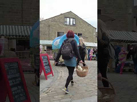
Hebden Bridge Walk Through #shorts #short
A quite walk through Hebden Bridge Last year #shorts #short #hebdenbridge #yorkshire #travel.
Nearby Amenities
Located within 500m of 53.739177,-2.0088165Have you been to Machpelah?
Leave your review of Machpelah below (or comments, questions and feedback).