Higher May Royd Wood
Wood, Forest in Yorkshire
England
Higher May Royd Wood

Higher May Royd Wood is a picturesque woodland located in the county of Yorkshire, England. Situated in the heart of the beautiful countryside, this wood is renowned for its natural beauty and tranquil atmosphere. The wood covers an area of approximately 50 acres and is characterized by a diverse range of trees, including oak, beech, and birch.
The woodland is home to a variety of wildlife, making it a haven for nature enthusiasts and wildlife photographers. Visitors to Higher May Royd Wood may be lucky enough to spot deer, squirrels, badgers, and a wide array of bird species. The wood's peaceful setting and abundance of flora and fauna make it an idyllic spot for walking, hiking, and nature observation.
The wood is easily accessible, with well-maintained footpaths winding through its enchanting landscape. These paths provide visitors with the opportunity to explore the wood at their own pace and enjoy the beauty of the surroundings. The wood is also equipped with picnic areas and benches, allowing visitors to relax and soak in the tranquility of their surroundings.
Higher May Royd Wood is a popular destination for both locals and tourists alike. Its natural charm, combined with its accessibility, make it a perfect spot for a day out in nature. Whether it's a leisurely stroll, a family picnic, or a wildlife adventure, this woodland offers something for everyone to enjoy.
If you have any feedback on the listing, please let us know in the comments section below.
Higher May Royd Wood Images
Images are sourced within 2km of 53.738368/-2.0031312 or Grid Reference SD9926. Thanks to Geograph Open Source API. All images are credited.


Higher May Royd Wood is located at Grid Ref: SD9926 (Lat: 53.738368, Lng: -2.0031312)
Division: West Riding
Unitary Authority: Calderdale
Police Authority: West Yorkshire
What 3 Words
///unheated.cartoons.shampoo. Near Hebden Bridge, West Yorkshire
Nearby Locations
Related Wikis
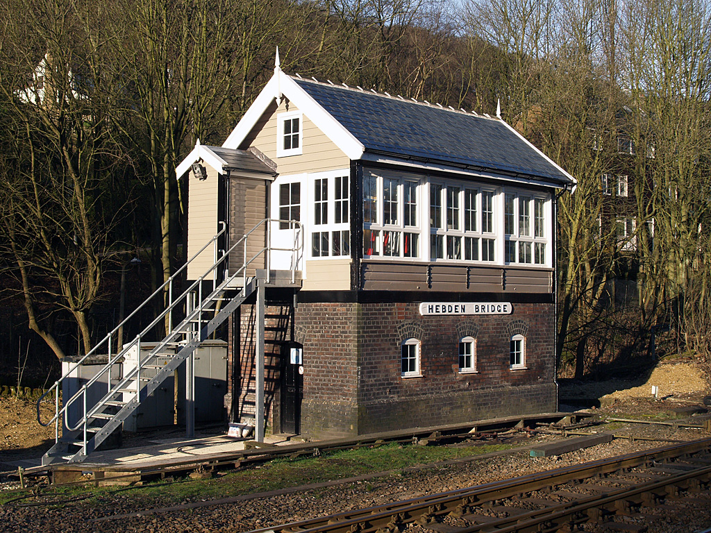
Hebden Bridge signal box
Hebden Bridge signal box is a Grade II listed former Lancashire and Yorkshire Railway signal box, located close to Hebden Bridge railway station in West...

Hebden Bridge railway station
Hebden Bridge railway station serves the town of Hebden Bridge in West Yorkshire, England. The station is on the Calder Valley Line, operated by Northern...

Hebden Royd
Hebden Royd is a civil parish in the Metropolitan Borough of Calderdale in West Yorkshire, England. According to the 2001 census it had a population of...

Hebden Bridge
Hebden Bridge is a market town in the Calderdale district of West Yorkshire, England. It is in the Upper Calder Valley, 8 miles (13 km) west of Halifax...

Hebden Bridge Picture House
Hebden Bridge Picture House in Hebden Bridge, West Yorkshire, is one of the last remaining council-owned cinemas in Britain. Together with the adjacent...

Birchcliffe Baptist Church
Birchcliffe Baptist Church is a redundant Baptist chapel in the town of Hebden Bridge, West Yorkshire, England. It was founded by Daniel Taylor in 1764...

Erringden
Erringden is a civil parish in the Metropolitan Borough of Calderdale in West Yorkshire, England. Previously it was a township within the chapelry of Heptonstall...

Battle of Heptonstall
The Battle of Heptonstall occurred in November 1643 during the First English Civil War at Hebden Bridge and Heptonstall, Yorkshire. During the battle,...
Nearby Amenities
Located within 500m of 53.738368,-2.0031312Have you been to Higher May Royd Wood?
Leave your review of Higher May Royd Wood below (or comments, questions and feedback).