Moor Plantation
Wood, Forest in Yorkshire
England
Moor Plantation

Moor Plantation is a picturesque woodland located in Yorkshire, England. Situated in the heart of the county, it covers a vast area of approximately 500 acres. The plantation is renowned for its rich biodiversity, consisting of a diverse range of tree species, including oak, beech, and birch, among others.
The woodland is characterized by its dense canopy and well-preserved undergrowth, creating a perfect habitat for a variety of wildlife. It is home to numerous species of birds, such as woodpeckers, owls, and songbirds, making it a popular spot for birdwatchers. Additionally, the woodland provides shelter for mammals like deer, foxes, and rabbits.
Moor Plantation offers visitors a tranquil and peaceful environment, ideal for outdoor activities and recreation. There are well-maintained walking trails that wind through the woodland, allowing visitors to explore its natural beauty at their own pace. These trails provide opportunities for hiking, cycling, and even horseback riding.
In addition to its natural beauty, Moor Plantation also holds historical significance. It was once part of a larger estate and has remnants of old stone walls and structures that date back several centuries. These historical features provide a glimpse into the region's past and add a unique charm to the woodland.
Overall, Moor Plantation is a haven for nature enthusiasts, offering a diverse ecosystem, recreational opportunities, and a touch of history. Its serene atmosphere and stunning scenery make it a must-visit destination for both locals and tourists seeking a peaceful escape in the heart of Yorkshire's countryside.
If you have any feedback on the listing, please let us know in the comments section below.
Moor Plantation Images
Images are sourced within 2km of 53.733577/-2.0132416 or Grid Reference SD9926. Thanks to Geograph Open Source API. All images are credited.


Moor Plantation is located at Grid Ref: SD9926 (Lat: 53.733577, Lng: -2.0132416)
Division: West Riding
Unitary Authority: Calderdale
Police Authority: West Yorkshire
What 3 Words
///chickens.skirting.honeybees. Near Hebden Bridge, West Yorkshire
Nearby Locations
Related Wikis

Erringden
Erringden is a civil parish in the Metropolitan Borough of Calderdale in West Yorkshire, England. Previously it was a township within the chapelry of Heptonstall...
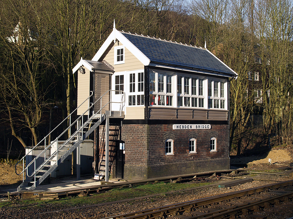
Hebden Bridge signal box
Hebden Bridge signal box is a Grade II listed former Lancashire and Yorkshire Railway signal box, located close to Hebden Bridge railway station in West...

Hebden Bridge railway station
Hebden Bridge railway station serves the town of Hebden Bridge in West Yorkshire, England. The station is on the Calder Valley Line, operated by Northern...

Hebden Bridge Picture House
Hebden Bridge Picture House in Hebden Bridge, West Yorkshire, is one of the last remaining council-owned cinemas in Britain. Together with the adjacent...

Battle of Heptonstall
The Battle of Heptonstall occurred in November 1643 during the First English Civil War at Hebden Bridge and Heptonstall, Yorkshire. During the battle,...

Hebden Royd
Hebden Royd is a civil parish in the Metropolitan Borough of Calderdale in West Yorkshire, England. According to the 2001 census it had a population of...

Hebden Bridge
Hebden Bridge is a market town in the Calderdale district of West Yorkshire, England. It is in the Upper Calder Valley, 8 miles (13 km) west of Halifax...

Hebden Bridge Town Hall
Hebden Bridge Town Hall, formerly Hebden Bridge Council Offices, is a municipal building in St George's Street, Hebden Bridge, West Yorkshire, England...
Nearby Amenities
Located within 500m of 53.733577,-2.0132416Have you been to Moor Plantation?
Leave your review of Moor Plantation below (or comments, questions and feedback).