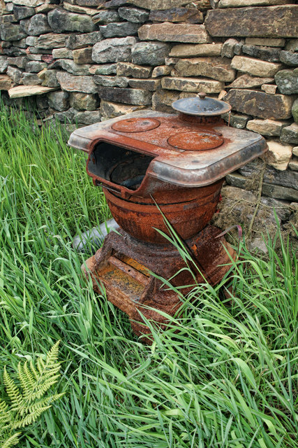
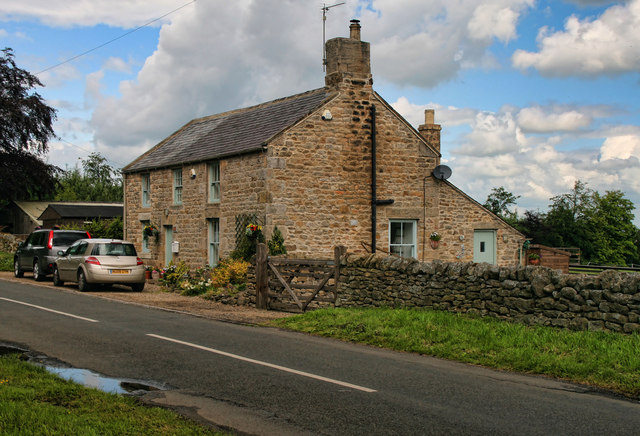
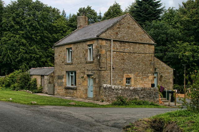
Garden Strips

Wood, Forest in Northumberland

England

Garden Strips

Lane Head
Lane Head Credit: Les Hull

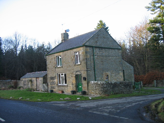
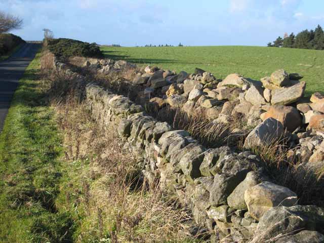
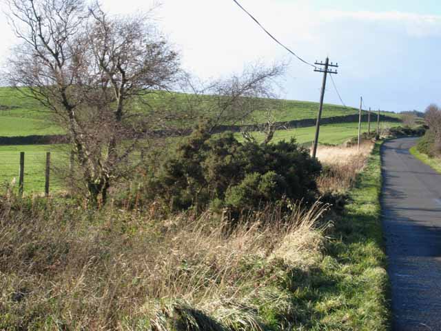
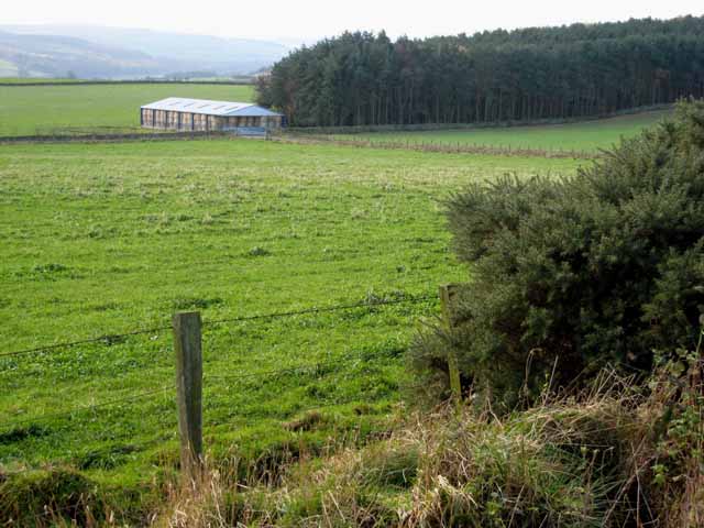
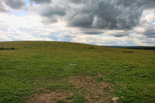
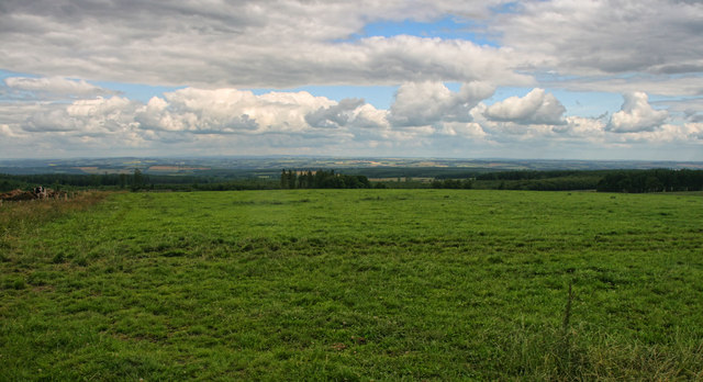
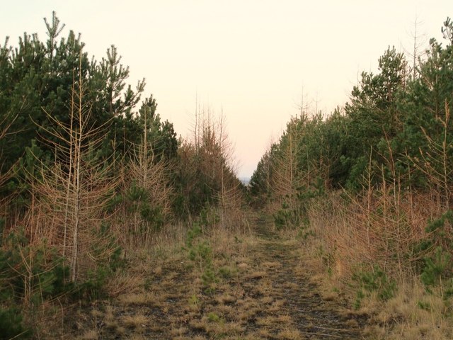
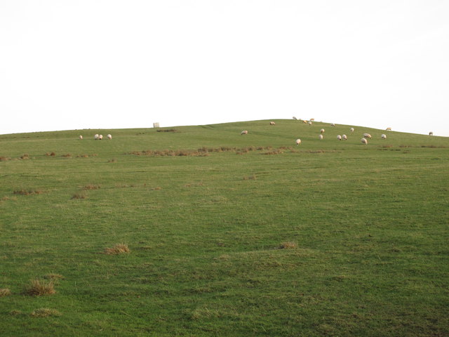
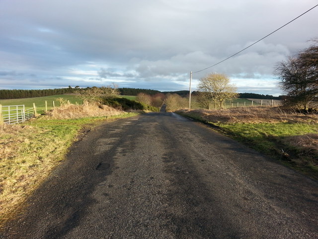
Garden Strips, Northumberland, also known as Wood or Forest, is a picturesque and serene area located in the northern region of England. Spanning approximately 200 acres, this stunning woodland is renowned for its natural beauty and rich biodiversity.

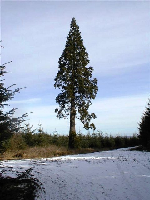
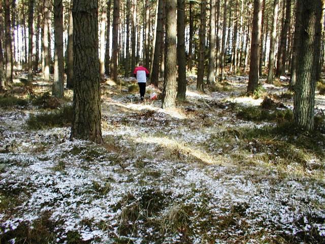
The woodland is characterized by a dense canopy of trees, primarily consisting of native species such as oak, birch, and ash. These majestic trees provide a tranquil and peaceful atmosphere, making it an ideal destination for nature lovers and outdoor enthusiasts.

Garden Strips is home to an array of wildlife, including various bird species, small mammals, and insects. It serves as a critical habitat for many protected species, contributing to the conservation efforts in the area. One can often spot squirrels scurrying amidst the trees or hear the melodic songs of birds echoing through the forest.

Visitors to Garden Strips can enjoy a range of activities, such as hiking, birdwatching, and photography. There are well-marked trails that wind through the woodland, offering breathtaking views of the surrounding countryside. The forest floor is adorned with carpets of wildflowers during spring, adding a burst of color and fragrance to the landscape.

The management of the woodland is overseen by local conservation organizations, ensuring the preservation of its natural integrity. Garden Strips, Northumberland, is a cherished and protected natural gem, providing a haven for native flora and fauna and offering visitors a serene escape into the beauty of nature.

If you have any feedback on the listing, please let us know in the comments section below.

Garden Strips Images

Images are sourced within 2km of 54.895448/-2.0135495 or Grid Reference NY9955. Thanks to Geograph Open Source API. All images are credited.

Lane Head
Lane Head
Track Junction, High Kellas Plantation A lonesome pine standing tall in a much younger block of forestry.
Track Junction, High Kellas Plantation
A lonesome pine standing tall in a much younger block of forestry.
Ditch End, Low Kellas Plantation A competitor in an orienteering event is approaching a control sited at the ditch end.
Ditch End, Low Kellas Plantation
A competitor in an orienteering event is approaching a control sited at the ditch end.
Healey Whins A farmstead viewed from the south within Kellas Forest.
Healey Whins
A farmstead viewed from the south within Kellas Forest.
Wall at Hairy Side
Wall at Hairy Side
Drunken telegraph pole, Hairy Side
Field, barn and plantation near West Minsteracres
Hairy Side View across Hairy Side above Derwent Reservoir.
Hairy Side
View across Hairy Side above Derwent Reservoir.
Old Stove Old Stove, including stove pipe and fuel, near Hairy Side.
Old Stove
Old Stove, including stove pipe and fuel, near Hairy Side.
Hairy Side Fields at Hairy Side.
Hairy Side
Fields at Hairy Side.
Healey Riggend
Healey Riggend
Lane Head
Lane Head
Footpath into Kellas Plantation east of Kellas Bridge
Donald's Grave below Hairy Side
Coal Road leading to Slaley Golf Course
Donald's Grave near Esper Shields Donald's Grave is apparently the name of this boundary stone on the south side of the minor road that runs from Kiln Pit Hill on the A68 to Blanchland, 10m east of the Coal Road (track) that leads north-west through the grounds of Slaley Hall.

The stone is Grade II Listed (List Entry Number: 1045376) and is described as:
"Probable boundary marker, C18th or perhaps a reworking of a more ancient stone. Gritstone. Roughly-cut monolith of trapezoidal plan, exposed height 0.9 metres. East face with incised B; north face with remains of incised design, possibly a cross within a circle; west face incised A (laid sideways) and S."

See closer photo here <a href="https://www.geograph.org.uk/photo/4246157">NZ0054 : Donald's Grave near Esper Shields (detail)</a>

Local researchers think the stone may be an allotment marker from the Bulbeck Common Award (1771) which was divided between George Silvertop of Minsteracres (S) and George Baker (B), the Lord of the Manor. It has also been suggested that Donald's Grave may have originally been mapped on the north side of the road but the nature of the feature represented by the name is not specified.

There are two further named stones just to the north, possibly on the same boundary: Greyhound Stone (which I couldn't find) and Hare Stone, an C18th boundary stone.

All 3 stones are named on the 1st Edition 6" OS Map Northumberland, 104 (1864):
<span class="nowrap"><a title="http://maps.nls.uk/view/102346503#zoom=5&lat=3290&lon=2260&layers=BT" rel="nofollow ugc noopener" href="http://maps.nls.uk/view/102346503#zoom=5&lat=3290&lon=2260&layers=BT">Link</a><img style="margin-left:2px;" alt="External link" title="External link - shift click to open in new window" src="https://s1.geograph.org.uk/img/external.png" width="10" height="10"/></span>

Only Donald's Grave is represented on current large scale mapping.

The Hare Stone is also Listed Grade II (List Entry Number: 1370318) said to be marked B (Blanchland) on south-west, and S (Slaley) on north-east side <a href="https://www.geograph.org.uk/photo/4247180">NY9955 : The Hare Stone near Slaley Hall</a>


The hill in the field beyond the wall is named Hairy Side.
Donald's Grave near Esper Shields
Donald's Grave is apparently the name of this boundary stone on the south side of the minor road that runs from Kiln Pit Hill on the A68 to Blanchland, 10m east of the Coal Road (track) that leads north-west through the grounds of Slaley Hall. The stone is Grade II Listed (List Entry Number: 1045376) and is described as: "Probable boundary marker, C18th or perhaps a reworking of a more ancient stone. Gritstone. Roughly-cut monolith of trapezoidal plan, exposed height 0.9 metres. East face with incised B; north face with remains of incised design, possibly a cross within a circle; west face incised A (laid sideways) and S." See closer photo here NZ0054 : Donald's Grave near Esper Shields (detail) Local researchers think the stone may be an allotment marker from the Bulbeck Common Award (1771) which was divided between George Silvertop of Minsteracres (S) and George Baker (B), the Lord of the Manor. It has also been suggested that Donald's Grave may have originally been mapped on the north side of the road but the nature of the feature represented by the name is not specified. There are two further named stones just to the north, possibly on the same boundary: Greyhound Stone (which I couldn't find) and Hare Stone, an C18th boundary stone. All 3 stones are named on the 1st Edition 6" OS Map Northumberland, 104 (1864): LinkExternal link Only Donald's Grave is represented on current large scale mapping. The Hare Stone is also Listed Grade II (List Entry Number: 1370318) said to be marked B (Blanchland) on south-west, and S (Slaley) on north-east side NY9955 : The Hare Stone near Slaley Hall The hill in the field beyond the wall is named Hairy Side.
Donald's Grave near Esper Shields (detail) See description here <a href="https://www.geograph.org.uk/photo/4246082">NZ0054 : Donald's Grave near Esper Shields</a>
Donald's Grave near Esper Shields (detail)
Edge of the Grid Square and just north of Redhouse Plantation Looking east where the road west of Minsteracres meets the northern edge of the grid square.
Edge of the Grid Square and just north of Redhouse Plantation
Looking east where the road west of Minsteracres meets the northern edge of the grid square.
Show me another place!

Garden Strips is located at Grid Ref: NY9955 (Lat: 54.895448, Lng: -2.0135495)

Unitary Authority: Northumberland

Police Authority: Northumbria

What 3 Words

///climber.figure.intruders. Near Slaley, Northumberland

Related Wikis

Slaley Hall

Slaley Hall is a country house golf resort in Northumberland in North East England, built by local developers Seamus O'Carroll and John Rourke which hosted...

Colpitts Grange

Colpitts Grange is a hamlet in Northumberland, England. It is about 7 miles (11 km) to the south-east of Hexham. == Governance == Colpitts Grange is in...

Slaley, Northumberland

Slaley is a village in Northumberland, England. It is situated to the southeast of Hexham. It is surrounded by the following villages: Ruffside, Whitley...

Minsteracres

Minsteracres is an 18th-century mansion house, now a Christian retreat centre, in Northumberland, England. It is a Grade II listed building.The house was...

Healey, Northumberland

Healey is a rural estate and civil parish in Northumberland, England, situated between Riding Mill to the north and Slaley to the south. The neo-Norman...

Derwent Reservoir (North East England)

The Derwent Reservoir is a reservoir on the River Derwent, on the border between County Durham and Northumberland, in England. It is west of Consett. It...

Pow Hill Bog

Pow Hill Bog is a Site of Special Scientific Interest in the Wear Valley district of County Durham, England. It lies alongside Derwent Reservoir, approximately...

St Andrew's Church, Shotley

St Andrew's Church, Shotley, is a redundant Anglican church standing in an isolated position at a height of 960 feet (293 m) on Greymare Hill in Northumberland...

Nearby Amenities

Located within 500m of 54.895448,-2.0135495
Bench
Backrest: yes
Colour: brown
Material: wood
Seats: 4
Lat/Long: 54.8950106/-2.0158148
Bench
Backrest: no
Colour: brown
Material: wood
Seats: 4
Lat/Long: 54.898993/-2.0171702
The data included in this document is from www.openstreetmap.org. The data is made available under ODbL.

Have you been to Garden Strips?

Leave your review of Garden Strips below (or comments, questions and feedback).