Smerrill Quarry Wood

Wood, Forest in Wiltshire Cotswold

England

Smerrill Quarry Wood

Trewsbury Road towards Coates The gates to the very grand Trewsbury Farm are to the left.
Trewsbury Road towards Coates Credit: Robin Webster

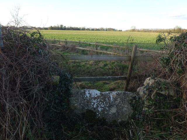
Smerrill Quarry Wood is a picturesque woodland located in the county of Wiltshire, England. Covering an area of approximately 10 hectares, this beautiful forest is renowned for its diverse range of flora and fauna, making it a popular spot for nature enthusiasts and hikers.

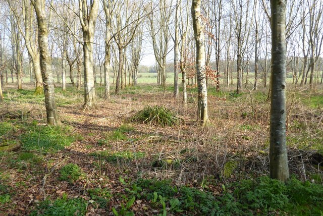
The wood is characterized by its mature broadleaf trees, including oak, beech, and ash, which provide a dense canopy, resulting in a cool and shaded environment during the summer months. The forest floor is adorned with a variety of wildflowers, such as bluebells, primroses, and wood anemones, adding bursts of color and fragrance to the surroundings.

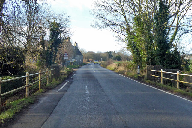
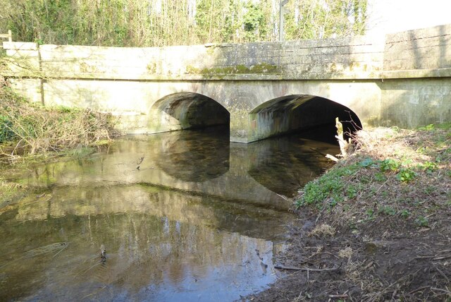
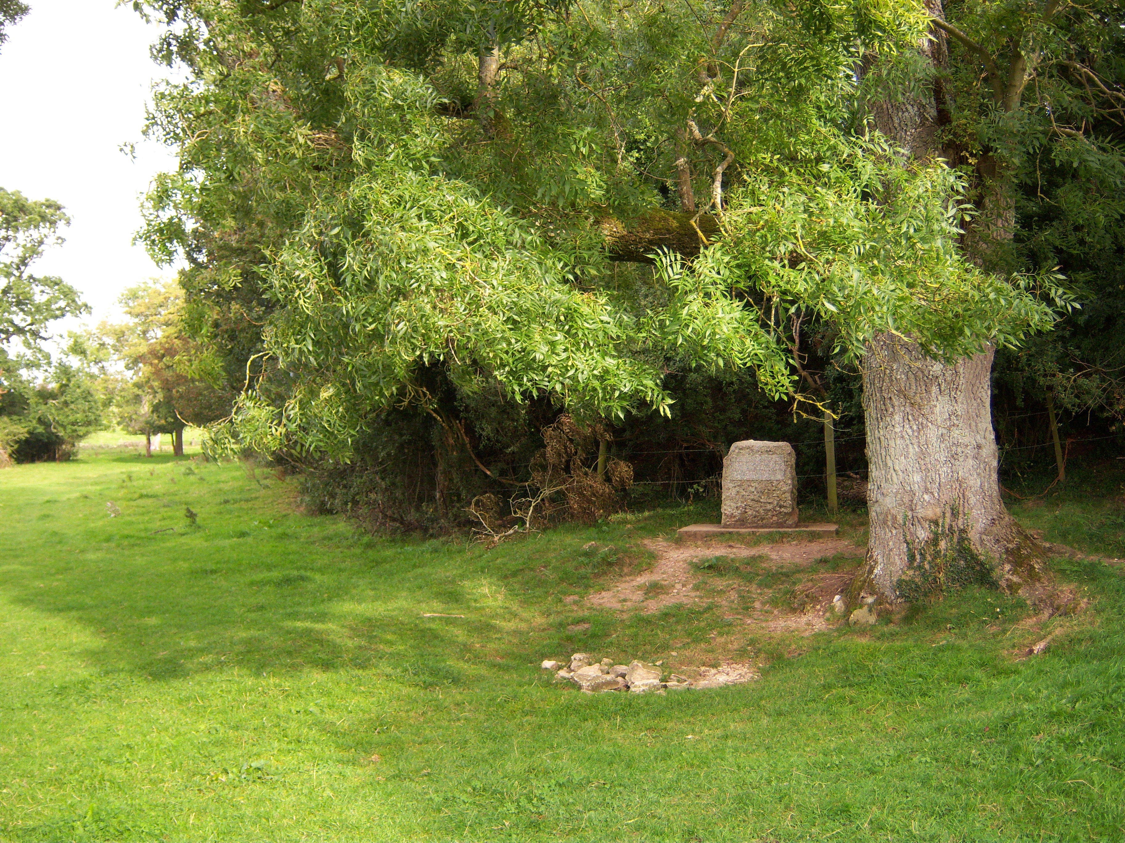
The woodland is intersected by a network of well-maintained footpaths, allowing visitors to explore the area and observe its abundant wildlife. Squirrels, badgers, and a wide array of bird species, including woodpeckers and owls, can often be spotted among the trees. The quarry itself, which was once a source of limestone for local construction, is now a tranquil pond, attracting a range of aquatic life.

Smerrill Quarry Wood is not only a haven for nature lovers but also a site of historical significance. The quarry and surrounding area have been inhabited since ancient times, with traces of Iron Age settlements and Roman activity discovered in the vicinity.

Overall, Smerrill Quarry Wood offers a serene and enchanting escape from the hustle and bustle of everyday life. Whether it's a leisurely stroll, birdwatching, or simply enjoying the wonders of nature, this woodland provides a truly captivating experience for visitors of all ages.

If you have any feedback on the listing, please let us know in the comments section below.

Smerrill Quarry Wood Images

Images are sourced within 2km of 51.690159/-2.002889 or Grid Reference ST9999. Thanks to Geograph Open Source API. All images are credited.

Trewsbury Road towards Coates The gates to the very grand Trewsbury Farm are to the left.
Trewsbury Road towards Coates
The gates to the very grand Trewsbury Farm are to the left.
Crossing the Thames at Parker's Bridge On the road between Ewen and Kemble.
Crossing the Thames at Parker's Bridge
On the road between Ewen and Kemble.
Road from Kemble towards Tarlton
Sheep grazing north of Kemble
The River Thames The River Thames near its source at Kemble.
The River Thames
The River Thames near its source at Kemble.
The River Thames The River Thames viewed from the bridge carrying the A429 near the village of Kemble.
The River Thames
The River Thames viewed from the bridge carrying the A429 near the village of Kemble.
The A429 at Kemble The A429 at Kemble where it crosses the infant River Thames.
The A429 at Kemble
The A429 at Kemble where it crosses the infant River Thames.
Bridge over the River Thames A bridge over the River Thames carrying the A429.
Bridge over the River Thames
A bridge over the River Thames carrying the A429.
Trees beside the River Thames Trees beside the River Thames between the villages of Kemble and Ewen.
Trees beside the River Thames
Trees beside the River Thames between the villages of Kemble and Ewen.
Barn in farmland A barn and trees in farmland beside the River Thames near the village of Ewen.
Barn in farmland
A barn and trees in farmland beside the River Thames near the village of Ewen.
Road crossing Parker's Bridge Road crossing Parker's Bridge near the village of Ewen.  The footpath sign is marking the route of the Thames Path.  The River Thames flows under this bridge.
Road crossing Parker's Bridge
Road crossing Parker's Bridge near the village of Ewen. The footpath sign is marking the route of the Thames Path. The River Thames flows under this bridge.
Kemble Station Part of the car park in front of Kemble Station.
Kemble Station
Part of the car park in front of Kemble Station.
Stone Stile, Kemble This is the view looking NW from School Road, East of Parkers Bridge (River Thames). The view SE is <a href="https://www.geograph.org.uk/photo/7157003">ST9997 : Stone Stile, Kemble</a>.
Stone Stile, Kemble
This is the view looking NW from School Road, East of Parkers Bridge (River Thames). The view SE is ST9997 : Stone Stile, Kemble.
Stone Stile, Kemble This is the view looking SE to School Road, East of Parkers Bridge (River Thames). The view NW looking in is <a href="https://www.geograph.org.uk/photo/7157002">ST9997 : Stone Stile, Kemble</a>.
Stone Stile, Kemble
This is the view looking SE to School Road, East of Parkers Bridge (River Thames). The view NW looking in is ST9997 : Stone Stile, Kemble.
The Thames Head Inn The Thames Head Inn stands on the Fosse Way; it is named after the nearby source of the River Thames.
The Thames Head Inn
The Thames Head Inn stands on the Fosse Way; it is named after the nearby source of the River Thames.
Stone Stile, Kemble Actually at Thames Head, or opposite the nearest access to the source of the Thames from the A433. On Gloucestershire footpath BKE7 (part of the Thames & Severn Way) Looking NE to the road, the view down is <a href="https://www.geograph.org.uk/photo/7300122">ST9898 : Stone Stile, Kemble</a>.
Stone Stile, Kemble
Actually at Thames Head, or opposite the nearest access to the source of the Thames from the A433. On Gloucestershire footpath BKE7 (part of the Thames & Severn Way) Looking NE to the road, the view down is ST9898 : Stone Stile, Kemble.
Stone Stile, Kemble Actually at Thames Head, or opposite the nearest access to the source of the Thames from the A433. On Gloucestershire footpath BKE7 (part of the Thames & Severn Way) Looking NE to the road, the view down is <a href="https://www.geograph.org.uk/photo/7300121">ST9898 : Stone Stile, Kemble</a>.
Stone Stile, Kemble
Actually at Thames Head, or opposite the nearest access to the source of the Thames from the A433. On Gloucestershire footpath BKE7 (part of the Thames & Severn Way) Looking NE to the road, the view down is ST9898 : Stone Stile, Kemble.
Car park, Kemble Station
Show me another place!

Smerrill Quarry Wood is located at Grid Ref: ST9999 (Lat: 51.690159, Lng: -2.002889)

Administrative County: Gloucestershire

District: Cotswold

Police Authority: Gloucestershire

What 3 Words

///giraffes.sides.plots. Near Coates, Gloucestershire

Nearby Locations

Smerrill Quarry Wood

Related Wikis

Park Leaze Halt railway station

Park Leaze Halt railway station was one of two intermediate halts on the Cirencester branch line from Kemble, Gloucestershire, England. It was one of the...

Kemble, Gloucestershire

Kemble is a village in the civil parish of Kemble and Ewen, in the Cotswold district of Gloucestershire, England. Historically part of Wiltshire, it lies...

Tetbury Road railway station

Tetbury Road railway station was built by the Cheltenham & Great Western Union Railway to serve the Gloucestershire villages of Kemble and Coates, and...

Thames Head

Thames Head is a group of seasonal springs that arise near the village of Coates in the Cotswolds, about three miles south-west of the town of Cirencester...

Kemble railway station

Kemble railway station is a railway station that serves the village of Kemble in Gloucestershire, England. The station is on the Swindon to Gloucester...

Kemble Railway Cuttings

Kemble Railway Cuttings (ST975976 & ST985973 & ST982989) is a 2.72-hectare (6.7-acre) geological Site of Special Scientific Interest in Gloucestershire...

A419 road

The A419 road is a primary route between Chiseldon near Swindon at junction 15 of the M4 with the A346 road, and Whitminster in Gloucestershire, England...

Coates, Gloucestershire

Coates is a village and civil parish situated in Cotswold District, Gloucestershire, England. It is around 3 miles (4.8 km) west of Cirencester and close...

Nearby Amenities

Located within 500m of 51.690159,-2.002889
Smerrill Quarry
Naptan AtcoCode: 1600GLA57042
Naptan Bearing: NE
Naptan BusStopType: CUS
Naptan CommonName: Smerrill Quarry
Naptan Indicator: Opp
Naptan NaptanCode: glogmwdp
Naptan Street: A429
Naptan Verified: no
Source: naptan_import
Lat/Long: 51.6891045/-2.0044412
Bus Stop
Smerrill Quarry
Bench: no
Bin: no
Bus: yes
Lit: no
Naptan AtcoCode: 1600GLA57043
Naptan Bearing: SW
Naptan CommonName: Smerrill Quarry
Naptan NaptanCode: glogmwdt
Naptan Street: A429
Naptan Verified: no
Public Transport: platform
Shelter: no
Source: naptan_import
Tactile Paving: no
Lat/Long: 51.6891944/-2.004123
The data included in this document is from www.openstreetmap.org. The data is made available under ODbL.

Have you been to Smerrill Quarry Wood?

Leave your review of Smerrill Quarry Wood below (or comments, questions and feedback).