Mabgate

Settlement in Yorkshire

England

Mabgate

The Cube, Leeds The Cube is the new name for the development originally called Dudley House, built in 1972 as a residential tower block above an office building. At one time it became known as "K2" <a href="https://www.geograph.org.uk/photo/639131">SE3033 : K2</a>. It was redeveloped in 2020 mainly as offices on the lower floors but also including shops and social spaces such as a comedy club and bar.
The Cube, Leeds Credit: Stephen Craven

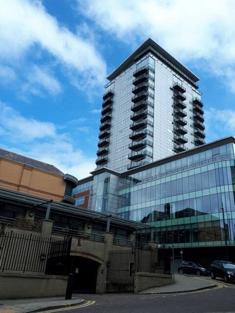
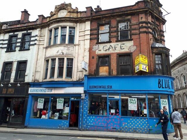
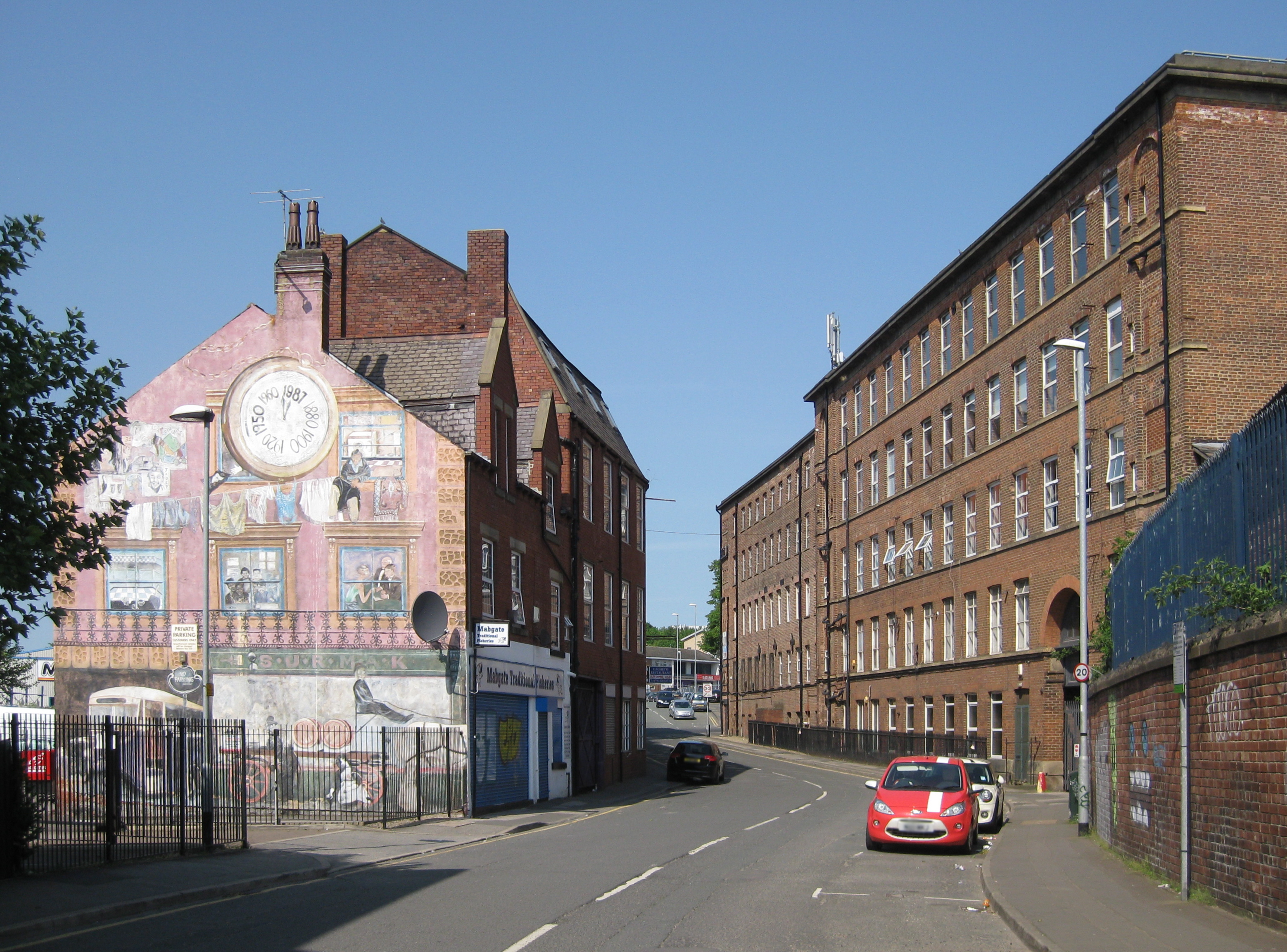
Mabgate is a vibrant area located in the city of Leeds, Yorkshire, England. Situated just outside the city center, it forms part of the historic district of East End. Mabgate has a rich history dating back to the 19th century when it was a bustling industrial hub, housing numerous factories that played a vital role in the city's textile and engineering sectors.

Today, Mabgate has undergone significant redevelopment and transformation, evolving into a diverse and dynamic neighborhood. The area is known for its eclectic mix of businesses, independent shops, and creative enterprises. It has become a hub for artists and musicians, with several art galleries, studios, and music venues dotted throughout its streets.

Mabgate's architecture reflects its industrial past, with many Victorian-era buildings still standing, albeit repurposed for modern use. The area is also characterized by its narrow, winding streets, which add to its unique charm.

In recent years, Mabgate has experienced a surge in popularity, attracting a growing number of young professionals, students, and artists seeking affordable living spaces and a vibrant community atmosphere. The area boasts a range of affordable housing options, including converted warehouses and new apartment complexes.

Mabgate's central location provides easy access to Leeds city center and its amenities, including various shopping centers, restaurants, and cultural attractions. Additionally, the area benefits from excellent transport links, with nearby bus and train stations connecting it to the wider region.

Overall, Mabgate offers a captivating blend of history, creativity, and affordability, making it an increasingly sought-after place to live, work, and explore in Yorkshire.

If you have any feedback on the listing, please let us know in the comments section below.
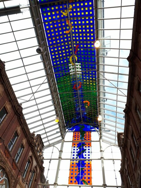
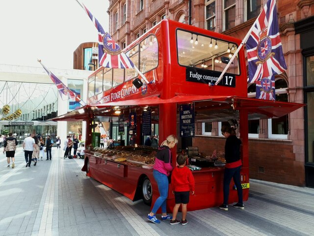
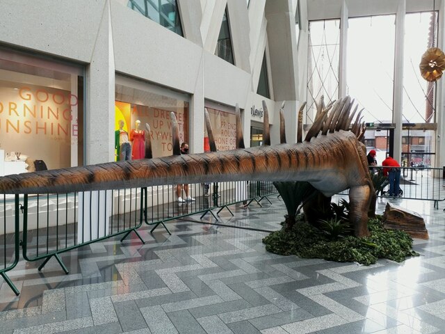
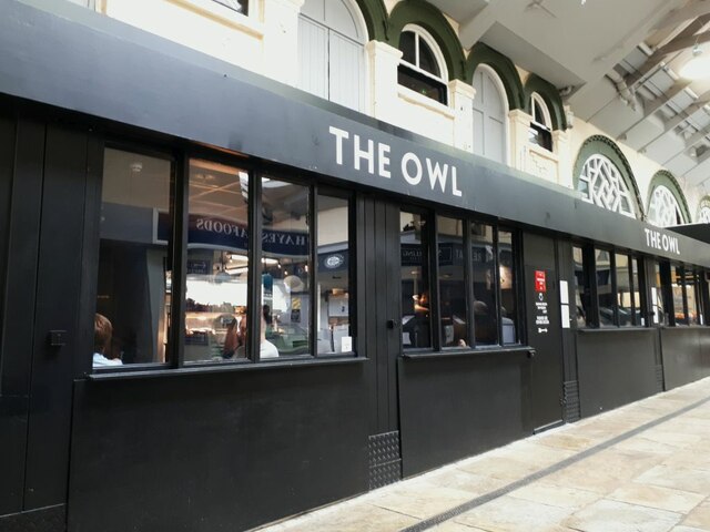
Mabgate Images

Images are sourced within 2km of 53.80043/-1.5329885 or Grid Reference SE3033. Thanks to Geograph Open Source API. All images are credited.

The Cube, Leeds The Cube is the new name for the development originally called Dudley House, built in 1972 as a residential tower block above an office building. At one time it became known as "K2" <a href="https://www.geograph.org.uk/photo/639131">SE3033 : K2</a>. It was redeveloped in 2020 mainly as offices on the lower floors but also including shops and social spaces such as a comedy club and bar.
The Cube, Leeds
The Cube is the new name for the development originally called Dudley House, built in 1972 as a residential tower block above an office building. At one time it became known as "K2" SE3033 : K2. It was redeveloped in 2020 mainly as offices on the lower floors but also including shops and social spaces such as a comedy club and bar.
Leeds Jurassic Trail: Stegosaurus The stegosaurus was in the Merrion shopping centre. This species lived in the Late Jurassic, about 150 million years ago and grew to 9 metres, so this is roughly a life-sized model (with baby).
Leeds Jurassic Trail: Stegosaurus
The stegosaurus was in the Merrion shopping centre. This species lived in the Late Jurassic, about 150 million years ago and grew to 9 metres, so this is roughly a life-sized model (with baby).
Leeds Jurassic Trail: Triceratops The triceratops was in the Merrion shopping centre and was fitted with a saddle on the non-moving centre section for children to ride.
Leeds Jurassic Trail: Triceratops
The triceratops was in the Merrion shopping centre and was fitted with a saddle on the non-moving centre section for children to ride.
Vegan protest, Merrion Street, Leeds A peaceful protest by a few vegan campaigners outside McDonalds. The production of beef for burgers is said to be responsible for extensive destruction of natural forest, inefficient use of farmland and a lot of greenhouse gas from the cows themselves. For the record, I'm not vegan myself but respect those who make this choice.
Vegan protest, Merrion Street, Leeds
A peaceful protest by a few vegan campaigners outside McDonalds. The production of beef for burgers is said to be responsible for extensive destruction of natural forest, inefficient use of farmland and a lot of greenhouse gas from the cows themselves. For the record, I'm not vegan myself but respect those who make this choice.
Leeds Jurassic Trail - Stigymoloch The stygimoloch was in St John's shopping centre. This species, with distinctive horns on its neck, lived in the Late Cretaceous, c.67 million years ago.
Leeds Jurassic Trail - Stigymoloch
The stygimoloch was in St John's shopping centre. This species, with distinctive horns on its neck, lived in the Late Cretaceous, c.67 million years ago.
Leeds Jurassic Trail - Pachycephalosaurus The pachycephalosaurus, named after its unusually thick skull, was in St John's shopping centre. This species lived in the Late Cretaceous, c.67 million years ago, the same period as the stigymoloch displayed next to it <a href="https://www.geograph.org.uk/photo/6918572">SE3033 : Leeds Jurassic Trail - Stigymoloch</a>. It only grew to 4.5 metres, so this is larger than life-sized model.
Leeds Jurassic Trail - Pachycephalosaurus
The pachycephalosaurus, named after its unusually thick skull, was in St John's shopping centre. This species lived in the Late Cretaceous, c.67 million years ago, the same period as the stigymoloch displayed next to it SE3033 : Leeds Jurassic Trail - Stigymoloch. It only grew to 4.5 metres, so this is larger than life-sized model.
Leeds Jurassic Trail - Dilophosaurus The dilophosaurus, named after the two distinctive lobes behind its head, was in the Core shopping centre. This species lived in the Early Jurassic, c.190 million years ago. The lobes may have been used to disperse body heat, like the ears of the African elephant today. It grew to 6 metres, so this is roughly a life-sized model.
Leeds Jurassic Trail - Dilophosaurus
The dilophosaurus, named after the two distinctive lobes behind its head, was in the Core shopping centre. This species lived in the Early Jurassic, c.190 million years ago. The lobes may have been used to disperse body heat, like the ears of the African elephant today. It grew to 6 metres, so this is roughly a life-sized model.
Leeds Jurassic Trail - Pteranodons Three pteranodons, flying reptiles, were in the Victoria Quarter shopping centre. This species lived in the Late Cretaceous, c.85 million years ago. The wingspan was around 7 metres, so these are smaller than life-sized models.
Leeds Jurassic Trail - Pteranodons
Three pteranodons, flying reptiles, were in the Victoria Quarter shopping centre. This species lived in the Late Cretaceous, c.85 million years ago. The wingspan was around 7 metres, so these are smaller than life-sized models.
Leeds Jurassic Trail - Pteranodon eggs A clutch of model dinosaur eggs from the pteranodons <a href="https://www.geograph.org.uk/photo/6918581">SE3033 : Leeds Jurassic Trail - Pteranodons</a>.
Leeds Jurassic Trail - Pteranodon eggs
A clutch of model dinosaur eggs from the pteranodons SE3033 : Leeds Jurassic Trail - Pteranodons.
Roof of the Victoria Quarter, Leeds The buildings to the left are part of the Cross Arcade, built c.1900 and grade II* listed. The glass roof installed in a 1990 refurbishment spans what was Queen Victoria Street and includes extensive stained glass panels. See also <a href="https://www.geograph.org.uk/photo/5101978">SE3033 : Stained glass roof, Leeds</a>.
Roof of the Victoria Quarter, Leeds
The buildings to the left are part of the Cross Arcade, built c.1900 and grade II* listed. The glass roof installed in a 1990 refurbishment spans what was Queen Victoria Street and includes extensive stained glass panels. See also SE3033 : Stained glass roof, Leeds.
The Great British Fudge Company This street trader catches the eye with a distinctive trailer made to look like a London bus. Unfortunately, they said none of their produce is gluten free (unlike 'proper' fudge) so we didn't buy any.
The Great British Fudge Company
This street trader catches the eye with a distinctive trailer made to look like a London bus. Unfortunately, they said none of their produce is gluten free (unlike 'proper' fudge) so we didn't buy any.
Leeds Jurassic Trail - Amargasaurus The amargasaurus was in the Victoria Gate shopping centre. This species lived in the Early Cretaceous, c.125 million years ago and grew to 10 metres, so this is roughly a life-sized model.
Leeds Jurassic Trail - Amargasaurus
The amargasaurus was in the Victoria Gate shopping centre. This species lived in the Early Cretaceous, c.125 million years ago and grew to 10 metres, so this is roughly a life-sized model.
Leeds Jurassic Trail - Yorkshiresaurus A newly discovered dinosaur of the Early Anthropocene, in Kirkgate Market.
Leeds Jurassic Trail - Yorkshiresaurus
A newly discovered dinosaur of the Early Anthropocene, in Kirkgate Market.
The Owl in Kirkgate Market A recently opened restaurant and craft beer bar.
The Owl in Kirkgate Market
A recently opened restaurant and craft beer bar.
Blue Rinse, Call Lane, Leeds A shop selling pre-loved clothing by weight (£15 per kilogram).
Blue Rinse, Call Lane, Leeds
A shop selling pre-loved clothing by weight (£15 per kilogram).
Plaque to Alice Bacon The blue plaque is inside Leeds' Corn Exchange, where Alice, who was the first female MP for a Yorkshire constituency, held her surgeries.  A current Leeds MP, Rachel Reeves, has written her biography, "Alice in Westminster".
Plaque to Alice Bacon
The blue plaque is inside Leeds' Corn Exchange, where Alice, who was the first female MP for a Yorkshire constituency, held her surgeries. A current Leeds MP, Rachel Reeves, has written her biography, "Alice in Westminster".
Leeds Corn Exchange A view from the balcony of the interior of the grade I listed building, now a shopping centre. But what's that on the ground floor- a dinosaur? <a href="https://www.geograph.org.uk/photo/6918612">SE3033 : Leeds Jurassic Trail - Spinosaurus</a>.
Leeds Corn Exchange
A view from the balcony of the interior of the grade I listed building, now a shopping centre. But what's that on the ground floor- a dinosaur? SE3033 : Leeds Jurassic Trail - Spinosaurus.
Leeds Jurassic Trail - Spinosaurus The spinosaurus was in the Corn Exchange. This species lived in the Late Cretaceous, c.95 million years ago and grew to 15 metres, so this is roughly a third-sized model. Was it deliberately placed above the words "We are the creators, dream big" around the perimeter of the stairwell to the basement?
Leeds Jurassic Trail - Spinosaurus
The spinosaurus was in the Corn Exchange. This species lived in the Late Cretaceous, c.95 million years ago and grew to 15 metres, so this is roughly a third-sized model. Was it deliberately placed above the words "We are the creators, dream big" around the perimeter of the stairwell to the basement?
Show me another place!

Mabgate is located at Grid Ref: SE3033 (Lat: 53.80043, Lng: -1.5329885)

Division: West Riding

Unitary Authority: Leeds

Police Authority: West Yorkshire

What 3 Words

///trips.send.track. Near Leeds, West Yorkshire

Related Wikis

Anglican Diocese of Leeds

The Anglican Diocese of Leeds (previously also known as the Diocese of West Yorkshire and the Dales) is a diocese (administrative division) of the Church...

Mabgate

Mabgate is an inner city area of Leeds, West Yorkshire, England and the name of one of its streets. In Leeds City Council's Mabgate Development Framework...

Leeds Playhouse

Leeds Playhouse is a theatre in the city centre of Leeds, West Yorkshire, England. It opened in 1990 in the Quarry Hill area of the city as the West Yorkshire...

Quarry Hill, Leeds

Quarry Hill is an area of central Leeds, West Yorkshire, England. It is bounded by the Leeds Inner Ring Road in the east and north and the Leeds – York...

Leeds College of Building

Leeds College of Building in Leeds, West Yorkshire, England, is the only further education college in the UK which specialises in the construction industry...

St Patrick's Church, Leeds

St Patrick's Church is the name of two Roman Catholic Parish Churches in Leeds, West Yorkshire. The original church was built from 1889 to 1891, designed...

BBC Radio Leeds

BBC Radio Leeds is the BBC's local radio station serving the county of West Yorkshire. It broadcasts on FM, DAB, digital TV and via BBC Sounds from studios...

Leeds Conservatoire

Leeds Conservatoire (formerly known as The Leeds Music Centre, the City of Leeds College of Music, and Leeds College of Music) is a higher education music...

Nearby Amenities

Located within 500m of 53.80043,-1.5329885
Crossing
Button Operated: yes
Crossing: traffic_signals
Crossing Ref: pelican
Kerb: flush
Tactile Paving: yes
Traffic Signals Sound: no
Traffic Signals Vibration: yes
Lat/Long: 53.7966495/-1.5341547
Crossing
Button Operated: yes
Crossing: traffic_signals
Crossing Ref: pelican
Kerb: flush
Tactile Paving: yes
Traffic Signals Sound: no
Traffic Signals Vibration: yes
Lat/Long: 53.7967/-1.5343963
Crossing
Button Operated: yes
Crossing: traffic_signals
Crossing Ref: toucan
Kerb: flush
Kerb Height: 0.06
Tactile Paving: yes
Traffic Signals Vibration: yes
Lat/Long: 53.7996301/-1.534422
Crossing: traffic_signals
Junction: traffic_signals
Lat/Long: 53.7994561/-1.5345324
Regent Street
Junction: yes
Junction Ref: 10
Lat/Long: 53.8000263/-1.5339269
Junction: yes
Lat/Long: 53.8023364/-1.5331227
Junction: yes
Lat/Long: 53.8036586/-1.5325958
Traffic Calming: hump
Lat/Long: 53.7977525/-1.5384955
North Street
Junction: yes
Junction Ref: 9
Lat/Long: 53.8007206/-1.5404945
Eastgate
Junction: yes
Junction Ref: 11
Lat/Long: 53.7985877/-1.5355562
Traffic Signals
Traffic Signals: junction
Traffic Signals Direction: forward
Lat/Long: 53.7970874/-1.5302807
Traffic Signals
Crossing: traffic_signals
Crossing Ref: toucan
Kerb: flush
Tactile Paving: yes
Lat/Long: 53.7983854/-1.5276569
Traffic Signals
Crossing: traffic_signals
Crossing Ref: pelican
Kerb: lowered
Tactile Paving: yes
Lat/Long: 53.7968718/-1.5305081
Tactile Paving: yes
Lat/Long: 53.7962517/-1.5313149
Traffic Signals
Lat/Long: 53.7971386/-1.5346595
Quarry Hill
Junction: yes
Junction Ref: 12
Lat/Long: 53.7970755/-1.534425
Pub
The Templar
Addr City: Leeds
Addr Housenumber: 2
Addr Postcode: LS2 7NU
Addr Street: Templar Street
Brand: Greene King
Brand Wikidata: Q5564162
Fhrs Id: 486646
Old Name: The Templars' Inn
Source Old Name: OS Leeds Sheet 11 Godfrey Edition, 1847
Website: https://www.greeneking.co.uk/pubs/west-yorkshire/templar-hotel
Lat/Long: 53.8000742/-1.5392725
Bus Stop
Victoria N
Bench: no
Bin: yes
Bus: yes
Departures Board: realtime
Lit: yes
Local Ref: 45010676
Naptan AtcoCode: 450010676
Naptan Bearing: S
Naptan CommonName: U5 Vicar Lane
Naptan Crossing: Harrison Street
Naptan Indicator: Stop 45010676
Naptan PlusbusZoneRef: LEEDS
Naptan ShortCommonName: Vicar Lane U5
Naptan Street: Vicar Lane
Naptan Verified: yes
Network: Metro West Yorkshire
Network Wikidata: Q7987043
Note: 2;3;3a
Public Transport: platform
Ref: 45010676
Shelter: yes
Source: naptan_import
Tactile Paving: no
Timetable: yes
Lat/Long: 53.7996668/-1.5395438
Traffic Signals
Crossing: traffic_signals
Crossing Ref: pelican
Lat/Long: 53.7982855/-1.5293046
Traffic Signals
Crossing: traffic_signals
Traffic Signals Direction: forward
Lat/Long: 53.8010611/-1.5396266
Traffic Signals
Crossing: traffic_signals
Traffic Signals Direction: forward
Lat/Long: 53.8009857/-1.5388301
Restaurant
Aagrah
Addr City: Leeds
Addr Housenumber: 1
Addr Postcode: LS9 8AH
Addr Street: St Peters Square
Cuisine: indian
Fhrs Id: 321199
Wheelchair: yes
Lat/Long: 53.7973127/-1.53382
Bus Stop
Victoria M
Bench: no
Bin: no
Bus: yes
Departures Board: realtime
Lit: yes
Local Ref: 45012971
Naptan AtcoCode: 450012971
Naptan Bearing: S
Naptan CommonName: U3 Vicar Lane
Naptan Crossing: North Court
Naptan Indicator: Stop 45012971
Naptan PlusbusZoneRef: LEEDS
Naptan ShortCommonName: Vicar Lane U3
Naptan Street: Vicar Lane
Naptan Verified: yes
Network: Metro West Yorkshire
Network Wikidata: Q7987043
Note: 7;7a;7s;51;52
Old Name: U3 Vicar Lane;Vicar Lane U3
Public Transport: platform
Ref: 45012971
Shelter: no
Source: naptan_import
Tactile Paving: no
Timetable: yes
Lat/Long: 53.8000338/-1.5394694
Traffic Signals
Crossing: traffic_signals
Junction: yes
Lat/Long: 53.798769/-1.5275001
Noexit: yes
Lat/Long: 53.804238/-1.5311948
Telephone
Booth: KX100
Covered: booth
Operator: BT
Operator Wikidata: Q593786
Lat/Long: 53.8039813/-1.5288772
Crossing
Button Operated: yes
Crossing: traffic_signals
Crossing Island: yes
Crossing Markings: dots
Crossing Ref: toucan
Kerb: lowered
Tactile Paving: yes
Traffic Signals: pedestrian_crossing
Traffic Signals Vibration: yes
Lat/Long: 53.7987758/-1.5356587
Traffic Signals
Traffic Signals: signal
Traffic Signals Direction: forward
Lat/Long: 53.7987359/-1.5362881
Traffic Signals
Traffic Signals: signal
Traffic Signals Direction: forward
Lat/Long: 53.8045288/-1.5326622
Traffic Signals
Traffic Signals: signal
Traffic Signals Direction: forward
Lat/Long: 53.8044965/-1.5321699
Bus Stop
Victoria O
Bench: yes
Bin: no
Bus: yes
Departures Board: realtime
Lit: no
Local Ref: 45012974
Naptan AtcoCode: 450012974
Naptan Bearing: S
Naptan CommonName: U7 Vicar Lane
Naptan Crossing: Lady Lane
Naptan Indicator: Stop 45012974
Naptan PlusbusZoneRef: LEEDS
Naptan ShortCommonName: Vicar Lane U7
Naptan Street: Vicar Lane
Naptan Verified: yes
Network: Metro West Yorkshire
Network Wikidata: Q7987043
Note: 7;12;13;13a;36;48;843(coastliner)
Public Transport: platform
Ref: 45012974
Shelter: no
Source: naptan_import
Tactile Paving: no
Timetable: yes
Lat/Long: 53.7994229/-1.5395961
Bus Stop
Victoria P
Bench: yes
Bin: yes
Bus: yes
Bus Routes: 11A, 56, x56, 64
Departures Board: realtime
Lit: yes
Live Display: yes
Local Ref: 45010678
Local Ref 1: M2
Naptan AtcoCode: 450010678
Naptan Bearing: S
Naptan CommonName: M2 Vicar Lane
Naptan Crossing: Sidney Street
Naptan Indicator: Stop 45010678
Naptan Landmark: Flannels Shop
Naptan PlusbusZoneRef: LEEDS
Naptan ShortCommonName: Vicar Lane M2
Naptan Street: Vicar Lane
Naptan Verified: yes
Network: Metro West Yorkshire
Network Wikidata: Q7987043
Old Name: M2 Vicar Lane
Public Transport: platform
Ref: 45010678
Shelter: yes
Source: naptan_import
Tactile Paving: no
Timetable: yes
Lat/Long: 53.7985451/-1.5397221
Traffic Signals
Lat/Long: 53.8029627/-1.5367227
Odbl: clean
Lat/Long: 53.8020344/-1.5277952
Odbl: clean
Lat/Long: 53.8008457/-1.5300512
Fountain
Lat/Long: 53.7985981/-1.5359301
Arthur Louis Aaron
Historic: monument
Lat/Long: 53.7985027/-1.5360287
Barrier: bollard
Bollard: rising
Lat/Long: 53.7986813/-1.5390552
Crossing
Button Operated: yes
Crossing: traffic_signals
Tactile Paving: yes
Traffic Signals Sound: no
Traffic Signals Vibration: yes
Lat/Long: 53.7966075/-1.5346307
Junction: yes
Lat/Long: 53.8036851/-1.5327646
Post Box
Brand: Royal Mail
Brand Wikidata: Q638098
Brand Wikipedia: en:Royal Mail
Collection Times: Mo-Fr 18:30
Note: Franked mail only
Opening Hours: Mo-Fr 12:00-18:30
Operator: Royal Mail
Operator Wikidata: Q638098
Post Box Type: meter
Ref: LS2 23
Royal Cypher: no
Source: survey;bing
Lat/Long: 53.8011336/-1.535885
Restaurant
Wens
Addr City: Leeds
Addr Housenumber: 72-74
Addr Postcode: LS2 7PN
Addr Street: North Street
Cuisine: chinese
Fhrs Id: 1150700
Old Name: Hansa's
Toilets Wheelchair: no
Wheelchair: limited
Lat/Long: 53.8016593/-1.5379448
Barrier: bollard
Lat/Long: 53.7968012/-1.5328522
Crossing
Button Operated: yes
Crossing: traffic_signals
Tactile Paving: yes
Lat/Long: 53.7987889/-1.5379318
Crossing
Button Operated: yes
Crossing: traffic_signals
Tactile Paving: yes
Lat/Long: 53.7987194/-1.537935
Barrier: lift_gate
Lat/Long: 53.7967229/-1.5363371
Crossing
Crossing: uncontrolled
Lat/Long: 53.7965815/-1.5361288
Barrier: bollard
Bicycle: yes
Bollard: fixed
Foot: yes
Lat/Long: 53.796153/-1.5334797
Post Box
Brand: Royal Mail
Brand Wikidata: Q638098
Brand Wikipedia: en:Royal Mail
Collection Times: Mo-Fr 18:00; Sa 13:00
Operator: Royal Mail
Operator Type: private
Operator Wikidata: Q638098
Post Box Design: type_a
Post Box Type: pillar
Ref: LS2 603
Royal Cypher: EIIR
Royal Cypher Wikidata: Q33102113
Lat/Long: 53.7992258/-1.536461
Arts Centre
Fabrication2
Addr City: Leeds
Addr Housename: Hereford House
Addr Housenumber: 6
Addr Postcode: LS2 7NT
Addr Street: Edward Street
Lat/Long: 53.7999545/-1.5388338
Bicycle Parking
Bicycle Parking: stands
Check Date: 2024-02-01
Covered: no
Lat/Long: 53.7965396/-1.5363341
Toilets
Fee: yes
Male: yes
Toilets Wheelchair: yes
Wheelchair: yes
Lat/Long: 53.7969782/-1.5359695
Arden News
Addr City: Leeds
Addr Postcode: LS2 7HU
Check Date Opening Hours: 2023-02-03
Fhrs Id: 931759
Opening Hours Signed: no
Shop: newsagent
Wheelchair: yes
Lat/Long: 53.7975486/-1.535998
Barrier: bollard
Lat/Long: 53.7998713/-1.5374382
Newman's Mens Hairstyling
Male: yes
Opening Hours: "make appointment by phone"
Phone: +44 113 245 1857
Shop: hairdresser
Lat/Long: 53.8004131/-1.5396851
Traffic Signals
Traffic Signals: signal
Traffic Signals Direction: backward
Lat/Long: 53.8000932/-1.5395349
Fast Food
PotPot
Addr City: Leeds
Addr Housenumber: 125
Addr Postcode: LS1 6PJ
Addr Street: Vicar Lane
Cuisine: vietnamese
Drive Through: no
Fhrs Id: 1526355
Lat/Long: 53.800483/-1.5396591
Bicycle Parking
Capacity: 16
Lat/Long: 53.797303/-1.5332122
Restaurant
Kendells Bistro
Addr City: Leeds
Addr Housename: St Peters Building
Addr Housenumber: 3
Addr Postcode: LS9 8AH
Addr Street: St Peters Square
Fhrs Id: 321939
Lat/Long: 53.7971349/-1.5331891
Traffic Signals
Crossing: traffic_signals
Traffic Signals Direction: forward
Lat/Long: 53.800862/-1.5396106
Traffic Signals
Traffic Signals: junction
Traffic Signals Direction: forward
Lat/Long: 53.7984799/-1.5277562
Traffic Signals
Traffic Signals: junction
Traffic Signals Direction: forward
Lat/Long: 53.7981734/-1.5294012
Motorway Junction
Lat/Long: 53.7998969/-1.5337898
Traffic Signals
Traffic Signals: signal
Traffic Signals Direction: forward
Lat/Long: 53.798955/-1.5295904
Traffic Signals
Crossing: traffic_signals
Crossing Ref: pelican
Kerb: lowered
Tactile Paving: yes
Lat/Long: 53.7982877/-1.5295146
Traffic Signals
Traffic Signals: junction
Traffic Signals Direction: forward
Lat/Long: 53.7986094/-1.528388
Motorway Junction
Lat/Long: 53.8000599/-1.5352153
Odbl: clean
Lat/Long: 53.8029124/-1.5280271
Junction: yes
Lat/Long: 53.8017436/-1.5331656
Barrier: lift_gate
Lat/Long: 53.8013461/-1.5347495
Phone
Emergency: phone
Ref: E4
Lat/Long: 53.800585/-1.5371646
Telephone
Booth: KX100
Covered: booth
Operator: BT
Operator Wikidata: Q593786
Lat/Long: 53.7993159/-1.5275004
Leeds Marsh Lane
Abandoned Railway: station
Railway: site
Wikidata: Q6773330
Wikipedia: en:Leeds Marsh Lane railway station
Lat/Long: 53.7967628/-1.5300123
Bus Stop
Lovell Park
Bench: no
Bus: yes
Local Ref: 45023950
Naptan AtcoCode: 450023950
Naptan Bearing: SW
Naptan CommonName: North Street St Thomas Row
Naptan Crossing: St Thomas Row
Naptan Indicator: Stop 45023950
Naptan Notes: On L/C-9New ttcase size 1 to be fitted awaiting new photo 30/05/08
Naptan PlusbusZoneRef: LEEDS
Naptan ShortCommonName: St Thomas Row
Naptan Street: North Street
Old Name: North Street St Thomas Row
Public Transport: platform
Ref: 45023950
Shelter: no
Source: naptan_import
Timetable: yes
Lat/Long: 53.8020584/-1.5374592
Toilets
Fee: yes
Female: yes
Toilets Wheelchair: yes
Wheelchair: yes
Lat/Long: 53.7970519/-1.5359705
Traffic Signals
Crossing: traffic_signals
Traffic Signals Direction: forward
Lat/Long: 53.8007298/-1.5389416
Traffic Signals
Crossing: traffic_signals
Crossing Ref: pelican
Kerb: lowered
Tactile Paving: yes
Lat/Long: 53.7978525/-1.5285626
Crossing
Lat/Long: 53.796151/-1.5312591
Barrier: bollard
Bollard: fixed
Lat/Long: 53.7968063/-1.5314293
Traffic Signals
Crossing: traffic_signals
Crossing Ref: toucan
Kerb: flush
Tactile Paving: yes
Traffic Signals: signal
Lat/Long: 53.7987342/-1.5273736
Barrier: kerb
Kerb: flush
Lat/Long: 53.7988397/-1.5273734
Traffic Signals
Crossing: traffic_signals
Crossing Ref: toucan
Kerb: lowered
Tactile Paving: yes
Lat/Long: 53.7988656/-1.5273081
Bus Stop
Lincoln Green Road Cromwell Street
Bus: yes
Local Ref: 45010292
Naptan AtcoCode: 450010292
Naptan Bearing: W
Naptan CommonName: Lincoln Green Road Cromwell Street
Naptan Crossing: Cromwell Street
Naptan Indicator: Stop 45010292
Naptan PlusbusZoneRef: LEEDS
Naptan ShortCommonName: Cromwell Street
Naptan Street: Lincoln Green Road
Naptan Verified: no
Public Transport: platform
Source: naptan_import
Lat/Long: 53.8027936/-1.527717
Bus Stop
Lincoln Green Road Macauley Street
Bus: yes
Local Ref: 45010293
Naptan AtcoCode: 450010293
Naptan Bearing: E
Naptan CommonName: Lincoln Green Road Macauley Street
Naptan Crossing: Macauley Street
Naptan Indicator: Stop 45010293
Naptan Landmark: Cherry Court Flats
Naptan PlusbusZoneRef: LEEDS
Naptan ShortCommonName: Macauley Street
Naptan Street: Lincoln Green Road
Naptan Verified: no
Public Transport: platform
Source: naptan_import
Lat/Long: 53.8031302/-1.5287458
Bus Stop
Lovell Park
Bench: yes
Bin: yes
Bus: yes
Lit: yes
Local Ref: 45010300
Naptan AtcoCode: 450010300
Naptan Bearing: NE
Naptan CommonName: North Street Byron Street
Naptan Crossing: Byron Street
Naptan Indicator: Stop 45010300
Naptan PlusbusZoneRef: LEEDS
Naptan ShortCommonName: Byron Street
Naptan Street: North Street
Naptan Verified: yes
Old Name: North Street Byron Street
Public Transport: platform
Ref: 45010300
Shelter: yes
Source: naptan_import
Tactile Paving: no
Timetable: yes
Lat/Long: 53.8025788/-1.5371791
Bus Stop
Victoria A
Bench: yes
Bin: yes
Bus: yes
Lit: yes
Live Display: yes
Local Ref: 45010668
Naptan AtcoCode: 450010668
Naptan Bearing: E
Naptan CommonName: G1 Leeds Eastgate
Naptan Crossing: Harewood Street
Naptan Indicator: Stop 45010668
Naptan PlusbusZoneRef: LEEDS
Naptan ShortCommonName: Eastgate G1
Naptan Street: Eastgate
Naptan Verified: yes
Network: Metro West Yorkshire
Network Wikidata: Q7987043
Old Name: G1 Leeds Eastgate
Public Transport: platform
Ref: 45010668
Shelter: yes
Source: naptan_import
Tactile Paving: no
Timetable: yes
Lat/Long: 53.7988907/-1.5387531
Bus Stop
Victoria B
Bench: no
Bus: yes
Live Display: yes
Local Ref: 45010669
Naptan AtcoCode: 450010669
Naptan Bearing: E
Naptan CommonName: G2 Leeds Eastgate
Naptan Crossing: Harewood Street
Naptan Indicator: Stop 45010669
Naptan PlusbusZoneRef: LEEDS
Naptan ShortCommonName: Eastgate G2
Naptan Street: Eastgate
Naptan Verified: yes
Old Name: G2 Leeds Eastgate
Public Transport: platform
Ref: 45010669
Shelter: no
Source: naptan_import
Timetable: yes
Lat/Long: 53.7988628/-1.5385105
Bus Stop
Victoria C
Bench: yes
Bin: yes
Bus: yes
Local Ref: 45010670
Naptan AtcoCode: 450010670
Naptan Bearing: E
Naptan CommonName: G3 Leeds Eastgate
Naptan Crossing: Millgarth Street
Naptan Indicator: Stop 45010670
Naptan PlusbusZoneRef: LEEDS
Naptan ShortCommonName: Eastgate G3
Naptan Street: Eastgate
Naptan Verified: yes
Network: Metro West Yorkshire
Network Wikidata: Q7987043
Old Name: G3 Leeds Eastgate
Public Transport: platform
Ref: 45029157
Shelter: yes
Source: naptan_import
Tactile Paving: no
Timetable: yes
Lat/Long: 53.7987961/-1.5375396
Bus Stop
Victoria D
Bench: yes
Bin: yes
Bus: yes
Live Display: yes
Local Ref: 45010671
Naptan AtcoCode: 450010671
Naptan Bearing: E
Naptan CommonName: G4 Leeds Eastgate
Naptan Crossing: Lady Lane
Naptan Indicator: Stop 45010671
Naptan PlusbusZoneRef: LEEDS
Naptan ShortCommonName: Eastgate G4
Naptan Street: Eastgate
Naptan Verified: yes
Network: Metro West Yorkshire
Network Wikidata: Q7987043
Old Name: G4 Leeds Eastgate
Public Transport: platform
Ref: 45010671
Shelter: yes
Source: naptan_import
Tactile Paving: no
Timetable: yes
Lat/Long: 53.798777/-1.5372513
(Stop Removed) F1 Leeds St Peters Street
Live Display: yes
Local Ref: 45010904
Naptan AtcoCode: 450010904
Naptan Bearing: SE
Naptan CommonName: F1 Leeds St Peters Street
Naptan Crossing: St Peters Square
Naptan Indicator: Stop 45010904
Naptan Landmark: West Yorkshire Playhouse
Naptan PlusbusZoneRef: LEEDS
Naptan ShortCommonName: St. Peters St F1
Naptan Street: St Peter-s Street
Naptan Verified: yes
Note: **stop removed**
Shelter: yes
Source: naptan_import
Timetable: yes
Lat/Long: 53.7976622/-1.5348496
Bus Stop
Cultural G
Bench: yes
Bin: no
Bus: yes
Departures Board: realtime
Lit: yes
Live Display: yes
Local Ref: 45010908
Naptan AtcoCode: 450010908
Naptan Bearing: W
Naptan CommonName: F7 Leeds York Street
Naptan Crossing: Church Lane
Naptan Indicator: Stop 45010908
Naptan PlusbusZoneRef: LEEDS
Naptan ShortCommonName: York Street F7
Naptan Street: York Street
Naptan Verified: yes
Network: Metro West Yorkshire
Network Wikidata: Q7987043
Old Name: F7 Leeds York Street
Public Transport: platform
Ref: 45010908
Shelter: yes
Source: naptan_import
Tactile Paving: no
Timetable: yes
Lat/Long: 53.7964102/-1.5349977
Bus Stop
Victoria I
Bench: yes
Bin: no
Bus: yes
Lit: yes
Live Display: yes
Local Ref: 45012977
Local Ref 1: V6
Naptan AtcoCode: 450012977
Naptan Bearing: N
Naptan CommonName: V6 Vicar Lane
Naptan Crossing: Eastgate
Naptan Indicator: Stop 45012977
Naptan Landmark: Trail Finder Shop
Naptan PlusbusZoneRef: LEEDS
Naptan ShortCommonName: Vicar Lane V6
Naptan Street: Vicar Lane
Naptan Verified: yes
Network: Metro West Yorkshire
Network Wikidata: Q7987043
Old Name: V6 Vicar Lane
Public Transport: platform
Ref: 45012977
Shelter: yes
Source: naptan_import
Tactile Paving: no
Timetable: yes
Lat/Long: 53.7986526/-1.5399396
Bus Stop
Regent Street Hope Road
Bench: yes
Bus: yes
Kerb: raised
Local Ref: 45010571
Naptan AtcoCode: 450010571
Naptan Bearing: N
Naptan CommonName: Regent Street Hope Road
Naptan Crossing: Hope Road
Naptan Indicator: Stop 45010571
Naptan PlusbusZoneRef: LEEDS
Naptan ShortCommonName: Hope Road
Naptan Street: Regent Street
Public Transport: platform
Shelter: yes
Source: naptan_import
Timetable: yes
Lat/Long: 53.801111/-1.5335769
Live Display: yes
Local Ref: 45010649
Naptan AtcoCode: 450010649
Naptan Bearing: W
Naptan CommonName: G5A Leeds Eastgate
Naptan Crossing: St Peters Street
Naptan Indicator: Stop 45010649
Naptan PlusbusZoneRef: LEEDS
Naptan ShortCommonName: Eastgate G5A
Naptan Street: Eastgate
Naptan Verified: yes
Note: bus stop removed!
Old Name: G5A Leeds Eastgate
Shelter: yes
Source: naptan_import
Timetable: yes
Lat/Long: 53.7986343/-1.5375413
Live Display: yes
Local Ref: 45010651
Naptan AtcoCode: 450010651
Naptan Bearing: W
Naptan CommonName: G7 Leeds Eastgate
Naptan Crossing: Harewood Street
Naptan Indicator: Stop 45010651
Naptan PlusbusZoneRef: LEEDS
Naptan ShortCommonName: Eastgate G7
Naptan Street: Eastgate
Naptan Verified: yes
Note: bus stop removed!
Old Name: G7 Leeds Eastgate
Shelter: yes
Source: naptan_import
Timetable: yes
Lat/Long: 53.7987003/-1.5383301
Live Display: yes
Local Ref: 45010652
Naptan AtcoCode: 450010652
Naptan Bearing: W
Naptan CommonName: G8 Leeds Eastgate
Naptan Crossing: Vicar Lane
Naptan Indicator: Stop 45010652
Naptan PlusbusZoneRef: LEEDS
Naptan ShortCommonName: Eastgate G8
Naptan Street: Eastgate
Naptan Verified: yes
Note: bus stop removed!
Old Name: G8 Leeds Eastgate
Shelter: yes
Source: naptan_import
Timetable: yes
Lat/Long: 53.7987194/-1.5386336
Bus Stop
Victoria G
Bench: yes
Bin: yes
Bus: yes
Lit: yes
Local Ref: 45012362
Naptan AtcoCode: 450012362
Naptan Bearing: W
Naptan CommonName: G5 Leeds Eastgate
Naptan Crossing: Union Street
Naptan Indicator: Stop 45012362
Naptan PlusbusZoneRef: LEEDS
Naptan ShortCommonName: Eastgate G5
Naptan Street: Eastgate
Naptan Verified: yes
Network: Metro West Yorkshire
Network Wikidata: Q7987043
Public Transport: platform
Ref: 45029641
Shelter: yes
Source: naptan_import
Tactile Paving: no
Timetable: real_time
Lat/Long: 53.7986966/-1.5382276
Bus Stop
Victoria H
Bench: yes
Bin: yes
Bus: yes
Lit: yes
Live Display: yes
Local Ref: 45010650
Naptan AtcoCode: 450010650
Naptan Bearing: W
Naptan CommonName: G6 Leeds Eastgate
Naptan Crossing: Harewood Street
Naptan Indicator: Stop 45010650
Naptan PlusbusZoneRef: LEEDS
Naptan ShortCommonName: Eastgate G6
Naptan Street: Eastgate
Naptan Verified: yes
Network: Metro West Yorkshire
Network Wikidata: Q7987043
Note: live_display=yes local_ref=45012363 naptan:AtcoCode=450012363 naptan:Bearing=W naptan:CommonName=G9 Leeds Eastgate naptan:Crossing=Harewood Street naptan:Indicator=Stop 45012363 naptan:PlusbusZoneRef=LEEDS naptan:ShortCommonName=Eastgate G9 naptan:Street=
Old Name: G6 Leeds Eastgate
Public Transport: platform
Ref: 45029640
Shelter: yes
Source: naptan_import
Tactile Paving: no
Timetable: yes
Lat/Long: 53.7987383/-1.5388611
Bus Stop
Burmantofts Street Rigton Approach
Bus: yes
Kerb: raised
Local Ref: 45013985
Naptan AtcoCode: 450013985
Naptan Bearing: NE
Naptan CommonName: Burmantofts Street Rigton Approach
Naptan Crossing: Rigton Approach
Naptan Indicator: Stop 45013985
Naptan Landmark: Agnes Stewart School
Naptan Notes: ECG - Tested & left working 09/01/08
Naptan PlusbusZoneRef: LEEDS
Naptan ShortCommonName: Rigton Approach
Naptan Street: Burmantofts Street
Naptan Verified: no
Public Transport: platform
Shelter: yes
Source: naptan_import
Lat/Long: 53.7997123/-1.5270674
Bus Stop
Burmantofts Street Nippet Lane
Bus: yes
Local Ref: 45013986
Naptan AtcoCode: 450013986
Naptan Bearing: NE
Naptan CommonName: Burmantofts Street Nippet Lane
Naptan Crossing: Nippet Lane
Naptan Indicator: Stop 45013986
Naptan Notes: ECG - Tested & left working 09/01/08
Naptan PlusbusZoneRef: LEEDS
Naptan ShortCommonName: Nippet Lane
Naptan Street: Burmantofts Street
Naptan Verified: no
Public Transport: platform
Source: naptan_import
Lat/Long: 53.8008517/-1.5258886
Bus Stop
Burmantofts Street Nippet Lane
Bus: yes
Local Ref: 45013989
Naptan AtcoCode: 450013989
Naptan Bearing: SW
Naptan CommonName: Burmantofts Street Nippet Lane
Naptan Crossing: Nippet Lane
Naptan Indicator: Stop 45013989
Naptan Landmark: Agnes Stewart School
Naptan PlusbusZoneRef: LEEDS
Naptan ShortCommonName: Nippet Lane
Naptan Street: Burmantofts Street
Naptan Verified: no
Public Transport: platform
Shelter: yes
Source: naptan_import
Lat/Long: 53.800278/-1.5260376
Bus Stop
Cultural B
Bench: yes
Bin: yes
Bus: yes
Departures Board: realtime
Lit: yes
Live Display: yes
Local Ref: 45014780
Naptan AtcoCode: 450014780
Naptan Bearing: E
Naptan CommonName: F4 Leeds York Street
Naptan Crossing: Cross York Street
Naptan Indicator: Stop 45014780
Naptan Landmark: Leeds City Bus Station & Market Place
Naptan PlusbusZoneRef: LEEDS
Naptan ShortCommonName: York Street F4
Naptan Street: York Street
Naptan Verified: yes
Network: Metro West Yorkshire
Network Wikidata: Q7987043
Old Name: F4 Leeds York Street
Public Transport: platform
Ref: 45014780
Shelter: yes
Source: naptan_import
Tactile Paving: no
Timetable: yes
Lat/Long: 53.7965447/-1.5364105
Bus Stop
Cultural C
Bus: yes
Live Display: yes
Local Ref: 45014781
Naptan AtcoCode: 450014781
Naptan Bearing: E
Naptan CommonName: F5 Leeds York Street
Naptan Crossing: Church Lane
Naptan Indicator: Stop 45014781
Naptan Landmark: Leeds City Bus Station
Naptan PlusbusZoneRef: LEEDS
Naptan ShortCommonName: York Street F5
Naptan Street: York Street
Naptan Verified: yes
Network: Metro West Yorkshire
Network Wikidata: Q7987043
Old Name: F5 Leeds York Street
Public Transport: platform
Ref: 45014781
Shelter: yes
Source: naptan_import
Timetable: yes
Lat/Long: 53.7965683/-1.5357257
Bus Stop
Cultural D
Bench: yes
Bin: yes
Bus: yes
Departures Board: realtime
Lit: yes
Local Ref: 45014783
Naptan AtcoCode: 450014783
Naptan Bearing: E
Naptan CommonName: York Street St Peters Place
Naptan Crossing: St Peters Place
Naptan Indicator: Stop 45014783
Naptan PlusbusZoneRef: LEEDS
Naptan ShortCommonName: St Peters Place
Naptan Street: York Street
Naptan Verified: yes
Network: Metro West Yorkshire
Network Wikidata: Q7987043
Old Name: F2 - York Street St Peters Place
Public Transport: platform
Ref: 45014783
Shelter: yes
Source: naptan_import
Tactile Paving: no
Timetable: yes
Lat/Long: 53.7970195/-1.5313952
Bus Stop
Cultural E
Bench: no
Bus: yes
Local Ref: 45014787
Naptan AtcoCode: 450014787
Naptan Bearing: W
Naptan CommonName: York Street Brick Lane
Naptan Crossing: Brick Street
Naptan Indicator: Stop 45014787
Naptan PlusbusZoneRef: LEEDS
Naptan ShortCommonName: Brick Street
Naptan Street: York Street
Naptan Verified: yes
Network: Metro West Yorkshire
Network Wikidata: Q7987043
Old Name: F6 - York Street Brick Lane
Public Transport: platform
Ref: 45014787
Shelter: no
Source: naptan_import
Timetable: yes
Lat/Long: 53.7966704/-1.5324019
Bus Stop
Byron Street Regent Street
Bench: no
Bin: yes
Bus: yes
Lit: yes
Local Ref: 45024240
Naptan AtcoCode: 450024240
Naptan Bearing: W
Naptan CommonName: Byron Street Regent Street
Naptan Crossing: Regent Street
Naptan Indicator: Stop 45024240
Naptan PlusbusZoneRef: LEEDS
Naptan ShortCommonName: Regent Street
Naptan Street: Byron Street
Naptan Verified: no
Public Transport: platform
Shelter: no
Source: naptan_import
Tactile Paving: no
Lat/Long: 53.8023947/-1.5337343
Coach Station Leeds City Bus Station
Local Ref: 45028113
Naptan AtcoCode: 450028113
Naptan Bearing: W
Naptan BusStopType: CUS
Naptan CommonName: Coach Station Leeds City Bus Station
Naptan Crossing: Dyer Street
Naptan Indicator: Stop 45028113
Naptan Landmark: Unknown
Naptan Notes: Dummy stop for the National Express
Naptan PlusbusZoneRef: LEEDS
Naptan ShortCommonName: Coach Station
Naptan Street: Leeds City Bus Station
Naptan Verified: no
Source: naptan_import
Lat/Long: 53.7975511/-1.5363539
Bus Stop
Leeds City Bus Station
Bench: yes
Bin: no
Bus: yes
Covered: yes
Lit: yes
Live Display: yes
Local Ref: 1
Naptan AtcoCode: 450030220
Naptan CommonName: Stand 1 Leeds City Bus Station
Naptan Indicator: Stop 45030220
Naptan Landmark: Leeds City Bus Station
Naptan PlusbusZoneRef: LEEDS
Naptan ShortCommonName: Leeds Bus Stn 1
Naptan Verified: yes
Public Transport: platform
Source: naptan_import
Tactile Paving: no
Timetable: yes
Lat/Long: 53.796699/-1.5357669
Bus Stop
Leeds City Bus Station
Bench: yes
Bin: yes
Bus: yes
Covered: yes
Lit: yes
Live Display: yes
Local Ref: 2
Naptan AtcoCode: 450030221
Naptan CommonName: Stand 2 Leeds City Bus Station
Naptan Indicator: Stop 45030221
Naptan Landmark: Leeds City Bus Station
Naptan PlusbusZoneRef: LEEDS
Naptan ShortCommonName: Leeds Bus Stn 2
Naptan Verified: yes
Public Transport: platform
Source: naptan_import
Tactile Paving: no
Timetable: yes
Lat/Long: 53.7967371/-1.5357676
Bus Stop
Leeds City Bus Station
Bench: yes
Bin: yes
Bus: yes
Covered: yes
Lit: yes
Live Display: yes
Local Ref: 3
Naptan AtcoCode: 450030222
Naptan CommonName: Stand 3 Leeds City Bus Station
Naptan Indicator: Stop 45030222
Naptan Landmark: Leeds City Bus Station
Naptan PlusbusZoneRef: LEEDS
Naptan ShortCommonName: Leeds Bus Stn 3
Naptan Verified: yes
Public Transport: platform
Source: naptan_import
Tactile Paving: no
Timetable: yes
Lat/Long: 53.7967751/-1.5357683
Bus Stop
Leeds City Bus Station
Bench: yes
Bin: yes
Bus: yes
Covered: yes
Lit: yes
Live Display: yes
Local Ref: 4
Naptan AtcoCode: 450030223
Naptan CommonName: Stand 4 Leeds City Bus Station
Naptan Indicator: Stop 45030223
Naptan Landmark: Leeds City Bus Station
Naptan PlusbusZoneRef: LEEDS
Naptan ShortCommonName: Leeds Bus Stn 4
Naptan Verified: yes
Public Transport: platform
Source: naptan_import
Tactile Paving: no
Timetable: yes
Lat/Long: 53.7968131/-1.535769
Bus Stop
Leeds City Bus Station
Bench: yes
Bin: yes
Bus: yes
Covered: yes
Lit: yes
Live Display: yes
Local Ref: 5
Naptan AtcoCode: 450030224
Naptan CommonName: Stand 5 Leeds City Bus Station
Naptan Indicator: Stop 45030224
Naptan Landmark: Leeds City Bus Station
Naptan PlusbusZoneRef: LEEDS
Naptan ShortCommonName: Leeds Bus Stn 5
Naptan Verified: yes
Public Transport: platform
Source: naptan_import
Tactile Paving: no
Timetable: yes
Lat/Long: 53.7968511/-1.5357697
Bus Stop
Leeds City Bus Station
Bench: yes
Bin: yes
Bus: yes
Covered: yes
Lit: yes
Live Display: yes
Local Ref: 6
Naptan AtcoCode: 450030225
Naptan CommonName: Stand 6 Leeds City Bus Station
Naptan Indicator: Stop 45030225
Naptan Landmark: Leeds City Bus Station
Naptan PlusbusZoneRef: LEEDS
Naptan ShortCommonName: Leeds Bus Stn 6
Naptan Verified: yes
Public Transport: platform
Source: naptan_import
Tactile Paving: no
Timetable: yes
Lat/Long: 53.7968892/-1.5357704
Bus Stop
Leeds City Bus Station
Bench: yes
Bin: yes
Bus: yes
Covered: yes
Lit: yes
Live Display: yes
Local Ref: 7
Naptan AtcoCode: 450030226
Naptan CommonName: Stand 7 Leeds City Bus Station
Naptan Indicator: Stop 45030226
Naptan Landmark: Leeds City Bus Station
Naptan PlusbusZoneRef: LEEDS
Naptan ShortCommonName: Leeds Bus Stn 7
Naptan Verified: yes
Public Transport: platform
Source: naptan_import
Tactile Paving: no
Timetable: yes
Lat/Long: 53.7969272/-1.5357711
Bus Stop
Leeds City Bus Station
Bench: yes
Bin: yes
Bus: yes
Covered: yes
Lit: yes
Live Display: yes
Local Ref: 8
Naptan AtcoCode: 450030227
Naptan CommonName: Stand 8 Leeds City Bus Station
Naptan Indicator: Stop 45030227
Naptan Landmark: Leeds City Bus Station
Naptan PlusbusZoneRef: LEEDS
Naptan ShortCommonName: Leeds Bus Stn 8
Naptan Verified: yes
Public Transport: platform
Source: naptan_import
Tactile Paving: no
Timetable: yes
Lat/Long: 53.7969652/-1.5357718
Bus Stop
Leeds City Bus Station
Bench: yes
Bin: yes
Bus: yes
Covered: yes
Lit: yes
Live Display: yes
Local Ref: 9
Naptan AtcoCode: 450030228
Naptan CommonName: Stand 9 Leeds City Bus Station
Naptan Indicator: Stop 45030228
Naptan Landmark: Leeds City Bus Station
Naptan PlusbusZoneRef: LEEDS
Naptan ShortCommonName: Leeds Bus Stn 9
Naptan Verified: yes
Public Transport: platform
Source: naptan_import
Tactile Paving: no
Timetable: yes
Lat/Long: 53.7970032/-1.5357725
Bus Stop
Leeds City Bus Station
Bench: yes
Bin: yes
Bus: yes
Covered: yes
Lit: yes
Live Display: yes
Local Ref: 10
Naptan AtcoCode: 450030229
Naptan CommonName: Stand 10 Leeds City Bus Station
Naptan Indicator: Stop 45030229
Naptan Landmark: Leeds City Bus Station
Naptan PlusbusZoneRef: LEEDS
Naptan ShortCommonName: Leeds Bus Stn 10
Naptan Verified: yes
Public Transport: platform
Source: naptan_import
Tactile Paving: no
Timetable: yes
Lat/Long: 53.7970413/-1.5357732
Bus Stop
Leeds City Bus Station
Bench: yes
Bin: yes
Bus: yes
Covered: yes
Lit: yes
Live Display: yes
Local Ref: 11
Naptan AtcoCode: 450030230
Naptan CommonName: Stand 11 Leeds City Bus Station
Naptan Indicator: Stop 45030230
Naptan Landmark: Leeds City Bus Station
Naptan PlusbusZoneRef: LEEDS
Naptan ShortCommonName: Leeds Bus Stn 11
Naptan Verified: yes
Public Transport: platform
Source: naptan_import
Tactile Paving: no
Timetable: yes
Lat/Long: 53.7970793/-1.5357739
Bus Stop
Leeds City Bus Station
Bench: yes
Bin: yes
Bus: yes
Covered: yes
Lit: yes
Live Display: yes
Local Ref: 12
Naptan AtcoCode: 450030231
Naptan CommonName: Stand 12 Leeds City Bus Station
Naptan Indicator: Stop 45030231
Naptan Landmark: Leeds City Bus Station
Naptan PlusbusZoneRef: LEEDS
Naptan ShortCommonName: Leeds Bus Stn 12
Naptan Verified: yes
Public Transport: platform
Source: naptan_import
Tactile Paving: no
Timetable: yes
Lat/Long: 53.7971173/-1.5357746
Bus Stop
Leeds City Bus Station
Bench: yes
Bin: yes
Bus: yes
Lit: yes
Live Display: yes
Local Ref: 13
Naptan AtcoCode: 450030232
Naptan CommonName: Stand 13 Leeds City Bus Station
Naptan Indicator: Stop 45030232
Naptan Landmark: Leeds City Bus Station
Naptan PlusbusZoneRef: LEEDS
Naptan ShortCommonName: Leeds Bus Stn 13
Naptan Verified: yes
Public Transport: platform
Shelter: yes
Source: naptan_import
Tactile Paving: no
Timetable: yes
Lat/Long: 53.7971553/-1.5357753
Bus Stop
Leeds City Bus Station
Bench: yes
Bin: yes
Bus: yes
Covered: yes
Lit: yes
Live Display: yes
Local Ref: 14
Naptan AtcoCode: 450030233
Naptan CommonName: Stand 14 Leeds City Bus Station
Naptan Indicator: Stop 45030233
Naptan Landmark: Leeds City Bus Station
Naptan PlusbusZoneRef: LEEDS
Naptan ShortCommonName: Leeds Bus Stn 14
Naptan Verified: yes
Public Transport: platform
Source: naptan_import
Tactile Paving: no
Timetable: yes
Lat/Long: 53.7971933/-1.5357759
Bus Stop
Leeds City Bus Station
Bench: yes
Bin: yes
Bus: yes
Lit: yes
Live Display: yes
Local Ref: 15
Naptan AtcoCode: 450030234
Naptan CommonName: Stand 15 Leeds City Bus Station
Naptan Indicator: Stop 45030234
Naptan Landmark: Leeds City Bus Station
Naptan PlusbusZoneRef: LEEDS
Naptan ShortCommonName: Leeds Bus Stn 15
Naptan Verified: yes
Public Transport: platform
Shelter: yes
Source: naptan_import
Tactile Paving: no
Timetable: yes
Lat/Long: 53.7972314/-1.5357766
Bus Stop
Leeds City Bus Station
Bench: yes
Bin: yes
Bus: yes
Covered: yes
Lit: yes
Live Display: yes
Local Ref: 16
Naptan AtcoCode: 450030235
Naptan CommonName: Stand 16 Leeds City Bus Station
Naptan Indicator: Stop 45030235
Naptan Landmark: Leeds City Bus Station
Naptan PlusbusZoneRef: LEEDS
Naptan ShortCommonName: Leeds Bus Stn 16
Naptan Verified: yes
Public Transport: platform
Source: naptan_import
Tactile Paving: no
Timetable: yes
Lat/Long: 53.7972694/-1.5357773
Bus Stop
Leeds City Bus Station
Bench: yes
Bin: yes
Bus: yes
Lit: yes
Live Display: yes
Local Ref: 17
Naptan AtcoCode: 450030236
Naptan CommonName: Stand 17 Leeds City Bus Station
Naptan Indicator: Stop 45030236
Naptan Landmark: Leeds City Bus Station
Naptan PlusbusZoneRef: LEEDS
Naptan ShortCommonName: Leeds Bus Stn 17
Naptan Verified: yes
Public Transport: platform
Shelter: yes
Source: naptan_import
Tactile Paving: no
Timetable: yes
Lat/Long: 53.7973074/-1.535778
Bus Stop
Leeds City Bus Station
Bench: yes
Bin: yes
Bus: yes
Lit: yes
Live Display: yes
Local Ref: 18
Naptan AtcoCode: 450030237
Naptan CommonName: Stand 18 Leeds City Bus Station
Naptan Indicator: Stop 45030237
Naptan Landmark: Leeds City Bus Station
Naptan PlusbusZoneRef: LEEDS
Naptan ShortCommonName: Leeds Bus Stn 18
Naptan Verified: yes
Public Transport: platform
Shelter: yes
Source: naptan_import
Tactile Paving: no
Timetable: yes
Lat/Long: 53.7973454/-1.5357787
Bus Stop
Leeds City Bus Station
Bench: yes
Bin: yes
Bus: yes
Lit: no
Live Display: yes
Local Ref: 19
Naptan AtcoCode: 450030238
Naptan CommonName: Stand 19 Leeds City Bus Station
Naptan Indicator: Stop 45030238
Naptan Landmark: Leeds City Bus Station
Naptan PlusbusZoneRef: LEEDS
Naptan ShortCommonName: Leeds Bus Stn 19
Naptan Verified: yes
Public Transport: platform
Shelter: yes
Source: naptan_import
Tactile Paving: no
Timetable: yes
Lat/Long: 53.7973835/-1.5357794
Bus Stop
Leeds City Bus Station
Bench: yes
Bin: yes
Bus: yes
Lit: yes
Live Display: yes
Local Ref: 20
Naptan AtcoCode: 450030239
Naptan CommonName: Stand 20 Leeds City Bus Station
Naptan Indicator: Stop 45030239
Naptan Landmark: Leeds City Bus Station
Naptan PlusbusZoneRef: LEEDS
Naptan ShortCommonName: Leeds Bus Stn 20
Naptan Verified: yes
Public Transport: platform
Shelter: yes
Source: naptan_import
Tactile Paving: no
Timetable: yes
Lat/Long: 53.7974215/-1.5357801
Bus Stop
Leeds City Bus Station
Bench: yes
Bin: yes
Bus: yes
Lit: yes
Live Display: yes
Local Ref: 21
Naptan AtcoCode: 450030240
Naptan CommonName: Stand 21 Leeds City Bus Station
Naptan Indicator: Stop 45030240
Naptan Landmark: Leeds City Bus Station
Naptan PlusbusZoneRef: LEEDS
Naptan ShortCommonName: Leeds Bus Stn 21
Naptan Verified: yes
Note: 840/843 Coastliner & York Zap
Public Transport: platform
Shelter: yes
Source: naptan_import
Tactile Paving: no
Timetable: yes
Lat/Long: 53.7974595/-1.5357808
Bus Stop
Leeds City Bus Station
Bench: yes
Bin: yes
Bus: yes
Lit: yes
Live Display: yes
Local Ref: 22
Naptan AtcoCode: 450030241
Naptan CommonName: Stand 22 Leeds City Bus Station
Naptan Indicator: Stop 45030241
Naptan Landmark: Leeds City Bus Station
Naptan PlusbusZoneRef: LEEDS
Naptan ShortCommonName: Leeds Bus Stn 22
Naptan Verified: yes
Note: 7 Wetherby & Hgte
Public Transport: platform
Shelter: yes
Source: naptan_import
Tactile Paving: no
Timetable: yes
Lat/Long: 53.7974975/-1.5357815
Bus Stop
Leeds City Bus Station
Bench: yes
Bin: yes
Bus: yes
Lit: yes
Live Display: yes
Local Ref: 23
Naptan AtcoCode: 450030242
Naptan CommonName: Stand 23 Leeds City Bus Station
Naptan Indicator: Stop 45030242
Naptan Landmark: Leeds City Bus Station
Naptan PlusbusZoneRef: LEEDS
Naptan ShortCommonName: Leeds Bus Stn 23
Naptan Verified: yes
Note: 36 Harrogate & Ripon
Public Transport: platform
Shelter: yes
Source: naptan_import
Tactile Paving: no
Timetable: yes
Lat/Long: 53.7975355/-1.5357822
Bus Stop
Leeds City Bus Station
Bench: yes
Bin: yes
Bus: yes
Lit: yes
Live Display: yes
Local Ref: 24
Naptan AtcoCode: 450030243
Naptan CommonName: Stand 24 Leeds City Bus Station
Naptan Indicator: Stop 45030243
Naptan Landmark: Leeds City Bus Station
Naptan PlusbusZoneRef: LEEDS
Naptan ShortCommonName: Leeds Bus Stn 24
Naptan Verified: yes
Public Transport: platform
Shelter: yes
Source: naptan_import
Tactile Paving: no
Timetable: yes
Lat/Long: 53.7975736/-1.5357829
Bus Stop
Leeds City Bus Station
Bench: yes
Bin: yes
Bus: yes
Lit: yes
Live Display: yes
Local Ref: 25
Naptan AtcoCode: 450030244
Naptan CommonName: Stand 25 Leeds City Bus Station
Naptan Indicator: Stop 45030244
Naptan Landmark: Leeds City Bus Station
Naptan PlusbusZoneRef: LEEDS
Naptan ShortCommonName: Leeds Bus Stn 25
Naptan Verified: yes
Public Transport: platform
Shelter: yes
Source: naptan_import
Tactile Paving: no
Timetable: yes
Lat/Long: 53.7976116/-1.5357836
Bus Stop
Leeds City Bus Station
Bench: yes
Bin: no
Bus: yes
Lit: yes
Live Display: yes
Local Ref: 26
Naptan AtcoCode: 450030245
Naptan CommonName: Stand 26 Leeds City Bus Station
Naptan Indicator: Stop 45030245
Naptan Landmark: Leeds City Bus Station
Naptan PlusbusZoneRef: LEEDS
Naptan ShortCommonName: Leeds Bus Stn 26
Naptan Verified: yes
Public Transport: platform
Shelter: yes
Source: naptan_import
Tactile Paving: no
Timetable: yes
Lat/Long: 53.7976496/-1.5357843
Bus Stop
York Road Marsh Lane
Bus: yes
Local Ref: 45011988
Naptan AtcoCode: 450011988
Naptan Bearing: W
Naptan CommonName: York Road Marsh Lane
Naptan Crossing: Marsh Lane
Naptan Indicator: Stop 45011988
Naptan PlusbusZoneRef: LEEDS
Naptan ShortCommonName: Marsh Lane
Naptan Street: York Road
Naptan Verified: yes
Network: Metro West Yorkshire
Network Wikidata: Q7987043
Public Transport: platform
Ref: 45011988
Shelter: no
Source: naptan_import
Timetable: yes
Lat/Long: 53.7982308/-1.5269835
Phone
Emergency: phone
Ref: W1
Lat/Long: 53.8014714/-1.5401263
Supa Saver
Addr City: Leeds
Addr Housenumber: 1 - 3
Addr Postcode: LS9 7LY
Addr Street: Cherry Row
Fhrs Id: 320884
Food: yes
Lottery: yes
Newspapers: yes
Shop: alcohol
Source Addr: FHRS Open Data
Lat/Long: 53.8034352/-1.529471
Crossing
Button Operated: yes
Crossing: traffic_signals
Crossing Island: yes
Crossing Markings: dots
Crossing Ref: pelican
Kerb: lowered
Tactile Paving: yes
Traffic Signals Vibration: yes
Lat/Long: 53.7986996/-1.5368292
Crossing
Button Operated: yes
Crossing: traffic_signals
Crossing Island: yes
Crossing Markings: dots
Crossing Ref: toucan
Kerb: lowered
Tactile Paving: yes
Traffic Signals: pedestrian_crossing
Traffic Signals Vibration: yes
Lat/Long: 53.7987647/-1.5354202
Traffic Signals
Lat/Long: 53.7973336/-1.5347602
Motorcycle Parking
Note: 4 spaces free
Lat/Long: 53.7991855/-1.5364206
Atm
Lat/Long: 53.8026154/-1.5326935
Barrier: kerb
Crossing: traffic_signals
Crossing Ref: pelican
Kerb: lowered
Tactile Paving: yes
Lat/Long: 53.7983601/-1.5293742
Traffic Signals
Traffic Signals: junction
Traffic Signals Direction: forward
Lat/Long: 53.7968699/-1.5308492
Barrier: kerb
Crossing: traffic_signals
Crossing Ref: pelican
Kerb: lowered
Tactile Paving: yes
Lat/Long: 53.7982104/-1.5293738
Traffic Signals
Crossing: traffic_signals
Crossing Ref: pelican
Kerb: lowered
Tactile Paving: yes
Lat/Long: 53.7969013/-1.5306746
Dentist
Burmantofts Dental Practice
Healthcare: dentist
Lat/Long: 53.8032033/-1.5298142
Traffic Calming: choker
Lat/Long: 53.802721/-1.5299892
KF Bakery & Takeaway
Addr City: Leeds
Addr Housenumber: 95-97
Addr Postcode: LS9 7DR
Addr Street: Mabgate
Fhrs Id: 1588597
Shop: bakery
Lat/Long: 53.802712/-1.5302357
kd bros.
Mot: yes
Phone: +44 113 246 0077
Shop: car_repair
Lat/Long: 53.8014204/-1.5324523
Crossing
Crossing: traffic_signals
Crossing Ref: pelican
Kerb: flush
Tactile Paving: yes
Lat/Long: 53.7960168/-1.5318901
Cafe
World Football
Addr City: Leeds
Addr Housenumber: 9e
Addr Postcode: LS9 7LY
Addr Street: Cherry Row
Addr Suburb: Burmantofts
Fhrs Id: 990868
Lat/Long: 53.8037263/-1.5293357
Crossing
Crossing: uncontrolled
Kerb: lowered
Tactile Paving: yes
Lat/Long: 53.7964663/-1.531335
Crossing
Crossing: uncontrolled
Kerb: lowered
Tactile Paving: no
Lat/Long: 53.7974503/-1.530219
Crossing
Button Operated: yes
Crossing: traffic_signals
Crossing Ref: toucan
Kerb: flush
Kerb Height: 0.06
Tactile Paving: yes
Traffic Signals Vibration: yes
Lat/Long: 53.799598/-1.5342429
Crossing
Button Operated: yes
Crossing: traffic_signals
Crossing Ref: puffin
Kerb: flush
Kerb Height: 0.06
Tactile Paving: yes
Traffic Signals Vibration: yes
Lat/Long: 53.7994803/-1.5341541
Cabinet: pstn
Operator: BT
Ref: 15
Utility: cabinet
Lat/Long: 53.7987805/-1.5391091
Cabinet: pstn
Man Made: street_cabinet
Operator: BT
Ref: J9
Utility: cabinet
Lat/Long: 53.7980672/-1.5358241
Cabinet: pstn
Operator: BT
Ref: 135
Utility: cabinet
Lat/Long: 53.7989188/-1.5393317
Crossing
Button Operated: yes
Crossing: traffic_signals
Crossing Ref: puffin
Kerb: flush
Kerb Height: 0.06
Tactile Paving: yes
Traffic Signals Vibration: yes
Lat/Long: 53.800088/-1.5338822
Crossing
Button Operated: yes
Crossing: traffic_signals
Crossing Ref: puffin
Kerb: flush
Kerb Height: 0.06
Tactile Paving: yes
Traffic Signals Vibration: yes
Lat/Long: 53.8000938/-1.5336965
Traffic Signals
Traffic Signals: junction
Traffic Signals Direction: forward
Lat/Long: 53.7985549/-1.5282831
Traffic Signals
Traffic Signals: signal
Traffic Signals Direction: forward
Lat/Long: 53.7996315/-1.5336256
Post Box
Brand: Royal Mail
Brand Wikidata: Q638098
Brand Wikipedia: en:Royal Mail
Collection Covid19: normal
Collection Plate Date: 2018-10-22
Collection Times: Mo-Fr 09:00; Sa 07:00
Colour: red
Note: check royal_cypher
Operator: Royal Mail
Operator Wikidata: Q638098
Post Box Apertures: 2
Post Box Design: type_c
Post Box Type: pillar
Ref: LS2 692D;LS2 1692D
Royal Cypher: EIIR
Royal Cypher Wikidata: Q33102113
Source: survey
Survey Date: 2021-11-24
Lat/Long: 53.7994725/-1.5395719
Entrance: yes
Lat/Long: 53.8006873/-1.5327917
Atm
Lat/Long: 53.7975353/-1.5385023
Shop: greengrocer
Lat/Long: 53.7973772/-1.5367033
Give Way
Direction: forward
Lat/Long: 53.7995065/-1.5336275
Crossing
Crossing: unmarked
Kerb: flush
Tactile Paving: yes
Lat/Long: 53.7977778/-1.5355939
Traffic Signals
Traffic Signals: signal
Traffic Signals Direction: forward
Lat/Long: 53.7977858/-1.5356751
Traffic Signals
Traffic Signals: signal
Traffic Signals Direction: forward
Lat/Long: 53.7990119/-1.5357935
Crossing
Lat/Long: 53.8022003/-1.5331708
Traffic Signals
Traffic Signals: signal
Traffic Signals Direction: forward
Lat/Long: 53.8045591/-1.5319849
Traffic Signals
Traffic Signals: signal
Traffic Signals Direction: forward
Lat/Long: 53.8047024/-1.5327436
Crossing
Lat/Long: 53.7974304/-1.5340837
Barrier: bollard
Bicycle: yes
Foot: yes
Horse: yes
Motor Vehicle: no
Lat/Long: 53.7990557/-1.531378
Crossing
Button Operated: yes
Crossing: traffic_signals
Tactile Paving: yes
Traffic Signals Vibration: yes
Lat/Long: 53.8011819/-1.5395278
Traffic Signals
Crossing: traffic_signals
Tactile Paving: yes
Traffic Signals Sound: no
Lat/Long: 53.8012763/-1.5387288
Give Way
Direction: forward
Lat/Long: 53.800352/-1.5396377
Traffic Signals
Crossing: traffic_signals
Traffic Signals Direction: forward
Lat/Long: 53.8009496/-1.5395965
Traffic Signals
Crossing: traffic_signals
Traffic Signals Direction: forward
Lat/Long: 53.8012187/-1.5395889
Post Box
Brand: Royal Mail
Brand Wikidata: Q638098
Brand Wikipedia: en:Royal Mail
Collection Times: Mo-Fr 09:00; Sa 07:00
Operator: Royal Mail
Operator Wikidata: Q638098
Post Box Type: pillar
Ref: LS2 382D
Royal Cypher: EIIR
Royal Cypher Wikidata: Q33102113
Source: survey
Lat/Long: 53.800874/-1.5333389
Entrance: yes
Lat/Long: 53.8007993/-1.532752
Fast Food
Adams
Addr City: Leeds
Addr Housenumber: 66
Addr Postcode: LS9 7SU
Addr Street: Lincoln Green Road
Fhrs Id: 1070593
Source: Bing; knowledge
Lat/Long: 53.8024161/-1.5264635
Crossing
Crossing: unmarked
Crossing Island: yes
Kerb: flush
Tactile Paving: yes
Traffic Calming: island
Lat/Long: 53.7991362/-1.5277094
Noexit: yes
Lat/Long: 53.8034212/-1.5277374
Restaurant
Akbar's
Addr City: Leeds
Addr Housenumber: 15
Addr Postcode: LS2 7LY
Addr Street: Eastgate
Cuisine: indian
Fhrs Id: 321135
Opening Hours: Mo-Sa 17:00-24:00; Su 17:00-23:30
Source: survey; Bing
Lat/Long: 53.7989157/-1.5382448
Colour: blue
Historic: memorial
Material: steel
Memorial: plaque
Lat/Long: 53.7996208/-1.5284598
Crossing
Button Operated: yes
Crossing: traffic_signals
Crossing Island: yes
Tactile Paving: yes
Traffic Signals Sound: no
Traffic Signals Vibration: yes
Lat/Long: 53.7965111/-1.5345366
Entrance: yes
Lat/Long: 53.7966525/-1.5358835
Fast Food
Greggs
Addr City: Leeds
Addr Housename: Central Bus Station
Addr Postcode: LS2 7HU
Addr Street: St Peters Street
Addr Unit: 1
Brand: Greggs
Brand Wikidata: Q3403981
Brand Wikipedia: en:Greggs
Contact Website: https://www.greggs.co.uk/shop-finder?shop-code=0612
Cuisine: sandwich;bakery
Fhrs Id: 322511
Opening Hours: Mo-Fr 06:30-20:00; Sa 07:00-20:00; Su 08:30-19:00
Operator: Gregg's
Takeaway: yes
Wheelchair: yes
Lat/Long: 53.797298/-1.5359894
Entrance: yes
Lat/Long: 53.797678/-1.5359008
Addr City: Leeds
Addr Housenumber: 21
Addr Postcode: LS2 7LY
Addr Street: Eastgate
Shop: vacant
Lat/Long: 53.7988906/-1.5379273
Man Made: surveillance
Surveillance: traffic
Lat/Long: 53.7983986/-1.5364145
Man Made: surveillance
Surveillance: traffic
Lat/Long: 53.7987748/-1.5364445
Man Made: surveillance
Surveillance: traffic
Lat/Long: 53.799954/-1.5363666
Restaurant
Kerala
Addr City: Leeds
Addr Housenumber: 2
Addr Postcode: LS2 7JL
Addr Street: Eastgate
Cuisine: indian
Fhrs Id: 734046
Lat/Long: 53.7986392/-1.5393357
Crossing
Button Operated: yes
Crossing: traffic_signals
Crossing Island: yes
Crossing Ref: pelican
Highway 1: crossing
Kerb: flush
Tactile Paving: yes
Traffic Signals: pedestrian_crossing
Traffic Signals Vibration: yes
Lat/Long: 53.7979054/-1.5354151
Crossing
Button Operated: yes
Crossing: traffic_signals
Crossing Island: yes
Crossing Markings: dots
Crossing Ref: toucan
Kerb: lowered
Tactile Paving: yes
Traffic Signals Vibration: yes
Lat/Long: 53.7982572/-1.535836
Crossing
Button Operated: yes
Crossing: traffic_signals
Crossing Island: yes
Crossing Markings: dots
Crossing Ref: toucan
Kerb: lowered
Tactile Paving: yes
Traffic Signals Vibration: yes
Lat/Long: 53.7983984/-1.5358099
Crossing
Button Operated: yes
Crossing: traffic_signals
Crossing Island: yes
Crossing Markings: dots
Kerb: lowered
Tactile Paving: yes
Traffic Signals Vibration: yes
Lat/Long: 53.7987884/-1.5362163
Crossing
Button Operated: yes
Crossing: traffic_signals
Crossing Island: yes
Crossing Markings: dots
Kerb: lowered
Tactile Paving: yes
Traffic Signals Vibration: yes
Lat/Long: 53.7988174/-1.5363761
Crossing
Button Operated: yes
Crossing: traffic_signals
Crossing Island: yes
Crossing Markings: dots
Kerb: lowered
Tactile Paving: yes
Traffic Signals Vibration: yes
Lat/Long: 53.7988675/-1.5362845
Crossing
Lat/Long: 53.7988962/-1.5365071
Crossing
Lat/Long: 53.798951/-1.5364107
Traffic Signals
Traffic Signals: signal
Traffic Signals Direction: forward
Lat/Long: 53.7989606/-1.5365693
Crossing
Lat/Long: 53.798974/-1.5365231
Bench
Lat/Long: 53.7984541/-1.533687
Post Box
Brand: Royal Mail
Brand Wikidata: Q638098
Brand Wikipedia: en:Royal Mail
Note: check royal_cypher
Operator: Royal Mail
Operator Type: private
Operator Wikidata: Q638098
Post Box Type: pillar
Ref: LS2 430D
Royal Cypher: EIIR
Royal Cypher Wikidata: Q33102113
Lat/Long: 53.7984562/-1.5337299
Bench
Lat/Long: 53.7984594/-1.5337658
Bench
Lat/Long: 53.7984869/-1.534106
Bench
Lat/Long: 53.7984911/-1.5341848
Bench
Lat/Long: 53.7984974/-1.5342618
Dentist
Impress
Addr City: Leeds
Addr Housenumber: 84-86
Addr Postcode: LS1 7JH
Addr Street: Vicar Lane
Healthcare: dentist
Healthcare Speciality: orthodontics
Lat/Long: 53.7986314/-1.5395891
Addr City: Leeds
Addr Housenumber: 88
Addr Postcode: LS1 7JH
Addr Street: Vicar Lane
Brand Wikipedia: en:STA Travel
Check Date: 2023-06-16
Old Name: STA Travel
Shop: vacant
Lat/Long: 53.7987017/-1.5395319
Tråd
Addr City: Leeds
Addr Housenumber: 80
Addr Postcode: LS1 7JH
Addr Street: Vicar Lane
Shop: clothes
Lat/Long: 53.7985684/-1.5396184
Cow Vintage
Addr City: Leeds
Addr Housenumber: 68-78
Addr Postcode: LS1 7JH
Addr Street: Vicar Lane
Shop: clothes
Lat/Long: 53.7984769/-1.5396589
City Store
Addr City: Leeds
Addr Postcode: LS9 8BL
Shop: convenience
Lat/Long: 53.7977528/-1.5348149
Hairitage
Male: yes
Shop: hairdresser
Lat/Long: 53.7986878/-1.5392895
Restaurant
Kerala
Cuisine: indian
Lat/Long: 53.7986995/-1.5393714
Restaurant
Tabula Rasa
Lat/Long: 53.798676/-1.5392075
Ladbrokes
Brand: Ladbrokes
Brand Wikidata: Q1799875
Brand Wikipedia: en:Ladbrokes Coral
Shop: bookmaker
Lat/Long: 53.7982788/-1.5394192
Art Hostel
Addr City: Leeds
Addr Postcode: LS9 7EH
Addr Street: Saint Mary's Street
Tourism: hostel
Lat/Long: 53.7992671/-1.5297119
Cafe
KTA Cafe & Bar
Addr City: Leeds
Addr Housename: Munro House
Addr Postcode: LS9 8AG
Addr Street: Duke Street
Addr Unit: 2b
Opening Hours: Mo-Fr 08:30-14:30
Lat/Long: 53.7967618/-1.5339258
Disused Shop: yes
Lat/Long: 53.7966885/-1.5338893
Addr City: Leeds
Addr Housenumber: 113
Addr Postcode: LS1 6PJ
Addr Street: Vicar Lane
Disused Shop: yes
Lat/Long: 53.7998701/-1.5399251
Addr City: Leeds
Addr Housenumber: 109
Addr Postcode: LS1 6PJ
Addr Street: Vicar Lane
Disused: deli
Fhrs Id: 323583
Old Name: Millies
Lat/Long: 53.7996774/-1.5399393
Pub
Santiago
Addr City: Leeds
Addr Housenumber: 1-3
Addr Postcode: LS1 6PG
Addr Street: Grand Arcade
Fhrs Id: 550362
Twitter: https://twitter.com/SantiagosLeeds
Lat/Long: 53.8001352/-1.5398445
Disused Shop: yes
Lat/Long: 53.7993646/-1.5399939
Regency Smart Supermarket
Addr City: Leeds
Addr Housenumber: 105
Addr Postcode: LS1 6PJ
Addr Street: Vicar Lane
Fhrs Id: 1229349
Shop: supermarket
Lat/Long: 53.7994688/-1.5399785
Travelodge
Addr City: Leeds
Addr Housenumber: 97
Addr Postcode: LS1 6PJ
Addr Street: Vicar Lane
Brand: Travelodge
Brand Wikidata: Q9361374
Brand Wikipedia: en:Travelodge UK
Internet Access: wlan
Internet Access Fee: customers
Internet Access Ssid: Travelodge WiFi
Phone: +44 871 984 6337
Tourism: hotel
Website: https://www.travelodge.co.uk/hotels/323/Leeds-Central-Vicar-Lane-hotel
Lat/Long: 53.7996104/-1.5399511
Hang Sing Hong
Addr City: Leeds
Addr Housenumber: 117-119
Addr Postcode: LS1 6PJ
Addr Street: Vicar Lane
Fhrs Id: 323087
Opening Hours: Mo-Sa 10:00-19:20; Su 10:00-19:00
Shop: supermarket
Lat/Long: 53.7999796/-1.5399168
Hobgoblin Music
Shop: musical_instrument
Lat/Long: 53.7989345/-1.5384958
Disused Shop: yes
Lat/Long: 53.7990754/-1.5394871
Disused Shop: yes
Lat/Long: 53.7990058/-1.539275
Addr City: Leeds
Addr Housenumber: 23
Addr Postcode: LS2 7LY
Addr Street: Eastgate
Shop: vacant
Lat/Long: 53.7988812/-1.5377847
The Tanning Shop
Addr City: Leeds
Addr Housenumber: 4
Addr Postcode: LS1 6PT
Addr Street: The Headrow
Leisure: tanning_salon
Opening Hours: Mo-Fr 08:00-20:00; Sa 09:00-19:00; Su 10:00-17:00
Operator: The Tanning Shop
Phone: +44 113 245 2223
Source: local knowledge
Website: https://thetanningshop.co.uk/leeds/
Lat/Long: 53.7991044/-1.5401597
Colours May Vary
Addr City: Leeds
Addr Street: Duke Street
Opening Hours: Mo-Fr 12:00-18:00; Sa 10:00-18:00
Shop: art
Lat/Long: 53.796881/-1.5339814
Leeds Playhouse Box Office
Addr City: Leeds
Addr Housenumber: 19
Addr Postcode: LS2 7LY
Addr Street: Eastgate
Shop: ticket
Lat/Long: 53.7989022/-1.538056
Bar
Vice & Virtue
Addr City: Leeds
Addr Housenumber: 68-72
Addr Postcode: LS1 6NU
Addr Street: New Briggate
Fhrs Id: 979656
Level: 1;2
Lat/Long: 53.8006616/-1.5402667
Restaurant
Chini
Lat/Long: 53.8005911/-1.5403835
Fast Food
Dukes Donuts & Coffee
Addr City: Leeds
Addr Housenumber: 66
Addr Postcode: LS1 6NU
Addr Street: New Briggate
Fhrs Id: 1207196
Old Name: Cats Pyjamas
Lat/Long: 53.8005918/-1.5405138
Bar
Brew York - New Briggate
Addr City: Leeds
Addr Housenumber: 72
Addr Postcode: LS1 6NU
Addr Street: New Briggate
Brewery: Brew York
Cuisine: korean
Note: Opening Thursday 20th May 2021 Accessibility for wheelchairs needs adding
Old Name: Dough
Opening Hours: Tu 16:00-22:00; We,Th 15:00-23:00; Fr,Sa 12:00-23:00; Su 12:00-18:00; Mo off
Operator: Brew York
Smoking: no
Website: https://brewyork.co.uk/venues/venue-leeds/
Lat/Long: 53.8006828/-1.5401632
Taxi
Street Cars
Addr City: Leeds
Addr Housenumber: 66a
Addr Postcode: LS1 6NU
Addr Street: New Briggate
Level: 1
Lat/Long: 53.8005821/-1.5405022
Pop
Addr City: Leeds
Addr Housenumber: 10
Addr Postcode: LS2 7HY
Addr Street: George Street
Shop: shoes
Lat/Long: 53.797623/-1.5389421
Bus: yes
Noexit: yes
Public Transport: stop_position
Ref: 8
Lat/Long: 53.7969883/-1.535683
Bus: yes
Coach: yes
Noexit: yes
Public Transport: stop_position
Lat/Long: 53.7971637/-1.5361326
Bus: yes
Noexit: yes
Public Transport: stop_position
Ref: 23
Lat/Long: 53.7975445/-1.53569
Bus: yes
Noexit: yes
Public Transport: stop_position
Ref: 12
Lat/Long: 53.7971372/-1.5356849
Bus: yes
Noexit: yes
Public Transport: stop_position
Ref: 18
Lat/Long: 53.7973686/-1.5356878
Bus: yes
Noexit: yes
Public Transport: stop_position
Ref: 19
Lat/Long: 53.7974018/-1.5356882
Bus: yes
Noexit: yes
Public Transport: stop_position
Ref: 16
Lat/Long: 53.7972925/-1.5356868
Bus: yes
Coach: yes
Noexit: yes
Public Transport: stop_position
Lat/Long: 53.7969616/-1.536131
Bus: yes
Coach: yes
Noexit: yes
Public Transport: stop_position
Lat/Long: 53.796911/-1.5361306
Bus: yes
Noexit: yes
Public Transport: stop_position
Ref: 4
Lat/Long: 53.7968383/-1.5356811
Bus: yes
Noexit: yes
Public Transport: stop_position
Ref: 20
Lat/Long: 53.7974399/-1.5356886
Bus: yes
Coach: yes
Noexit: yes
Public Transport: stop_position
Ref: 1
Lat/Long: 53.7967237/-1.5356797
Bus: yes
Noexit: yes
Public Transport: stop_position
Ref: 9
Lat/Long: 53.797028/-1.5356835
Bus: yes
Noexit: yes
Public Transport: stop_position
Ref: 25
Lat/Long: 53.7976204/-1.5356909
Bus: yes
Noexit: yes
Public Transport: stop_position
Ref: 24
Lat/Long: 53.7975792/-1.5356904
Bus: yes
Noexit: yes
Public Transport: stop_position
Ref: 22
Lat/Long: 53.7975089/-1.5356886
Bus: yes
Coach: yes
Noexit: yes
Public Transport: stop_position
Lat/Long: 53.7972648/-1.5361334
Bus: yes
Noexit: yes
Public Transport: stop_position
Ref: 7
Lat/Long: 53.7969536/-1.5356826
Bus: yes
Coach: yes
Noexit: yes
Public Transport: stop_position
Lat/Long: 53.79681/-1.5361298
Leeds Coach Station
Bus: yes
Coach: yes
Noexit: yes
Public Transport: stop_position
Lat/Long: 53.7970626/-1.5361318
Bus: yes
Noexit: yes
Public Transport: stop_position
Ref: 11
Lat/Long: 53.7970991/-1.5356844
Bus: yes
Noexit: yes
Public Transport: stop_position
Ref: 21
Lat/Long: 53.7974743/-1.5356901
Bus: yes
Noexit: yes
Public Transport: stop_position
Ref: 2
Lat/Long: 53.7967633/-1.5356802
Bus: yes
Coach: yes
Noexit: yes
Public Transport: stop_position
Lat/Long: 53.7967594/-1.5361294
Bus: yes
Noexit: yes
Public Transport: stop_position
Ref: 17
Lat/Long: 53.7973254/-1.5356863
Bus: yes
Coach: yes
Noexit: yes
Public Transport: stop_position
Lat/Long: 53.7970121/-1.5361314
Bus: yes
Noexit: yes
Public Transport: stop_position
Ref: 6
Lat/Long: 53.7969202/-1.5356822
Bus: yes
Noexit: yes
Public Transport: stop_position
Ref: 14
Lat/Long: 53.7972132/-1.5356858
Bus: yes
Noexit: yes
Public Transport: stop_position
Ref: 5
Lat/Long: 53.7968759/-1.5356816
Bus: yes
Coach: yes
Noexit: yes
Public Transport: stop_position
Lat/Long: 53.7968605/-1.5361302
Bus: yes
Coach: yes
Noexit: yes
Public Transport: stop_position
Lat/Long: 53.7971132/-1.5361322
Bus: yes
Noexit: yes
Public Transport: stop_position
Ref: 3
Lat/Long: 53.7968045/-1.5356807
Bus: yes
Coach: yes
Noexit: yes
Public Transport: stop_position
Lat/Long: 53.7972143/-1.536133
Bus: yes
Noexit: yes
Public Transport: stop_position
Ref: 15
Lat/Long: 53.7972512/-1.5356863
Bus: yes
Noexit: yes
Public Transport: stop_position
Ref: 10
Lat/Long: 53.7970596/-1.5356839
Bus: yes
Noexit: yes
Public Transport: stop_position
Ref: 13
Lat/Long: 53.7971737/-1.5356853
Squirrel Self-Storage
Addr City: Leeds
Addr Housename: Regent Buildings
Addr Postcode: LS2 7QA
Addr Street: Regent Street
Entrance: yes
Operator: Rhino Enterprises Ltd
Phone: +44 113 242 2000
Shop: storage_rental
Website: http://www.squirrelstorage.co.uk
Lat/Long: 53.801286/-1.5329153
Pub
The Reliance
Addr City: Leeds
Addr Housenumber: 76 - 78
Addr Postcode: LS2 7PN
Addr Street: North Street
Fhrs Id: 320005
Food: yes
Real Ale: yes
Source Addr: FHRS Open Data
Toilets Wheelchair: no
Wheelchair: limited
Wikidata: Q61865226
Lat/Long: 53.801735/-1.537857
Traffic Signals
Lat/Long: 53.7959962/-1.5319332
Crossing
Lat/Long: 53.7962155/-1.5311514
Traffic Signals
Traffic Signals: junction
Traffic Signals Direction: forward
Lat/Long: 53.7962515/-1.5311819
Tactile Paving: yes
Lat/Long: 53.7961373/-1.5312056
Crossing
Crossing: traffic_signals
Crossing Ref: pelican
Kerb: lowered
Tactile Paving: yes
Lat/Long: 53.7961351/-1.5314085
Crossing
Lat/Long: 53.7960712/-1.5313015
Tactile Paving: yes
Lat/Long: 53.7960741/-1.5312355
Barrier: lift_gate
Lat/Long: 53.7976304/-1.5364265
Toilets
Check Date: 2022-03-26
Fee: £0.30
Wheelchair: no
Lat/Long: 53.7974754/-1.5360983
Give Way
Lat/Long: 53.7987333/-1.527197
Traffic Signals
Crossing: traffic_signals
Crossing Ref: pelican
Kerb: flush
Tactile Paving: yes
Traffic Signals: signal
Lat/Long: 53.7988563/-1.5274551
Barrier: kerb
Kerb: flush
Lat/Long: 53.7988631/-1.5275128
Barrier: kerb
Kerb: lowered
Lat/Long: 53.7988756/-1.5272552
Give Way
Direction: forward
Lat/Long: 53.8042851/-1.5326076
Crossing
Button Operated: yes
Crossing: traffic_signals
Crossing Ref: pelican
Tactile Paving: yes
Traffic Signals Vibration: yes
Lat/Long: 53.8028077/-1.5368455
Traffic Signals
Traffic Signals: signal
Traffic Signals Direction: forward
Lat/Long: 53.8027966/-1.5366551
Crossing
Button Operated: yes
Crossing: traffic_signals
Crossing Ref: pelican
Tactile Paving: yes
Traffic Signals Vibration: yes
Lat/Long: 53.8028251/-1.5366926
Traffic Signals
Traffic Signals: signal
Traffic Signals Direction: forward
Lat/Long: 53.8027601/-1.5366658
Crossing
Button Operated: yes
Crossing: traffic_signals
Crossing Ref: pelican
Tactile Paving: yes
Traffic Signals Vibration: yes
Lat/Long: 53.8027491/-1.5367463
Traffic Signals
Lat/Long: 53.802654/-1.5369803
Traffic Signals
Lat/Long: 53.8040511/-1.5359926
Traffic Signals
Lat/Long: 53.8040543/-1.5357324
Crossing
Button Operated: yes
Crossing: traffic_signals
Crossing Island: no
Crossing Markings: dots
Crossing Ref: toucan
Tactile Paving: yes
Traffic Signals Vibration: yes
Lat/Long: 53.802546/-1.5263386
Give Way
Lat/Long: 53.7978873/-1.5282485
Crossing
Crossing: traffic_signals
Crossing Ref: pelican
Lat/Long: 53.7971867/-1.5305309
Barrier: kerb
Kerb: flush
Lat/Long: 53.798975/-1.5275995
Crossing
Crossing: traffic_signals
Crossing Ref: pelican
Kerb: lowered
Tactile Paving: yes
Traffic Signals: pedestrian_crossing
Lat/Long: 53.8005356/-1.5258328
Cafe
The Swine That Dines
Addr City: Leeds
Addr Housenumber: 58
Addr Postcode: LS2 7PN
Addr Street: North Street
Cuisine: sandwich
Fhrs Id: 323420
Internet Access: no
Lat/Long: 53.8013931/-1.5383417
A&B Lawyers
Addr City: Leeds
Addr Housenumber: 76
Addr Postcode: LS9 7SU
Addr Street: Lincoln Green Road
Office: lawyer
Lat/Long: 53.8019355/-1.5262034
Pharmacy
Well Pharmacy
Addr City: Leeds
Addr Housenumber: 84-86
Addr Postcode: LS9 7SU
Addr Street: Lincoln Green Road
Brand: Well Pharmacy
Brand Wikidata: Q7726524
Brand Wikipedia: en:Well Pharmacy
Healthcare: pharmacy
Website: https://finder.well.co.uk/store/leeds-lincoln-green-road
Lat/Long: 53.8021581/-1.5260676
MENA Foods
Addr City: Leeds
Addr Housenumber: 68 - 72
Addr Postcode: LS9 7SU
Addr Street: Lincoln Green Road
Fhrs Id: 1522959
Old Name: Aladdin Markets
Shop: convenience
Lat/Long: 53.8022193/-1.5266053
Cafe
Lincoln Green Internet Cafe
Addr City: Leeds
Addr Housenumber: 74
Addr Postcode: LS9 7SU
Addr Street: Lincoln Green Road
Fhrs Id: 1280340
Internet Access: yes
Lat/Long: 53.8020029/-1.5265014
St Mary's Church Centre
Social Facility: food_bank
Lat/Long: 53.8019795/-1.5263982
Shop: variety_store
Lat/Long: 53.8020097/-1.5261581
William Hill
Addr City: Leeds
Addr Housenumber: 80-82
Addr Postcode: LS9 7SU
Addr Street: Lincoln Green Road
Brand: William Hill
Brand Wikidata: Q4053147
Brand Wikipedia: en:William Hill (bookmaker)
Shop: bookmaker
Lat/Long: 53.8020839/-1.5261129
Give Way
Direction: forward
Lat/Long: 53.7995432/-1.5338531
Bench
Backrest: no
Lat/Long: 53.7989829/-1.5389322
Bench
Backrest: no
Lat/Long: 53.7990432/-1.5389041
Man Made: surveillance
Surveillance Type: ALPR
Surveillance Zone: traffic
Lat/Long: 53.7965282/-1.5354056
Open Innovations
Addr City: Leeds
Addr Housename: Munro House
Addr Postcode: LS9 8AG
Addr Street: Duke Street
Addr Unit: 4
Fhrs Id: 1125138
Level: 3
Office: ngo
Website: https://open-innovations.org/
Lat/Long: 53.7967058/-1.5338561
Railway: switch
Lat/Long: 53.7963317/-1.5334769
Railway: switch
Lat/Long: 53.7963985/-1.5328268
Traffic Signals
Traffic Signals: signal
Traffic Signals Direction: forward
Lat/Long: 53.7997336/-1.5336933
Street Lamp
Lamp Type: floodlight
Lat/Long: 53.8009015/-1.5389575
Barrier: lift_gate
Lat/Long: 53.7974718/-1.5305863
Barrier: lift_gate
Lat/Long: 53.7974281/-1.5306745
Restaurant
Zaap Thai
Addr City: Leeds
Addr Housenumber: 16-17
Addr Postcode: LS1 6PG
Addr Street: Grand Arcade
Cuisine: thai
Diet Vegetarian: yes
Fhrs Id: 801111
Opening Hours: Su-Th 12:00-22:00; Fr,Sa 12:00-23:00
Website: https://www.zaapthai.co.uk/leeds
Lat/Long: 53.8002598/-1.5397653
Pub
ShuffleDog Leeds
Addr City: Leeds
Addr Housename: Crispin Lofts
Addr Postcode: LS2 7PF
Addr Street: New York Road
Addr Unit: 1
Brand: BrewDog
Brand Wikidata: Q911367
Brand Wikipedia: en:BrewDog
Craft Keg: yes
Fhrs Id: 847986
Operator: BrewDog
Lat/Long: 53.8010952/-1.5388075
Restaurant
Thai Aroy Dee
Addr City: Leeds
Addr Housenumber: 100-102
Addr Postcode: LS2 7NL
Addr Street: Vicar Lane
Fhrs Id: 997537
Opening Hours: Mo-Su 12:00-23:00
Lat/Long: 53.7999634/-1.5393399
Crossing Island: yes
Lat/Long: 53.8027941/-1.5367368
Crossing
Crossing: traffic_signals
Crossing Ref: pelican
Tactile Paving: yes
Lat/Long: 53.8040748/-1.5357765
Crossing
Crossing: traffic_signals
Crossing Ref: pelican
Lat/Long: 53.8040795/-1.5359765
Pub
The Brunswick
Addr City: Leeds
Addr Housenumber: 82
Addr Postcode: LS2 7PN
Addr Street: North Street
Craft Ale: yes
Fhrs Id: 818457
Food: yes
Real Ale: yes
Source Addr: FHRS Open Data
Lat/Long: 53.8020209/-1.537433
Citispace Stores
Addr City: Leeds
Addr Housename: Suite 5
Addr Postcode: LS2 7QJ
Addr Street: Byron Street
Shop: convenience
Source Addr: FHRS Open Data
Lat/Long: 53.802513/-1.5340385
Fast Food
DJ's Deli
Addr City: Leeds
Addr Housenumber: 45
Addr Postcode: LS2 7QJ
Addr Street: Byron Street
Cuisine: burger;pizza;sandwich
Fhrs Id: 839661
Phone: +44 113 245 8994
Takeaway: yes
Wheelchair: yes
Lat/Long: 53.8024819/-1.5338043
Patriot Games
Addr City: Leeds
Addr Housename: Citispace
Addr Housenumber: 11
Addr Postcode: LS2 7QN
Addr Street: Regent Street
Addr Unit: 2
Fhrs Id: 1157878
Phone: +44 113 243 3352
Shop: games
Lat/Long: 53.8026715/-1.5332916
Fast Food
Jenny's Jerk Chicken
Addr City: Leeds
Addr Postcode: LS2 7HW
Cuisine: caribbean
Fhrs Id: 906220
Takeaway: yes
Wheelchair: yes
Lat/Long: 53.7969676/-1.5377878
The Agyeboats Barbers
Addr City: Leeds
Addr Housenumber: 45
Addr Postcode: LS2 7QJ
Addr Street: Byron Street
Addr Unit: 4
Shop: hairdresser
Lat/Long: 53.8024661/-1.5336965
Tourism: artwork
Lat/Long: 53.7970433/-1.5324719
Tourism: artwork
Lat/Long: 53.7970545/-1.5326289
Waste Basket
Lat/Long: 53.7983293/-1.5322227
Waste Basket
Lat/Long: 53.7981709/-1.5322715
Waste Basket
Lat/Long: 53.7982525/-1.5322756
Bench
Backrest: no
Lat/Long: 53.7984062/-1.5322796
Waste Basket
Lat/Long: 53.7986179/-1.5321302
Entrance: main
Lat/Long: 53.798158/-1.5392033
Entrance: service
Lat/Long: 53.7977975/-1.5384858
Parking Entrance
Barrier: height_restrictor
Maxheight: 6'10";2.08
Parking: multi-storey
Lat/Long: 53.7966024/-1.5368725
Parking Entrance
Barrier: height_restrictor
Maxheight: 6'10";2.08
Parking: multi-storey
Lat/Long: 53.7966004/-1.5368043
Barrier: height_restrictor
Maxheight: 6
Lat/Long: 53.7965985/-1.5367342
Barrier: shuter
Lat/Long: 53.7969659/-1.5372522
Give Way
Lat/Long: 53.798047/-1.5356295
Cafe
Relish Food
Addr City: Leeds
Addr Housenumber: 59
Addr Postcode: LS9 8AB
Addr Street: Brussels Street
Fhrs Id: 953884
Name En: Relish Food
Not Addr Postcode: LS9
Phone: +44 113 243 3133
Website: https://relishfood.co.uk/
Lat/Long: 53.796197/-1.5323976
Beijing Tong Ren Tang
Addr City: Leeds
Addr Housenumber: 56
Addr Postcode: LS2 7PN
Addr Street: North Street
Healthcare: alternative
Lat/Long: 53.8013399/-1.5384386
Phun Tawee Health and Beauty
Addr City: Leeds
Addr Housenumber: 54
Addr Postcode: LS2 7PN
Addr Street: North Street
Shop: beauty
Lat/Long: 53.8012877/-1.5385218
Hot Interiors
Addr City: Leeds
Addr Housenumber: 68
Addr Postcode: LS2 7PN
Addr Street: North Street
Shop: interior_decoration
Lat/Long: 53.8015609/-1.538094
Addr Housename: Merchants House
Addr Street: North Street
Entrance: yes
Lat/Long: 53.8015458/-1.5381842
Piranha Hair Studio
Addr City: Leeds
Addr Housenumber: 60
Addr Postcode: LS2 7PN
Addr Street: North Street
Shop: hairdresser
Lat/Long: 53.8014405/-1.5382629
Tint
Addr City: Leeds
Addr Housenumber: 70
Addr Postcode: LS2 7PN
Addr Street: North Street
Shop: hairdresser
Lat/Long: 53.8015989/-1.5380296
Community Centre
Leeds Chinese Community Centre
Addr City: Leeds
Addr Housenumber: 84 - 86
Addr Postcode: LS2 7PN
Addr Street: North Street
Fhrs Id: 320006
Source Addr: FHRS Open Data
Lat/Long: 53.8020686/-1.5373724
Venture Photography
Addr City: Leeds
Addr Housenumber: 62-64
Addr Postcode: LS2 7PN
Addr Street: North Street
Craft: photographer
Website: https://www.venturephotography.com/
Lat/Long: 53.8014865/-1.5381771
Entrance: main
Lat/Long: 53.7984469/-1.5378369
Entrance: main
Lat/Long: 53.7980061/-1.5379154
Entrance: shop
Lat/Long: 53.7978381/-1.537839
Bar
Loop
Addr City: Leeds
Addr Housenumber: 9
Addr Postcode: LS1 6PQ
Addr Street: Merrion Street
Fhrs Id: 1137694
Old Name: The Pit
Lat/Long: 53.8003347/-1.5400116
Barrier: bollard
Lat/Long: 53.7999607/-1.5332984
Give Way
Direction: forward
Lat/Long: 53.8007426/-1.5255305
Bar
Verve
Addr Street: Merrion Street
Opening Hours: Mo-Su 10:00-05:00
Lat/Long: 53.8004806/-1.5402402
Bar
Mojo's
Addr City: Leeds
Addr Housename: 18
Addr Postcode: LS1 6PQ
Addr Street: Merrion Street
Fhrs Id: 319959
Opening Hours: Mo-Su 10:00-05:00
Lat/Long: 53.800491/-1.5403105
Barrier: bollard
Lat/Long: 53.8001619/-1.5256751
Casino
Victoria Gate Casino
Source: survey
Lat/Long: 53.798576/-1.5383208
Entrance: yes
Lat/Long: 53.798645/-1.5383124
Entrance: service
Lat/Long: 53.7978298/-1.5380388
Crossing
Button Operated: yes
Crossing: traffic_signals
Crossing Island: yes
Crossing Markings: dots
Crossing Ref: toucan
Kerb: flush
Kerb Height: 0.06
Tactile Paving: yes
Traffic Signals Vibration: yes
Lat/Long: 53.8009346/-1.5334126
Crossing
Button Operated: yes
Crossing: traffic_signals
Crossing Island: yes
Crossing Markings: dots
Crossing Ref: toucan
Kerb: flush
Kerb Height: 0.06
Tactile Paving: yes
Traffic Signals Vibration: yes
Lat/Long: 53.8009487/-1.5335443
Crossing
Button Operated: yes
Crossing: traffic_signals
Crossing Markings: dots
Crossing Ref: toucan
Kerb: flush
Kerb Height: 0.06
Tactile Paving: yes
Traffic Signals Vibration: yes
Lat/Long: 53.8037576/-1.5325769
Crossing
Button Operated: yes
Crossing: traffic_signals
Crossing Markings: dots
Crossing Ref: toucan
Kerb: flush
Kerb Height: 0.06
Tactile Paving: yes
Traffic Signals Vibration: yes
Lat/Long: 53.803822/-1.5327321
OneBelow
Addr City: Leeds
Addr Place: Regent Street Retail Park
Addr Postcode: LS7 1AX
Addr Street: Regent Street
Addr Unit: B
Brand: OneBelow
Brand Wikidata: Q65079443
Brand Wikipedia: en:OneBelow
Fhrs Id: 1125113
Shop: variety_store
Lat/Long: 53.8036432/-1.5307474
PureGym
Brand: PureGym
Brand Wikidata: Q18345898
Brand Wikipedia: en:PureGym
Contact Website: https://www.puregym.com/gyms/leeds-regent-street/
Leisure: fitness_centre
Level: 1
Operator: Pure Gym
Lat/Long: 53.8037762/-1.5305892
Leeds Bike Mill
Addr City: Leeds
Addr Housenumber: 37
Addr Postcode: LS9 7DS
Addr Street: Mabgate Green
Service Bicycle Second Hand: yes
Shop: bicycle
Website: https://leedsbikemill.org
Lat/Long: 53.8007927/-1.5327045
Access: customers
Entrance: staircase
Lat/Long: 53.7985958/-1.5375019
Entrance: main
Lat/Long: 53.7975894/-1.5384442
Crossing
Crossing: marked
Crossing Island: no
Crossing Markings: yes
Crossing Ref: pelican
Tactile Paving: yes
Lat/Long: 53.7977772/-1.5377862
Entrance: main
Lat/Long: 53.7975691/-1.5378079
Entrance: main
Lat/Long: 53.7974466/-1.5376814
Cafe
Better Days
Addr City: Leeds
Addr Housenumber: 10-11
Addr Postcode: LS1 6PG
Addr Street: Grand Arcade
Old Name: Roots & Fruits
Opening Hours: We-Th 11:00-22:00; Fr,Sa 11:00-24:00; Su 11:00-22:00
Reservation: yes
Website: https://www.rootsandfruits.net/
Lat/Long: 53.8002163/-1.5405392
Fountain
Lat/Long: 53.7984634/-1.5339283
Ice Cream
Amorino
Addr City: Leeds
Addr Housename: Victoria Gate
Addr Postcode: LS2 7AR
Addr Street: Eastgate
Brand: Amorino
Brand Wikidata: Q2843884
Brand Wikipedia: fr:Amorino
Fhrs Id: 1207189
Opening Hours: Mo-Fr 10:00-19:00, Sa 09:00-19:00, Su 11:00-17:00
Website: https://www.victorialeeds.co.uk/dining/cafes-takeaways/amorino
Lat/Long: 53.7980879/-1.5389729
Bar
The Old Red Bus Station
Addr City: Leeds
Addr Housenumber: 102-104
Addr Postcode: LS2 7NL
Addr Street: Vicar Lane
Fhrs Id: 1537697
Opening Hours: Th-Fr 16:00-01:00; Sa 13:00-01:00
Opening Hours Kitchen: Th-Fr 16:00-22:00; Sa 13:00-22:00
Website: https://theoldredbusstation.com/
Lat/Long: 53.7994928/-1.5393935
Addr City: Leeds
Addr Housenumber: 114-116
Addr Postcode: LS2 7NL
Addr Street: Vicar Lane
Disused Shop: yes
Lat/Long: 53.7998207/-1.5393506
Nong Fern Thai Supermarket
Addr City: Leeds
Addr Housenumber: 97-99
Addr Postcode: LS1 6PJ
Addr Street: Vicar Lane
Fhrs Id: 666666
Opening Hours: Mo-Su 10:00-19:00
Shop: supermarket
Lat/Long: 53.7992695/-1.5399756
Hotham's Gin School & Distillery
Addr City: Leeds
Addr Housenumber: 9-11
Addr Postcode: LS2 7LY
Addr Street: East Parade
Fhrs Id: 1204883
Old Name: Cats Pyjamas
Shop: alcohol
Lat/Long: 53.7989427/-1.538615
Cafe
Pumpkin
Addr City: Leeds
Addr Housename: National Express Coach Station
Addr Postcode: LS2 7LA
Addr Street: Dyer Street
Brand: Pumpkin
Brand Wikidata: Q27825961
Brand Wikipedia: en:Pumpkin Café Shop
Check Date Opening Hours: 2023-02-03
Cuisine: coffee_shop
Fhrs Id: 322404
Opening Hours Signed: no
Takeaway: yes
Lat/Long: 53.7975158/-1.5361775
Power: substation
Lat/Long: 53.7976583/-1.5377158
Addr City: Leeds
Addr Housenumber: 32
Addr Postcode: LS2 7HY
Addr Street: George Street
Old Name: Magdalenka-Polish Mini Market
Shop: vacant
Lat/Long: 53.7976441/-1.5379223
Addr City: Leeds
Addr Housenumber: 12-14
Addr Postcode: LS2 7HY
Addr Street: George Street
Disused Amenity: fast_food
Old Name: The Fishermans Wife
Lat/Long: 53.7976314/-1.5387672
Restaurant
Sarto
Addr City: Leeds
Addr Housename: Munro House
Addr Postcode: LS9 8AG
Addr Street: Duke Street
Addr Unit: 1b
Fhrs Id: 1193312
Not Addr Postcode: Opens Autumn 2019
Lat/Long: 53.7970239/-1.534072
Library
Leeds Conservatoire Library
Operator: Leeds Conservatoire
Lat/Long: 53.797495/-1.5344431
Addr City: Leeds
Addr Housenumber: 29
Addr Postcode: LS2 7LY
Addr Street: Eastgate
Building: residential
Lat/Long: 53.7988243/-1.5370063
Addr City: Leeds
Addr Housenumber: 27
Addr Postcode: LS2 7LY
Addr Street: Eastgate
Building: residential
Lat/Long: 53.7988386/-1.5371995
Addr City: Leeds
Addr Housenumber: 25
Addr Postcode: LS2 7LY
Addr Street: Eastgate
Building: residential
Lat/Long: 53.79886/-1.5374865
Entrance: yes
Lat/Long: 53.7989374/-1.5388419
Check Date: 2023-06-16
Shop: vacant
Lat/Long: 53.7990905/-1.5399957
Crampton & Moore
Addr City: Leeds
Addr Housenumber: 111
Addr Postcode: LS1 6PJ
Addr Street: Vicar Lane
Opening Hours: Mo-Sa 09:00-17:00; Su 10:00-16:00
Shop: hifi
Website: https://www.cramptonandmoore.co.uk/
Lat/Long: 53.79974/-1.5399313
Crossing
Crossing: traffic_signals
Crossing Ref: pelican
Lat/Long: 53.796989/-1.5307803
Crossing
Colour: pink
Crossing: marked
Tactile Paving: yes
Lat/Long: 53.797636/-1.5353084
Crossing
Button Operated: yes
Crossing: traffic_signals
Crossing Island: yes
Crossing Markings: dots
Tactile Paving: no
Lat/Long: 53.7987106/-1.5354381
Grit Bin
Lat/Long: 53.7981003/-1.531489
Barrier: bollard
Lat/Long: 53.7978246/-1.5331807
Inscription: Leeds Methodist Pioneers
Memorial: plaque
Lat/Long: 53.7984948/-1.534579
Waste Basket
Lat/Long: 53.7984465/-1.5342276
Cafe
Lat/Long: 53.7983245/-1.5340559
Waste Basket
Lat/Long: 53.7983823/-1.5338735
Bicycle Parking
Capacity: 6
Lat/Long: 53.7982984/-1.5337756
Barrier: bollard
Lat/Long: 53.7978778/-1.5332741
Barrier: bollard
Lat/Long: 53.7974857/-1.5332137
Waste Basket
Lat/Long: 53.7973114/-1.5332348
Restaurant
The Man Behind The Curtain
Addr City: Leeds
Addr Housenumber: 68-78
Addr Postcode: LS1 7JH
Addr Street: Vicar Lane
Fhrs Id: 1193317
Website: https://themanbehindthecurtain.co.uk/
Wheelchair: yes
Wikidata: Q23302037
Lat/Long: 53.7983253/-1.5394324
Addr City: Leeds
Addr Housename: Central Bus Station
Addr Postcode: LS2 7HU
Addr Street: New York Street
Old Name: Costa
Shop: vacant
Takeaway: yes
Lat/Long: 53.7969161/-1.5359676
NailsUSA
Addr City: Leeds
Addr Housenumber: 98
Addr Postcode: LS2 7NL
Addr Street: Vicar Lane
Shop: beauty
Lat/Long: 53.7993574/-1.5394244
Nuad Thai Boran
Addr City: Leeds
Addr Housenumber: 106-108
Addr Postcode: LS2 7NL
Addr Street: Vicar Lane
Massage: thai
Shop: massage
Lat/Long: 53.7996314/-1.5393774
Restaurant
Mommy Thai
Addr City: Leeds
Addr Housenumber: 110
Addr Postcode: LS2 7NL
Addr Street: Vicar Lane
Cuisine: thai
Fhrs Id: 1221439
Lat/Long: 53.799694/-1.5393649
Bar
Howl
Addr City: Leeds
Addr Housenumber: 112
Addr Postcode: LS2 7NL
Addr Street: Vicar Lane
Fhrs Id: 1062705
Lat/Long: 53.7997328/-1.5393604
Cafe
Just Grand Vintage Tearoom
Addr City: Leeds
Addr Housenumber: 8-9
Addr Postcode: LS1 6PG
Addr Street: Grand Arcade
Fhrs Id: 666654
Lat/Long: 53.8001978/-1.5403805
Restaurant
La Tranquilite
Addr City: Leeds
Addr Housenumber: 10
Addr Postcode: LS1 6PQ
Addr Street: Merrion Street
Fhrs Id: 322798
Lat/Long: 53.8004433/-1.5399306
Bar
Mean Eyed Cat Bar
Addr City: Leeds
Addr Housenumber: 12-14
Addr Postcode: LS1 6PQ
Addr Street: Merrion Street
Fhrs Id: 550345
Lat/Long: 53.8004667/-1.5400983
Bar
Manahatta
Addr City: Leeds
Addr Housenumber: 11
Addr Postcode: LS1 6PQ
Addr Street: Merrion Street
Fhrs Id: 740499
Lat/Long: 53.8004041/-1.5405194
Fast Food
Noodle House
Addr City: Leeds
Addr Housenumber: 20
Addr Postcode: LS1 6PQ
Addr Street: Merrion Street
Cuisine: noodle
Fhrs Id: 1085540
Takeaway: yes
Lat/Long: 53.8005083/-1.5404201
Restaurant
Laghetto Restaurant
Addr City: Leeds
Addr Housenumber: 99
Addr Postcode: LS9 7DR
Addr Street: Mabgate
Cuisine: african
Fhrs Id: 542461
Lat/Long: 53.8028313/-1.5300407
Newroz Mini Market
Addr City: Leeds
Addr Housenumber: 9f
Addr Postcode: LS9 7LY
Addr Street: Cherry Row
Addr Suburb: Burmantofts
Shop: convenience
Lat/Long: 53.8037651/-1.5293366
Fast Food
BFC
Addr City: Leeds
Addr Housenumber: 11
Addr Postcode: LS9 7LY
Addr Street: Cherry Row
Addr Suburb: Burmantofts
Cuisine: chicken
Fhrs Id: 1516271
Takeaway: yes
Lat/Long: 53.8037936/-1.5293231
Restaurant
Newroz
Addr City: Leeds
Addr Housenumber: 9b
Addr Postcode: LS9 7LY
Addr Street: Cherry Row
Addr Suburb: Burmantofts
Cuisine: kurdish
Fhrs Id: 1613130
Lat/Long: 53.8036415/-1.5293688
Barrier: block
Bicycle: yes
Foot: yes
Material: plastic
Motor Vehicle: no
Lat/Long: 53.7992838/-1.5395713
Cafe
East Africa Centre
Addr City: Leeds
Addr Housenumber: 11a
Addr Postcode: LS9 7LY
Addr Street: Cherry Row
Addr Suburb: Burmantofts
Addr Unit: 2
Fhrs Id: 323403
Lat/Long: 53.8038134/-1.5290918
Cafe
Arabian Nights Lounge
Addr City: Leeds
Addr Housenumber: 11a
Addr Postcode: LS9 7LY
Addr Street: Cherry Row
Addr Suburb: Burmantofts
Addr Unit: 1
Fhrs Id: 924084
Lat/Long: 53.8038146/-1.529179
Traffic Signals
Lat/Long: 53.7987321/-1.528008
Traffic Calming: choker
Lat/Long: 53.7963268/-1.5326331
Traffic Signals
Lat/Long: 53.7987396/-1.5279918
Traffic Signals
Direction: forward
Lat/Long: 53.7965144/-1.5337798
Traffic Signals
Direction: forward
Lat/Long: 53.7965188/-1.534417
Traffic Signals
Direction: forward
Lat/Long: 53.7963317/-1.5342559
Traffic Signals
Traffic Signals: signal
Traffic Signals Direction: forward
Lat/Long: 53.7966941/-1.5325968
Crossing
Crossing: marked
Crossing Markings: dots
Lat/Long: 53.7964892/-1.5338608
Bicycle Parking
Bicycle Parking: stands
Capacity: 4
Covered: no
Operator: Leeds City Council
Lat/Long: 53.798725/-1.5366564
Fast Food
The Yorkshire Wrap Company
Addr City: Leeds
Addr Housename: Kirkgate Market
Addr Postcode: LS2 7HL
Addr Street: Kirkgate
Fhrs Id: 928934
Takeaway: only
Lat/Long: 53.797115/-1.5379921
Fast Food
Maxis Rotisserie
Addr City: Leeds
Addr Housename: Kirkgate Market
Addr Postcode: LS2 7HL
Addr Street: Kirkgate
Addr Unit: Stall 16 Butchers Row
Contact Facebook: https://www.facebook.com/maxisrotisserie/
Contact Instagram: https://www.instagram.com/maxisrotisserie/
Cuisine: chinese
Fhrs Id: 321462
Opening Hours: Mo-Sa 10:00-17:00
Takeaway: yes
Website: http://maxisyork.co.uk/leeds/
Wikimedia Commons: File:Maxis Rotisserie, Leeds.jpg
Lat/Long: 53.7974104/-1.5386074
Fast Food
Istanbul Bakery
Addr City: Leeds
Addr Housename: Kirkgate Market
Addr Postcode: LS2 7HW
Addr Street: Kirkgate
Addr Unit: Cafe A 1976 Hall
Cuisine: turkish
Fhrs Id: 1080052
Takeaway: only
Lat/Long: 53.797121/-1.5380729
Addr City: Leeds
Addr Housenumber: 4-5
Addr Postcode: LS1 6PG
Addr Street: Grand Arcade
Shop: vacant
Lat/Long: 53.8001544/-1.5399788
Restaurant
Casa Colombiana
Addr City: Leeds
Addr Housenumber: 6
Addr Postcode: LS1 6PG
Addr Street: Grand Arcade
Fhrs Id: 706378
Opening Hours: Tu-Fr 17:00-22:00; Sa 12:00-22:00
Website: http://www.casacolombiana.co.uk/
Lat/Long: 53.8001706/-1.5401204
Lords Barbering
Addr City: Leeds
Addr Housenumber: 7
Addr Postcode: LS1 6PG
Addr Street: Grand Arcade
Male: yes
Shop: hairdresser
Website: https://www.lordsbarbering.co.uk/
Lat/Long: 53.800184/-1.5402604
Restaurant
Stuzzi
Addr City: Leeds
Addr Housenumber: 7
Addr Postcode: LS1 6PQ
Addr Street: Merrion Street
Cuisine: italian
Fhrs Id: 1217996
Lat/Long: 53.8003139/-1.5398498
Our Handmade Collective
Addr City: Leeds
Addr Housenumber: 19
Addr Parentstreet: Vicar Lane
Addr Postcode: LS1 6PG
Addr Street: Grand Arcade
Email: hello@ourhandmadecollective.co.uk
Opening Hours: Tu-Sa 10:00-18:00; Su 11:00-16:00
Phone: +44 113 4182304
Shop: gift
Source: survey
Website: https://shoponline.ourhandmadecollective.co.uk/
Lat/Long: 53.8002539/-1.5399768
West Yorkshire Cameras
Addr City: Leeds
Addr Housenumber: 20
Addr Postcode: LS1 6PG
Addr Street: Grand Arcade
Opening Hours: Mo-Sa 11:00-16:00; Su off
Shop: photo
Website: https://wycameras.com/
Lat/Long: 53.800268/-1.5400966
Bar
Roxy Ball Room
Addr City: Leeds
Addr Housenumber: 9a
Addr Postcode: LS1 6PQ
Addr Street: Merrion Street
Fhrs Id: 1137705
Lat/Long: 53.8003126/-1.5401935
The Gentlemans Tailor
Addr City: Leeds
Addr Housenumber: 23
Addr Postcode: LS1 6PG
Addr Street: Grand Arcade
Shop: tailor
Lat/Long: 53.8003063/-1.540405
Handstanned
Addr City: Leeds
Addr Housenumber: 25-26
Addr Postcode: LS1 6PG
Addr Street: Grand Arcade
Shop: beauty
Website: http://www.handstanned.co.uk/
Lat/Long: 53.8003234/-1.5405557
Entrance: yes
Lat/Long: 53.7987263/-1.5394243
Entrance: yes
Lat/Long: 53.7987218/-1.5393893
The White Company
Addr City: Leeds
Addr Housename: Victoria Gate
Addr Postcode: LS2 7AR
Addr Street: Harewood Street
Addr Unit: 4
Brand: The White Company
Brand Wikidata: Q48814470
Level: 0
Shop: department_store
Lat/Long: 53.7985075/-1.5380162
Fast Food
Paradise Grill
Addr City: Leeds
Addr Housename: The Arches
Addr Postcode: LS9 8HB
Addr Street: Railway Street
Addr Suburb: Richmond Hill
Addr Unit: 72
Cuisine: burger;chicken
Fhrs Id: 1157904
Old Name: Paradise Grill
Takeaway: yes
Lat/Long: 53.7967244/-1.5305583
Restaurant
Casa Piri Piri
Addr City: Leeds
Addr Housenumber: 5
Addr Postcode: LS9 8AQ
Addr Street: St Peters Place
Fhrs Id: 1266648
Old Name: Estabulo
Lat/Long: 53.7971498/-1.5330273
Power: Quarry Hill
Lat/Long: 53.7986777/-1.5296674
Photo Booth
Lat/Long: 53.7975654/-1.5385018
Fast Food
Cargo Crepe
Addr City: Leeds
Addr Housename: Kirkgate Market
Addr Postcode: LS2 7HY
Addr Street: Kirkgate
Addr Unit: Cafe I 1976 Hall
Fhrs Id: 1171863
Old Name: Frizza
Lat/Long: 53.7970398/-1.5379139
AJ Afro Caribbean Food And Veg
Addr City: Leeds
Addr Housename: Kirkgate Market
Addr Postcode: LS2 7JJ
Addr Street: Kirkgate
Addr Unit: 410
Fhrs Id: 322076
Shop: greengrocer
Lat/Long: 53.7971835/-1.5382345
Entrance: main
Lat/Long: 53.7971937/-1.5376997
Entrance: main
Lat/Long: 53.7972871/-1.537693
Entrance: main
Lat/Long: 53.7970883/-1.537707
Josephine Hair Braiding
Shop: hairdresser
Lat/Long: 53.7972987/-1.5381141
Josephine Hair Braiding
Shop: hairdresser
Lat/Long: 53.7975007/-1.5383542
Jaynes Cards
Shop: gift
Lat/Long: 53.7974991/-1.5382881
Top Phone
Shop: mobile_phone
Lat/Long: 53.797496/-1.538156
Delacy Jewellery
Shop: jewelry
Lat/Long: 53.7974944/-1.53809
Shop: vacant
Lat/Long: 53.7974912/-1.5379706
Ego
Shop: clothes
Lat/Long: 53.797435/-1.5383475
Present Times
Shop: gift
Lat/Long: 53.7974302/-1.5382522
Jacks Fabrics
Shop: fabric
Lat/Long: 53.7974271/-1.5381302
Hair Station
Shop: hairdresser
Lat/Long: 53.797426/-1.5380381
Josephine Hair Braiding
Shop: hairdresser
Lat/Long: 53.7974234/-1.5379635
Sweet Man
Shop: confectionery
Lat/Long: 53.7974207/-1.5378888
Fast Food
Yummy Sushi
Cuisine: sushi
Takeaway: only
Lat/Long: 53.7972666/-1.5378791
Fast Food
Curry N Kebab
Addr City: Leeds
Addr Housename: Kirkgate Market
Addr Postcode: LS2 7JH
Addr Street: Kirkgate
Addr Unit: 455
Cuisine: indian;kebab
Fhrs Id: 322934
Takeaway: only
Lat/Long: 53.7972684/-1.5379329
Shop: jewelry
Lat/Long: 53.7972684/-1.5380197
Emmaus
Shop: charity
Lat/Long: 53.7972543/-1.5381011
Home Star
Shop: houseware
Lat/Long: 53.7972551/-1.5381973
Neils Fruit & Veg
Shop: greengrocer
Lat/Long: 53.7972791/-1.5382558
Shop: carpet
Lat/Long: 53.7972827/-1.5383634
The Look
Shop: beauty
Lat/Long: 53.7972845/-1.5384172
Zest Perfumes & Cosmetics
Shop: perfumery
Lat/Long: 53.7973391/-1.5378955
Cafe
Lat/Long: 53.7973391/-1.5379532
Nuad Thai Boran
Massage: thai
Shop: massage
Lat/Long: 53.7973431/-1.5380484
Shop: vacant
Lat/Long: 53.7973486/-1.5382469
RK Nails and Beauty Salon
Addr City: Leeds
Addr Housename: Kirkgate Market
Addr Postcode: LS2 7HY
Addr Street: Kirkgate
Addr Unit: 476
Shop: beauty
Lat/Long: 53.7973526/-1.5383542
Addr City: Leeds
Addr Housename: Victoria Gate
Addr Postcode: LS2 7AR
Addr Street: Harewood Street
Addr Unit: 27
Level: 0
Lat/Long: 53.7981352/-1.5387055
Addr City: Leeds
Addr Housename: Victoria Gate
Addr Postcode: LS2 7AR
Addr Street: Harewood Street
Addr Unit: 26
Level: 0
Lat/Long: 53.7981352/-1.5385982
Restaurant
Cau
Addr City: Leeds
Addr Housename: Victoria Gate
Addr Postcode: LS2 7AR
Addr Street: Harewood Street
Addr Unit: 23
Fhrs Id: 941338
Level: 0
Lat/Long: 53.7981304/-1.5382227
Addr City: Leeds
Addr Housename: Victoria Gate
Addr Postcode: LS2 7AR
Addr Street: Harewood Street
Addr Unit: 8
Level: 0
Lat/Long: 53.798395/-1.5382791
Addr City: Leeds
Addr Housename: Victoria Gate
Addr Postcode: LS2 7AR
Addr Street: Harewood Street
Addr Unit: 31
Level: 0
Lat/Long: 53.7979245/-1.5388021
Addr City: Leeds
Addr Housename: Victoria Gate
Addr Postcode: LS2 7AR
Addr Street: Harewood Street
Addr Unit: 18-19
Level: 0
Lat/Long: 53.7982477/-1.5383515
Sound Leisure
Addr City: Leeds
Addr Housename: Victoria Gate
Addr Postcode: LS2 7AR
Addr Street: Harewood Street
Addr Unit: 24
Level: 0
Shop: hifi
Lat/Long: 53.7981289/-1.5383112
Calvin Klein
Addr City: Leeds
Addr Housename: Victoria Gate
Addr Postcode: LS2 7AR
Addr Street: Harewood Street
Addr Unit: 29
Brand: Calvin Klein
Brand Wikidata: Q1068628
Brand Wikipedia: en:Calvin Klein (fashion house)
Level: 0
Shop: clothes
Lat/Long: 53.7979245/-1.5390489
Cafe
Le Pain Quotidien
Addr City: Leeds
Addr Housename: Victoria Gate
Addr Postcode: LS2 7AR
Addr Street: Harewood Street
Addr Unit: 16-17
Brand: Le Pain Quotidien
Brand Wikidata: Q2046903
Brand Wikipedia: en:Le Pain Quotidien
Cuisine: coffee_shop
Fhrs Id: 941337
Level: 0
Takeaway: yes
Lat/Long: 53.7982271/-1.5386385
Fast Food
Pret A Manger
Addr City: Leeds
Addr Housename: Victoria Gate
Addr Postcode: LS2 7AR
Addr Street: Harewood Street
Addr Unit: 20-21
Brand: Pret A Manger
Brand Wikidata: Q2109109
Brand Wikipedia: en:Pret a Manger
Cuisine: sandwich
Fhrs Id: 937212
Level: 0
Short Name: Pret
Takeaway: yes
Lat/Long: 53.7982524/-1.538094
T2
Addr City: Leeds
Addr Housename: Victoria Gate
Addr Postcode: LS2 7AR
Addr Street: Harewood Street
Addr Unit: 9
Fhrs Id: 941336
Level: 0
Shop: tea
Lat/Long: 53.798395/-1.5384963
Seasalt
Addr City: Leeds
Addr Housename: Victoria Gate
Addr Postcode: LS2 7AR
Addr Street: Harewood Street
Addr Unit: 30
Brand: Seasalt
Brand Wikidata: Q107344382
Level: 0
Shop: clothes
Lat/Long: 53.7979245/-1.5389121
Russell & Bromley
Addr City: Leeds
Addr Housename: Victoria Gate
Addr Postcode: LS2 7AR
Addr Street: Harewood Street
Addr Unit: 34
Level: 0
Shop: shoes
Lat/Long: 53.7979388/-1.538389
Nespresso
Addr City: Leeds
Addr Housename: Victoria Gate
Addr Postcode: LS2 7AR
Addr Street: Harewood Street
Addr Unit: 10-11
Brand: Nespresso
Brand Wikidata: Q301301
Brand Wikipedia: en:Nespresso
Level: 0
Shop: coffee
Lat/Long: 53.7983871/-1.5387511
Neom
Addr City: Leeds
Addr Housename: Victoria Gate
Addr Postcode: LS2 7AR
Addr Street: Harewood Street
Addr Unit: 22
Level: 0
Shop: perfumery
Lat/Long: 53.7981336/-1.5381181
Joules
Addr City: Leeds
Addr Housename: Victoria Gate
Addr Postcode: LS2 7AR
Addr Street: Harewood Street
Addr Unit: 32
Brand: Joules
Brand Wikidata: Q25351738
Brand Wikipedia: en:Joules (clothing)
Level: 0
Shop: clothes
Lat/Long: 53.7979293/-1.5386975
Honey Birdette
Addr City: Leeds
Addr Housename: Victoria Gate
Addr Postcode: LS2 7AR
Addr Street: Harewood Street
Addr Unit: 25
Level: 0
Shop: clothes
Lat/Long: 53.798132/-1.5384051
Hackett
Addr City: Leeds
Addr Housename: Victoria Gate
Addr Postcode: LS2 7AR
Addr Street: Harewood Street
Addr Unit: 7
Level: 0
Shop: clothes
Lat/Long: 53.7983934/-1.5381476
GANT
Addr City: Leeds
Addr Housename: Victoria Gate
Addr Postcode: LS2 7AR
Addr Street: Harewood Street
Addr Unit: 33
Brand: GANT
Brand Wikidata: Q1493667
Brand Wikipedia: en:Gant (retailer)
Level: 0
Shop: clothes
Lat/Long: 53.7979324/-1.5385848
& Other Stories
Addr City: Leeds
Addr Housename: Victoria Gate
Addr Postcode: LS2 7AR
Addr Street: Harewood Street
Addr Unit: 35-36
Brand: & Other Stories
Brand Wikidata: Q85322338
Clothes: women
Level: 0
Shop: clothes
Lat/Long: 53.7979419/-1.5382683
COS
Addr City: Leeds
Addr Housename: Victoria Gate
Addr Postcode: LS2 7AR
Addr Street: Harewood Street
Addr Unit: 37-38
Brand: COS
Brand Wikidata: Q60772401
Brand Wikipedia: en:COS (clothing)
Level: 0
Shop: clothes
Lat/Long: 53.7979483/-1.5381262
Anthropologie
Addr City: Leeds
Addr Housename: Victoria Gate
Addr Postcode: LS2 7AR
Addr Street: Harewood Street
Addr Unit: 12-13
Brand: Anthropologie
Brand Wikidata: Q4773903
Brand Wikipedia: en:Anthropologie
Clothes: women
Level: 0
Shop: clothes
Lat/Long: 53.7983807/-1.5389738
Aspinal of London
Addr City: Leeds
Addr Housename: Victoria Gate
Addr Postcode: LS2 7AR
Addr Street: Harewood Street
Addr Unit: 14-15
Level: 0
Shop: bag
Lat/Long: 53.798159/-1.5388933
Tommy Hilfiger
Addr City: Leeds
Addr Housename: Victoria Gate
Addr Postcode: LS2 7AR
Addr Street: Harewood Street
Addr Unit: 28
Brand: Tommy Hilfiger
Brand Wikidata: Q634881
Brand Wikipedia: en:Tommy Hilfiger (company)
Level: 0
Shop: clothes
Lat/Long: 53.7979324/-1.5391964
Market Bazaar
Shop: variety_store
Lat/Long: 53.7972358/-1.5380222
Fast Food
Sweet Saeeda
Addr City: Leeds
Addr Housename: Kirkgate Market
Addr Postcode: LS2 7HY
Addr Street: Kirkgate
Addr Unit: 411
Cuisine: tunisian
Fhrs Id: 846982
Takeaway: only
Lat/Long: 53.7971819/-1.5381691
Shop: clothes
Lat/Long: 53.7971803/-1.5381037
Shop: vacant
Lat/Long: 53.7971787/-1.5380383
Don Little
Shop: appliance
Lat/Long: 53.7971771/-1.537973
The Tool Box
Shop: hardware
Lat/Long: 53.7971756/-1.5379076
Kirkgate Market Toys Shop
Shop: toys
Lat/Long: 53.7972274/-1.5377661
Shop: carpet
Lat/Long: 53.7972595/-1.5377647
Cafe
Kirkgate Cafe
Addr City: Leeds
Addr Housename: Kirkgate Market
Addr Postcode: LS2 7JG
Addr Street: Kirkgate
Addr Unit: 51,56,57
Fhrs Id: 321437
Lat/Long: 53.7972334/-1.5379082
Gamechanger
Shop: video_games
Lat/Long: 53.7973653/-1.5378928
Liquid Lounge
Shop: e-cigarette
Lat/Long: 53.7973902/-1.5378915
Shop: clothes
Lat/Long: 53.7971688/-1.5377708
Rise & Shine
Shop: furniture
Lat/Long: 53.7973403/-1.5377574
Phone Empire
Shop: mobile_phone
Lat/Long: 53.7974005/-1.537754
Taxi
Lat/Long: 53.7986041/-1.5370832
The Bridal House
Addr City: Leeds
Addr Housename: Citispace
Addr Housenumber: 11
Addr Postcode: LS2 7QN
Addr Street: Regent Street
Addr Unit: 1
Shop: clothes
Lat/Long: 53.8025644/-1.5333223
Vintage Cash Cow
Addr City: Leeds
Addr Housenumber: 17
Addr Postcode: LS2 7QN
Addr Street: Regent Street
Shop: second_hand
Website: https://www.vintagecashcow.co.uk/
Lat/Long: 53.803133/-1.5331399
Addr City: Leeds
Addr Housename: Citispace
Addr Housenumber: 11
Addr Postcode: LS2 7QN
Addr Street: Regent Street
Addr Unit: 4
Shop: vacant
Lat/Long: 53.8028939/-1.5332285
Azmara Salon
Addr City: Leeds
Addr Housename: Citispace
Addr Housenumber: 11
Addr Postcode: LS2 7QN
Addr Street: Regent Street
Addr Unit: 3
Shop: hairdresser
Lat/Long: 53.8027909/-1.533266
Entrance: yes
Lat/Long: 53.797895/-1.5368677
Cafe
Delight Cafe
Addr City: Leeds
Addr Housename: Universal Church Of The Kingdom Of God
Addr Housenumber: 12-14
Addr Postcode: LS2 7QA
Addr Street: Regent Street
Addr Suburb: Sheepscar
Fhrs Id: 804432
Lat/Long: 53.801526/-1.5329401
Sri Non Kitchen
Addr City: Leeds
Addr Housenumber: 17
Addr Postcode: LS9 7SY
Addr Street: Naseby Walk
Addr Suburb: Burmantofts
Craft: caterer
Fhrs Id: 947033
Lat/Long: 53.8011625/-1.5261635
Bar
Yorkshire Dance Centre
Addr City: Leeds
Addr Housename: St Peters Building
Addr Housenumber: 3
Addr Postcode: LS9 8AH
Addr Street: St Peters Square
Fhrs Id: 555753
Lat/Long: 53.7971308/-1.5332352
Forum Leisure Centre
Addr City: Leeds
Addr Housename: Quarry House
Addr Postcode: LS2 7UA
Addr Street: Quarry Hill
Fhrs Id: 321733
Leisure: sports_centre
Lat/Long: 53.7980857/-1.5302189
Cafe
Compass ESS Services (DWP)
Addr City: Leeds
Addr Housename: Quarry House
Addr Postcode: LS2 7PD
Addr Street: Quarry Hill
Fhrs Id: 320076
Lat/Long: 53.7982176/-1.5310907
Entrance: yes
Lat/Long: 53.8020244/-1.5264146
St Vincents
Addr City: Leeds
Addr Housenumber: 88
Addr Postcode: LS9 7SU
Addr Street: Lincoln Green Road
Shop: charity
Lat/Long: 53.8022323/-1.5260224
Erfan
Addr City: Leeds
Addr Housenumber: 20
Addr Postcode: LS9 7SS
Addr Street: Cromwell Street
Fhrs Id: 1134059
Shop: bakery
Lat/Long: 53.8024/-1.5281385
Give Way
Direction: forward
Lat/Long: 53.7996728/-1.5336587
Give Way
Direction: forward
Lat/Long: 53.7995752/-1.533915
Traffic Signals
Crossing: traffic_signals
Traffic Signals: signal
Lat/Long: 53.7998829/-1.5334567
Crossing
Crossing: marked
Lat/Long: 53.7999387/-1.5333247
Barrier: bollard
Lat/Long: 53.7999216/-1.533347
Crossing
Button Operated: yes
Crossing: traffic_signals
Crossing Ref: puffin
Kerb: flush
Kerb Height: 0.06
Tactile Paving: yes
Traffic Signals Vibration: yes
Lat/Long: 53.7997049/-1.5336967
Traffic Signals
Traffic Signals: signal
Traffic Signals Direction: forward
Lat/Long: 53.7988892/-1.5354925
Crossing
Button Operated: yes
Crossing: traffic_signals
Crossing Island: yes
Crossing Markings: dots
Tactile Paving: no
Lat/Long: 53.7987899/-1.5355391
Crossing
Button Operated: yes
Crossing: traffic_signals
Crossing Island: yes
Crossing Markings: dots
Crossing Ref: toucan
Kerb: lowered
Tactile Paving: yes
Traffic Signals: pedestrian_crossing
Traffic Signals Vibration: yes
Lat/Long: 53.7988381/-1.5355195
Crossing
Crossing: marked
Crossing Ref: zebra
Kerb: raised
Tactile Paving: yes
Lat/Long: 53.7981807/-1.5266971
Man Made: surveillance
Surveillance Type: camera
Lat/Long: 53.7982808/-1.5272318
Crossing
Crossing: marked
Crossing Ref: zebra
Kerb: raised
Tactile Paving: yes
Lat/Long: 53.7982309/-1.526997
Crossing
Crossing: marked
Lat/Long: 53.7979685/-1.5284612
Traffic Signals
Crossing: traffic_signals
Crossing Ref: pelican
Kerb: flush
Tactile Paving: yes
Traffic Signals: signal
Lat/Long: 53.7990229/-1.5276801
Ref: A64
Lat/Long: 53.7986858/-1.5274179
Turning Circle
Lat/Long: 53.7970306/-1.5328924
Crossing
Crossing: marked
Crossing Ref: zebra
Tactile Paving: yes
Lat/Long: 53.7966778/-1.5322799
Give Way
Lat/Long: 53.7971002/-1.534303
Give Way
Direction: forward
Lat/Long: 53.7966929/-1.5340648
Barrier: cycle_barrier
Cycle Barrier: double
Cycle Barrier Installation: fixed
Lat/Long: 53.7966892/-1.5346964
Barrier: cycle_barrier
Cycle Barrier: double
Cycle Barrier Installation: fixed
Lat/Long: 53.7966617/-1.5346774
Exit
Access: emergency
Barrier: lift_gate
Emergency: exit
Lat/Long: 53.7977383/-1.5355252
Traffic Signals
Crossing: marked
Crossing Ref: pelican
Highway 1: crossing
Kerb: flush
Tactile Paving: yes
Traffic Signals: pedestrian_crossing
Traffic Signals Direction: forward
Lat/Long: 53.7980517/-1.535329
Barrier: kerb
Kerb: lowered
Lat/Long: 53.7987298/-1.535727
Barrier: kerb
Kerb: lowered
Lat/Long: 53.7984313/-1.5358397
Barrier: kerb
Kerb: lowered
Lat/Long: 53.798736/-1.536154
Barrier: bollard
Lat/Long: 53.7978419/-1.5349023
Barrier: lift_gate
Lat/Long: 53.7978264/-1.5347545
Defibrillator
Defibrillator Location: On rear wall of main concourse between toilets and retail unit.
Emergency: defibrillator
Indoor: yes
Lat/Long: 53.7969462/-1.5359221
Entrance: yes
Lat/Long: 53.7976646/-1.5363669
Entrance: yes
Lat/Long: 53.7972901/-1.5360861
Parcel Locker
Amazon Locker - Noodle
Brand: Amazon Hub
Brand En: Amazon Hub Locker
Brand Ja: Amazon Hub ロッカー
Brand Wikidata: Q16974764
Brand Wikipedia: en:Amazon Locker
Indoor: yes
Name En: Amazon Hub Locker
Name Ja: Amazon Hub ロッカー
Operator: Noodle
Parcel Mail In: yes
Lat/Long: 53.7974157/-1.5360737
Magpie
Addr City: Leeds
Addr Housename: Munro House
Addr Housenumber: Floor 3
Addr Postcode: LS9 8AG
Addr Street: Duke Street
Office: advertising_agency
Opening Hours: Mo-Fr 08:30-17:30
Phone: +44 113 318 3051
Website: https://www.wearemagpie.com/
Lat/Long: 53.7969487/-1.5340404
Bus Stop
Leeds Coach Station
Bench: no
Bus: yes
Lit: yes
Public Transport: platform
Shelter: yes
Tactile Paving: no
Lat/Long: 53.7967324/-1.5360651
Bus Stop
Leeds Coach Station
Bench: no
Bus: yes
Lit: yes
Public Transport: platform
Shelter: yes
Tactile Paving: no
Lat/Long: 53.7967831/-1.536067
Bus Stop
Leeds Coach Station
Bench: no
Bus: yes
Lit: yes
Public Transport: platform
Shelter: yes
Tactile Paving: no
Lat/Long: 53.7968338/-1.5360689
Bus Stop
Leeds Coach Station
Bench: no
Bus: yes
Lit: yes
Public Transport: platform
Shelter: yes
Tactile Paving: no
Lat/Long: 53.7968829/-1.5360708
Bus Stop
Leeds Coach Station
Bench: no
Bus: yes
Lit: yes
Public Transport: platform
Shelter: yes
Tactile Paving: no
Lat/Long: 53.796932/-1.5360726
Bus Stop
Leeds Coach Station
Bench: no
Bus: yes
Lit: yes
Public Transport: platform
Shelter: yes
Tactile Paving: no
Lat/Long: 53.7969843/-1.5360746
Bus Stop
Leeds Coach Station
Bench: no
Bus: yes
Lit: yes
Public Transport: platform
Shelter: yes
Tactile Paving: no
Lat/Long: 53.7970382/-1.5360766
Bus Stop
Leeds Coach Station
Bench: no
Bus: yes
Lit: yes
Public Transport: platform
Shelter: yes
Tactile Paving: no
Lat/Long: 53.7970864/-1.5360784
Bus Stop
Leeds Coach Station
Bench: no
Bus: yes
Lit: yes
Public Transport: platform
Shelter: yes
Tactile Paving: no
Lat/Long: 53.7971348/-1.5360803
Bus Stop
Leeds Coach Station
Bench: no
Bus: yes
Lit: yes
Public Transport: platform
Shelter: yes
Tactile Paving: no
Lat/Long: 53.7971855/-1.5360822
Bus Stop
Leeds Coach Station
Bench: no
Bus: yes
Lit: yes
Local Ref: A
Public Transport: platform
Shelter: yes
Tactile Paving: no
Lat/Long: 53.7972401/-1.5360842
Bus: yes
Noexit: yes
Public Transport: stop_position
Lat/Long: 53.7976496/-1.5356921
Cafe
Northern Ballet Theatre Cafe
Addr City: Leeds
Addr Housenumber: 2
Addr Postcode: LS2 7PA
Addr Street: St Cecilia Street
Fhrs Id: 1099001
Lat/Long: 53.7971007/-1.5320966
Fast Food
Chef In A Box
Addr City: Leeds
Addr Housenumber: 34
Addr Postcode: LS2 7HY
Addr Street: George Street
Lat/Long: 53.7976532/-1.5376373
Cafe
Chance & Counters
Addr City: Leeds
Addr Housenumber: 6-8
Addr Postcode: LS1 6PQ
Addr Street: Merrion Street
Lat/Long: 53.8004314/-1.5398374
Give Way
Lat/Long: 53.7968477/-1.5347888
Give Way
Lat/Long: 53.7967095/-1.53493
Traffic Signals
Traffic Signals: signal
Traffic Signals Direction: forward
Lat/Long: 53.7975813/-1.5353172
Crossing
Button Operated: yes
Crossing: traffic_signals
Crossing Island: yes
Crossing Markings: dots
Kerb: lowered
Tactile Paving: yes
Traffic Signals Vibration: yes
Lat/Long: 53.7983998/-1.5363574
Barrier: lift_gate
Lat/Long: 53.7983805/-1.5367152
Crossing
Crossing: marked
Crossing Markings: zebra
Lat/Long: 53.7979733/-1.5361901
Parking
Lat/Long: 53.7982167/-1.5364026
Crossing
Crossing: marked
Crossing Markings: zebra
Lat/Long: 53.7981732/-1.5362892
Crossing
Crossing: marked
Crossing Markings: zebra
Lat/Long: 53.7980991/-1.5360427
Crossing
Crossing: marked
Crossing Markings: zebra
Lat/Long: 53.7981858/-1.5361538
Parking Entrance
Lat/Long: 53.7983287/-1.5366937
Barrier: lift_gate
Lat/Long: 53.7983797/-1.5366677
Crossing
Crossing: marked
Crossing Island: no
Crossing Ref: zebra
Tactile Paving: yes
Lat/Long: 53.7996547/-1.5283686
Crossing
Crossing: marked
Crossing Island: no
Crossing Ref: zebra
Tactile Paving: yes
Lat/Long: 53.7998781/-1.5284624
Proposed
Bus: yes
Departures Board: realtime
Note: planes to merge both stops: 'Burmantofts Street Rigton Approach / 450013985' & 'Burmantofts Street Nippet Lane / 450013986' to one site (here)
Proposed: bus_stop
Public Transport: platform
Shelter: yes
Lat/Long: 53.8002757/-1.5265259
Burmantofts Street Nippet Lane
Bus: yes
Local Ref: 45013989
Public Transport: stop_position
Lat/Long: 53.8002604/-1.5261466
Traffic Signals
Traffic Signals: signal
Lat/Long: 53.8008689/-1.5255914
Traffic Signals
Traffic Signals: signal
Lat/Long: 53.8006101/-1.5259627
Traffic Signals
Traffic Signals: signal
Lat/Long: 53.8005849/-1.5259029
Crossing
Lat/Long: 53.7971893/-1.5339677
Shiloh Coffee Roasters
Addr City: Leeds
Addr Housename: Mabgate Mills
Addr Postcode: LS9 7DZ
Addr Street: Mabgate
Addr Suburb: Sheepscar
Addr Unit: 6
Fhrs Id: 1157880
Shop: coffee
Lat/Long: 53.8030388/-1.5295042
Cafe
Babylon
Addr City: Leeds
Addr Housenumber: 11a
Addr Postcode: LS9 7LY
Addr Street: Cherry Row
Addr Suburb: Burmantofts
Fhrs Id: 1223670
Lat/Long: 53.8038942/-1.52913
Taxi
Speedline
Addr City: Leeds
Addr Housenumber: 13-15
Addr Postcode: LS9 7LY
Addr Street: Cherry Row
Addr Suburb: Burmantofts
Lat/Long: 53.8039038/-1.5289744
Fast Food
Corner Hut
Addr City: Leeds
Addr Housenumber: 15a
Addr Postcode: LS9 7LY
Addr Street: Cherry Row
Addr Suburb: Burmantofts
Fhrs Id: 1075887
Lat/Long: 53.8039532/-1.528945
Music Venue,events Venue, Bar
Boom Leeds
Addr City: Leeds
Addr Housename: Boom Leeds, Byron Street Mills
Addr Postcode: LS2 7QG
Addr Street: Millwright Street
Addr Unit: 8
Description: Leeds live music venue dedicated to punk, hardcore and metal.
Live Music: yes
Music: alternative, punk, metal, rock
Website: www.boomleeds.com
Lat/Long: 53.8021468/-1.5322034
Bar
Babel Lounge
Lat/Long: 53.8044303/-1.5306683
Pit Stop Motors
Shop: car_repair
Lat/Long: 53.803952/-1.5298006
Shisha Wholesale
Shop: yes
Lat/Long: 53.8039686/-1.5291341
Corner Mart
Addr City: Leeds
Addr Housenumber: 13a
Addr Postcode: LS9 7LY
Addr Street: Cherry Row
Addr Suburb: Burmantofts
Fhrs Id: 1208435
Shop: convenience
Lat/Long: 53.8038546/-1.5289637
Hookah Lounge
My Sheesh
Lat/Long: 53.8038775/-1.5292038
Fast Food
RFC
Cuisine: chicken
Lat/Long: 53.8038134/-1.5292306
Hookah Lounge
Ocean Lounge
Addr City: Leeds
Addr Housenumber: 11
Addr Postcode: LS9 7LY
Addr Street: Cherry Row
Addr Suburb: Burmantofts
Lat/Long: 53.8036843/-1.5293513
Shop: vacant
Lat/Long: 53.8035591/-1.5294063
Shop: vacant
Lat/Long: 53.8035172/-1.5294278
Supa Protein
Shop: yes
Lat/Long: 53.8034681/-1.5294519
AK Barber
Shop: hairdresser
Lat/Long: 53.8028574/-1.5300232
United Refugee Service
Office: ngo
Lat/Long: 53.8027782/-1.5301265
Cafe
Red Sea Cafe
Addr City: Leeds
Addr Housenumber: 64-74
Addr Postcode: LS9 7DZ
Addr Street: Mabgate
Addr Suburb: Sheepscar
Addr Unit: 22
Lat/Long: 53.8019371/-1.5307353
Events Venue
Studio 24
Addr City: Leeds
Addr Housenumber: 64-74
Addr Postcode: LS9 7DZ
Addr Street: Mabgate
Addr Suburb: Sheepscar
Addr Unit: 23a
Lat/Long: 53.801766/-1.5308735
Cafe
Café BBC Leeds
Addr City: Leeds
Addr Housenumber: 2
Addr Postcode: LS9 8AH
Addr Street: St Peters Square
Fhrs Id: 1177712
Lat/Long: 53.7974397/-1.5336616
Teapot
Addr City: Leeds
Addr Housename: Kirkgate Market
Addr Postcode: LS2 7HY
Addr Street: Kirkgate
Addr Unit: C
Fhrs Id: 899497
Shop: tea
Lat/Long: 53.7971133/-1.5379077
Fast Food
Fishermans Wife
Addr City: Leeds
Addr Postcode: LS2 7HW
Cuisine: fish_and_chips
Lat/Long: 53.7970287/-1.5377848
Traffic Signals
Traffic Signals: signal
Traffic Signals Direction: backward
Lat/Long: 53.7964412/-1.5337822
Crossing
Crossing: marked
Crossing Markings: dots
Lat/Long: 53.7965514/-1.5339358
Traffic Signals
Direction: forward
Traffic Signals Direction: forward
Lat/Long: 53.7966737/-1.53417
Crossing
Crossing: unmarked
Lat/Long: 53.8036943/-1.5328343
Crossing
Lat/Long: 53.8046097/-1.5329286
Barrier: kerb
Kerb: flush
Lat/Long: 53.799037/-1.5277145
Crossing
Lat/Long: 53.8000385/-1.5340101
Crossing
Lat/Long: 53.8023455/-1.5331964
Crossing: unmarked
Lat/Long: 53.8008259/-1.5336488
Crossing
Lat/Long: 53.8001711/-1.5339084
Crossing
Lat/Long: 53.8000967/-1.5339676
Jacob Thompson-Bell
Addr City: Leeds
Addr Housename: Leeds College of Music
Addr Housenumber: 3
Addr Postcode: LS2 7PD
Addr Street: Quarry Hill
Fhrs Id: 1200374
Lat/Long: 53.7974508/-1.5329213
Traffic Signals
Traffic Signals: signal
Lat/Long: 53.7978459/-1.5358892
Barrier: bollard
Lat/Long: 53.7977561/-1.5375749
Give Way
Lat/Long: 53.7965377/-1.5360427
Barrier: lift_gate
Lat/Long: 53.79748/-1.5341323
Crossing
Button Operated: yes
Crossing: traffic_signals
Crossing Island: yes
Crossing Markings: dots
Kerb: lowered
Tactile Paving: yes
Traffic Signals Vibration: yes
Lat/Long: 53.7990331/-1.5357424
Tactile Paving: yes
Lat/Long: 53.7988149/-1.5355762
Barrier: bollard
Lat/Long: 53.7998472/-1.5334405
Give Way
Direction: backward
Lat/Long: 53.7966091/-1.5339961
Traffic Signals
Traffic Signals: signal
Traffic Signals Direction: forward
Lat/Long: 53.7965849/-1.5339674
Barrier: bollard
Bicycle: yes
Foot: yes
Motor Vehicle: no
Lat/Long: 53.7965471/-1.5327187
Crossing
Crossing: uncontrolled
Crossing Markings: yes
Crossing Ref: zebra
Tactile Paving: yes
Lat/Long: 53.8037924/-1.5313283
Tactile Paving: yes
Lat/Long: 53.7990909/-1.5357201
Noexit: yes
Lat/Long: 53.7988295/-1.5279678
Tactile Paving: yes
Lat/Long: 53.7989298/-1.5275645
Traffic Signals
Traffic Signals: junction
Traffic Signals Direction: forward
Lat/Long: 53.7982628/-1.5295191
Traffic Signals
Traffic Signals: junction
Traffic Signals Direction: forward
Lat/Long: 53.7980923/-1.5293014
Traffic Signals
Traffic Signals: junction
Traffic Signals Direction: forward
Lat/Long: 53.7984951/-1.5283453
Traffic Signals
Traffic Signals: junction
Traffic Signals Direction: forward
Lat/Long: 53.7983872/-1.5275574
Traffic Signals
Traffic Signals: junction
Traffic Signals Direction: forward
Lat/Long: 53.7981228/-1.5284349
Traffic Signals
Traffic Signals: junction
Traffic Signals Direction: forward
Lat/Long: 53.7981595/-1.5286808
Traffic Signals
Traffic Signals: junction
Traffic Signals Direction: forward
Lat/Long: 53.7980984/-1.5290842
Traffic Signals
Traffic Signals: junction
Traffic Signals Direction: forward
Lat/Long: 53.7971732/-1.5305702
Traffic Signals
Traffic Signals: junction
Traffic Signals Direction: forward
Lat/Long: 53.7971771/-1.5303561
Traffic Signals
Traffic Signals: junction
Traffic Signals Direction: forward
Lat/Long: 53.7969513/-1.5303141
Traffic Signals
Traffic Signals: junction
Traffic Signals Direction: forward
Lat/Long: 53.7968769/-1.5307058
Traffic Signals
Traffic Signals: junction
Traffic Signals Direction: forward
Lat/Long: 53.7962728/-1.5312903
Junction: yes
Lastcheck: 07/12/21
Note: part time bus lanes from East Gate (07/12/21): Vic Lane(N) 7am-10am Headrow 4pm-7pm Vic Lane(S) all routes Eastgate All
Lat/Long: 53.7988924/-1.5397503
Parking
Capacity Disabled: 0
Parking: surface
Lat/Long: 53.8013429/-1.5308882
Waste Basket
Operator: CITY CENTRE MANAGEMENT
Ref UK Leedscc Bin: 2626
Lat/Long: 53.798507/-1.534566
Waste Basket
Operator: CITY CENTRE MANAGEMENT
Ref UK Leedscc Bin: 3790
Lat/Long: 53.796921/-1.532055
Waste Basket
Operator: CITY CENTRE MANAGEMENT
Ref UK Leedscc Bin: 2976
Lat/Long: 53.797509/-1.534653
Waste Basket
Operator: CITY CENTRE MANAGEMENT
Ref UK Leedscc Bin: 3789
Lat/Long: 53.796976/-1.53169
Waste Basket
Operator: CITY CENTRE MANAGEMENT
Ref UK Leedscc Bin: 986
Lat/Long: 53.798776/-1.536747
Waste Basket
Operator: CITY CENTRE MANAGEMENT
Ref UK Leedscc Bin: 985
Lat/Long: 53.798573/-1.536883
Waste Basket
Operator: CITY CENTRE MANAGEMENT
Ref UK Leedscc Bin: 969
Lat/Long: 53.798207/-1.537904
Waste Basket
Operator: CITY CENTRE MANAGEMENT
Ref UK Leedscc Bin: 987
Lat/Long: 53.798847/-1.537493
Waste Basket
Operator: CITY CENTRE MANAGEMENT
Ref UK Leedscc Bin: 3421
Lat/Long: 53.798464/-1.539778
Waste Basket
Operator: CITY CENTRE MANAGEMENT
Ref UK Leedscc Bin: 984
Lat/Long: 53.798644/-1.537687
Waste Basket
Operator: CITY CENTRE MANAGEMENT
Ref UK Leedscc Bin: 981
Lat/Long: 53.798823/-1.54008
Waste Basket
Operator: CITY CENTRE MANAGEMENT
Ref UK Leedscc Bin: 3422
Lat/Long: 53.79864/-1.539707
Waste Basket
Operator: CITY CENTRE MANAGEMENT
Ref UK Leedscc Bin: 970
Lat/Long: 53.7987/-1.538556
Waste Basket
Operator: CITY CENTRE MANAGEMENT
Ref UK Leedscc Bin: 982
Lat/Long: 53.798752/-1.53941
Waste Basket
Operator: CITY CENTRE MANAGEMENT
Ref UK Leedscc Bin: 991
Lat/Long: 53.799049/-1.539924
Waste Basket
Operator: CITY CENTRE MANAGEMENT
Ref UK Leedscc Bin: 3423
Lat/Long: 53.798762/-1.53966
Waste Basket
Operator: CITY CENTRE MANAGEMENT
Ref UK Leedscc Bin: 968
Lat/Long: 53.798888/-1.538036
Waste Basket
Operator: CITY CENTRE MANAGEMENT
Ref UK Leedscc Bin: 983
Lat/Long: 53.79868/-1.538165
Waste Basket
Ref UK Leedscc Bin: 4188
Lat/Long: 53.798/-1.528193
Waste Basket
Operator: CITY CENTRE MANAGEMENT
Ref UK Leedscc Bin: 990
Lat/Long: 53.798991/-1.539541
Waste Basket
Operator: CITY CENTRE MANAGEMENT
Ref UK Leedscc Bin: 988
Lat/Long: 53.79892/-1.538623
Waste Basket
Operator: CITY CENTRE MANAGEMENT
Ref UK Leedscc Bin: 989
Lat/Long: 53.798967/-1.539044
Waste Basket
Operator: CITY CENTRE MANAGEMENT
Ref UK Leedscc Bin: 3424
Lat/Long: 53.799358/-1.539541
Waste Basket
Operator: CITY CENTRE MANAGEMENT
Ref UK Leedscc Bin: 3425
Lat/Long: 53.799483/-1.539538
Waste Basket
Operator: CITY CENTRE MANAGEMENT
Ref UK Leedscc Bin: 2276
Lat/Long: 53.800672/-1.536892
Waste Basket
Operator: CITY CENTRE MANAGEMENT
Ref UK Leedscc Bin: 3426
Lat/Long: 53.79967/-1.539747
Waste Basket
Operator: CITY CENTRE MANAGEMENT
Ref UK Leedscc Bin: 3427
Lat/Long: 53.799842/-1.539505
Waste Basket
Operator: CITY CENTRE MANAGEMENT
Ref UK Leedscc Bin: 3428
Lat/Long: 53.800066/-1.539691
Waste Basket
Ref UK Leedscc Bin: 834
Lat/Long: 53.800983/-1.528785
Waste Basket
Ref UK Leedscc Bin: 2209
Lat/Long: 53.800784/-1.528162
Waste Basket
Operator: CITY CENTRE MANAGEMENT
Ref UK Leedscc Bin: 2275
Lat/Long: 53.800962/-1.538245
Waste Basket
Ref UK Leedscc Bin: 495
Lat/Long: 53.79986/-1.52641
Waste Basket
Ref UK Leedscc Bin: 833
Lat/Long: 53.801593/-1.527956
Waste Basket
Ref UK Leedscc Bin: 494
Lat/Long: 53.799671/-1.52551
Waste Basket
Ref UK Leedscc Bin: 830
Lat/Long: 53.800803/-1.525999
Waste Basket
Ref UK Leedscc Bin: 829
Lat/Long: 53.802086/-1.526503
Waste Basket
Ref UK Leedscc Bin: 1860
Lat/Long: 53.80276/-1.527684
Waste Basket
Ref UK Leedscc Bin: 828
Lat/Long: 53.802132/-1.526263
Waste Basket
Ref UK Leedscc Bin: 1854
Lat/Long: 53.802393/-1.526729
Waste Basket
Ref UK Leedscc Bin: 1856
Lat/Long: 53.803337/-1.5295148
Waste Basket
Ref UK Leedscc Bin: 1853
Lat/Long: 53.802323/-1.526432
Waste Basket
Ref UK Leedscc Bin: 1851
Lat/Long: 53.802272/-1.526106
Waste Basket
Ref UK Leedscc Bin: 1864
Lat/Long: 53.802462/-1.526404
Waste Basket
Ref UK Leedscc Bin: 1852
Lat/Long: 53.802441/-1.52636
Waste Basket
Ref UK Leedscc Bin: 1857
Lat/Long: 53.8035792/-1.5293374
Waste Basket
Ref UK Leedscc Bin: 1859
Lat/Long: 53.803383/-1.528485
Waste Basket
Ref UK Leedscc Bin: 1858
Lat/Long: 53.803768/-1.529172
Waste Basket
Ref UK Leedscc Bin: 832
Lat/Long: 53.803906/-1.528509
Community Centre
Lincoln Green Community Centre
Lat/Long: 53.8023571/-1.5270403
Give Way
Lat/Long: 53.8046115/-1.5307213
Crossing
Crossing: unmarked
Crossing Island: yes
Crossing Markings: no
Tactile Paving: yes
Lat/Long: 53.8036758/-1.5314492
Crossing
Crossing: uncontrolled
Crossing Markings: yes
Crossing Ref: zebra
Tactile Paving: yes
Lat/Long: 53.8037425/-1.5315501
Crossing
Crossing: uncontrolled
Crossing Markings: yes
Crossing Ref: zebra
Tactile Paving: yes
Lat/Long: 53.8037167/-1.5310732
Give Way
Direction: forward
Lat/Long: 53.8037233/-1.531267
Crossing
Crossing: marked
Crossing Island: no
Kerb: sloped
Tactile Paving: no
Temporary: yes
Lat/Long: 53.8002557/-1.532768
Bollard: traffic_sign
Kerb: flush
Traffic Calming: island
Lat/Long: 53.7965325/-1.5338442
Crossing
Button Operated: yes
Crossing: traffic_signals
Crossing Ref: pelican
Kerb: flush
Tactile Paving: yes
Traffic Signals Sound: no
Traffic Signals Vibration: yes
Lat/Long: 53.796556/-1.5338611
Crossing
Button Operated: yes
Crossing: traffic_signals
Crossing Ref: pelican
Kerb: flush
Tactile Paving: yes
Traffic Signals Sound: no
Traffic Signals Vibration: yes
Lat/Long: 53.7965065/-1.5338053
Street Lamp
Lamp Mount: high_mast
Lamp Type: electric
Lat/Long: 53.7973712/-1.5297584
Street Lamp
Lamp Mount: high_mast
Lamp Type: electric
Lat/Long: 53.7970228/-1.5308512
Street Lamp
Lamp Mount: high_mast
Lamp Type: electric
Lat/Long: 53.7980834/-1.5297274
Street Lamp
Lamp Mount: high_mast
Lamp Type: electric
Lat/Long: 53.7986985/-1.5294886
Street Lamp
Lamp Mount: high_mast
Lamp Type: electric
Lat/Long: 53.798441/-1.5284302
Street Lamp
Lamp Mount: high_mast
Lamp Type: electric
Lat/Long: 53.7977284/-1.5287384
Street Lamp
Lamp Mount: high_mast
Lamp Type: electric
Lat/Long: 53.7963048/-1.5310676
Barrier: bollard
Lat/Long: 53.8009619/-1.5269518
Shelter
Lat/Long: 53.8017006/-1.5258251
Crossing
Crossing: marked
Lat/Long: 53.7996948/-1.5301368
Playhouse Gardens
Leisure: park
Lat/Long: 53.798485/-1.5350531
Traffic Signals
Crossing: marked
Crossing Island: no
Crossing Ref: pelican
Tactile Paving: yes
Traffic Signals: signal
Traffic Signals Direction: backward
Lat/Long: 53.7989324/-1.540129
Traffic Signals
Crossing: marked
Crossing Island: no
Crossing Ref: pelican
Tactile Paving: yes
Traffic Signals: signal
Traffic Signals Direction: backward
Lat/Long: 53.7987519/-1.5397768
Traffic Signals
Crossing: marked
Crossing Island: no
Crossing Ref: pelican
Tactile Paving: yes
Traffic Signals: signal
Traffic Signals Direction: forward
Lat/Long: 53.7988234/-1.5395081
Traffic Signals
Crossing: marked
Crossing Island: no
Crossing Ref: pelican
Tactile Paving: yes
Traffic Signals: signal
Traffic Signals Direction: forward
Lat/Long: 53.7990248/-1.5396538
Parking Entrance
Lat/Long: 53.8010203/-1.5366545
Parking Entrance
Lat/Long: 53.8011639/-1.5365727
Parking Entrance
Lat/Long: 53.8014098/-1.537724
Traffic Signals
Traffic Signals: signal
Traffic Signals Direction: forward
Lat/Long: 53.8008602/-1.5404202
Traffic Signals
Traffic Signals: signal
Traffic Signals Direction: forward
Lat/Long: 53.7983996/-1.5363405
Traffic Signals
Traffic Signals: signal
Traffic Signals Direction: forward
Lat/Long: 53.7986086/-1.5367511
Traffic Signals
Traffic Signals: signal
Traffic Signals Direction: forward
Lat/Long: 53.7987054/-1.5368864
Traffic Signals
Traffic Signals: signal
Traffic Signals Direction: forward
Lat/Long: 53.798795/-1.5363692
Traffic Signals
Traffic Signals: signal
Traffic Signals Direction: forward
Lat/Long: 53.7988989/-1.5365279
Traffic Signals
Traffic Signals: signal
Traffic Signals Direction: forward
Lat/Long: 53.7978016/-1.5351174
Crossing
Button Operated: yes
Crossing: traffic_signals
Crossing Island: yes
Tactile Paving: yes
Traffic Signals Vibration: yes
Lat/Long: 53.7979489/-1.5352607
Traffic Signals
Traffic Signals: pedestrian_crossing
Traffic Signals Direction: forward
Lat/Long: 53.7977755/-1.537864
Barrier: bollard
Lat/Long: 53.7987855/-1.5264545
Recycling
Recycling Type: container
Lat/Long: 53.7987167/-1.5266031
Noexit: yes
Lat/Long: 53.7978704/-1.5278325
Bus Stop
Victoria L
Bench: yes
Bin: yes
Bus: yes
Departures Board: realtime
Lit: yes
Naptan AtcoCode: 450032209
Naptan NaptanCode: 45032209
Network: Metro West Yorkshire
Network Wikidata: Q7987043
Note: 7(770);7;7a;7s;843(coastliner)
Public Transport: platform
Ref: 45032209
Shelter: yes
Tactile Paving: no
Timetable: yes
Lat/Long: 53.799958/-1.5397303
Bus Stop
Victoria K
Bench: yes
Bin: yes
Bus: yes
Departures Board: realtime
Lit: yes
Naptan AtcoCode: 450032208
Naptan NaptanCode: 45032208
Network: Metro West Yorkshire
Network Wikidata: Q7987043
Note: 2;3;3a;36;48
Public Transport: platform
Ref: 45032208
Shelter: yes
Tactile Paving: no
Timetable: yes
Lat/Long: 53.7998063/-1.539745
Bus Stop
Victoria J
Bench: yes
Bin: yes
Bus: yes
Departures Board: realtime
Lit: yes
Naptan AtcoCode: 450032202
Naptan NaptanCode: 45032202
Network: Metro West Yorkshire
Network Wikidata: Q7987043
Note: 12;13;13a
Public Transport: platform
Ref: 45032202
Shelter: yes
Tactile Paving: no
Timetable: yes
Lat/Long: 53.799427/-1.5397769
Crossing
Button Operated: yes
Crossing: traffic_signals
Crossing Ref: pelican
Tactile Paving: yes
Traffic Signals Sound: no
Traffic Signals Vibration: yes
Lat/Long: 53.8009007/-1.5393828
Barrier: bollard
Motor Vehicle: no
Lat/Long: 53.797854/-1.5379259
NHS England
Addr City: Leeds
Addr Housename: Quarry House
Addr Postcode: LS2 7UE
Addr Street: Quarry Hill
Government: healthcare
Office: government
Lat/Long: 53.7985486/-1.531222
Department for Work and Pensions
Addr City: Leeds
Addr Housename: Quarry House
Addr Postcode: LS2 7UA
Addr Street: Quarry Hill
Government: ministry
Office: government
Lat/Long: 53.797893/-1.5305788
Department of Health & Social Care
Addr City: Leeds
Addr Housename: Quarry House
Addr Postcode: LS2 7PD
Addr Street: Quarry Hill
Government: healthcare
Office: government
Lat/Long: 53.7979861/-1.53139
Toilets
Lat/Long: 53.8026175/-1.5323743
Entrance: yes
Lat/Long: 53.8026691/-1.5323385
Atm
Currency GBP: yes
Drive Through: no
Lat/Long: 53.8026989/-1.5326037
Crossing
Crossing: marked
Crossing Island: no
Tactile Paving: yes
Lat/Long: 53.8036521/-1.5325241
Crossing
Lat/Long: 53.8030559/-1.5327037
Crossing
Lat/Long: 53.8029061/-1.5327495
Crossing
Lat/Long: 53.8027111/-1.532809
Crossing
Lat/Long: 53.8023137/-1.5329304
Crossing
Lat/Long: 53.8017411/-1.5331053
Crossing
Lat/Long: 53.8013834/-1.5332145
Crossing
Lat/Long: 53.8004966/-1.5334853
Crossing
Lat/Long: 53.8044783/-1.532061
Crossing
Lat/Long: 53.8045929/-1.5322231
Crossing
Crossing: unmarked
Tactile Paving: no
Lat/Long: 53.8049091/-1.5328443
Crossing
Lat/Long: 53.8022092/-1.5332416
Crossing
Lat/Long: 53.803862/-1.5337631
Recycling
St Peter's Sqaure
Addr City: Leeds
Addr Postcode: LS9 8AH
Addr Street: St. Peter's Square
Operator: Leeds City Council
Operator Type: council
Recycling Cans: yes
Recycling Mixed Glass: yes
Recycling Plastic Bottles: yes
Recycling Plastic Cups: yes
Recycling Trash: yes
Recycling Type: centre
Lat/Long: 53.7972092/-1.5340939
Traffic Signals
Traffic Signals: signal
Traffic Signals Direction: forward
Lat/Long: 53.7966948/-1.5328981
Traffic Signals
Traffic Signals: signal
Traffic Signals Direction: forward
Lat/Long: 53.7966757/-1.5325908
Traffic Signals
Traffic Signals: signal
Traffic Signals Direction: forward
Lat/Long: 53.7968945/-1.532471
Crossing
Crossing: traffic_signals
Lat/Long: 53.7967125/-1.5327875
Crossing
Crossing: traffic_signals
Lat/Long: 53.7966527/-1.5327623
Bicycle Parking
Lat/Long: 53.7985802/-1.5390477
Tactile Paving: yes
Lat/Long: 53.797792/-1.5286995
Bicycle Parking
Access: yes
Bicycle Parking: stands
Capacity: 10
Covered: yes
Fee: no
Operator: Aldi
Operator Type: business
Lat/Long: 53.804178/-1.5320908
Bicycle Parking
Access: yes
Bicycle Parking: rack
Capacity: 10
Covered: no
Fee: no
Lat/Long: 53.801528/-1.538252
Bicycle Parking
Access: yes
Bicycle Parking: stands
Capacity: 8
Covered: no
Fee: no
Lat/Long: 53.7982203/-1.5350429
Bicycle Parking
Access: yes
Bicycle Parking: stands
Capacity: 12
Covered: no
Fee: no
Lat/Long: 53.7988037/-1.5344168
Bicycle Parking
Access: yes
Bicycle Parking: stands
Capacity: 20
Covered: no
Fee: no
Operator: Leeds City College
Lat/Long: 53.7991949/-1.5342748
Barrier: lift_gate
Lat/Long: 53.7993827/-1.528164
Traffic Signals
Traffic Signals: signal
Traffic Signals Direction: backward
Lat/Long: 53.8005466/-1.5394233
Crossing
Button Operated: yes
Crossing: traffic_signals
Crossing Ref: toucan
Tactile Paving: yes
Traffic Signals Vibration: yes
Lat/Long: 53.8008421/-1.5395335
Crossing
Button Operated: yes
Crossing: traffic_signals
Crossing Ref: toucan
Tactile Paving: yes
Traffic Signals Vibration: yes
Lat/Long: 53.8009617/-1.5395145
Crossing
Button Operated: yes
Crossing: traffic_signals
Crossing Ref: toucan
Tactile Paving: yes
Traffic Signals Vibration: yes
Lat/Long: 53.8010867/-1.5395554
Crossing
Button Operated: yes
Crossing: traffic_signals
Crossing Ref: pelican
Tactile Paving: yes
Traffic Signals Sound: no
Traffic Signals Vibration: yes
Lat/Long: 53.800896/-1.5391679
Crossing
Button Operated: yes
Crossing: traffic_signals
Tactile Paving: yes
Traffic Signals Sound: no
Traffic Signals Vibration: yes
Lat/Long: 53.8009742/-1.5387628
Crossing
Button Operated: yes
Crossing: traffic_signals
Tactile Paving: yes
Traffic Signals Vibration: yes
Lat/Long: 53.8007481/-1.5390065
Access: no
Barrier: bollard
Bicycle: yes
Foot: yes
Horse: yes
Motor Vehicle: no
Lat/Long: 53.7966506/-1.5305704
Barrier: bollard
Bicycle: yes
Foot: yes
Motor Vehicle: no
Lat/Long: 53.7966974/-1.5303954
Tactile Paving: yes
Lat/Long: 53.8003334/-1.5264026
Traffic Calming: hump
Lat/Long: 53.7996384/-1.526398
Old St. Agnes Cross
Man Made: cross
Material: wood
Lat/Long: 53.7992977/-1.527906
Cafe
Café Oasis
Outdoor Seating: yes
Lat/Long: 53.7997361/-1.5280721
Victoria A
Bus: yes
Network: Metro West Yorkshire
Network Wikidata: Q7987043
Public Transport: stop_position
Lat/Long: 53.7988413/-1.5387608
Cultural C
Bus: yes
Network: Metro West Yorkshire
Network Wikidata: Q7987043
Public Transport: stop_position
Lat/Long: 53.7964705/-1.5356926
Traffic Signals
Button Operated: yes
Crossing: traffic_signals
Tactile Paving: yes
Traffic Signals: pedestrian_crossing
Traffic Signals Direction: forward
Traffic Signals Sound: no
Lat/Long: 53.8006295/-1.5394013
Tactile Paving: yes
Lat/Long: 53.8007769/-1.5395153
Parking Entrance
Lat/Long: 53.7975626/-1.5306376
Parking Entrance
Lat/Long: 53.7976048/-1.5306299
Give Way
Lat/Long: 53.7975732/-1.5304571
Parking Entrance
Lat/Long: 53.7978221/-1.5304316
Give Way
Lat/Long: 53.7976026/-1.5304128
Give Way
Lat/Long: 53.7975816/-1.530327
Parking Entrance
Lat/Long: 53.7984993/-1.5302634
Cafe
Lat/Long: 53.798091/-1.5303004
Vending Machine
Vending: parking_tickets
Lat/Long: 53.7998672/-1.5385338
Vending Machine
Vending: parking_tickets
Lat/Long: 53.7993646/-1.5386237
Barrier: bollard
Lat/Long: 53.7994517/-1.538675
Barrier: bollard
Lat/Long: 53.799458/-1.5375197
Barrier: bollard
Lat/Long: 53.8001284/-1.5385653
Vending Machine
Payment Cards: yes
Payment Contactless: yes
Vending: parking_tickets
Lat/Long: 53.8000599/-1.537082
Lit: yes
Lat/Long: 53.7971784/-1.5360819
Victoria J
Bus: yes
Network: Metro West Yorkshire
Network Wikidata: Q7987043
Public Transport: stop_position
Ref: 45032202
Lat/Long: 53.7994753/-1.5397125
Door: double
Entrance: main
Lockable: yes
Ref: West
Lat/Long: 53.7982458/-1.5314163
Door: double
Entrance: main
Lockable: yes
Ref: East
Lat/Long: 53.7981422/-1.5300452
Crossing
Crossing: marked
Lat/Long: 53.7979827/-1.5323449
Crossing
Button Operated: yes
Crossing: traffic_signals
Crossing Island: yes
Crossing Markings: dots
Crossing Ref: pelican
Kerb: lowered
Tactile Paving: yes
Traffic Signals Vibration: yes
Lat/Long: 53.7986196/-1.5368103
Tactile Paving: yes
Lat/Long: 53.7995645/-1.5346945
Crossing
Lat/Long: 53.7992479/-1.5353972
Crossing
Lat/Long: 53.7992314/-1.5353778
Tactile Paving: yes
Lat/Long: 53.7991065/-1.5357423
Barrier: kerb
Kerb: flush
Lat/Long: 53.7995584/-1.5346622
Post Depot
goodsixty
Website: https://www.goodsixty.co.uk/leeds-kirkgate-market
Lat/Long: 53.7974948/-1.5377326
Toilets
Access: customers
Female: yes
Toilets Disposal: flush
Wheelchair: yes
Lat/Long: 53.7976064/-1.5377286
Crossing
Continuous Sidewalk: yes
Crossing: pavement
Crossing Ref: continental
Traffic Calming: table
Lat/Long: 53.8006631/-1.5405168
Give Way
Direction: forward
Lat/Long: 53.8040643/-1.5286101
Crossing
Crossing: unmarked
Crossing Markings: no
Crossing Ref: pavement
Traffic Calming: table
Lat/Long: 53.803671/-1.5288987
Crossing
Button Operated: yes
Crossing: traffic_signals
Crossing Markings: dots
Tactile Paving: yes
Traffic Signals Vibration: yes
Lat/Long: 53.8031878/-1.5293146
Tactile Paving: yes
Lat/Long: 53.8037623/-1.5330023
Give Way
Direction: forward
Lat/Long: 53.804029/-1.5306501
Give Way
Direction: backward
Lat/Long: 53.8037269/-1.5314584
Give Way
Direction: forward
Lat/Long: 53.8036158/-1.5312845
Crossing
Crossing: unmarked
Crossing Island: yes
Crossing Markings: no
Tactile Paving: yes
Lat/Long: 53.8036588/-1.5312965
Proposed Highway: traffic_signals
Traffic Signals: signal
Traffic Signals Direction: forward
Lat/Long: 53.804541/-1.5328225
Give Way
Direction: forward
Lat/Long: 53.8046242/-1.5327554
Traffic Signals
Traffic Signals: signal
Traffic Signals Direction: backward
Lat/Long: 53.8033114/-1.529397
Traffic Signals
Traffic Signals: signal
Traffic Signals Direction: backward
Lat/Long: 53.8031758/-1.5292601
Traffic Calming: chicane
Lat/Long: 53.8031832/-1.5295757
Traffic Signals
Traffic Signals: signal
Traffic Signals Direction: forward
Lat/Long: 53.8032836/-1.5296945
Crossing
Button Operated: yes
Crossing: traffic_signals
Crossing Markings: dots
Tactile Paving: yes
Traffic Signals Vibration: yes
Lat/Long: 53.8032841/-1.5294263
Crossing
Crossing: marked
Crossing Island: no
Kerb: sloped
Tactile Paving: no
Temporary: yes
Lat/Long: 53.8001818/-1.532762
Bicycle Parking
Access: yes
Bicycle Parking: stands
Capacity: 6
Covered: no
Fee: no
Operator: Leeds City Council
Operator Type: public
Lat/Long: 53.799529/-1.5395367
Bench
Backrest: yes
Colour: silver
Direction: 90
Material: metal
Seats: 2
Lat/Long: 53.7994569/-1.5395555
Bicycle Parking
Access: yes
Bicycle Parking: stands
Capacity: 6
Covered: no
Fee: no
Operator: Leeds City Council
Operator Type: local_authority
Lat/Long: 53.8002783/-1.5396206
Bench
Backrest: no
Colour: silver
Material: metal
Seats: 2
Lat/Long: 53.8002577/-1.5396273
Bicycle Parking
Access: yes
Bicycle Parking: stands
Capacity: 2
Colour: black
Covered: no
Operator: Leeds City Council
Operator Type: local_authority
Lat/Long: 53.8004425/-1.5326168
Bicycle Parking
Access: yes
Bicycle Parking: stands
Capacity: 2
Colour: black
Covered: no
Operator: Leeds City Council
Operator Type: local_authority
Lat/Long: 53.8004247/-1.5326416
Bench
Backrest: no
Colour: black
Material: metal
Seats: 2
Lat/Long: 53.8004338/-1.5326255
Traffic Signals
Traffic Signals: signal
Traffic Signals Direction: forward
Lat/Long: 53.803166/-1.5295911
Bench
Backrest: no
Colour: black
Material: metal
Seats: 2
Lat/Long: 53.8010039/-1.5318481
Bicycle Parking
Access: yes
Bicycle Parking: stands
Capacity: 8
Covered: no
Fee: no
Operator: Leeds City Council
Operator Type: local_authority
Lat/Long: 53.801026/-1.5318266
Bench
Backrest: no
Colour: black
Material: metal
Seats: 2
Lat/Long: 53.8012842/-1.5315718
Bicycle Parking
Bicycle Parking: stands
Capacity: 2
Covered: no
Operator: Leeds City Council
Operator Type: local_authority
Lat/Long: 53.8012732/-1.5315812
Bicycle Parking
Access: yes
Bicycle Parking: stands
Capacity: 2
Covered: no
Fee: no
Operator: Leeds City Council
Operator Type: local_authority
Lat/Long: 53.8012961/-1.5315638
Bench
Backrest: no
Colour: black
Material: metal
Seats: 2
Lat/Long: 53.8015417/-1.5313935
Bicycle Parking
Access: yes
Bicycle Parking: stands
Capacity: 2
Fee: no
Operator: Leeds City Council
Lat/Long: 53.8009841/-1.5317261
Bench
Backrest: no
Colour: black
Material: metal
Seats: 2
Lat/Long: 53.8009959/-1.531714
East Bank
Board Type: welcome_sign
Direction: 25
Information: board
Source: survey
Survey Date: 2022-05-18
Tourism: information
Lat/Long: 53.7964833/-1.5309539
Speed Camera
Direction: 111
Maxspeed: 40 mph
Lat/Long: 53.8007418/-1.5384543
Traffic Signals
Traffic Signals: signal
Traffic Signals Direction: forward
Lat/Long: 53.7988723/-1.5296884
Bicycle Parking
Access: yes
Bicycle Parking: stands
Capacity: 2
Colour: black
Covered: no
Fee: no
Operator: Leeds City Council
Operator Type: local_authority
Lat/Long: 53.8019239/-1.5310227
Bench
Backrest: no
Colour: black
Material: metal
Seats: 2
Lat/Long: 53.8019041/-1.5310442
Bicycle Parking
Access: yes
Bicycle Parking: stands
Capacity: 2
Colour: black
Covered: no
Fee: no
Operator: Leeds City Council
Operator Type: local_authority
Lat/Long: 53.8018851/-1.5310603
Bicycle Parking
Access: yes
Bicycle Parking: stands
Capacity: 2
Colour: black
Covered: no
Fee: no
Operator: Leeds City Council
Operator Type: local_authority
Lat/Long: 53.8020586/-1.5307317
Bench
Backrest: no
Colour: black
Material: metal
Seats: 2
Lat/Long: 53.8020451/-1.5307425
Bicycle Parking
Access: yes
Bicycle Parking: stands
Capacity: 2
Colour: black
Covered: no
Fee: no
Operator: Leeds City Council
Operator Type: local_authority
Lat/Long: 53.8020308/-1.5307532
Bench
Backrest: no
Colour: silver
Material: metal
Seats: 2
Lat/Long: 53.8004003/-1.5393376
Bicycle Parking
Access: yes
Bicycle Parking: stands
Capacity: 6
Colour: silver
Covered: no
Fee: no
Operator: Leeds City Council
Operator Type: local_authority
Lat/Long: 53.8003868/-1.5393429
Bench
Backrest: no
Colour: silve
Material: metal
Seats: 2
Lat/Long: 53.7991524/-1.5395722
Bench
Backrest: no
Colour: silver
Material: metal
Seats: 6
Lat/Long: 53.798929/-1.5393121
Bench
Backrest: no
Colour: silver
Material: metal
Seats: 6
Lat/Long: 53.7989108/-1.5392504
Bench
Backrest: no
Colour: silver
Material: metal
Seats: 6
Lat/Long: 53.7989116/-1.5391766
Bench
Backrest: no
Seats: 2
Lat/Long: 53.7990328/-1.5388306
Bench
Backrest: no
Lat/Long: 53.7989734/-1.5388561
Victoria L
Bus: yes
Network: Metro West Yorkshire
Network Wikidata: Q7987043
Public Transport: stop_position
Ref: 45032209
Lat/Long: 53.7999932/-1.5395697
Bus: yes
Local Ref: 45014783
Network: Metro West Yorkshire
Network Wikidata: Q7987043
Public Transport: stop_position
Ref: 45014783
Lat/Long: 53.7969781/-1.5312734
Cultural E
Bus: yes
Local Ref: 45014787
Network: Metro West Yorkshire
Network Wikidata: Q7987043
Public Transport: stop_position
Ref: 45014787
Lat/Long: 53.7966958/-1.5325256
Cultural G
Bus: yes
Local Ref: 45010908
Network: Metro West Yorkshire
Network Wikidata: Q7987043
Public Transport: stop_position
Ref: 45010908
Lat/Long: 53.796461/-1.535121
Vending Machine
Payment Cards: yes
Payment Contactless: yes
Vending: parking_tickets
Lat/Long: 53.8003166/-1.5379987
Entrance: yes
Lat/Long: 53.8030179/-1.5361633
Give Way
Direction: forward
Lat/Long: 53.8005372/-1.539595
Crossing
Crossing: unmarked
Crossing Island: no
Kerb: lowered
Tactile Paving: yes
Lat/Long: 53.8019335/-1.5382355
Regent Street Hope Road
Bus: yes
Local Ref: 45010571
Public Transport: stop_position
Lat/Long: 53.8011376/-1.5334853
Bus Stop
Cultural H
Bench: yes
Bin: yes
Bus: yes
Departures Board: realtime
Lit: yes
Live Display: yes
Local Ref: 45032252
Naptan Bearing: W
Naptan PlusbusZoneRef: LEEDS
Network: Metro West Yorkshire
Network Wikidata: Q7987043
Public Transport: platform
Ref: 45032252
Shelter: yes
Tactile Paving: no
Timetable: yes
Lat/Long: 53.7964146/-1.5354492
Crossing
Button Operated: yes
Crossing: traffic_signals
Crossing Island: no
Crossing Markings: dots
Crossing Ref: pelican
Tactile Paving: yes
Traffic Signals Direction: both
Traffic Signals Sound: yes
Traffic Signals Vibration: yes
Lat/Long: 53.7964722/-1.5357942
Cultural H
Bus: yes
Local Ref: 45032252
Network: Metro West Yorkshire
Network Wikidata: Q7987043
Public Transport: stop_position
Ref: 45032252
Lat/Long: 53.7964687/-1.5355005
Victoria D
Bus: yes
Network: Metro West Yorkshire
Network Wikidata: Q7987043
Public Transport: stop_position
Ref: 45010671
Lat/Long: 53.7987248/-1.5371293
Traffic Signals
Traffic Signals: signal
Traffic Signals Direction: forward
Lat/Long: 53.8001779/-1.5395152
Cycleway: asl
Direction: forward
Lat/Long: 53.8010427/-1.5396779
Crossing
Button Operated: yes
Crossing: traffic_signals
Crossing Island: no
Crossing Ref: toucan
Kerb: flush
Tactile Paving: yes
Traffic Signals Sound: yes
Traffic Signals Vibration: yes
Lat/Long: 53.8001346/-1.5395249
Give Way
Direction: forward
Lat/Long: 53.8000853/-1.5386018
Tactile Paving: yes
Lat/Long: 53.8001508/-1.5387723
Tactile Paving: yes
Lat/Long: 53.8005537/-1.5393454
Tactile Paving: yes
Lat/Long: 53.8001732/-1.5387644
Tactile Paving: yes
Lat/Long: 53.8005511/-1.5393085
Crossing
Button Operated: yes
Crossing: traffic_signals
Crossing Island: no
Crossing Markings: dots
Crossing Ref: toucan
Tactile Paving: yes
Traffic Signals Sound: yes
Traffic Signals Vibration: yes
Lat/Long: 53.8005964/-1.5394101
Tactile Paving: yes
Lat/Long: 53.8006495/-1.5392939
Crossing
Button Operated: yes
Crossing: traffic_signals
Crossing Ref: pelican
Tactile Paving: yes
Traffic Signals Vibration: yes
Lat/Long: 53.8008922/-1.5403957
Give Way
Direction: forward
Lat/Long: 53.8012734/-1.5388293
Traffic Signals
Traffic Signals: signal
Traffic Signals Direction: forward
Lat/Long: 53.8011074/-1.5389342
Traffic Signals
Traffic Signals: signal
Traffic Signals Direction: forward
Lat/Long: 53.8011247/-1.5389826
Tactile Paving: yes
Lat/Long: 53.8006577/-1.5394755
Tactile Paving: yes
Lat/Long: 53.8006629/-1.5395421
Tactile Paving: yes
Lat/Long: 53.8007643/-1.5395441
Tactile Paving: yes
Lat/Long: 53.8008254/-1.5396184
Tactile Paving: yes
Lat/Long: 53.8008123/-1.5396359
Crossing
Continuous Sidewalk: yes
Crossing: pavement
Crossing Ref: continental
Traffic Calming: table
Lat/Long: 53.8006569/-1.5404709
Traffic Signals
Traffic Signals: signal
Traffic Signals Direction: forward
Lat/Long: 53.8027847/-1.5368657
Crossing
Button Operated: yes
Crossing: traffic_signals
Crossing Markings: dots
Tactile Paving: yes
Traffic Signals Vibration: yes
Lat/Long: 53.8032623/-1.5296093
Crossing
Crossing: unmarked
Crossing Markings: no
Crossing Ref: pavement
Traffic Calming: table
Lat/Long: 53.8036665/-1.5288795
Crossing
Crossing: unmarked
Crossing Markings: no
Crossing Ref: pavement
Traffic Calming: table
Lat/Long: 53.8030368/-1.528346
Crossing
Crossing: unmarked
Crossing Markings: no
Crossing Ref: pavement
Traffic Calming: table
Lat/Long: 53.802774/-1.5271364
Traffic Signals
Traffic Signals: signal
Traffic Signals Direction: forward
Lat/Long: 53.802562/-1.5264117
Traffic Signals
Traffic Signals: signal
Traffic Signals Direction: backward
Lat/Long: 53.802535/-1.5262882
Crossing
Crossing: unmarked
Crossing Markings: no
Crossing Ref: pavement
Traffic Calming: table
Lat/Long: 53.8028845/-1.5280427
Crossing
Crossing: unmarked
Crossing Markings: no
Crossing Ref: pavement
Traffic Calming: table
Lat/Long: 53.8030505/-1.5288136
Cycleway: asl
Direction: forward
Lat/Long: 53.8044938/-1.5326948
Cycleway: asl
Direction: forward
Lat/Long: 53.8046004/-1.5319423
Doctors
Evolve
Healthcare: doctor
Healthcare Speciality: podiatry
Lat/Long: 53.800445/-1.539674
York Road Marsh Lane
Bus: yes
Local Ref: 45011988
Network: Metro West Yorkshire
Network Wikidata: Q7987043
Public Transport: stop_position
Ref: 45011988
Lat/Long: 53.7983168/-1.5269628
Department for Work and Pensions
Addr City: Leeds
Addr Housename: Quarry House
Addr Postcode: LS2 7UB
Addr Street: Quarry Hill
Government: ministry
Office: government
Lat/Long: 53.798464/-1.5304288
Dentist
Quarry House Dental Practice
Addr City: Leeds
Addr Housename: Quarry House
Addr Postcode: LS2 7PD
Addr Street: Quarry Hill
Healthcare: dentist
Lat/Long: 53.7987797/-1.530765
George S Hall Ltd
Addr City: Leeds
Addr Housename: Quarry House
Addr Postcode: LS2 7PD
Addr Street: Quarry Hill
Office: yes
Lat/Long: 53.7977449/-1.5310057
Traffic Signals
Traffic Signals: signal
Traffic Signals Direction: forward
Lat/Long: 53.798815/-1.5353959
Traffic Signals
Traffic Signals: signal
Traffic Signals Direction: forward
Lat/Long: 53.7987948/-1.5356974
Traffic Signals
Traffic Signals: signal
Traffic Signals Direction: forward
Lat/Long: 53.7982283/-1.5357874
Traffic Signals
Traffic Signals: signal
Traffic Signals Direction: forward
Lat/Long: 53.7984134/-1.5357628
Traffic Signals
Traffic Signals: signal
Traffic Signals Direction: forward
Lat/Long: 53.7978968/-1.5354079
Cultural B
Bus: yes
Local Ref: 45014780
Network: Metro West Yorkshire
Network Wikidata: Q7987043
Public Transport: stop_position
Lat/Long: 53.7964745/-1.5363001
Victoria G
Bus: yes
Local Ref: 45012362
Network: Metro West Yorkshire
Network Wikidata: Q7987043
Public Transport: stop_position
Ref: 45029641
Lat/Long: 53.7987476/-1.5383305
Victoria H
Bus: yes
Local Ref: 45010650
Network: Metro West Yorkshire
Network Wikidata: Q7987043
Public Transport: stop_position
Lat/Long: 53.7987852/-1.5388595
Victoria I
Bus: yes
Local Ref: 45012977
Network: Metro West Yorkshire
Network Wikidata: Q7987043
Public Transport: stop_position
Lat/Long: 53.7987035/-1.5397946
Victoria K
Bus: yes
Network: Metro West Yorkshire
Network Wikidata: Q7987043
Public Transport: stop_position
Ref: 45032208
Lat/Long: 53.7998112/-1.5396046
Victoria O
Bus: yes
Local Ref: 45012974
Network: Metro West Yorkshire
Network Wikidata: Q7987043
Public Transport: stop_position
Ref: 45012974
Lat/Long: 53.7993918/-1.5396099
Victoria N
Bus: yes
Local Ref: 45010676
Network: Metro West Yorkshire
Network Wikidata: Q7987043
Public Transport: stop_position
Lat/Long: 53.7996024/-1.5396458
Victoria M
Bus: yes
Local Ref: 45012971
Network: Metro West Yorkshire
Network Wikidata: Q7987043
Public Transport: stop_position
Lat/Long: 53.7998273/-1.5396017
Victoria C
Bus: yes
Local Ref: 45010670
Network: Metro West Yorkshire
Network Wikidata: Q7987043
Public Transport: stop_position
Lat/Long: 53.7987522/-1.537472
Caledonian Travel
Shop: travel_agency
Lat/Long: 53.7971878/-1.535975
Post Box
Collection Times: Mo-Fr 09:00; Sa 07:00
Operator: Royal Mail
Post Box Type: pillar
Ref: LS2 44D
Royal Cypher: EIIR
Lat/Long: 53.796934/-1.5359214
Traffic Signals
Traffic Signals: signal
Traffic Signals Direction: forward
Lat/Long: 53.7996121/-1.5344565
Traffic Signals
Traffic Signals: signal
Traffic Signals Direction: forward
Lat/Long: 53.7996424/-1.5341776
Traffic Signals
Traffic Signals: signal
Traffic Signals Direction: forward
Lat/Long: 53.7999971/-1.5340404
Traffic Signals
Traffic Signals: signal
Traffic Signals Direction: forward
Lat/Long: 53.7999835/-1.5339751
Crossing
Button Operated: yes
Crossing: traffic_signals
Crossing Ref: puffin
Kerb: flush
Kerb Height: 0.06
Tactile Paving: yes
Traffic Signals Vibration: yes
Lat/Long: 53.8001471/-1.5340435
Crossing
Button Operated: yes
Crossing: traffic_signals
Crossing Ref: puffin
Kerb: flush
Kerb Height: 0.06
Tactile Paving: yes
Traffic Signals Vibration: yes
Lat/Long: 53.80008/-1.5335978
Traffic Signals
Traffic Signals: signal
Traffic Signals Direction: forward
Lat/Long: 53.8000522/-1.5341118
Crossing
Button Operated: yes
Crossing: traffic_signals
Crossing Ref: puffin
Kerb: flush
Kerb Height: 0.06
Tactile Paving: yes
Traffic Signals Vibration: yes
Lat/Long: 53.8000447/-1.5340555
Traffic Signals
Traffic Signals: signal
Traffic Signals Direction: forward
Lat/Long: 53.8001377/-1.5340852
Traffic Signals
Traffic Signals: signal
Traffic Signals Direction: forward
Lat/Long: 53.7994908/-1.5341146
Junction: yes
Lat/Long: 53.8023734/-1.5329645
Crossing
Lat/Long: 53.8021817/-1.5330219
Junction: yes
Lat/Long: 53.8023192/-1.5329812
Crossing
Lat/Long: 53.8000327/-1.5335766
Crossing: unmarked
Lat/Long: 53.8008302/-1.533709
Give Way
Direction: forward
Lat/Long: 53.800833/-1.5337476
Crossing
Crossing: uncontrolled
Crossing Island: no
Crossing Markings: zebra
Tactile Paving: yes
Traffic Calming: table
Lat/Long: 53.8009305/-1.5336306
Crossing
Crossing: uncontrolled
Crossing Island: no
Crossing Markings: zebra
Tactile Paving: yes
Traffic Calming: table
Lat/Long: 53.8012073/-1.5335592
Proposed Highway: traffic_signals
Traffic Signals: signal
Traffic Signals Direction: forward
Lat/Long: 53.8021464/-1.5331865
Proposed Highway: traffic_signals
Traffic Signals: signal
Traffic Signals Direction: forward
Lat/Long: 53.8022435/-1.5330036
Proposed Highway: traffic_signals
Traffic Signals: signal
Traffic Signals Direction: forward
Lat/Long: 53.8024247/-1.5329491
Crossing
Lat/Long: 53.8023531/-1.5332656
Traffic Signals
Traffic Signals: signal
Traffic Signals Direction: forward
Lat/Long: 53.8038098/-1.5325607
Traffic Signals
Traffic Signals: signal
Traffic Signals Direction: forward
Lat/Long: 53.803576/-1.5327936
Traffic Signals
Traffic Signals: signal
Traffic Signals Direction: backward
Lat/Long: 53.8036382/-1.5323714
Cycleway: asl
Direction: forward
Lat/Long: 53.8035357/-1.5328043
Traffic Signals
Traffic Signals: signal
Traffic Signals Direction: forward
Lat/Long: 53.7999124/-1.5334887
Traffic Signals
Traffic Signals: signal
Traffic Signals Direction: forward
Lat/Long: 53.8001439/-1.5336795
Traffic Signals
Traffic Signals: signal
Traffic Signals Direction: forward
Lat/Long: 53.8001386/-1.5336064
Leylands
Place: neighbourhood
Wikidata: Q30593608
Wikipedia: en:Leylands, Leeds
Lat/Long: 53.8017983/-1.5356795
The data included in this document is from www.openstreetmap.org. The data is made available under ODbL.

Have you been to Mabgate?

Leave your review of Mabgate below (or comments, questions and feedback).