Kirby Creek

Sea, Estuary, Creek in Essex Tendring

England

Kirby Creek

Skippers Island; 2010
Skippers Island; 2010 Credit: Mr James D

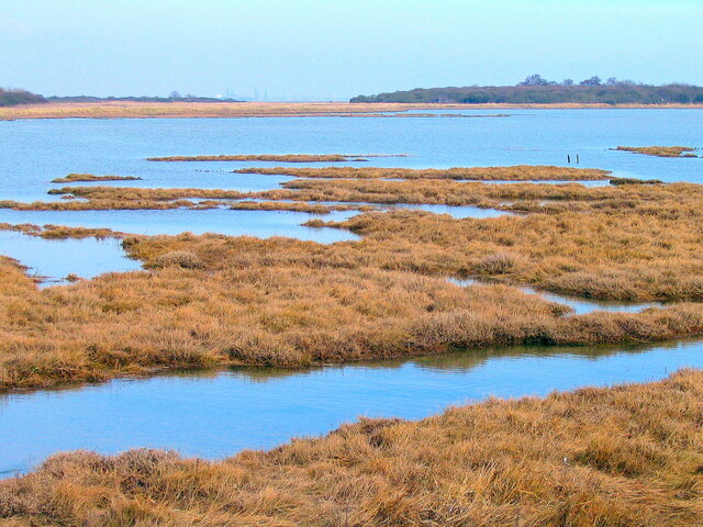
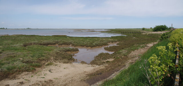
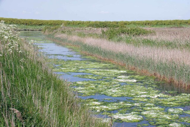
Kirby Creek is a picturesque waterway located in the county of Essex, England. This natural feature serves as a sea, estuary, and creek, showcasing a diverse ecosystem and providing numerous recreational opportunities for both locals and visitors.

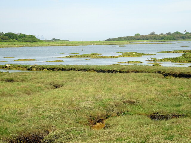
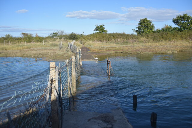
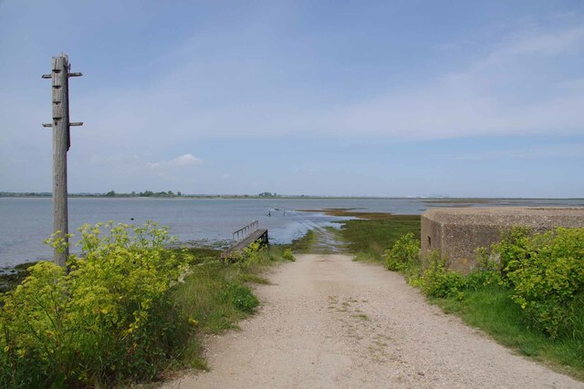
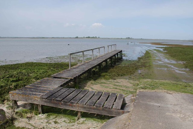
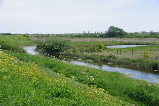
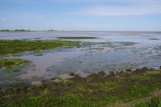
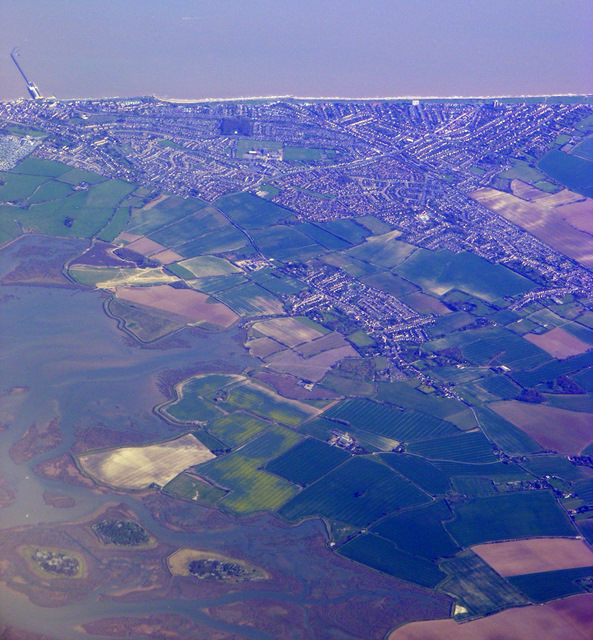
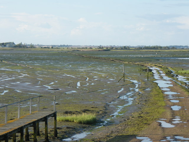
Situated on the east coast of England, Kirby Creek is part of the wider River Colne estuary system. The creek itself stretches approximately 10 miles inland, flowing through vast salt marshes and mudflats. These tidal flats provide a vital habitat for a variety of wildlife, including birds, fish, and invertebrates. Birdwatchers flock to the area to catch glimpses of rare species such as avocets, curlews, and oystercatchers.

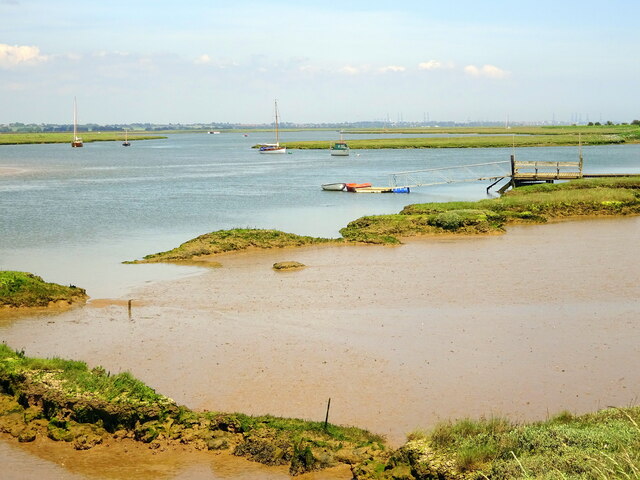
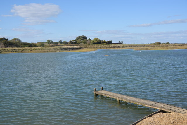
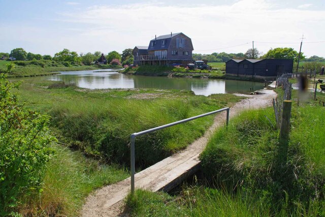
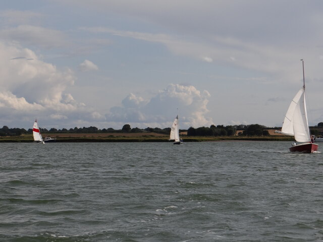
The mouth of Kirby Creek opens out into the North Sea, offering stunning views of the coastline and providing access to the open waters for boating enthusiasts. Its proximity to the sea also means that the creek experiences tides, which greatly impact the water levels and create shifting sandbanks and channels.

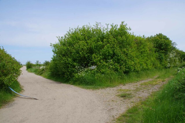
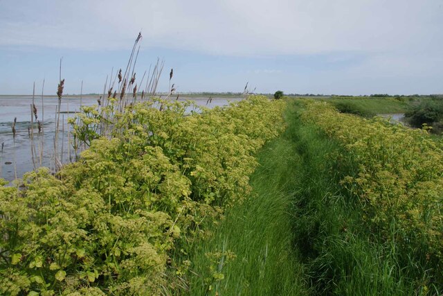
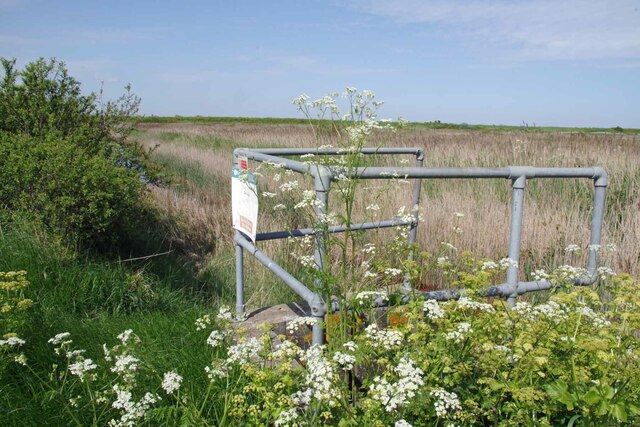
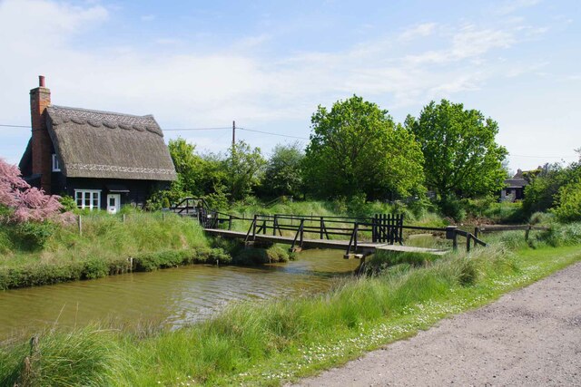
The surrounding area of Kirby Creek is a haven for nature lovers and outdoor enthusiasts. There are several walking and cycling trails that meander alongside the creek, providing opportunities to explore the beautiful landscapes and observe the local flora and fauna. Fishing is also a popular activity in the creek, with anglers often casting their lines in search of sea bass, flounder, and mullet.

Kirby Creek is not only a natural gem but also an important ecological and recreational resource for the community. Its diverse habitats, stunning vistas, and abundance of wildlife make it a must-visit destination for anyone seeking tranquility and a connection to nature in Essex.

If you have any feedback on the listing, please let us know in the comments section below.

Kirby Creek Images

Images are sourced within 2km of 51.870887/1.2294909 or Grid Reference TM2224. Thanks to Geograph Open Source API. All images are credited.

Skippers Island; 2010
Skippers Island; 2021
Hamford Water; near Skippers Island
Part of Hamford Water National Nature Reserve Near the Quay, Kirby-le-Soken, is this small jetty used by swimmers in the tidal water.
Part of Hamford Water National Nature Reserve
Near the Quay, Kirby-le-Soken, is this small jetty used by swimmers in the tidal water.
High tide thwarts points-bagger I had intended to walk this path to access three more squares I haven't visited but didn't have suitable footwear for the high tide.
High tide thwarts points-bagger
I had intended to walk this path to access three more squares I haven't visited but didn't have suitable footwear for the high tide.
The Way to Horsey Island The old Island Lane and footpath is out of shot to the left.
The Way to Horsey Island
The old Island Lane and footpath is out of shot to the left.
Pillbox and Horsey Causeway Looking across Hamford Water towards Horsey Island <span class="nowrap"><a title="https://en.wikipedia.org/wiki/Horsey_Island" rel="nofollow ugc noopener" href="https://en.wikipedia.org/wiki/Horsey_Island">Link</a><img style="margin-left:2px;" alt="External link" title="External link - shift click to open in new window" src="https://s1.geograph.org.uk/img/external.png" width="10" height="10"/></span>
Pillbox and Horsey Causeway
Looking across Hamford Water towards Horsey Island LinkExternal link
Jetty For Horsey Island A receding tide on Hamford Water <span class="nowrap"><a title="https://en.wikipedia.org/wiki/Horsey_Island" rel="nofollow ugc noopener" href="https://en.wikipedia.org/wiki/Horsey_Island">Link</a><img style="margin-left:2px;" alt="External link" title="External link - shift click to open in new window" src="https://s1.geograph.org.uk/img/external.png" width="10" height="10"/></span>
Jetty For Horsey Island
A receding tide on Hamford Water LinkExternal link
Horsey Jetty Panorama Looking along the sea wall back towards the <a href="https://www.geograph.org.uk/photo/7490432">TM2322 : Jetty For Horsey Island</a>.
Horsey Jetty Panorama
Looking along the sea wall back towards the TM2322 : Jetty For Horsey Island.
Borrow Dike Near St Peters Point The Alexanders in the foreground are prolific on the sea wall.
Borrow Dike Near St Peters Point
The Alexanders in the foreground are prolific on the sea wall.
Saltmarsh in the Wade Looking across Hamford Water.
Saltmarsh in the Wade
Looking across Hamford Water.
Alexanders On the Sea Wall Looking along Frinton & Walton Footpath 36 that follows the seawall.
Alexanders On the Sea Wall
Looking along Frinton & Walton Footpath 36 that follows the seawall.
Algae on the Borrow Dike Looking towards St Peters Point.
Algae on the Borrow Dike
Looking towards St Peters Point.
Decoy Hall Sluice Looking towards St Peter's Point
Decoy Hall Sluice
Looking towards St Peter's Point
Kirby Quay The footbridge carries Frinton & Walton Footpath 32  across the ditch.
Kirby Quay
The footbridge carries Frinton & Walton Footpath 32 across the ditch.
Thatch Cottage The photo title is what it says on the gate but the Ordnance Survey says Thatched Cottage.
Thatch Cottage
The photo title is what it says on the gate but the Ordnance Survey says Thatched Cottage.
Up Kirby Creek Dinghies sailing out of Kirby Creek from the direction of Honey Island.
Up Kirby Creek
Dinghies sailing out of Kirby Creek from the direction of Honey Island.
Walton on the Naze from the air Looking over Skipper's Island towards the town and the pier. Viewed from a Prague bound flight from Heathrow.
Walton on the Naze from the air
Looking over Skipper's Island towards the town and the pier. Viewed from a Prague bound flight from Heathrow.
Show me another place!

Kirby Creek is located at Grid Ref: TM2224 (Lat: 51.870887, Lng: 1.2294909)

Administrative County: Essex

District: Tendring

Police Authority: Essex

What 3 Words

///crafts.sing.scrubber. Near Walton-on-the-Naze, Essex

Related Wikis

Skipper's Island

Skipper's Island is a 94.3-hectare (233-acre) nature reserve north of Kirby-le-Soken in Essex, England. It is owned and managed by the Essex Wildlife Trust...

Horsey Island

Horsey Island is an island in the parish of Thorpe-le-Soken, Essex. It lies in Hamford Water and is part of the Hamford Water National Nature Reserve,...

Hamford Water

Hamford Water is a 2,185.8-hectare (5,401-acre) biological Site of Special Scientific Interest between Walton-on-the-Naze and Harwich in Essex. The site...

The Sokens

The Sokens is a name often used to describe the area containing the traditional parishes of Thorpe, Kirby and Walton, which now lie in Tendring district...

Have you been to Kirby Creek?

Leave your review of Kirby Creek below (or comments, questions and feedback).