Oakley Creek

Sea, Estuary, Creek in Essex Tendring

England

Oakley Creek

Group of trees near bridleway, Little Oakley
Group of trees near bridleway, Little Oakley Credit: Roger Jones

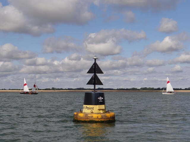
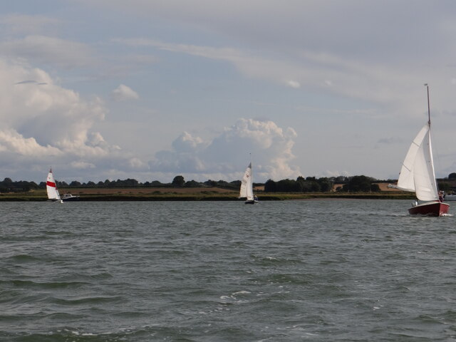
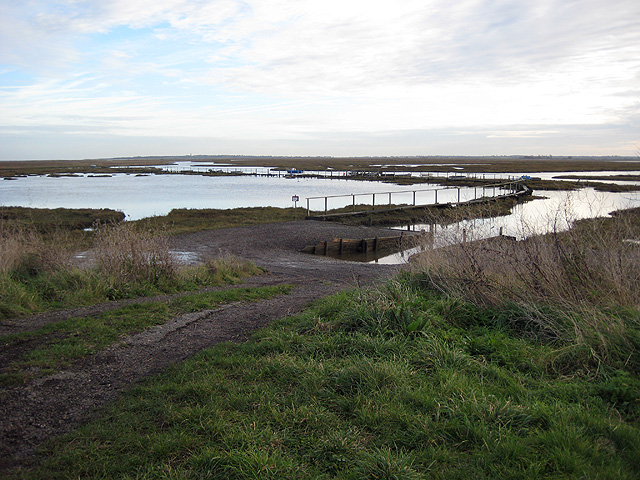
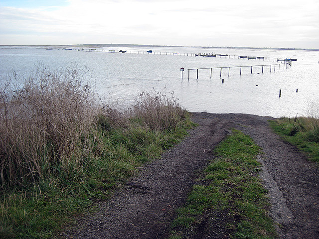
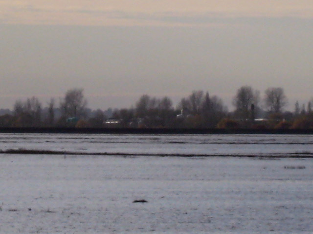
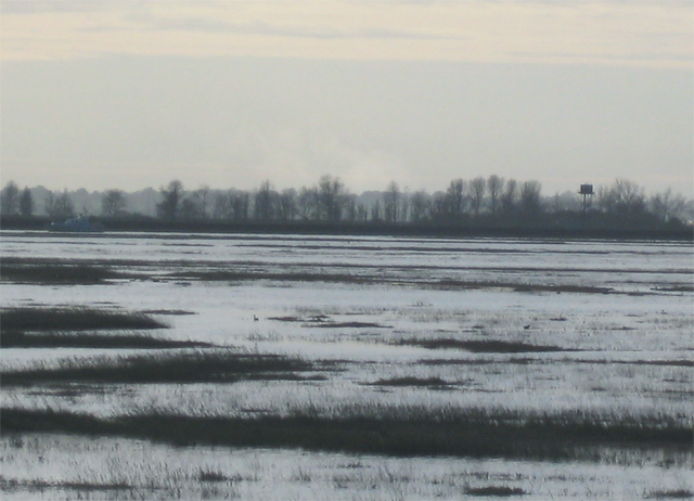
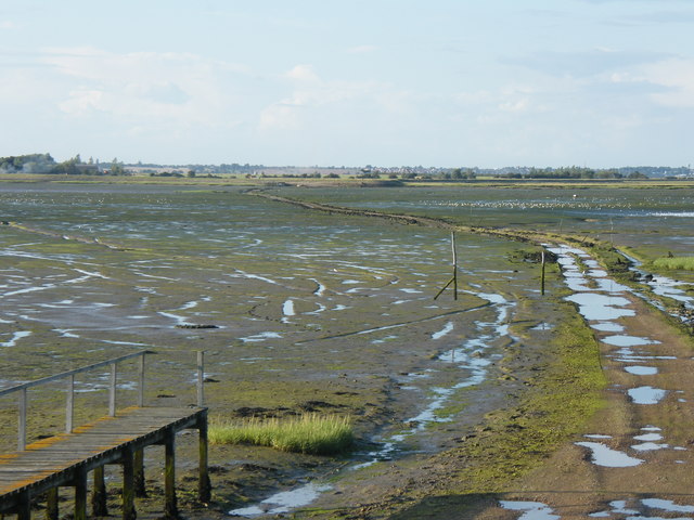
Oakley Creek is a picturesque waterway located in Essex, England. Situated near the small town of Oakley, this creek flows into the North Sea, making it an estuary. With its tranquil surroundings and diverse wildlife, Oakley Creek is a popular destination for nature enthusiasts and those seeking a peaceful retreat.

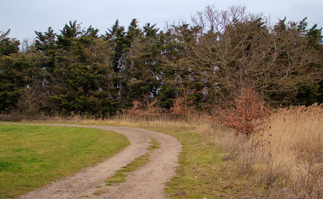
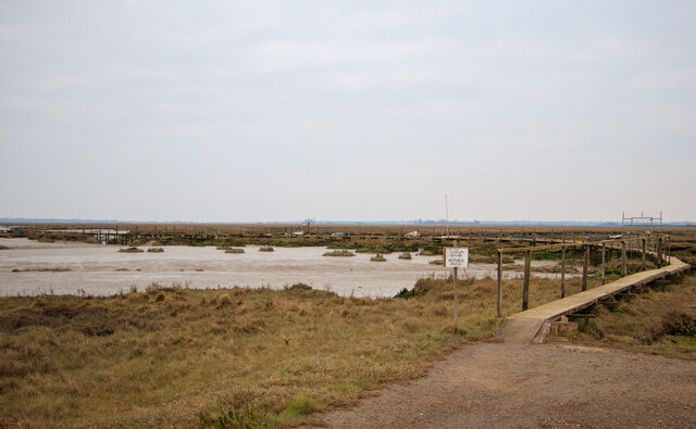
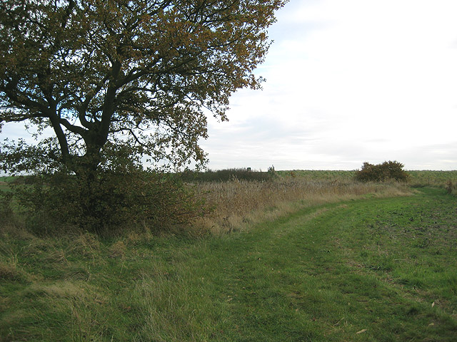
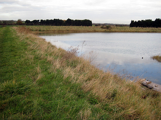
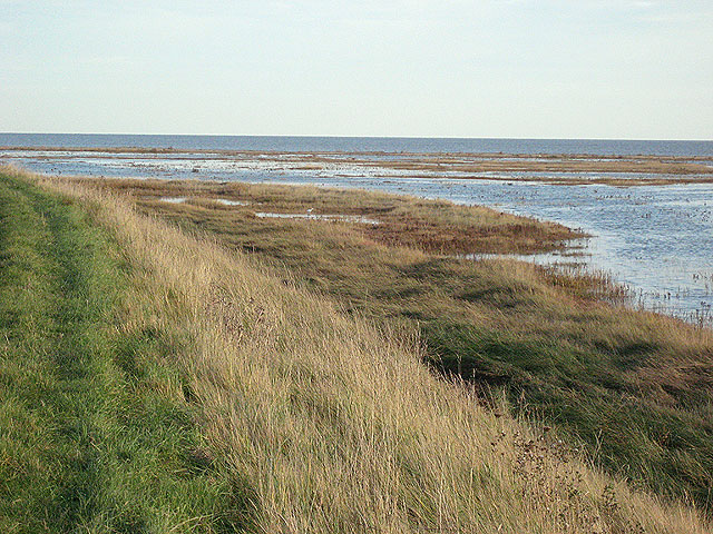
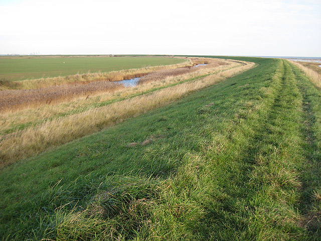
The creek stretches approximately 7 kilometers in length, meandering through lush marshlands and reed beds. The estuarine environment of Oakley Creek provides a diverse habitat for numerous species of plants and animals. The water is brackish, a mixture of saltwater from the sea and freshwater from rivers and rainfall, supporting a variety of marine life.

At low tide, the creek reveals a vast expanse of mudflats, which are important feeding grounds for wading birds such as curlews, oystercatchers, and sandpipers. These mudflats also attract numerous species of migratory birds during their annual journeys. Birdwatchers flock to Oakley Creek to observe these magnificent creatures in their natural habitat.

The surrounding marshlands are home to a wide range of plant species, including saltmarsh grasses and reeds. These provide shelter and nesting sites for various bird species and serve as a vital breeding ground for fish and crustaceans.

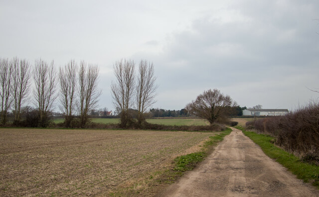
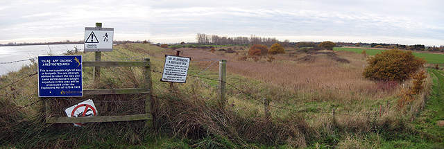
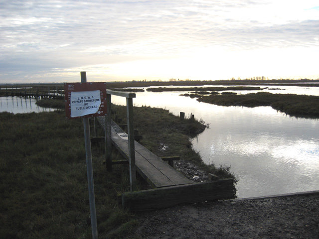
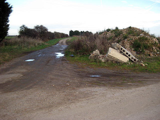
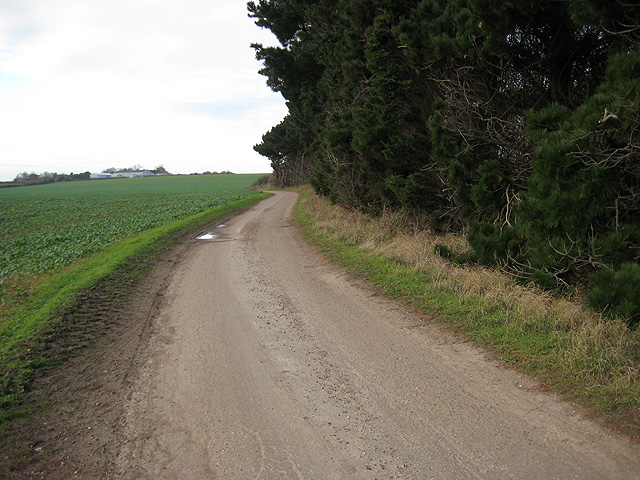
The creek is accessible to visitors via footpaths and observation points along its banks. These vantage points offer stunning views of the estuary, especially during sunset when the sky is painted with vibrant hues. Oakley Creek provides opportunities for leisurely walks, birdwatching, and photography, allowing visitors to immerse themselves in the beauty of nature.

Overall, Oakley Creek is a hidden gem in Essex, offering a serene escape from the hustle and bustle of urban life. Its diverse ecosystem and scenic landscapes make it a must-visit destination for nature lovers and those seeking tranquility by the water's edge.

If you have any feedback on the listing, please let us know in the comments section below.

Oakley Creek Images

Images are sourced within 2km of 51.891335/1.230638 or Grid Reference TM2226. Thanks to Geograph Open Source API. All images are credited.

Group of trees near bridleway, Little Oakley
Private walkway, Hamford Water National Nature Reserve This walkway on Hamford Water National Nature Reserve <span class="nowrap"><a title="https://www.gov.uk/government/publications/essexs-national-nature-reserves/essexs-national-nature-reserves#hamford-water" rel="nofollow ugc noopener" href="https://www.gov.uk/government/publications/essexs-national-nature-reserves/essexs-national-nature-reserves#hamford-water">Link</a><img style="margin-left:2px;" alt="External link" title="External link - shift click to open in new window" src="https://s1.geograph.org.uk/img/external.png" width="10" height="10"/></span> is marked 'private' for the use of Little Oakley and District Wildfowlers’ Association.

Hamford Water is also a SSSI.
Private walkway, Hamford Water National Nature Reserve
This walkway on Hamford Water National Nature Reserve LinkExternal link is marked 'private' for the use of Little Oakley and District Wildfowlers’ Association. Hamford Water is also a SSSI.
Bridleway to Little Oakley Hall farm
Island Point North Cardinal Buoy Helping to keep vessels from running aground on Mussel Scarfe, this buoy directs traffic to pass it to the north as it exits Walton Channel and joins the Hamford Water.   At night a quick white flashing light is emitted.
Island Point North Cardinal Buoy
Helping to keep vessels from running aground on Mussel Scarfe, this buoy directs traffic to pass it to the north as it exits Walton Channel and joins the Hamford Water. At night a quick white flashing light is emitted.
Up Kirby Creek Dinghies sailing out of Kirby Creek from the direction of Honey Island.
Up Kirby Creek
Dinghies sailing out of Kirby Creek from the direction of Honey Island.
Approaching the sea wall from Little Oakley The sea wall, seen here along the skyline, separates low land on this side from the sea and salt marshes at a higher level beyond.  The muddy marshes beyond the wall at this point have the graphic name of "Bull's Ooze".
Approaching the sea wall from Little Oakley
The sea wall, seen here along the skyline, separates low land on this side from the sea and salt marshes at a higher level beyond. The muddy marshes beyond the wall at this point have the graphic name of "Bull's Ooze".
Looking west towards Great Oakley Dock This view, shortly after high tide, shows graphically the contrast of levels on the sea and land sides of the sea wall.  Detail of the warning signs appear in another image <a href="https://www.geograph.org.uk/photo/620908">TM2127 : You have been warned!</a>.
Looking west towards Great Oakley Dock
This view, shortly after high tide, shows graphically the contrast of levels on the sea and land sides of the sea wall. Detail of the warning signs appear in another image TM2127 : You have been warned!.
You have been warned! Beyond this point is an explosives factory, Great Oakley Works, operated by "exchem" and situated on an isolated promontory projecting into the salt marshes, quite effectively isolated, in fact.
You have been warned!
Beyond this point is an explosives factory, Great Oakley Works, operated by "exchem" and situated on an isolated promontory projecting into the salt marshes, quite effectively isolated, in fact.
Wildfowlers' walkway on an ebbing tide An hour before, all but the approach road was submerged.  A passing member of the LODWA explained that his association had bought the marshes hereabouts and operated under the supervision of English Nature. The walkway is protected by a private sign; along its length a number of small boats are tied up. See <a href="https://www.geograph.org.uk/photo/749619">TM2227 : Wildfowler's walkway leading to Bull's Ooze</a> for one of several alternative views by Portsbob.
Wildfowlers' walkway on an ebbing tide
An hour before, all but the approach road was submerged. A passing member of the LODWA explained that his association had bought the marshes hereabouts and operated under the supervision of English Nature. The walkway is protected by a private sign; along its length a number of small boats are tied up. See TM2227 : Wildfowler's walkway leading to Bull's Ooze for one of several alternative views by Portsbob.
Wildfowlers' jetty shortly after high tide Compare <a href="https://www.geograph.org.uk/photo/620912">TM2227 : Wildfowlers' walkway on an ebbing tide</a>.  This image represents the situation some 90 to 120 minutes after high tide, with the jetty still inaccessible except in waders.
Wildfowlers' jetty shortly after high tide
Compare TM2227 : Wildfowlers' walkway on an ebbing tide. This image represents the situation some 90 to 120 minutes after high tide, with the jetty still inaccessible except in waders.
Looking south across Bull's Ooze The LODWA warns you off this low jetty, which leads to a number of wildfowlers' boats out in this muddy saltmarsh north of Hamford Water. The whole area here was fictionalised in Arthur Ransome's "Secret Water" <span class="nowrap"><a title="http://en.wikipedia.org/wiki/Secret_Water" rel="nofollow ugc noopener" href="http://en.wikipedia.org/wiki/Secret_Water">Link</a><img style="margin-left:2px;" alt="External link" title="External link - shift click to open in new window" src="https://s1.geograph.org.uk/img/external.png" width="10" height="10"/></span> and this part was called "Northern Sea".
Looking south across Bull's Ooze
The LODWA warns you off this low jetty, which leads to a number of wildfowlers' boats out in this muddy saltmarsh north of Hamford Water. The whole area here was fictionalised in Arthur Ransome's "Secret Water" LinkExternal link and this part was called "Northern Sea".
Bend in the sea wall near wildfowlers' jetty Water levels are still high up to 2 hours after high tide, still covering the mud and salt marshes.
Bend in the sea wall near wildfowlers' jetty
Water levels are still high up to 2 hours after high tide, still covering the mud and salt marshes.
Track towards the marshes Just down the road passing Little Oakley Sewage Works, this side track branches off towards the sea while the main track to the right leads to an informal car park for wildfowlers.  This is private land.
Track towards the marshes
Just down the road passing Little Oakley Sewage Works, this side track branches off towards the sea while the main track to the right leads to an informal car park for wildfowlers. This is private land.
Road heading back to Little Oakley Look right and you see <a href="https://www.geograph.org.uk/photo/620935">TM2228 : Track towards the marshes</a>, look left and you are facing north-west back towards the rising ground of Little Oakley and the road passing the sewage works.
Road heading back to Little Oakley
Look right and you see TM2228 : Track towards the marshes, look left and you are facing north-west back towards the rising ground of Little Oakley and the road passing the sewage works.
Salt marsh meets salt water The separation between marsh and open sea is very marginal here, especially after damage done in recent surge tides to the slight ridge between sea and marsh.
Salt marsh meets salt water
The separation between marsh and open sea is very marginal here, especially after damage done in recent surge tides to the slight ridge between sea and marsh.
The sweep of the sea wall The sea wall sweeps round to the north at it approaches the actual shore at Irlam's Beach. Off to the extreme left are the cranes of Felixstowe docks and the white dot in the field was a swan grazing on the new shoots of an autumn-sown grain crop.
The sweep of the sea wall
The sea wall sweeps round to the north at it approaches the actual shore at Irlam's Beach. Off to the extreme left are the cranes of Felixstowe docks and the white dot in the field was a swan grazing on the new shoots of an autumn-sown grain crop.
Distant view of explosives factory Great Oakley Works on Bramble Island (more a promontory than an island) is remote and hard to reach, protected on three sides by mud flats and salt marshes. A geograph is perhaps only possible from a small boat. More info from Wikipedia: <span class="nowrap"><a title="http://en.wikipedia.org/wiki/Great_Oakley%2C_Essex" rel="nofollow ugc noopener" href="http://en.wikipedia.org/wiki/Great_Oakley%2C_Essex">Link</a><img style="margin-left:2px;" alt="External link" title="External link - shift click to open in new window" src="https://s1.geograph.org.uk/img/external.png" width="10" height="10"/></span> plus this: <span class="nowrap"><a title="http://www.ivanhenderson.labour.co.uk/ViewPage.cfm?Page=15199" rel="nofollow ugc noopener" href="http://www.ivanhenderson.labour.co.uk/ViewPage.cfm?Page=15199">Link</a><img style="margin-left:2px;" alt="External link" title="External link - shift click to open in new window" src="https://s1.geograph.org.uk/img/external.png" width="10" height="10"/></span>
Distant view of explosives factory
Great Oakley Works on Bramble Island (more a promontory than an island) is remote and hard to reach, protected on three sides by mud flats and salt marshes. A geograph is perhaps only possible from a small boat. More info from Wikipedia: LinkExternal link plus this: LinkExternal link
Bramble Island and Oakley Creek On the edge of Great Oakley works, we can see the silhouette of a water tower, perhaps, and a military-looking vessel in Oakley Creek heading away from the factory towards Harwich or Felixstowe.
Bramble Island and Oakley Creek
On the edge of Great Oakley works, we can see the silhouette of a water tower, perhaps, and a military-looking vessel in Oakley Creek heading away from the factory towards Harwich or Felixstowe.
Show me another place!

Oakley Creek is located at Grid Ref: TM2226 (Lat: 51.891335, Lng: 1.230638)

Administrative County: Essex

District: Tendring

Police Authority: Essex

What 3 Words

///lofts.startles.showed. Near Walton-on-the-Naze, Essex

Related Wikis

Pewit Island

Pewit Island is an uninhabited island at the north of Hamford Water off the coast of the English county of Essex. The nearest town is the port of Harwich...

Hamford Water

Hamford Water is a 2,185.8-hectare (5,401-acre) biological Site of Special Scientific Interest between Walton-on-the-Naze and Harwich in Essex. The site...

Horsey Island

Horsey Island is an island in the parish of Thorpe-le-Soken, Essex. It lies in Hamford Water and is part of the Hamford Water National Nature Reserve,...

Skipper's Island

Skipper's Island is a 94.3-hectare (233-acre) nature reserve north of Kirby-le-Soken in Essex, England. It is owned and managed by the Essex Wildlife Trust...

Little Oakley, Essex

Little Oakley is a village in Essex, England, on the western outskirts of Harwich. The parish population at the 2011 census was 1,171.It is the site of...

Great Oakley, Essex

Great Oakley is a village and civil parish in the Tendring district of Essex, England. It is a long, narrow parish lying on the top of a low (25 m) ridge...

Little Oakley F.C.

Little Oakley Football Club is a football club based in Little Oakley, Essex, England. They are currently members of the Essex Senior League and play at...

Little Oakley Channel Deposit

Little Oakley Channel Deposit is a three-hectare geological Site of Special Scientific Interest in Little Oakley in Essex, England. It is a Geological...

Nearby Amenities

Located within 500m of 51.891335,1.230638
New Island
Place: island
Source Name: OS_OpenData_StreetView
Lat/Long: 51.8901429/1.2358364
The data included in this document is from www.openstreetmap.org. The data is made available under ODbL.

Have you been to Oakley Creek?

Leave your review of Oakley Creek below (or comments, questions and feedback).