Bramble Creek

Sea, Estuary, Creek in Essex Tendring

England

Bramble Creek

Hamford Water; near Skippers Island
Hamford Water; near Skippers Island Credit: Mr James D

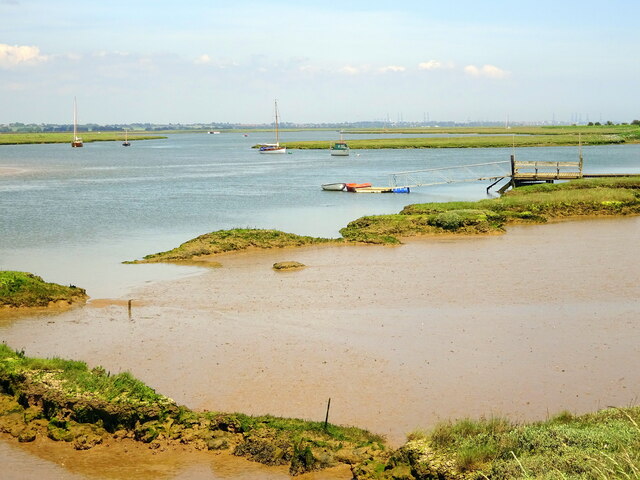
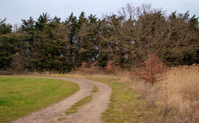
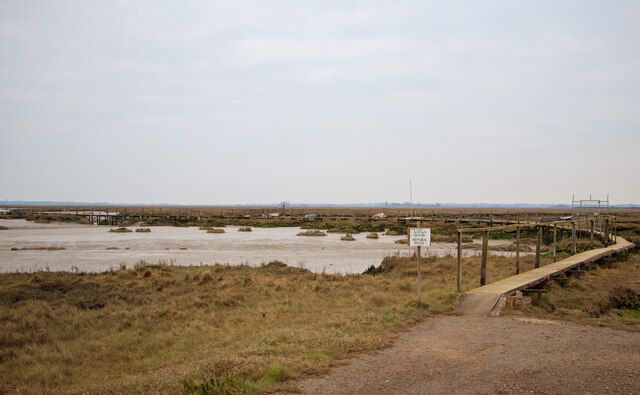
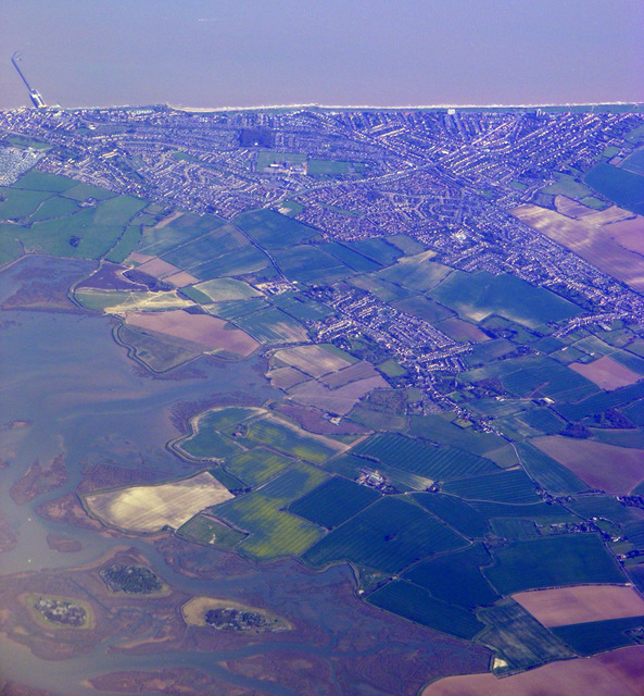
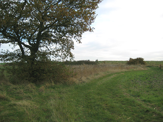
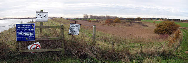
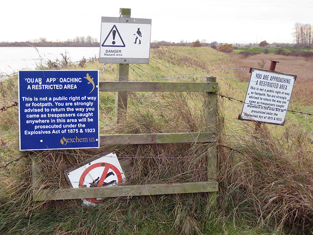
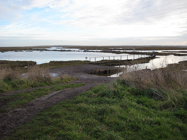
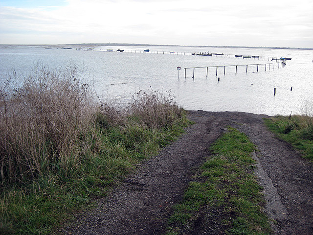
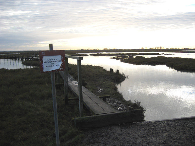
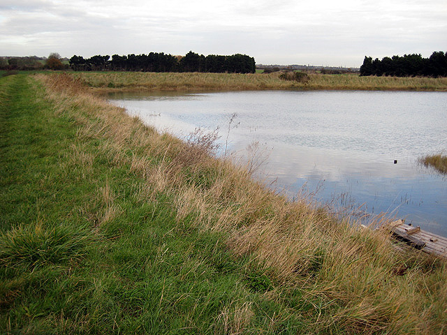
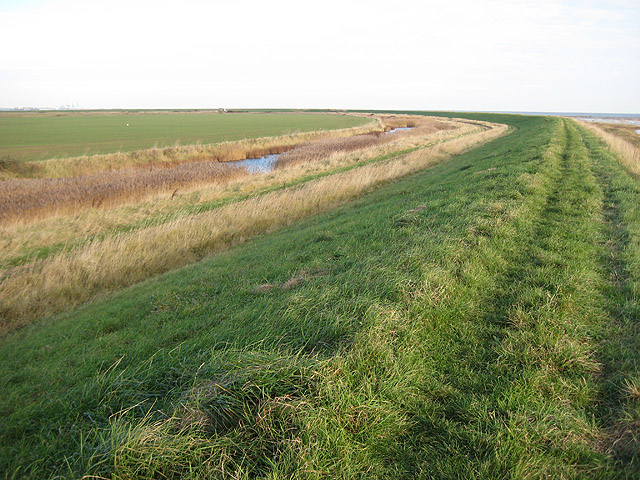
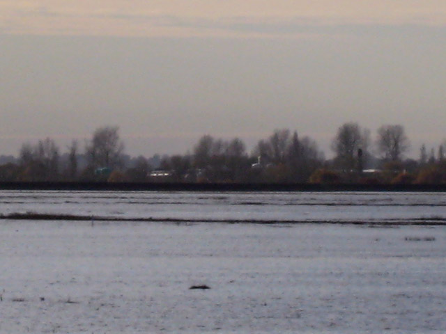
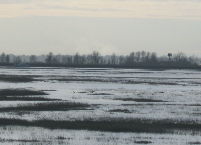
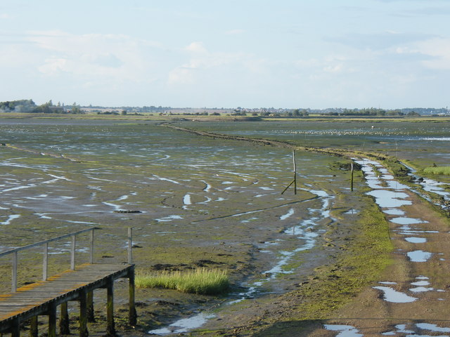
Bramble Creek is a picturesque waterway located in the county of Essex, England. Nestled between the sea and an estuary, it is a charming creek that offers a tranquil escape for nature lovers and outdoor enthusiasts. Spanning approximately 3 miles, Bramble Creek meanders through lush marshlands and verdant coastal vegetation, creating a diverse and thriving ecosystem.

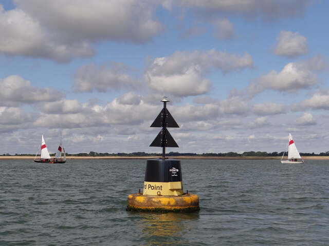
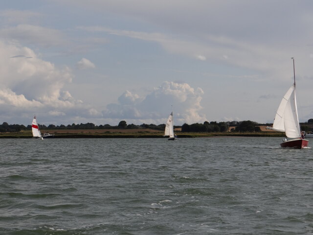
The creek is influenced by the tides of the North Sea, which contribute to the constant ebb and flow of its waters. During high tide, the creek is filled with crystal-clear seawater, which sparkles under the sun's rays. At low tide, the creek reveals a sandy shoreline dotted with small rock formations and vibrant marine life, making it a popular spot for beachcombing and exploring.

Bramble Creek is a haven for a wide range of bird species, making it a paradise for birdwatchers. From majestic herons and elegant egrets to colorful kingfishers and elusive avocets, the creek attracts a rich diversity of feathered inhabitants. Additionally, the surrounding marshes and reed beds provide a sanctuary for various mammals, such as otters and seals, adding to the area's natural allure.

The creek is also known for its accessibility to water sports enthusiasts. Kayakers and paddleboarders can navigate the calm waters, taking in the breathtaking views of the surrounding coastal landscapes. Fishing is also a popular activity in Bramble Creek, with anglers casting their lines in search of sea bass, flounder, and other local fish species.

Overall, Bramble Creek is a hidden gem in Essex, offering a serene and idyllic setting for nature lovers, birdwatchers, and those seeking a peaceful retreat by the sea.

If you have any feedback on the listing, please let us know in the comments section below.

Bramble Creek Images

Images are sourced within 2km of 51.889002/1.2271565 or Grid Reference TM2226. Thanks to Geograph Open Source API. All images are credited.

Hamford Water; near Skippers Island
Group of trees near bridleway, Little Oakley
Private walkway, Hamford Water National Nature Reserve This walkway on Hamford Water National Nature Reserve <span class="nowrap"><a title="https://www.gov.uk/government/publications/essexs-national-nature-reserves/essexs-national-nature-reserves#hamford-water" rel="nofollow ugc noopener" href="https://www.gov.uk/government/publications/essexs-national-nature-reserves/essexs-national-nature-reserves#hamford-water">Link</a><img style="margin-left:2px;" alt="External link" title="External link - shift click to open in new window" src="https://s1.geograph.org.uk/img/external.png" width="10" height="10"/></span> is marked 'private' for the use of Little Oakley and District Wildfowlers’ Association.

Hamford Water is also a SSSI.
Private walkway, Hamford Water National Nature Reserve
This walkway on Hamford Water National Nature Reserve LinkExternal link is marked 'private' for the use of Little Oakley and District Wildfowlers’ Association. Hamford Water is also a SSSI.
Island Point North Cardinal Buoy Helping to keep vessels from running aground on Mussel Scarfe, this buoy directs traffic to pass it to the north as it exits Walton Channel and joins the Hamford Water.   At night a quick white flashing light is emitted.
Island Point North Cardinal Buoy
Helping to keep vessels from running aground on Mussel Scarfe, this buoy directs traffic to pass it to the north as it exits Walton Channel and joins the Hamford Water. At night a quick white flashing light is emitted.
Up Kirby Creek Dinghies sailing out of Kirby Creek from the direction of Honey Island.
Up Kirby Creek
Dinghies sailing out of Kirby Creek from the direction of Honey Island.
Walton on the Naze from the air Looking over Skipper's Island towards the town and the pier. Viewed from a Prague bound flight from Heathrow.
Walton on the Naze from the air
Looking over Skipper's Island towards the town and the pier. Viewed from a Prague bound flight from Heathrow.
Skipper's Island, in Hamford Water National Nature Reserve Some buildings on the island are visible in the middle of the photo, in the middle distance.  The tide is ebbing, a little below halfway to low tide. The area of Hamford Water was fictionalised in Arthur Ransome's "Secret Water" <span class="nowrap"><a title="http://en.wikipedia.org/wiki/Secret_Water" rel="nofollow ugc noopener" href="http://en.wikipedia.org/wiki/Secret_Water">Link</a><img style="margin-left:2px;" alt="External link" title="External link - shift click to open in new window" src="https://s1.geograph.org.uk/img/external.png" width="10" height="10"/></span>.  In the book, Skipper's Island is called "Mastodon Island".
Skipper's Island, in Hamford Water National Nature Reserve
Some buildings on the island are visible in the middle of the photo, in the middle distance. The tide is ebbing, a little below halfway to low tide. The area of Hamford Water was fictionalised in Arthur Ransome's "Secret Water" LinkExternal link. In the book, Skipper's Island is called "Mastodon Island".
Approaching the sea wall from Little Oakley The sea wall, seen here along the skyline, separates low land on this side from the sea and salt marshes at a higher level beyond.  The muddy marshes beyond the wall at this point have the graphic name of "Bull's Ooze".
Approaching the sea wall from Little Oakley
The sea wall, seen here along the skyline, separates low land on this side from the sea and salt marshes at a higher level beyond. The muddy marshes beyond the wall at this point have the graphic name of "Bull's Ooze".
Looking west towards Great Oakley Dock This view, shortly after high tide, shows graphically the contrast of levels on the sea and land sides of the sea wall.  Detail of the warning signs appear in another image <a href="https://www.geograph.org.uk/photo/620908">TM2127 : You have been warned!</a>.
Looking west towards Great Oakley Dock
This view, shortly after high tide, shows graphically the contrast of levels on the sea and land sides of the sea wall. Detail of the warning signs appear in another image TM2127 : You have been warned!.
You have been warned! Beyond this point is an explosives factory, Great Oakley Works, operated by "exchem" and situated on an isolated promontory projecting into the salt marshes, quite effectively isolated, in fact.
You have been warned!
Beyond this point is an explosives factory, Great Oakley Works, operated by "exchem" and situated on an isolated promontory projecting into the salt marshes, quite effectively isolated, in fact.
Wildfowlers' walkway on an ebbing tide An hour before, all but the approach road was submerged.  A passing member of the LODWA explained that his association had bought the marshes hereabouts and operated under the supervision of English Nature. The walkway is protected by a private sign; along its length a number of small boats are tied up. See <a href="https://www.geograph.org.uk/photo/749619">TM2227 : Wildfowler's walkway leading to Bull's Ooze</a> for one of several alternative views by Portsbob.
Wildfowlers' walkway on an ebbing tide
An hour before, all but the approach road was submerged. A passing member of the LODWA explained that his association had bought the marshes hereabouts and operated under the supervision of English Nature. The walkway is protected by a private sign; along its length a number of small boats are tied up. See TM2227 : Wildfowler's walkway leading to Bull's Ooze for one of several alternative views by Portsbob.
Wildfowlers' jetty shortly after high tide Compare <a href="https://www.geograph.org.uk/photo/620912">TM2227 : Wildfowlers' walkway on an ebbing tide</a>.  This image represents the situation some 90 to 120 minutes after high tide, with the jetty still inaccessible except in waders.
Wildfowlers' jetty shortly after high tide
Compare TM2227 : Wildfowlers' walkway on an ebbing tide. This image represents the situation some 90 to 120 minutes after high tide, with the jetty still inaccessible except in waders.
Looking south across Bull's Ooze The LODWA warns you off this low jetty, which leads to a number of wildfowlers' boats out in this muddy saltmarsh north of Hamford Water. The whole area here was fictionalised in Arthur Ransome's "Secret Water" <span class="nowrap"><a title="http://en.wikipedia.org/wiki/Secret_Water" rel="nofollow ugc noopener" href="http://en.wikipedia.org/wiki/Secret_Water">Link</a><img style="margin-left:2px;" alt="External link" title="External link - shift click to open in new window" src="https://s1.geograph.org.uk/img/external.png" width="10" height="10"/></span> and this part was called "Northern Sea".
Looking south across Bull's Ooze
The LODWA warns you off this low jetty, which leads to a number of wildfowlers' boats out in this muddy saltmarsh north of Hamford Water. The whole area here was fictionalised in Arthur Ransome's "Secret Water" LinkExternal link and this part was called "Northern Sea".
Bend in the sea wall near wildfowlers' jetty Water levels are still high up to 2 hours after high tide, still covering the mud and salt marshes.
Bend in the sea wall near wildfowlers' jetty
Water levels are still high up to 2 hours after high tide, still covering the mud and salt marshes.
Track towards the marshes Just down the road passing Little Oakley Sewage Works, this side track branches off towards the sea while the main track to the right leads to an informal car park for wildfowlers.  This is private land.
Track towards the marshes
Just down the road passing Little Oakley Sewage Works, this side track branches off towards the sea while the main track to the right leads to an informal car park for wildfowlers. This is private land.
The sweep of the sea wall The sea wall sweeps round to the north at it approaches the actual shore at Irlam's Beach. Off to the extreme left are the cranes of Felixstowe docks and the white dot in the field was a swan grazing on the new shoots of an autumn-sown grain crop.
The sweep of the sea wall
The sea wall sweeps round to the north at it approaches the actual shore at Irlam's Beach. Off to the extreme left are the cranes of Felixstowe docks and the white dot in the field was a swan grazing on the new shoots of an autumn-sown grain crop.
Distant view of explosives factory Great Oakley Works on Bramble Island (more a promontory than an island) is remote and hard to reach, protected on three sides by mud flats and salt marshes. A geograph is perhaps only possible from a small boat. More info from Wikipedia: <span class="nowrap"><a title="http://en.wikipedia.org/wiki/Great_Oakley%2C_Essex" rel="nofollow ugc noopener" href="http://en.wikipedia.org/wiki/Great_Oakley%2C_Essex">Link</a><img style="margin-left:2px;" alt="External link" title="External link - shift click to open in new window" src="https://s1.geograph.org.uk/img/external.png" width="10" height="10"/></span> plus this: <span class="nowrap"><a title="http://www.ivanhenderson.labour.co.uk/ViewPage.cfm?Page=15199" rel="nofollow ugc noopener" href="http://www.ivanhenderson.labour.co.uk/ViewPage.cfm?Page=15199">Link</a><img style="margin-left:2px;" alt="External link" title="External link - shift click to open in new window" src="https://s1.geograph.org.uk/img/external.png" width="10" height="10"/></span>
Distant view of explosives factory
Great Oakley Works on Bramble Island (more a promontory than an island) is remote and hard to reach, protected on three sides by mud flats and salt marshes. A geograph is perhaps only possible from a small boat. More info from Wikipedia: LinkExternal link plus this: LinkExternal link
Bramble Island and Oakley Creek On the edge of Great Oakley works, we can see the silhouette of a water tower, perhaps, and a military-looking vessel in Oakley Creek heading away from the factory towards Harwich or Felixstowe.
Bramble Island and Oakley Creek
On the edge of Great Oakley works, we can see the silhouette of a water tower, perhaps, and a military-looking vessel in Oakley Creek heading away from the factory towards Harwich or Felixstowe.
Show me another place!

Bramble Creek is located at Grid Ref: TM2226 (Lat: 51.889002, Lng: 1.2271565)

Administrative County: Essex

District: Tendring

Police Authority: Essex

What 3 Words

///manifests.inhaled.images. Near Walton-on-the-Naze, Essex

Related Wikis

Pewit Island

Pewit Island is an uninhabited island at the north of Hamford Water off the coast of the English county of Essex. The nearest town is the port of Harwich...

Hamford Water

Hamford Water is a 2,185.8-hectare (5,401-acre) biological Site of Special Scientific Interest between Walton-on-the-Naze and Harwich in Essex. The site...

Horsey Island

Horsey Island is an island in the parish of Thorpe-le-Soken, Essex. It lies in Hamford Water and is part of the Hamford Water National Nature Reserve,...

Skipper's Island

Skipper's Island is a 94.3-hectare (233-acre) nature reserve north of Kirby-le-Soken in Essex, England. It is owned and managed by the Essex Wildlife Trust...

Great Oakley, Essex

Great Oakley is a village and civil parish in the Tendring district of Essex, England. It is a long, narrow parish lying on the top of a low (25 m) ridge...

Landermere Wharf

Landermere Wharf, sometimes called Landermere Quay, is a former dock area suitable for lying at anchor in the Tendring district of Essex, England.The wharf...

The Sokens

The Sokens is a name often used to describe the area containing the traditional parishes of Thorpe, Kirby and Walton, which now lie in Tendring district...

Little Oakley, Essex

Little Oakley is a village in Essex, England, on the western outskirts of Harwich. The parish population at the 2011 census was 1,171.It is the site of...

Related Videos

Great Oakley 11mile/17km Walk. Starring TOM OUTDOORS. #Walk #Essex #Collaboration

Our good friend TOM OUTDOORS invited us to join him on a 10.5mile walk starting at Gt Oakley in Essex, traveling through ...

Harwich to Hamford Water Nature Reserve: Seal Colony Boat Trip

A vlog of our boat trip to visit the Seal Colony at Hamford Water nature Reserve from Harwich, Essex. We left Harwich Ha'Penny ...

Seal Watching Trip Harwich - Hamford Water Nature Reserve - Private Seal Watching Tour

We booked a private hire seal watching tour with Seal Watching Harwich. Splitting the cost with our friends made this option very ...

Abandoned Boat Walk, Walton-on-the-Naze, Essex.

Not long now until lockdown is eased abit now and we can get back out there again in the way we want to! In the mean time here's ...

Have you been to Bramble Creek?

Leave your review of Bramble Creek below (or comments, questions and feedback).