Honey Island

Island in Essex Tendring

England

Honey Island

Skippers Island; 2010
Skippers Island; 2010 Credit: Mr James D

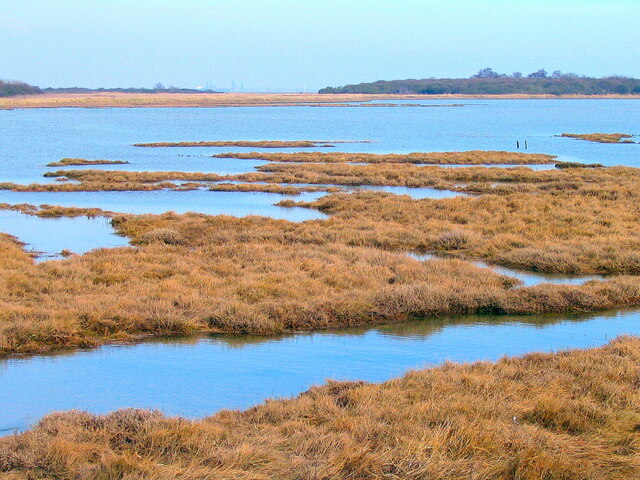
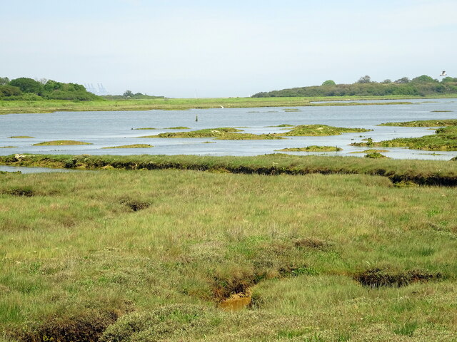
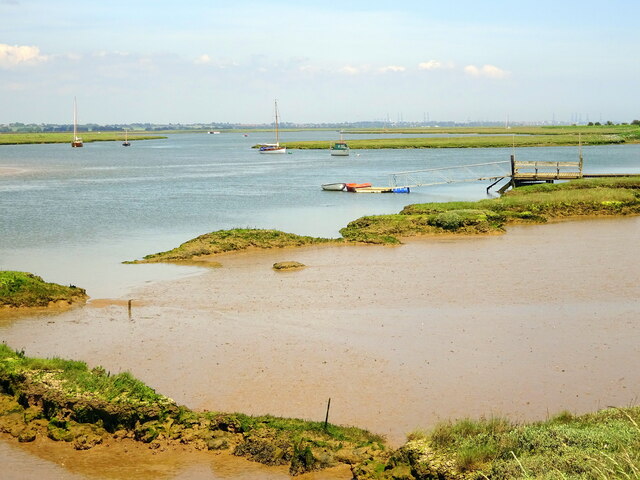
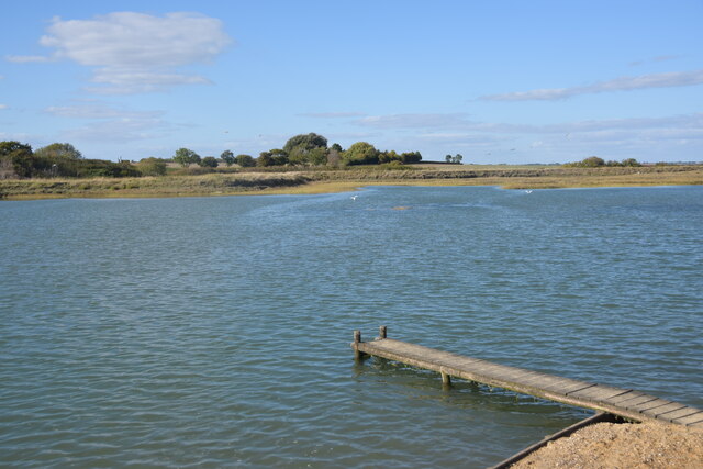
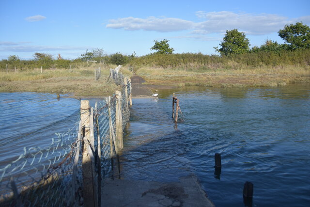
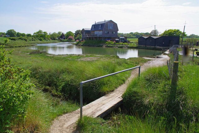
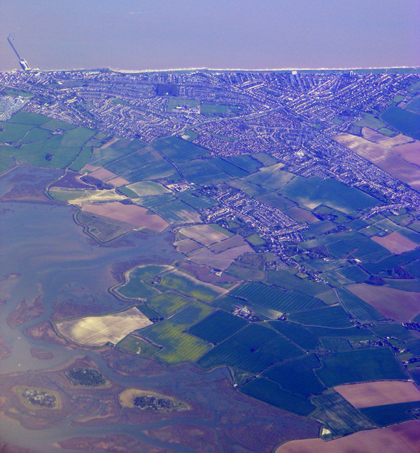
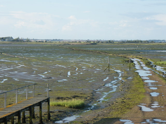
Honey Island, located off the coast of Essex in England, is a small and picturesque island that holds a significant historical and environmental value. Situated in the Blackwater Estuary, it covers an area of approximately 180 acres and is only accessible by boat.

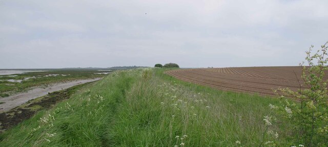
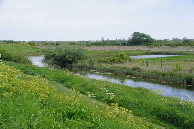
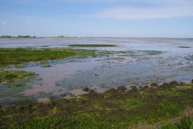
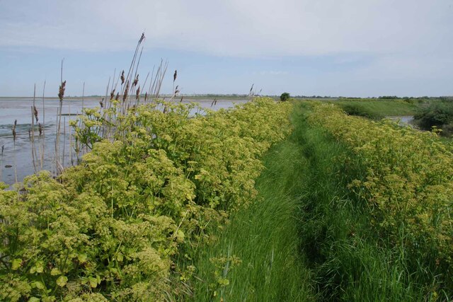
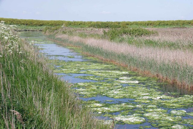
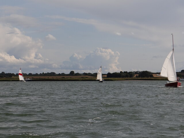
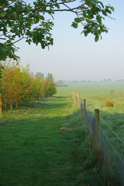
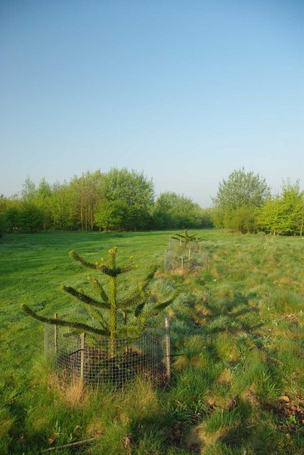
The island is renowned for its stunning natural beauty, with a diverse array of habitats including salt marshes, mudflats, and woodlands. It serves as an important sanctuary for a variety of bird species, making it a popular destination for birdwatchers and nature enthusiasts. Over 300 bird species have been recorded on Honey Island, including rare and migratory species such as the avocet and the little egret.

The island is also home to a rich and fascinating history. It was first mentioned in historical records dating back to the 12th century, and it has been inhabited by humans for centuries. In the past, it served as a base for smugglers during the 18th and 19th centuries, taking advantage of its secluded location and complex waterways.

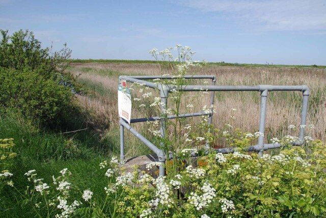
Today, Honey Island is primarily used for conservation purposes. It is managed by the Essex Wildlife Trust, which works diligently to preserve its unique ecosystems and protect its wildlife. The island is open to visitors, allowing them to explore its trails and observe the abundant wildlife. It is an ideal destination for nature lovers seeking tranquility and a glimpse into the rich history of the area.

If you have any feedback on the listing, please let us know in the comments section below.

Honey Island Images

Images are sourced within 2km of 51.873222/1.2247034 or Grid Reference TM2224. Thanks to Geograph Open Source API. All images are credited.

Skippers Island; 2010
Skippers Island; 2021
Hamford Water; near Skippers Island
Part of Hamford Water National Nature Reserve Near the Quay, Kirby-le-Soken, is this small jetty used by swimmers in the tidal water.
Part of Hamford Water National Nature Reserve
Near the Quay, Kirby-le-Soken, is this small jetty used by swimmers in the tidal water.
High tide thwarts points-bagger I had intended to walk this path to access three more squares I haven't visited but didn't have suitable footwear for the high tide.
High tide thwarts points-bagger
I had intended to walk this path to access three more squares I haven't visited but didn't have suitable footwear for the high tide.
Thorpe le Soken Footpath 23 Looking towards Thorpe le Soken.
Thorpe le Soken Footpath 23
Looking towards Thorpe le Soken.
Borrow Dike Near St Peters Point The Alexanders in the foreground are prolific on the sea wall.
Borrow Dike Near St Peters Point
The Alexanders in the foreground are prolific on the sea wall.
Saltmarsh in the Wade Looking across Hamford Water.
Saltmarsh in the Wade
Looking across Hamford Water.
Alexanders On the Sea Wall Looking along Frinton & Walton Footpath 36 that follows the seawall.
Alexanders On the Sea Wall
Looking along Frinton & Walton Footpath 36 that follows the seawall.
Algae on the Borrow Dike Looking towards St Peters Point.
Algae on the Borrow Dike
Looking towards St Peters Point.
Decoy Hall Sluice Looking towards St Peter's Point
Decoy Hall Sluice
Looking towards St Peter's Point
Kirby Quay The footbridge carries Frinton & Walton Footpath 32  across the ditch.
Kirby Quay
The footbridge carries Frinton & Walton Footpath 32 across the ditch.
Up Kirby Creek Dinghies sailing out of Kirby Creek from the direction of Honey Island.
Up Kirby Creek
Dinghies sailing out of Kirby Creek from the direction of Honey Island.
Walton on the Naze from the air Looking over Skipper's Island towards the town and the pier. Viewed from a Prague bound flight from Heathrow.
Walton on the Naze from the air
Looking over Skipper's Island towards the town and the pier. Viewed from a Prague bound flight from Heathrow.
Edge of Soken Wood This appears to be the boundary fence of the Woodland Trust's 
<span class="nowrap"><a title="https://www.woodlandtrust.org.uk/visiting-woods/woods/soken-wood/" rel="nofollow ugc noopener" href="https://www.woodlandtrust.org.uk/visiting-woods/woods/soken-wood/">Link</a><img style="margin-left:2px;" alt="External link" title="External link - shift click to open in new window" src="https://s1.geograph.org.uk/img/external.png" width="10" height="10"/></span> <a href="https://www.geograph.org.uk/photo/2379837">TM2222 : Soken Wood</a> however the field on the far side seems to have open access 
see <a href="https://www.geograph.org.uk/photo/2379921">TM2222 : Backwater Plea</a>
Edge of Soken Wood
This appears to be the boundary fence of the Woodland Trust's LinkExternal link TM2222 : Soken Wood however the field on the far side seems to have open access see TM2222 : Backwater Plea
Jurassic Wood The fossil record shows that at one time <a href="https://www.geograph.org.uk/photo/2379837">TM2222 : Soken Wood</a> and other exotic species grew in this area the Woodland Trust <span class="nowrap"><a title="http://www.woodlandtrust.org.uk/en/our-woods/pages/wood-details.aspx?wood=5382&site=soken-wood" rel="nofollow ugc noopener" href="http://www.woodlandtrust.org.uk/en/our-woods/pages/wood-details.aspx?wood=5382&site=soken-wood">Link</a><img style="margin-left:2px;" alt="External link" title="External link - shift click to open in new window" src="https://s1.geograph.org.uk/img/external.png" width="10" height="10"/></span> has planted some of these in a section of <a href="https://www.geograph.org.uk/photo/2379837">TM2222 : Soken Wood</a> <span class="nowrap"><a title="http://www.wildessex.net/sites/Soken%20Wood.htm" rel="nofollow ugc noopener" href="http://www.wildessex.net/sites/Soken%20Wood.htm">Link</a><img style="margin-left:2px;" alt="External link" title="External link - shift click to open in new window" src="https://s1.geograph.org.uk/img/external.png" width="10" height="10"/></span>
Jurassic Wood
The fossil record shows that at one time TM2222 : Soken Wood and other exotic species grew in this area the Woodland Trust LinkExternal link has planted some of these in a section of TM2222 : Soken Wood LinkExternal link
Monkey   Puzzle Millions of years ago this site was a <a href="https://www.geograph.org.uk/photo/2379859">TM2222 : Jurassic Wood</a> The Woodland Trust <span class="nowrap"><a title="https://www.woodlandtrust.org.uk/visiting-woods/woods/soken-wood/" rel="nofollow ugc noopener" href="https://www.woodlandtrust.org.uk/visiting-woods/woods/soken-wood/">Link</a><img style="margin-left:2px;" alt="External link" title="External link - shift click to open in new window" src="https://s1.geograph.org.uk/img/external.png" width="10" height="10"/></span> have planted some exotic trees in <a href="https://www.geograph.org.uk/photo/2379837">TM2222 : Soken Wood</a> <span class="nowrap"><a title="http://www.wildessex.net/sites/Soken%20Wood.htm" rel="nofollow ugc noopener" href="http://www.wildessex.net/sites/Soken%20Wood.htm">Link</a><img style="margin-left:2px;" alt="External link" title="External link - shift click to open in new window" src="https://s1.geograph.org.uk/img/external.png" width="10" height="10"/></span> to give a flavour of what it was like before mankind. Take an even closer look at <a href="https://www.geograph.org.uk/photo/2379882">TM2222 : Spider Puzzle?</a>
Monkey Puzzle
Millions of years ago this site was a TM2222 : Jurassic Wood The Woodland Trust LinkExternal link have planted some exotic trees in TM2222 : Soken Wood LinkExternal link to give a flavour of what it was like before mankind. Take an even closer look at TM2222 : Spider Puzzle?
Spider Puzzle? No puzzled monkeys on this <a href="https://www.geograph.org.uk/photo/2379875">TM2222 : Monkey   Puzzle</a> but the spiders clearly like it
Spider Puzzle?
No puzzled monkeys on this TM2222 : Monkey Puzzle but the spiders clearly like it
Show me another place!

Honey Island is located at Grid Ref: TM2224 (Lat: 51.873222, Lng: 1.2247034)

Administrative County: Essex

District: Tendring

Police Authority: Essex

What 3 Words

///brotherly.daring.ribcage. Near Walton-on-the-Naze, Essex

Related Wikis

Skipper's Island

Skipper's Island is a 94.3-hectare (233-acre) nature reserve north of Kirby-le-Soken in Essex, England. It is owned and managed by the Essex Wildlife Trust...

Hamford Water

Hamford Water is a 2,185.8-hectare (5,401-acre) biological Site of Special Scientific Interest between Walton-on-the-Naze and Harwich in Essex. The site...

Horsey Island

Horsey Island is an island in the parish of Thorpe-le-Soken, Essex. It lies in Hamford Water and is part of the Hamford Water National Nature Reserve,...

The Sokens

The Sokens is a name often used to describe the area containing the traditional parishes of Thorpe, Kirby and Walton, which now lie in Tendring district...

Nearby Amenities

Located within 500m of 51.873222,1.2247034
World War II bombing decoy HA2 Kirby-le-Soken
Historic: monument
Monument: ww2_bombing_decoy
Url: https://historicengland.org.uk/listing/the-list/list-entry/1019882
Lat/Long: 51.8696135/1.221588
The data included in this document is from www.openstreetmap.org. The data is made available under ODbL.

Have you been to Honey Island?

Leave your review of Honey Island below (or comments, questions and feedback).