Skipper's Island

Island in Essex Tendring

England

Skipper's Island

Towards Landermere Quay Looking towards <a href="https://www.geograph.org.uk/photo/7484429">TM1923 : Landermere Quay</a> past an <a href="https://www.geograph.org.uk/photo/7484426">TM1923 : Abandoned Boat on Hamford Water</a>
Towards Landermere Quay Credit: Glyn Baker

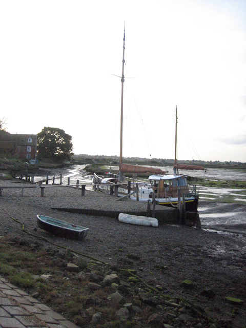
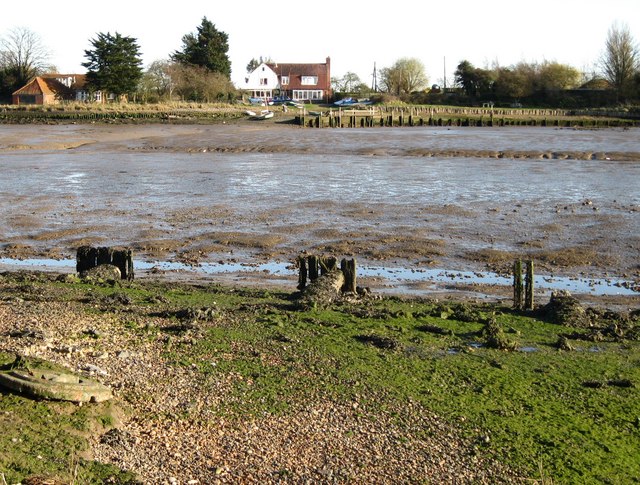
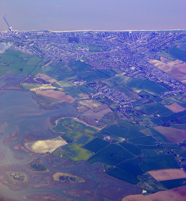
Skipper's Island, located off the coast of Essex, is a small and picturesque island in the eastern part of England. Situated in the estuary of the River Blackwater, this charming island covers an area of approximately 10 acres and is home to a rich and diverse wildlife.

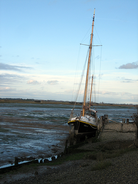
The island gets its name from the local fishermen who used to anchor their boats nearby and take refuge on the island during storms. It has since become a popular destination for nature enthusiasts and birdwatchers due to its unique ecosystem and bird population.

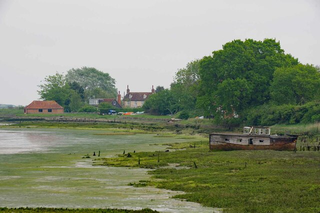
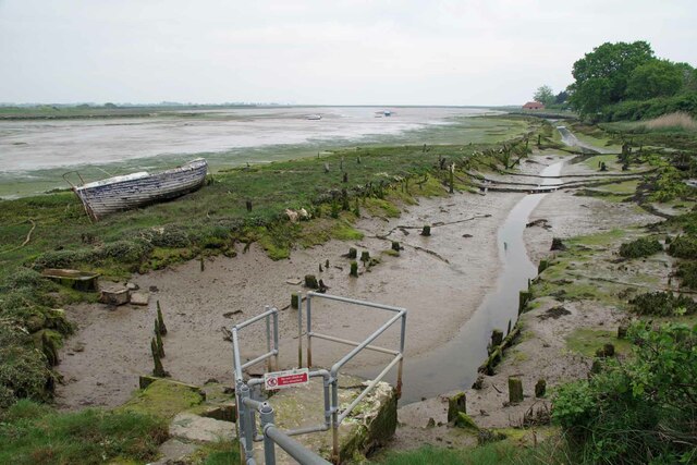
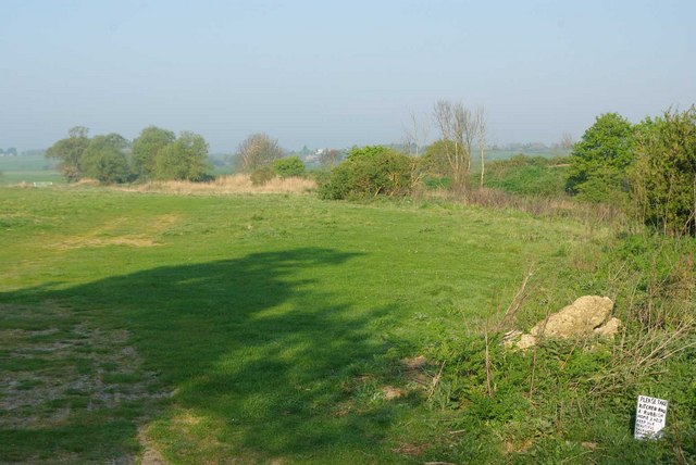
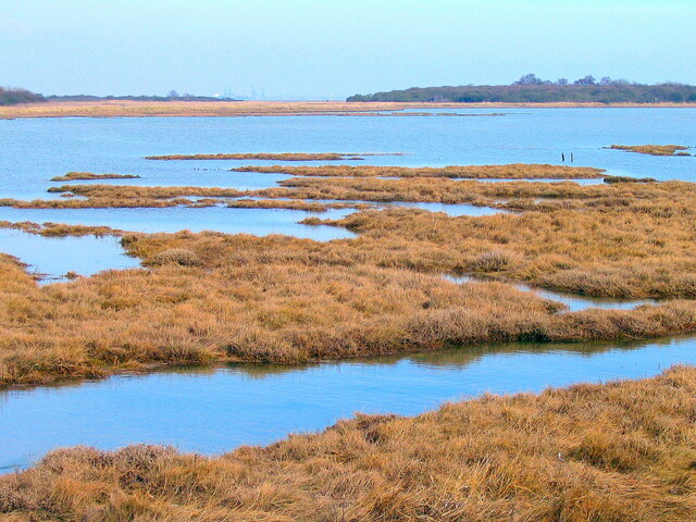
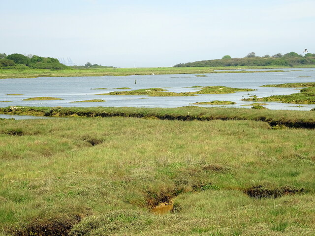
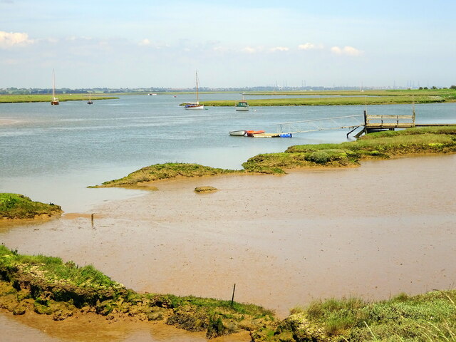
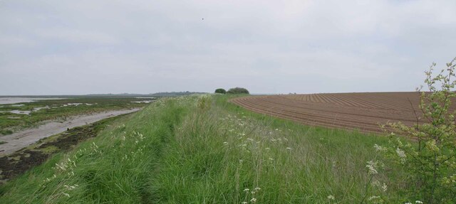
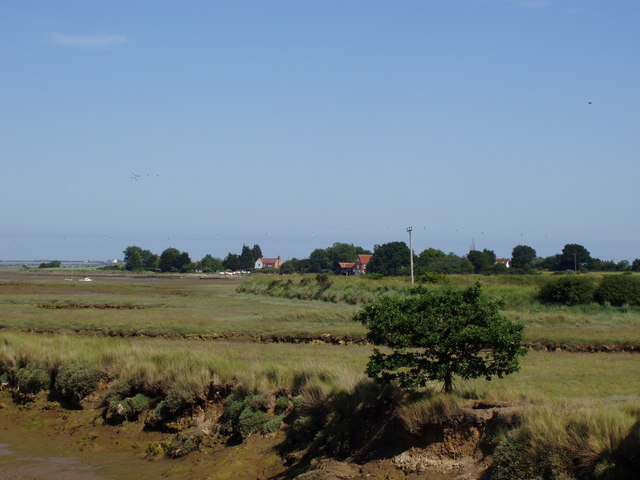
Skipper's Island boasts a varied landscape, with its shores lined by sandy beaches and its interior featuring grassy meadows and patches of woodland. The island is also known for its impressive cliffs that offer stunning panoramic views of the surrounding area.

The island's diverse range of wildlife includes various bird species such as oystercatchers, curlews, and little egrets, which can be spotted nesting and feeding along the shoreline. Additionally, the island is home to a colony of grey seals that can often be seen basking on the rocks at low tide.

Access to Skipper's Island is limited, with only a small number of guided tours and boat trips available during the summer months. Visitors can explore the island's nature trails, enjoy picnics on its sandy beaches, or simply relax and soak in the tranquil atmosphere.

Overall, Skipper's Island is a hidden gem in Essex, providing a haven for wildlife and offering visitors a unique opportunity to appreciate the beauty of nature in a serene and unspoiled setting.

If you have any feedback on the listing, please let us know in the comments section below.

Skipper's Island Images

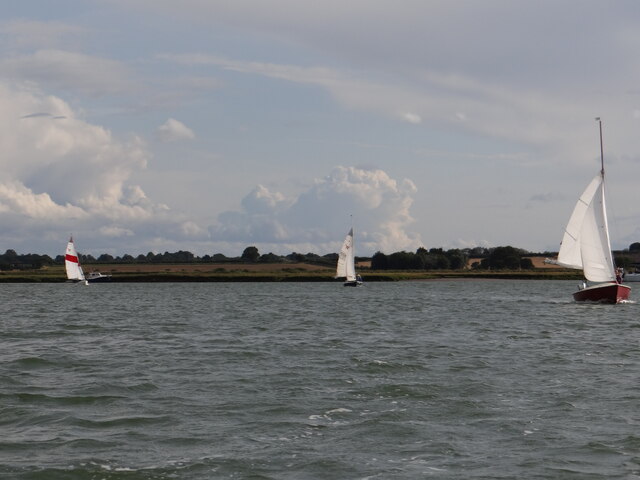
Images are sourced within 2km of 51.875501/1.2176591 or Grid Reference TM2124. Thanks to Geograph Open Source API. All images are credited.

Towards Landermere Quay Looking towards <a href="https://www.geograph.org.uk/photo/7484429">TM1923 : Landermere Quay</a> past an <a href="https://www.geograph.org.uk/photo/7484426">TM1923 : Abandoned Boat on Hamford Water</a>
Towards Landermere Quay
Landermere Quay A former quay in Hamford Waters.
Landermere Quay
A former quay in Hamford Waters.
Yacht at a small quay on Landermere Creek "Stenoa" at rest - but she'll refloat on the next high tide.  The area of Hamford Water was fictionalised in Arthur Ransome's "Secret Water" <span class="nowrap"><a title="http://en.wikipedia.org/wiki/Secret_Water" rel="nofollow ugc noopener" href="http://en.wikipedia.org/wiki/Secret_Water">Link</a><img style="margin-left:2px;" alt="External link" title="External link - shift click to open in new window" src="https://s1.geograph.org.uk/img/external.png" width="10" height="10"/></span>
Yacht at a small quay on Landermere Creek
"Stenoa" at rest - but she'll refloat on the next high tide. The area of Hamford Water was fictionalised in Arthur Ransome's "Secret Water" LinkExternal link
Gull Cottages, at the end of the track This line of uniform pink cottages in an isolated settlement sat snugly beside the track and behind a line of trees, all that separated them from the marshes and the north wind. Currently, the first in the row is to let, as advertised on the yellow notice.
Gull Cottages, at the end of the track
This line of uniform pink cottages in an isolated settlement sat snugly beside the track and behind a line of trees, all that separated them from the marshes and the north wind. Currently, the first in the row is to let, as advertised on the yellow notice.
Small quay near the end of the creek "Stenoa" is also in <a href="https://www.geograph.org.uk/photo/603497">TM1923 : Yacht at a small quay on Landermere Creek</a>.  This is the view looking inland up towards the end of Landermere Creek.
Small quay near the end of the creek
"Stenoa" is also in TM1923 : Yacht at a small quay on Landermere Creek. This is the view looking inland up towards the end of Landermere Creek.
Old quay opposite Landermere An ancient track leads across the saltings to the remains of an old quay, opposite Landermere Quay which can be seen on the other side of the creek.
Old quay opposite Landermere
An ancient track leads across the saltings to the remains of an old quay, opposite Landermere Quay which can be seen on the other side of the creek.
Old mooring post in Landermere Creek This mooring post is situated close to the remains of a former quay, opposite Landermere Quay which can be seen on the opposite side of the creek.
Old mooring post in Landermere Creek
This mooring post is situated close to the remains of a former quay, opposite Landermere Quay which can be seen on the opposite side of the creek.
Landermere Quay The old quay is viewed from the opposite side of the creek.
Landermere Quay
The old quay is viewed from the opposite side of the creek.
Sea wall and borrow dyke In the foreground the borrow dyke can just be seen. This acts as the secondary defence against flooding should the sea wall beyond be breached. In the distance are the container cranes at Felixstowe Docks.
Sea wall and borrow dyke
In the foreground the borrow dyke can just be seen. This acts as the secondary defence against flooding should the sea wall beyond be breached. In the distance are the container cranes at Felixstowe Docks.
Lone tree in a drain near Beaumont Quay A rough cattle path follows the line of a drain, which leads eastwards towards the sea wall. The tree is growing out of the bank of the ditch.
Lone tree in a drain near Beaumont Quay
A rough cattle path follows the line of a drain, which leads eastwards towards the sea wall. The tree is growing out of the bank of the ditch.
Walton on the Naze from the air Looking over Skipper's Island towards the town and the pier. Viewed from a Prague bound flight from Heathrow.
Walton on the Naze from the air
Looking over Skipper's Island towards the town and the pier. Viewed from a Prague bound flight from Heathrow.
Backwater Plea The small hand drawn sign on the right entreaties visitors to take their rubbish home to “keep our Beautiful Backwater Beautiful” it is ironic really as a few yards away there is a Council rubbish tip.
Backwater Plea
The small hand drawn sign on the right entreaties visitors to take their rubbish home to “keep our Beautiful Backwater Beautiful” it is ironic really as a few yards away there is a Council rubbish tip.
Skippers Island; 2010
Skippers Island; 2021
Hamford Water; near Skippers Island
Thorpe le Soken Footpath 23 Looking towards Thorpe le Soken.
Thorpe le Soken Footpath 23
Looking towards Thorpe le Soken.
Up Kirby Creek Dinghies sailing out of Kirby Creek from the direction of Honey Island.
Up Kirby Creek
Dinghies sailing out of Kirby Creek from the direction of Honey Island.
Landermere from Beaumont Quay View of Landermere from the quay at Beaumont
Landermere from Beaumont Quay
View of Landermere from the quay at Beaumont
Show me another place!

Skipper's Island is located at Grid Ref: TM2124 (Lat: 51.875501, Lng: 1.2176591)

Administrative County: Essex

District: Tendring

Police Authority: Essex

What 3 Words

///servicing.motor.body. Near Thorpe le Soken, Essex

Related Wikis

Skipper's Island

Skipper's Island is a 94.3-hectare (233-acre) nature reserve north of Kirby-le-Soken in Essex, England. It is owned and managed by the Essex Wildlife Trust...

Hamford Water

Hamford Water is a 2,185.8-hectare (5,401-acre) biological Site of Special Scientific Interest between Walton-on-the-Naze and Harwich in Essex. The site...

The Sokens

The Sokens is a name often used to describe the area containing the traditional parishes of Thorpe, Kirby and Walton, which now lie in Tendring district...

Landermere Wharf

Landermere Wharf, sometimes called Landermere Quay, is a former dock area suitable for lying at anchor in the Tendring district of Essex, England.The wharf...

Have you been to Skipper's Island?

Leave your review of Skipper's Island below (or comments, questions and feedback).