Horsey Island

Island in Essex Tendring

England

Horsey Island

Skippers Island; 2010
Skippers Island; 2010 Credit: Mr James D

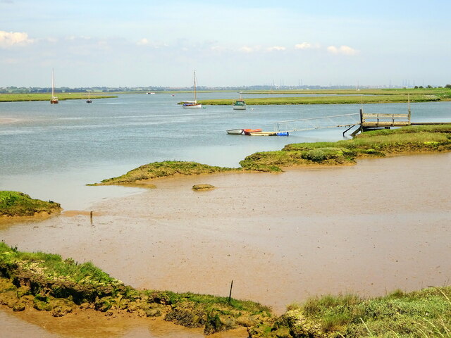
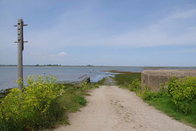
Horsey Island, located off the coast of Essex, England, is a small and picturesque island situated in the Blackwater Estuary. The island, also known as Potton Island, covers an area of approximately 250 acres and is accessible only by boat. It is a popular destination for nature enthusiasts, birdwatchers, and those looking to escape the hustle and bustle of city life.

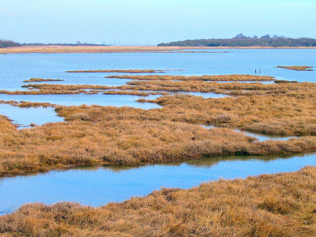
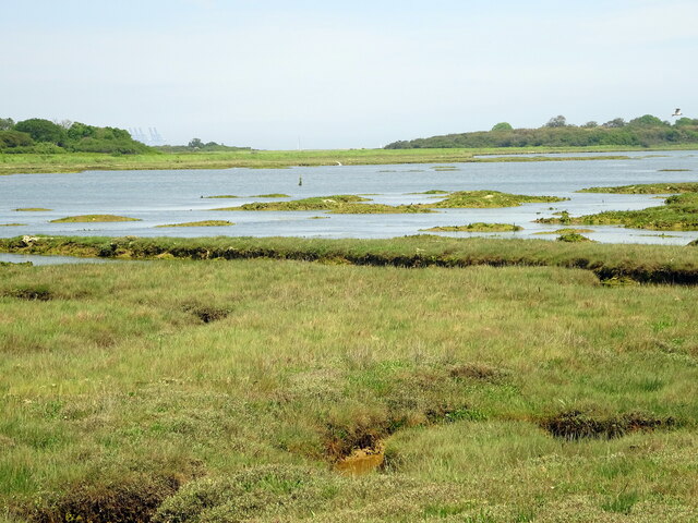
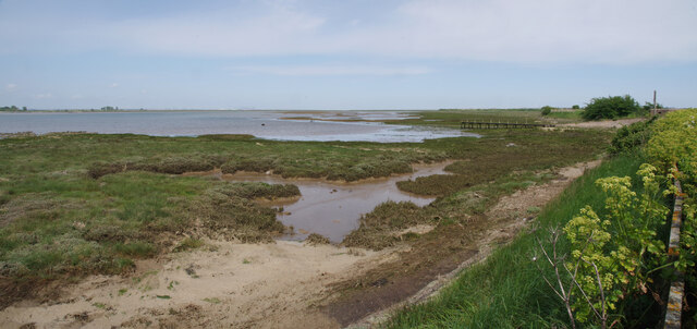
Horsey Island is renowned for its diverse wildlife and is designated as a Site of Special Scientific Interest (SSSI). The island is home to a variety of bird species, including avocets, brent geese, and redshanks. During the winter months, it becomes a haven for migratory birds, attracting birdwatchers from far and wide.

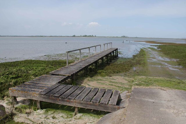
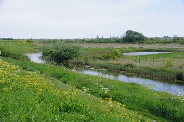
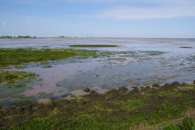
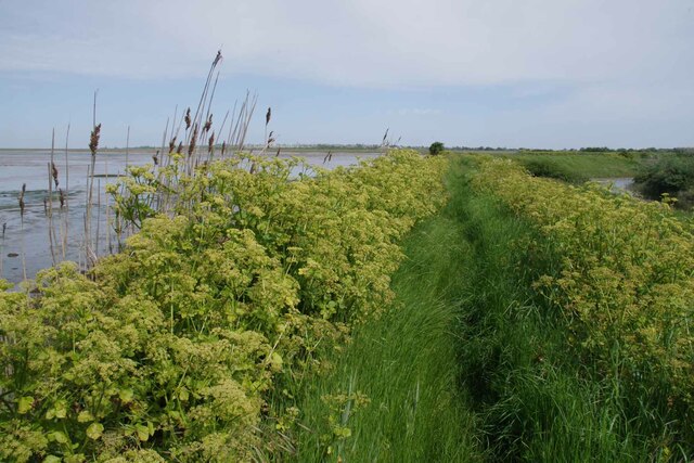
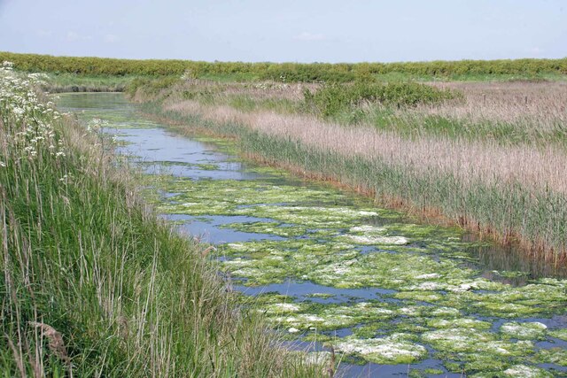
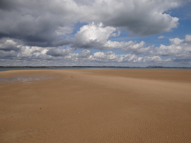
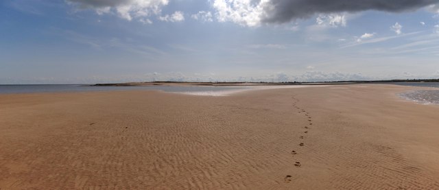
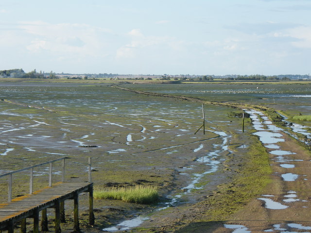
The landscape of Horsey Island is a mix of saltmarshes, mudflats, and reed beds, providing a unique habitat for numerous plant and animal species. The island's saltmarshes are particularly important as they serve as a breeding ground for fish and provide protection against coastal erosion.

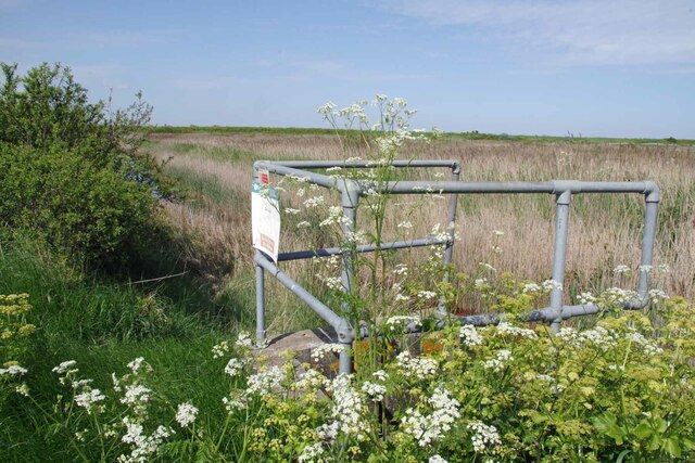
While Horsey Island does not have any permanent human residents, it is occasionally visited by dedicated conservationists and researchers who monitor and study the island's wildlife. Access to the island is restricted to protect its fragile ecosystem, and visitors are encouraged to respect the natural surroundings and adhere to conservation guidelines.

Boat trips to Horsey Island are available from nearby towns and villages, allowing visitors to experience the beauty of this tranquil island firsthand. Whether it's observing birds in their natural habitat or enjoying a peaceful stroll along the shoreline, Horsey Island offers a unique and enriching experience for nature lovers seeking solace in the natural world.

If you have any feedback on the listing, please let us know in the comments section below.

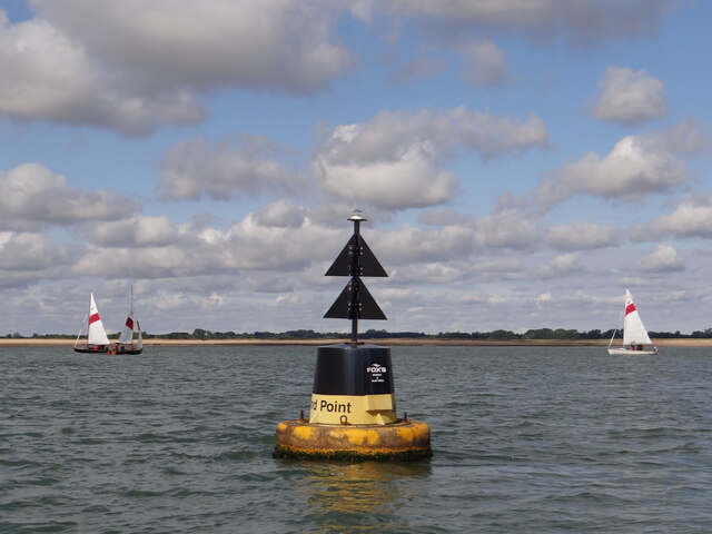
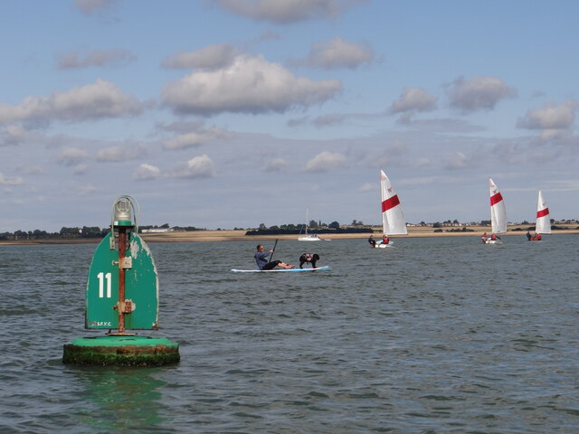
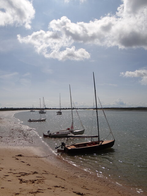
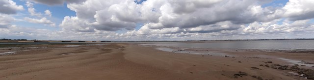
Horsey Island Images

Images are sourced within 2km of 51.876386/1.2381973 or Grid Reference TM2224. Thanks to Geograph Open Source API. All images are credited.

Skippers Island; 2010
Skippers Island; 2021
Hamford Water; near Skippers Island
Stone Point, Walton-on-the-Naze Stone Point at Hamford Water, Walton-on-the-Naze. Thames barges are visible lining the opposite bank.
Stone Point, Walton-on-the-Naze
Stone Point at Hamford Water, Walton-on-the-Naze. Thames barges are visible lining the opposite bank.
Pillbox and Horsey Causeway Looking across Hamford Water towards Horsey Island <span class="nowrap"><a title="https://en.wikipedia.org/wiki/Horsey_Island" rel="nofollow ugc noopener" href="https://en.wikipedia.org/wiki/Horsey_Island">Link</a><img style="margin-left:2px;" alt="External link" title="External link - shift click to open in new window" src="https://s1.geograph.org.uk/img/external.png" width="10" height="10"/></span>
Pillbox and Horsey Causeway
Looking across Hamford Water towards Horsey Island LinkExternal link
Jetty For Horsey Island A receding tide on Hamford Water <span class="nowrap"><a title="https://en.wikipedia.org/wiki/Horsey_Island" rel="nofollow ugc noopener" href="https://en.wikipedia.org/wiki/Horsey_Island">Link</a><img style="margin-left:2px;" alt="External link" title="External link - shift click to open in new window" src="https://s1.geograph.org.uk/img/external.png" width="10" height="10"/></span>
Jetty For Horsey Island
A receding tide on Hamford Water LinkExternal link
Horsey Jetty Panorama Looking along the sea wall back towards the <a href="https://www.geograph.org.uk/photo/7490432">TM2322 : Jetty For Horsey Island</a>.
Horsey Jetty Panorama
Looking along the sea wall back towards the TM2322 : Jetty For Horsey Island.
Borrow Dike Near St Peters Point The Alexanders in the foreground are prolific on the sea wall.
Borrow Dike Near St Peters Point
The Alexanders in the foreground are prolific on the sea wall.
Saltmarsh in the Wade Looking across Hamford Water.
Saltmarsh in the Wade
Looking across Hamford Water.
Alexanders On the Sea Wall Looking along Frinton & Walton Footpath 36 that follows the seawall.
Alexanders On the Sea Wall
Looking along Frinton & Walton Footpath 36 that follows the seawall.
Algae on the Borrow Dike Looking towards St Peters Point.
Algae on the Borrow Dike
Looking towards St Peters Point.
Decoy Hall Sluice Looking towards St Peter's Point
Decoy Hall Sluice
Looking towards St Peter's Point
Island Point North Cardinal Buoy Helping to keep vessels from running aground on Mussel Scarfe, this buoy directs traffic to pass it to the north as it exits Walton Channel and joins the Hamford Water.   At night a quick white flashing light is emitted.
Island Point North Cardinal Buoy
Helping to keep vessels from running aground on Mussel Scarfe, this buoy directs traffic to pass it to the north as it exits Walton Channel and joins the Hamford Water. At night a quick white flashing light is emitted.
Doggy Paddle! Plenty of activity on the water around starboard channel marker No 11
Doggy Paddle!
Plenty of activity on the water around starboard channel marker No 11
Free parking at Stone Point Selection of craft anchored to the south of Stone Point on the Walton Channel.  The crews are enjoying the sunshine on dry land!
Free parking at Stone Point
Selection of craft anchored to the south of Stone Point on the Walton Channel. The crews are enjoying the sunshine on dry land!
Stone Point panorama View of the Walton Channel and Hamford Water as they meet near the Mulberry Harbour vessels on the banks.  Note the several navigation buoys designed to keep traffic from running aground.
Stone Point panorama
View of the Walton Channel and Hamford Water as they meet near the Mulberry Harbour vessels on the banks. Note the several navigation buoys designed to keep traffic from running aground.
Almost in the next gridsquare If the tides were spring rather than neaps, I might have stood on the next gridsquare to the north. Felixstowe docks can be seen in the distance.
Almost in the next gridsquare
If the tides were spring rather than neaps, I might have stood on the next gridsquare to the north. Felixstowe docks can be seen in the distance.
Stone Point View of the tip of Stone point from the plentiful sands to the north.
Stone Point
View of the tip of Stone point from the plentiful sands to the north.
Show me another place!

Horsey Island is located at Grid Ref: TM2224 (Lat: 51.876386, Lng: 1.2381973)

Administrative County: Essex

District: Tendring

Police Authority: Essex

What 3 Words

///seeing.servicing.taller. Near Walton-on-the-Naze, Essex

Related Wikis

Hamford Water

Hamford Water is a 2,185.8-hectare (5,401-acre) biological Site of Special Scientific Interest between Walton-on-the-Naze and Harwich in Essex. The site...

Horsey Island

Horsey Island is an island in the parish of Thorpe-le-Soken, Essex. It lies in Hamford Water and is part of the Hamford Water National Nature Reserve,...

Skipper's Island

Skipper's Island is a 94.3-hectare (233-acre) nature reserve north of Kirby-le-Soken in Essex, England. It is owned and managed by the Essex Wildlife Trust...

Pewit Island

Pewit Island is an uninhabited island at the north of Hamford Water off the coast of the English county of Essex. The nearest town is the port of Harwich...

Nearby Amenities

Located within 500m of 51.876386,1.2381973
Horsey Island
Aeroway: aerodrome
Source: http://www.ukairfieldguide.net/airfields/Horsey-Island
Lat/Long: 51.8764132/1.2311524
The data included in this document is from www.openstreetmap.org. The data is made available under ODbL.

Have you been to Horsey Island?

Leave your review of Horsey Island below (or comments, questions and feedback).