Pewit Island

Island in Essex Tendring

England

Pewit Island

Stone Point, Walton-on-the-Naze Stone Point at Hamford Water, Walton-on-the-Naze. Thames barges are visible lining the opposite bank.
Stone Point, Walton-on-the-Naze Credit: Hobs

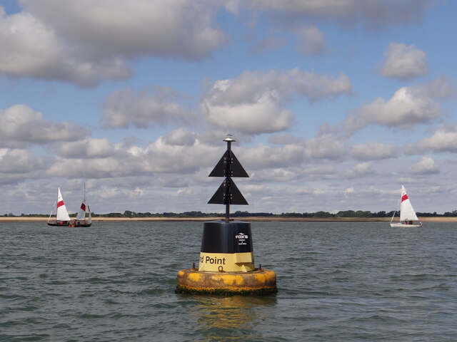
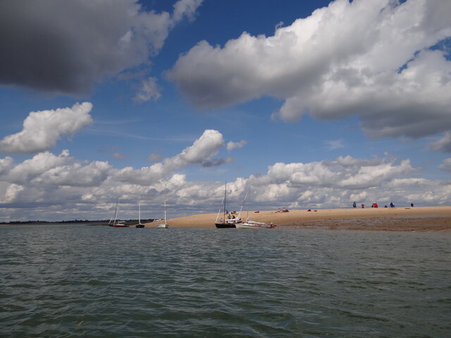
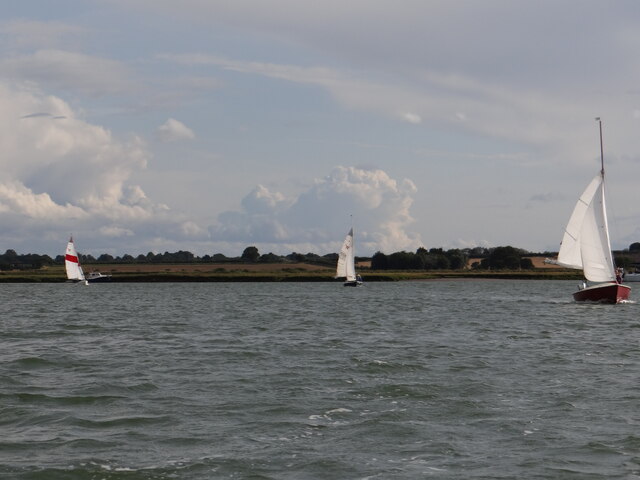
Pewit Island is a small island located in the River Crouch, off the coast of Essex, England. It is situated approximately 2 miles south of Burnham-on-Crouch and is known for its picturesque scenery and rich history.

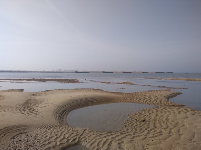
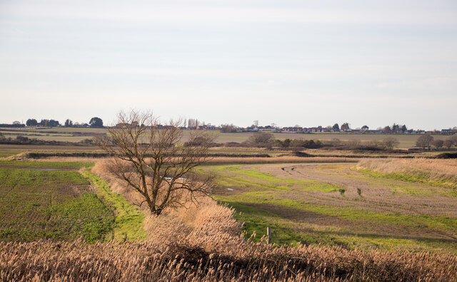
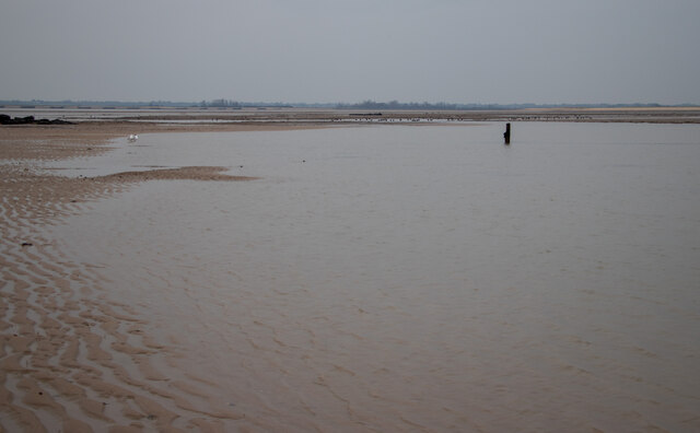
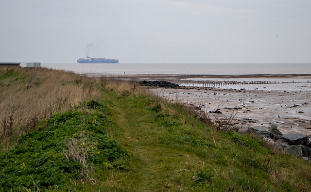
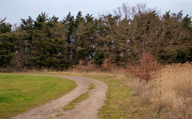
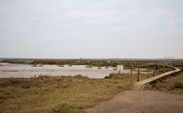
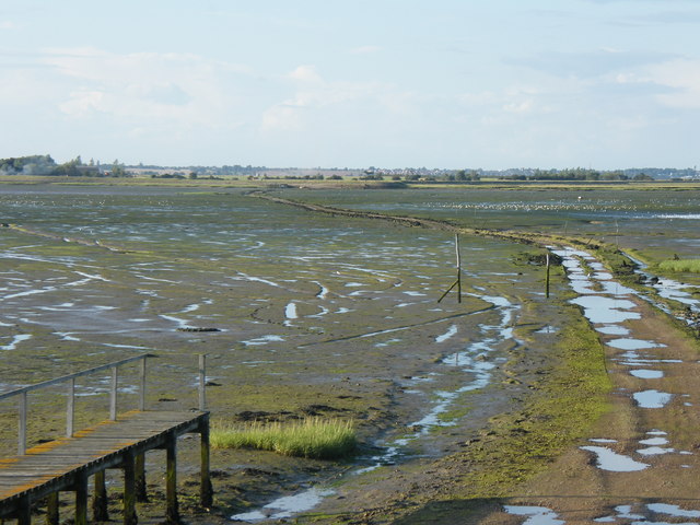
The island covers an area of around 20 acres and is predominantly marshland, with a few patches of woodland. It is accessible by boat and has no permanent residents, making it a peaceful retreat for nature enthusiasts and birdwatchers.

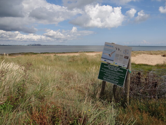
Pewit Island is particularly renowned for its diverse bird population. It serves as an important nesting site for several species, including avocets, oystercatchers, and redshanks. The island's marshes provide an ideal habitat for these birds, offering ample food sources and protection from predators.

In addition to its natural beauty, Pewit Island has historical significance. It is believed to have been inhabited since Roman times, with archaeological evidence of human occupation dating back to the 1st century AD. The remains of a Roman fort and a Saxon settlement have been discovered on the island, indicating its strategic importance in the past.

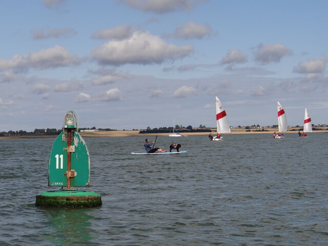
Today, Pewit Island is primarily used for recreational purposes. It attracts visitors who enjoy walking, birdwatching, and exploring its historical sites. The island offers stunning views of the surrounding estuary and is a popular spot for boat trips and picnics.

Overall, Pewit Island is a captivating destination for nature lovers and history enthusiasts alike. Its tranquil environment and fascinating past make it a hidden gem in the Essex countryside.

If you have any feedback on the listing, please let us know in the comments section below.
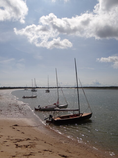
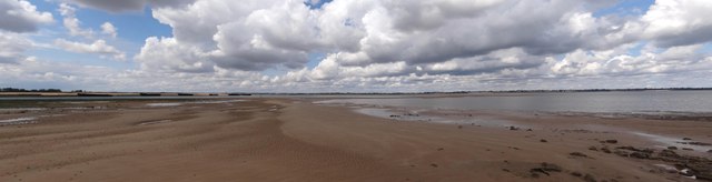
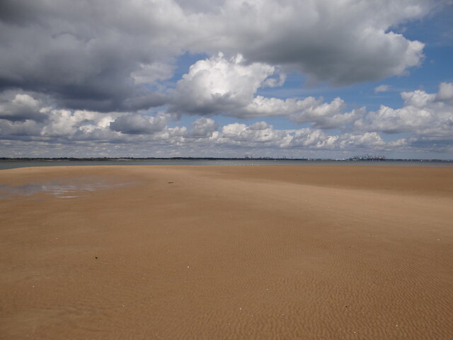
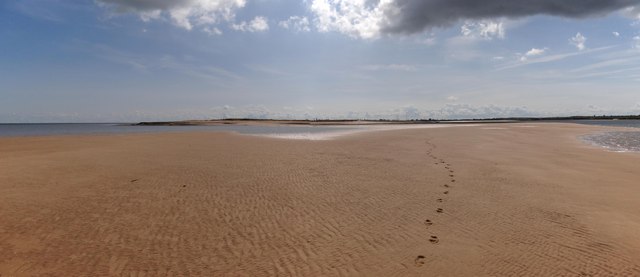
Pewit Island Images

Images are sourced within 2km of 51.892191/1.2413839 or Grid Reference TM2326. Thanks to Geograph Open Source API. All images are credited.

Stone Point, Walton-on-the-Naze Stone Point at Hamford Water, Walton-on-the-Naze. Thames barges are visible lining the opposite bank.
Stone Point, Walton-on-the-Naze
Stone Point at Hamford Water, Walton-on-the-Naze. Thames barges are visible lining the opposite bank.
Looking inland from the sea wall at Little Oakley
Irlam's Beach, Little Oakley This area is part of Hamford Water National Nature Reserve & SSSI: <span class="nowrap"><a title="https://www.gov.uk/government/publications/essexs-national-nature-reserves/essexs-national-nature-reserves#hamford-water" rel="nofollow ugc noopener" href="https://www.gov.uk/government/publications/essexs-national-nature-reserves/essexs-national-nature-reserves#hamford-water">Link</a><img style="margin-left:2px;" alt="External link" title="External link - shift click to open in new window" src="https://s1.geograph.org.uk/img/external.png" width="10" height="10"/></span>
Irlam's Beach, Little Oakley
This area is part of Hamford Water National Nature Reserve & SSSI: LinkExternal link
Looking to the North Sea at Little Oakley As seen from sea wall footpath.

The coastal area is part of the Hamford Water National Nature Reserve & SSSI. <span class="nowrap"><a title="https://www.gov.uk/government/publications/essexs-national-nature-reserves/essexs-national-nature-reserves#hamford-water" rel="nofollow ugc noopener" href="https://www.gov.uk/government/publications/essexs-national-nature-reserves/essexs-national-nature-reserves#hamford-water">Link</a><img style="margin-left:2px;" alt="External link" title="External link - shift click to open in new window" src="https://s1.geograph.org.uk/img/external.png" width="10" height="10"/></span>
Looking to the North Sea at Little Oakley
As seen from sea wall footpath. The coastal area is part of the Hamford Water National Nature Reserve & SSSI. LinkExternal link
Group of trees near bridleway, Little Oakley
Private walkway, Hamford Water National Nature Reserve This walkway on Hamford Water National Nature Reserve <span class="nowrap"><a title="https://www.gov.uk/government/publications/essexs-national-nature-reserves/essexs-national-nature-reserves#hamford-water" rel="nofollow ugc noopener" href="https://www.gov.uk/government/publications/essexs-national-nature-reserves/essexs-national-nature-reserves#hamford-water">Link</a><img style="margin-left:2px;" alt="External link" title="External link - shift click to open in new window" src="https://s1.geograph.org.uk/img/external.png" width="10" height="10"/></span> is marked 'private' for the use of Little Oakley and District Wildfowlers’ Association.

Hamford Water is also a SSSI.
Private walkway, Hamford Water National Nature Reserve
This walkway on Hamford Water National Nature Reserve LinkExternal link is marked 'private' for the use of Little Oakley and District Wildfowlers’ Association. Hamford Water is also a SSSI.
Island Point North Cardinal Buoy Helping to keep vessels from running aground on Mussel Scarfe, this buoy directs traffic to pass it to the north as it exits Walton Channel and joins the Hamford Water.   At night a quick white flashing light is emitted.
Island Point North Cardinal Buoy
Helping to keep vessels from running aground on Mussel Scarfe, this buoy directs traffic to pass it to the north as it exits Walton Channel and joins the Hamford Water. At night a quick white flashing light is emitted.
Doggy Paddle! Plenty of activity on the water around starboard channel marker No 11
Doggy Paddle!
Plenty of activity on the water around starboard channel marker No 11
Free parking at Stone Point Selection of craft anchored to the south of Stone Point on the Walton Channel.  The crews are enjoying the sunshine on dry land!
Free parking at Stone Point
Selection of craft anchored to the south of Stone Point on the Walton Channel. The crews are enjoying the sunshine on dry land!
Stone Point panorama View of the Walton Channel and Hamford Water as they meet near the Mulberry Harbour vessels on the banks.  Note the several navigation buoys designed to keep traffic from running aground.
Stone Point panorama
View of the Walton Channel and Hamford Water as they meet near the Mulberry Harbour vessels on the banks. Note the several navigation buoys designed to keep traffic from running aground.
Almost in the next gridsquare If the tides were spring rather than neaps, I might have stood on the next gridsquare to the north. Felixstowe docks can be seen in the distance.
Almost in the next gridsquare
If the tides were spring rather than neaps, I might have stood on the next gridsquare to the north. Felixstowe docks can be seen in the distance.
Stone Point View of the tip of Stone point from the plentiful sands to the north.
Stone Point
View of the tip of Stone point from the plentiful sands to the north.
Little terns information board at Stone Point
No 6 Port navigation buoy Starboard navigation buoy No 7 can be seen to the left in the distance.
No 6 Port navigation buoy
Starboard navigation buoy No 7 can be seen to the left in the distance.
Port navigation buoy No 4A
Port Navigation Buoy No 4 "High Hill"
Test match Impromptu game of beach cricket played out on the sands at Stone Point at low tide.
Test match
Impromptu game of beach cricket played out on the sands at Stone Point at low tide.
Up Kirby Creek Dinghies sailing out of Kirby Creek from the direction of Honey Island.
Up Kirby Creek
Dinghies sailing out of Kirby Creek from the direction of Honey Island.
Show me another place!

Pewit Island is located at Grid Ref: TM2326 (Lat: 51.892191, Lng: 1.2413839)

Administrative County: Essex

District: Tendring

Police Authority: Essex

What 3 Words

///vacancies.offstage.teach. Near Walton-on-the-Naze, Essex

Nearby Locations

Pewit Island Dugmore Creek

Related Wikis

Pewit Island

Pewit Island is an uninhabited island at the north of Hamford Water off the coast of the English county of Essex. The nearest town is the port of Harwich...

Hamford Water

Hamford Water is a 2,185.8-hectare (5,401-acre) biological Site of Special Scientific Interest between Walton-on-the-Naze and Harwich in Essex. The site...

Horsey Island

Horsey Island is an island in the parish of Thorpe-le-Soken, Essex. It lies in Hamford Water and is part of the Hamford Water National Nature Reserve,...

Skipper's Island

Skipper's Island is a 94.3-hectare (233-acre) nature reserve north of Kirby-le-Soken in Essex, England. It is owned and managed by the Essex Wildlife Trust...

Nearby Amenities

Located within 500m of 51.892191,1.2413839
Pewit Island
Place: island
Source Name: OS_OpenData_StreetView
Wikidata: Q7179555
Lat/Long: 51.8930231/1.2408897
New Island
Place: island
Source Name: OS_OpenData_StreetView
Lat/Long: 51.8901429/1.2358364
The data included in this document is from www.openstreetmap.org. The data is made available under ODbL.

Have you been to Pewit Island?

Leave your review of Pewit Island below (or comments, questions and feedback).