Whiteness

Range Of Mountains, Range Of Hills in Shetland

Scotland

Whiteness

Trig point Known to the Ordnance Survey as White Ness
Trig point Credit: Iain Macaulay

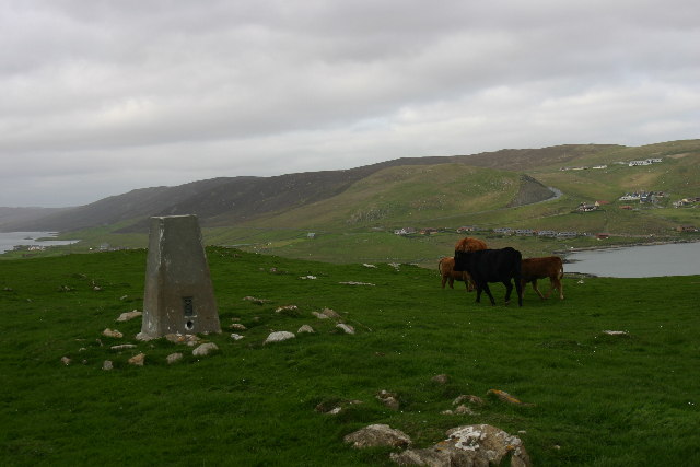
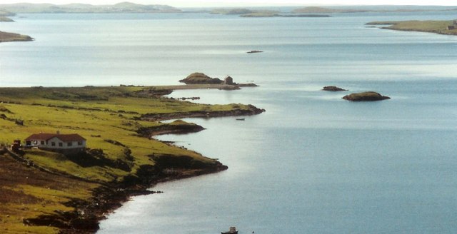
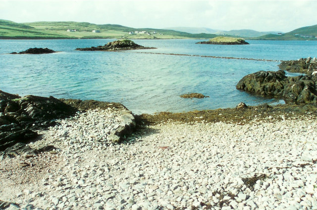
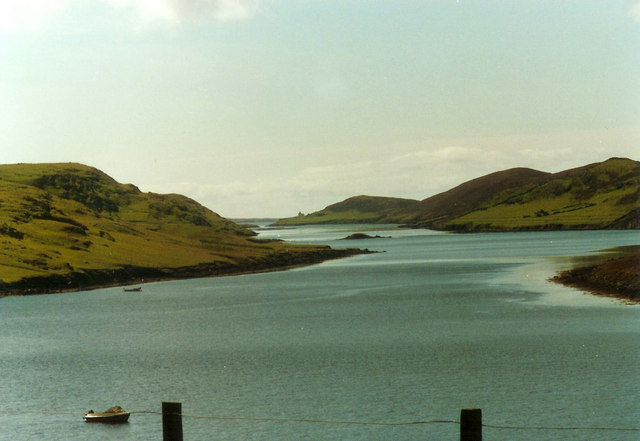
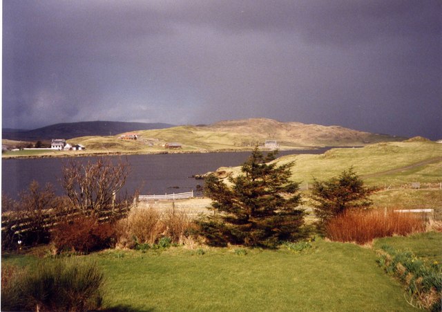
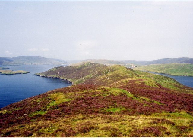
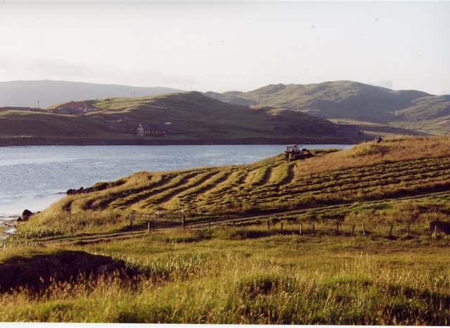
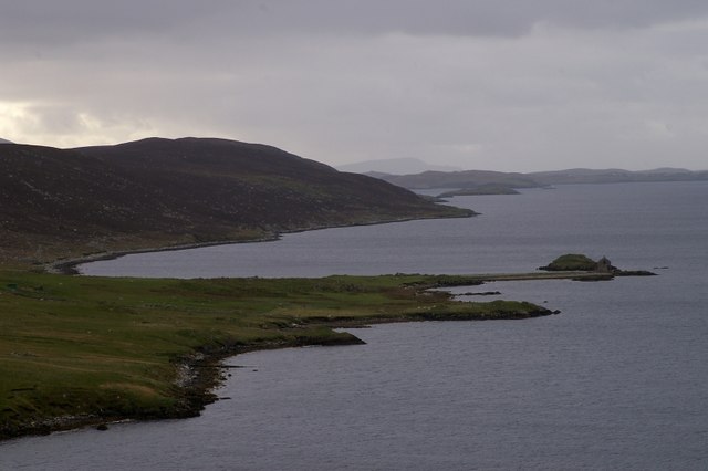
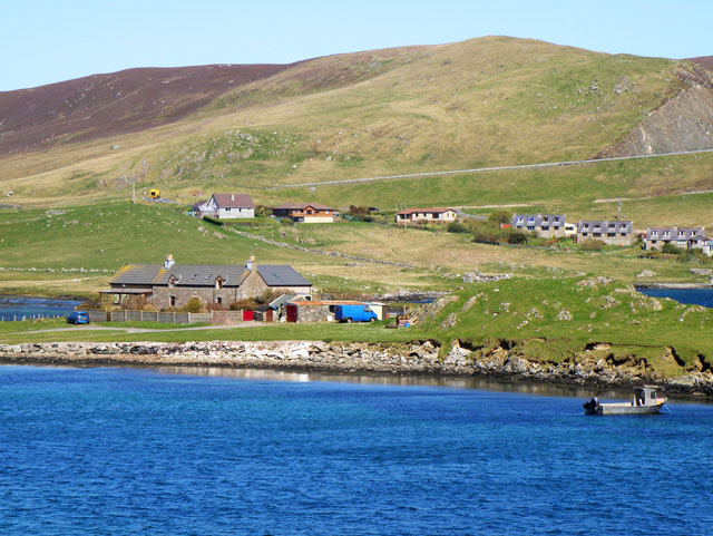
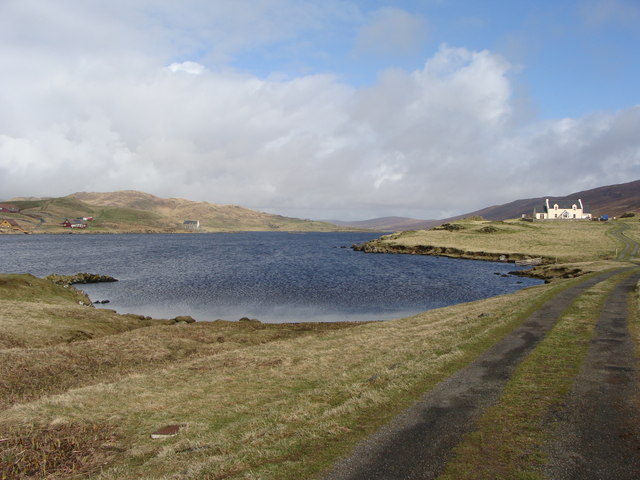
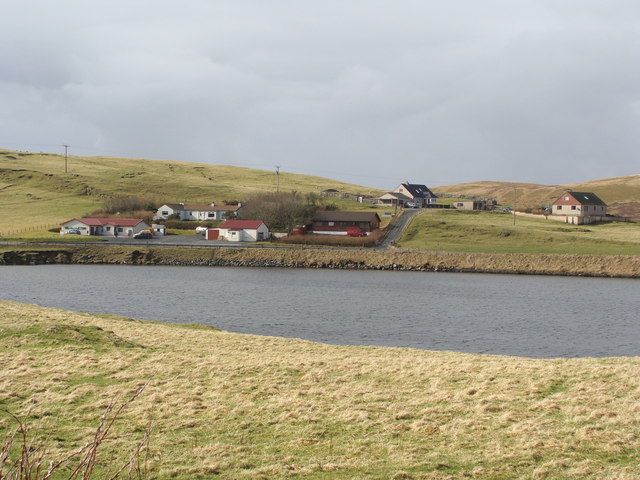
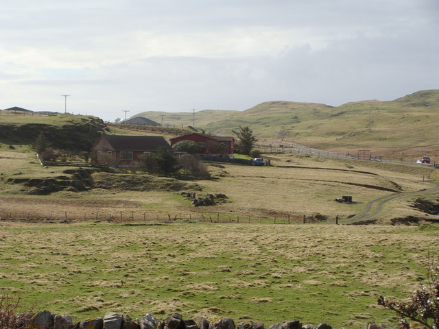
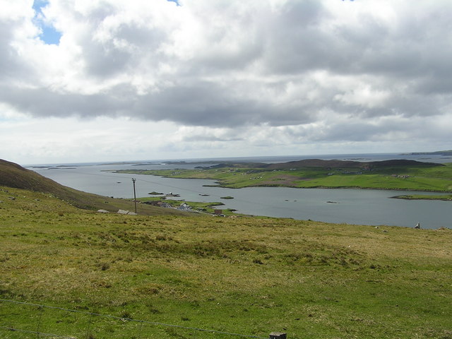
Whiteness is a range of mountains and hills located in Shetland, an archipelago in Scotland. Stretching across approximately 6 kilometers, it is situated on the west coast of the Shetland mainland, near the village of Weisdale.

The Whiteness range is characterized by its rugged and dramatic landscape, featuring steep slopes, deep valleys, and rocky outcrops. The highest peak in the range reaches an elevation of around 285 meters, providing stunning panoramic views of the surrounding countryside and coastline.

The mountains and hills of Whiteness are predominantly composed of ancient metamorphic rocks, including gneiss and schist, which were formed around 650 million years ago. These rocks have been shaped by millions of years of geological processes, including glaciation and erosion, resulting in the distinctive features seen today.

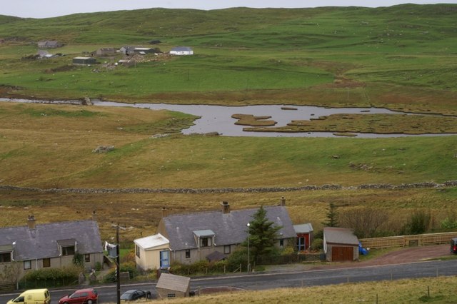
The range is home to a variety of flora and fauna, with heather, mosses, and grasses covering the lower slopes, while hardier plants and lichens can be found higher up. The area supports a range of bird species, including golden eagles, kestrels, and puffins, as well as occasional sightings of red deer and otters.

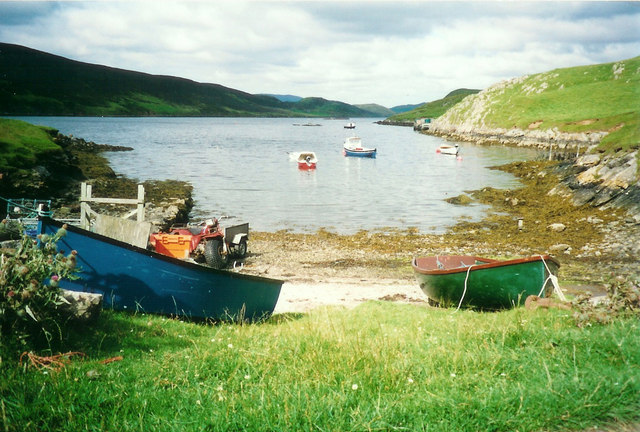
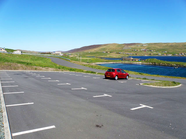
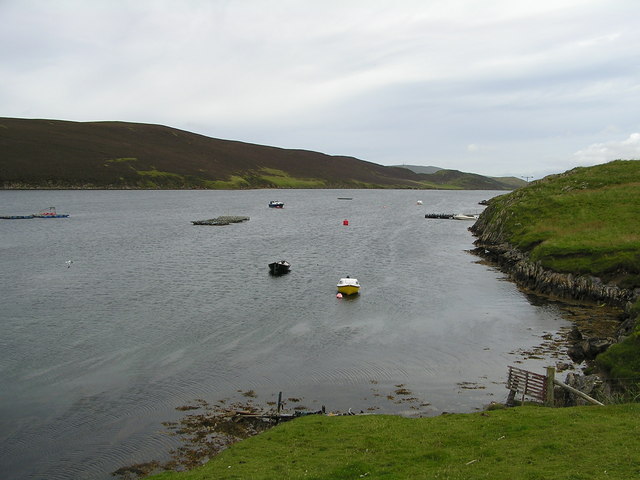
Whiteness is a popular destination for outdoor enthusiasts, offering ample opportunities for hiking, wildlife spotting, and photography. Several walking trails have been established throughout the range, providing access to its diverse natural beauty. Additionally, the range is easily accessible by road, making it an ideal location for day trips or longer explorations of the Shetland landscape.

If you have any feedback on the listing, please let us know in the comments section below.

Whiteness Images

Images are sourced within 2km of 60.190037/-1.3023109 or Grid Reference HU3845. Thanks to Geograph Open Source API. All images are credited.

Trig point Known to the Ordnance Survey as White Ness
Trig point
Known to the Ordnance Survey as White Ness
Punds Punts and moored boats at Punds, South Whiteness
Punds
Punts and moored boats at Punds, South Whiteness
Bod of Nesbister The camping Bod at Nesbister, formerly a fishing station
Bod of Nesbister
The camping Bod at Nesbister, formerly a fishing station
Nesbister Nesbister looking out on the Bod of Nesbister, with Burra and the Scalloway isles in the distance. There is an ancient tidal Pictish causeway below the sea between the Bod isles and the land.
Nesbister
Nesbister looking out on the Bod of Nesbister, with Burra and the Scalloway isles in the distance. There is an ancient tidal Pictish causeway below the sea between the Bod isles and the land.
Pictish Causeway at Nesbister This ancient Pictish causeway near the Bod of Nesbister can only be seen at low tide.
Pictish Causeway at Nesbister
This ancient Pictish causeway near the Bod of Nesbister can only be seen at low tide.
Stromness Voe Stromness Voe with the Ness on the right. The house in the distance is Jackville, accessible only by foot or boat.
Stromness Voe
Stromness Voe with the Ness on the right. The house in the distance is Jackville, accessible only by foot or boat.
View over the Loch of Strom, Whiteness, Shetland Taken from a house (through the window, hence the streak on the left of the image) located at the south end of the Loch of Strom.  Hogaland is just off the right-hand side of the photo. There are a few more buildings now on the far side of the loch, but it has changed little other than that.
View over the Loch of Strom, Whiteness, Shetland
Taken from a house (through the window, hence the streak on the left of the image) located at the south end of the Loch of Strom. Hogaland is just off the right-hand side of the photo. There are a few more buildings now on the far side of the loch, but it has changed little other than that.
Strom Ness from Hill of Olligarth This ness is flanked by Stromness Voe (the water to the left of the picture) and the entrance to Weisdale Voe.  In the distance can be seen houses in the village of Hamnavoe. Don't be fooled into thinking you're in Orkney - this Strom Ness is definitely in Shetland!
Strom Ness from Hill of Olligarth
This ness is flanked by Stromness Voe (the water to the left of the picture) and the entrance to Weisdale Voe. In the distance can be seen houses in the village of Hamnavoe. Don't be fooled into thinking you're in Orkney - this Strom Ness is definitely in Shetland!
Making hay while the sun shines, Hogaland ...and never is that expression more apt than in Shetland!  The summer days are long, but the season is short, so there's plenty to be done on a bonny day.
Making hay while the sun shines, Hogaland
...and never is that expression more apt than in Shetland! The summer days are long, but the season is short, so there's plenty to be done on a bonny day.
Nesbister The head of Whiteness Voe.
Nesbister
The head of Whiteness Voe.
The Vadill, Whiteness Voe A vadill is a place that is shallow enough to be waded across.
The Vadill, Whiteness Voe
A vadill is a place that is shallow enough to be waded across.
Car park for the new burial ground
House by Mousa Ness In the distance can just be seen the A971 climbing the hill.
House by Mousa Ness
In the distance can just be seen the A971 climbing the hill.
Loch of Strom from the track to Hogaland
Brugarth from Hogaland
Houses near Stebbigrind, from Hogaland
Whiteness Voe
Whiteness Voe
Stromness Voe
Stromness Voe
Show me another place!

Whiteness is located at Grid Ref: HU3845 (Lat: 60.190037, Lng: -1.3023109)

Unitary Authority: Shetland Islands

Police Authority: Highlands and Islands

What 3 Words

///ruling.breath.modem. Near Scalloway, Shetland Islands

Related Wikis

Whiteness, Shetland

Whiteness (Old Norse: Hvitanes, white headland) is a village in Tingwall parish, Shetland Islands, Scotland, on Mainland. It is also an ancient civil parish...

Hoy, Shetland

Hoy (Háey, Old Norse for 'high island') is a small island in Weisdale Voe, an arm of the sea in the Shetland islands, Scotland. Nearby are the smaller...

Flotta, Shetland

Flotta (grid reference HU375462) is an island off the south west of Mainland, Shetland. The name may come from the Old Norse, flatey meaning flat island...

Setter Hill, Tingwall

Setter Hill is a hill in Tingwall, Shetland, Scotland. == References ==

Greena

Greena is a small island off the west coast of Mainland, Shetland. It is 10m at its highest point, and is north of Flotta, Shetland. It is in Weisdale...

North Havra

North Havra (Old Norse: Hafrey, ocean island) is a small island off south west Shetland. It is 30 metres at its highest point. Situated 1/3 mile from the...

Tingwall Airport

Tingwall Airport (IATA: LWK, ICAO: EGET), also known as Lerwick/Tingwall Airport, is located in the Tingwall valley, near the village of Gott, 4 NM (7...

Law Ting Holm

Law Ting Holm (also known as Tingaholm) is a small promontory at the north end of the freshwater Loch of Tingwall, Mainland Shetland, Scotland. It was...

Nearby Amenities

Located within 500m of 60.190037,-1.3023109
Power: pole
Lat/Long: 60.1938927/-1.2978163
Generator Method: wind_turbine
Generator Source: wind
Power: generator
Lat/Long: 60.1882869/-1.3058283
Power: pole
Lat/Long: 60.1861048/-1.3004997
Power: pole
Lat/Long: 60.1866997/-1.3002386
Power: pole
Lat/Long: 60.187359/-1.2999661
Power: pole
Lat/Long: 60.1879619/-1.2997281
Power: pole
Lat/Long: 60.1886521/-1.2994555
Power: pole
Lat/Long: 60.1892469/-1.2992176
Power: pole
Lat/Long: 60.1897936/-1.2989982
Power: pole
Lat/Long: 60.1901828/-1.2988226
Power: pole
Lat/Long: 60.1907628/-1.2985801
Power: pole
Lat/Long: 60.1866871/-1.301285
Power: pole
Lat/Long: 60.1872499/-1.3020289
Power: pole
Lat/Long: 60.1925805/-1.2980049
Power: pole
Lat/Long: 60.1931225/-1.2973858
Power: pole
Lat/Long: 60.1938562/-1.2984946
Bus Stop
South Whiteness
Public Transport: platform
Lat/Long: 60.1924314/-1.2992379
The data included in this document is from www.openstreetmap.org. The data is made available under ODbL.

Have you been to Whiteness?

Leave your review of Whiteness below (or comments, questions and feedback).