Stromness Voe

Sea, Estuary, Creek in Shetland

Scotland

Stromness Voe

Trig point Known to the Ordnance Survey as White Ness
Trig point Credit: Iain Macaulay

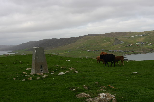
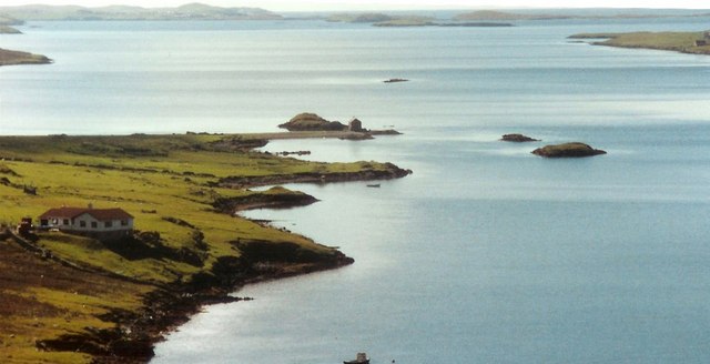
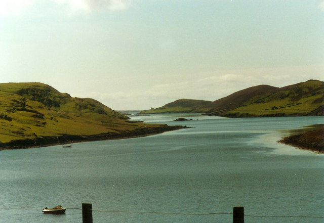
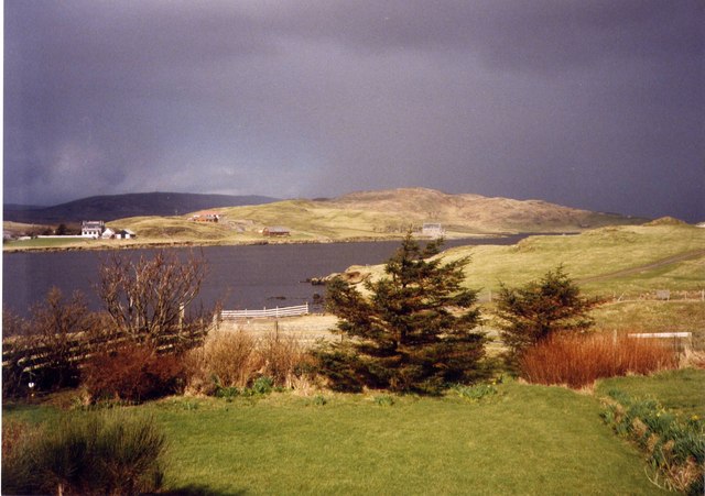
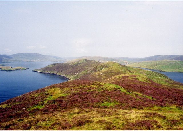
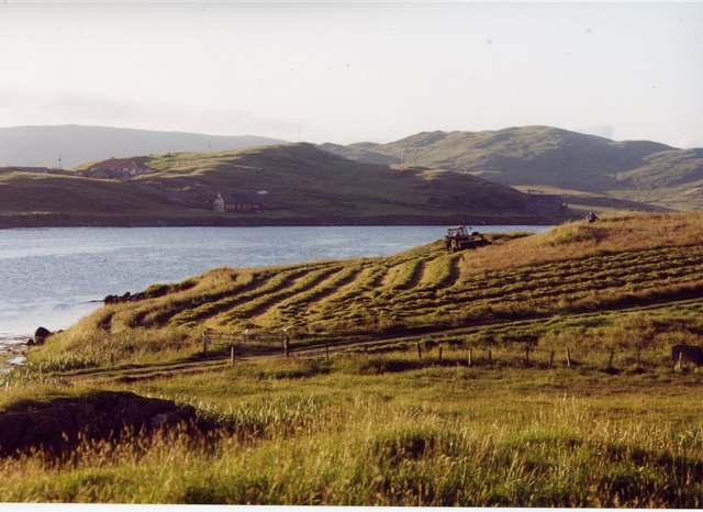
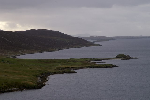
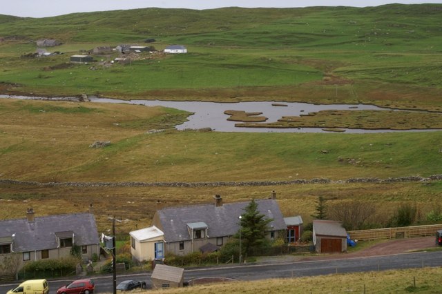
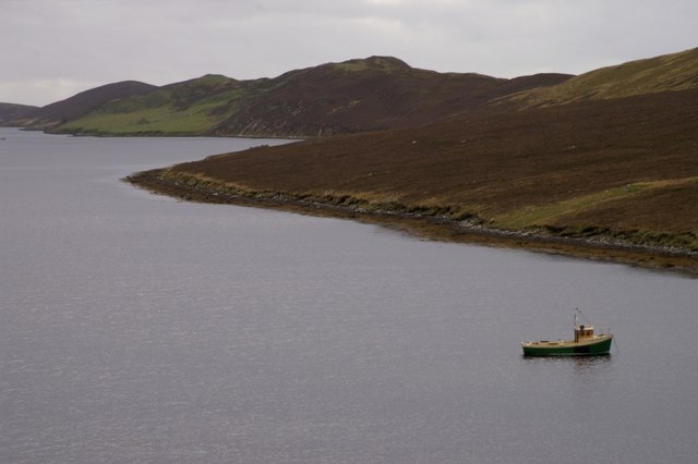
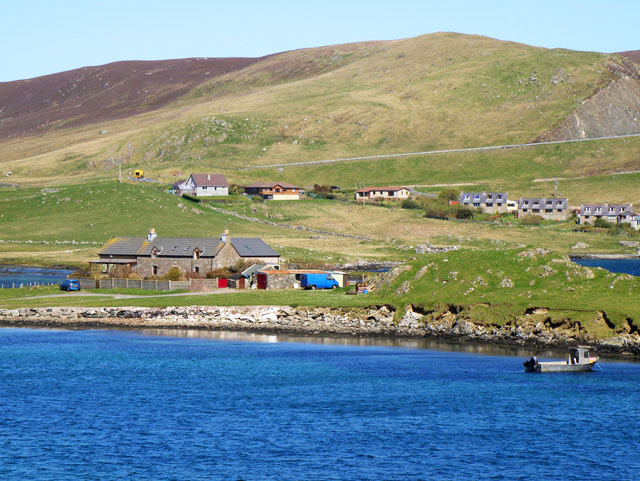
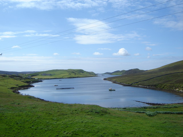
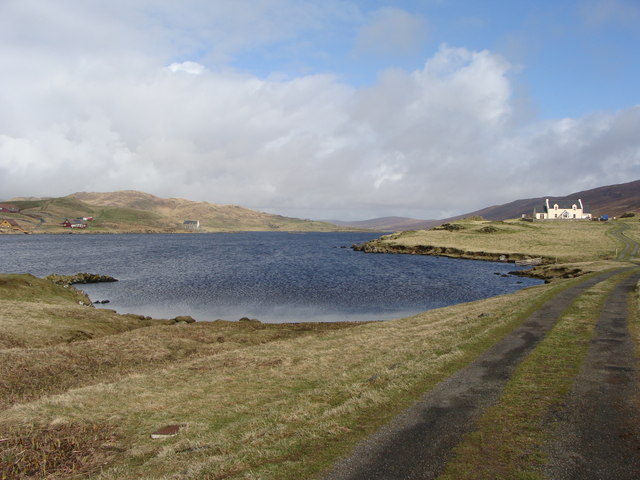
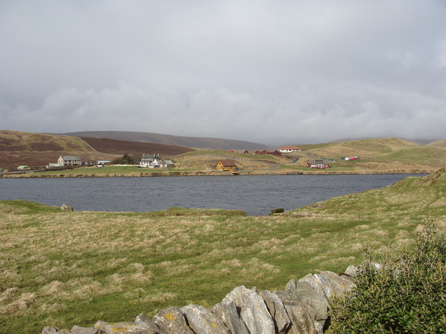
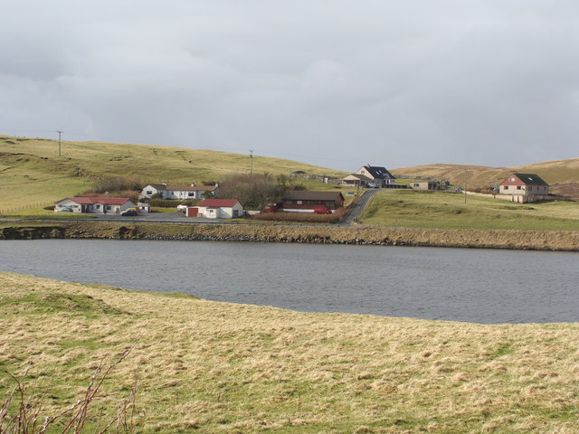
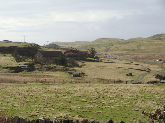
Stromness Voe is a picturesque sea inlet located on the west coast of Mainland, the largest island in the Shetland archipelago in Scotland. It is situated about 12 miles northwest of Lerwick, the main town of Shetland. The Voe is surrounded by stunning natural beauty, with rolling hills and rugged cliffs providing a dramatic backdrop.

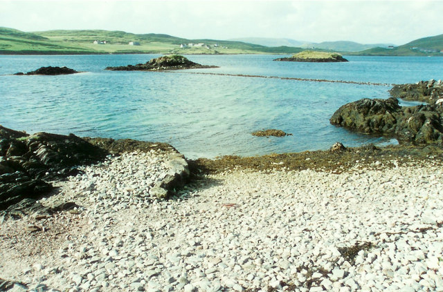
As an estuary, Stromness Voe serves as the mouth of the Burn of Stromness, a small river that flows into the sea. The Voe stretches about 3 miles inland, offering a sheltered harbor for boats and ships. The calm waters of the Voe make it an ideal spot for various water activities, including sailing, kayaking, and fishing.

The Voe is also home to a diverse range of wildlife, with seals often spotted lounging on the rocky shores and numerous seabirds nesting on the cliffs. The surrounding coastal areas are rich in marine life, making it a popular spot for birdwatching and wildlife enthusiasts.

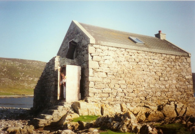
Stromness Voe has historical significance as well, with the remains of an ancient Norse settlement called the "Old Scatness" located nearby. The site provides insight into the lives of the early inhabitants of Shetland and offers archaeological treasures for visitors to explore.

Overall, Stromness Voe is a stunning natural feature of Shetland, offering a tranquil and scenic location for both locals and tourists to enjoy the beauty of the Scottish coast.

If you have any feedback on the listing, please let us know in the comments section below.

Stromness Voe Images

Images are sourced within 2km of 60.193471/-1.3082433 or Grid Reference HU3845. Thanks to Geograph Open Source API. All images are credited.

Trig point Known to the Ordnance Survey as White Ness
Trig point
Known to the Ordnance Survey as White Ness
Bod of Nesbister The camping Bod at Nesbister, formerly a fishing station
Bod of Nesbister
The camping Bod at Nesbister, formerly a fishing station
Nesbister Nesbister looking out on the Bod of Nesbister, with Burra and the Scalloway isles in the distance. There is an ancient tidal Pictish causeway below the sea between the Bod isles and the land.
Nesbister
Nesbister looking out on the Bod of Nesbister, with Burra and the Scalloway isles in the distance. There is an ancient tidal Pictish causeway below the sea between the Bod isles and the land.
Pictish Causeway at Nesbister This ancient Pictish causeway near the Bod of Nesbister can only be seen at low tide.
Pictish Causeway at Nesbister
This ancient Pictish causeway near the Bod of Nesbister can only be seen at low tide.
Stromness Voe Stromness Voe with the Ness on the right. The house in the distance is Jackville, accessible only by foot or boat.
Stromness Voe
Stromness Voe with the Ness on the right. The house in the distance is Jackville, accessible only by foot or boat.
View over the Loch of Strom, Whiteness, Shetland Taken from a house (through the window, hence the streak on the left of the image) located at the south end of the Loch of Strom.  Hogaland is just off the right-hand side of the photo. There are a few more buildings now on the far side of the loch, but it has changed little other than that.
View over the Loch of Strom, Whiteness, Shetland
Taken from a house (through the window, hence the streak on the left of the image) located at the south end of the Loch of Strom. Hogaland is just off the right-hand side of the photo. There are a few more buildings now on the far side of the loch, but it has changed little other than that.
Strom Ness from Hill of Olligarth This ness is flanked by Stromness Voe (the water to the left of the picture) and the entrance to Weisdale Voe.  In the distance can be seen houses in the village of Hamnavoe. Don't be fooled into thinking you're in Orkney - this Strom Ness is definitely in Shetland!
Strom Ness from Hill of Olligarth
This ness is flanked by Stromness Voe (the water to the left of the picture) and the entrance to Weisdale Voe. In the distance can be seen houses in the village of Hamnavoe. Don't be fooled into thinking you're in Orkney - this Strom Ness is definitely in Shetland!
Making hay while the sun shines, Hogaland ...and never is that expression more apt than in Shetland!  The summer days are long, but the season is short, so there's plenty to be done on a bonny day.
Making hay while the sun shines, Hogaland
...and never is that expression more apt than in Shetland! The summer days are long, but the season is short, so there's plenty to be done on a bonny day.
Nesbister The head of Whiteness Voe.
Nesbister
The head of Whiteness Voe.
The Vadill, Whiteness Voe A vadill is a place that is shallow enough to be waded across.
The Vadill, Whiteness Voe
A vadill is a place that is shallow enough to be waded across.
Stromness Voe
Stromness Voe
Car park for the new burial ground
House by Mousa Ness In the distance can just be seen the A971 climbing the hill.
House by Mousa Ness
In the distance can just be seen the A971 climbing the hill.
Stromness Voe A classic Shetland voe - which is a drowned valley or inlet rather like a Norwegian fjord
Stromness Voe
A classic Shetland voe - which is a drowned valley or inlet rather like a Norwegian fjord
Loch of Strom from the track to Hogaland
Loch of Strom, and view of Olligarth from Hogaland
Brugarth from Hogaland
Houses near Stebbigrind, from Hogaland
Show me another place!

Stromness Voe is located at Grid Ref: HU3845 (Lat: 60.193471, Lng: -1.3082433)

Unitary Authority: Shetland Islands

Police Authority: Highlands and Islands

What 3 Words

///variation.shook.label. Near Scalloway, Shetland Islands

Related Wikis

Flotta, Shetland

Flotta (grid reference HU375462) is an island off the south west of Mainland, Shetland. The name may come from the Old Norse, flatey meaning flat island...

Hoy, Shetland

Hoy (Háey, Old Norse for 'high island') is a small island in Weisdale Voe, an arm of the sea in the Shetland islands, Scotland. Nearby are the smaller...

Whiteness, Shetland

Whiteness (Old Norse: Hvitanes, white headland) is a village in Tingwall parish, Shetland Islands, Scotland, on Mainland. It is also an ancient civil parish...

Greena

Greena is a small island off the west coast of Mainland, Shetland. It is 10m at its highest point, and is north of Flotta, Shetland. It is in Weisdale...

Setter Hill, Tingwall

Setter Hill is a hill in Tingwall, Shetland, Scotland. == References ==

North Havra

North Havra (Old Norse: Hafrey, ocean island) is a small island off south west Shetland. It is 30 metres at its highest point. Situated 1/3 mile from the...

Tingwall Airport

Tingwall Airport (IATA: LWK, ICAO: EGET), also known as Lerwick/Tingwall Airport, is located in the Tingwall valley, near the village of Gott, 4 NM (7...

Law Ting Holm

Law Ting Holm (also known as Tingaholm) is a small promontory at the north end of the freshwater Loch of Tingwall, Mainland Shetland, Scotland. It was...

Nearby Amenities

Located within 500m of 60.193471,-1.3082433
Stromness
Place: locality
Lat/Long: 60.1943791/-1.3100582
The data included in this document is from www.openstreetmap.org. The data is made available under ODbL.

Have you been to Stromness Voe?

Leave your review of Stromness Voe below (or comments, questions and feedback).