Whiteness Voe

Sea, Estuary, Creek in Shetland

Scotland

Whiteness Voe

Punds Punts and moored boats at Punds, South Whiteness
Punds Credit: Jeremy Duncan

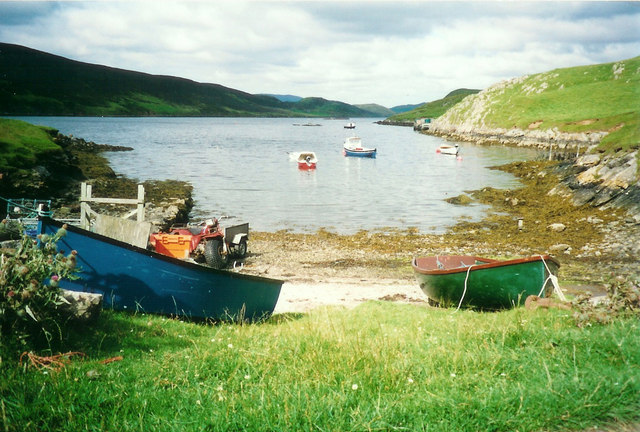
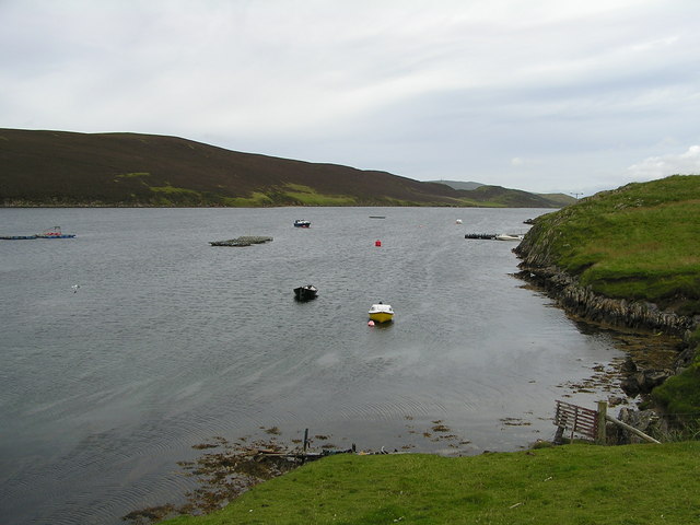
Whiteness Voe is a picturesque sea inlet located in the Shetland Islands, Scotland. It stretches inland from the North Sea, forming a narrow and winding estuary that eventually transitions into a creek as it reaches the village of Whiteness. The Voe is situated on the western side of the mainland and is surrounded by stunning natural landscapes.

With its calm and sheltered waters, Whiteness Voe serves as an important anchorage for local fishing boats and small pleasure crafts. It offers a peaceful and idyllic environment for recreational activities such as sailing, kayaking, and fishing. The Voe provides ample opportunities for exploring its diverse marine life, including various fish species and seabirds that are often seen along its shores.

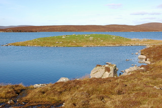
The surrounding area of Whiteness Voe is characterized by rolling hills, lush green fields, and scattered coastal cliffs. The Voe itself is flanked by rocky shores, which are adorned with colorful wildflowers during the spring and summer months. The changing tides offer a dynamic and ever-evolving landscape that attracts both locals and tourists alike.

The village of Whiteness, located at the head of the Voe, is a small and charming settlement with a population of around 200 people. It offers basic amenities such as a pub, a shop, and a post office, catering to the needs of both residents and visitors. The Voe and its surrounding area are also home to several historic sites, including ancient ruins and archaeological remains, providing a glimpse into the region's rich cultural heritage.

Overall, Whiteness Voe is a captivating and tranquil location, showcasing the natural beauty and cultural significance of the Shetland Islands.

If you have any feedback on the listing, please let us know in the comments section below.

Whiteness Voe Images

Images are sourced within 2km of 60.163748/-1.3129579 or Grid Reference HU3842. Thanks to Geograph Open Source API. All images are credited.

Punds Punts and moored boats at Punds, South Whiteness
Punds
Punts and moored boats at Punds, South Whiteness
Looking towards Binna Ness The island on the right is North Havra.
Looking towards Binna Ness
The island on the right is North Havra.
Stromness Voe
Stromness Voe
Pund, White Ness
Pund, White Ness
Jackville, on Binna Ness This house has no access by road. The only access is by boat from White Ness.
The house was built in 1848.
Jackville, on Binna Ness
This house has no access by road. The only access is by boat from White Ness. The house was built in 1848.
Pund, White Ness
Pund, White Ness
Pund, White Ness Looking north into Stromness Voe.
Pund, White Ness
Looking north into Stromness Voe.
Sheep at South Whiteness At the end of the road, looking across Whiteness Voe to Hill of Burwick.
Sheep at South Whiteness
At the end of the road, looking across Whiteness Voe to Hill of Burwick.
Standing stone, South Ustaness, South Whiteness This stone is not marked on any maps.
Standing stone, South Ustaness, South Whiteness
This stone is not marked on any maps.
North Ustaness, South Whiteness
Loch of Ustaness The Loch of Ustaness and a little "child" lochan on its outflow burn.
Loch of Ustaness
The Loch of Ustaness and a little "child" lochan on its outflow burn.
Water Board pier on Ustaness This loch used to supply water for the district when the normal supply on the Hill of Weisdale ran low. It was easy to tell when the switch happened as Ustaness water was much darker and peatier from the tap.
Water Board pier on Ustaness
This loch used to supply water for the district when the normal supply on the Hill of Weisdale ran low. It was easy to tell when the switch happened as Ustaness water was much darker and peatier from the tap.
Maggie Black's Loch Looking across Maggie Black's Loch to the 5 wind turbines on Burradale.
What was once a finely built hill dyke is now slowly going to ruin.
Maggie Black's Loch
Looking across Maggie Black's Loch to the 5 wind turbines on Burradale. What was once a finely built hill dyke is now slowly going to ruin.
Vatna Pund The small walled off peninsula of Vatna Pund on the Loch of Ustaness.
It has been used to hold animals till relatively recently but it may have had more ancient uses as there is a neolithic homestead just a few hundred metres away.
Vatna Pund
The small walled off peninsula of Vatna Pund on the Loch of Ustaness. It has been used to hold animals till relatively recently but it may have had more ancient uses as there is a neolithic homestead just a few hundred metres away.
Hill of Burwick marker cairn A small marker cairn atop the hill of Burwick.
Hill of Burwick marker cairn
A small marker cairn atop the hill of Burwick.
Loch of Burwick Looking down onto the Loch of Burwick. The private track that leads to the small settlement there can be seen snaking down the hill behind the loch.
Loch of Burwick
Looking down onto the Loch of Burwick. The private track that leads to the small settlement there can be seen snaking down the hill behind the loch.
Taing of Grutwick The green Taing of Grutwick near Burwick.
There are salmon cages and a feeding barge in the mouth of the voe with Langa isle behind them.
Taing of Grutwick
The green Taing of Grutwick near Burwick. There are salmon cages and a feeding barge in the mouth of the voe with Langa isle behind them.
Sheep at Whiteness The farmer has left his tractor in order to herd the sheep off the road. Thanks to Mike Pennington for help in locating this photograph. There has been a lot of new building in this area since.
Sheep at Whiteness
The farmer has left his tractor in order to herd the sheep off the road. Thanks to Mike Pennington for help in locating this photograph. There has been a lot of new building in this area since.
Show me another place!

Whiteness Voe is located at Grid Ref: HU3842 (Lat: 60.163748, Lng: -1.3129579)

Unitary Authority: Shetland Islands

Police Authority: Highlands and Islands

What 3 Words

///burglars.pulps.coarser. Near Scalloway, Shetland Islands

Related Wikis

North Havra

North Havra (Old Norse: Hafrey, ocean island) is a small island off south west Shetland. It is 30 metres at its highest point. Situated 1/3 mile from the...

Burwick

Burwick is a small peninsula north of Scalloway in the Shetland Islands, Scotland. The Hill of Burwick rises to 107 metres (351 ft), the Ness of Burwick...

Burwick Holm

Burwick Holm is a small island off the west coast of Mainland, Shetland. It is located in the Bur Wick inlet, and near Scalloway.

Whiteness, Shetland

Whiteness (Old Norse: Hvitanes, white headland) is a village in Tingwall parish, Shetland Islands, Scotland, on Mainland. It is also an ancient civil parish...

Setter Hill, Tingwall

Setter Hill is a hill in Tingwall, Shetland, Scotland. == References ==

Hoy, Shetland

Hoy (Háey, Old Norse for 'high island') is a small island in Weisdale Voe, an arm of the sea in the Shetland islands, Scotland. Nearby are the smaller...

Langa, Shetland

Langa (Old Norse: Langey ) is the collective name for two uninhabited islands off Hildasay, in Shetland, Scotland. The islands are connected by a tombolo...

Hildasay

Hildasay (Scots: Hildasay; Old Norse: Hildisey) (from the Old Norse masculine name Hildir with ey "island"), also known as Hildisay, is an uninhabited...

Nearby Amenities

Located within 500m of 60.163748,-1.3129579
Turning Circle
Lat/Long: 60.1681199/-1.3126365
Harpa
Place: locality
Lat/Long: 60.1640718/-1.3139259
Power: pole
Lat/Long: 60.1678285/-1.312001
The data included in this document is from www.openstreetmap.org. The data is made available under ODbL.

Have you been to Whiteness Voe?

Leave your review of Whiteness Voe below (or comments, questions and feedback).