Button Hills

Range Of Mountains, Range Of Hills in Shetland

Scotland

Button Hills

Approaching Grutin A few houses in the valley at the head of Dales Voe.
Approaching Grutin Credit: Des Blenkinsopp

Button Hills is a range of hills located in the Shetland Islands, an archipelago in Scotland, United Kingdom. Situated in the central part of the main island of Mainland, the hills are part of the larger Shetland Range of Mountains.

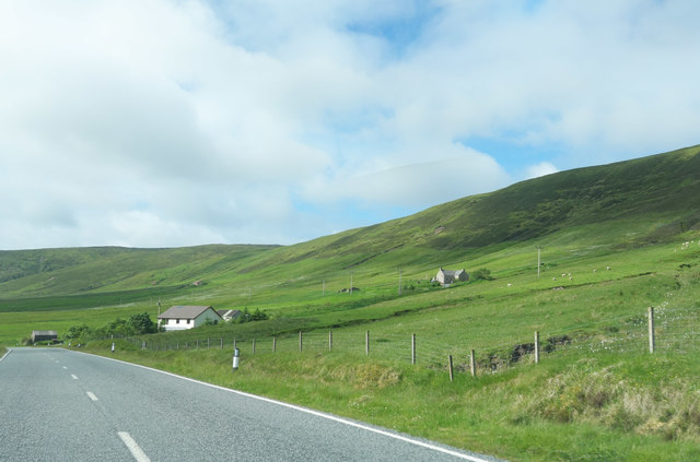
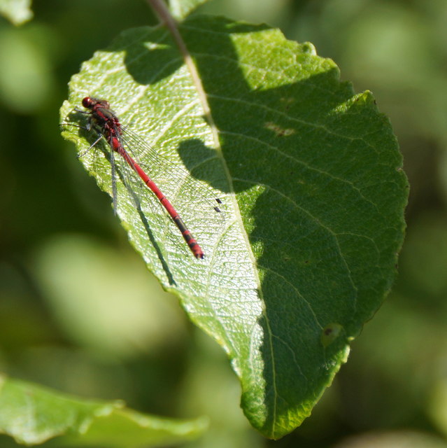
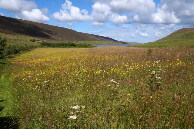
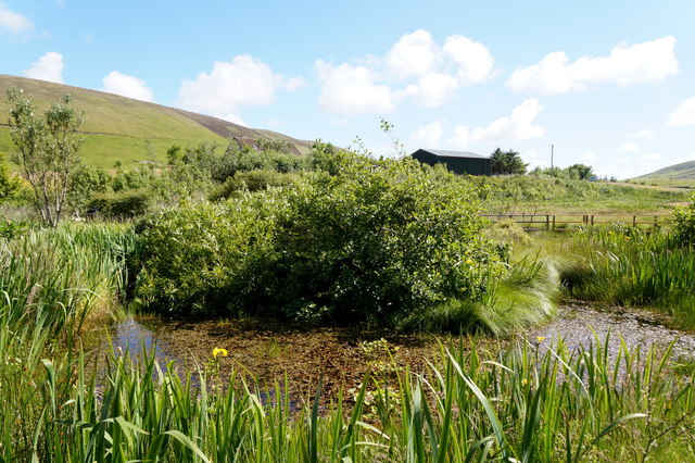
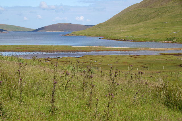
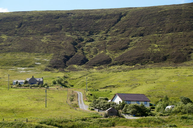
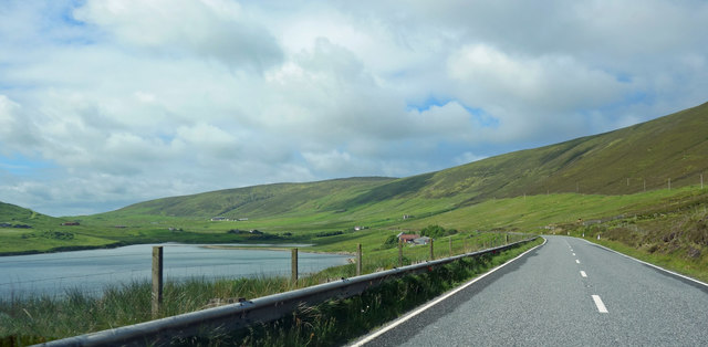
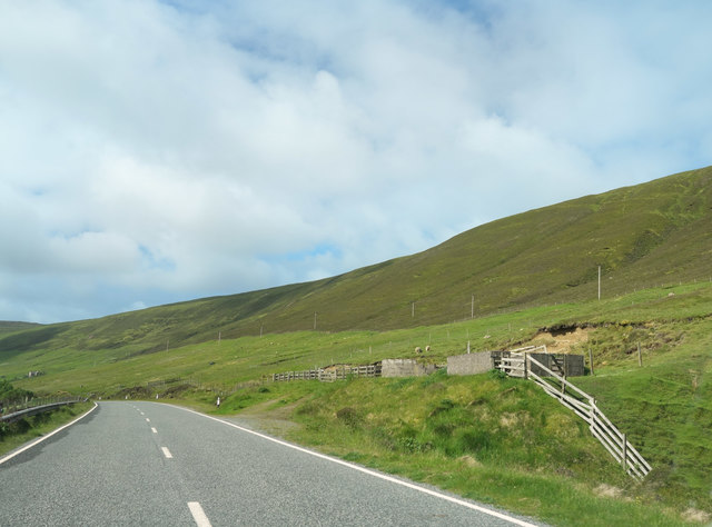
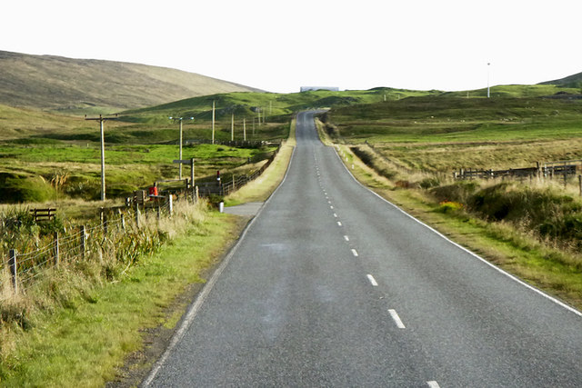
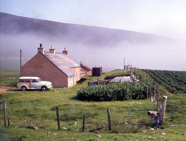
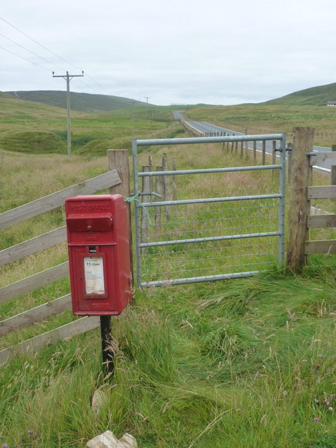
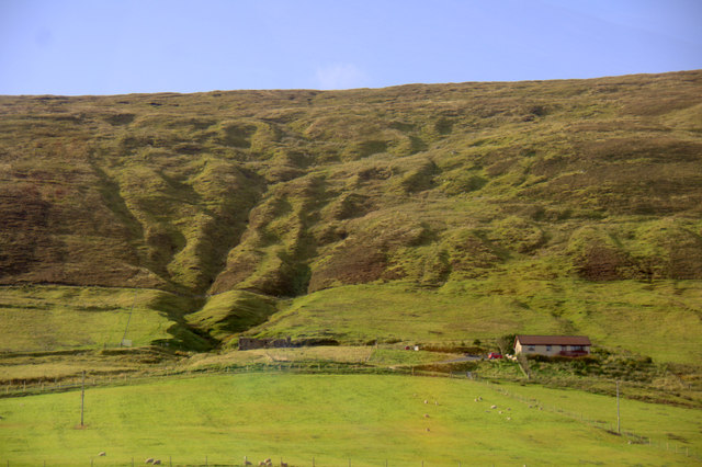
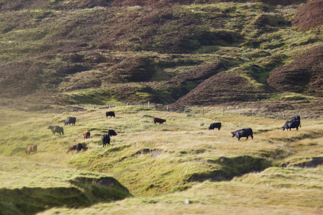
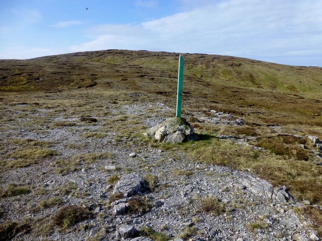
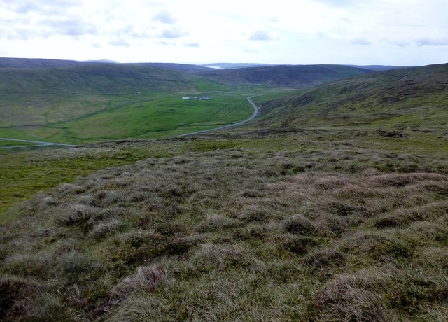
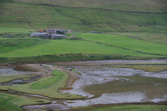
The Button Hills offer a picturesque landscape of rolling hills and rugged terrain, characteristic of the Shetland Islands. The range is composed mainly of rocky outcrops and heather-covered slopes, providing a diverse habitat for various plant and animal species. The hills are known for their rich biodiversity, with several rare and endemic species found in the area.

The highest peak in the Button Hills reaches an elevation of approximately 350 meters (1150 feet) above sea level, offering stunning panoramic views of the surrounding islands and coastlines. The hills are popular among hikers and nature enthusiasts, who visit to explore the scenic trails and enjoy the tranquility of the natural environment.

Button Hills is also home to a variety of bird species, including seabirds such as puffins, fulmars, and guillemots. The area is a designated Site of Special Scientific Interest (SSSI) due to its important role in supporting breeding colonies and migratory routes for these birds.

In addition to its natural beauty, the Button Hills have historical significance, with ancient archaeological sites scattered throughout the range. These sites include burial mounds, stone circles, and remnants of ancient settlements, providing insights into the island's past.

Overall, the Button Hills in Shetland offer a unique blend of natural beauty, biodiversity, and historical significance, making them a popular destination for outdoor enthusiasts and those interested in exploring the rich cultural heritage of the region.

If you have any feedback on the listing, please let us know in the comments section below.
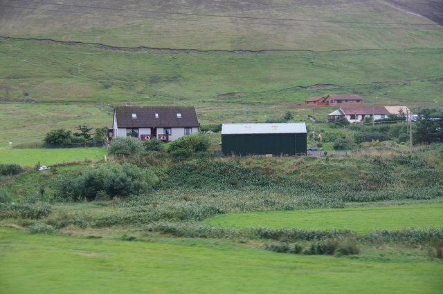
Button Hills Images

Images are sourced within 2km of 60.401753/-1.294247 or Grid Reference HU3868. Thanks to Geograph Open Source API. All images are credited.

Approaching Grutin A few houses in the valley at the head of Dales Voe.
Approaching Grutin
A few houses in the valley at the head of Dales Voe.
Large Red Damselfly (Pyrrhosoma nymphula), Sandgarth, Voe At its only Shetland site, although presumably brought in with plants when the pond was created.
Large Red Damselfly (Pyrrhosoma nymphula), Sandgarth, Voe
At its only Shetland site, although presumably brought in with plants when the pond was created.
Meadow at Sandgarth, Voe Looking towards Dales Voe.
Meadow at Sandgarth, Voe
Looking towards Dales Voe.
The pond at Sandgarth, Voe
Dales Voe from the Sandgarth plantation
Grutin, Dales Lees, from the Sandgarth plantation
Near Pund of Grutin A sneaky through the car window shot on the short bit of road that is in HU4069. Actually, it's not that bad a picture content-wise. 90% of this square is the same moorland hillside that you see stretching into the distance.
Near Pund of Grutin
A sneaky through the car window shot on the short bit of road that is in HU4069. Actually, it's not that bad a picture content-wise. 90% of this square is the same moorland hillside that you see stretching into the distance.
Hill of Dale This impressive hillside stretches for around 10 kms along the north west side of Dales Voe and the valley beyond.
Hill of Dale
This impressive hillside stretches for around 10 kms along the north west side of Dales Voe and the valley beyond.
Isles Road (A968) near Lower Sandgarth The A968 is the United Kingdom's northernmost A-road. It is 42 miles long and connects the islands of Yell and Unst to the Shetland Mainland. Travelling the length of the road involves two ferry crossings and the road is actually separated into three sections. The first 10 miles is from the A970 at Voe on the Shetland mainland to the ferry terminal at Toft. The next 17½ miles crosses the island of Yell, running between the ferry terminals at Ulsta and Gutcher. Finally, the road runs for a further 10 miles across Unst from the ferry terminal at Belmont to Haroldswick.
Isles Road (A968) near Lower Sandgarth
The A968 is the United Kingdom's northernmost A-road. It is 42 miles long and connects the islands of Yell and Unst to the Shetland Mainland. Travelling the length of the road involves two ferry crossings and the road is actually separated into three sections. The first 10 miles is from the A970 at Voe on the Shetland mainland to the ferry terminal at Toft. The next 17½ miles crosses the island of Yell, running between the ferry terminals at Ulsta and Gutcher. Finally, the road runs for a further 10 miles across Unst from the ferry terminal at Belmont to Haroldswick.
Sandgarth, Dales The house went up in smoke some years later, along with the unfortunate owner, sadly.
Sandgarth, Dales
The house went up in smoke some years later, along with the unfortunate owner, sadly.
Dales: postbox № ZE2 70 A small postbox serving few scattered properties around the head of Dales Voe. It is emptied at 11:15 on weekday and Saturday mornings.
Dales: postbox № ZE2 70
A small postbox serving few scattered properties around the head of Dales Voe. It is emptied at 11:15 on weekday and Saturday mornings.
Westerscord, Voe
Westerscord, Voe
Cattle at Dales Lees
View Towards Dalescord Hill At the bealach between Souther Hill and Dalescord Hill.
View Towards Dalescord Hill
At the bealach between Souther Hill and Dalescord Hill.
Dalescord Hill [Button Hills] Early morning bag with Tricky Speirs.
Name: Dalescord Hill [Button Hills]
Hill number: 1534
Height: 252m / 827ft
Area: 22: Shetland Islands
Class: Ma
Grid ref: HU 39314 68432
Summit feature: cairn on peat hag
Drop: 203m
Col: 49m  HU410660
Dalescord Hill [Button Hills]
Early morning bag with Tricky Speirs. Name: Dalescord Hill [Button Hills] Hill number: 1534 Height: 252m / 827ft Area: 22: Shetland Islands Class: Ma Grid ref: HU 39314 68432 Summit feature: cairn on peat hag Drop: 203m Col: 49m HU410660
Return Route From Dalecord Hill This is the return route down this moorland to my car by the roadside near the middle of the photo.
Return Route From Dalecord Hill
This is the return route down this moorland to my car by the roadside near the middle of the photo.
Houb at the head of Dales Voe Looking across to the farm of Dale.
Houb at the head of Dales Voe
Looking across to the farm of Dale.
Sandgarth, Voe House at the head of Dales Voe, Delting.
Sandgarth, Voe
House at the head of Dales Voe, Delting.
Show me another place!

Button Hills is located at Grid Ref: HU3868 (Lat: 60.401753, Lng: -1.294247)

Unitary Authority: Shetland Islands

Police Authority: Highlands and Islands

What 3 Words

///ringside.generated.blazers. Near Brae, Shetland Islands

Nearby Locations

Button Hills Riding Hill

Related Wikis

Delting

Delting is a civil parish and community council area on Mainland, Shetland, Scotland. It includes the Sullom Voe oil terminal and its main settlements...

North Mainland

The North Mainland of the Shetland Islands, Scotland is the part of the Mainland lying north of Voe (60° 21′N). == Geography == Notable places in North...

Brae

"Brae" is also the Lowland Scots language word for the slope or brow of a hill.Brae (Old Norse: Breiðeið, meaning "the wide isthmus") is a village on the...
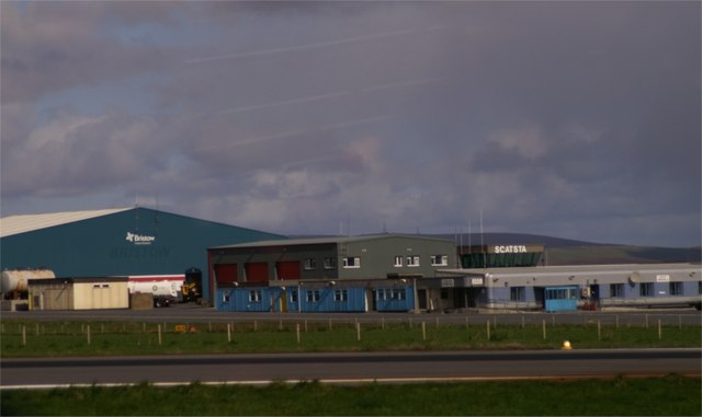
Scatsta Airport

Scatsta Airport (IATA: SCS, ICAO: EGPM), was a commercial airport on the island of Mainland, Shetland in Scotland located 17 nautical miles (31 km; 20...

Busta Voe

Busta Voe, (HU665350), in the north central Mainland, Shetland, is a sea inlet lying between the village of Brae and the island of Muckle Roe. At the head...

Mavis Grind

Mavis Grind (Old Norse: Mæfeiðs grind or Mæveiðs grind, meaning "gate of the narrow isthmus") is a narrow isthmus joining the Northmavine peninsula to...

Sullom

Sullom is a village on the Shetland peninsula of Northmavine, between Haggrister and Bardister. It lies on the northwest side of Sullom Voe, to which it...

Sullom Voe

Sullom Voe is an inlet of the North Sea between the parishes of Delting and Northmavine in Shetland, Scotland. It is a location of the Sullom Voe oil terminal...

Have you been to Button Hills?

Leave your review of Button Hills below (or comments, questions and feedback).