Riding Hill
Hill, Mountain in Shetland
Scotland
Riding Hill
Riding Hill is a prominent hill located in the Shetland Islands, Scotland. It stands at an elevation of approximately 340 meters (1,115 feet) above sea level, making it one of the highest points in the archipelago. The hill is situated in the southern part of the main island, known as Mainland, near the village of Sandwick.
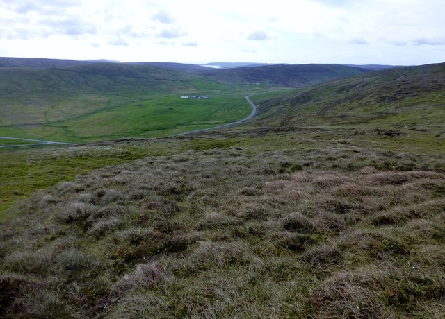
Riding Hill offers breathtaking panoramic views of the surrounding countryside and coastline. On a clear day, visitors can see as far as the North Sea to the east and the Atlantic Ocean to the west. The hill is covered in heather and grass, providing a picturesque setting for hikers and nature enthusiasts.
The ascent up Riding Hill is relatively moderate, with a well-defined path leading to the summit. Along the way, walkers may encounter some sheep that graze in the area. The hill's gentle slopes make it accessible for a wide range of fitness levels.
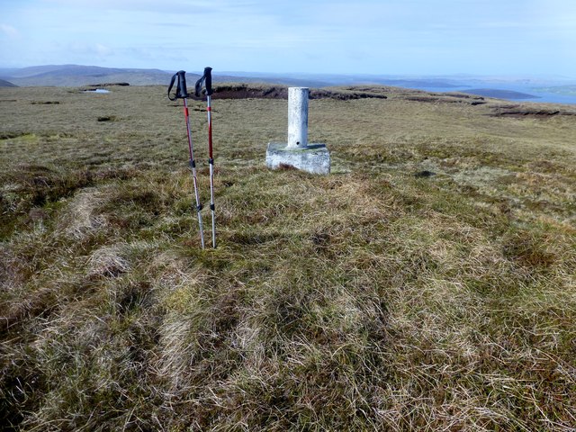
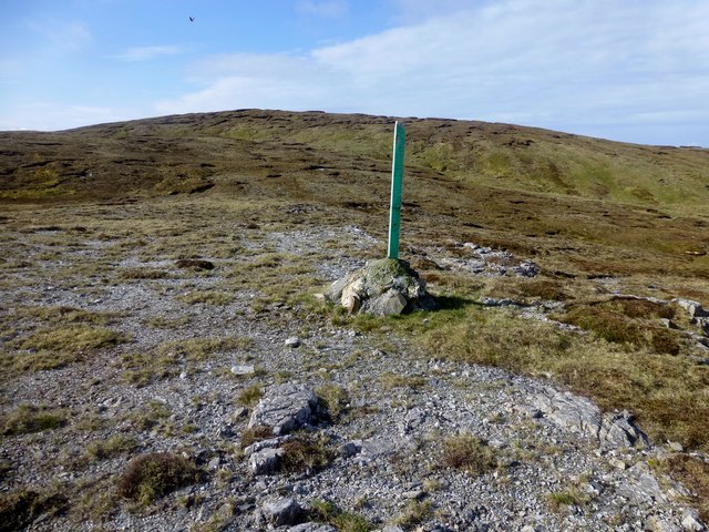
At the top of Riding Hill, there is a cairn, a man-made pile of stones, which serves as a marker and provides a spot for visitors to rest and take in the stunning vistas. The hill is a popular destination for both locals and tourists, offering a peaceful escape from the hustle and bustle of everyday life.
Riding Hill is also known for its historical significance. It is believed that the Vikings, who inhabited the Shetland Islands centuries ago, used the hill as a lookout point to monitor the seas for approaching ships.
Overall, Riding Hill in Shetland is a must-visit location for nature lovers and those seeking a tranquil retreat, offering stunning views, a moderate hiking challenge, and a connection to the islands' rich history.
If you have any feedback on the listing, please let us know in the comments section below.
Riding Hill Images
Images are sourced within 2km of 60.39442/-1.303206 or Grid Reference HU3868. Thanks to Geograph Open Source API. All images are credited.

![Dalescord Hill [Button Hills] Early morning bag with Tricky Speirs.
Name: Dalescord Hill [Button Hills]
Hill number: 1534
Height: 252m / 827ft
Area: 22: Shetland Islands
Class: Ma
Grid ref: HU 39314 68432
Summit feature: cairn on peat hag
Drop: 203m
Col: 49m HU410660](https://s0.geograph.org.uk/geophotos/03/58/82/3588276_87f721cd.jpg)

Riding Hill is located at Grid Ref: HU3868 (Lat: 60.39442, Lng: -1.303206)
Unitary Authority: Shetland Islands
Police Authority: Highlands and Islands
What 3 Words
///grips.haunts.conveying. Near Brae, Shetland Islands
Nearby Locations
Related Wikis

Delting
Delting is a civil parish and community council area on Mainland, Shetland, Scotland. It includes the Sullom Voe oil terminal and its main settlements...

Brae
"Brae" is also the Lowland Scots language word for the slope or brow of a hill.Brae (Old Norse: Breiðeið, meaning "the wide isthmus") is a village on the...

Busta Voe
Busta Voe, (HU665350), in the north central Mainland, Shetland, is a sea inlet lying between the village of Brae and the island of Muckle Roe. At the head...

North Mainland
The North Mainland of the Shetland Islands, Scotland is the part of the Mainland lying north of Voe (60° 21′N). == Geography == Notable places in North...
Have you been to Riding Hill?
Leave your review of Riding Hill below (or comments, questions and feedback).