Tun Brook Wood

Wood, Forest in Lancashire Preston

England

Tun Brook Wood

Gantries and footbridge over M6
Gantries and footbridge over M6 Credit: Alpin Stewart

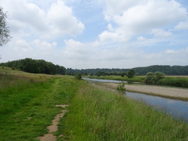
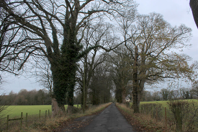
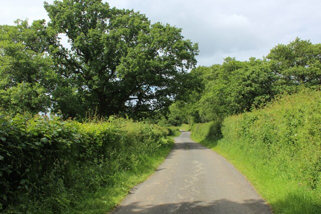
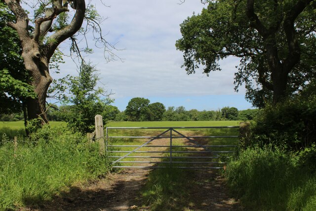
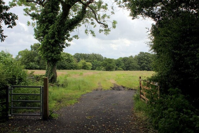
Tun Brook Wood is a picturesque woodland located in the county of Lancashire in England. Spanning an area of approximately 100 hectares, it is a well-preserved natural habitat that offers a range of recreational activities for visitors.

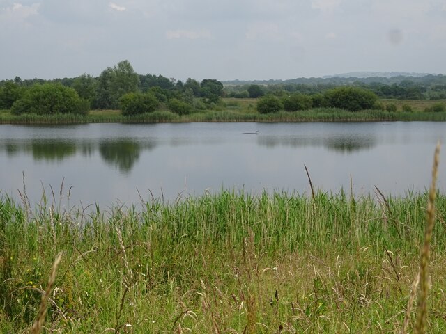
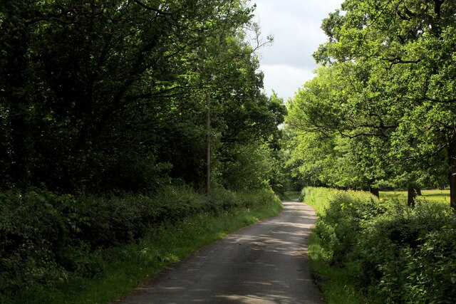
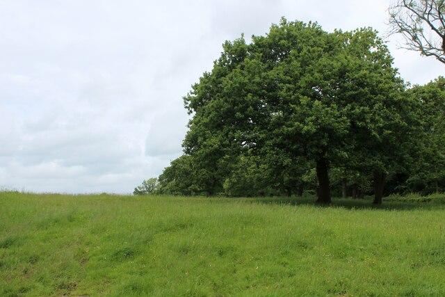
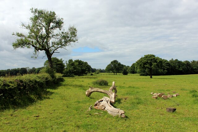
The wood is composed primarily of native broadleaf trees, including oak, birch, and beech, which create a dense and vibrant canopy overhead. The undergrowth is rich with various wildflowers, ferns, and mosses, adding to the beauty and biodiversity of the woodland. Tun Brook, a small stream that meanders through the wood, adds a soothing touch to the overall ambiance.

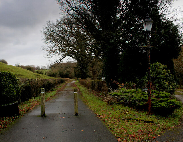
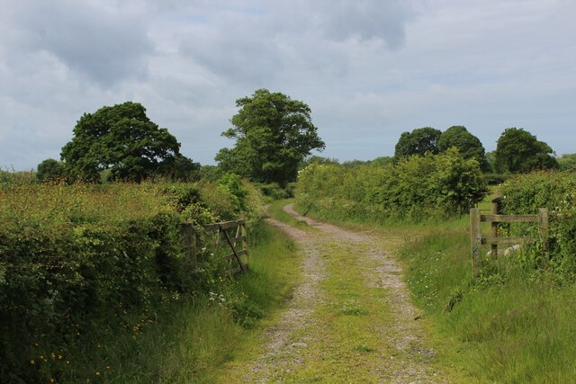
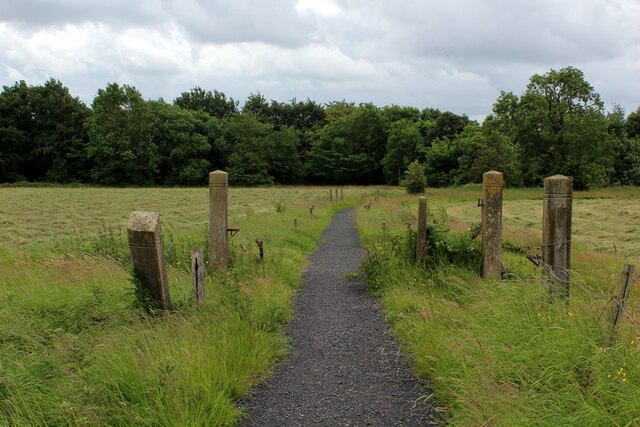
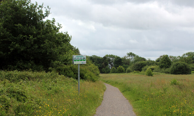
Walking trails wind their way through the wood, allowing visitors to explore its serene surroundings at their leisure. These paths are well-maintained and offer varying levels of difficulty, catering to both casual strollers and more experienced hikers. Along the trails, one can encounter an array of wildlife, including birds, squirrels, and even the occasional deer.

Tun Brook Wood is also a popular destination for birdwatching enthusiasts. The diverse habitat attracts a wide range of bird species, including woodpeckers, owls, and various songbirds. Binoculars in hand, visitors can catch glimpses of these feathered creatures in their natural habitat.

Overall, Tun Brook Wood is a tranquil and enchanting forest that provides a haven for both nature lovers and outdoor enthusiasts. Its diverse flora and fauna, coupled with its well-maintained walking trails, make it a must-visit destination for anyone seeking solace in the beauty of Lancashire's natural landscapes.

If you have any feedback on the listing, please let us know in the comments section below.

Tun Brook Wood Images

Images are sourced within 2km of 53.787056/-2.622713 or Grid Reference SD5932. Thanks to Geograph Open Source API. All images are credited.

Gantries and footbridge over M6
B6243 crossing M6
B6243 crossing M6
Path by the River Ribble at Brockholes Nature Reserve
Ribbleton Pool, Brockholes Nature Reserve
Junction 31A signage - northbound M6
B6243 bridge - northbound M6
On Dean Lane
On Dean Lane
Access to Lower Hall Farm The end of Potter Lane, becomes the access lane for Lower Hall Farm on the banks of the River Ribble
Access to Lower Hall Farm
The end of Potter Lane, becomes the access lane for Lower Hall Farm on the banks of the River Ribble
Potter Lane An avenue of trees at the northern end of the no through road, that is Potter Lane.
Potter Lane
An avenue of trees at the northern end of the no through road, that is Potter Lane.
Farm Track leading towards Elston Lane
Elston Lane in Big Wood Adopted by the Ribble Way long distance footpath - but maybe for not much longer.
About half a mile further on, the trail takes to fields before descending sharply through woods to cross Tun Brook - but the footbridge has gone, and it will be a very long time if ever that a replacement is constructed.
A red notice near Place House Farm advises walkers to find an alternative route, and another partially obscured effort in Big Wood tells Ribble Way walkers to turn round, and then turn left off Elston Lane before Chapel House Farm.
This will take walkers across Tun Brook, and will probably see the Ribble Way permanently re-routed on this footpath.
<a href="https://www.geograph.org.uk/photo/3443988">SD5932 : Footbridge over Tun Brook</a>
Elston Lane in Big Wood
Adopted by the Ribble Way long distance footpath - but maybe for not much longer. About half a mile further on, the trail takes to fields before descending sharply through woods to cross Tun Brook - but the footbridge has gone, and it will be a very long time if ever that a replacement is constructed. A red notice near Place House Farm advises walkers to find an alternative route, and another partially obscured effort in Big Wood tells Ribble Way walkers to turn round, and then turn left off Elston Lane before Chapel House Farm. This will take walkers across Tun Brook, and will probably see the Ribble Way permanently re-routed on this footpath. SD5932 : Footbridge over Tun Brook
Pasture beside Elston Lane
On Elston Lane Adopted by the Ribble Way long distance footpath - but maybe for not much longer.
About half a mile further on, the trail takes to fields before descending sharply through woods to cross Tun Brook - but the footbridge has gone, and it will be a very long time if ever that a replacement is constructed.
A red notice near Place House Farm advises walkers to find an alternative route, and another partially obscured effort in Big Wood tells Ribble Way walkers to turn round, and then turn left off Elston Lane before Chapel House Farm.
This will take walkers across Tun Brook, and will probably see the Ribble Way permanently re-routed on this footpath.
<a href="https://www.geograph.org.uk/photo/3443988">SD5932 : Footbridge over Tun Brook</a>
On Elston Lane
Adopted by the Ribble Way long distance footpath - but maybe for not much longer. About half a mile further on, the trail takes to fields before descending sharply through woods to cross Tun Brook - but the footbridge has gone, and it will be a very long time if ever that a replacement is constructed. A red notice near Place House Farm advises walkers to find an alternative route, and another partially obscured effort in Big Wood tells Ribble Way walkers to turn round, and then turn left off Elston Lane before Chapel House Farm. This will take walkers across Tun Brook, and will probably see the Ribble Way permanently re-routed on this footpath. SD5932 : Footbridge over Tun Brook
Gate and Field off Elston Lane
Ribble Way heading towards Tun Brook Wood The Ribble Way long distance footpath crosses this pasture to the woods beyond - but maybe for not much longer.
A red notice beside the entrance to this field warns of a closure - informing walkers that the footbridge across Tun Brook has been destroyed, and it will be a very long time if ever that a replacement is constructed.
A red notice near Place House Farm advises walkers to find an alternative route, and another partially obscured effort in Big Wood tells Ribble Way walkers to turn round, and then turn left off Elston Lane before Chapel House Farm.
This will take walkers across Tun Brook, and will probably see the Ribble Way permanently re-routed on this footpath.
<a href="https://www.geograph.org.uk/photo/3443988">SD5932 : Footbridge over Tun Brook</a>
Ribble Way heading towards Tun Brook Wood
The Ribble Way long distance footpath crosses this pasture to the woods beyond - but maybe for not much longer. A red notice beside the entrance to this field warns of a closure - informing walkers that the footbridge across Tun Brook has been destroyed, and it will be a very long time if ever that a replacement is constructed. A red notice near Place House Farm advises walkers to find an alternative route, and another partially obscured effort in Big Wood tells Ribble Way walkers to turn round, and then turn left off Elston Lane before Chapel House Farm. This will take walkers across Tun Brook, and will probably see the Ribble Way permanently re-routed on this footpath. SD5932 : Footbridge over Tun Brook
Ribble Way approaching Red Scar Wood Hard surface path takes the long distance footpath to Red Scar Woods, which then follows the edge of the trees.
The woods conceal very steep banks that slide down to the River Ribble far below.
Ribble Way approaching Red Scar Wood
Hard surface path takes the long distance footpath to Red Scar Woods, which then follows the edge of the trees. The woods conceal very steep banks that slide down to the River Ribble far below.
Ribble Way near Roman Road Farm The long distance farm takes a sharp right here, before heading towards Red Scar Woods
Ribble Way near Roman Road Farm
The long distance farm takes a sharp right here, before heading towards Red Scar Woods
Footpath heading South towards Boilton Wood The path follows the edge of Red Scar Wood. Concealed within the trees is an older path which runs parallel to this one - and carries the Ribble Way long distance footpath. The woods then plunge very steeply down to the River Ribble, below.
Footpath heading South towards Boilton Wood
The path follows the edge of Red Scar Wood. Concealed within the trees is an older path which runs parallel to this one - and carries the Ribble Way long distance footpath. The woods then plunge very steeply down to the River Ribble, below.
Show me another place!

Tun Brook Wood is located at Grid Ref: SD5932 (Lat: 53.787056, Lng: -2.622713)

Administrative County: Lancashire

District: Preston

Police Authority: Lancashire

What 3 Words

///youths.heats.anthems. Near Goosnargh, Lancashire

Related Wikis

Courtaulds Red Scar Works Preston

Red Scar Works was built in 1939 by Courtaulds and produced rayon. It was located in Ribbleton Preston off Longridge Road. The closure of the works was...

St Michael's Church, Grimsargh

St Michael's Church is in the village of Grimsargh, Lancashire, England. It is an active Anglican parish church in the deanery of Grimsargh, the archdeaconry...

Brockholes (nature reserve)

Brockholes is a nature reserve near Preston, Lancashire, England, just off Junction 31 of the M6 motorway. It is owned by the Wildlife Trust for Lancashire...

Preston Rural East

Preston Rural East is an electoral ward in the City of Preston, Lancashire, England. The ward is in the eastern and northeastern part of the city near...

Grimsargh railway station

Grimsargh railway station was on the single track Preston and Longridge Railway. It served the village of Grimsargh in Lancashire, England. When the line...

Grimsargh

Grimsargh is a village and civil parish in the City of Preston, Lancashire, England. located 6 miles (10 km) east of Preston. == History == The name Grimsargh...

Lancashire dialect

The Lancashire dialect (or colloquially, Lanky) refers to the Northern English vernacular speech of the English county of Lancashire. The region is notable...

Rock FM (Lancashire)

Rock FM is an Independent Local Radio station based in Manchester, England, owned and operated by Bauer as part of the Hits Radio network. It broadcasts...

Nearby Amenities

Located within 500m of 53.787056,-2.622713
Barrier: stile
Foot: yes
Lat/Long: 53.7852914/-2.6291781
The data included in this document is from www.openstreetmap.org. The data is made available under ODbL.

Have you been to Tun Brook Wood?

Leave your review of Tun Brook Wood below (or comments, questions and feedback).