Elston

Settlement in Lancashire Preston

England

Elston

Path by the River Ribble at Brockholes Nature Reserve
Path by the River Ribble at Brockholes Nature Reserve Credit: Greum

Elston is a small village located in the county of Lancashire, England. Situated in the Ribble Valley district, it lies approximately 5 miles north of the town of Clitheroe. The village is nestled amidst the picturesque landscape of the Forest of Bowland, an Area of Outstanding Natural Beauty.

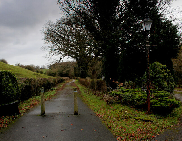
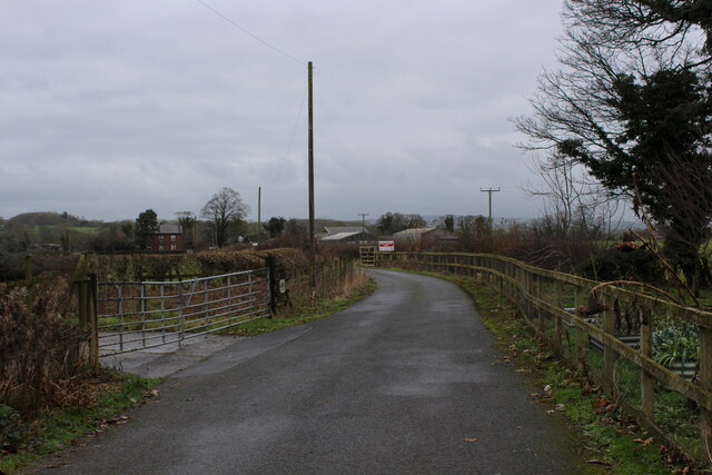
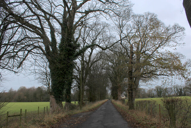
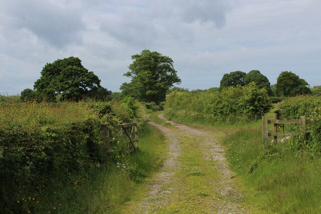
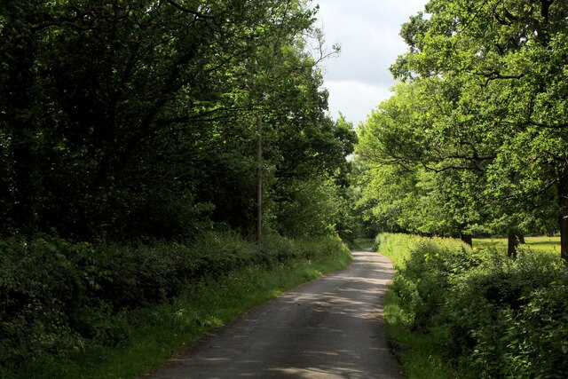
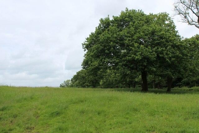
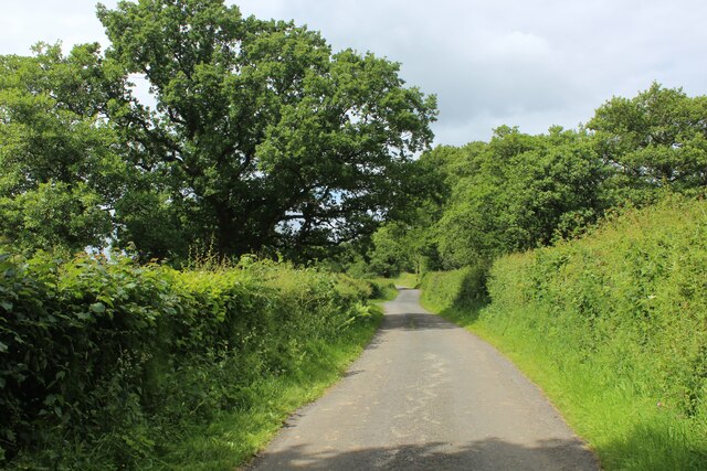
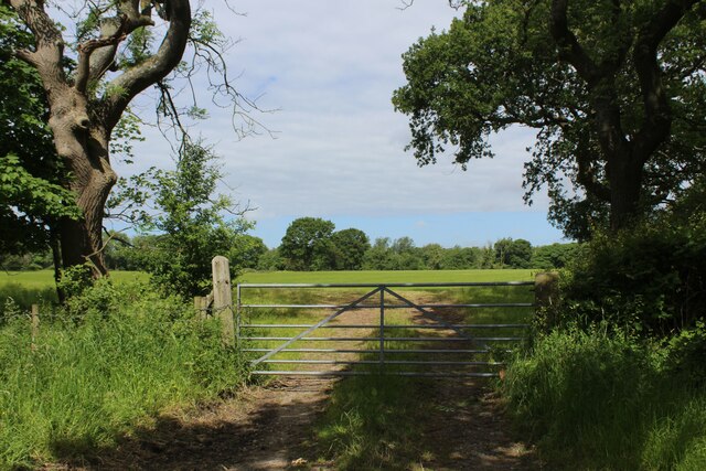
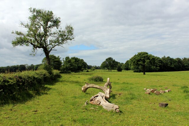
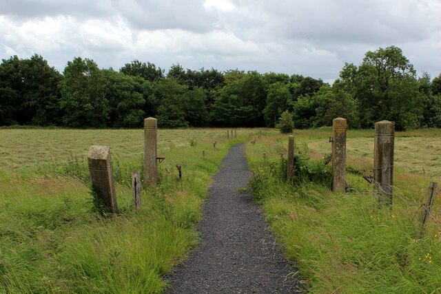
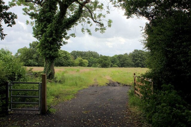
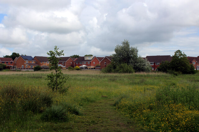
Elston is a rural community with a population of around 300 residents. It is primarily an agricultural area, characterized by rolling hills, lush green fields, and charming stone-built houses. The village is known for its tranquil and peaceful atmosphere, offering a desirable escape from the bustling city life.

Despite its small size, Elston has a rich history, dating back to the medieval period. The village features several historical landmarks, such as St. James' Church, a Grade II listed building originating from the 16th century. The church serves as a focal point for the community and hosts regular services and events.

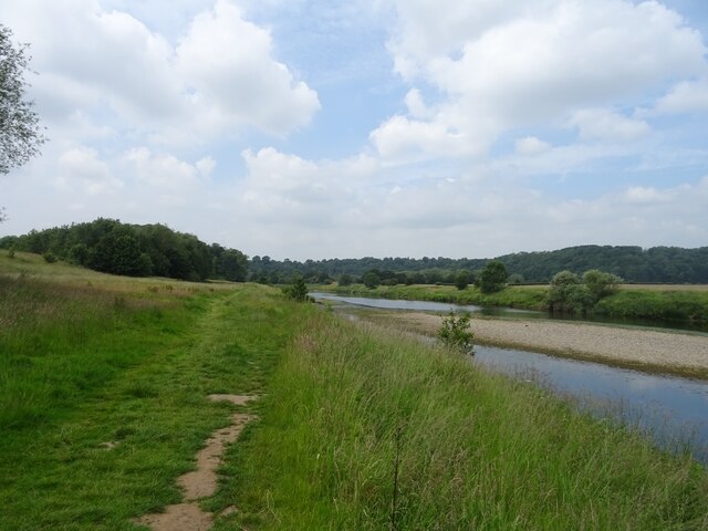
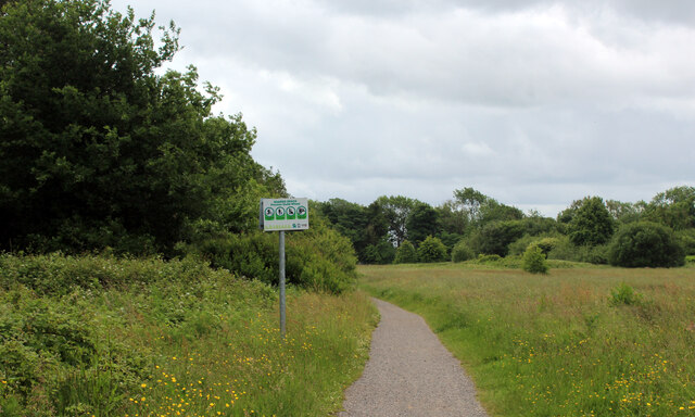
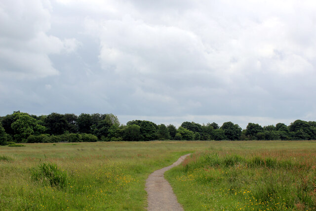
Nature enthusiasts will find plenty to explore in and around Elston. The surrounding countryside offers numerous walking trails, allowing visitors to appreciate the stunning scenery and spot local wildlife. Additionally, the nearby River Ribble provides opportunities for fishing and boating.

While Elston lacks major amenities and services, it benefits from its close proximity to Clitheroe, where residents can access a wider range of shops, restaurants, and cultural attractions. Overall, Elston is a tranquil and idyllic village, offering a peaceful retreat in the heart of Lancashire's stunning countryside.

If you have any feedback on the listing, please let us know in the comments section below.
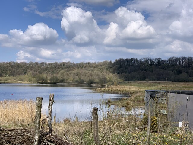
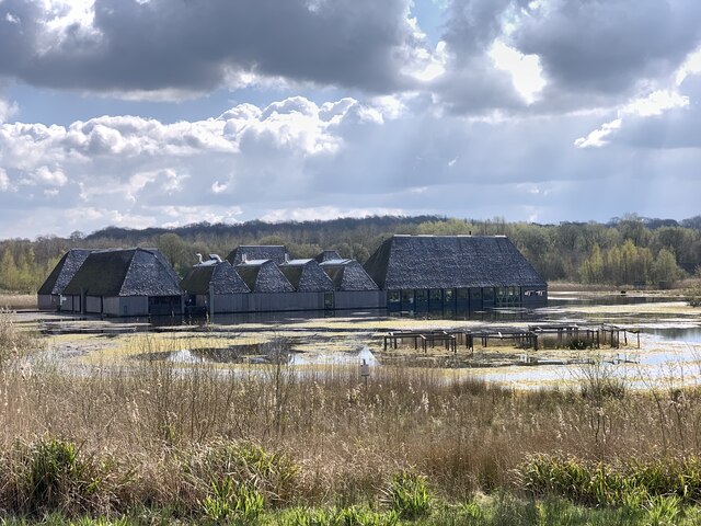
Elston Images

Images are sourced within 2km of 53.786152/-2.6131528 or Grid Reference SD5932. Thanks to Geograph Open Source API. All images are credited.

Path by the River Ribble at Brockholes Nature Reserve
On Dean Lane
On Dean Lane
Access to Lower Hall Farm The end of Potter Lane, becomes the access lane for Lower Hall Farm on the banks of the River Ribble
Access to Lower Hall Farm
The end of Potter Lane, becomes the access lane for Lower Hall Farm on the banks of the River Ribble
Potter Lane An avenue of trees at the northern end of the no through road, that is Potter Lane.
Potter Lane
An avenue of trees at the northern end of the no through road, that is Potter Lane.
Farm Track leading towards Elston Lane
Elston Lane in Big Wood Adopted by the Ribble Way long distance footpath - but maybe for not much longer.
About half a mile further on, the trail takes to fields before descending sharply through woods to cross Tun Brook - but the footbridge has gone, and it will be a very long time if ever that a replacement is constructed.
A red notice near Place House Farm advises walkers to find an alternative route, and another partially obscured effort in Big Wood tells Ribble Way walkers to turn round, and then turn left off Elston Lane before Chapel House Farm.
This will take walkers across Tun Brook, and will probably see the Ribble Way permanently re-routed on this footpath.
<a href="https://www.geograph.org.uk/photo/3443988">SD5932 : Footbridge over Tun Brook</a>
Elston Lane in Big Wood
Adopted by the Ribble Way long distance footpath - but maybe for not much longer. About half a mile further on, the trail takes to fields before descending sharply through woods to cross Tun Brook - but the footbridge has gone, and it will be a very long time if ever that a replacement is constructed. A red notice near Place House Farm advises walkers to find an alternative route, and another partially obscured effort in Big Wood tells Ribble Way walkers to turn round, and then turn left off Elston Lane before Chapel House Farm. This will take walkers across Tun Brook, and will probably see the Ribble Way permanently re-routed on this footpath. SD5932 : Footbridge over Tun Brook
Pasture beside Elston Lane
On Elston Lane Adopted by the Ribble Way long distance footpath - but maybe for not much longer.
About half a mile further on, the trail takes to fields before descending sharply through woods to cross Tun Brook - but the footbridge has gone, and it will be a very long time if ever that a replacement is constructed.
A red notice near Place House Farm advises walkers to find an alternative route, and another partially obscured effort in Big Wood tells Ribble Way walkers to turn round, and then turn left off Elston Lane before Chapel House Farm.
This will take walkers across Tun Brook, and will probably see the Ribble Way permanently re-routed on this footpath.
<a href="https://www.geograph.org.uk/photo/3443988">SD5932 : Footbridge over Tun Brook</a>
On Elston Lane
Adopted by the Ribble Way long distance footpath - but maybe for not much longer. About half a mile further on, the trail takes to fields before descending sharply through woods to cross Tun Brook - but the footbridge has gone, and it will be a very long time if ever that a replacement is constructed. A red notice near Place House Farm advises walkers to find an alternative route, and another partially obscured effort in Big Wood tells Ribble Way walkers to turn round, and then turn left off Elston Lane before Chapel House Farm. This will take walkers across Tun Brook, and will probably see the Ribble Way permanently re-routed on this footpath. SD5932 : Footbridge over Tun Brook
Gate and Field off Elston Lane
Ribble Way heading towards Tun Brook Wood The Ribble Way long distance footpath crosses this pasture to the woods beyond - but maybe for not much longer.
A red notice beside the entrance to this field warns of a closure - informing walkers that the footbridge across Tun Brook has been destroyed, and it will be a very long time if ever that a replacement is constructed.
A red notice near Place House Farm advises walkers to find an alternative route, and another partially obscured effort in Big Wood tells Ribble Way walkers to turn round, and then turn left off Elston Lane before Chapel House Farm.
This will take walkers across Tun Brook, and will probably see the Ribble Way permanently re-routed on this footpath.
<a href="https://www.geograph.org.uk/photo/3443988">SD5932 : Footbridge over Tun Brook</a>
Ribble Way heading towards Tun Brook Wood
The Ribble Way long distance footpath crosses this pasture to the woods beyond - but maybe for not much longer. A red notice beside the entrance to this field warns of a closure - informing walkers that the footbridge across Tun Brook has been destroyed, and it will be a very long time if ever that a replacement is constructed. A red notice near Place House Farm advises walkers to find an alternative route, and another partially obscured effort in Big Wood tells Ribble Way walkers to turn round, and then turn left off Elston Lane before Chapel House Farm. This will take walkers across Tun Brook, and will probably see the Ribble Way permanently re-routed on this footpath. SD5932 : Footbridge over Tun Brook
Ribble Way approaching Red Scar Wood Hard surface path takes the long distance footpath to Red Scar Woods, which then follows the edge of the trees.
The woods conceal very steep banks that slide down to the River Ribble far below.
Ribble Way approaching Red Scar Wood
Hard surface path takes the long distance footpath to Red Scar Woods, which then follows the edge of the trees. The woods conceal very steep banks that slide down to the River Ribble far below.
Ribble Way near Roman Road Farm The long distance farm takes a sharp right here, before heading towards Red Scar Woods
Ribble Way near Roman Road Farm
The long distance farm takes a sharp right here, before heading towards Red Scar Woods
Footpath heading South towards Boilton Wood The path follows the edge of Red Scar Wood. Concealed within the trees is an older path which runs parallel to this one - and carries the Ribble Way long distance footpath. The woods then plunge very steeply down to the River Ribble, below.
Footpath heading South towards Boilton Wood
The path follows the edge of Red Scar Wood. Concealed within the trees is an older path which runs parallel to this one - and carries the Ribble Way long distance footpath. The woods then plunge very steeply down to the River Ribble, below.
Pope Lane Hard surfaced footpath that crosses a large grass space from Red Scar Woods to reach and then traverse the M6 over a bridge, and into the Ribbleton district of Preston.
Pope Lane
Hard surfaced footpath that crosses a large grass space from Red Scar Woods to reach and then traverse the M6 over a bridge, and into the Ribbleton district of Preston.
Approaching "The Hills" Housing Estate Crossing a patch of rough ground between the housing estate and the disused Longridge/Preston railway line
Approaching "The Hills" Housing Estate
Crossing a patch of rough ground between the housing estate and the disused Longridge/Preston railway line
Visitor Village at Brockholes Nature Reserve Most of the site was originally farmland, on the floodplain of the River Ribble. It was bordered by woodland on the slopes to the north, and by the river to the east and south. The M6 motorway was opened in 1958.
Sand and gravel was quarried east of the M6 from 1996 to 2007, when the activity transferred to the west of the M6 (Lower Brockholes).
The site was bought by the Lancashire Wildlife Trust in 2007.
The gravel pits have been modified to improve the habitat for wildlife, and enable water levels to be controlled. The creation of wildflower meadows, reedbeds and woodland continues. 
The reserve opened to the public at Easter 2011, after the floating visitor village had been completed.
See <span class="nowrap"><a title="http://www.brockholes.org/" rel="nofollow ugc noopener" href="http://www.brockholes.org/">Link</a><img style="margin-left:2px;" alt="External link" title="External link - shift click to open in new window" src="https://s1.geograph.org.uk/img/external.png" width="10" height="10"/></span> .
Visitor Village at Brockholes Nature Reserve
Most of the site was originally farmland, on the floodplain of the River Ribble. It was bordered by woodland on the slopes to the north, and by the river to the east and south. The M6 motorway was opened in 1958. Sand and gravel was quarried east of the M6 from 1996 to 2007, when the activity transferred to the west of the M6 (Lower Brockholes). The site was bought by the Lancashire Wildlife Trust in 2007. The gravel pits have been modified to improve the habitat for wildlife, and enable water levels to be controlled. The creation of wildflower meadows, reedbeds and woodland continues. The reserve opened to the public at Easter 2011, after the floating visitor village had been completed. See LinkExternal link .
Number One Pit, Brockholes Nature Reserve Most of the site was originally farmland, on the floodplain of the River Ribble. It was bordered by woodland on the slopes to the north, and by the river to the east and south. The M6 motorway was opened in 1958.
Sand and gravel was quarried east of the M6 from 1996 to 2007, when the activity transferred to the west of the M6 (Lower Brockholes).
The site was bought by the Lancashire Wildlife Trust in 2007.
The gravel pits have been modified to improve the habitat for wildlife, and enable water levels to be controlled. The creation of wildflower meadows, reedbeds and woodland continues. 
The reserve opened to the public at Easter 2011, after the floating visitor village had been completed.
See <span class="nowrap"><a title="http://www.brockholes.org/" rel="nofollow ugc noopener" href="http://www.brockholes.org/">Link</a><img style="margin-left:2px;" alt="External link" title="External link - shift click to open in new window" src="https://s1.geograph.org.uk/img/external.png" width="10" height="10"/></span> .
Number One Pit, Brockholes Nature Reserve
Most of the site was originally farmland, on the floodplain of the River Ribble. It was bordered by woodland on the slopes to the north, and by the river to the east and south. The M6 motorway was opened in 1958. Sand and gravel was quarried east of the M6 from 1996 to 2007, when the activity transferred to the west of the M6 (Lower Brockholes). The site was bought by the Lancashire Wildlife Trust in 2007. The gravel pits have been modified to improve the habitat for wildlife, and enable water levels to be controlled. The creation of wildflower meadows, reedbeds and woodland continues. The reserve opened to the public at Easter 2011, after the floating visitor village had been completed. See LinkExternal link .
Visitor Village at Brockholes Nature Reserve Most of the site was originally farmland, on the floodplain of the River Ribble. It was bordered by woodland on the slopes to the north, and by the river to the east and south. The M6 motorway was opened in 1958.
Sand and gravel was quarried east of the M6 from 1996 to 2007, when the activity transferred to the west of the M6 (Lower Brockholes).
The site was bought by the Lancashire Wildlife Trust in 2007.
The gravel pits have been modified to improve the habitat for wildlife, and enable water levels to be controlled. The creation of wildflower meadows, reedbeds and woodland continues. 
The reserve opened to the public at Easter 2011, after the floating visitor village had been completed.
See <span class="nowrap"><a title="http://www.brockholes.org/" rel="nofollow ugc noopener" href="http://www.brockholes.org/">Link</a><img style="margin-left:2px;" alt="External link" title="External link - shift click to open in new window" src="https://s1.geograph.org.uk/img/external.png" width="10" height="10"/></span> .
Visitor Village at Brockholes Nature Reserve
Most of the site was originally farmland, on the floodplain of the River Ribble. It was bordered by woodland on the slopes to the north, and by the river to the east and south. The M6 motorway was opened in 1958. Sand and gravel was quarried east of the M6 from 1996 to 2007, when the activity transferred to the west of the M6 (Lower Brockholes). The site was bought by the Lancashire Wildlife Trust in 2007. The gravel pits have been modified to improve the habitat for wildlife, and enable water levels to be controlled. The creation of wildflower meadows, reedbeds and woodland continues. The reserve opened to the public at Easter 2011, after the floating visitor village had been completed. See LinkExternal link .
Show me another place!

Elston is located at Grid Ref: SD5932 (Lat: 53.786152, Lng: -2.6131528)

Administrative County: Lancashire

District: Preston

Police Authority: Lancashire

What 3 Words

///contoured.songbird.task. Near Longridge, Lancashire

Related Wikis

Lancashire dialect

The Lancashire dialect (or colloquially, Lanky) refers to the Northern English vernacular speech of the English county of Lancashire. The region is notable...

Rock FM (Lancashire)

Rock FM is an Independent Local Radio station based in Manchester, England, owned and operated by Bauer as part of the Hits Radio network. It broadcasts...

Lancashire

Lancashire ( LAN-kə-shər, -⁠sheer; abbreviated Lancs) is a ceremonial county in North West England. It is bordered by Cumbria to the north, North Yorkshire...

Brockholes (nature reserve)

Brockholes is a nature reserve near Preston, Lancashire, England, just off Junction 31 of the M6 motorway. It is owned by the Wildlife Trust for Lancashire...

Alston Hall

Alston Hall is a 19th-century Victorian gothic style country mansion located in Longridge (near Preston) in Lancashire, England. It is not to be confused...

St Michael's Church, Grimsargh

St Michael's Church is in the village of Grimsargh, Lancashire, England. It is an active Anglican parish church in the deanery of Grimsargh, the archdeaconry...

Samlesbury

Samlesbury ( or locally ) is a village and civil parish in South Ribble, Lancashire, England. Samlesbury Hall, a historic house, is in the village, as...

Courtaulds Red Scar Works Preston

Red Scar Works was built in 1939 by Courtaulds and produced rayon. It was located in Ribbleton Preston off Longridge Road. The closure of the works was...

Related Videos

SOLO HIKING in the Lancashire Countryside - South Ribble Valley - Nabs Head & Samlesbury Circular.

A lovely 5 mile hike in Lancashire, England. Nabs Head & Samlesbury Circular in the South Ribble Valley!

Great British Walks

In this video we visit Brockholes Nature Reserve in Preston, Lancashire, England. We spend about 3 hours walking in the fresh air ...

Much To Do About Nothing

5 mile gentle walk with my dog enjoying the sunshine to Brockholes Nature Reserve in Preston, Lancashire. 13 February 2023 ...

Have you been to Elston?

Leave your review of Elston below (or comments, questions and feedback).