Springs Wood

Wood, Forest in Cumberland Carlisle

England

Springs Wood

Lanercost Priory - March 2016 (1) Tomb of Elizabeth Dacre Howard (detail). See also: <a href="https://www.geograph.org.uk/photo/3190932">NY5563 : Child's Tomb, Lanercost Priory</a> .
Lanercost Priory - March 2016 (1) Credit: The Carlisle Kid

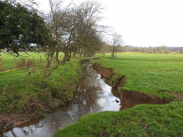
Springs Wood, located in Cumberland, is a picturesque forest that spans across a vast area of land. The wood is well-known for its natural beauty and tranquil atmosphere, attracting nature enthusiasts and hikers alike. It is situated in a region marked by rolling hills and lush greenery, offering visitors a captivating view of the surrounding landscape.

The woodland is home to a diverse range of flora and fauna, making it an ideal spot for wildlife enthusiasts and bird watchers. The dense canopy of trees, which consists primarily of oak, beech, and pine, provides a haven for various species of birds, including woodpeckers, owls, and warblers. The forest floor is adorned with a carpet of ferns, wildflowers, and mosses, adding to its enchanting appeal.

Trails wind through the forest, allowing visitors to explore the wood at their leisure. These paths cater to different difficulty levels, accommodating both casual strollers and avid hikers. Along the way, there are several designated picnic spots and benches, providing opportunities for relaxation and enjoying the peaceful ambiance.

Springs Wood is not only a recreational destination but also holds historical significance. It was once part of an ancient hunting ground and has been mentioned in historical documents dating back centuries. The wood has witnessed the passage of time, remaining a serene retreat for generations to enjoy.

Overall, Springs Wood in Cumberland offers a serene and captivating experience for nature lovers, history enthusiasts, and those seeking solace in the midst of a natural oasis. Its diverse ecosystem, scenic trails, and rich historical background make it a must-visit destination for anyone exploring the region.

If you have any feedback on the listing, please let us know in the comments section below.
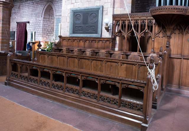
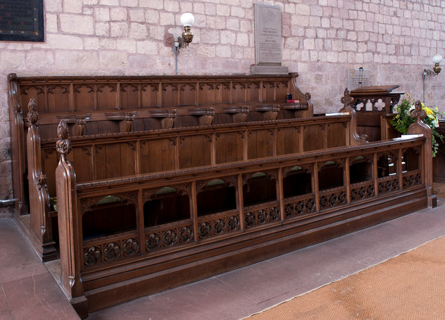
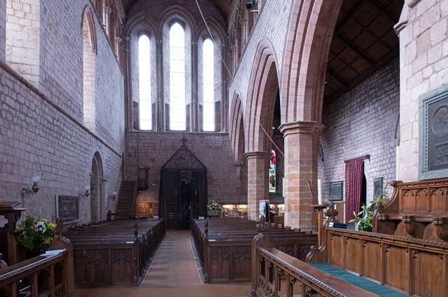
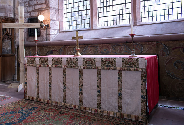
Springs Wood Images

Images are sourced within 2km of 54.969781/-2.6920252 or Grid Reference NY5564. Thanks to Geograph Open Source API. All images are credited.

Lanercost Priory - March 2016 (1) Tomb of Elizabeth Dacre Howard (detail). See also: <a href="https://www.geograph.org.uk/photo/3190932">NY5563 : Child's Tomb, Lanercost Priory</a> .
Lanercost Priory - March 2016 (1)
Tomb of Elizabeth Dacre Howard (detail). See also: NY5563 : Child's Tomb, Lanercost Priory .
Lanercost Priory - March 2016 (2) Tomb of Sir Humphrey & Lady Mabel Dacre.
Lanercost Priory - March 2016 (2)
Tomb of Sir Humphrey & Lady Mabel Dacre.
Lanercost Priory - March 2016 (3) Tomb of Sir Humphrey & Lady Mabel Dacre and part of the North Transept.
Lanercost Priory - March 2016 (3)
Tomb of Sir Humphrey & Lady Mabel Dacre and part of the North Transept.
Lanercost Priory - March 2016 (4) Remains of the east window.
Lanercost Priory - March 2016 (4)
Remains of the east window.
Lanercost Priory - March 2016 (5) The ruined east end with (to left) the Priory Church of St Mary Magdalene - see also: <a href="https://www.geograph.org.uk/photo/445357">NY5563 : Lanercost Priory, ruined chancel</a> .
Lanercost Priory - March 2016 (5)
The ruined east end with (to left) the Priory Church of St Mary Magdalene - see also: NY5563 : Lanercost Priory, ruined chancel .
Lanercost Priory - March 2016 (6) Remains of monk's dining room - the arched doorway gives access to the undercroft.
Lanercost Priory - March 2016 (6)
Remains of monk's dining room - the arched doorway gives access to the undercroft.
Lanercost Priory - March 2016 (7) Lands adjoining the Priory are still used as a working farm.
Lanercost Priory - March 2016 (7)
Lands adjoining the Priory are still used as a working farm.
Lanercost Priory - March 2016 (8) Dacre tower- part of the family residence created by Thomas Dacre after dissolution of the Priory in 1538.
Lanercost Priory - March 2016 (8)
Dacre tower- part of the family residence created by Thomas Dacre after dissolution of the Priory in 1538.
Lanercost Priory - March 2016 (9) The undercroft - see also: <a href="https://www.geograph.org.uk/photo/3190829">NY5563 : Lanercost Priory Refectory Undercroft</a> .
Lanercost Priory - March 2016 (9)
The undercroft - see also: NY5563 : Lanercost Priory Refectory Undercroft .
Lanercost Priory - March 2016 (10) Dacre Hall - east wall. A residence built by the Dacre family from the former monastic west range. Now in use as the village hall.
Lanercost Priory - March 2016 (10)
Dacre Hall - east wall. A residence built by the Dacre family from the former monastic west range. Now in use as the village hall.
Lanercost Priory - March 2016 (11) Priory Church of St Mary Magdalene (1) - north choir pews. Above the pews can be seen the memorial to Charles Howard (see: <a href="https://www.geograph.org.uk/photo/3190777">NY5563 : Lanercost Priory Church, Memorial to Charles Howard</a> ).
Lanercost Priory - March 2016 (11)
Priory Church of St Mary Magdalene (1) - north choir pews. Above the pews can be seen the memorial to Charles Howard (see: NY5563 : Lanercost Priory Church, Memorial to Charles Howard ).
Lanercost Priory - March 2016 (12) Priory Church of St Mary Magdalene (2) - south choir pews.
Lanercost Priory - March 2016 (12)
Priory Church of St Mary Magdalene (2) - south choir pews.
Lanercost Priory - March 2016 (13) Priory Church of St Mary Magdalene (3) - view down the nave to the west door. For a view to the east window, see: <a href="https://www.geograph.org.uk/photo/3190753">NY5563 : Lanercost Priory Church (Nave and East Window)</a> .
Lanercost Priory - March 2016 (13)
Priory Church of St Mary Magdalene (3) - view down the nave to the west door. For a view to the east window, see: NY5563 : Lanercost Priory Church (Nave and East Window) .
Lanercost Priory - March 2016 (14) Priory Church of St Mary Magdalene (4) - altar and William Morris designed dossal. Commissioned by the 9th Earl of Carlisle from his friend and arts & crafts artist William Morris, the dossal was hung on Easter Day 1887.
Lanercost Priory - March 2016 (14)
Priory Church of St Mary Magdalene (4) - altar and William Morris designed dossal. Commissioned by the 9th Earl of Carlisle from his friend and arts & crafts artist William Morris, the dossal was hung on Easter Day 1887.
Lanercost Priory - March 2016 (15) Priory Church of St Mary Magdalene (5) - detail from the William Morris dossal.
Lanercost Priory - March 2016 (15)
Priory Church of St Mary Magdalene (5) - detail from the William Morris dossal.
Lanercost Priory - March 2016 (16) Priory Church of St Mary Magdalene (6) - nave and north side pews.
Lanercost Priory - March 2016 (16)
Priory Church of St Mary Magdalene (6) - nave and north side pews.
Lanercost Priory - March 2016 (17) Priory Church of St Mary Magdalene (7) - memorial to the Charlton brothers. Memorial to the two sons (and only children) of the artist John Charlton and his wife, Kate J M Charlton. Lt Hugh Vaughan Clarlton, killed on 24 June 1916 and his younger brother, Cpt John Macfarlan Charlton, killed on the first day of the Somme, 1 July 1916.

For information on the artist John Charlton, see: <span class="nowrap"><a title="https://en.wikipedia.org/wiki/John_Charlton_(artist)" rel="nofollow ugc noopener" href="https://en.wikipedia.org/wiki/John_Charlton_(artist)">Link</a><img style="margin-left:2px;" alt="External link" title="External link - shift click to open in new window" src="https://s1.geograph.org.uk/img/external.png" width="10" height="10"/></span>
Lanercost Priory - March 2016 (17)
Priory Church of St Mary Magdalene (7) - memorial to the Charlton brothers. Memorial to the two sons (and only children) of the artist John Charlton and his wife, Kate J M Charlton. Lt Hugh Vaughan Clarlton, killed on 24 June 1916 and his younger brother, Cpt John Macfarlan Charlton, killed on the first day of the Somme, 1 July 1916. For information on the artist John Charlton, see: LinkExternal link
Lanercost Priory - March 2016 (18) Priory Church of St Mary Magdalene (8) -  Cecilia Roberts Memorial Window. Designed by the Irish artist Evie Hone, additional information can be found: <a href="https://www.geograph.org.uk/photo/3190793">NY5563 : Lanercost Priory Church, Cecilia Roberts Memorial Stained Glass Window</a> .
Lanercost Priory - March 2016 (18)
Priory Church of St Mary Magdalene (8) - Cecilia Roberts Memorial Window. Designed by the Irish artist Evie Hone, additional information can be found: NY5563 : Lanercost Priory Church, Cecilia Roberts Memorial Stained Glass Window .
Show me another place!

Springs Wood is located at Grid Ref: NY5564 (Lat: 54.969781, Lng: -2.6920252)

Administrative County: Cumbria

District: Carlisle

Police Authority: Cumbria

What 3 Words

///victor.delays.handyman. Near Brampton, Cumbria

Related Wikis

Burtholme

Burtholme refers to any of a civil parish in Cumbria, England, a hamlet within that parish or a family name originally linked to the place. It also appears...
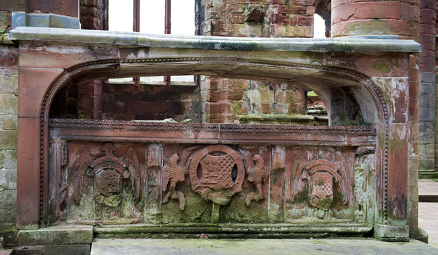
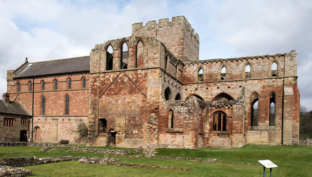
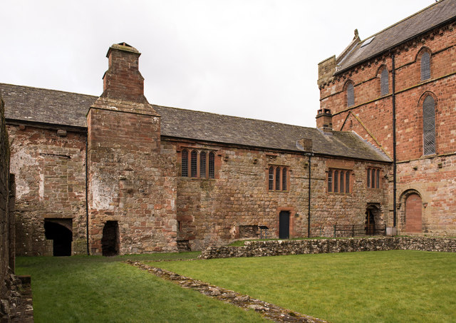
Lanercost Priory

Lanercost Priory was founded by Robert de Vaux between 1165 and 1174, the most likely date being 1169, to house Augustinian canons. The priory is situated...

Lanercost

Lanercost is a village in the northern part of Cumbria, England. The settlement is in the civil parish of Burtholme, in the City of Carlisle local government...

Milecastle 54

Milecastle 54 (Randylands) was a milecastle on Hadrian's Wall (grid reference NY55066444). == Description == Milecastle 54 is on a west-facing hill-slope...

Milecastle 53

Milecastle 53 (Banks Burn) was a milecastle on Hadrian's Wall (grid reference NY56486460). == Description == Milecastle 53 is west of the hamlet of Banks...

Banks, Cumbria

Banks is a village in Cumbria, England, astride the course of Hadrian's Wall, 3 mile (5 km) NE of the market town of Brampton. The historic Lanercost Priory...
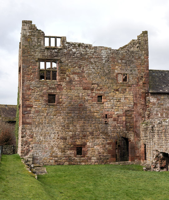
Naworth Castle

Naworth Castle, also known or recorded in historical documents as "Naward", is a castle in Cumbria, England, near the town of Brampton. It is adjacent...

Pike Hill Signal Tower

Pike Hill Signal Tower was one of a number of signal stations that were built on high ground overlooking the line of the Roman Stanegate road in northern...

Nearby Amenities

Located within 500m of 54.969781,-2.6920252
The Forge
Naptan AtcoCode: 090033083603
Naptan Bearing: E
Naptan BusStopType: CUS
Naptan CommonName: The Forge
Naptan Indicator: opp
Naptan Landmark: the Forge
Naptan NaptanCode: cumampja
Naptan Street: No name
Naptan Verified: no
Source: naptan_import
Lat/Long: 54.9668622/-2.6968674
Lanercost
Place: hamlet
Wikidata: Q3372273
Lat/Long: 54.9675664/-2.6968326
Defibrillator
Defibrillator Location: outside Lanercost cricket pavilion - facing road
Emergency: defibrillator
Indoor: no
Lat/Long: 54.9670672/-2.690663
Power: pole
Lat/Long: 54.9684141/-2.6988163
Power: pole
Lat/Long: 54.9691234/-2.6988163
Power: pole
Lat/Long: 54.9698789/-2.698841
Power: pole
Lat/Long: 54.970606/-2.698839
Power: pole
Lat/Long: 54.9715375/-2.6990717
The data included in this document is from www.openstreetmap.org. The data is made available under ODbL.

Have you been to Springs Wood?

Leave your review of Springs Wood below (or comments, questions and feedback).