Abbey Gills Wood

Wood, Forest in Cumberland Carlisle

England

Abbey Gills Wood

Burthinghurst Farmhouse and farm shed.
Burthinghurst Credit: Rose and Trev Clough

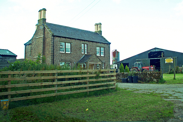
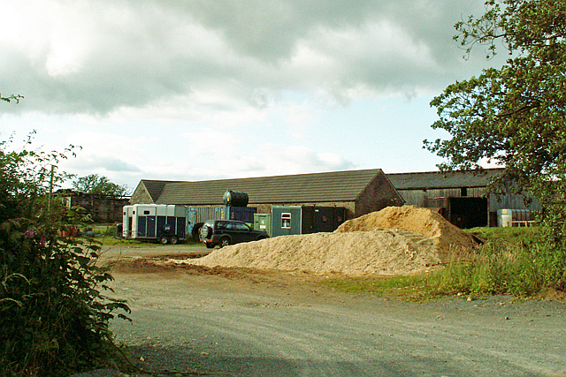
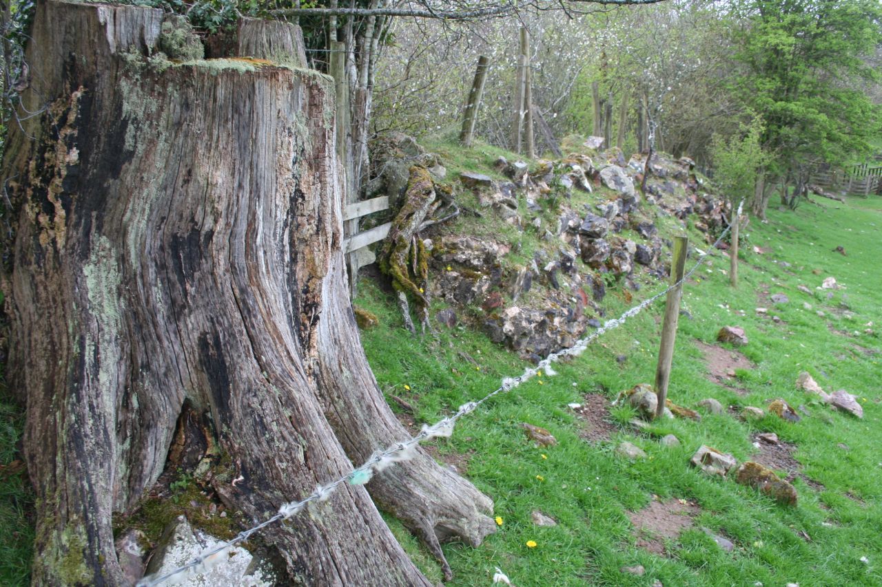
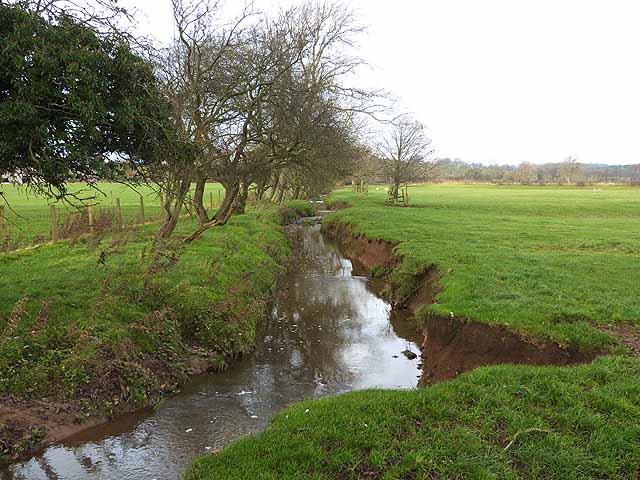
Abbey Gills Wood is a serene and enchanting forest located in Cumberland, England. Spanning over a vast area, the wood is nestled in the heart of the breathtaking Lake District National Park, offering visitors a tranquil escape from the bustling city life. With its rich history and diverse flora and fauna, Abbey Gills Wood is a haven for nature enthusiasts and history buffs alike.

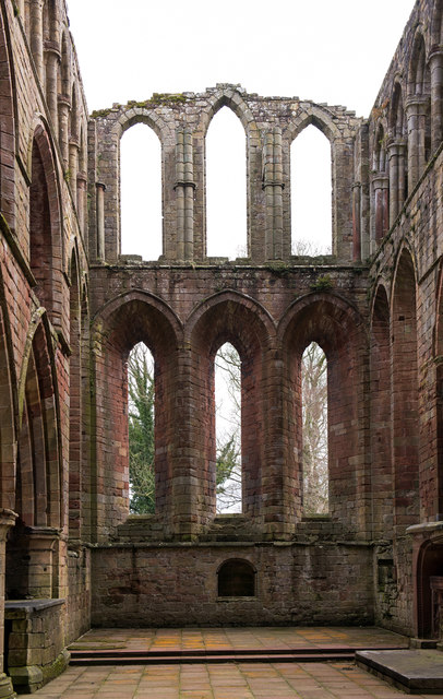
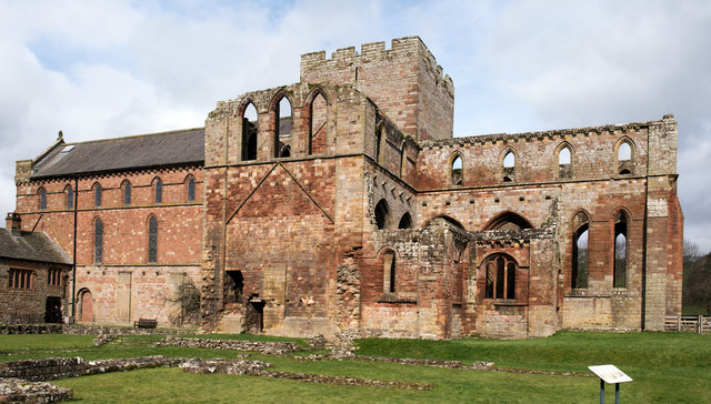
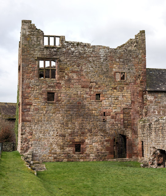
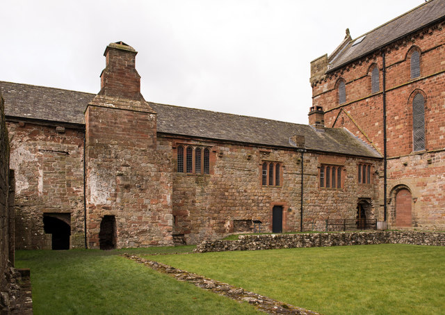
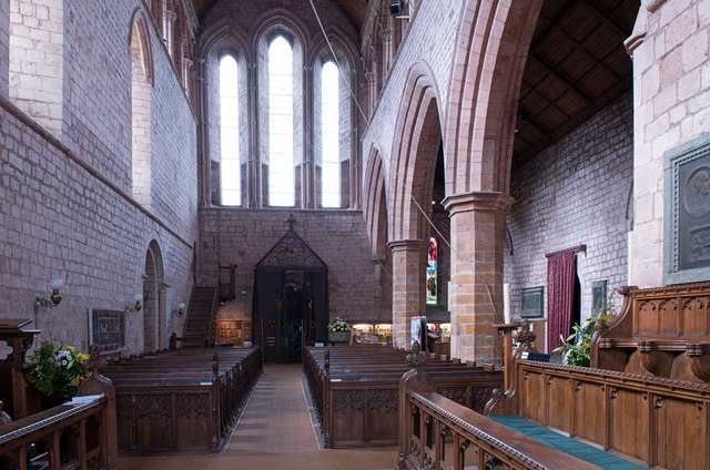
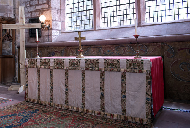
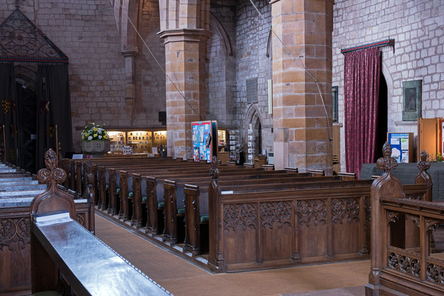
The wood derives its name from the nearby ruins of the medieval Abbey of St. Mary, which adds a touch of mystery and intrigue to the surroundings. The remnants of the abbey can still be seen, adding to the charm and historical significance of the area. The wood itself is a mix of ancient oak, ash, and birch trees, creating a captivating canopy that filters sunlight and casts dappled shadows on the forest floor.

Walking through Abbey Gills Wood, visitors are greeted by a symphony of sounds from birds chirping, leaves rustling, and the gentle flow of nearby streams. The forest is home to a variety of wildlife, including deer, red squirrels, and a myriad of bird species. Keen-eyed visitors may even spot elusive creatures such as badgers and foxes.

Trails and pathways wind through the wood, inviting visitors to explore its beauty at their own pace. Whether it's a leisurely stroll or a more adventurous hike, Abbey Gills Wood offers something for everyone. The wood is also a popular spot for picnics and nature photography, with picturesque views at every turn.

In conclusion, Abbey Gills Wood is a captivating forest in Cumberland, offering a peaceful retreat and a glimpse into the area's rich history. Its natural beauty, diverse flora and fauna, and historical significance make it a must-visit destination for nature lovers and history enthusiasts alike.

If you have any feedback on the listing, please let us know in the comments section below.

Abbey Gills Wood Images

Images are sourced within 2km of 54.970177/-2.7029824 or Grid Reference NY5564. Thanks to Geograph Open Source API. All images are credited.

Burthinghurst Farmhouse and farm shed.
Burthinghurst
Farmhouse and farm shed.
Stable block, Kingwater Equestrian Centre
Lanercost Priory - March 2016 (1) Tomb of Elizabeth Dacre Howard (detail). See also: <a href="https://www.geograph.org.uk/photo/3190932">NY5563 : Child's Tomb, Lanercost Priory</a> .
Lanercost Priory - March 2016 (1)
Tomb of Elizabeth Dacre Howard (detail). See also: NY5563 : Child's Tomb, Lanercost Priory .
Lanercost Priory - March 2016 (2) Tomb of Sir Humphrey & Lady Mabel Dacre.
Lanercost Priory - March 2016 (2)
Tomb of Sir Humphrey & Lady Mabel Dacre.
Lanercost Priory - March 2016 (3) Tomb of Sir Humphrey & Lady Mabel Dacre and part of the North Transept.
Lanercost Priory - March 2016 (3)
Tomb of Sir Humphrey & Lady Mabel Dacre and part of the North Transept.
Lanercost Priory - March 2016 (4) Remains of the east window.
Lanercost Priory - March 2016 (4)
Remains of the east window.
Lanercost Priory - March 2016 (5) The ruined east end with (to left) the Priory Church of St Mary Magdalene - see also: <a href="https://www.geograph.org.uk/photo/445357">NY5563 : Lanercost Priory, ruined chancel</a> .
Lanercost Priory - March 2016 (5)
The ruined east end with (to left) the Priory Church of St Mary Magdalene - see also: NY5563 : Lanercost Priory, ruined chancel .
Lanercost Priory - March 2016 (6) Remains of monk's dining room - the arched doorway gives access to the undercroft.
Lanercost Priory - March 2016 (6)
Remains of monk's dining room - the arched doorway gives access to the undercroft.
Lanercost Priory - March 2016 (7) Lands adjoining the Priory are still used as a working farm.
Lanercost Priory - March 2016 (7)
Lands adjoining the Priory are still used as a working farm.
Lanercost Priory - March 2016 (8) Dacre tower- part of the family residence created by Thomas Dacre after dissolution of the Priory in 1538.
Lanercost Priory - March 2016 (8)
Dacre tower- part of the family residence created by Thomas Dacre after dissolution of the Priory in 1538.
Lanercost Priory - March 2016 (9) The undercroft - see also: <a href="https://www.geograph.org.uk/photo/3190829">NY5563 : Lanercost Priory Refectory Undercroft</a> .
Lanercost Priory - March 2016 (9)
The undercroft - see also: NY5563 : Lanercost Priory Refectory Undercroft .
Lanercost Priory - March 2016 (10) Dacre Hall - east wall. A residence built by the Dacre family from the former monastic west range. Now in use as the village hall.
Lanercost Priory - March 2016 (10)
Dacre Hall - east wall. A residence built by the Dacre family from the former monastic west range. Now in use as the village hall.
Lanercost Priory - March 2016 (11) Priory Church of St Mary Magdalene (1) - north choir pews. Above the pews can be seen the memorial to Charles Howard (see: <a href="https://www.geograph.org.uk/photo/3190777">NY5563 : Lanercost Priory Church, Memorial to Charles Howard</a> ).
Lanercost Priory - March 2016 (11)
Priory Church of St Mary Magdalene (1) - north choir pews. Above the pews can be seen the memorial to Charles Howard (see: NY5563 : Lanercost Priory Church, Memorial to Charles Howard ).
Lanercost Priory - March 2016 (12) Priory Church of St Mary Magdalene (2) - south choir pews.
Lanercost Priory - March 2016 (12)
Priory Church of St Mary Magdalene (2) - south choir pews.
Lanercost Priory - March 2016 (13) Priory Church of St Mary Magdalene (3) - view down the nave to the west door. For a view to the east window, see: <a href="https://www.geograph.org.uk/photo/3190753">NY5563 : Lanercost Priory Church (Nave and East Window)</a> .
Lanercost Priory - March 2016 (13)
Priory Church of St Mary Magdalene (3) - view down the nave to the west door. For a view to the east window, see: NY5563 : Lanercost Priory Church (Nave and East Window) .
Lanercost Priory - March 2016 (14) Priory Church of St Mary Magdalene (4) - altar and William Morris designed dossal. Commissioned by the 9th Earl of Carlisle from his friend and arts & crafts artist William Morris, the dossal was hung on Easter Day 1887.
Lanercost Priory - March 2016 (14)
Priory Church of St Mary Magdalene (4) - altar and William Morris designed dossal. Commissioned by the 9th Earl of Carlisle from his friend and arts & crafts artist William Morris, the dossal was hung on Easter Day 1887.
Lanercost Priory - March 2016 (15) Priory Church of St Mary Magdalene (5) - detail from the William Morris dossal.
Lanercost Priory - March 2016 (15)
Priory Church of St Mary Magdalene (5) - detail from the William Morris dossal.
Lanercost Priory - March 2016 (16) Priory Church of St Mary Magdalene (6) - nave and north side pews.
Lanercost Priory - March 2016 (16)
Priory Church of St Mary Magdalene (6) - nave and north side pews.
Show me another place!

Abbey Gills Wood is located at Grid Ref: NY5564 (Lat: 54.970177, Lng: -2.7029824)

Administrative County: Cumbria

District: Carlisle

Police Authority: Cumbria

What 3 Words

///bloom.encloses.respond. Near Brampton, Cumbria

Related Wikis

Milecastle 54

Milecastle 54 (Randylands) was a milecastle on Hadrian's Wall (grid reference NY55066444). == Description == Milecastle 54 is on a west-facing hill-slope...

Lanercost

Lanercost is a village in the northern part of Cumbria, England. The settlement is in the civil parish of Burtholme, in the City of Carlisle local government...
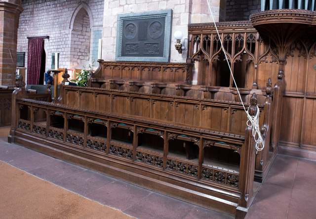
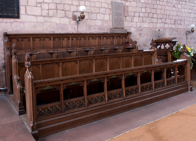
Lanercost Priory

Lanercost Priory was founded by Robert de Vaux between 1165 and 1174, the most likely date being 1169, to house Augustinian canons. The priory is situated...

Burtholme

Burtholme refers to any of a civil parish in Cumbria, England, a hamlet within that parish or a family name originally linked to the place. It also appears...

Milecastle 53

Milecastle 53 (Banks Burn) was a milecastle on Hadrian's Wall (grid reference NY56486460). == Description == Milecastle 53 is west of the hamlet of Banks...

Milecastle 55

Milecastle 55 (Low Wall) was a milecastle on Hadrian's Wall (grid reference NY53596437). == Description == Milecastle 55 is in a pasture field east of...

Naworth Castle

Naworth Castle, also known or recorded in historical documents as "Naward", is a castle in Cumbria, England, near the town of Brampton. It is adjacent...

Banks, Cumbria

Banks is a village in Cumbria, England, astride the course of Hadrian's Wall, 3 mile (5 km) NE of the market town of Brampton. The historic Lanercost Priory...

Nearby Amenities

Located within 500m of 54.970177,-2.7029824
Lanercost
Place: hamlet
Wikidata: Q3372273
Lat/Long: 54.9675664/-2.6968326
Mile Castle 54
Historic: archaeological_site
Is In County: Northumberland
Source: NLS-OS-1st_Series
Wikidata: Q16206481
Wikipedia: en:Milecastle 54
Lat/Long: 54.9727111/-2.7034746
Information: guidepost
Tourism: information
Lat/Long: 54.96671/-2.6980392
The data included in this document is from www.openstreetmap.org. The data is made available under ODbL.

Have you been to Abbey Gills Wood?

Leave your review of Abbey Gills Wood below (or comments, questions and feedback).