The Park

Wood, Forest in Gloucestershire Forest of Dean

England

The Park

Path along course of Wye Valley Railway near Tintern
Path along course of Wye Valley Railway near Tintern Credit: Gareth James

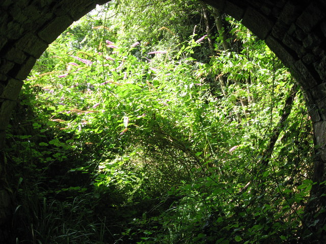
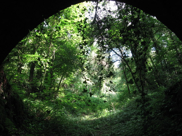
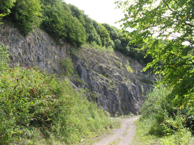
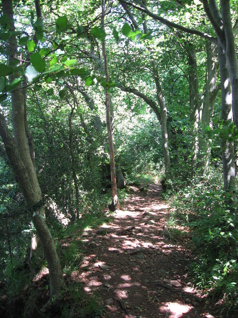
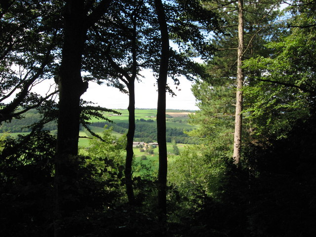
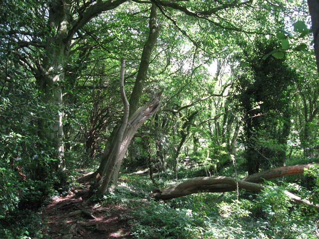
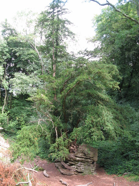
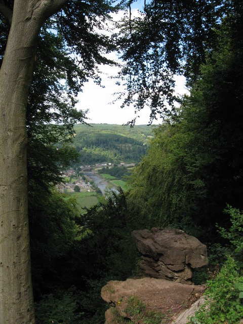
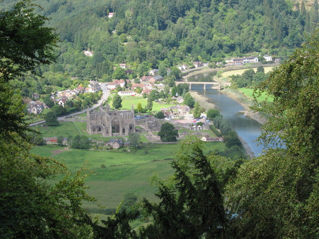
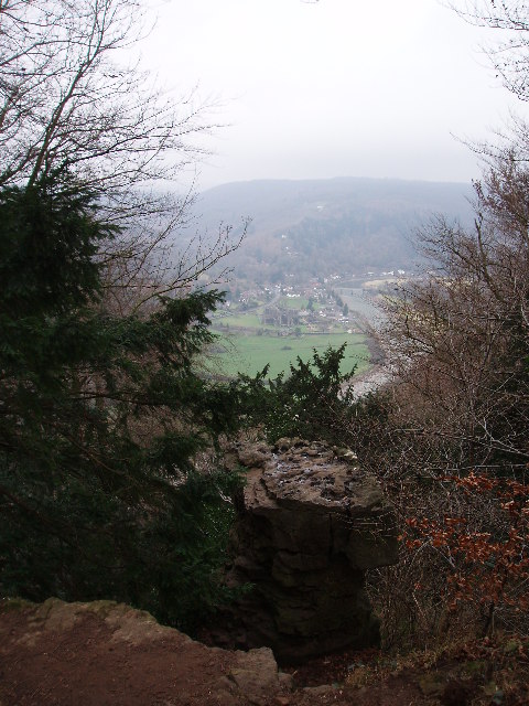
The Park, Gloucestershire, also known as Wood or Forest Park, is a picturesque and expansive natural area located in the county of Gloucestershire, England. Covering an area of approximately 75 square kilometers, it is renowned for its breathtaking landscapes, dense woodlands, and diverse wildlife.

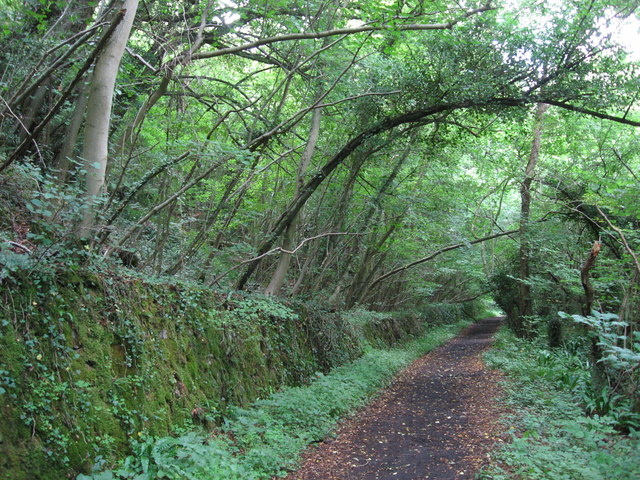
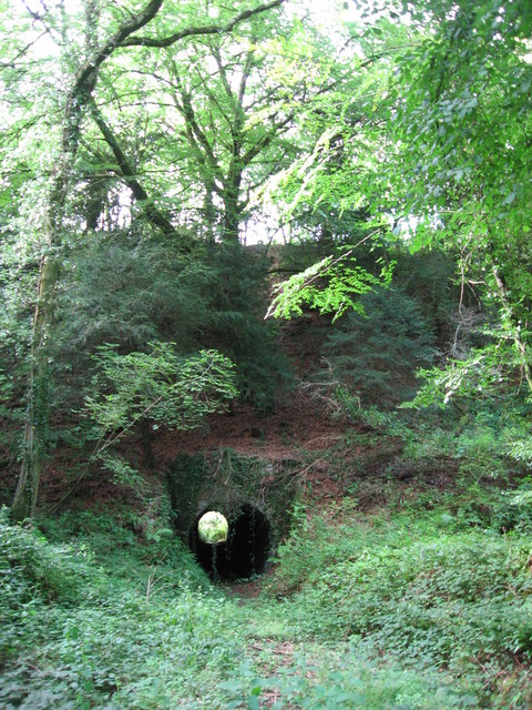
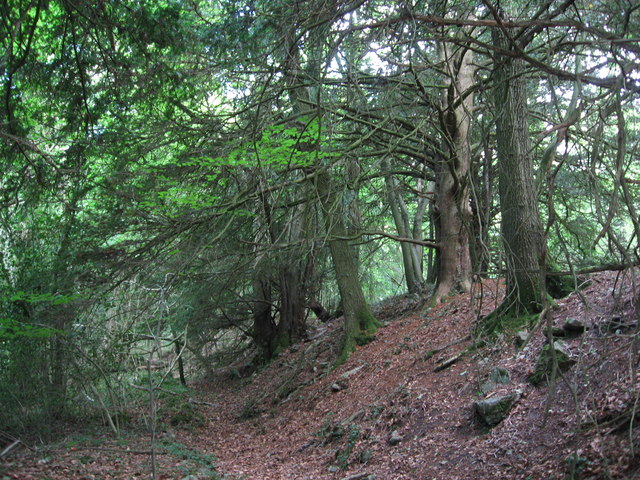
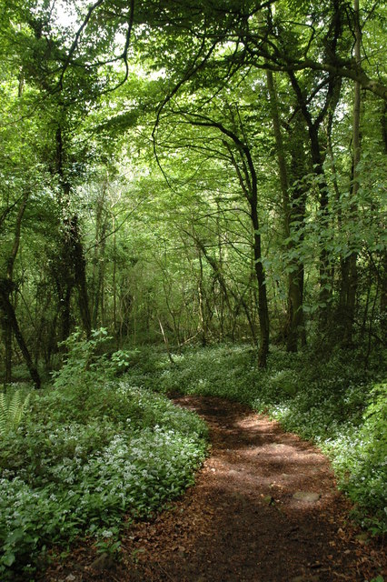
The park is characterized by its ancient woodlands, which are home to a wide range of tree species, including oak, beech, and birch. These woodlands provide a haven for numerous species of birds, mammals, and insects, making it a popular destination for nature enthusiasts and wildlife photographers.

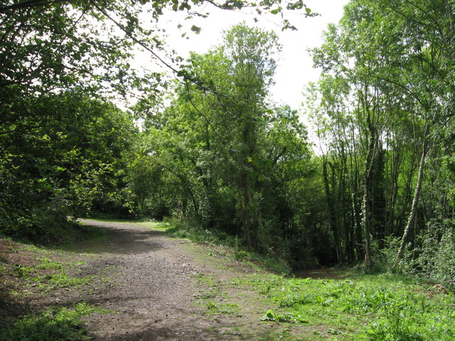
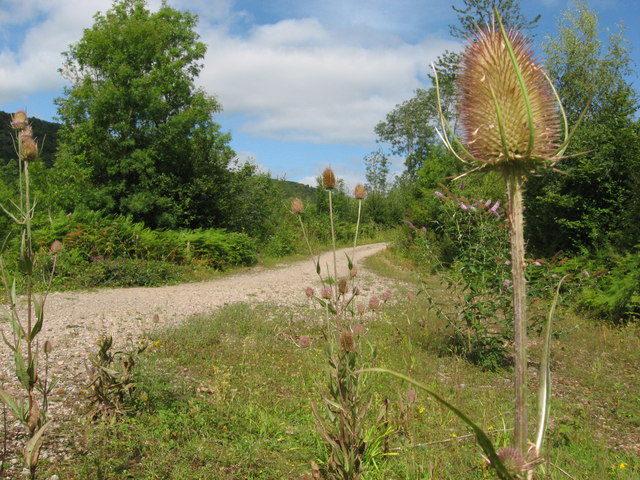
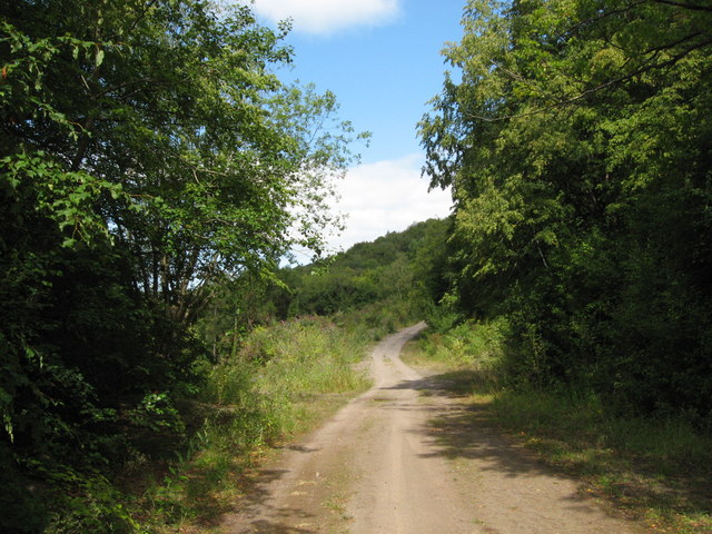
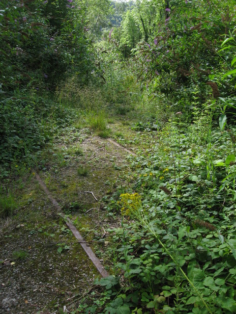
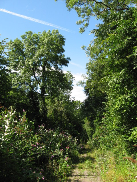
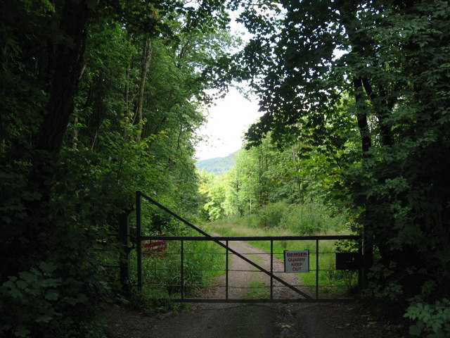
The Park also boasts several walking and cycling trails, allowing visitors to explore the park's natural beauty at their own pace. These trails provide access to hidden gems such as tranquil lakes, babbling streams, and peaceful meadows, providing ample opportunities for relaxation and reflection.

In addition to its natural attractions, The Park offers various recreational activities for visitors. These include picnicking, fishing, and horseback riding, providing entertainment for all ages and interests. The park also hosts seasonal events, such as guided nature walks and outdoor concerts, further enhancing the visitor experience.

Whether you are seeking a peaceful retreat into nature or an active day out with family and friends, The Park, Gloucestershire, offers a diverse range of attractions and activities. Its stunning landscapes, rich biodiversity, and numerous recreational opportunities make it a must-visit destination for nature lovers and outdoor enthusiasts alike.

If you have any feedback on the listing, please let us know in the comments section below.

The Park Images

Images are sourced within 2km of 51.690493/-2.6446715 or Grid Reference ST5599. Thanks to Geograph Open Source API. All images are credited.

Path along course of Wye Valley Railway near Tintern
Path along course of Wye Valley Railway near Tintern The railway line carried on straight ahead at this point, through the trees. Walkers now have a choice and can drop down right, or go up to the left.
Path along course of Wye Valley Railway near Tintern
The railway line carried on straight ahead at this point, through the trees. Walkers now have a choice and can drop down right, or go up to the left.
Path junction in woods near River Wye
Tunnel beneath disused railway line near Tintern Quarry
(No) light at the end of the tunnel The path at the western end of the tunnel (<a href="https://www.geograph.org.uk/photo/2544718">ST5498 : Tunnel beneath disused railway line near Tintern Quarry</a>) is very overgrown and currently impassable.
(No) light at the end of the tunnel
The path at the western end of the tunnel (ST5498 : Tunnel beneath disused railway line near Tintern Quarry) is very overgrown and currently impassable.
Path from tunnel under railway near Tintern Quarry The view from the eastern portal of <a href="https://www.geograph.org.uk/photo/2544718">ST5498 : Tunnel beneath disused railway line near Tintern Quarry</a> shows an overgrown, but still passable path.
Path from tunnel under railway near Tintern Quarry
The view from the eastern portal of ST5498 : Tunnel beneath disused railway line near Tintern Quarry shows an overgrown, but still passable path.
Path near Tintern Quarry
Disused railway near Tintern Quarry The rails are still in place, though obviously have not seen a train for many years!
Disused railway near Tintern Quarry
The rails are still in place, though obviously have not seen a train for many years!
Part of Tintern Quarry
Footpath near Tintern Quarry
Gateway to Tintern Quarry
Beside Offa's Dyke
Beside Offa's Dyke
On Offa's Dyke
On Offa's Dyke
View west from Offa's Dyke Reddings Farm can be seen between the trees.
View west from Offa's Dyke
Reddings Farm can be seen between the trees.
On Offa's Dyke
On Offa's Dyke
Yew tree growing from rocky outcrop Near the Devil's Pulpit on Offa's Dyke.
Yew tree growing from rocky outcrop
Near the Devil's Pulpit on Offa's Dyke.
The Devil's Pulpit
The Devil's Pulpit
View from the Devil's Pulpit As seen in <a href="https://www.geograph.org.uk/photo/2544763">ST5499 : The Devil's Pulpit</a>, the view is over Tintern, with its Abbey, the River Wye and the Wireworks Branch bridge prominent.
View from the Devil's Pulpit
As seen in ST5499 : The Devil's Pulpit, the view is over Tintern, with its Abbey, the River Wye and the Wireworks Branch bridge prominent.
Show me another place!

The Park is located at Grid Ref: ST5599 (Lat: 51.690493, Lng: -2.6446715)

Administrative County: Gloucestershire

District: Forest of Dean

Police Authority: Gloucestershire

What 3 Words

///gong.weeded.fields. Near Tintern, Monmouthshire

Related Wikis

Miss Grace's Lane

Miss Grace's Lane (also known as Miss Grace's Lane Swallett), near Tidenham in the Forest of Dean, Gloucestershire, England, is a natural cave system,...

Poor's Allotment

Poor's Allotment (grid reference ST560990) is a 28.57-hectare (70.6-acre) biological Site of Special Scientific Interest in Gloucestershire, notified in...

East Wood, Tidenham

East Wood (grid reference SO561001) (west site) and (grid reference SO563001) (east site) is a 0.82-hectare (2.0-acre) nature reserve in Gloucestershire...

Ridley Bottom, Tidenham

Ridley Bottom (grid reference ST563985) is a 1.1-hectare (2.7-acre) nature reserve in Gloucestershire. The site is listed in the 'Forest of Dean Local...

Devil's Pulpit, Gloucestershire

The Devil's Pulpit is a rocky limestone outcrop and scenic viewpoint in the Forest of Dean District of Gloucestershire, England, within the Wye Valley...

Tintern Quarry

Tintern Quarry was a quarry in the Forest of Dean, Gloucestershire, England. It was served by the Wye Valley Railway from 1876 until it closed in 1981...

Lippets Grove

Lippets Grove (grid reference SO540000) is a 5-hectare (12-acre) nature reserve in Gloucestershire. The site was leased from the Forestry Commission in...

Shorn Cliff and Caswell Woods

Shorn Cliff And Caswell Woods (SO540005 & SO540990) is a 69.2-hectare (171-acre) biological Site of Special Scientific Interest in Gloucestershire, notified...

Nearby Amenities

Located within 500m of 51.690493,-2.6446715
Miss Grace's Lane Cave
Created By: Potlatch 0.10f
Natural: cave_entrance
Wikidata: Q16895211
Lat/Long: 51.6911958/-2.6488066
Bus Stop
St Michael & All Angels Church
Naptan AtcoCode: 1600GL4781
Naptan Bearing: SW
Naptan CommonName: St Michael & All Angels Church
Naptan Indicator: Opp
Naptan NaptanCode: gloadjdt
Naptan Street: B4228
Naptan Verified: no
Source: naptan_import
Lat/Long: 51.6861953/-2.6427522
Give Way
Direction: forward
Lat/Long: 51.6903485/-2.6399019
Give Way
Direction: forward
Lat/Long: 51.6864119/-2.6425465
Give Way
Direction: backward
Lat/Long: 51.6865202/-2.6424937
Man Made: survey_point
Operator: Ordnance Survey
Operator Wikidata: Q548721
Ref: S3378
Survey Point Structure: pillar
Lat/Long: 51.6900334/-2.644319
The data included in this document is from www.openstreetmap.org. The data is made available under ODbL.

Have you been to The Park?

Leave your review of The Park below (or comments, questions and feedback).