Mill Strip

Wood, Forest in Cumberland Eden

England

Mill Strip

Brougham Castle The castle is situated in the south to southeastern corner of the grid square, southwest of Penrith in Cumbria. The picture was taken looking eastwards towards the castle from the road.
Brougham Castle Credit: Pam Brophy

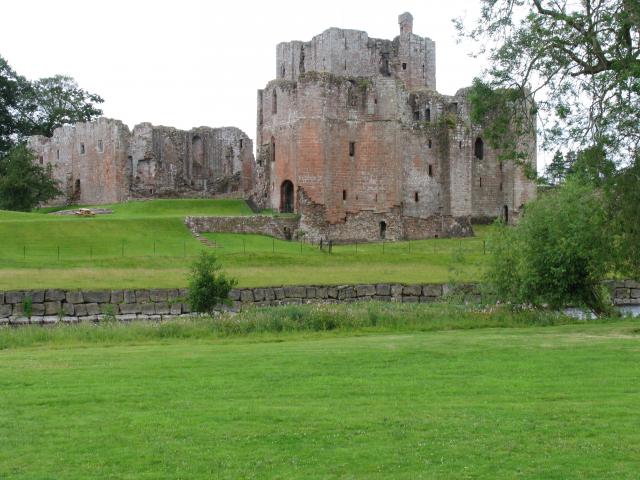
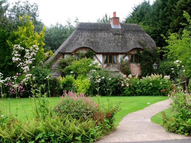
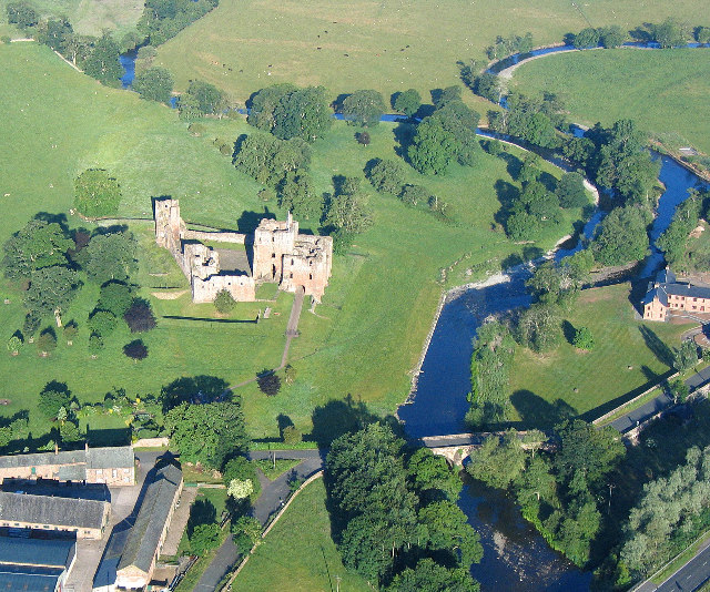
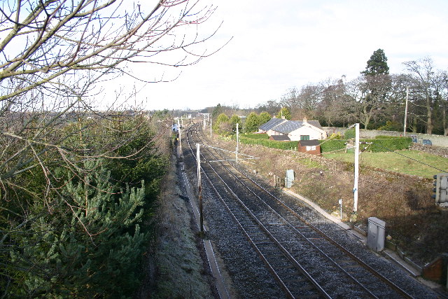
Mill Strip, Cumberland is a woodland area located in the county of Cumberland, England. It is situated within the larger expanse of the Cumberland Forest, which is renowned for its natural beauty and rich biodiversity. Mill Strip is a specific section of this forest, characterized by its dense growth of tall, mature trees and lush undergrowth.

The woodland is primarily composed of various species of hardwood trees, including oak, beech, and maple. These towering trees provide ample shade and create a serene and tranquil atmosphere within the woodland. The forest floor is covered with a thick layer of fallen leaves and moss, adding to the overall picturesque quality of the area.

Mill Strip is intersected by a small stream, which flows gently through the woodland. The presence of water enhances the habitat and supports a diverse range of plant and animal life. The stream also adds to the aesthetic appeal of the area, creating a peaceful and soothing ambiance.

The woodland is home to a plethora of wildlife, including squirrels, rabbits, and numerous species of birds. Birdwatchers often visit Mill Strip, as it offers an opportunity to observe a variety of avian species in their natural habitat.

Mill Strip is a popular destination for nature enthusiasts and hikers, who are drawn to its serene and unspoiled beauty. The woodland provides a tranquil escape from the hustle and bustle of city life, offering visitors a chance to immerse themselves in the natural world and appreciate the wonders of the Cumberland Forest.

If you have any feedback on the listing, please let us know in the comments section below.
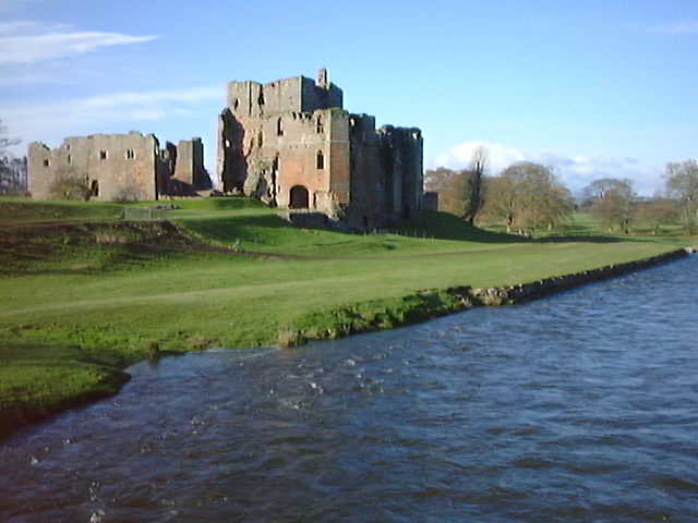
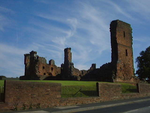
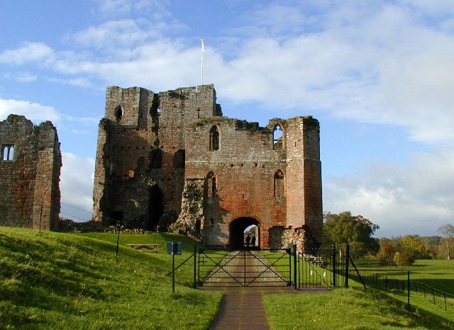
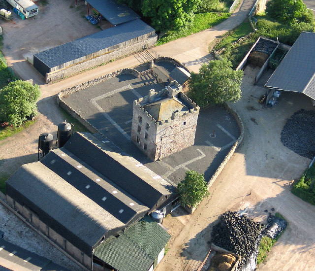
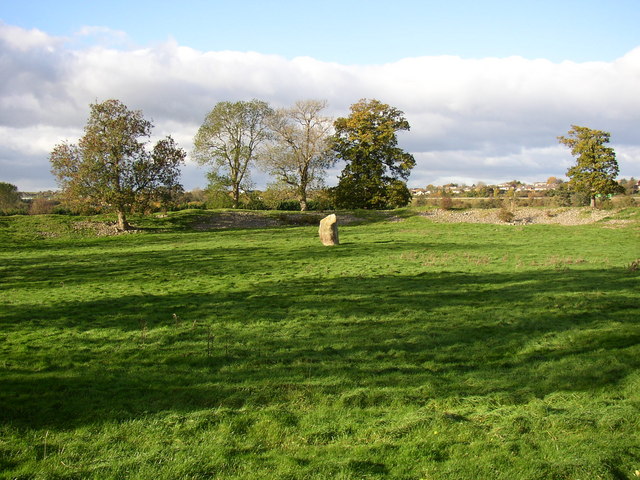
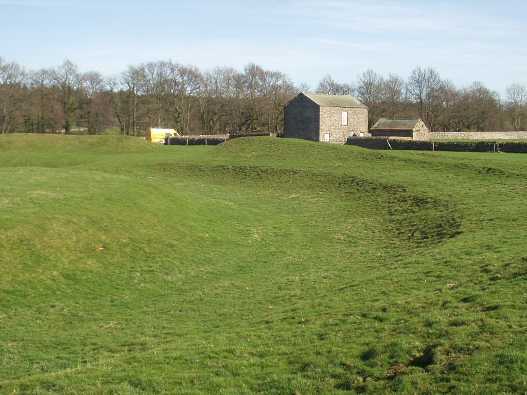
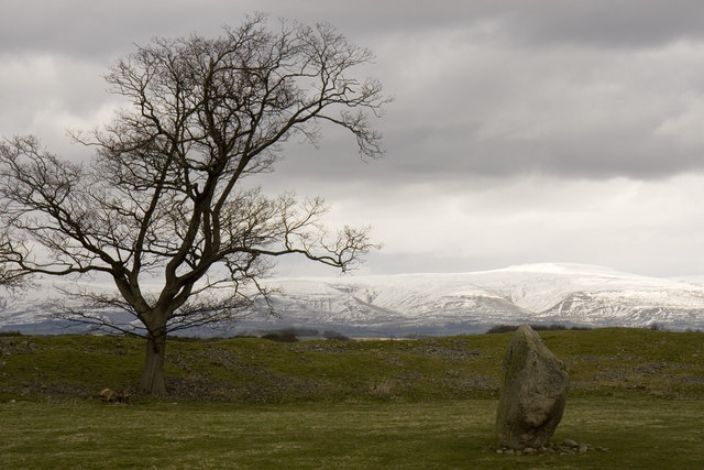
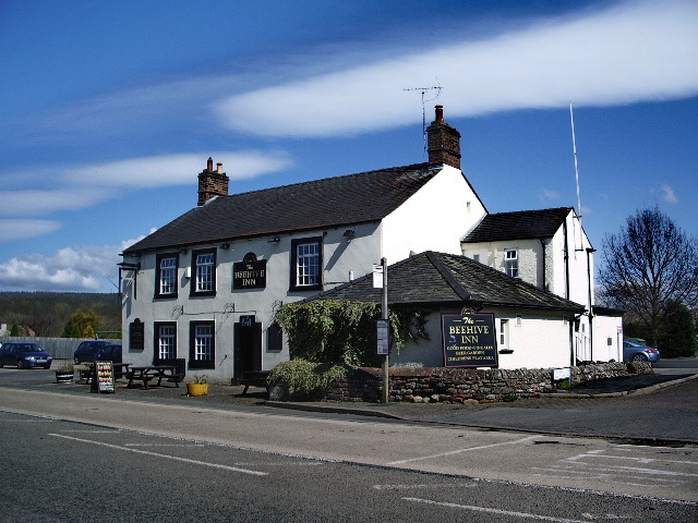
Mill Strip Images

Images are sourced within 2km of 54.652651/-2.7391812 or Grid Reference NY5228. Thanks to Geograph Open Source API. All images are credited.

Brougham Castle The castle is situated in the south to southeastern corner of the grid square, southwest of Penrith in Cumbria. The picture was taken looking eastwards towards the castle from the road.
Brougham Castle
The castle is situated in the south to southeastern corner of the grid square, southwest of Penrith in Cumbria. The picture was taken looking eastwards towards the castle from the road.
Brougham Hall This Manor House situated in the south eastern corner of the square, has seen all sorts of troubled times. It is now a craft centre and produces delicious smoked cheese.
Brougham Hall
This Manor House situated in the south eastern corner of the square, has seen all sorts of troubled times. It is now a craft centre and produces delicious smoked cheese.
One of a pair This photograph of the knocker on the door at Brougham Hall, is submitted as a supplementary photo, as it is of some interest. Its partner is to be found on the door of Durham Cathedral <a title="https://www.geograph.org.uk/photo/2532705" href="https://www.geograph.org.uk/photo/2532705">Link</a>.
One of a pair
This photograph of the knocker on the door at Brougham Hall, is submitted as a supplementary photo, as it is of some interest. Its partner is to be found on the door of Durham Cathedral Link.
Honeysuckle Cottage Visitor Centre This is a photograph of the visitors' centre for Lilliput Lane Miniature Cottages. The exact grid reference is NY510288.
Honeysuckle Cottage Visitor Centre
This is a photograph of the visitors' centre for Lilliput Lane Miniature Cottages. The exact grid reference is NY510288.
Brougham Castle This ancient castle which was home to Lady Anne Clifford. Open to the public under the care of English Heritage.
Brougham Castle
This ancient castle which was home to Lady Anne Clifford. Open to the public under the care of English Heritage.
Penrith Castle Penrith Castle freely open to the public. Located across the road from the railway station so worth a browse whilst you await a train
Penrith Castle
Penrith Castle freely open to the public. Located across the road from the railway station so worth a browse whilst you await a train
Brougham Castle near Penrith Photo shows the double gatehouse - started in the 13th century based on a roman fort.
Brougham Castle near Penrith
Photo shows the double gatehouse - started in the 13th century based on a roman fort.
Clifton Hall Pele, near Penrith, Cumbria Built in late 16th century
<span class="nowrap"><a title="www.visitcumbria.com/pen/clifthal.htm" rel="nofollow ugc noopener" href="http://www.visitcumbria.com/pen/clifthal.htm">Link</a><img style="margin-left:2px;" alt="External link" title="External link - shift click to open in new window" src="https://s1.geograph.org.uk/img/external.png" width="10" height="10"/></span>
Clifton Hall Pele, near Penrith, Cumbria
Built in late 16th century LinkExternal link
River Eamont at Brougham Castle, Cumbria This view shows the waters of the River Eamont and River Lowther meeting at Brougham Castle. <span class="nowrap"><a title="http://www.visitcumbria.com/pen/brougham.htm" rel="nofollow ugc noopener" href="http://www.visitcumbria.com/pen/brougham.htm">Link</a><img style="margin-left:2px;" alt="External link" title="External link - shift click to open in new window" src="https://s1.geograph.org.uk/img/external.png" width="10" height="10"/></span>
River Eamont at Brougham Castle, Cumbria
This view shows the waters of the River Eamont and River Lowther meeting at Brougham Castle. LinkExternal link
Penrith Railway Station, August 1974 Nearly new electric loco 87030 passes through on an express to Euston
Penrith Railway Station, August 1974
Nearly new electric loco 87030 passes through on an express to Euston
Modern factory, Penrith The cars are on the M6 motorway
Modern factory, Penrith
The cars are on the M6 motorway
A6 to Cliburn Junction.
Train Line Yanwath Looking North, from B5230 road bridge at Yanwath
Train Line Yanwath
Looking North, from B5230 road bridge at Yanwath
Fremington House A large, imposing sandstone house.
Fremington House
A large, imposing sandstone house.
Redhills Now bypassed by the A66 dual carriageway, a few metres away, and next to a main railway line, there are few dwellings left in this old hamlet
Redhills
Now bypassed by the A66 dual carriageway, a few metres away, and next to a main railway line, there are few dwellings left in this old hamlet
Penrith Railway Station warning (the boring, real version) For the more imaginative, less real version have a look at the following picture, for which I have no copyright or ownership, nor any info regarding the wag responsible . . . 
<span class="nowrap"><a title="http://www.bimmerfest.com/photos/data/500/theplacetobe.jpg" rel="nofollow ugc noopener" href="http://www.bimmerfest.com/photos/data/500/theplacetobe.jpg">Link</a><img style="margin-left:2px;" alt="External link" title="External link - shift click to open in new window" src="https://s1.geograph.org.uk/img/external.png" width="10" height="10"/></span>
Penrith Railway Station warning (the boring, real version)
For the more imaginative, less real version have a look at the following picture, for which I have no copyright or ownership, nor any info regarding the wag responsible . . . LinkExternal link
Carleton Hall. Cumbria constabulary headquarters at the moment.
Carleton Hall.
Cumbria constabulary headquarters at the moment.
Mayburgh Henge, northern part with standing-stone, Yanwath and Eamont Bridge Mayburgh Henge consists of a single circular bank, up to 6.5 metres high, and 50m across its base, with a single entrance and enclosing a level area 90m dia. It contains a single monolith 2.8m high, one of eight that existed in the 18C, four in the centre and four at the entrance. The other seven were destroyed using gunpowder.  The henge probably dates from between 2000 and 1000BC, and may have been a meeting place or refuge for a large prehistoric community.
Mayburgh Henge, northern part with standing-stone, Yanwath and Eamont Bridge
Mayburgh Henge consists of a single circular bank, up to 6.5 metres high, and 50m across its base, with a single entrance and enclosing a level area 90m dia. It contains a single monolith 2.8m high, one of eight that existed in the 18C, four in the centre and four at the entrance. The other seven were destroyed using gunpowder. The henge probably dates from between 2000 and 1000BC, and may have been a meeting place or refuge for a large prehistoric community.
Show me another place!

Mill Strip is located at Grid Ref: NY5228 (Lat: 54.652651, Lng: -2.7391812)

Administrative County: Cumbria

District: Eden

Police Authority: Cumbria

What 3 Words

///divided.unhappy.basically. Near Penrith, Cumbria

Related Wikis

Eamont Bridge (structure)

Eamont Bridge is a road bridge over the River Eamont, at the village of the same name, immediately to the south of Penrith, Cumbria, England. It is a scheduled...

King Arthur's Round Table

King Arthur's Round Table is a Neolithic henge in the village of Eamont Bridge in the English county of Cumbria, around 2 kilometres (1 mi) south east...

Mayburgh Henge

Mayburgh Henge is a large prehistoric monument in the county of Cumbria in northern England. The henge is in the care of English Heritage and is a Scheduled...

Brougham Hall

Brougham Hall is a historic house museum located in the village of Brougham just outside Penrith, Cumbria, England. == History == The de Burgham family...

Eamont Bridge

Eamont Bridge is a small village immediately to the south of Penrith, Cumbria, England. The village is named after the bridge over the River Eamont and...

Ullswater Community College

Ullswater Community College (UCC) is a large mixed comprehensive school in Penrith, Cumbria. It currently has around 1550 students, including about 200...

Carleton, Penrith

Carleton is a suburb of the town of Penrith, Cumbria, England, that has seen a huge growth in housing since the 1960s and is, of 2018, still expanding...

Yanwath and Eamont Bridge

Yanwath and Eamont Bridge is a civil parish in the Eden District of Cumbria, England, consisting of the small village of Yanwath and most of the neighbouring...

Nearby Amenities

Located within 500m of 54.652651,-2.7391812
Source: survey
Lat/Long: 54.6546102/-2.7441171
Source: survey
Lat/Long: 54.6553046/-2.7419743
Source: survey
Lat/Long: 54.6547542/-2.7414434
Mini Roundabout
Direction: clockwise
Lat/Long: 54.6486349/-2.739743
Traffic Signals
Ref: A6
Lat/Long: 54.651234/-2.7418522
Note: Junction name "Kemplay Bank"
Lat/Long: 54.6568028/-2.736816
Traffic Signals
Source: survey
Lat/Long: 54.6545059/-2.7436341
Traffic Signals
Lat/Long: 54.6518134/-2.7421412
King Arthur's Round Table
Historic: archaeological_site
Website: https://www.english-heritage.org.uk/visit/places/king-arthurs-round-table/
Wikidata: Q283800
Wikipedia: en:King Arthur's Round Table
Lat/Long: 54.6482924/-2.7402806
Barrier: stile
Lat/Long: 54.6520527/-2.7391259
Barrier: stile
Lat/Long: 54.6521877/-2.7391674
Bus Stop
Crown Hotel
Naptan AtcoCode: 090074720916
Naptan Bearing: W
Naptan CommonName: Crown Hotel
Naptan Indicator: opp
Naptan Landmark: The Crown Hotel
Naptan NaptanCode: cumdgjwm
Naptan Street: B5320
Naptan Verified: no
Source: naptan_import
Lat/Long: 54.6484843/-2.7405072
Bus Stop
The Crown Hotel
Naptan AtcoCode: 090074720919
Naptan Bearing: N
Naptan CommonName: The Crown Hotel
Naptan Indicator: o/s
Naptan Landmark: Crown Hotel
Naptan NaptanCode: cumdgjwp
Naptan Street: A6
Naptan Verified: yes
Source: naptan_import
Lat/Long: 54.648972/-2.7401131
Bus Stop
The Beehive PH
Naptan AtcoCode: 090074721101
Naptan Bearing: S
Naptan CommonName: The Beehive PH
Naptan Indicator: o/s
Naptan Landmark: The Beehive Pub
Naptan NaptanCode: cumdgmad
Naptan Street: A6
Naptan Verified: yes
Source: naptan_import
Lat/Long: 54.6490539/-2.7399441
Traffic Signals
Source: survey
Lat/Long: 54.6554969/-2.7421847
Crossing
Crossing: unmarked
Crossing Island: yes
Crossing Markings: no
Kerb: flush
Tactile Paving: yes
Lat/Long: 54.6552501/-2.7413936
Traffic Signals
Lat/Long: 54.6550187/-2.7415116
Traffic Signals
Source: survey
Lat/Long: 54.6553475/-2.7423122
Crossing
Bicycle: yes
Crossing: unmarked
Crossing Island: yes
Crossing Markings: no
Crossing Signals: yes
Crossing Ref: toucan
Source: survey
Tactile Paving: yes
Lat/Long: 54.6549588/-2.7412247
Barrier: kissing_gate
Source: survey;gps
Lat/Long: 54.65069/-2.7458114
Tourism: information
Lat/Long: 54.6484003/-2.7403643
Bus Stop
Bench: no
Covered: no
Naptan AtcoCode: 090074724685
Naptan NaptanCode: cumdtwmg
Shelter: no
Lat/Long: 54.6500319/-2.740774
Carleton Hall Park
Place: locality
Lat/Long: 54.6548074/-2.7355229
Crossing
Bicycle: yes
Crossing: unmarked
Crossing Markings: no
Crossing Signals: yes
Crossing Ref: toucan
Kerb: lowered
Tactile Paving: yes
Lat/Long: 54.6541506/-2.7426244
Crossing
Bicycle: yes
Crossing: unmarked
Crossing Island: yes
Crossing Markings: no
Crossing Signals: yes
Crossing Ref: toucan
Source: survey
Tactile Paving: yes
Lat/Long: 54.6549905/-2.7414931
Crossing
Bicycle: yes
Crossing: unmarked
Crossing Island: yes
Crossing Markings: no
Crossing Signals: yes
Crossing Ref: toucan
Source: survey
Tactile Paving: yes
Lat/Long: 54.6551476/-2.7431505
Fixme: This telephone box appears to be missing on Street Level Imagery. Please confirm if it has been removed or is in a different location.
Mapillary: 818991835680398
Removed Amenity: telephone
Source: survey
Survey Date: 2020-08-03
Lat/Long: 54.6503594/-2.7411974
Crossing
Crossing: unmarked
Crossing Island: yes
Crossing Markings: no
Tactile Paving: yes
Lat/Long: 54.6540563/-2.7422323
Bench
Lat/Long: 54.650044/-2.7410658
Post Box
Brand: Royal Mail
Brand Wikidata: Q638098
Mapillary: 364000418391779
Operator: Royal Mail
Operator Wikidata: Q638098
Post Box Mounting: pier
Post Box Type: lamp
Ref: CA10 87
Survey Date: 2020-08-03
Lat/Long: 54.6501428/-2.7410511
Crossing
Crossing: unmarked
Sloped Curb: both
Tactile Paving: yes
Lat/Long: 54.6501979/-2.7409907
Bus Stop
Bench: yes
Shelter: yes
Lat/Long: 54.6500347/-2.7409705
Traffic Signals
Source: survey
Lat/Long: 54.6541593/-2.7425482
Traffic Signals
Source: survey
Lat/Long: 54.6539936/-2.7426754
Waterway: weir
Lat/Long: 54.6517091/-2.7390365
Entrance: yes
Lat/Long: 54.6560958/-2.7438068
Barrier: kissing_gate
Source: survey;gps
Lat/Long: 54.6485072/-2.7402996
Eamont Bridge
Place: village
Wikidata: Q1276943
Wikipedia: en:Eamont Bridge
Lat/Long: 54.6503883/-2.7411171
Source: survey
Lat/Long: 54.6546743/-2.743996
Traffic Signals
Source: survey
Lat/Long: 54.6544497/-2.7439185
Source: survey
Lat/Long: 54.6546601/-2.7436891
Crossing
Bicycle: yes
Crossing: unmarked
Crossing Island: yes
Crossing Markings: no
Crossing Signals: yes
Crossing Ref: toucan
Source: survey
Tactile Paving: yes
Lat/Long: 54.6552886/-2.7432208
Crossing
Crossing: marked
Crossing Markings: yes
Traffic Calming: table
Lat/Long: 54.6556432/-2.7375865
Crossing
Crossing: unmarked
Crossing Island: no
Crossing Markings: no
Tactile Paving: no
Lat/Long: 54.65439/-2.7416052
Direction: WSW
Generator Method: photovoltaic
Generator Output Electricity: yes
Generator Source: solar
Generator Type: solar_photovoltaic_panel
Location: roof
Power: generator
Lat/Long: 54.6508938/-2.741771
Direction: WSW
Generator Method: photovoltaic
Generator Output Electricity: yes
Generator Source: solar
Generator Type: solar_photovoltaic_panel
Location: roof
Power: generator
Lat/Long: 54.6506362/-2.7415591
Direction: WSW
Generator Method: photovoltaic
Generator Output Electricity: yes
Generator Source: solar
Generator Type: solar_photovoltaic_panel
Location: roof
Power: generator
Lat/Long: 54.6491/-2.7403708
Defibrillator
Emergency: defibrillator
Lat/Long: 54.6500843/-2.741143
Defibrillator
Emergency: defibrillator
Lat/Long: 54.6500897/-2.7411429
Direction: 220
Man Made: surveillance
Surveillance: public
Surveillance Type: ALPR
Surveillance Zone: traffic
Lat/Long: 54.6559303/-2.7418693
Direction: 75
Man Made: surveillance
Surveillance: public
Surveillance Type: ALPR
Surveillance Zone: traffic
Lat/Long: 54.6559324/-2.7418648
Crossing
Bicycle: yes
Crossing: unmarked
Crossing Island: yes
Crossing Markings: no
Crossing Signals: yes
Crossing Ref: toucan
Tactile Paving: yes
Lat/Long: 54.6542697/-2.7440223
Crossing
Bicycle: yes
Crossing: unmarked
Crossing Island: yes
Crossing Markings: no
Crossing Signals: yes
Crossing Ref: toucan
Tactile Paving: yes
Lat/Long: 54.654477/-2.7438743
Crossing
Bicycle: yes
Crossing: unmarked
Crossing Island: yes
Crossing Markings: no
Crossing Signals: yes
Crossing Ref: toucan
Tactile Paving: yes
Lat/Long: 54.6540228/-2.7427353
Crossing
Bicycle: yes
Crossing: unmarked
Crossing Island: yes
Crossing Markings: no
Crossing Signals: yes
Crossing Ref: toucan
Tactile Paving: yes
Lat/Long: 54.6554596/-2.7421575
Crossing
Bicycle: yes
Crossing: unmarked
Crossing Island: yes
Crossing Markings: no
Crossing Signals: yes
Crossing Ref: toucan
Tactile Paving: yes
Lat/Long: 54.6555755/-2.7423663
Generator Method: photovoltaic
Generator Orientation: south
Generator Output Electricity: yes
Generator Solar Modules: 30
Generator Source: solar
Generator Type: solar_photovoltaic_panel
Location: roof
Power: generator
Lat/Long: 54.6514073/-2.7435909
Generator Method: photovoltaic
Generator Output Electricity: yes
Generator Source: solar
Generator Type: solar_photovoltaic_panel
Location: roof
Power: generator
Lat/Long: 54.6516526/-2.7427282
Traffic Signals
Lat/Long: 54.6551283/-2.743196
Traffic Signals
Lat/Long: 54.6552956/-2.7432821
Traffic Signals
Lat/Long: 54.6549784/-2.7411965
Cumbria Fire and Rescue Service
Government: fire_service
Office: government
Website: https://www.cumbriafire.gov.uk/
Wikidata: Q5194033
Wikipedia: en:Cumbria Fire and Rescue Service
Lat/Long: 54.6543683/-2.7408997
The data included in this document is from www.openstreetmap.org. The data is made available under ODbL.

Have you been to Mill Strip?

Leave your review of Mill Strip below (or comments, questions and feedback).