The Warren

Wood, Forest in Dorset

England

The Warren

Burton Freshwater Caravan park As well as the static caravans such as these ones there are a large number of pitches for touring caravans. View north close to the northern edge of the grid square.
Burton Freshwater Caravan park Credit: Nigel Mykura

The Warren, located in Dorset, England, is a picturesque woodland area that is known for its natural beauty and tranquil atmosphere. Covering an area of approximately 200 acres, The Warren is characterized by its dense forest of oak, beech, and pine trees, creating a haven for wildlife and nature enthusiasts alike.

This woodland is a popular destination for outdoor activities such as hiking, walking, and cycling. It boasts an extensive network of well-maintained trails that wind through the forest, offering visitors the opportunity to explore its diverse flora and fauna. The Warren is home to a variety of wildlife, including deer, foxes, badgers, and a wide range of bird species, making it a haven for birdwatchers and wildlife photographers.

In addition to its natural attractions, The Warren also features several amenities to enhance visitors' experience. There are picnic areas and benches scattered throughout the woodland, providing perfect spots for relaxation and enjoying a packed lunch amidst the serene surroundings. Furthermore, the area is equipped with well-marked paths and informative signposts, ensuring that visitors can navigate the woodlands easily and learn about its history and ecology.

The Warren is open to the public year-round and is free to access, making it an accessible destination for individuals and families seeking a peaceful escape from the hustle and bustle of everyday life. Its proximity to nearby towns and villages also makes it a convenient day trip option for both locals and tourists, who can immerse themselves in the tranquility and natural beauty that The Warren has to offer.

If you have any feedback on the listing, please let us know in the comments section below.
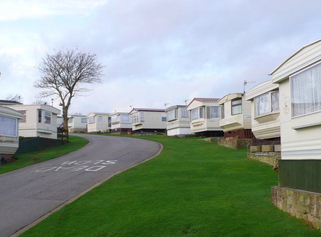
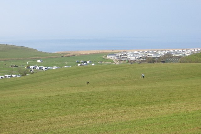
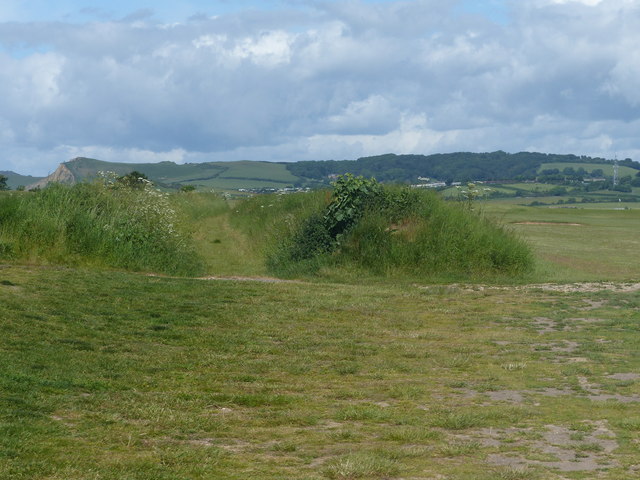
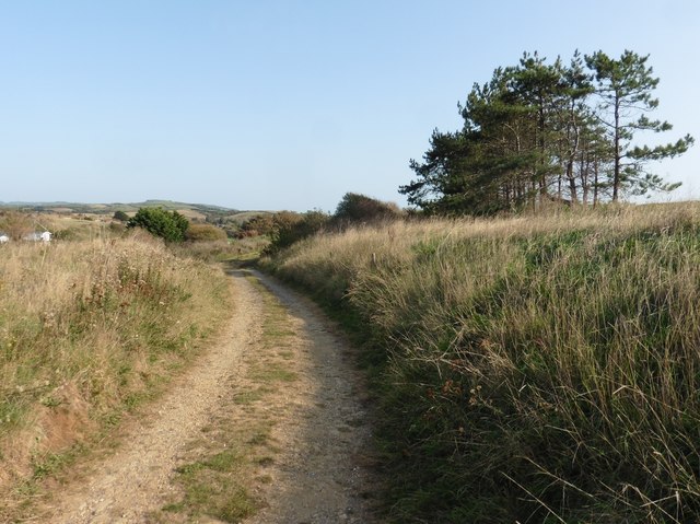
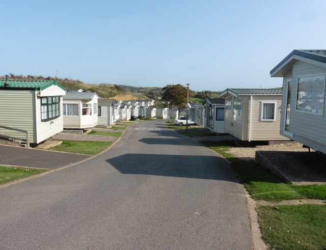
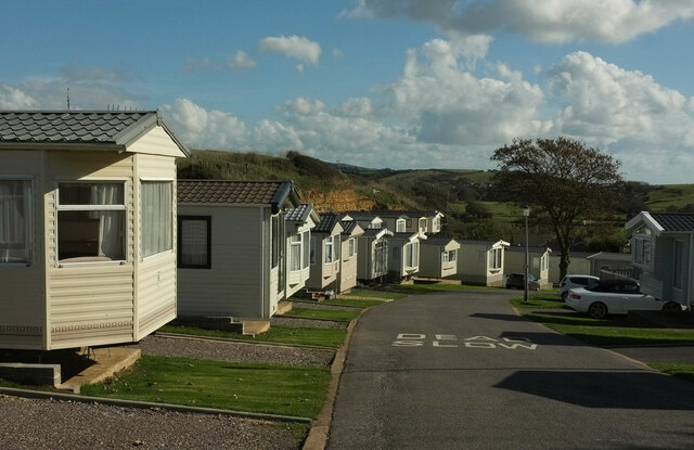
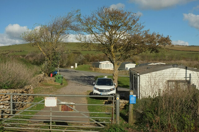
The Warren Images

Images are sourced within 2km of 50.724257/-2.740955 or Grid Reference SY4791. Thanks to Geograph Open Source API. All images are credited.

Burton Freshwater Caravan park As well as the static caravans such as these ones there are a large number of pitches for touring caravans. View north close to the northern edge of the grid square.
Burton Freshwater Caravan park
As well as the static caravans such as these ones there are a large number of pitches for touring caravans. View north close to the northern edge of the grid square.
Mown grass A big area of mown grass, not a field, behind a caravan park near Burton Bradstock.
Mown grass
A big area of mown grass, not a field, behind a caravan park near Burton Bradstock.
Path between two banks Crossing the golf course
Path between two banks
Crossing the golf course
Path to Wennet Hill
Path to Wennet Hill
Caravan park on Wennet Hill
Freshwater Beach Holiday Park Footpath W7 17 follows this road through the holiday park.
Freshwater Beach Holiday Park
Footpath W7 17 follows this road through the holiday park.
Path into Freshwater Beach Holiday Park Footpath W7 17 heads through the gate and then turns right behind the tree; footpath W7 20 continues ahead to the B3157, with another public footpath turning off it through the site.
Path into Freshwater Beach Holiday Park
Footpath W7 17 heads through the gate and then turns right behind the tree; footpath W7 20 continues ahead to the B3157, with another public footpath turning off it through the site.
6 West Bay Road, West Bay Grade II Listed 18th or 19th century building.
6 West Bay Road, West Bay
Grade II Listed 18th or 19th century building.
26 East Street, Bridport Grade II Listed building with 19th century front and 18th century rear section. An early photo shows the building with a sign reading Bridport Aeroplane Bank. Early in 1918 National War Bonds were sold by the Government to raise funds. Reportedly Bridport raised enough here to buy two squadrons. Kelly's 1911 and 1915 editions lists West Dorset Conservative Association and John William Brown organizing & registration agent at this address. Prior to the July 1945 elections Arthur Cowley local Conservative agent recently returned from service in the RAF, set up office here.  In the 1970s Wilfred Snook sold LPs, singles, televisions, radios etc from here. He was followed by Redifusion later taken over by Granada TV Rental. Around 1994 they were replaced by a clothes shop for a short while followed by Palmer Snell estate agents. It was then empty for a while and online searches show a dental practice here but it is now leased to the Weldmar Trust (possibly from 2016) and has flats above.
26 East Street, Bridport
Grade II Listed building with 19th century front and 18th century rear section. An early photo shows the building with a sign reading Bridport Aeroplane Bank. Early in 1918 National War Bonds were sold by the Government to raise funds. Reportedly Bridport raised enough here to buy two squadrons. Kelly's 1911 and 1915 editions lists West Dorset Conservative Association and John William Brown organizing & registration agent at this address. Prior to the July 1945 elections Arthur Cowley local Conservative agent recently returned from service in the RAF, set up office here. In the 1970s Wilfred Snook sold LPs, singles, televisions, radios etc from here. He was followed by Redifusion later taken over by Granada TV Rental. Around 1994 they were replaced by a clothes shop for a short while followed by Palmer Snell estate agents. It was then empty for a while and online searches show a dental practice here but it is now leased to the Weldmar Trust (possibly from 2016) and has flats above.
28 East Street, Bridport Grade II Listed early to mid 19th century building. Former 332 sq m Barclays Bank that closed its doors on 29th March 2019. This was the site of the former Green Dragon pub that became a wagon office of the carrier Thomas Russell in 1781.  In 1852 Edward Flight (ca.1803-1871 the man behind Bridport’s railway) moved his legal practice to 28 East Street and rebuilt the former wagon office in the classical form we see today. Flight probably moved out after his fall from grace in 1863 when his properties were put up for auction. Prior to 1895 my directories don't have street numbers but Flight is listed in East Street in 1859 but not in 1889. After this, directories list a series of tailor's at this address, 1895 Alfred Knight, 1911 Edward Benham and 1915 Robert B Swaffield.
28 East Street, Bridport
Grade II Listed early to mid 19th century building. Former 332 sq m Barclays Bank that closed its doors on 29th March 2019. This was the site of the former Green Dragon pub that became a wagon office of the carrier Thomas Russell in 1781. In 1852 Edward Flight (ca.1803-1871 the man behind Bridport’s railway) moved his legal practice to 28 East Street and rebuilt the former wagon office in the classical form we see today. Flight probably moved out after his fall from grace in 1863 when his properties were put up for auction. Prior to 1895 my directories don't have street numbers but Flight is listed in East Street in 1859 but not in 1889. After this, directories list a series of tailor's at this address, 1895 Alfred Knight, 1911 Edward Benham and 1915 Robert B Swaffield.
Nantes solicitors, 36 East Street, Bridport Grade II Listed building dated 1847. Currently occupied by Nantes solicitors, consulting directories, they list, 1895 County Court Office (at Barrack Street in 1889) including Charles George Nantes (1850–1934) solicitor, registrar of county court, clerk to the commissioners of Bridport harbour, public notary & commissioner for oaths & coroner & clerk to the Bridport Railway Company. In 1911 and 1915, Still County Court Office, Charles George Nantes is described as registrar & high bailiff. It seems Nantes have been here in one form or another since the late 19th century?
Nantes solicitors, 36 East Street, Bridport
Grade II Listed building dated 1847. Currently occupied by Nantes solicitors, consulting directories, they list, 1895 County Court Office (at Barrack Street in 1889) including Charles George Nantes (1850–1934) solicitor, registrar of county court, clerk to the commissioners of Bridport harbour, public notary & commissioner for oaths & coroner & clerk to the Bridport Railway Company. In 1911 and 1915, Still County Court Office, Charles George Nantes is described as registrar & high bailiff. It seems Nantes have been here in one form or another since the late 19th century?
Former Literary and Scientific Institute, 51 East Street, Bridport Grade II* Listed building. The building was constructed in 1834-35 as a Mechanics Institute founded by Henry Warburton MP, for the education and training of Bridport’s young working men. By 1855 it was reconstituted as a Literary and Scientific Institute ‘to encourage the intellectual and moral improvement of all classes and the cultivation of Literature, Science and Art’. Bridport School of Art was established in 1865 and in 1883 the upstairs room was divided to provide permanent studios and lecture rooms for the Art school. 1922 to 1939 the building provided accommodation for a Men’s club. Post war the Red Cross used the upstairs as a depot and the ground floor was a reading room, a card room and a billiard room. Around 1950 the building was handed over to Dorset County Council. Between 1952 and 1997 the building served as the town’s public library that then left the building empty and neglected until it was declared unsafe and listed as ‘at risk’ in 2002. Established in 2009 Bridport Area Development Trust quickly focused on rescue of the building that was finally re-opened on 25th May 2018 by HRH the Prince of Wales. The building is now home to work and event spaces with high-tech communications.
Former Literary and Scientific Institute, 51 East Street, Bridport
Grade II* Listed building. The building was constructed in 1834-35 as a Mechanics Institute founded by Henry Warburton MP, for the education and training of Bridport’s young working men. By 1855 it was reconstituted as a Literary and Scientific Institute ‘to encourage the intellectual and moral improvement of all classes and the cultivation of Literature, Science and Art’. Bridport School of Art was established in 1865 and in 1883 the upstairs room was divided to provide permanent studios and lecture rooms for the Art school. 1922 to 1939 the building provided accommodation for a Men’s club. Post war the Red Cross used the upstairs as a depot and the ground floor was a reading room, a card room and a billiard room. Around 1950 the building was handed over to Dorset County Council. Between 1952 and 1997 the building served as the town’s public library that then left the building empty and neglected until it was declared unsafe and listed as ‘at risk’ in 2002. Established in 2009 Bridport Area Development Trust quickly focused on rescue of the building that was finally re-opened on 25th May 2018 by HRH the Prince of Wales. The building is now home to work and event spaces with high-tech communications.
United Reformed and Methodist Church, East Street, Bridport Grade II Listed church 1859 by Poulton and Woodman of Reading. The former Methodist church in South Street was sold and the Congregational church in East Street was chosen as the home for the new church partnership that came into existence as an Local Ecumenical Partnership on 10 November 1971. Over 2015-2018 the church was upgrade with improved heating, seating, available floor space and additional audio visual facilities for the Church and its ancillary buildings. At the same time the necessary upgrades to meet current Health and Safety obligations were carried out as well as meeting requirements for disability access and  fire safety.
United Reformed and Methodist Church, East Street, Bridport
Grade II Listed church 1859 by Poulton and Woodman of Reading. The former Methodist church in South Street was sold and the Congregational church in East Street was chosen as the home for the new church partnership that came into existence as an Local Ecumenical Partnership on 10 November 1971. Over 2015-2018 the church was upgrade with improved heating, seating, available floor space and additional audio visual facilities for the Church and its ancillary buildings. At the same time the necessary upgrades to meet current Health and Safety obligations were carried out as well as meeting requirements for disability access and fire safety.
Unitarian Chapel, 49 East Street, Bridport Grade II* Listed 1794 Unitarian Chapel. The elevation to Rax Lane was built as a school in 1840. Known as 'The Chapel In The Garden' the Unitarian website tells us that the chapel was built in 1798, on the site of the Crown Inn, by Thomas Collins Colfox. The garden at the front was the original graveyard.
Unitarian Chapel, 49 East Street, Bridport
Grade II* Listed 1794 Unitarian Chapel. The elevation to Rax Lane was built as a school in 1840. Known as 'The Chapel In The Garden' the Unitarian website tells us that the chapel was built in 1798, on the site of the Crown Inn, by Thomas Collins Colfox. The garden at the front was the original graveyard.
NatWest Bank, 22 East Street, Bridport Grade II Listed mid 19th century bank. The front shows evidence of carvings having been removed from the stonework and I find that Kelly's lists Lloyds Bank at 22 East Street in 1911-1915 and John Nicholls ironmonger in 1889-1895. Prior to this street numbers aren't available. It seems likely that the ashlar ground floor façade was added by Lloyds around 1890-1910 who probably also carried out internal layout changes as well.
NatWest Bank, 22 East Street, Bridport
Grade II Listed mid 19th century bank. The front shows evidence of carvings having been removed from the stonework and I find that Kelly's lists Lloyds Bank at 22 East Street in 1911-1915 and John Nicholls ironmonger in 1889-1895. Prior to this street numbers aren't available. It seems likely that the ashlar ground floor façade was added by Lloyds around 1890-1910 who probably also carried out internal layout changes as well.
The Old Court, 41 West Street, Bridport Grade II Listed building with 1844 datestone. Joseph Gundry and Co. Ltd. (manufacturers of fishing nets, lines and twines) was established in 1665 and are shown in directories at West Street since at least 1842 and presumably had the Court built. There is no evidence of power supply and it seems that the building was probably a warehouse, workshops or office. Certainly in 1766 an insurance valuation describes him as a twine spinner, sailcloth maker, maltster and brewer and shows utensils and stock of hemp and flax in his warehouse near West Mill, probably the previous building shown here on early maps. In 1963 united with Bridport Industries Ltd. they became Bridport-Gundry Ltd at the same time extending the Court Works northwards. Amsafe seems to have grown from Bridport-Gundry in 1979 and certainly latterly used the 'Old Court' as offices. Amsafe stopped using the building in October 2010 and it was reported that 'Bridport Antiques 15 months refurbishment of the Old Court in West Street was completed for the opening in April 2017'. Sales particulars for the flats tell us they were 'converted to a very high standard by Lighthouse Land and Developers Ltd in 2017'.
The Old Court, 41 West Street, Bridport
Grade II Listed building with 1844 datestone. Joseph Gundry and Co. Ltd. (manufacturers of fishing nets, lines and twines) was established in 1665 and are shown in directories at West Street since at least 1842 and presumably had the Court built. There is no evidence of power supply and it seems that the building was probably a warehouse, workshops or office. Certainly in 1766 an insurance valuation describes him as a twine spinner, sailcloth maker, maltster and brewer and shows utensils and stock of hemp and flax in his warehouse near West Mill, probably the previous building shown here on early maps. In 1963 united with Bridport Industries Ltd. they became Bridport-Gundry Ltd at the same time extending the Court Works northwards. Amsafe seems to have grown from Bridport-Gundry in 1979 and certainly latterly used the 'Old Court' as offices. Amsafe stopped using the building in October 2010 and it was reported that 'Bridport Antiques 15 months refurbishment of the Old Court in West Street was completed for the opening in April 2017'. Sales particulars for the flats tell us they were 'converted to a very high standard by Lighthouse Land and Developers Ltd in 2017'.
The Market House, 17 West Street, Bridport Early to mid 19th century Grade II Listed building previously the Royal Oak. Palmers brewery renamed the pub after refurbishment around 2010. A previous Market House pub existed in East Street, now demolished. Directories list the following landlords, 1842-1844 John Smith, 1851-1852 Ann Smith, 1855-1875 Thomas James Smith, 1889-1895 George Smith and 1911-1915 Frederick Norris. Before becoming the Royal Oak it was known as Three Boars’ Heads suggesting it was built well before 1842 or existed as a previous building possibly changing its name when rebuilt?
The Market House, 17 West Street, Bridport
Early to mid 19th century Grade II Listed building previously the Royal Oak. Palmers brewery renamed the pub after refurbishment around 2010. A previous Market House pub existed in East Street, now demolished. Directories list the following landlords, 1842-1844 John Smith, 1851-1852 Ann Smith, 1855-1875 Thomas James Smith, 1889-1895 George Smith and 1911-1915 Frederick Norris. Before becoming the Royal Oak it was known as Three Boars’ Heads suggesting it was built well before 1842 or existed as a previous building possibly changing its name when rebuilt?
11 West Street, Bridport Grade II Listed 18th century building. Now apparently part of the TSB bank next door, all I can determine was that 1911-1915 it was the private residence of Walter Daniel Aldridge.
11 West Street, Bridport
Grade II Listed 18th century building. Now apparently part of the TSB bank next door, all I can determine was that 1911-1915 it was the private residence of Walter Daniel Aldridge.
Show me another place!

The Warren is located at Grid Ref: SY4791 (Lat: 50.724257, Lng: -2.740955)

Unitary Authority: Dorset

Police Authority: Dorset

What 3 Words

///warmers.recitals.betrayed. Near Bridport, Dorset

Related Wikis

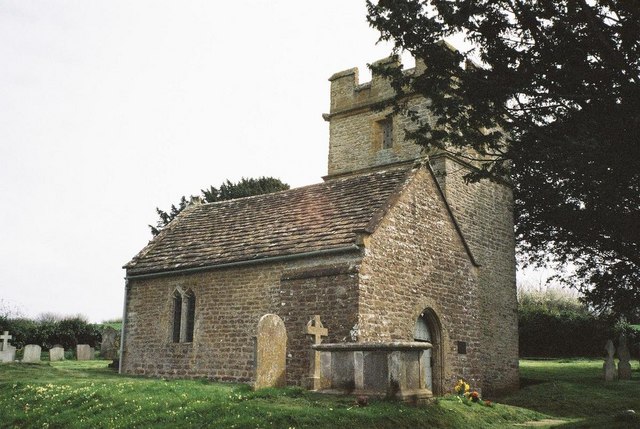
Holy Trinity Old Church, Bothenhampton

Holy Trinity Old Church in Bothenhampton, Dorset, England was built in the 13th or 14th century. It is recorded in the National Heritage List for England...

Bothenhampton

Bothenhampton is a village and civil parish in southwest Dorset, England, just outside the town of Bridport. It is separated from the town only by the...

Holy Trinity Church, Bothenhampton

Holy Trinity Church is a Church of England parish church at Bothenhampton, near Bridport in Dorset, England. It was designed and built by the English arts...

Walditch

Walditch is a small village and former civil parish, now in the parish of Bothenhampton, in the Dorset district, in the ceremonial county of Dorset, England...

Nearby Amenities

Located within 500m of 50.724257,-2.740955
Bothen (Hyde) Hill
Natural: peak
Lat/Long: 50.7263374/-2.7449251
Power: pole
Source: bing
Transformer: distribution
Lat/Long: 50.7218328/-2.7384093
Power: pole
Source: bing
Lat/Long: 50.721635/-2.7376355
Power: pole
Source: bing
Lat/Long: 50.7214372/-2.7365251
The data included in this document is from www.openstreetmap.org. The data is made available under ODbL.

Have you been to The Warren?

Leave your review of The Warren below (or comments, questions and feedback).