Spunham Wood

Wood, Forest in Lancashire South Lakeland

England

Spunham Wood

Kirkby Pool
Kirkby Pool Credit: Adrian Taylor

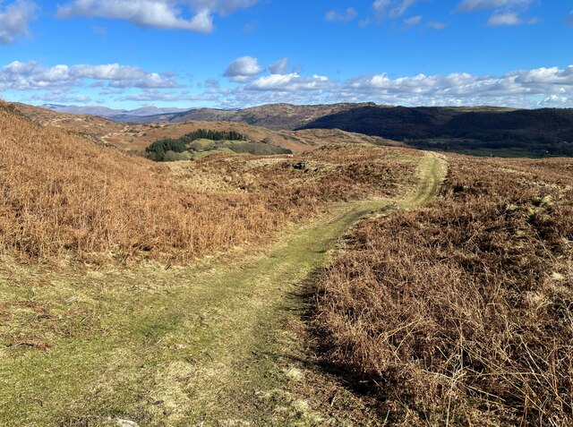
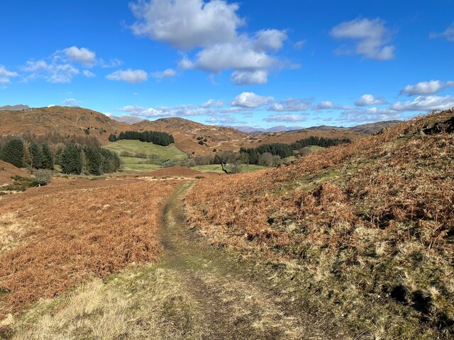
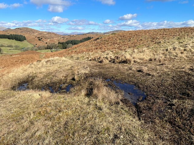
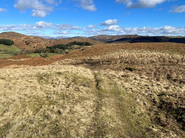
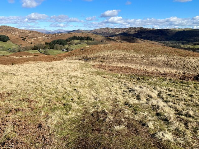
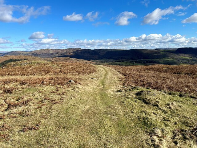
Spunham Wood is a picturesque forest located in the county of Lancashire, England. Covering an area of approximately 100 acres, this woodland is renowned for its natural beauty and serene atmosphere. Nestled within the rolling hills of Lancashire, Spunham Wood offers a tranquil escape for nature enthusiasts and outdoor lovers.

The forest is predominantly composed of broadleaf trees, including oak, ash, and beech, which provide a rich canopy of greenery throughout the year. The diverse vegetation creates a haven for various wildlife species, making it a popular destination for birdwatchers and wildlife photographers.

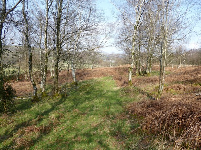
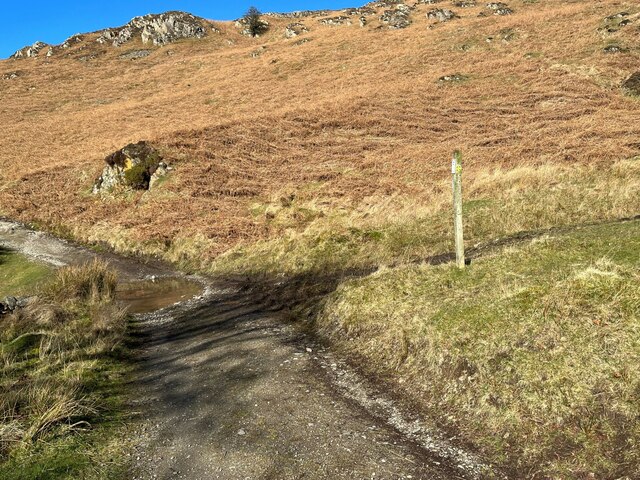
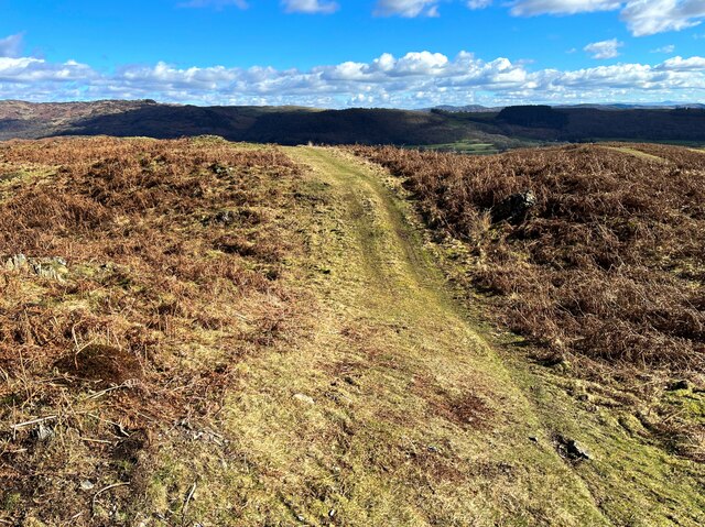
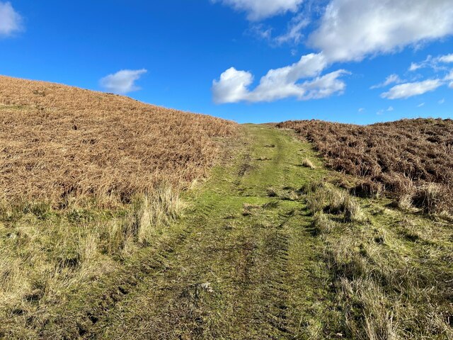
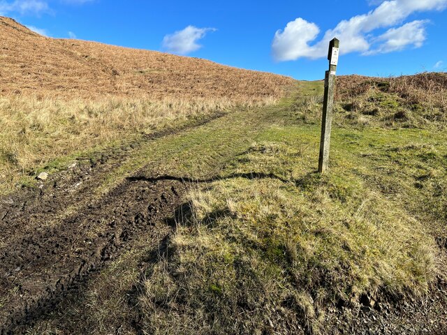
Visitors to Spunham Wood can explore a network of well-maintained trails that wind their way through the forest. These paths offer a chance to immerse oneself in the peaceful surroundings, with the sounds of birdsong and rustling leaves accompanying every step. The forest also features a small stream that meanders through its heart, adding to its enchanting charm.

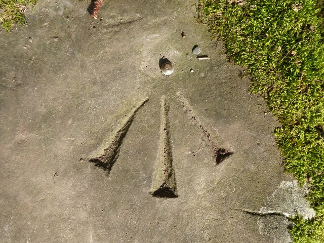
In addition to its natural beauty, Spunham Wood boasts a rich history. The forest has been a part of Lancashire's landscape for centuries and has witnessed the passage of time. Remnants of ancient settlements, including stone walls and earthworks, can still be found within the woodland, serving as a reminder of its historical significance.

Spunham Wood is a cherished gem in Lancashire, providing a sanctuary for nature lovers and history enthusiasts alike. Whether it's a leisurely stroll, a birdwatching expedition, or a moment of tranquility amidst nature, this forest offers a captivating experience for all who venture within its leafy embrace.

If you have any feedback on the listing, please let us know in the comments section below.

Spunham Wood Images

Images are sourced within 2km of 54.291579/-3.1483397 or Grid Reference SD2589. Thanks to Geograph Open Source API. All images are credited.

Kirkby Pool
Kirkby Pool
Stile beside Buttstead Wood The public footpath from The Hill to Woodland crosses this stile adjacent to Buttstead Wood.
There is an Ordnance Survey rivet benchmark with cut mark on the bottom stone step of the stile (detail photograph <a href="https://www.geograph.org.uk/photo/7259390">SD2389 : Benchmark, Buttstead Wood</a>).
Stile beside Buttstead Wood
The public footpath from The Hill to Woodland crosses this stile adjacent to Buttstead Wood. There is an Ordnance Survey rivet benchmark with cut mark on the bottom stone step of the stile (detail photograph SD2389 : Benchmark, Buttstead Wood).
Benchmark, Buttstead Wood Detail of the Ordnance Survey rivet benchmark with cut mark on the horizontal bottom step of a public footpath stile adjacent to Buttstead Wood.  The benchmark marks a height of 8.6076m above mean sea level (Ordnance Datum Newlyn) last verified in 1954 (location photograph <a href="https://www.geograph.org.uk/photo/7259381">SD2389 : Stile beside Buttstead Wood</a>).
Benchmark, Buttstead Wood
Detail of the Ordnance Survey rivet benchmark with cut mark on the horizontal bottom step of a public footpath stile adjacent to Buttstead Wood. The benchmark marks a height of 8.6076m above mean sea level (Ordnance Datum Newlyn) last verified in 1954 (location photograph SD2389 : Stile beside Buttstead Wood).
Woodland path near Latter Rigg
The Cumbria Way, Tottlebank The main track is the public bridleway from Tottlebank to Heathwaite; the track to the right is a public footpath to Cockenskell.
Northbound walkers following The Cumbria Way turn right here to follow the footpath up the hill (next photograph <a href="https://www.geograph.org.uk/photo/7428087">SD2688 : The Cumbria Way, Tottlebank</a>).
The Cumbria Way, Tottlebank
The main track is the public bridleway from Tottlebank to Heathwaite; the track to the right is a public footpath to Cockenskell. Northbound walkers following The Cumbria Way turn right here to follow the footpath up the hill (next photograph SD2688 : The Cumbria Way, Tottlebank).
Path on Tottlebank Height This path is the route of The Cumbria Way over the open fell between Tottlebank Farm and Cockenskell (next photograph <a href="https://www.geograph.org.uk/photo/7432096">SD2788 : The Cumbria Way near The Low</a>).
Path on Tottlebank Height
This path is the route of The Cumbria Way over the open fell between Tottlebank Farm and Cockenskell (next photograph SD2788 : The Cumbria Way near The Low).
Path on Tottlebank Height This undulating path is the route of The Cumbria Way over the open fell between Tottlebank Farm and Cockenskell (next photograph <a href="https://www.geograph.org.uk/photo/7427169">SD2788 : Path on Tottlebank Height</a>).
Path on Tottlebank Height
This undulating path is the route of The Cumbria Way over the open fell between Tottlebank Farm and Cockenskell (next photograph SD2788 : Path on Tottlebank Height).
Public footpath near Tottlebank This footpath is the route of The Cumbria Way over the open fell between Tottlebank Farm and Cockenskell (next photograph <a href="https://www.geograph.org.uk/photo/7432849">SD2788 : Public footpath near Tottlebank</a>).
Public footpath near Tottlebank
This footpath is the route of The Cumbria Way over the open fell between Tottlebank Farm and Cockenskell (next photograph SD2788 : Public footpath near Tottlebank).
The Cumbria Way, Tottlebank This Cumbria Way leaves a public bridleway by Tottlebank Farm and follows the public footpath to Cockenskell up the hill (next photograph <a href="https://www.geograph.org.uk/photo/7428052">SD2788 : Public footpath near Tottlebank</a>).
The Cumbria Way, Tottlebank
This Cumbria Way leaves a public bridleway by Tottlebank Farm and follows the public footpath to Cockenskell up the hill (next photograph SD2788 : Public footpath near Tottlebank).
Road Junction
Road Junction
Path beside Dam Moss This path is the route of The Cumbria Way, a long distance path from Ulverston to Carlisle (next photograph <a href="https://www.geograph.org.uk/photo/7430040">SD2788 : Path near Dam Moss</a>).
Path beside Dam Moss
This path is the route of The Cumbria Way, a long distance path from Ulverston to Carlisle (next photograph SD2788 : Path near Dam Moss).
The Cumbria Way, Dam Moss The public footpath from Tottlebank Farm to Cockenskell crosses the top of Dam Moss by a boggy section of path.  This is the route of The Cumbria Way (next photograph <a href="https://www.geograph.org.uk/photo/7430256">SD2788 : Path beside Dam Moss</a>).
The Cumbria Way, Dam Moss
The public footpath from Tottlebank Farm to Cockenskell crosses the top of Dam Moss by a boggy section of path. This is the route of The Cumbria Way (next photograph SD2788 : Path beside Dam Moss).
Path beside Dam Moss This path, beside the top of Dam Moss, is the route of The Cumbria Way, a long distance path from Ulverston to Carlisle (next photograph <a href="https://www.geograph.org.uk/photo/7430265">SD2788 : The Cumbria Way, Dam Moss</a>).
Path beside Dam Moss
This path, beside the top of Dam Moss, is the route of The Cumbria Way, a long distance path from Ulverston to Carlisle (next photograph SD2788 : The Cumbria Way, Dam Moss).
Path near Dam Moss This path is the route of The Cumbria Way near The Low, approaching the top of Dam Moss (next photograph <a href="https://www.geograph.org.uk/photo/7430328">SD2788 : Path beside Dam Moss</a>).
Path near Dam Moss
This path is the route of The Cumbria Way near The Low, approaching the top of Dam Moss (next photograph SD2788 : Path beside Dam Moss).
Broad path near The Low This path is the route of The Cumbria Way between Tottlebank Farm and Cockenskell (next photograph <a href="https://www.geograph.org.uk/photo/7439921">SD2788 : The Cumbria Way near The Low</a>).
Broad path near The Low
This path is the route of The Cumbria Way between Tottlebank Farm and Cockenskell (next photograph SD2788 : The Cumbria Way near The Low).
Path near The Low This farmer's path over the open common is the route of The Cumbria Way between Tottlebank and Cockenskell (next photograph <a href="https://www.geograph.org.uk/photo/7431931">SD2788 : Broad path near The Low</a>).
The two fells in the middle distance beyond the plantations are Wool Knott and Beacon Fell. Beyond are the twin peaks of Dow Crag and Coniston Old Man.
Path near The Low
This farmer's path over the open common is the route of The Cumbria Way between Tottlebank and Cockenskell (next photograph SD2788 : Broad path near The Low). The two fells in the middle distance beyond the plantations are Wool Knott and Beacon Fell. Beyond are the twin peaks of Dow Crag and Coniston Old Man.
Path junction near The Low Walkers following The Cumbria Way between Tottlebank and Cockenskell over Blawith Common turn left at this path junction (next photograph <a href="https://www.geograph.org.uk/photo/7431966">SD2788 : Path near The Low</a>).
Both paths re-join near Dam Moss.
Path junction near The Low
Walkers following The Cumbria Way between Tottlebank and Cockenskell over Blawith Common turn left at this path junction (next photograph SD2788 : Path near The Low). Both paths re-join near Dam Moss.
The Cumbria Way near The Low This path is the route of The Cumbria Way between Tottlebank and Cockenskell (next photograph <a href="https://www.geograph.org.uk/photo/7431997">SD2788 : Path junction near The Low</a>).
The public footpath marked on Ordnance Survey maps which indicates the official route of The Cumbria Way does not coincide with paths and tracks on the ground.
The Cumbria Way near The Low
This path is the route of The Cumbria Way between Tottlebank and Cockenskell (next photograph SD2788 : Path junction near The Low). The public footpath marked on Ordnance Survey maps which indicates the official route of The Cumbria Way does not coincide with paths and tracks on the ground.
Show me another place!

Spunham Wood is located at Grid Ref: SD2589 (Lat: 54.291579, Lng: -3.1483397)

Administrative County: Cumbria

District: South Lakeland

Police Authority: Cumbria

What 3 Words

///jogged.messy.formally. Near Ulverston, Cumbria

Related Wikis

St John the Evangelist's Church, Woodland

St John the Evangelist's Church is in the hamlet of Woodland, about 4 kilometres (2 mi) to the northeast of Broughton-in-Furness, Cumbria, England. It...

Woodland, Cumbria

Woodland is a dispersed hamlet within the civil parish of Kirkby Ireleth in the Furness region of Cumbria, England, and is located in the southern part...

Blawith Knott

Blawith Knott is a hill in the south of the English Lake District, near Woodland, Cumbria. It is the subject of a chapter of Wainwright's book The Outlying...

Rosthwaite, Broughton West

Rosthwaite is a settlement in the Broughton West civil parish of Westmorland and Furness, Cumbria England. It is part of the Lake District, 3 miles (4...

Nearby Amenities

Located within 500m of 54.291579,-3.1483397
Barrier: cattle_grid
Lat/Long: 54.2926987/-3.1549399
Barrier: kissing_gate
Lat/Long: 54.2946161/-3.150148
Ford: yes
Lat/Long: 54.2928237/-3.1456363
Ford: yes
Lat/Long: 54.2928903/-3.1446344
Power: pole
Lat/Long: 54.2913742/-3.1550779
Power: pole
Lat/Long: 54.2918278/-3.1536272
Power: pole
Lat/Long: 54.2922494/-3.1523367
Power: pole
Lat/Long: 54.2926425/-3.1510891
Power: pole
Lat/Long: 54.293765/-3.1486758
Power: pole
Lat/Long: 54.2943313/-3.1474009
Power: pole
Lat/Long: 54.2949181/-3.146126
Power: pole
Lat/Long: 54.295546/-3.1447866
Power: pole
Lat/Long: 54.2920169/-3.1516982
Power: pole
Lat/Long: 54.2914597/-3.1500523
The data included in this document is from www.openstreetmap.org. The data is made available under ODbL.

Have you been to Spunham Wood?

Leave your review of Spunham Wood below (or comments, questions and feedback).