Henbutts Wood

Wood, Forest in Lancashire South Lakeland

England

Henbutts Wood

Ordnance Survey Rivet This OS rivet can be found on the wall east side of Woodlands Road. It marks a point 69.758m above mean sea level.
Ordnance Survey Rivet Credit: Adrian Dust

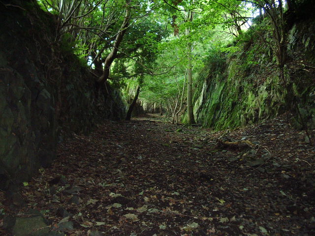
Henbutts Wood is a picturesque woodland located in Lancashire, England. Situated near the town of Clitheroe, it covers an area of approximately 20 acres and offers a serene escape into nature. This ancient wood has a rich history dating back centuries and is a popular destination for nature lovers and hikers alike.

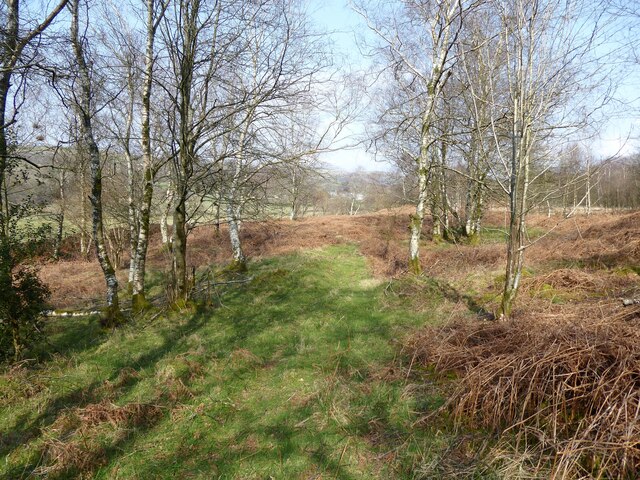
The wood is characterized by a diverse range of tree species, including oak, beech, and birch, which create a vibrant and ever-changing landscape throughout the year. The dense canopy provides shelter for a variety of wildlife, making it a haven for birdwatchers and wildlife enthusiasts.

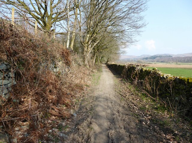
Tranquil walking trails meander through Henbutts Wood, allowing visitors to explore its natural beauty at their own pace. The paths are well-maintained and easily accessible, making it suitable for people of all ages and abilities. Along the way, visitors may encounter enchanting wildflowers, moss-covered fallen logs, and the occasional glimpse of woodland creatures such as squirrels or deer.

Throughout the seasons, Henbutts Wood offers a kaleidoscope of colors and scents. In spring, the forest floor is carpeted with bluebells and primroses, while autumn brings a breathtaking display of fiery reds and golden hues. The wood is particularly magical in winter when the trees are cloaked in a frosty silence, creating a serene and ethereal atmosphere.

Henbutts Wood is a true gem of Lancashire, providing a peaceful retreat for those seeking solace in nature. Its natural beauty, diverse wildlife, and well-maintained trails make it a must-visit destination for anyone looking to immerse themselves in the wonders of the English countryside.

If you have any feedback on the listing, please let us know in the comments section below.

Henbutts Wood Images

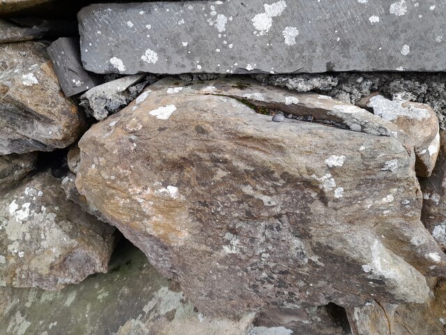
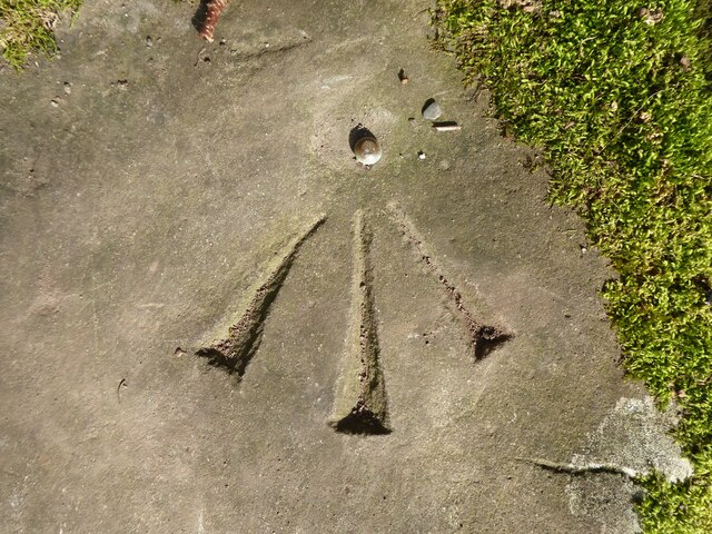
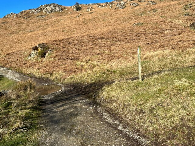
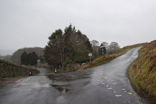
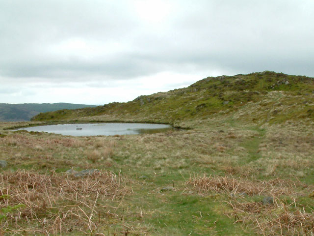
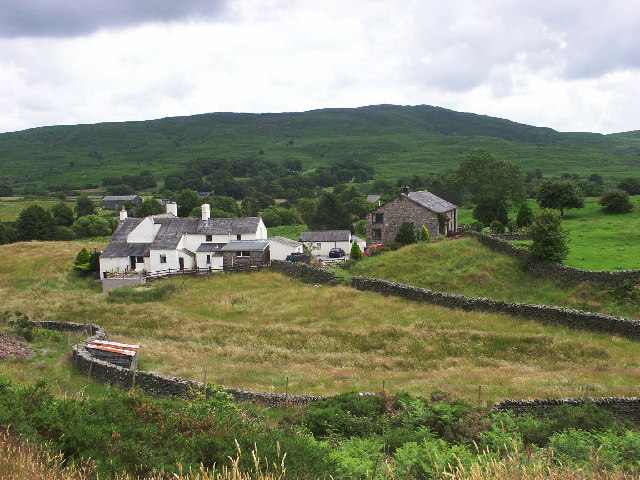
Images are sourced within 2km of 54.291427/-3.1520074 or Grid Reference SD2589. Thanks to Geograph Open Source API. All images are credited.

Ordnance Survey Rivet This OS rivet can be found on the wall east side of Woodlands Road. It marks a point 69.758m above mean sea level.
Ordnance Survey Rivet
This OS rivet can be found on the wall east side of Woodlands Road. It marks a point 69.758m above mean sea level.
Kirkby Pool
Kirkby Pool
Lane near Brookside The lane is a public footpath leading to Buttstead Wood.
Lane near Brookside
The lane is a public footpath leading to Buttstead Wood.
Stile beside Buttstead Wood The public footpath from The Hill to Woodland crosses this stile adjacent to Buttstead Wood.
There is an Ordnance Survey rivet benchmark with cut mark on the bottom stone step of the stile (detail photograph <a href="https://www.geograph.org.uk/photo/7259390">SD2389 : Benchmark, Buttstead Wood</a>).
Stile beside Buttstead Wood
The public footpath from The Hill to Woodland crosses this stile adjacent to Buttstead Wood. There is an Ordnance Survey rivet benchmark with cut mark on the bottom stone step of the stile (detail photograph SD2389 : Benchmark, Buttstead Wood).
Benchmark, Buttstead Wood Detail of the Ordnance Survey rivet benchmark with cut mark on the horizontal bottom step of a public footpath stile adjacent to Buttstead Wood.  The benchmark marks a height of 8.6076m above mean sea level (Ordnance Datum Newlyn) last verified in 1954 (location photograph <a href="https://www.geograph.org.uk/photo/7259381">SD2389 : Stile beside Buttstead Wood</a>).
Benchmark, Buttstead Wood
Detail of the Ordnance Survey rivet benchmark with cut mark on the horizontal bottom step of a public footpath stile adjacent to Buttstead Wood. The benchmark marks a height of 8.6076m above mean sea level (Ordnance Datum Newlyn) last verified in 1954 (location photograph SD2389 : Stile beside Buttstead Wood).
Woodland path near Latter Rigg
The Cumbria Way, Tottlebank The main track is the public bridleway from Tottlebank to Heathwaite; the track to the right is a public footpath to Cockenskell.
Northbound walkers following The Cumbria Way turn right here to follow the footpath up the hill (next photograph <a href="https://www.geograph.org.uk/photo/7428087">SD2688 : The Cumbria Way, Tottlebank</a>).
The Cumbria Way, Tottlebank
The main track is the public bridleway from Tottlebank to Heathwaite; the track to the right is a public footpath to Cockenskell. Northbound walkers following The Cumbria Way turn right here to follow the footpath up the hill (next photograph SD2688 : The Cumbria Way, Tottlebank).
Road Junction
Road Junction
Tottlebank Height Tarn and the summit of Tottlebank Height
Tottlebank Height
Tarn and the summit of Tottlebank Height
Ringhouse Farm and Cottages, Lake District This is Ringhouse Farm and its associated cottages which are available for rent (google 'em for details). Ideally situated for access to the south lakes and beyond and plenty of walks from the farm if you don't feel like getting into the car.
Ringhouse Farm and Cottages, Lake District
This is Ringhouse Farm and its associated cottages which are available for rent (google 'em for details). Ideally situated for access to the south lakes and beyond and plenty of walks from the farm if you don't feel like getting into the car.
Looking towards Blawith Knott From the fell road to Woodland
Looking towards Blawith Knott
From the fell road to Woodland
Fell Road Under Blawith Knott
Fell Road
Under Blawith Knott
Sheep Near Woodland By the entrance to Thornthwaite Farm. Cuckoo Pint (Lords and Ladies) growing on the verge.
Sheep Near Woodland
By the entrance to Thornthwaite Farm. Cuckoo Pint (Lords and Ladies) growing on the verge.
Road bridge This bridge spans the old Broughton-in-Furness to Coniston Railway about 2 miles NE of Broughton
Road bridge
This bridge spans the old Broughton-in-Furness to Coniston Railway about 2 miles NE of Broughton
Dismantled railway Looking SE towards Broughton-in-Furness along the old Broughton-in-Furness to Coniston Railway
Dismantled railway
Looking SE towards Broughton-in-Furness along the old Broughton-in-Furness to Coniston Railway
St John the Evangelist Church, Woodland
St John the Evangelist Church, Woodland, Interior
Barriers Gate and Cattle Grid across the road to Hawes Farm
Barriers
Gate and Cattle Grid across the road to Hawes Farm
Show me another place!

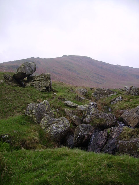
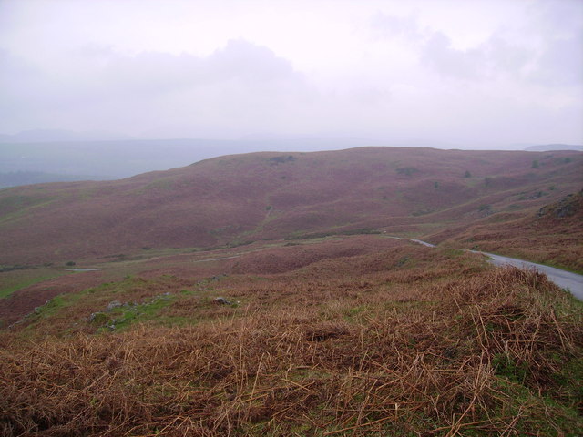
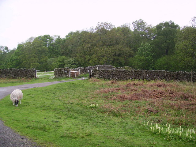
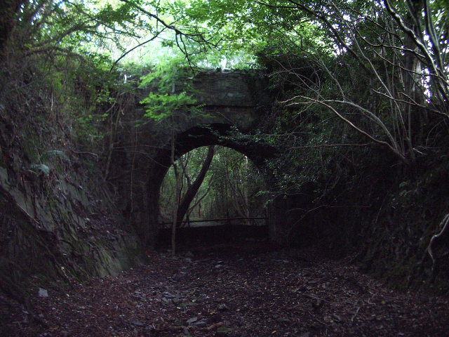
Henbutts Wood is located at Grid Ref: SD2589 (Lat: 54.291427, Lng: -3.1520074)

Administrative County: Cumbria

District: South Lakeland

Police Authority: Cumbria

What 3 Words

///partly.amazed.stormy. Near Ulverston, Cumbria

Related Wikis

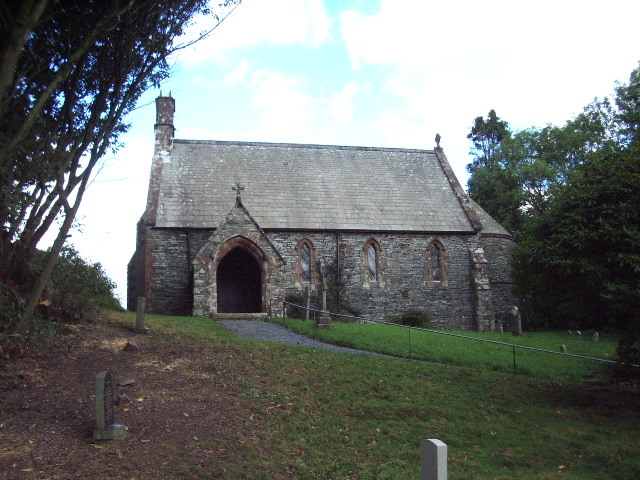
St John the Evangelist's Church, Woodland

St John the Evangelist's Church is in the hamlet of Woodland, about 4 kilometres (2 mi) to the northeast of Broughton-in-Furness, Cumbria, England. It...

Woodland, Cumbria

Woodland is a dispersed hamlet within the civil parish of Kirkby Ireleth in the Furness region of Cumbria, England, and is located in the southern part...

Blawith Knott

Blawith Knott is a hill in the south of the English Lake District, near Woodland, Cumbria. It is the subject of a chapter of Wainwright's book The Outlying...

Rosthwaite, Broughton West

Rosthwaite is a settlement in the Broughton West civil parish of Westmorland and Furness, Cumbria England. It is part of the Lake District, 3 miles (4...

Nearby Amenities

Located within 500m of 54.291427,-3.1520074
Barrier: cattle_grid
Lat/Long: 54.2926105/-3.1576923
Barrier: cattle_grid
Lat/Long: 54.2919651/-3.1569409
Barrier: cattle_grid
Lat/Long: 54.2926987/-3.1549399
Barrier: kissing_gate
Lat/Long: 54.2946161/-3.150148
Barrier: cattle_grid
Lat/Long: 54.2877748/-3.1559159
Give Way
Direction: forward
Lat/Long: 54.2945262/-3.1569139
Post Box
Collection Times: Mo-Fr 10:00; Sa 11:00
Drive Through: no
Post Box Type: lamp
Ref: LA20 24
Lat/Long: 54.2942894/-3.1568407
Woodland
Place: locality
Wikidata: Q15058964
Wikipedia: en:Woodland, Cumbria
Lat/Long: 54.2920659/-3.1584183
Ford: yes
Lat/Long: 54.2928237/-3.1456363
Power: pole
Lat/Long: 54.2930562/-3.1590863
Power: pole
Lat/Long: 54.2923896/-3.1590433
Power: pole
Lat/Long: 54.2914164/-3.1590121
Power: pole
Lat/Long: 54.2906027/-3.1589789
Power: pole
Lat/Long: 54.2900181/-3.1589359
Power: pole
Lat/Long: 54.2896922/-3.1584166
Power: pole
Lat/Long: 54.2891064/-3.1570967
Power: pole
Lat/Long: 54.288532/-3.1557359
Power: pole
Lat/Long: 54.2901742/-3.1577
Power: pole
Lat/Long: 54.2908956/-3.1565364
Power: pole
Lat/Long: 54.2913742/-3.1550779
Power: pole
Lat/Long: 54.2918278/-3.1536272
Power: pole
Lat/Long: 54.2922494/-3.1523367
Power: pole
Lat/Long: 54.2926425/-3.1510891
Power: pole
Lat/Long: 54.293765/-3.1486758
Power: pole
Lat/Long: 54.2943313/-3.1474009
Power: pole
Lat/Long: 54.2920169/-3.1516982
Power: pole
Lat/Long: 54.2914597/-3.1500523
The data included in this document is from www.openstreetmap.org. The data is made available under ODbL.

Have you been to Henbutts Wood?

Leave your review of Henbutts Wood below (or comments, questions and feedback).