Green Moor Wood

Wood, Forest in Lancashire South Lakeland

England

Green Moor Wood

Kirkby Pool
Kirkby Pool Credit: Adrian Taylor

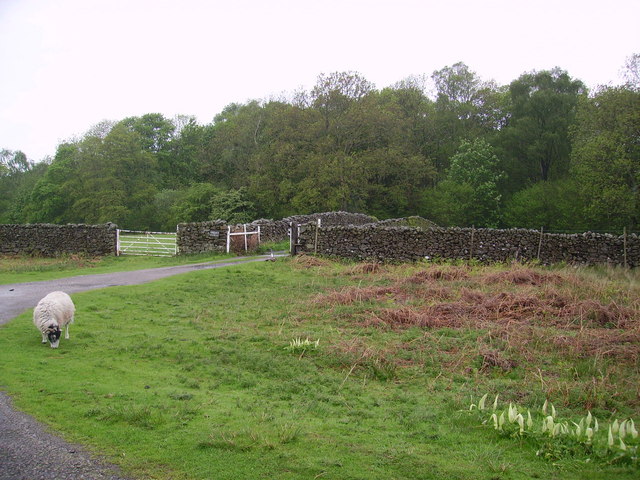
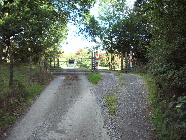
Green Moor Wood is a picturesque woodland located in Lancashire, England. Spread over an area of approximately 50 acres, this enchanting forest is a haven for nature enthusiasts and a popular destination for hiking and exploring.

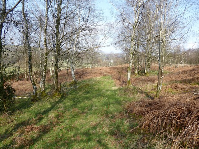
The wood is characterized by its dense, lush vegetation, consisting of a variety of tree species including oak, beech, birch, and pine. These towering trees create a serene and peaceful ambiance, providing shelter for numerous bird species and small mammals. The forest floor is carpeted with a vibrant array of wildflowers, adding to the area's natural beauty.

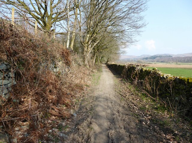
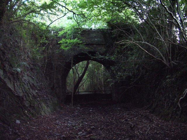
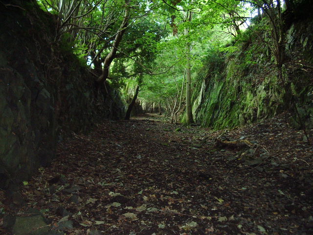
Traversing through Green Moor Wood, visitors can discover a network of well-maintained trails and footpaths, offering opportunities for leisurely walks or more challenging hikes. The paths wind their way through the forest, leading to hidden clearings and secluded spots, perfect for picnicking or simply immersing oneself in the tranquility of nature.

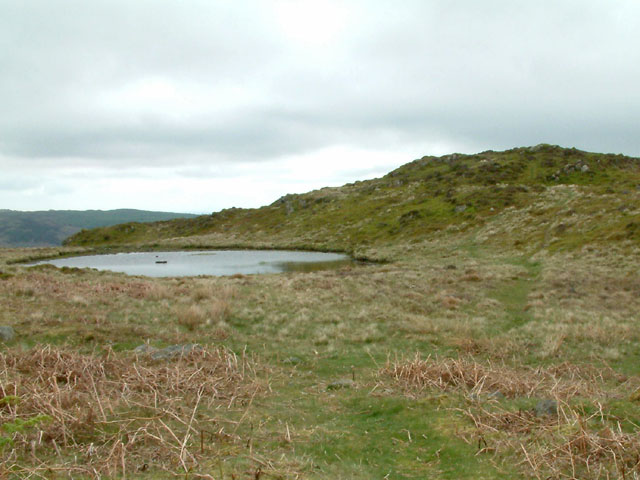
The wood also features a small stream that meanders through its heart, adding a touch of serenity to the already idyllic setting. The stream provides a refreshing spot for wildlife and visitors alike.

Green Moor Wood is a cherished local treasure, attracting visitors year-round. Its accessibility and proximity to nearby towns make it an ideal escape from the hustle and bustle of daily life. The wood offers a chance to reconnect with nature, breathe in the fresh air, and unwind in a tranquil setting. Whether you are a nature lover, a keen hiker, or simply seeking a moment of respite, Green Moor Wood is a must-visit destination in Lancashire.

If you have any feedback on the listing, please let us know in the comments section below.

Green Moor Wood Images

Images are sourced within 2km of 54.297093/-3.1516739 or Grid Reference SD2589. Thanks to Geograph Open Source API. All images are credited.

Kirkby Pool
Kirkby Pool
Lane near Brookside The lane is a public footpath leading to Buttstead Wood.
Lane near Brookside
The lane is a public footpath leading to Buttstead Wood.
Stile beside Buttstead Wood The public footpath from The Hill to Woodland crosses this stile adjacent to Buttstead Wood.
There is an Ordnance Survey rivet benchmark with cut mark on the bottom stone step of the stile (detail photograph <a href="https://www.geograph.org.uk/photo/7259390">SD2389 : Benchmark, Buttstead Wood</a>).
Stile beside Buttstead Wood
The public footpath from The Hill to Woodland crosses this stile adjacent to Buttstead Wood. There is an Ordnance Survey rivet benchmark with cut mark on the bottom stone step of the stile (detail photograph SD2389 : Benchmark, Buttstead Wood).
Benchmark, Buttstead Wood Detail of the Ordnance Survey rivet benchmark with cut mark on the horizontal bottom step of a public footpath stile adjacent to Buttstead Wood.  The benchmark marks a height of 8.6076m above mean sea level (Ordnance Datum Newlyn) last verified in 1954 (location photograph <a href="https://www.geograph.org.uk/photo/7259381">SD2389 : Stile beside Buttstead Wood</a>).
Benchmark, Buttstead Wood
Detail of the Ordnance Survey rivet benchmark with cut mark on the horizontal bottom step of a public footpath stile adjacent to Buttstead Wood. The benchmark marks a height of 8.6076m above mean sea level (Ordnance Datum Newlyn) last verified in 1954 (location photograph SD2389 : Stile beside Buttstead Wood).
Woodland path near Latter Rigg
Road Junction
Road Junction
Tottlebank Height Tarn and the summit of Tottlebank Height
Tottlebank Height
Tarn and the summit of Tottlebank Height
Ringhouse Farm and Cottages, Lake District This is Ringhouse Farm and its associated cottages which are available for rent (google 'em for details). Ideally situated for access to the south lakes and beyond and plenty of walks from the farm if you don't feel like getting into the car.
Ringhouse Farm and Cottages, Lake District
This is Ringhouse Farm and its associated cottages which are available for rent (google 'em for details). Ideally situated for access to the south lakes and beyond and plenty of walks from the farm if you don't feel like getting into the car.
Looking towards Blawith Knott From the fell road to Woodland
Looking towards Blawith Knott
From the fell road to Woodland
Fell Road Under Blawith Knott
Fell Road
Under Blawith Knott
Sheep Near Woodland By the entrance to Thornthwaite Farm. Cuckoo Pint (Lords and Ladies) growing on the verge.
Sheep Near Woodland
By the entrance to Thornthwaite Farm. Cuckoo Pint (Lords and Ladies) growing on the verge.
Road bridge This bridge spans the old Broughton-in-Furness to Coniston Railway about 2 miles NE of Broughton
Road bridge
This bridge spans the old Broughton-in-Furness to Coniston Railway about 2 miles NE of Broughton
Dismantled railway Looking SE towards Broughton-in-Furness along the old Broughton-in-Furness to Coniston Railway
Dismantled railway
Looking SE towards Broughton-in-Furness along the old Broughton-in-Furness to Coniston Railway
St John the Evangelist Church, Woodland
St John the Evangelist Church, Woodland, Interior
Barriers Gate and Cattle Grid across the road to Hawes Farm
Barriers
Gate and Cattle Grid across the road to Hawes Farm
On Woodland Fell Descending from White Borran. Wool Knott and Bell Knott on the skyline.
On Woodland Fell
Descending from White Borran. Wool Knott and Bell Knott on the skyline.
Wool Knott On the summit which is mostly heather
Wool Knott
On the summit which is mostly heather
Show me another place!

Green Moor Wood is located at Grid Ref: SD2589 (Lat: 54.297093, Lng: -3.1516739)

Administrative County: Cumbria

District: South Lakeland

Police Authority: Cumbria

What 3 Words

///obligated.arrive.screeches. Near Ulverston, Cumbria

Related Wikis

Woodland, Cumbria

Woodland is a dispersed hamlet within the civil parish of Kirkby Ireleth in the Furness region of Cumbria, England, and is located in the southern part...

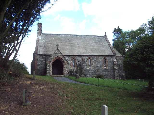
St John the Evangelist's Church, Woodland

St John the Evangelist's Church is in the hamlet of Woodland, about 4 kilometres (2 mi) to the northeast of Broughton-in-Furness, Cumbria, England. It...

Rosthwaite, Broughton West

Rosthwaite is a settlement in the Broughton West civil parish of Westmorland and Furness, Cumbria England. It is part of the Lake District, 3 miles (4...

Woodland railway station

Woodland railway station served the hamlet of Woodland, in Lancashire, England (now in Cumbria). It was on the branch line to Coniston. == History == Authorised...

Blawith Knott

Blawith Knott is a hill in the south of the English Lake District, near Woodland, Cumbria. It is the subject of a chapter of Wainwright's book The Outlying...

Woodland Fell

Woodland Fell is an upland area in the south of the English Lake District, south of Torver, Cumbria. It is the subject of a chapter of Wainwright's book...

Broughton West

Broughton West is a civil parish in the Westmorland and Furness district of Cumbria, England. In the 2001 census the parish had a population of 954, decreasing...

Beacon Fell, Cumbria

Beacon Fell is a fell in the southern Lake District of England with an altitude of 836 feet (255 m). It is the subject of a chapter of Wainwright's book...

Nearby Amenities

Located within 500m of 54.297093,-3.1516739
Barrier: cattle_grid
Lat/Long: 54.299715/-3.1527158
Barrier: kissing_gate
Lat/Long: 54.2946161/-3.150148
Give Way
Direction: forward
Lat/Long: 54.2945262/-3.1569139
Post Box
Collection Times: Mo-Fr 10:00; Sa 11:00
Drive Through: no
Post Box Type: lamp
Ref: LA20 24
Lat/Long: 54.2942894/-3.1568407
Barrier: stile
Bicycle: no
Foot: yes
Horse: no
Material: wood
Motor Vehicle: no
Stile: stepover
Lat/Long: 54.2975192/-3.1446384
Barrier: cattle_grid
Lat/Long: 54.3009621/-3.1510897
Power: pole
Lat/Long: 54.2977006/-3.1592405
Power: pole
Lat/Long: 54.2967378/-3.1592698
Power: pole
Lat/Long: 54.2926425/-3.1510891
Power: pole
Lat/Long: 54.293765/-3.1486758
Power: pole
Lat/Long: 54.2943313/-3.1474009
Power: pole
Lat/Long: 54.2949181/-3.146126
Power: pole
Lat/Long: 54.295546/-3.1447866
Power: pole
Lat/Long: 54.2965065/-3.1444742
Power: pole
Lat/Long: 54.2976505/-3.1441013
The data included in this document is from www.openstreetmap.org. The data is made available under ODbL.

Have you been to Green Moor Wood?

Leave your review of Green Moor Wood below (or comments, questions and feedback).