Dry Haw Wood

Wood, Forest in Lancashire South Lakeland

England

Dry Haw Wood

The Cumbria Way, Tottlebank The main track is the public bridleway from Tottlebank to Heathwaite; the track to the right is a public footpath to Cockenskell.
Northbound walkers following The Cumbria Way turn right here to follow the footpath up the hill (next photograph <a href="https://www.geograph.org.uk/photo/7428087">SD2688 : The Cumbria Way, Tottlebank</a>).
The Cumbria Way, Tottlebank Credit: Adrian Taylor

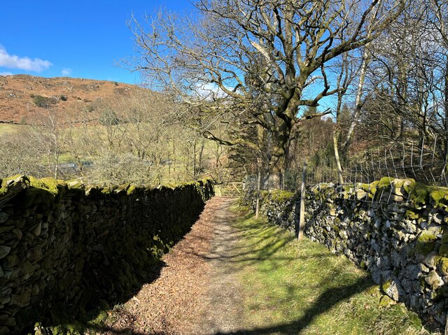
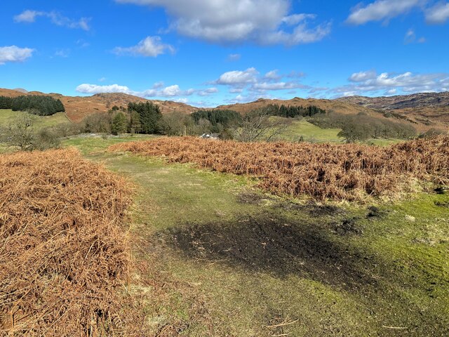
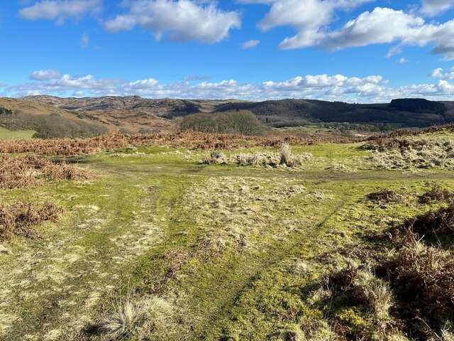
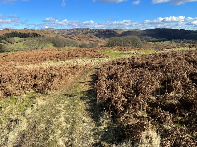
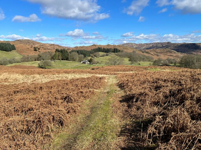
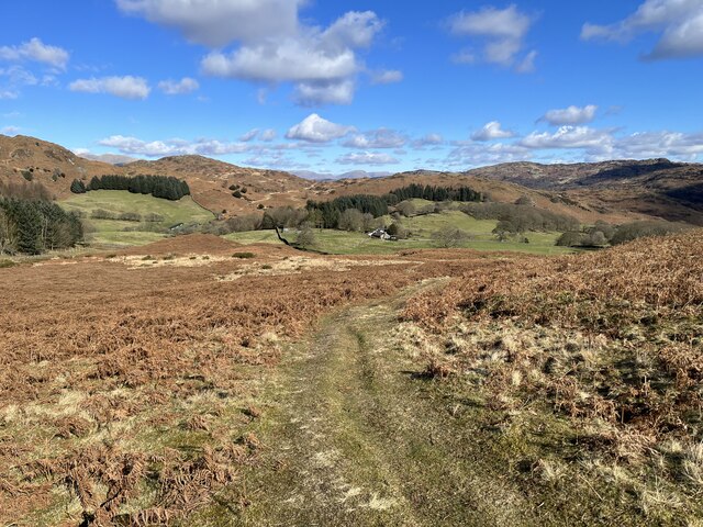
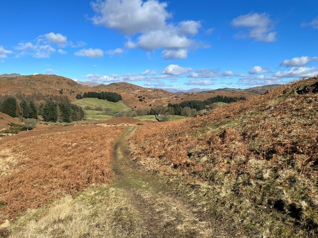
Dry Haw Wood is a picturesque woodland located in Lancashire, England. Covering an area of approximately 100 acres, it is a haven for nature enthusiasts and outdoor lovers. The wood is characterized by its dense canopy of trees, which include a variety of species such as oak, beech, birch, and pine.

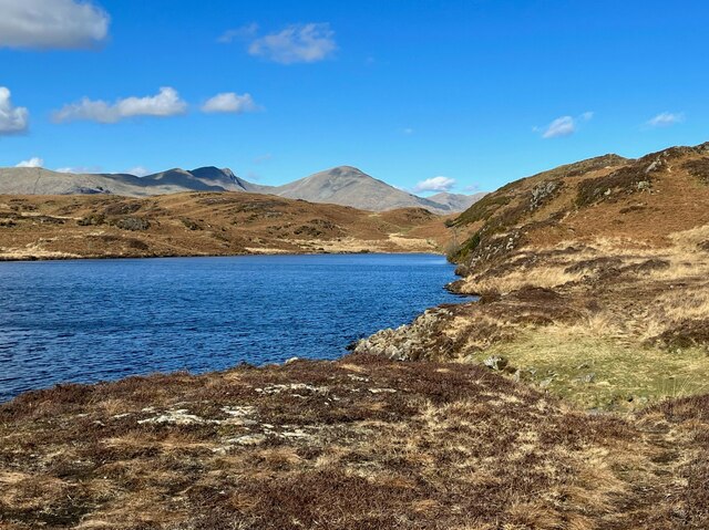
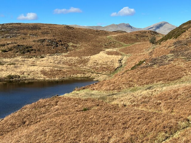
The woodland is known for its diverse ecosystem, supporting a wide range of flora and fauna. The forest floor is adorned with a carpet of wildflowers, ferns, and mosses, creating a vibrant and enchanting atmosphere. The wood is also home to numerous bird species, making it a popular spot for birdwatching enthusiasts.

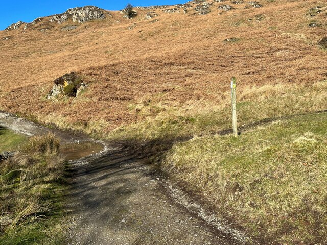
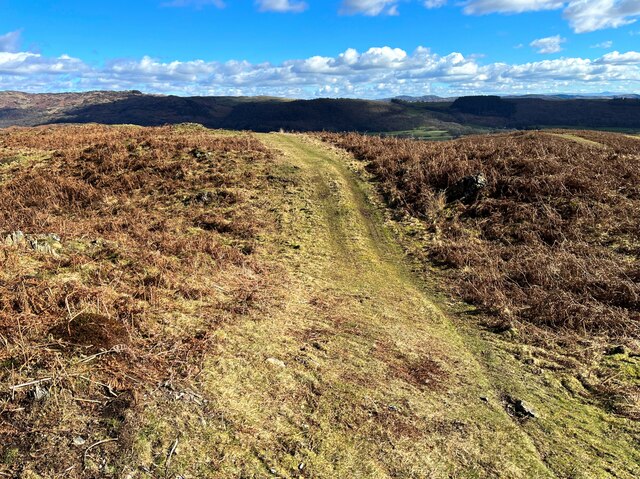
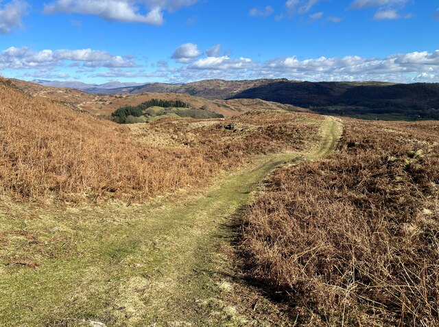
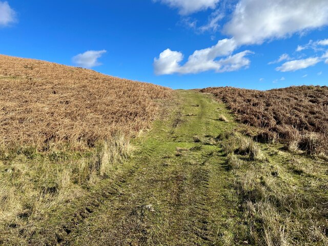
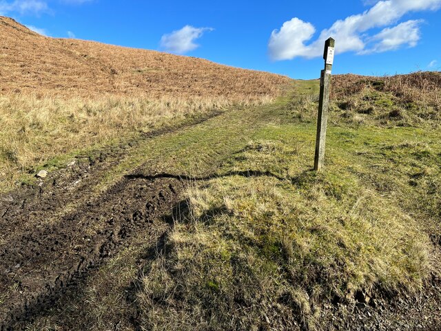
Dry Haw Wood offers a network of well-maintained footpaths and trails that wind through the forest, allowing visitors to explore its natural beauty at their leisure. The paths are suitable for walkers of all abilities, offering a mix of easy strolls and more challenging hikes.

Visitors to the wood can expect to encounter various wildlife species, including squirrels, rabbits, and even the occasional deer. The tranquil and peaceful atmosphere of Dry Haw Wood makes it an ideal place for nature photography and quiet contemplation.

The wood is easily accessible, with ample parking available nearby, and it is open to the public year-round. Whether you are seeking a peaceful retreat or an opportunity to connect with nature, Dry Haw Wood offers a captivating and serene environment that is sure to leave a lasting impression on all who visit.

If you have any feedback on the listing, please let us know in the comments section below.
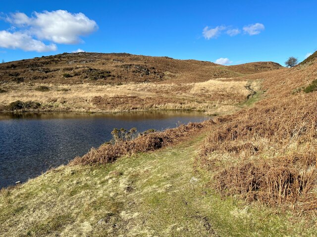
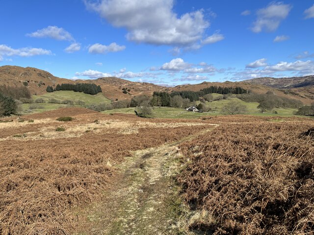
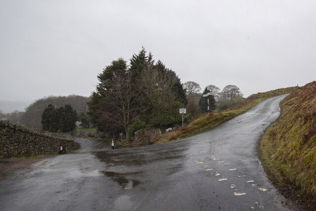
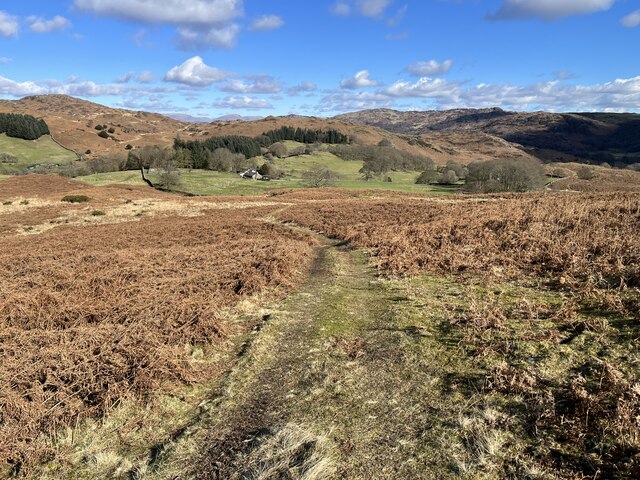
Dry Haw Wood Images

Images are sourced within 2km of 54.298399/-3.1399706 or Grid Reference SD2589. Thanks to Geograph Open Source API. All images are credited.

The Cumbria Way, Tottlebank The main track is the public bridleway from Tottlebank to Heathwaite; the track to the right is a public footpath to Cockenskell.
Northbound walkers following The Cumbria Way turn right here to follow the footpath up the hill (next photograph <a href="https://www.geograph.org.uk/photo/7428087">SD2688 : The Cumbria Way, Tottlebank</a>).
The Cumbria Way, Tottlebank
The main track is the public bridleway from Tottlebank to Heathwaite; the track to the right is a public footpath to Cockenskell. Northbound walkers following The Cumbria Way turn right here to follow the footpath up the hill (next photograph SD2688 : The Cumbria Way, Tottlebank).
Path on Tottlebank Height This path is the route of The Cumbria Way over the open fell between Tottlebank Farm and Cockenskell (next photograph <a href="https://www.geograph.org.uk/photo/7432096">SD2788 : The Cumbria Way near The Low</a>).
Path on Tottlebank Height
This path is the route of The Cumbria Way over the open fell between Tottlebank Farm and Cockenskell (next photograph SD2788 : The Cumbria Way near The Low).
Path on Tottlebank Height This undulating path is the route of The Cumbria Way over the open fell between Tottlebank Farm and Cockenskell (next photograph <a href="https://www.geograph.org.uk/photo/7427169">SD2788 : Path on Tottlebank Height</a>).
Path on Tottlebank Height
This undulating path is the route of The Cumbria Way over the open fell between Tottlebank Farm and Cockenskell (next photograph SD2788 : Path on Tottlebank Height).
Public footpath near Tottlebank This footpath is the route of The Cumbria Way over the open fell between Tottlebank Farm and Cockenskell (next photograph <a href="https://www.geograph.org.uk/photo/7432849">SD2788 : Public footpath near Tottlebank</a>).
Public footpath near Tottlebank
This footpath is the route of The Cumbria Way over the open fell between Tottlebank Farm and Cockenskell (next photograph SD2788 : Public footpath near Tottlebank).
The Cumbria Way, Tottlebank This Cumbria Way leaves a public bridleway by Tottlebank Farm and follows the public footpath to Cockenskell up the hill (next photograph <a href="https://www.geograph.org.uk/photo/7428052">SD2788 : Public footpath near Tottlebank</a>).
The Cumbria Way, Tottlebank
This Cumbria Way leaves a public bridleway by Tottlebank Farm and follows the public footpath to Cockenskell up the hill (next photograph SD2788 : Public footpath near Tottlebank).
Beacon Tarn The Cumbria Way long distance path follows the far shore of the tarn; Dow Crag and Coniston Old Man form an impressive backdrop.
Beacon Tarn
The Cumbria Way long distance path follows the far shore of the tarn; Dow Crag and Coniston Old Man form an impressive backdrop.
Beacon Tarn and the Coniston Fells Beacon Tarn lies in a hollow in the Blawith Fells; in the background are Dow Crag and Coniston Old Man.  The steep gorse covered bank to the right is the western slope of Beacon Fell and the path leading through the col behind the solitary hawthorn tree is The Cumbria Way.
Beacon Tarn and the Coniston Fells
Beacon Tarn lies in a hollow in the Blawith Fells; in the background are Dow Crag and Coniston Old Man. The steep gorse covered bank to the right is the western slope of Beacon Fell and the path leading through the col behind the solitary hawthorn tree is The Cumbria Way.
Lane near Cockenskell The Tottlebank Farm to Beacon Tarn public footpath passes through a walled lane near Cockenskell. This is the route of The Cumbria Way long distance path (next photograph <a href="https://www.geograph.org.uk/photo/6884736">SD2789 : Gate on The Cumbria Way near Cockenskell</a>).
Lane near Cockenskell
The Tottlebank Farm to Beacon Tarn public footpath passes through a walled lane near Cockenskell. This is the route of The Cumbria Way long distance path (next photograph SD2789 : Gate on The Cumbria Way near Cockenskell).
Path near Appletree Holme This path on Blawith Common near Appletree Holme is the route of The Cumbria Way (next photograph <a href="https://www.geograph.org.uk/photo/6883308">SD2788 : The Cumbria Way near Cockenskell</a>).
Path near Appletree Holme
This path on Blawith Common near Appletree Holme is the route of The Cumbria Way (next photograph SD2788 : The Cumbria Way near Cockenskell).
Paths near Appletree Holme At this junction of paths on Blawith Common northbound walkers following The Cumbria Way keep left (next photograph <a href="https://www.geograph.org.uk/photo/7429743">SD2788 : Path near Appletree Holme</a>).
Paths near Appletree Holme
At this junction of paths on Blawith Common northbound walkers following The Cumbria Way keep left (next photograph SD2788 : Path near Appletree Holme).
Path near Appletree Holme This path on Blawith Common near Appletree Holme is the route of The Cumbria Way long distance path (next photograph <a href="https://www.geograph.org.uk/photo/7429783">SD2788 : Paths near Appletree Holme</a>).
Path near Appletree Holme
This path on Blawith Common near Appletree Holme is the route of The Cumbria Way long distance path (next photograph SD2788 : Paths near Appletree Holme).
Path near Appletree Holme This path through bracken near Appletree Holme is the route of The Cumbria Way long distance path (next photograph <a href="https://www.geograph.org.uk/photo/7429793">SD2788 : Path near Appletree Holme</a>).
Cockenskell Farm House is in the distance.
Path near Appletree Holme
This path through bracken near Appletree Holme is the route of The Cumbria Way long distance path (next photograph SD2788 : Path near Appletree Holme). Cockenskell Farm House is in the distance.
The north end of Beacon Tarn Beacon Tarn lies in a hollow of the Blawith Fells beside The Cumbria Way long distance path.
The north end of Beacon Tarn
Beacon Tarn lies in a hollow of the Blawith Fells beside The Cumbria Way long distance path.
Footpath near Appletree Holme This path through bracken near Appletree Holme is the public footpath from Tottlebank Farm to Cockenskell; it is also The Cumbria Way long distance path (next photograph <a href="https://www.geograph.org.uk/photo/7429808">SD2788 : Path near Appletree Holme</a>).
Cockenskell Farm House is in the distance.
Footpath near Appletree Holme
This path through bracken near Appletree Holme is the public footpath from Tottlebank Farm to Cockenskell; it is also The Cumbria Way long distance path (next photograph SD2788 : Path near Appletree Holme). Cockenskell Farm House is in the distance.
Road Junction
Road Junction
Footpath above Appletree Holme This path over open fell is a public footpath from Tottlebank Farm to Cockenskell.  It is also the route of The Cumbria Way (next photograph <a href="https://www.geograph.org.uk/photo/7429897">SD2788 : Footpath near Appletree Holme</a>).
Beacon Fell rises in the left background.
Footpath above Appletree Holme
This path over open fell is a public footpath from Tottlebank Farm to Cockenskell. It is also the route of The Cumbria Way (next photograph SD2788 : Footpath near Appletree Holme). Beacon Fell rises in the left background.
Path near Dam Moss This path is the route of The Cumbria Way, a long distance path from Ulverston to Carlisle (next photograph <a href="https://www.geograph.org.uk/photo/7429986">SD2788 : Footpath above Appletree Holme</a>).
Path near Dam Moss
This path is the route of The Cumbria Way, a long distance path from Ulverston to Carlisle (next photograph SD2788 : Footpath above Appletree Holme).
Path beside Dam Moss This path is the route of The Cumbria Way, a long distance path from Ulverston to Carlisle (next photograph <a href="https://www.geograph.org.uk/photo/7430040">SD2788 : Path near Dam Moss</a>).
Path beside Dam Moss
This path is the route of The Cumbria Way, a long distance path from Ulverston to Carlisle (next photograph SD2788 : Path near Dam Moss).
Show me another place!

Dry Haw Wood is located at Grid Ref: SD2589 (Lat: 54.298399, Lng: -3.1399706)

Administrative County: Cumbria

District: South Lakeland

Police Authority: Cumbria

What 3 Words

///regal.dining.lightbulb. Near Ulverston, Cumbria

Related Wikis

Woodland Fell

Woodland Fell is an upland area in the south of the English Lake District, south of Torver, Cumbria. It is the subject of a chapter of Wainwright's book...

Blawith Knott

Blawith Knott is a hill in the south of the English Lake District, near Woodland, Cumbria. It is the subject of a chapter of Wainwright's book The Outlying...

Woodland, Cumbria

Woodland is a dispersed hamlet within the civil parish of Kirkby Ireleth in the Furness region of Cumbria, England, and is located in the southern part...

St John the Evangelist's Church, Woodland

St John the Evangelist's Church is in the hamlet of Woodland, about 4 kilometres (2 mi) to the northeast of Broughton-in-Furness, Cumbria, England. It...

Nearby Amenities

Located within 500m of 54.298399,-3.1399706
Barrier: stile
Lat/Long: 54.3012988/-3.1426315
Woodland Fell
Place: locality
Lat/Long: 54.2954232/-3.1394926
Barrier: stile
Bicycle: no
Foot: yes
Horse: no
Material: wood
Motor Vehicle: no
Stile: stepover
Lat/Long: 54.2975192/-3.1446384
Power: pole
Lat/Long: 54.295546/-3.1447866
Power: pole
Lat/Long: 54.2965065/-3.1444742
Power: pole
Lat/Long: 54.2976505/-3.1441013
Power: pole
Lat/Long: 54.2994666/-3.1434667
Power: pole
Lat/Long: 54.3002323/-3.1431329
Power: pole
Lat/Long: 54.3011437/-3.1427463
Power: pole
Lat/Long: 54.3016655/-3.1437908
The data included in this document is from www.openstreetmap.org. The data is made available under ODbL.

Have you been to Dry Haw Wood?

Leave your review of Dry Haw Wood below (or comments, questions and feedback).