Addistone Wood

Wood, Forest in Lancashire South Lakeland

England

Addistone Wood

Kirkby Pool
Kirkby Pool Credit: Adrian Taylor

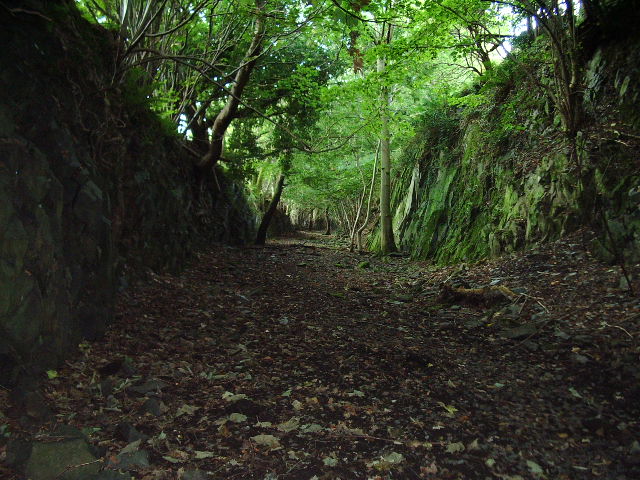
Addistone Wood is a charming woodland located in the county of Lancashire, England. Spanning over an area of approximately 50 acres, it is a well-preserved forest that offers visitors a peaceful retreat from the hustle and bustle of daily life.

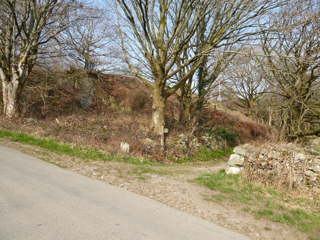
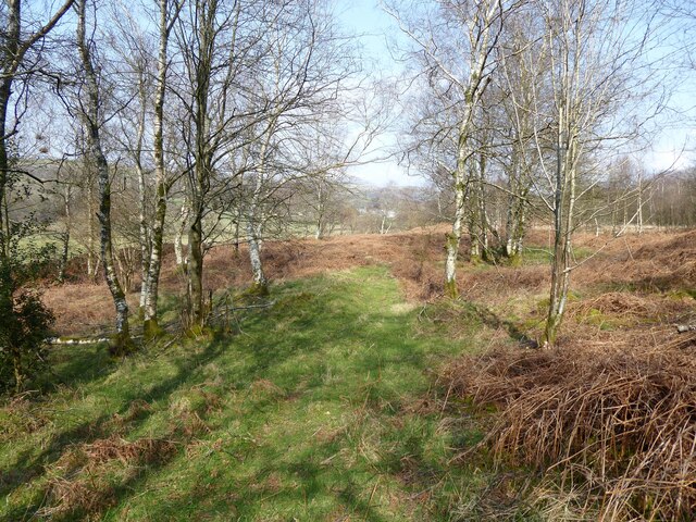
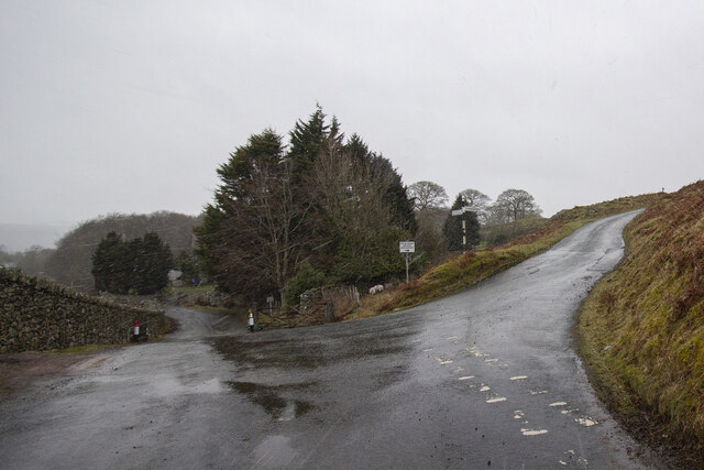
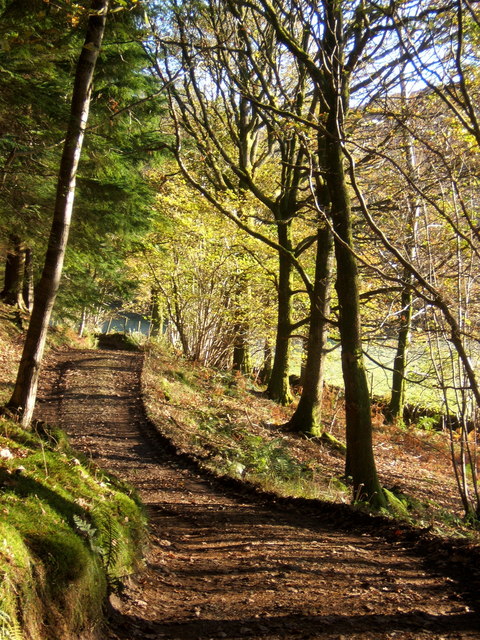
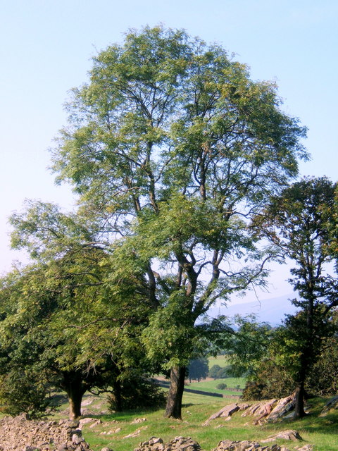
Situated on the outskirts of the village of Addistone, the wood is easily accessible and attracts nature enthusiasts, walkers, and families alike. The woodland is characterized by a diverse range of trees, including oak, birch, and beech, which create a rich and vibrant canopy overhead. The forest floor is covered with a carpet of moss, ferns, and wildflowers, adding to the enchanting atmosphere.

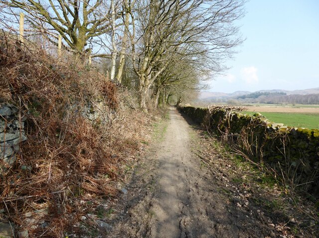
A network of well-maintained footpaths wind their way through Addistone Wood, providing visitors with the opportunity to explore its hidden corners and discover its natural wonders. The paths lead to picturesque spots, such as a tranquil pond and a small stream that meanders through the woodland, offering delightful spots for picnics or a quiet moment of reflection.

The wood is home to a variety of wildlife, making it a haven for nature lovers. Visitors may catch glimpses of squirrels darting through the trees, rabbits hopping across the forest floor, or birdsong filling the air as they spot numerous species of birds nesting and feeding in the branches above.

Addistone Wood is open to the public year-round, and admission is free. The forest is well-maintained by local authorities, ensuring a clean and safe environment for visitors. Whether seeking a peaceful stroll, a family outing, or an opportunity to connect with nature, Addistone Wood is a hidden gem that promises a memorable experience for all who visit.

If you have any feedback on the listing, please let us know in the comments section below.

Addistone Wood Images

Images are sourced within 2km of 54.304687/-3.1638889 or Grid Reference SD2490. Thanks to Geograph Open Source API. All images are credited.

Kirkby Pool
Kirkby Pool
Lane near Brookside The lane is a public footpath leading to Buttstead Wood.
Lane near Brookside
The lane is a public footpath leading to Buttstead Wood.
Stile beside Buttstead Wood The public footpath from The Hill to Woodland crosses this stile adjacent to Buttstead Wood.
There is an Ordnance Survey rivet benchmark with cut mark on the bottom stone step of the stile (detail photograph <a href="https://www.geograph.org.uk/photo/7259390">SD2389 : Benchmark, Buttstead Wood</a>).
Stile beside Buttstead Wood
The public footpath from The Hill to Woodland crosses this stile adjacent to Buttstead Wood. There is an Ordnance Survey rivet benchmark with cut mark on the bottom stone step of the stile (detail photograph SD2389 : Benchmark, Buttstead Wood).
Benchmark, Buttstead Wood Detail of the Ordnance Survey rivet benchmark with cut mark on the horizontal bottom step of a public footpath stile adjacent to Buttstead Wood.  The benchmark marks a height of 8.6076m above mean sea level (Ordnance Datum Newlyn) last verified in 1954 (location photograph <a href="https://www.geograph.org.uk/photo/7259381">SD2389 : Stile beside Buttstead Wood</a>).
Benchmark, Buttstead Wood
Detail of the Ordnance Survey rivet benchmark with cut mark on the horizontal bottom step of a public footpath stile adjacent to Buttstead Wood. The benchmark marks a height of 8.6076m above mean sea level (Ordnance Datum Newlyn) last verified in 1954 (location photograph SD2389 : Stile beside Buttstead Wood).
Lane entrance near Brookside Leading from the road near Brookside the lane leads to Buttstead Wood and carries a public footpath to Low Rosthwaite.
There is an Ordnance Survey rivet benchmark on the top of the low stone post partially hidden in the brambles to the left of the footpath signpost (photograph <a href="https://www.geograph.org.uk/photo/7260566">SD2389 : Rivet benchmark near Brookside</a>).
Lane entrance near Brookside
Leading from the road near Brookside the lane leads to Buttstead Wood and carries a public footpath to Low Rosthwaite. There is an Ordnance Survey rivet benchmark on the top of the low stone post partially hidden in the brambles to the left of the footpath signpost (photograph SD2389 : Rivet benchmark near Brookside).
Rivet benchmark near Brookside Detail of an Ordnance Survey rivet benchmark on the top of a low stone post near Brookside.  The benchmark marks a height of 11.0246m above mean sea level (Ordnance Datum Newlyn) last verified in 1972 (location photograph <a href="https://www.geograph.org.uk/photo/7260558">SD2389 : Lane entrance near Brookside</a>).
Rivet benchmark near Brookside
Detail of an Ordnance Survey rivet benchmark on the top of a low stone post near Brookside. The benchmark marks a height of 11.0246m above mean sea level (Ordnance Datum Newlyn) last verified in 1972 (location photograph SD2389 : Lane entrance near Brookside).
Woodland path near Latter Rigg
Road Junction
Road Junction
Ringhouse Farm and Cottages, Lake District This is Ringhouse Farm and its associated cottages which are available for rent (google 'em for details). Ideally situated for access to the south lakes and beyond and plenty of walks from the farm if you don't feel like getting into the car.
Ringhouse Farm and Cottages, Lake District
This is Ringhouse Farm and its associated cottages which are available for rent (google 'em for details). Ideally situated for access to the south lakes and beyond and plenty of walks from the farm if you don't feel like getting into the car.
Road bridge This bridge spans the old Broughton-in-Furness to Coniston Railway about 2 miles NE of Broughton
Road bridge
This bridge spans the old Broughton-in-Furness to Coniston Railway about 2 miles NE of Broughton
Dismantled railway Looking SE towards Broughton-in-Furness along the old Broughton-in-Furness to Coniston Railway
Dismantled railway
Looking SE towards Broughton-in-Furness along the old Broughton-in-Furness to Coniston Railway
St John the Evangelist Church, Woodland
St John the Evangelist Church, Woodland, Interior
Barriers Gate and Cattle Grid across the road to Hawes Farm
Barriers
Gate and Cattle Grid across the road to Hawes Farm
Track through the woods heading for Green Moor
View from a lane above Hawthwaite Black Combe in the distance.
View from a lane above Hawthwaite
Black Combe in the distance.
Fine trees on meadowland near Green Moor
Church of St John the Evangelist, Woodland
Show me another place!

Addistone Wood is located at Grid Ref: SD2490 (Lat: 54.304687, Lng: -3.1638889)

Administrative County: Cumbria

District: South Lakeland

Police Authority: Cumbria

What 3 Words

///direction.promotes.unfolds. Near Millom, Cumbria

Related Wikis

Woodland railway station

Woodland railway station served the hamlet of Woodland, in Lancashire, England (now in Cumbria). It was on the branch line to Coniston. == History == Authorised...

Rosthwaite, Broughton West

Rosthwaite is a settlement in the Broughton West civil parish of Westmorland and Furness, Cumbria England. It is part of the Lake District, 3 miles (4...

Woodland, Cumbria

Woodland is a dispersed hamlet within the civil parish of Kirkby Ireleth in the Furness region of Cumbria, England, and is located in the southern part...

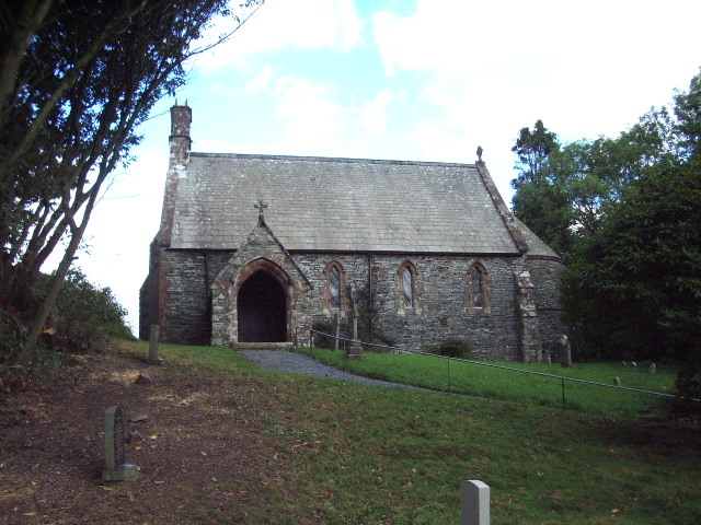
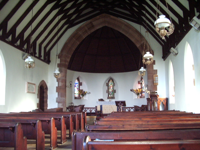
St John the Evangelist's Church, Woodland

St John the Evangelist's Church is in the hamlet of Woodland, about 4 kilometres (2 mi) to the northeast of Broughton-in-Furness, Cumbria, England. It...

Broughton West

Broughton West is a civil parish in the Westmorland and Furness district of Cumbria, England. In the 2001 census the parish had a population of 954, decreasing...

Blacksmiths Arms, Broughton Mills

The Blacksmiths Arms is a Grade II listed public house at Broughton Mills, Cumbria, England.It is on the Campaign for Real Ale's National Inventory of...

Broughton Mills

Broughton Mills is a village in Cumbria, England, located 3.5 kilometres from the larger town of Broughton-in-furness. The village consists of about 40...

Blawith Knott

Blawith Knott is a hill in the south of the English Lake District, near Woodland, Cumbria. It is the subject of a chapter of Wainwright's book The Outlying...

Nearby Amenities

Located within 500m of 54.304687,-3.1638889
Barrier: stile
Lat/Long: 54.3088468/-3.1638429
Little Intake
Place: locality
Lat/Long: 54.3052015/-3.1591064
Woodland
Abandoned Railway: station
Railway: site
Wikidata: Q8032897
Wikipedia: en:Woodland railway station
Lat/Long: 54.3031337/-3.1678629
Barrier: stile
Lat/Long: 54.3026711/-3.1658032
Baskell Wood
Place: locality
Lat/Long: 54.3043166/-3.1672569
Addistone Wood
Place: locality
Lat/Long: 54.3048631/-3.1649523
Bridge Yeat Wood
Place: locality
Lat/Long: 54.303317/-3.1647182
New Close Wood
Place: locality
Lat/Long: 54.3021664/-3.1648168
Power: pole
Lat/Long: 54.3030851/-3.1709912
Power: pole
Lat/Long: 54.3038323/-3.1696591
Power: pole
Lat/Long: 54.3044188/-3.1685606
Power: pole
Lat/Long: 54.3050635/-3.1674459
Power: pole
Lat/Long: 54.3057731/-3.1661605
Power: pole
Lat/Long: 54.3064394/-3.1649186
Power: pole
Lat/Long: 54.3071245/-3.1636929
Power: pole
Lat/Long: 54.3074779/-3.1626942
Power: pole
Lat/Long: 54.3078209/-3.1617261
Power: pole
Lat/Long: 54.3083659/-3.1601508
Power: pole
Lat/Long: 54.3081008/-3.1648343
Power: pole
Lat/Long: 54.3077386/-3.1644106
Power: pole
Lat/Long: 54.3028526/-3.1700863
Power: pole
Lat/Long: 54.3024254/-3.1684795
Power: pole
Lat/Long: 54.3020005/-3.1668589
Power: pole
Lat/Long: 54.3013807/-3.1663982
Power: pole
Lat/Long: 54.3008088/-3.1658905
Power: pole
Lat/Long: 54.3002938/-3.1648479
Power: pole
Lat/Long: 54.3004533/-3.1633348
Power: pole
Lat/Long: 54.3013101/-3.1625948
Power: pole
Lat/Long: 54.3019219/-3.1620696
Power: pole
Lat/Long: 54.3030828/-3.1610407
The data included in this document is from www.openstreetmap.org. The data is made available under ODbL.

Have you been to Addistone Wood?

Leave your review of Addistone Wood below (or comments, questions and feedback).