Bilscombe Wood

Wood, Forest in Somerset Somerset West and Taunton

England

Bilscombe Wood

Corfe Farmland Residential housing dotted on farmland on the outskirts of Corfe, Somerset.
Corfe Farmland Credit: John Allan

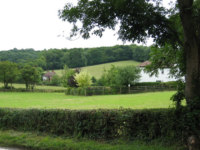
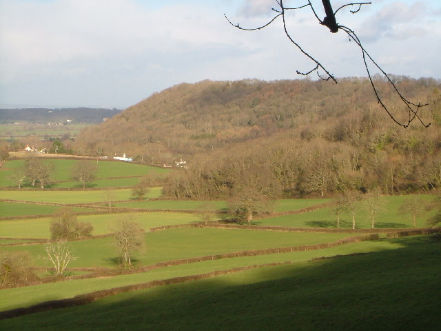
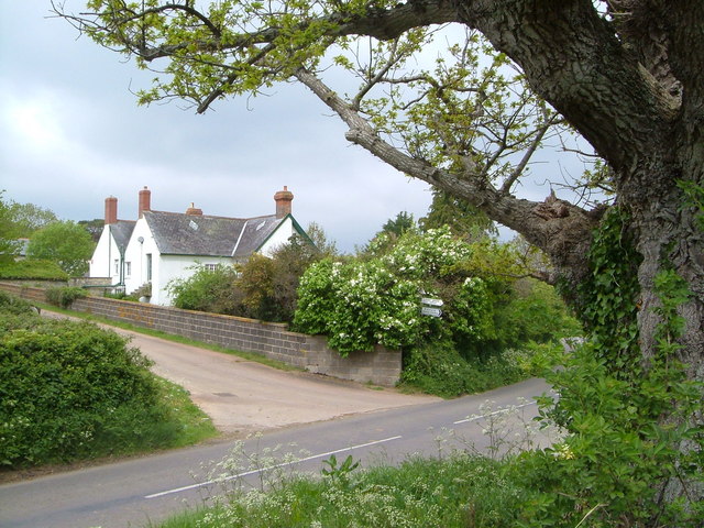
Bilscombe Wood is a charming woodland located in Somerset, England. Spread across an area of approximately 70 hectares, this beautiful forest is a popular destination for nature enthusiasts, hikers, and birdwatchers. It is situated near the village of Bishopswood, just a few miles east of the town of Chard.

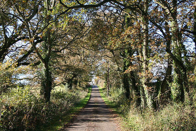
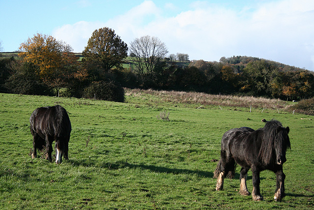
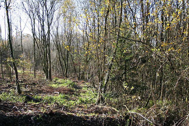
The wood is primarily made up of deciduous trees, such as oak, beech, and ash, which create a stunning canopy overhead. The forest floor is adorned with a carpet of bluebells during the spring, adding to its natural beauty. Bilscombe Wood is also home to a variety of wildlife, including deer, badgers, and a wide range of bird species, making it a haven for wildlife lovers.

There are several walking trails that wind their way through the wood, allowing visitors to explore its diverse flora and fauna. These paths are well-maintained and easy to follow, making it an ideal destination for families and people of all ages. The wood also offers breathtaking views of the surrounding countryside, providing a peaceful and tranquil escape from the hustle and bustle of daily life.

Bilscombe Wood is managed by the Forestry Commission, ensuring its preservation and maintenance for future generations to enjoy. The wood is open to the public throughout the year, with no admission fee. Visitors are encouraged to follow the designated trails and respect the natural environment by not littering or disturbing the wildlife.

Overall, Bilscombe Wood is a picturesque and serene woodland that offers a delightful escape into nature, providing a perfect setting for relaxation and exploration.

If you have any feedback on the listing, please let us know in the comments section below.

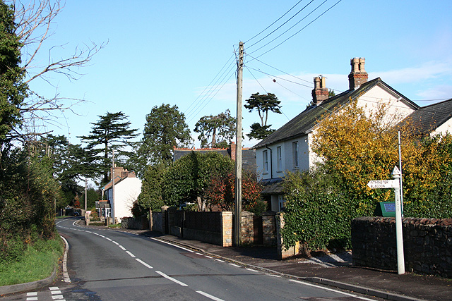
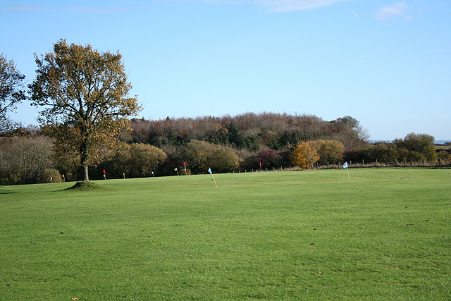
Bilscombe Wood Images

Images are sourced within 2km of 50.964887/-3.0784445 or Grid Reference ST2418. Thanks to Geograph Open Source API. All images are credited.

Corfe Farmland Residential housing dotted on farmland on the outskirts of Corfe, Somerset.
Corfe Farmland
Residential housing dotted on farmland on the outskirts of Corfe, Somerset.
Murlinch Wood, Woodram Looking northeast along the wooded scarp of the Blackdown Hills, with the fields around Woodram below, and the houses of Corfe village under Pickeridge Hill beyond. Taken from where Woodram Lane, here byway T 21/84, emerges from the woods. See also <a href="https://www.geograph.org.uk/photo/1609699">ST2218 : Fields southwest of Corfe</a>.
Murlinch Wood, Woodram
Looking northeast along the wooded scarp of the Blackdown Hills, with the fields around Woodram below, and the houses of Corfe village under Pickeridge Hill beyond. Taken from where Woodram Lane, here byway T 21/84, emerges from the woods. See also ST2218 : Fields southwest of Corfe.
Badger Street Details at <span class="nowrap"><a title="http://webapp1.somerset.gov.uk/her/details.asp?prn=40797" rel="nofollow ugc noopener" href="http://webapp1.somerset.gov.uk/her/details.asp?prn=40797">Link</a><img style="margin-left:2px;" alt="External link" title="External link - shift click to open in new window" src="https://s1.geograph.org.uk/img/external.png" width="10" height="10"/></span> of this C17 farmhouse, seen from the nearby road junction.
Badger Street
Details at LinkExternal link of this C17 farmhouse, seen from the nearby road junction.
Corfe: war memorial Near the 19th century church and by the entrance to Mill Lane. Greystones is the house across the main road. Looking west-south-west
Corfe: war memorial
Near the 19th century church and by the entrance to Mill Lane. Greystones is the house across the main road. Looking west-south-west
Corfe: by the Pitminster turning Looking north towards Taunton on the main road, three miles distant. Behind the photographer stands the White Hart Inn
Corfe: by the Pitminster turning
Looking north towards Taunton on the main road, three miles distant. Behind the photographer stands the White Hart Inn
Corfe: Taunton and Pickeridge Golf Club Looking east-north-east by the car park, The course is on Pickeridge Hill, on the Blackdowns
Corfe: Taunton and Pickeridge Golf Club
Looking east-north-east by the car park, The course is on Pickeridge Hill, on the Blackdowns
Corfe: lane near Lawns Farm Looking west
Corfe: lane near Lawns Farm
Looking west
Corfe: on Whitford Hill Looking west-south-west
Corfe: on Whitford Hill
Looking west-south-west
Staple Fitzpaine: above Bow Green By Underhill Lane, looking north east on the north-eastern flanks of the Blackdown Hills. Mendip hills are on the furthest horizon.
Staple Fitzpaine: above Bow Green
By Underhill Lane, looking north east on the north-eastern flanks of the Blackdown Hills. Mendip hills are on the furthest horizon.
Staple Fitzpaine: Staple Park Wood On the edge of a Forestry Commission plantation, looking south west
Staple Fitzpaine: Staple Park Wood
On the edge of a Forestry Commission plantation, looking south west
Staple Fitzpaine: Staple Lawns The green bridleway, left, runs to Lawns Farm and Pickeridge Hill and the muddy track on the right heads for Witch Lodge. Looking north west
Staple Fitzpaine: Staple Lawns
The green bridleway, left, runs to Lawns Farm and Pickeridge Hill and the muddy track on the right heads for Witch Lodge. Looking north west
Bridleway through White's Wood The bridleway from Staple Park towards Orchard Portman approaches Broughton Brook near the northwest corner of the square.
Bridleway through White's Wood
The bridleway from Staple Park towards Orchard Portman approaches Broughton Brook near the northwest corner of the square.
Bridleway and Orchard Wood On the left is Orchard Wood, on a hill which forms an outlier of the Blackdown Hills (and seen from other directions in <a href="https://www.geograph.org.uk/photo/135647">ST2520 : Netherclay Lane</a> and <a href="https://www.geograph.org.uk/photo/135653">ST2420 : Orchard Wood from lane near Orchard Portman</a>) and which enters the southwest corner of the square. The bridleway, following a green lane from near Heale, continues into the Blackdowns.
Bridleway and Orchard Wood
On the left is Orchard Wood, on a hill which forms an outlier of the Blackdown Hills (and seen from other directions in ST2520 : Netherclay Lane and ST2420 : Orchard Wood from lane near Orchard Portman) and which enters the southwest corner of the square. The bridleway, following a green lane from near Heale, continues into the Blackdowns.
Field below Lime Ridge Wood Numerous oaks in this meadow at the foot of the Blackdown Hills, represented by the steep slope of Lime Ridge Wood at the left edge of the image. From the bridleway seen in <a href="https://www.geograph.org.uk/photo/352437">ST2419 : Bridleway and Orchard Wood</a>.
Field below Lime Ridge Wood
Numerous oaks in this meadow at the foot of the Blackdown Hills, represented by the steep slope of Lime Ridge Wood at the left edge of the image. From the bridleway seen in ST2419 : Bridleway and Orchard Wood.
Bridleway and Orchard Wood Looking down the bridleway T 19/8 shown in <a href="https://www.geograph.org.uk/photo/352437">ST2419 : Bridleway and Orchard Wood</a>, with Orchard Wood on the right; the tree seen close to in <a href="https://www.geograph.org.uk/photo/353069">ST2419 : Field below Lime Ridge Wood</a> is the one 100 metres down the track.
Bridleway and Orchard Wood
Looking down the bridleway T 19/8 shown in ST2419 : Bridleway and Orchard Wood, with Orchard Wood on the right; the tree seen close to in ST2419 : Field below Lime Ridge Wood is the one 100 metres down the track.
Bridleway to Netherclay From the junction with T 19/8, the rather muddy bridleway T 19/9 veers off northeastwards around the southern side of Orchard Wood (left), the Blackdown Hills outlier.
Bridleway to Netherclay
From the junction with T 19/8, the rather muddy bridleway T 19/9 veers off northeastwards around the southern side of Orchard Wood (left), the Blackdown Hills outlier.
Lime Ridge Wood Evidence of coppicing and recent felling beside the bridleway to Staple Park, taken close to the junction shown in <a href="https://www.geograph.org.uk/photo/353112">ST2419 : Bridleway to Netherclay</a>.
Lime Ridge Wood
Evidence of coppicing and recent felling beside the bridleway to Staple Park, taken close to the junction shown in ST2419 : Bridleway to Netherclay.
Broughton Brook Looking up the stream from bridleway T 23/19, beside the bridge over it. The partly-cleared wood on the right is Lime Ridge Wood; on the left, well upstream, is Piddle Wood.
Broughton Brook
Looking up the stream from bridleway T 23/19, beside the bridge over it. The partly-cleared wood on the right is Lime Ridge Wood; on the left, well upstream, is Piddle Wood.
Show me another place!

Bilscombe Wood is located at Grid Ref: ST2418 (Lat: 50.964887, Lng: -3.0784445)

Administrative County: Somerset

District: Somerset West and Taunton

Police Authority: Avon and Somerset

What 3 Words

///refusals.hoofs.commit. Near Taunton, Somerset

Nearby Locations

Bilscombe Wood Oakey Copse

Related Wikis

Corfe

Corfe is a village and civil parish in Somerset, England, situated below the Blackdown Hills 4 miles (6.4 km) south of Taunton. The village has a population...

Church of St Nicholas, Corfe

The Anglican Church of St Nicholas in Corfe, Somerset, England was built in the Norman period and rebuilt in 1842. It is a Grade II* listed building....

Staple Fitzpaine

Staple Fitzpaine is a village and civil parish in Somerset, England, situated 5 miles (8.0 km) south of Taunton. The village has a population of 189 and...

Pitminster

Pitminster is a village and civil parish in Somerset, England, situated 4 miles (6.4 km) south of Taunton. The parish has a population of 956. The parish...

William Portman Almshouses

The William Portman Almshouses in Staple Fitzpaine, Somerset, England was built in 1643. It is a Grade II* listed building. == History == The almshouses...

Staple Hill (Somerset)

Staple Hill is a hill in the English county of Somerset, the highest point in the Blackdown Hills. It is classed as both a Marilyn and a Hardy.This is...

Poundisford Park

Poundisford Park north of Pitminster, Somerset, England is an English country house that typifies progressive housebuilding on the part of the West Country...

Ruttersleigh

Ruttersleigh (grid reference ST250165) is a 97 hectares (240 acres) biological Site of Special Scientific Interest between Buckland St Mary and Staple...

Related Videos

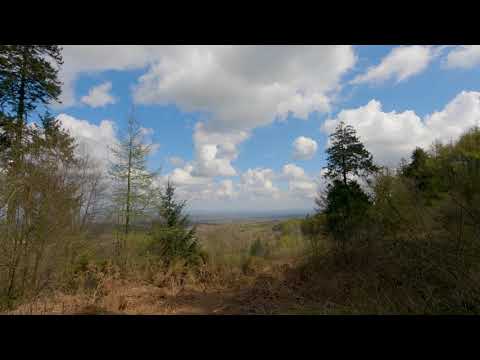
Blackdown Hills, Staple Hill. GoPro Hero 9 (5k)

A test of the Gopro Hero 9 in 5K30 using the linear lens mostly and Hypersmooth 3.0 without the horizon leveling. Staple Hill is a ...

Autumnal churchyard in Somerset ☺ 🍂 #shortsyoutube #shortsvideo #shorts

A little explore of a beautiful Church (St Peter's) in a lovely Somerset village called Staple Fitzpaine.

Nearby Amenities

Located within 500m of 50.964887,-3.0784445
The data included in this document is from www.openstreetmap.org. The data is made available under ODbL.

Have you been to Bilscombe Wood?

Leave your review of Bilscombe Wood below (or comments, questions and feedback).