Rawfold Wood

Wood, Forest in Lancashire South Lakeland

England

Rawfold Wood

Entrance to Duddon Hall
Entrance to Duddon Hall Credit: P Gaskell

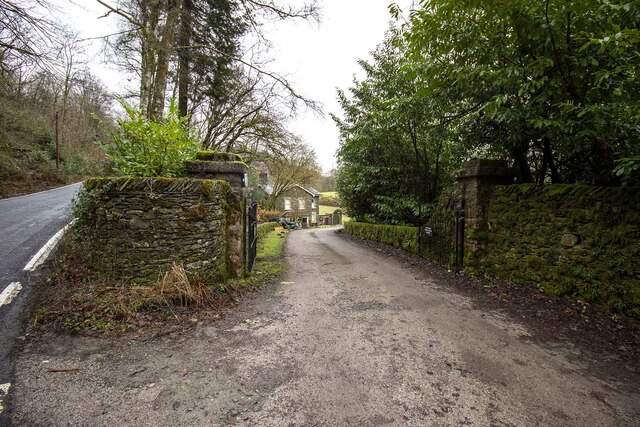
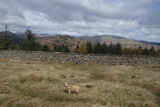
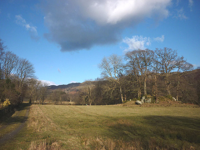
Rawfold Wood is a picturesque woodland located in Lancashire, England. Covering an area of approximately 50 acres, it is a stunning natural habitat that attracts visitors throughout the year. The wood is situated near the village of Rawfold, hence its name.

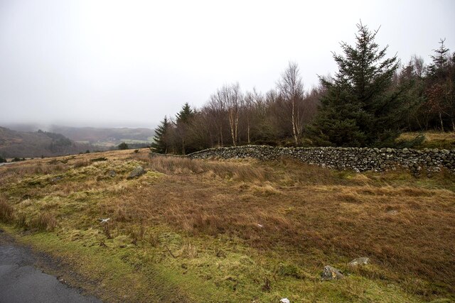
The woodland is characterized by a diverse range of tree species, including oak, beech, birch, and pine. This variety creates a rich and vibrant ecosystem, supporting a wide array of flora and fauna. The forest floor is adorned with carpets of bluebells, wild garlic, and ferns, adding to its enchanting beauty.

Rawfold Wood offers a peaceful and tranquil environment, making it an ideal destination for nature lovers and outdoor enthusiasts. Visitors can explore the woodland through a network of well-maintained footpaths, which wind their way through the trees. These paths provide opportunities for leisurely walks, jogging, and even birdwatching.

The wood is also home to various wildlife species, such as deer, badgers, foxes, and a variety of birds. Birdwatchers can spot species such as woodpeckers, owls, and nuthatches among the towering trees. Nature enthusiasts can enjoy the sights and sounds of the forest, immersing themselves in the natural beauty of the surroundings.

Rawfold Wood is open to the public and managed by the local council. It is easily accessible, with ample parking facilities and signposted entrances. The wood provides a peaceful retreat from the hustle and bustle of everyday life, allowing visitors to reconnect with nature and enjoy the tranquility of this beautiful woodland.

If you have any feedback on the listing, please let us know in the comments section below.

Rawfold Wood Images

Images are sourced within 2km of 54.295766/-3.2348864 or Grid Reference SD1989. Thanks to Geograph Open Source API. All images are credited.

Entrance to Duddon Hall
Smallthwaite Plantation
Recent felling on Coops Wood has opened up a view of the bridge over the Duddon
Sawmill at Beckfoot On The edge of the hamlet of Beckfoot on the delightful Ulpha Park path.
Sawmill at Beckfoot
On The edge of the hamlet of Beckfoot on the delightful Ulpha Park path.
Bluebells, Furnace Wood In deepest Duddon
Bluebells, Furnace Wood
In deepest Duddon
Dry Tarn, Barrow The drought has dried up this tiny tarn. I suspect it is the same as <a href="https://www.geograph.org.uk/photo/3741119">SD1888 : Small tarn on Barrow</a>
Dry Tarn, Barrow
The drought has dried up this tiny tarn. I suspect it is the same as SD1888 : Small tarn on Barrow
Ascending Barrow Looking towards the Duddon estuary
Ascending Barrow
Looking towards the Duddon estuary
On Barrow A rarely frequented top
On Barrow
A rarely frequented top
On Barrow Looks like the top
On Barrow
Looks like the top
Descending Barrow Penn, our next objective in shot
Descending Barrow
Penn, our next objective in shot
Forest Edge Under Barrow
Forest Edge
Under Barrow
Duddon iron furnace (disused) A charcoal burning blast furnace dating from 1736. Isaac Wilkinson's cylinder bellows powered by water were first applied here. It is a Scheduled Ancient Monument but is temporarily closed to the public while structural issues are considered. There is a good view from the bridleway that goes past the site.
Duddon iron furnace (disused)
A charcoal burning blast furnace dating from 1736. Isaac Wilkinson's cylinder bellows powered by water were first applied here. It is a Scheduled Ancient Monument but is temporarily closed to the public while structural issues are considered. There is a good view from the bridleway that goes past the site.
Pasture by the Duddon The track from Beckfoot skirts this on the west with the Duddon flowing to Rawfold Bridge on the right.
Pasture by the Duddon
The track from Beckfoot skirts this on the west with the Duddon flowing to Rawfold Bridge on the right.
Pivot type mark This Pivot style mark can be found on the SE parapet of the bridge.
Pivot type mark
This Pivot style mark can be found on the SE parapet of the bridge.
Ordnance Survey Rivet This OS rivet can be found on a boulder NE side of the road. It marks a point 128.778m above mean sea level.
Ordnance Survey Rivet
This OS rivet can be found on a boulder NE side of the road. It marks a point 128.778m above mean sea level.
Ordnance Survey Pivot This OS pivot can be found on a boulder north side of the road. It marks a point 151.068m above mean sea level.
Ordnance Survey Pivot
This OS pivot can be found on a boulder north side of the road. It marks a point 151.068m above mean sea level.
Ordnance Survey Pivot This OS pivot can be found on a boulder SE side of the road. It marks a point 170.478m above mean sea level.
Ordnance Survey Pivot
This OS pivot can be found on a boulder SE side of the road. It marks a point 170.478m above mean sea level.
Ordnance Survey Pivot This OS pivot can be found on a boulder NW side of the road. It marks a point 185.148m above mean sea level.
Ordnance Survey Pivot
This OS pivot can be found on a boulder NW side of the road. It marks a point 185.148m above mean sea level.
Show me another place!

Rawfold Wood is located at Grid Ref: SD1989 (Lat: 54.295766, Lng: -3.2348864)

Administrative County: Cumbria

District: South Lakeland

Police Authority: Cumbria

What 3 Words

///dumps.iterative.unzips. Near Millom, Cumbria

Related Wikis

Duddon Valley

The Duddon Valley is a valley in the southern Lake District National Park in Cumbria, England. The River Duddon flows through the valley, rising in the...

Bank End

Bank End is a village in Cumbria, England. == External links == Media related to Bank End, South Lakeland at Wikimedia Commons

Duddon furnace

The Duddon furnace (Grid Reference SD 197883) is a surviving charcoal-fuelled blast furnace near Broughton-in-Furness in Cumbria. It is on the west side...

Duddon Bridge

Duddon Bridge is a hamlet in Cumbria, England. == References ==

Broughton Mills

Broughton Mills is a village in Cumbria, England, located 3.5 kilometres from the larger town of Broughton-in-furness. The village consists of about 40...

Broughton-in-Furness

Broughton in Furness is a market town in the civil parish of Broughton West in the Westmorland and Furness district of Cumbria, England. It had a population...

Dunnerdale Fells

Dunnerdale Fells is an upland area in the English Lake District, between Ulpha and Broughton Mills, Cumbria. It is the subject of a chapter of Wainwright...

Great Stickle

Great Stickle is a fell located in the southern Lake District of England with an altitude of 305 m (1,001 ft). Alfred Wainwright included it in the Stickle...

Nearby Amenities

Located within 500m of 54.295766,-3.2348864
Barrier: bollard
Lat/Long: 54.295723/-3.241371
Barrier: bollard
Lat/Long: 54.2957216/-3.2412085
Barrier: bollard
Lat/Long: 54.2956743/-3.2412285
Rawfold
Place: locality
Lat/Long: 54.2937104/-3.2296949
Barrier: stile
Lat/Long: 54.2961354/-3.2320577
Barrier: stile
Lat/Long: 54.2963952/-3.2302436
Barrier: stile
Lat/Long: 54.2964185/-3.230168
Power: pole
Lat/Long: 54.2990481/-3.2397358
Power: pole
Lat/Long: 54.2987806/-3.2382993
Power: pole
Lat/Long: 54.2986879/-3.2372827
Power: pole
Lat/Long: 54.2985575/-3.2355478
Power: pole
Lat/Long: 54.2977841/-3.2383345
The data included in this document is from www.openstreetmap.org. The data is made available under ODbL.

Have you been to Rawfold Wood?

Leave your review of Rawfold Wood below (or comments, questions and feedback).