Combe Wood

Wood, Forest in Somerset Somerset West and Taunton

England

Combe Wood

Meadowside Cottages, Combe Florey See also <a href="https://www.geograph.org.uk/photo/5028206">ST1531 : Combe Florey View</a>.
Meadowside Cottages, Combe Florey Credit: Stephen Craven

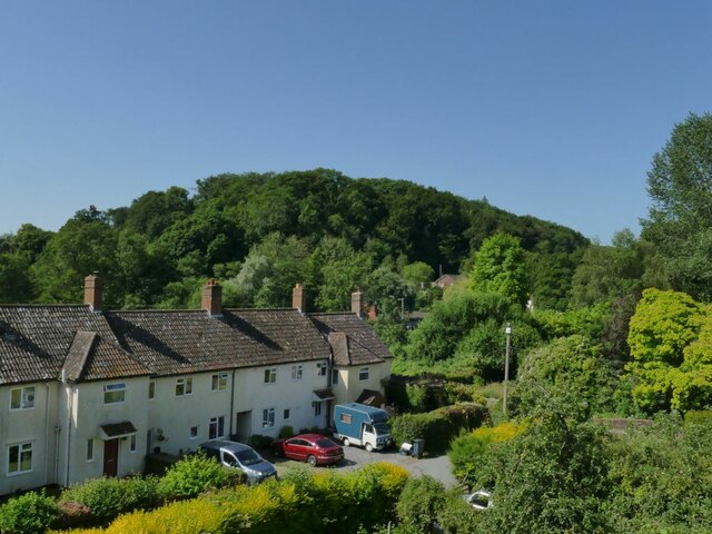
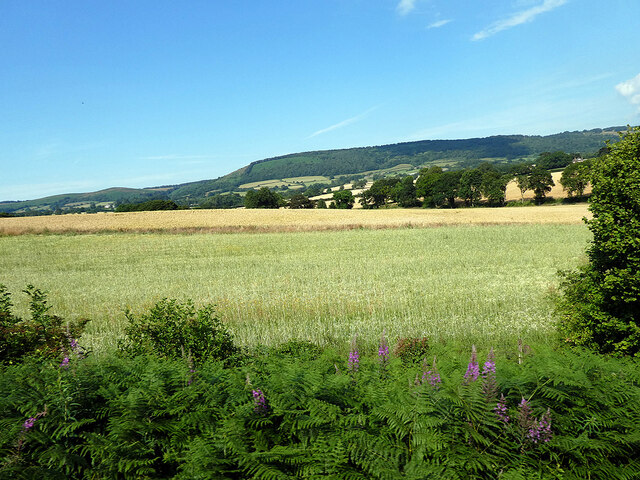
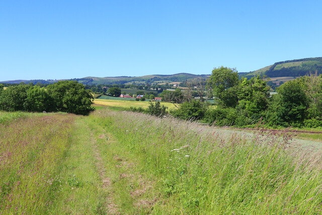
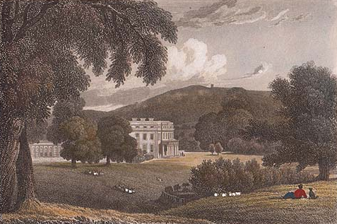
Combe Wood, located in Somerset, England, is a picturesque woodland area known for its natural beauty and diverse ecosystem. Spanning approximately 100 hectares, the wood is situated along the steep slopes of the Quantock Hills, offering visitors breathtaking panoramic views of the surrounding countryside.

The wood is primarily composed of broadleaved trees, including oak, beech, and ash, creating a dense and vibrant canopy that provides shelter and sustenance for a variety of wildlife. The forest floor is carpeted with wildflowers, ferns, and mosses, adding to the enchanting atmosphere of the wood.

Combe Wood is a popular destination for nature enthusiasts, hikers, and birdwatchers due to its rich biodiversity. The wood is home to a wide range of animal species, including deer, badgers, foxes, and a plethora of bird species such as woodpeckers, owls, and thrushes. The tranquil atmosphere and peaceful surroundings make it an ideal spot for birdwatching and wildlife photography.

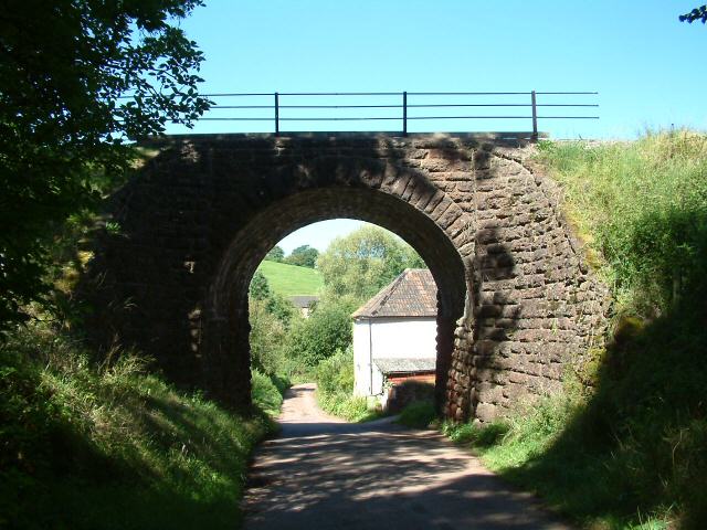
There are several well-maintained walking trails within Combe Wood, allowing visitors to explore its beauty at their own pace. The trails wind through the wood, passing by babbling streams, clearings with ancient stone walls, and hidden glades that feel like secret hideaways. Along the way, walkers may encounter fascinating points of interest, such as the remnants of an Iron Age hillfort known as Trendle Ring, which adds a touch of historical significance to the wood.

Overall, Combe Wood is a captivating natural gem, offering visitors an opportunity to immerse themselves in the tranquility of nature while enjoying its abundant wildlife and breathtaking landscapes.

If you have any feedback on the listing, please let us know in the comments section below.
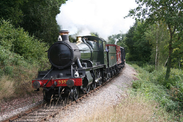
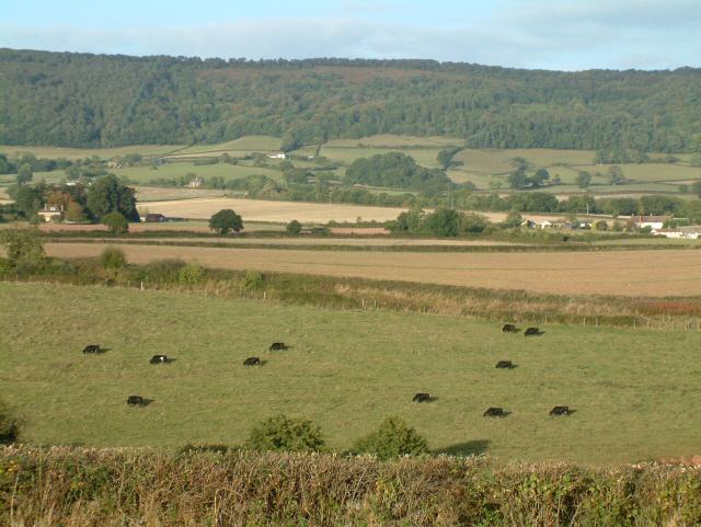
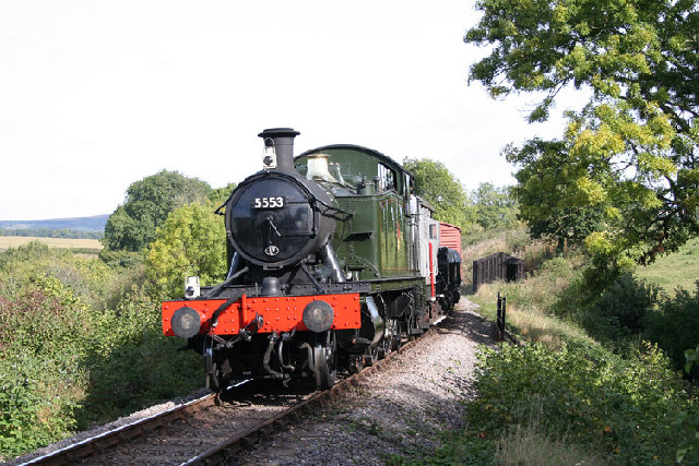
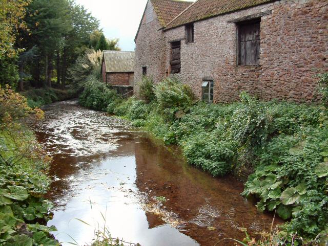
Combe Wood Images

Images are sourced within 2km of 51.079467/-3.226463 or Grid Reference ST1431. Thanks to Geograph Open Source API. All images are credited.

Meadowside Cottages, Combe Florey See also <a href="https://www.geograph.org.uk/photo/5028206">ST1531 : Combe Florey View</a>.
Meadowside Cottages, Combe Florey
Somerset County Council fingerpost in Combe Florey parish SCC fingerpost condition in January 2022, prior to refurbishment which is due in the Summer of 2022. Located at the Combe Florey-Ash Priors crossroads on  the B3224.
Somerset County Council fingerpost in Combe Florey parish
SCC fingerpost condition in January 2022, prior to refurbishment which is due in the Summer of 2022. Located at the Combe Florey-Ash Priors crossroads on the B3224.
Somerset County Council fingerpost - on the A358 Combe Florey SCC fingerpost condition in January 2022 prior to refurbishment, which is due to take place in the Summer of 2022. The post is on the A358 at the junction with the road leading into Combe Florey village.
Somerset County Council fingerpost - on the A358 Combe Florey
SCC fingerpost condition in January 2022 prior to refurbishment, which is due to take place in the Summer of 2022. The post is on the A358 at the junction with the road leading into Combe Florey village.
Crops beside the railway Near Crowcombe.
Crops beside the railway
Near Crowcombe.
Somerset County Council fingerpost - A358 Combe Florey Somerset County Council fingerpost - on the A358 at the Combe Florey junction which was refurbished in July 2022 as part of the Somerset County Council fingerpost restoration project. Repainting was undertaken by 2 volunteers working on behalf of Combe Florey parish council which provided the paints and materials.
Somerset County Council fingerpost - A358 Combe Florey
Somerset County Council fingerpost - on the A358 at the Combe Florey junction which was refurbished in July 2022 as part of the Somerset County Council fingerpost restoration project. Repainting was undertaken by 2 volunteers working on behalf of Combe Florey parish council which provided the paints and materials.
Somerset County Council fingerpost - on the B3224 at the Ash Priors - Combe Florey Crossroads This fingerpost was refurbished in July 2022 as part of the Somerset County Council fingerpost restoration project. Repainting was undertaken by 2 volunteers working on behalf of Combe Florey parish Council which provided the paints and  materials.
Somerset County Council fingerpost - on the B3224 at the Ash Priors - Combe Florey Crossroads
This fingerpost was refurbished in July 2022 as part of the Somerset County Council fingerpost restoration project. Repainting was undertaken by 2 volunteers working on behalf of Combe Florey parish Council which provided the paints and materials.
Direction Sign - Signpost on the B3224 south of Lydeard St Lawrence Located on the west side of the junction of the B3224 and the minor road north to the village in Lydeard St Lawrence parish. 4 arms and pyramid finial. See also <a title="https://www.geograph.org.uk/photo/2151544" href="https://www.geograph.org.uk/photo/2151544">Link</a>.

Milestone Society National ID: SO_ST1231A
Direction Sign - Signpost on the B3224 south of Lydeard St Lawrence
Located on the west side of the junction of the B3224 and the minor road north to the village in Lydeard St Lawrence parish. 4 arms and pyramid finial. See also Link. Milestone Society National ID: SO_ST1231A
Ordnance Survey Cut Mark This OS cut mark can be found on the porch of St Peter's Church. It marks a point 80.164m above mean sea level.
Ordnance Survey Cut Mark
This OS cut mark can be found on the porch of St Peter's Church. It marks a point 80.164m above mean sea level.
Nornvis Bridge Fields near the railway line.
Nornvis Bridge
Fields near the railway line.
Taunton Deane : Grassy Field A grassy field with muddy tyre tracks.
Taunton Deane : Grassy Field
A grassy field with muddy tyre tracks.
West Somerset Railway, Churchlands Bridge, Combe Florey The steam-hauled train is heading up the grade to Crowcombe Heathfield
West Somerset Railway, Churchlands Bridge, Combe Florey
The steam-hauled train is heading up the grade to Crowcombe Heathfield
Nethercott Bridge The bridge carries the West Somerset Railway high above the quiet hamlet of Nethercott...
Nethercott Bridge
The bridge carries the West Somerset Railway high above the quiet hamlet of Nethercott...
Combe Florey: village street The street leads to Combe Florey church, the Old Manor House and on to a junction with the A358 Taunton-Minehead road. The village was home to the writer Evelyn Waugh, who died in 1966
Combe Florey: village street
The street leads to Combe Florey church, the Old Manor House and on to a junction with the A358 Taunton-Minehead road. The village was home to the writer Evelyn Waugh, who died in 1966
Combe Florey: the West Somerset Railway near Nethercott Locomotive 9351 on a demonstration freight train from Bishop’s Lydeard to Williton. Note – a Photographer’s Lineside Pass has to be obtained from the WSR office at Minehead for access to railway property other than the trains and stations
Combe Florey: the West Somerset Railway near Nethercott
Locomotive 9351 on a demonstration freight train from Bishop’s Lydeard to Williton. Note – a Photographer’s Lineside Pass has to be obtained from the WSR office at Minehead for access to railway property other than the trains and stations
Railway Cutting near Trebles Holford
Combe Florey: West Somerset Railway at Nethercott 5553 heads a demonstration freight train on this heritage line. Note: a Photographer’s Lineside Pass has to be obtained from the railway’s office at Minehead for shots such as this on railway property
Combe Florey: West Somerset Railway at Nethercott
5553 heads a demonstration freight train on this heritage line. Note: a Photographer’s Lineside Pass has to be obtained from the railway’s office at Minehead for shots such as this on railway property
Farm at Nethercott Nearby was a notice about planning permission to convert the old stone barn into three dwellings...
Farm at Nethercott
Nearby was a notice about planning permission to convert the old stone barn into three dwellings...
Lane to Pyleigh The lane to Pyleigh and West Leigh off the B3224.
Lane to Pyleigh
The lane to Pyleigh and West Leigh off the B3224.
Show me another place!

Combe Wood is located at Grid Ref: ST1431 (Lat: 51.079467, Lng: -3.226463)

Administrative County: Somerset

District: Somerset West and Taunton

Police Authority: Avon and Somerset

What 3 Words

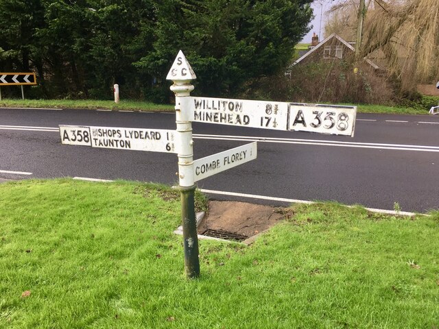
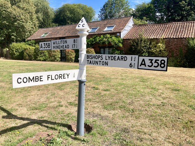
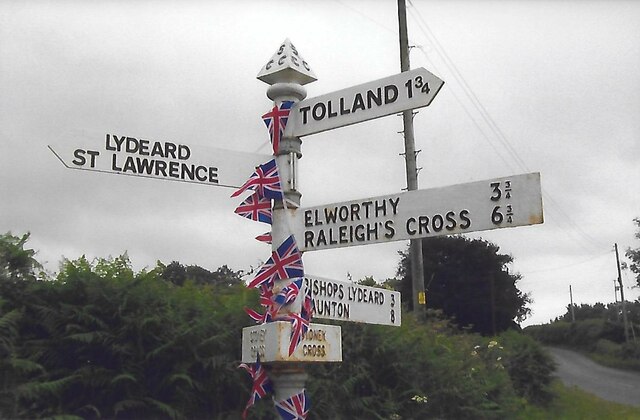
///roaring.dishing.amps. Near Bishops Lydeard, Somerset

Related Wikis

Combe Florey House

Combe Florey House in Combe Florey, Somerset, England is a country house dating from the early 18th century. It replaced an Elizabethan manor house which...

Combe Florey

Combe Florey is a village and civil parish in Somerset, England, situated 6 miles (9.7 km) northwest of Taunton, on the West Somerset Railway. The village...

Lydeard St Lawrence

Lydeard St Lawrence or St Lawrence Lydiard is a village and civil parish in Somerset, England, situated 7 miles (11.3 km) north west of Taunton. The village...

Cockercombe tuff

Cockercombe Tuff is a greenish-grey, hard pyroclastic rock, formed by the compression of volcanic ash containing high quantities of chlorite, which gives...

Cockercombe

Cockercombe is a hamlet within the civil parish of West Bagborough in the Somerset West and Taunton district of Somerset, England, approximately 8.3 miles...

Crowcombe Heathfield railway station

Crowcombe Heathfield railway station is a station on the West Somerset Railway, a heritage railway in Somerset, England. It is situated 2 miles (3.2 km...

Sandhill Park

Sandhill Park in the parish of Bishops Lydeard, Somerset, England is a derelict country house built in about 1720. It was used in the 20th century as a...

Church of the Holy Trinity, Ash Priors

The Church of the Holy Trinity in Ash Priors, Somerset, England was built in the 15th century. It is a Grade II* listed building. == History == In the...

Nearby Amenities

Located within 500m of 51.079467,-3.226463
Brand: National Grid
Brand Wikidata: Q1465461
Material: wood
Operator: National Grid Electricity Distribution Plc
Operator Old: Western Power Distribution
Operator Wikidata: Q7988183
Owner: National Grid Electricity Distribution (South West) Plc
Owner Wikidata: Q114397866
Power: pole
Lat/Long: 51.0755072/-3.2277999
Access: private
Door: overhead
Entrance: yes
Motorcar: private
Lat/Long: 51.0783215/-3.2289363
Brand: National Grid
Brand Wikidata: Q1465461
Material: wood
Operator: National Grid Electricity Distribution Plc
Operator Old: Western Power Distribution
Operator Wikidata: Q7988183
Owner: National Grid Electricity Distribution (South West) Plc
Owner Wikidata: Q114397866
Power: pole
Lat/Long: 51.0780608/-3.2275611
Brand: National Grid
Brand Wikidata: Q1465461
Material: wood
Operator: National Grid Electricity Distribution Plc
Operator Old: Western Power Distribution
Operator Wikidata: Q7988183
Owner: National Grid Electricity Distribution (South West) Plc
Owner Wikidata: Q114397866
Power: pole
Lat/Long: 51.0781442/-3.2283483
Brand: National Grid
Brand Wikidata: Q1465461
Material: wood
Operator: National Grid Electricity Distribution Plc
Operator Old: Western Power Distribution
Operator Wikidata: Q7988183
Owner: National Grid Electricity Distribution (South West) Plc
Owner Wikidata: Q114397866
Power: pole
Lat/Long: 51.0779218/-3.2265714
Brand: National Grid
Brand Wikidata: Q1465461
Guyed: yes
Material: wood
Operator: National Grid Electricity Distribution Plc
Operator Old: Western Power Distribution
Operator Wikidata: Q7988183
Owner: National Grid Electricity Distribution (South West) Plc
Owner Wikidata: Q114397866
Power: pole
Lat/Long: 51.0774246/-3.2252571
Brand: National Grid
Brand Wikidata: Q1465461
Frequency: 50
Location Transition: yes
Material: wood
Operator: National Grid Electricity Distribution Plc
Operator Old: Western Power Distribution
Operator Wikidata: Q7988183
Owner: National Grid Electricity Distribution (South West) Plc
Owner Wikidata: Q114397866
Phases: 1
Power: pole
Transformer: distribution
Lat/Long: 51.0762282/-3.2238181
Brand: National Grid
Brand Wikidata: Q1465461
Material: wood
Operator: National Grid Electricity Distribution Plc
Operator Old: Western Power Distribution
Operator Wikidata: Q7988183
Owner: National Grid Electricity Distribution (South West) Plc
Owner Wikidata: Q114397866
Power: pole
Lat/Long: 51.0768629/-3.2245778
Brand: National Grid
Brand Wikidata: Q1465461
Material: wood
Operator: National Grid Electricity Distribution Plc
Operator Old: Western Power Distribution
Operator Wikidata: Q7988183
Owner: National Grid Electricity Distribution (South West) Plc
Owner Wikidata: Q114397866
Power: pole
Lat/Long: 51.077064/-3.2304338
Brand: National Grid
Brand Wikidata: Q1465461
Material: wood
Operator: National Grid Electricity Distribution Plc
Operator Old: Western Power Distribution
Operator Wikidata: Q7988183
Owner: National Grid Electricity Distribution (South West) Plc
Owner Wikidata: Q114397866
Power: pole
Lat/Long: 51.0784905/-3.2328518
Brand: National Grid
Brand Wikidata: Q1465461
Material: wood
Operator: National Grid Electricity Distribution Plc
Operator Old: Western Power Distribution
Operator Wikidata: Q7988183
Owner: National Grid Electricity Distribution (South West) Plc
Owner Wikidata: Q114397866
Power: pole
Lat/Long: 51.0777566/-3.2315945
The data included in this document is from www.openstreetmap.org. The data is made available under ODbL.

Have you been to Combe Wood?

Leave your review of Combe Wood below (or comments, questions and feedback).