Combe Florey

Civil Parish in Somerset Somerset West and Taunton

England

Combe Florey

Path through pea crop near Ash Priors
Path through pea crop near Ash Priors Credit: Roger Cornfoot

Combe Florey is a civil parish located in the county of Somerset, England. Situated on the eastern slopes of the Quantock Hills, it lies approximately 4 miles southwest of the town of Taunton. The parish covers an area of about 1,200 acres and has a population of around 250 people.

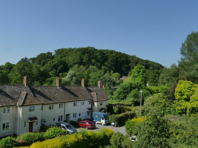
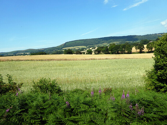
Combe Florey is a predominantly rural area, known for its picturesque countryside and charming landscapes. The parish is characterized by rolling hills, lush green fields, and dense woodland, offering a peaceful and idyllic setting for residents and visitors alike.

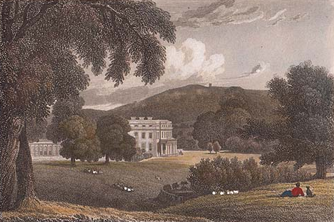
The village itself is small and compact, with a cluster of traditional stone-built houses and cottages. The centerpiece of the village is the Grade II* listed Combe Florey House, a stunning Elizabethan mansion that dates back to the 16th century. The house, with its beautiful gardens and parkland, adds to the historic charm of the area.

Despite its small size, Combe Florey has a rich history. It was mentioned in the Domesday Book of 1086 and has been home to several notable figures throughout the centuries, including the poet Samuel Taylor Coleridge, who lived in the village for a period.

The parish is surrounded by a network of footpaths and bridleways, making it a popular destination for outdoor enthusiasts. The Quantock Hills, designated an Area of Outstanding Natural Beauty, offer opportunities for hiking, cycling, and horse riding, allowing visitors to explore the stunning countryside and enjoy breathtaking views.

Overall, Combe Florey is a charming and picturesque civil parish, offering a tranquil escape in the heart of the Somerset countryside.

If you have any feedback on the listing, please let us know in the comments section below.
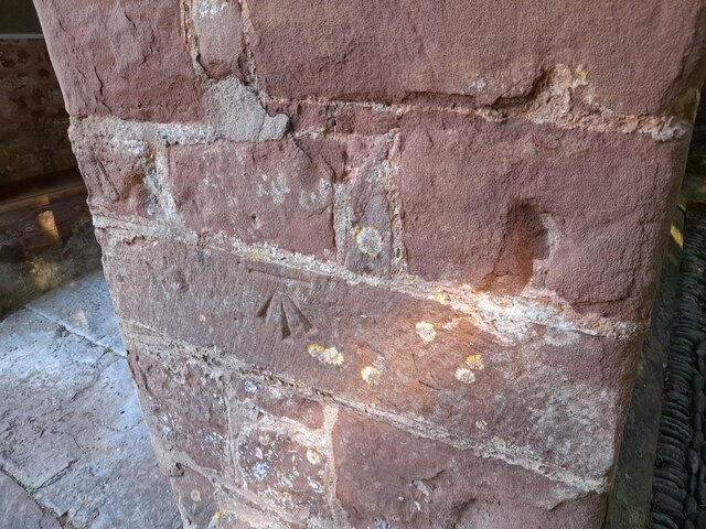
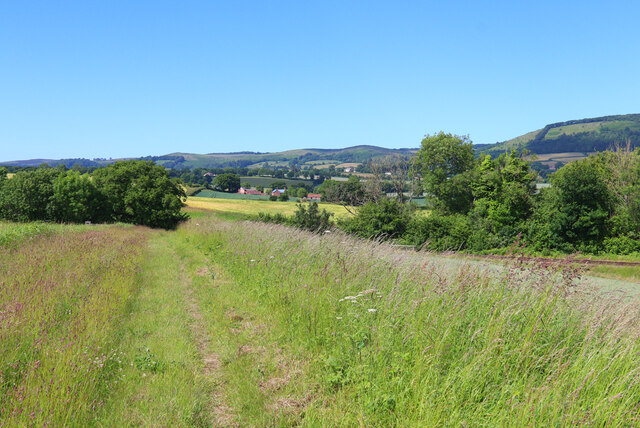
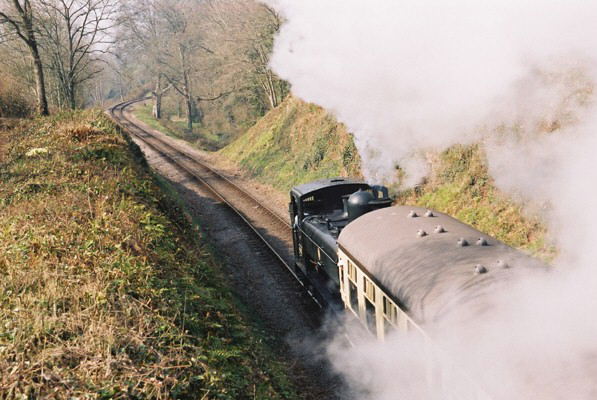
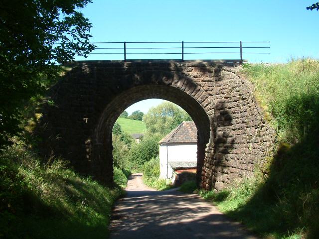
Combe Florey Images

Images are sourced within 2km of 51.078083/-3.215093 or Grid Reference ST1431. Thanks to Geograph Open Source API. All images are credited.

Path through pea crop near Ash Priors
Barn and horse trough
Meadowside Cottages, Combe Florey See also <a href="https://www.geograph.org.uk/photo/5028206">ST1531 : Combe Florey View</a>.
Meadowside Cottages, Combe Florey
Somerset County Council fingerpost in Combe Florey parish SCC fingerpost condition in January 2022, prior to refurbishment which is due in the Summer of 2022. Located at the Combe Florey-Ash Priors crossroads on  the B3224.
Somerset County Council fingerpost in Combe Florey parish
SCC fingerpost condition in January 2022, prior to refurbishment which is due in the Summer of 2022. Located at the Combe Florey-Ash Priors crossroads on the B3224.
Somerset County Council fingerpost - on the A358 Combe Florey SCC fingerpost condition in January 2022 prior to refurbishment, which is due to take place in the Summer of 2022. The post is on the A358 at the junction with the road leading into Combe Florey village.
Somerset County Council fingerpost - on the A358 Combe Florey
SCC fingerpost condition in January 2022 prior to refurbishment, which is due to take place in the Summer of 2022. The post is on the A358 at the junction with the road leading into Combe Florey village.
Crops beside the railway Near Crowcombe.
Crops beside the railway
Near Crowcombe.
Somerset County Council fingerpost - A358 Combe Florey Somerset County Council fingerpost - on the A358 at the Combe Florey junction which was refurbished in July 2022 as part of the Somerset County Council fingerpost restoration project. Repainting was undertaken by 2 volunteers working on behalf of Combe Florey parish council which provided the paints and materials.
Somerset County Council fingerpost - A358 Combe Florey
Somerset County Council fingerpost - on the A358 at the Combe Florey junction which was refurbished in July 2022 as part of the Somerset County Council fingerpost restoration project. Repainting was undertaken by 2 volunteers working on behalf of Combe Florey parish council which provided the paints and materials.
Somerset County Council fingerpost - on the B3224 at the Ash Priors - Combe Florey Crossroads This fingerpost was refurbished in July 2022 as part of the Somerset County Council fingerpost restoration project. Repainting was undertaken by 2 volunteers working on behalf of Combe Florey parish Council which provided the paints and  materials.
Somerset County Council fingerpost - on the B3224 at the Ash Priors - Combe Florey Crossroads
This fingerpost was refurbished in July 2022 as part of the Somerset County Council fingerpost restoration project. Repainting was undertaken by 2 volunteers working on behalf of Combe Florey parish Council which provided the paints and materials.
Ordnance Survey Cut Mark This OS cut mark can be found on the porch of St Peter's Church. It marks a point 80.164m above mean sea level.
Ordnance Survey Cut Mark
This OS cut mark can be found on the porch of St Peter's Church. It marks a point 80.164m above mean sea level.
Nornvis Bridge Fields near the railway line.
Nornvis Bridge
Fields near the railway line.
Taunton Deane : Countryside Scenery Looking out across the countryside of the Taunton Deane District with the Quantock Hills in view.
Taunton Deane : Countryside Scenery
Looking out across the countryside of the Taunton Deane District with the Quantock Hills in view.
Taunton Deane : Countryside Scenery Looking out across the Taunton Deane countryside.
Taunton Deane : Countryside Scenery
Looking out across the Taunton Deane countryside.
Taunton Deane : Countryside Scenery Looking out across the Taunton Deane District.
Taunton Deane : Countryside Scenery
Looking out across the Taunton Deane District.
Taunton Deane : Grassy Field A grassy field with muddy tyre tracks.
Taunton Deane : Grassy Field
A grassy field with muddy tyre tracks.
Taunton Deane : Grassy Field & Horses Horses in a grassy field overlooking the Quantocks.
Taunton Deane : Grassy Field & Horses
Horses in a grassy field overlooking the Quantocks.
West Somerset Railway, Churchlands Bridge, Combe Florey The steam-hauled train is heading up the grade to Crowcombe Heathfield
West Somerset Railway, Churchlands Bridge, Combe Florey
The steam-hauled train is heading up the grade to Crowcombe Heathfield
Nethercott Bridge The bridge carries the West Somerset Railway high above the quiet hamlet of Nethercott...
Nethercott Bridge
The bridge carries the West Somerset Railway high above the quiet hamlet of Nethercott...
Combe Florey: village street The street leads to Combe Florey church, the Old Manor House and on to a junction with the A358 Taunton-Minehead road. The village was home to the writer Evelyn Waugh, who died in 1966
Combe Florey: village street
The street leads to Combe Florey church, the Old Manor House and on to a junction with the A358 Taunton-Minehead road. The village was home to the writer Evelyn Waugh, who died in 1966
Show me another place!

Combe Florey is located at Grid Ref: ST1431 (Lat: 51.078083, Lng: -3.215093)

Administrative County: Somerset

District: Somerset West and Taunton

Police Authority: Avon and Somerset

What 3 Words

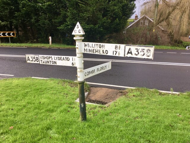
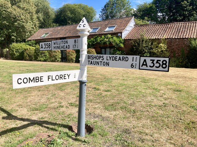
///cricket.allies.decades. Near Bishops Lydeard, Somerset

Related Wikis

Combe Florey House

Combe Florey House in Combe Florey, Somerset, England is a country house dating from the early 18th century. It replaced an Elizabethan manor house which...

Combe Florey

Combe Florey is a village and civil parish in Somerset, England, situated 6 miles (9.7 km) northwest of Taunton, on the West Somerset Railway. The village...

Cockercombe tuff

Cockercombe Tuff is a greenish-grey, hard pyroclastic rock, formed by the compression of volcanic ash containing high quantities of chlorite, which gives...

Cockercombe

Cockercombe is a hamlet within the civil parish of West Bagborough in the Somerset West and Taunton district of Somerset, England, approximately 8.3 miles...
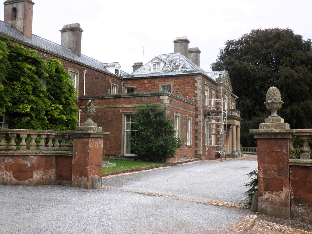
Sandhill Park

Sandhill Park in the parish of Bishops Lydeard, Somerset, England is a derelict country house built in about 1720. It was used in the 20th century as a...

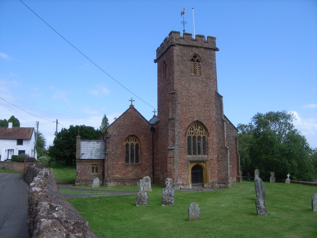
Church of the Holy Trinity, Ash Priors

The Church of the Holy Trinity in Ash Priors, Somerset, England was built in the 15th century. It is a Grade II* listed building. == History == In the...

Ash Priors

Ash Priors is a village and parish in Somerset, England, situated 5 miles (8.0 km) north west of Taunton. The village has a population of 155. == History... ==

Lydeard House

Lydeard House in Bishops Lydeard, Somerset, England was built in the mid 18th century. It is a Grade II* listed building. == History == Lydeard House was...

Nearby Amenities

Located within 500m of 51.078083,-3.215093
Give Way
Direction: backward
Source Give Way: sign
Lat/Long: 51.0780212/-3.2110561
Direction: NNW
Layer: 1
Location: bridge
Maxheight: 4.2
Traffic Sign: maxheight
Lat/Long: 51.0782322/-3.2110787
Brand: National Grid
Brand Wikidata: Q1465461
Material: wood
Operator: National Grid Electricity Distribution Plc
Operator Old: Western Power Distribution
Operator Wikidata: Q7988183
Owner: National Grid Electricity Distribution (South West) Plc
Owner Wikidata: Q114397866
Power: pole
Lat/Long: 51.0767961/-3.2111098
Brand: National Grid
Brand Wikidata: Q1465461
Frequency: 50
Location Transition: yes
Material: wood
Operator: National Grid Electricity Distribution Plc
Operator Old: Western Power Distribution
Operator Wikidata: Q7988183
Owner: National Grid Electricity Distribution (South West) Plc
Owner Wikidata: Q114397866
Phases: 1
Power: pole
Transformer: distribution
Lat/Long: 51.0775932/-3.2120566
Brand: National Grid
Brand Wikidata: Q1465461
Material: wood
Operator: National Grid Electricity Distribution Plc
Operator Old: Western Power Distribution
Operator Wikidata: Q7988183
Owner: National Grid Electricity Distribution (South West) Plc
Owner Wikidata: Q114397866
Power: pole
Lat/Long: 51.0759577/-3.2100932
Yes
Access: private
Barrier: cattle_grid
Bicycle: no
Emergency: yes
Goods: yes
Hgv: no
Motorcar: yes
Motorcycle: yes
Lat/Long: 51.0744587/-3.2119788
Turning Circle
Lat/Long: 51.0742297/-3.2128224
Access: private
Door: hinged
Entrance: main
Level: 0
Lat/Long: 51.0748499/-3.2133572
Access: private
Door: hinged
Door Type: double
Entrance: yes
Foot: yes
Horse: no
Level: 0
Motorcar: no
Lat/Long: 51.0749132/-3.2137363
Access: private
Door: hinged
Door Type: double
Entrance: yes
Foot: yes
Horse: no
Level: 0
Motorcar: no
Lat/Long: 51.0749244/-3.2136478
Access: private
Door: hinged
Door Type: double
Entrance: yes
Foot: yes
Horse: no
Level: 0
Motorcar: no
Lat/Long: 51.0749499/-3.2135963
Access: private
Door: folding
Entrance: main
Level: 1
Lat/Long: 51.0747911/-3.2138149
Access: private
Door: folding
Entrance: main
Level: 1
Lat/Long: 51.0748996/-3.2138377
Access: private
Door: hinged
Door Type: double
Entrance: yes
Horse: no
Level: 0
Motorcar: yes
Lat/Long: 51.0748479/-3.2137728
Access: private
Door: hinged
Door Type: double
Entrance: yes
Horse: no
Level: 0
Motorcar: yes
Lat/Long: 51.0748089/-3.2137238
Access: private
Door: hinged
Door Type: double
Entrance: yes
Foot: yes
Horse: no
Level: 0
Motorcar: no
Lat/Long: 51.074767/-3.2135235
Access: private
Door: hinged
Door Type: double
Entrance: yes
Horse: no
Level: 0
Motorcar: yes
Lat/Long: 51.0747894/-3.2136993
Access: private
Door: hinged
Door Type: double
Entrance: yes
Horse: no
Level: 0
Motorcar: yes
Lat/Long: 51.0747301/-3.2136507
Access: private
Door: hinged
Door Type: double
Entrance: yes
Foot: yes
Horse: no
Level: 0
Motorcar: no
Lat/Long: 51.0749372/-3.2136221
Access: private
Door: hinged
Door Type: double
Entrance: yes
Horse: no
Level: 0
Motorcar: yes
Lat/Long: 51.074746/-3.2136707
Access: private
Door: hinged
Door Type: double
Entrance: yes
Horse: no
Level: 0
Motorcar: yes
Lat/Long: 51.0748284/-3.2137483
Access: private
Door: hinged
Door Type: single
Entrance: yes
Foot: yes
Horse: no
Level: 0
Motorcar: no
Lat/Long: 51.074872/-3.2138031
Access: private
Door: hinged
Door Type: double
Entrance: yes
Foot: yes
Horse: yes
Level: 0
Motorcar: no
Lat/Long: 51.0749731/-3.2135496
Access: private
Door: hinged
Door Type: double
Entrance: yes
Motorcar: yes
Lat/Long: 51.078503/-3.2124201
Access: private
Door: hinged
Entrance: main
Foot: yes
Motorcar: no
Lat/Long: 51.0778781/-3.2115538
Access: private
Door: hinged
Door Type: double
Entrance: yes
Motorcar: private
Lat/Long: 51.0779093/-3.2111548
Grit Bin
Colour: yellow
Content: sand
Direction: S
Material: plastic
Lat/Long: 51.0780385/-3.2111168
Access: private
Door: hinged
Door Type: double
Entrance: yes
Foot: yes
Motorcar: private
Lat/Long: 51.0778002/-3.2116314
Access: private
Door: overhead
Entrance: yes
Motorcar: private
Lat/Long: 51.0783598/-3.2118195
Access: private
Door: overhead
Entrance: yes
Motorcar: private
Lat/Long: 51.0782815/-3.2118494
Direction: backward
Maxspeed: 50 mph
Maxspeed Type: sign
Traffic Sign: maxspeed
Lat/Long: 51.078014/-3.2111165
Direction: SSE
Layer: 1
Location: bridge
Maxheight: 4.2
Traffic Sign: maxheight
Lat/Long: 51.0781455/-3.2110546
Access: customers
Leisure: picnic_table
Operator: The Farmers Arms
Lat/Long: 51.0780751/-3.2121532
Access: customers
Leisure: picnic_table
Operator: The Farmers Arms
Lat/Long: 51.0780561/-3.2121874
Access: customers
Leisure: picnic_table
Operator: The Farmers Arms
Lat/Long: 51.0780962/-3.2122343
Access: customers
Leisure: picnic_table
Operator: The Farmers Arms
Lat/Long: 51.078121/-3.2122008
Access: customers
Leisure: picnic_table
Operator: The Farmers Arms
Lat/Long: 51.0781484/-3.2122444
Access: customers
Leisure: picnic_table
Operator: The Farmers Arms
Lat/Long: 51.0781766/-3.212184
Access: private
Door: overhead
Entrance: yes
Motorcar: yes
Lat/Long: 51.0767971/-3.2132555
Access: private
Door: overhead
Entrance: yes
Motorcar: yes
Lat/Long: 51.0767959/-3.213338
Access: private
Door: overhead
Entrance: yes
Motorcar: yes
Lat/Long: 51.0767965/-3.2132969
Farmers Arms
Bus: yes
Direction: both
Operator: Hatch Green Coaches; First South West
Public Transport: stop_position
Ref: 23;28
Ref SMS Backward: sotagjaw
Ref SMS Forward: sotagjat
Lat/Long: 51.0781208/-3.2110488
Bus Stop
Farmers Arms N-bound
Bench: no
Bin: no
Bus: yes
Direction: forward
Naptan AtcoCode: 3600SOA31046
Naptan Bearing: N
Naptan CommonName: Farmers Arms
Naptan Indicator: N-bound
Naptan NaptanCode: sotagjat
Naptan Street: A358
Naptan Verified: no
Network: The Buses of Somerset
Network Wikidata: Q17018973
Operator: First South West
Operator Wikidata: Q5454172
Public Transport: platform
Ref: 23;28;28E
Ref SMS: sotagjat
Shelter: no
Lat/Long: 51.0780635/-3.2110729
Bus Stop
Farmers Arms S-bound
Bench: no
Bin: no
Bus: yes
Direction: backward
Naptan AtcoCode: 3600SOA31047
Naptan Bearing: S
Naptan CommonName: Farmers Arms
Naptan Indicator: S-bound
Naptan NaptanCode: sotagjaw
Naptan Street: A358
Naptan Verified: no
Network: The Buses of Somerset
Network Wikidata: Q17018973
Operator: First South West
Operator Wikidata: Q5454172
Public Transport: platform
Ref: 23;28;28E
Ref SMS: sotagjaw
Shelter: no
Lat/Long: 51.0782194/-3.2110421
Brand: National Grid
Brand Wikidata: Q1465461
Design: two-level
Line Management: branch
Material: wood
Operator: National Grid Electricity Distribution Plc
Operator Old: Western Power Distribution
Operator Wikidata: Q7988183
Owner: National Grid Electricity Distribution (South West) Plc
Owner Wikidata: Q114397866
Power: pole
Lat/Long: 51.081377/-3.2132303
The data included in this document is from www.openstreetmap.org. The data is made available under ODbL.

Have you been to Combe Florey?

Leave your review of Combe Florey below (or comments, questions and feedback).