Bicknell Plantation

Wood, Forest in Devon Mid Devon

England

Bicknell Plantation

A road junction near Nine Ash Cross
A road junction near Nine Ash Cross Credit: Roger A Smith

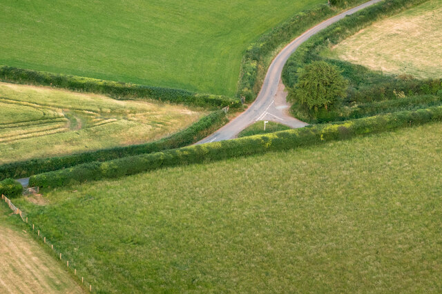
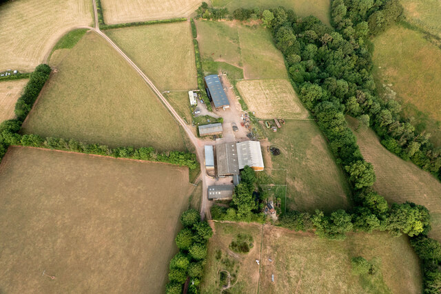
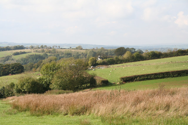
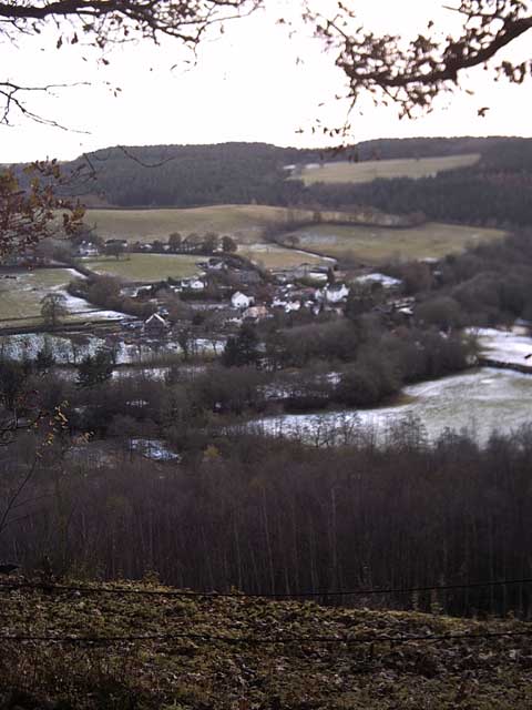
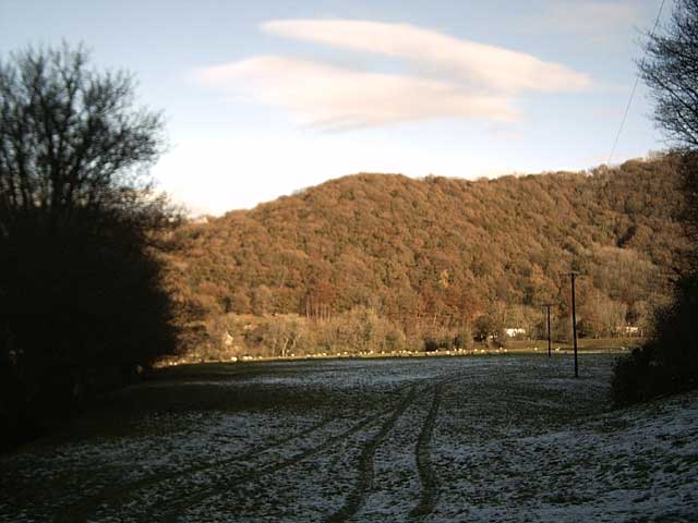
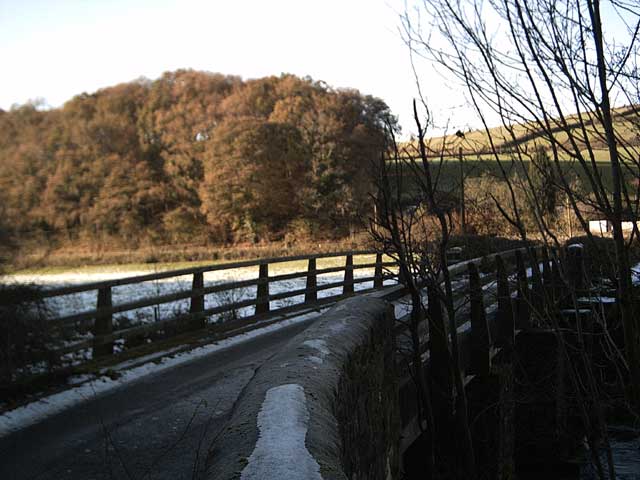
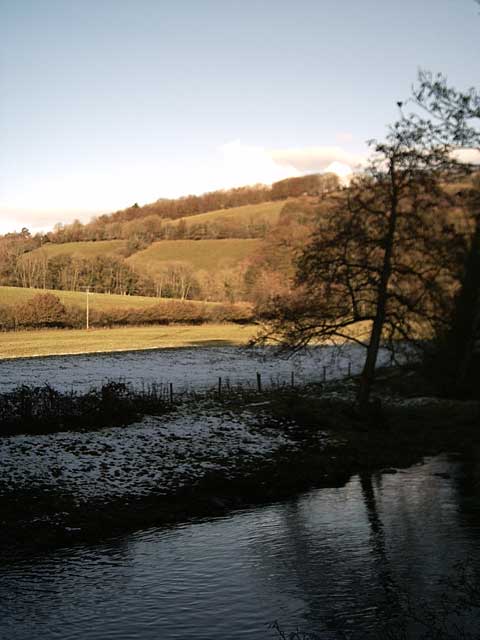
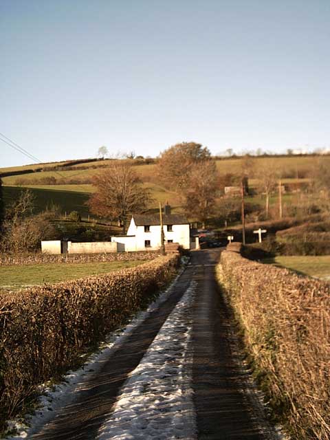
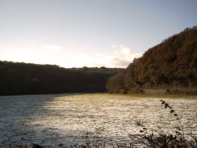
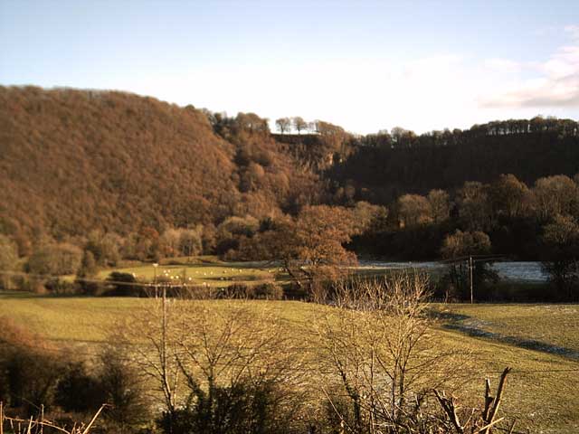
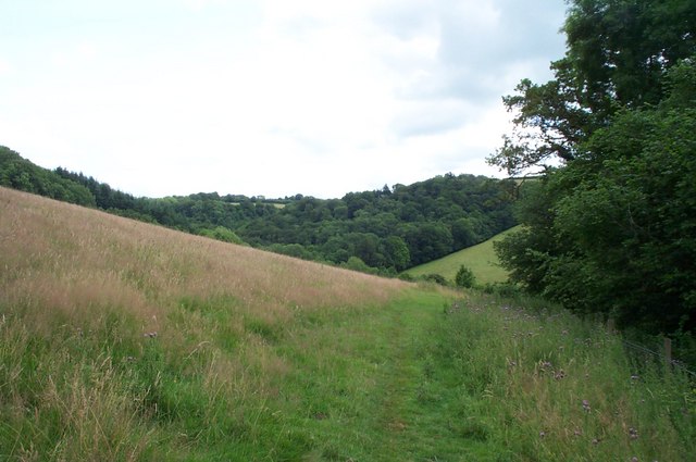
Bicknell Plantation, located in Devon, England, is a picturesque woodland area known for its natural beauty and diverse ecosystem. Spanning over a significant area, the plantation is a haven for nature enthusiasts and those seeking tranquility.

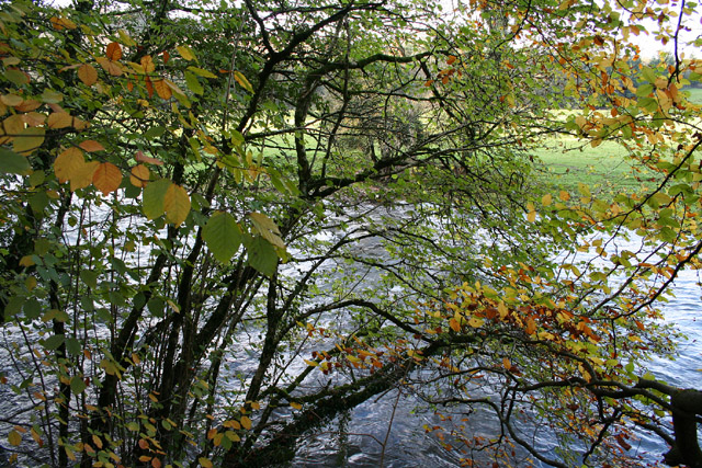
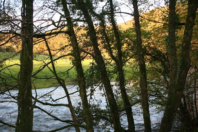
The main feature of Bicknell Plantation is its dense forest, composed primarily of native broadleaf trees such as oak, beech, and ash. These trees provide a lush canopy that offers shade and shelter to a wide range of flora and fauna. The forest floor is covered with a rich carpet of wildflowers, ferns, and mosses, creating a vibrant and colorful undergrowth.

The plantation is also home to a variety of wildlife, including deer, foxes, badgers, and a multitude of bird species. Nature lovers can spot woodland birds such as woodpeckers, owls, and thrushes, with their melodic songs filling the air.

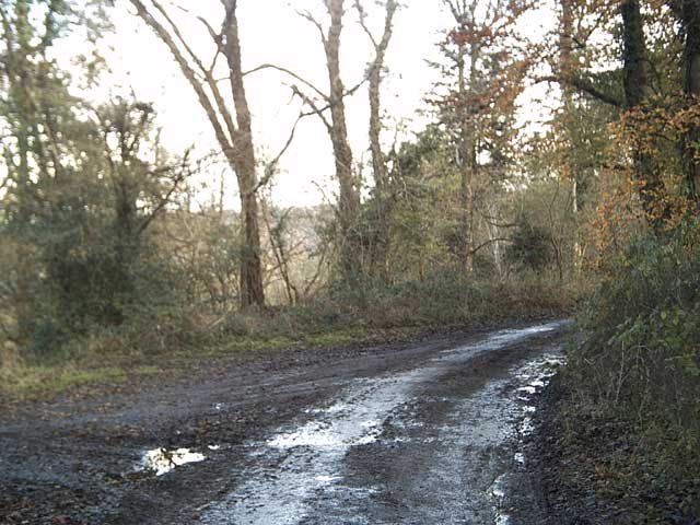
Visitors to Bicknell Plantation can explore the area through a network of well-maintained walking trails, allowing them to immerse themselves in the natural surroundings. These trails wind through the forest, offering glimpses of stunning views, tranquil streams, and hidden clearings.

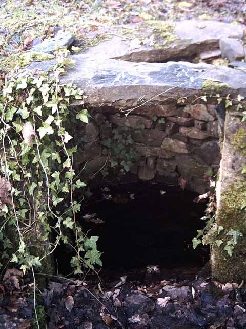
The plantation is not only a place of natural beauty but also serves as an important habitat for the preservation of local biodiversity. Conservation efforts are in place to protect and enhance the existing ecosystem, ensuring its long-term sustainability.

In conclusion, Bicknell Plantation in Devon is a captivating woodland area that offers a serene escape from the hustle and bustle of daily life. With its breathtaking scenery, diverse wildlife, and well-preserved trails, it is a destination that appeals to nature enthusiasts and those seeking solace in the heart of nature.

If you have any feedback on the listing, please let us know in the comments section below.

Bicknell Plantation Images

Images are sourced within 2km of 50.961211/-3.4796893 or Grid Reference SS9619. Thanks to Geograph Open Source API. All images are credited.

A road junction near Nine Ash Cross
Barns & sheds on Shute Farm
Tiverton: Shute Farm The farm overlooks the Exe valley to the west
Tiverton: Shute Farm
The farm overlooks the Exe valley to the west
Tiverton: the Exe at Cove Cleave The river flows strongly after the early November rains
Tiverton: the Exe at Cove Cleave
The river flows strongly after the early November rains
Tiverton: the Exe at Cove Cleave The river flows strongly after the early November rains
Tiverton: the Exe at Cove Cleave
The river flows strongly after the early November rains
Exe Valley Way near Holmingham Wood The Way leaves the valley and climbs up to the ridge above Holmingham Quarry.
Exe Valley Way near Holmingham Wood
The Way leaves the valley and climbs up to the ridge above Holmingham Quarry.
Well at Holmingham Wood Taken on the Exe Valley Way. This well is 157m above sea level, ~60m above the valley below. I'm not sure how the water gets here.
Well at Holmingham Wood
Taken on the Exe Valley Way. This well is 157m above sea level, ~60m above the valley below. I'm not sure how the water gets here.
View of Cove from Holmingham Woods Taken on the Exe Valley Way. This is the view from the ridge above Holmingham Quarry.
View of Cove from Holmingham Woods
Taken on the Exe Valley Way. This is the view from the ridge above Holmingham Quarry.
Farmland near Halfpenny Bridge Taken on the Exe Valley Way.
Farmland near Halfpenny Bridge
Taken on the Exe Valley Way.
Halfpenny Bridge Taken on the Exe Valley Way.
Halfpenny Bridge
Taken on the Exe Valley Way.
River Exe at Halfpenny Bridge Taken on the Exe Valley Way.
River Exe at Halfpenny Bridge
Taken on the Exe Valley Way.
Halfpenny Cross Taken on the Exe Valley Way.
Halfpenny Cross
Taken on the Exe Valley Way.
Exe Valley in the Snow Taken on the Exe Valley Way near Hallpenny Bridge
Exe Valley in the Snow
Taken on the Exe Valley Way near Hallpenny Bridge
Cove Cleave from Hallpenny Cross Taken from the Exe Valley Way north of Hallpenny Cross
Cove Cleave from Hallpenny Cross
Taken from the Exe Valley Way north of Hallpenny Cross
Public Bridleway from Cove Down Farm to Shute Farm
Bampton: on Halfpenny Bridge A crossing of the river Exe linking Bampton with Stoodleigh. The bridge at one time carried a small aqueduct – a leat which originated at a weir on the river Batherm near the Exeter Inn; it crossed the river Exe here to run on past Holmingham and, it would appear, provide the power for a waterwheel or turbine to run machinery in the now defunct Holmingham Quarry. Evidence for the leat channel exists in stonework visible on either side of the bridge and it is shown on the old OS Pathfinder map 1256 for Dulverton
Bampton: on Halfpenny Bridge
A crossing of the river Exe linking Bampton with Stoodleigh. The bridge at one time carried a small aqueduct – a leat which originated at a weir on the river Batherm near the Exeter Inn; it crossed the river Exe here to run on past Holmingham and, it would appear, provide the power for a waterwheel or turbine to run machinery in the now defunct Holmingham Quarry. Evidence for the leat channel exists in stonework visible on either side of the bridge and it is shown on the old OS Pathfinder map 1256 for Dulverton
Cliffs near Cove This sheer cliff is close to the River Exe, but very difficult to photograph close in.
Cliffs near Cove
This sheer cliff is close to the River Exe, but very difficult to photograph close in.
A396 runs through woodland in the Exe Valley
Show me another place!

Bicknell Plantation is located at Grid Ref: SS9619 (Lat: 50.961211, Lng: -3.4796893)

Administrative County: Devon

District: Mid Devon

Police Authority: Devon and Cornwall

What 3 Words

///sulky.intend.intruders. Near Tiverton, Devon

Related Wikis

Cove, Devon

Cove is a small village in the county of Devon, England. It is 4 miles north of Tiverton and 2 miles from Bampton in the Exe Valley some 450 feet above...

River Batherm

The River Batherm is a river which flows through Somerset and Devon in England. The river rises on high ground near the village of Sperry Barton, between...

Castle Close

Castle Close is a circular earthwork located near Stoodleigh in Mid Devon, England at OS grid reference SS937181. It is described on maps as a settlement...

Bampton, Devon

Bampton is a small town and parish in northeast Devon, England, on the River Batherm, a tributary of the River Exe. It is about 6 miles (9.7 km) north...

Bampton Castle, Devon

Bampton Castle in the parish of Bampton, Devon was the seat of the feudal barony of Bampton. It is located on a spur that overlooks the River Batherm....

Knightshayes Court

Knightshayes Court is a Victorian country house near Tiverton, Devon, England, designed by William Burges for the Heathcoat-Amory family. Nikolaus Pevsner...

Stoodleigh

Stoodleigh is a village and civil parish in the Mid Devon district of Devon, England, located 6 miles (10 km) north of Tiverton and 5 miles (8 km) south...

Washfield

Washfield is a village, parish and former manor in Devon, England, situated about 2 miles north-west of Tiverton. The parish church is dedicated to St...

Nearby Amenities

Located within 500m of 50.961211,-3.4796893
Power: pole
Source: bing
Transformer: distribution
Lat/Long: 50.9612692/-3.4780848
Power: pole
Source: bing
Lat/Long: 50.9614221/-3.4771541
Power: pole
Source: bing
Lat/Long: 50.9616231/-3.47588
Power: pole
Source: bing
Lat/Long: 50.9617363/-3.4744853
Power: pole
Source: bing
Lat/Long: 50.9618326/-3.4731093
Power: pole
Source: bing
Lat/Long: 50.9595333/-3.4736833
Power: pole
Source: bing
Lat/Long: 50.9612295/-3.4727606
Power: pole
Source: bing
Lat/Long: 50.9606146/-3.4727311
The data included in this document is from www.openstreetmap.org. The data is made available under ODbL.

Have you been to Bicknell Plantation?

Leave your review of Bicknell Plantation below (or comments, questions and feedback).