High Wood

Wood, Forest in Devon Mid Devon

England

High Wood

Stoodleigh : Country Lane A small lane heading through the countryside.
Stoodleigh : Country Lane Credit: Lewis Clarke

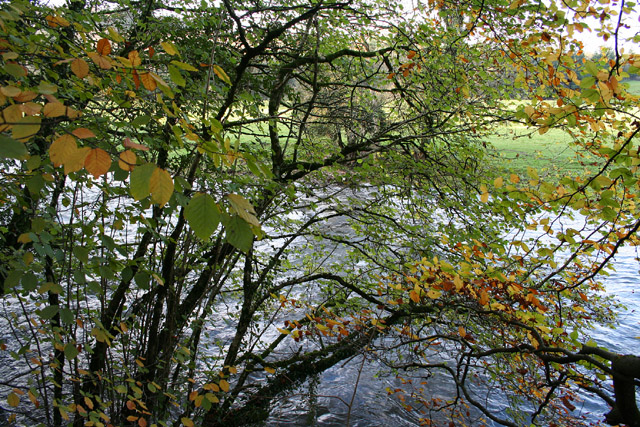
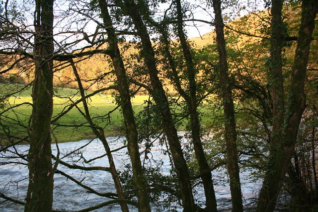
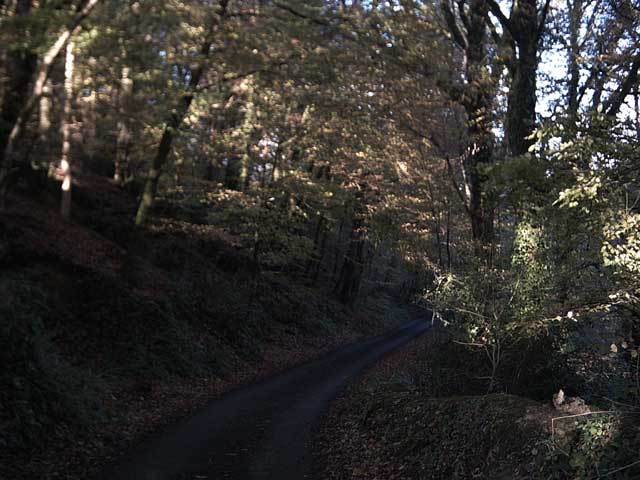
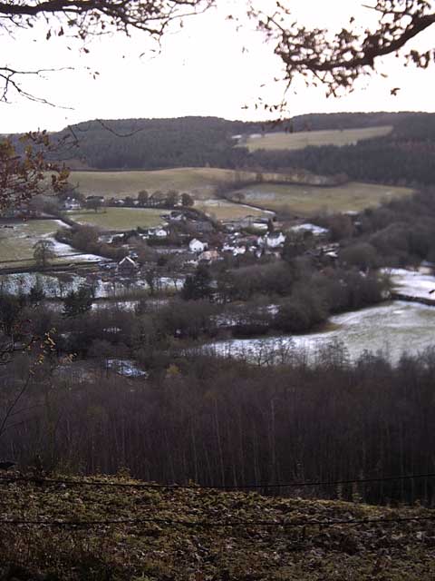
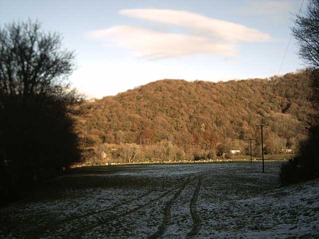
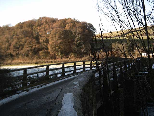
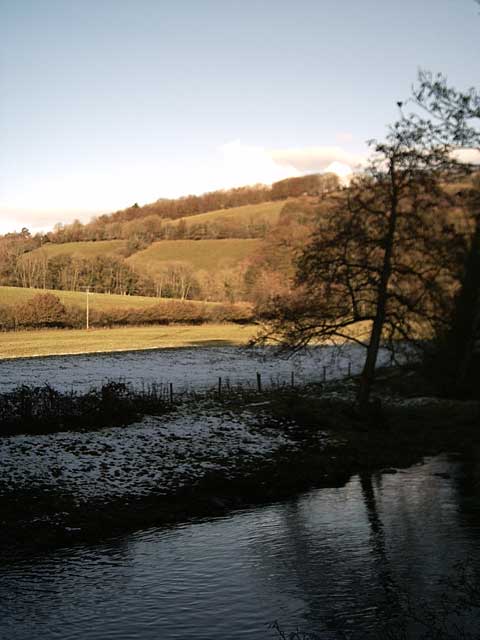
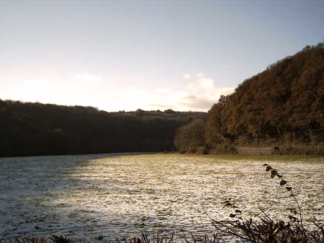
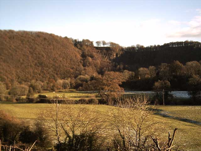
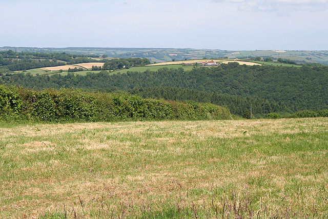
High Wood is a picturesque forest situated in Devon, England. Covering an area of approximately 500 acres, it is well-known for its abundant natural beauty and diverse wildlife. The wood is primarily composed of deciduous trees, including oak, beech, and ash, creating a vibrant and enchanting atmosphere throughout the year.

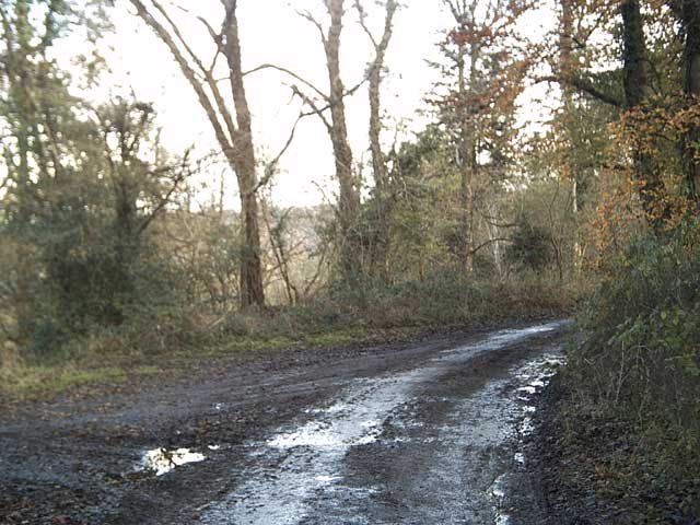
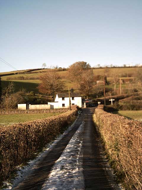
The forest offers a range of recreational activities, making it a popular destination for nature lovers and outdoor enthusiasts. There are numerous walking trails and paths that crisscross through the wood, allowing visitors to explore its hidden corners and discover its many delights. These trails are well-maintained and provide stunning views of the surrounding countryside, making it an ideal place for a leisurely stroll or a more challenging hike.

High Wood is also home to a variety of wildlife, with numerous bird species, such as tits, finches, and woodpeckers, making it their habitat. Small mammals, including squirrels and badgers, can also be spotted among the trees. The wood's diverse ecosystem supports a rich array of flora and fauna, making it a perfect spot for nature enthusiasts and photographers.

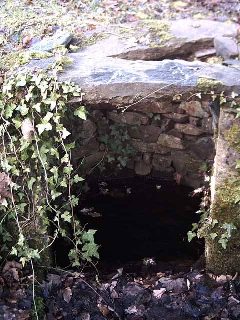
In addition to its natural beauty, High Wood holds historical significance. It is believed to have been used for timber production during the medieval period, and remnants of charcoal pits can still be found within the wood. These historical features add an extra layer of intrigue to the forest, captivating visitors with its fascinating past.

Overall, High Wood is a captivating destination that offers a perfect blend of natural beauty, recreational activities, and historical significance. Its tranquil atmosphere and diverse wildlife make it a must-visit location for those seeking to connect with nature in the heart of Devon.

If you have any feedback on the listing, please let us know in the comments section below.
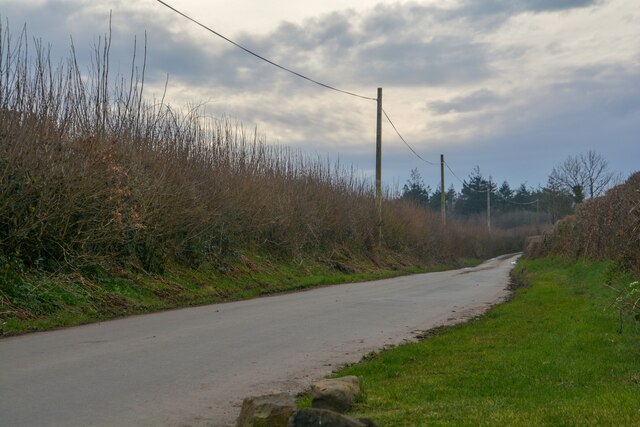
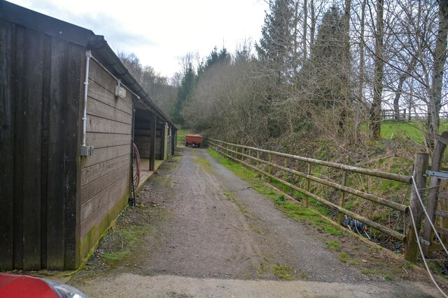
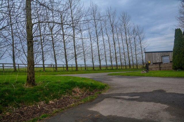
High Wood Images

Images are sourced within 2km of 50.970216/-3.5012682 or Grid Reference SS9420. Thanks to Geograph Open Source API. All images are credited.

Stoodleigh : Country Lane A small lane heading through the countryside.
Stoodleigh : Country Lane
A small lane heading through the countryside.
Stoodleigh : West Steart Farm Looking along a track by a barn.
Stoodleigh : West Steart Farm
Looking along a track by a barn.
Stoodleigh : West Steart Farm A road heads to the farm.
Stoodleigh : West Steart Farm
A road heads to the farm.
Bampton : A396 A pothole which had just torn my tyre to shreds.
Bampton : A396
A pothole which had just torn my tyre to shreds.
Bampton : A396 The road is closed due to a fatal fire.
Bampton : A396
The road is closed due to a fatal fire.
Tiverton: the Exe at Cove Cleave The river flows strongly after the early November rains
Tiverton: the Exe at Cove Cleave
The river flows strongly after the early November rains
Tiverton: the Exe at Cove Cleave The river flows strongly after the early November rains
Tiverton: the Exe at Cove Cleave
The river flows strongly after the early November rains
Exe Valley Way near Holmingham Wood The Way leaves the valley and climbs up to the ridge above Holmingham Quarry.
Exe Valley Way near Holmingham Wood
The Way leaves the valley and climbs up to the ridge above Holmingham Quarry.
Exe Valley Way near Bampton So this isn't the Exe Valley, this is the Batherm Valley. But Bampton a nice place to visit so the way goes this way.
Exe Valley Way near Bampton
So this isn't the Exe Valley, this is the Batherm Valley. But Bampton a nice place to visit so the way goes this way.
Well at Holmingham Wood Taken on the Exe Valley Way. This well is 157m above sea level, ~60m above the valley below. I'm not sure how the water gets here.
Well at Holmingham Wood
Taken on the Exe Valley Way. This well is 157m above sea level, ~60m above the valley below. I'm not sure how the water gets here.
View of Cove from Holmingham Woods Taken on the Exe Valley Way. This is the view from the ridge above Holmingham Quarry.
View of Cove from Holmingham Woods
Taken on the Exe Valley Way. This is the view from the ridge above Holmingham Quarry.
Farmland near Halfpenny Bridge Taken on the Exe Valley Way.
Farmland near Halfpenny Bridge
Taken on the Exe Valley Way.
Halfpenny Bridge Taken on the Exe Valley Way.
Halfpenny Bridge
Taken on the Exe Valley Way.
River Exe at Halfpenny Bridge Taken on the Exe Valley Way.
River Exe at Halfpenny Bridge
Taken on the Exe Valley Way.
Halfpenny Cross Taken on the Exe Valley Way.
Halfpenny Cross
Taken on the Exe Valley Way.
Exe Valley in the Snow Taken on the Exe Valley Way near Hallpenny Bridge
Exe Valley in the Snow
Taken on the Exe Valley Way near Hallpenny Bridge
Cove Cleave from Hallpenny Cross Taken from the Exe Valley Way north of Hallpenny Cross
Cove Cleave from Hallpenny Cross
Taken from the Exe Valley Way north of Hallpenny Cross
Stoodleigh: near Steart Looking north-north-east over the Exe valley towards Westhill Farm in Bampton parish
Stoodleigh: near Steart
Looking north-north-east over the Exe valley towards Westhill Farm in Bampton parish
Show me another place!

High Wood is located at Grid Ref: SS9420 (Lat: 50.970216, Lng: -3.5012682)

Administrative County: Devon

District: Mid Devon

Police Authority: Devon and Cornwall

What 3 Words

///spenders.cheering.ignore. Near Tiverton, Devon

Related Wikis

Cove, Devon

Cove is a small village in the county of Devon, England. It is 4 miles north of Tiverton and 2 miles from Bampton in the Exe Valley some 450 feet above...

River Batherm

The River Batherm is a river which flows through Somerset and Devon in England. The river rises on high ground near the village of Sperry Barton, between...

Castle Close

Castle Close is a circular earthwork located near Stoodleigh in Mid Devon, England at OS grid reference SS937181. It is described on maps as a settlement...

Bampton, Devon

Bampton is a small town and parish in northeast Devon, England, on the River Batherm, a tributary of the River Exe. It is about 6 miles (9.7 km) north...

Nearby Amenities

Located within 500m of 50.970216,-3.5012682
Power: pole
Source: bing
Lat/Long: 50.9667695/-3.5057746
Power: pole
Source: bing
Lat/Long: 50.9666757/-3.5044979
Power: pole
Source: bing
Lat/Long: 50.9665034/-3.5037683
Power: pole
Source: bing
Lat/Long: 50.967022/-3.4968026
Power: pole
Source: bing
Lat/Long: 50.9670625/-3.4961723
Power: pole
Source: bing
Lat/Long: 50.967022/-3.4973431
Power: pole
Source: bing
Lat/Long: 50.9668126/-3.4973082
Power: pole
Source: bing
Lat/Long: 50.9662686/-3.5027531
Power: pole
Source: bing
Lat/Long: 50.9659426/-3.5013369
The data included in this document is from www.openstreetmap.org. The data is made available under ODbL.

Have you been to High Wood?

Leave your review of High Wood below (or comments, questions and feedback).