Battleton Wood

Wood, Forest in Somerset Somerset West and Taunton

England

Battleton Wood

Country Lane near Marsh Bridge
Country Lane near Marsh Bridge Credit: thejackrustles

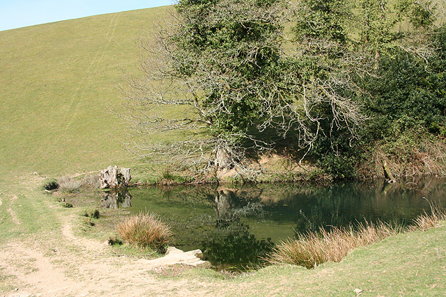
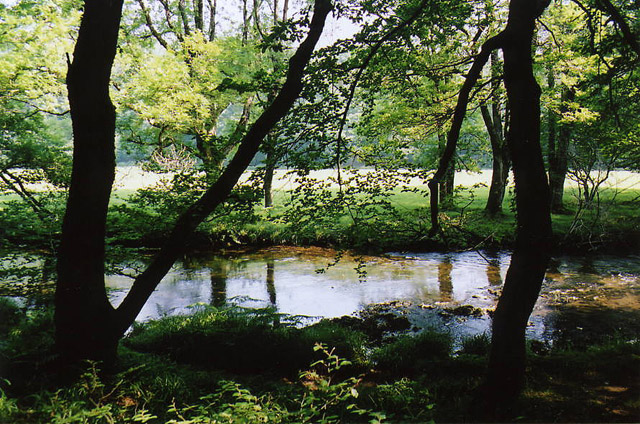
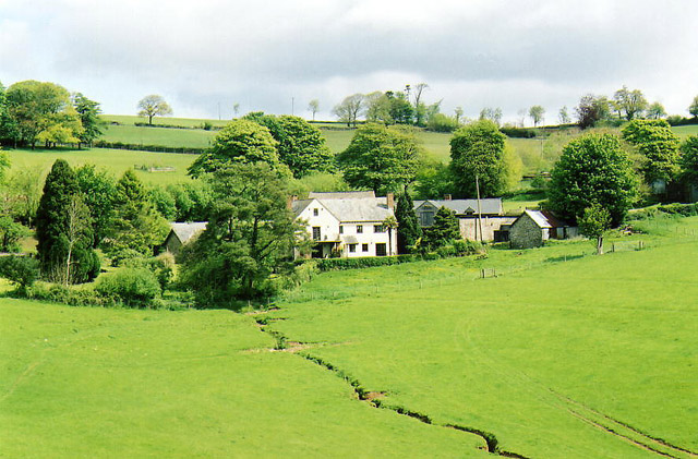
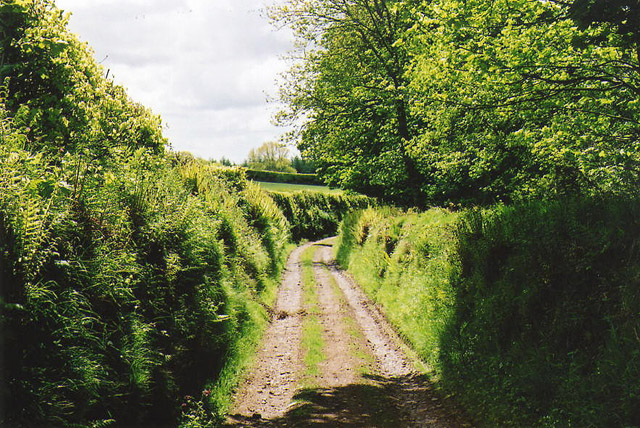
Battleton Wood is a picturesque forest located in Somerset, England. Spanning over 100 acres, this woodland is situated in the southern part of the county, near the town of Wellington. Offering a tranquil escape from the hustle and bustle of everyday life, Battleton Wood is a popular destination for nature enthusiasts, hikers, and families alike.

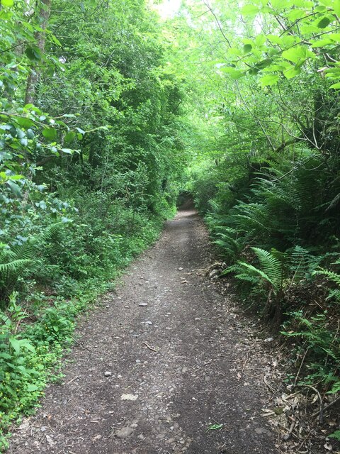
The woodland is characterized by its diverse range of tree species, including oak, beech, and ash. The dense canopy created by these towering trees provides a cool and shaded environment during the summer months. The forest floor is covered with a variety of wildflowers, ferns, and mosses, adding to its natural beauty.

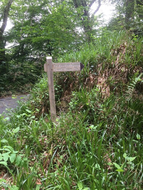
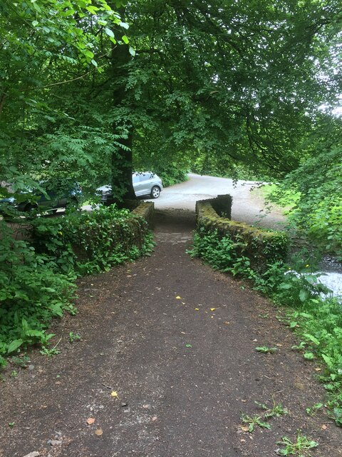
Visitors to Battleton Wood can explore the numerous walking trails that wind their way through the forest. These well-maintained paths cater to different levels of difficulty, ensuring that both casual strollers and experienced hikers can enjoy the wood at their own pace. Along the way, there are several benches and picnic spots, allowing visitors to rest and appreciate the serenity of the surroundings.

The woodland is also home to a diverse array of wildlife. Birdwatchers can spot species such as woodpeckers, jays, and owls, while lucky visitors may catch a glimpse of deer, foxes, and badgers. The forest provides a haven for these creatures, offering shelter and sustenance throughout the year.

Overall, Battleton Wood is a hidden gem in Somerset, offering a peaceful and enchanting natural escape. Its stunning scenery, well-maintained trails, and abundant wildlife make it an ideal destination for anyone seeking solace in nature's embrace.

If you have any feedback on the listing, please let us know in the comments section below.

Battleton Wood Images

Images are sourced within 2km of 51.033808/-3.5492755 or Grid Reference SS9127. Thanks to Geograph Open Source API. All images are credited.

Country Lane near Marsh Bridge
Footpath Sign to Court Down
Right of Way to Court Down
Marsh Bridge
Marsh Bridge
Bridge over the River Barle at Dulverton
Chapel in Dulverton
Chapel in Dulverton
Church of All Saints, Dulverton
High Street, Dulverton
Bridge over the River Barle at Dulverton
Barle Bridge, Dulverton A Grade II Listed bridge over the River Barle. Mediaeval in origin, repaired 1624, subsequently widened 1819 by J Stone, repaired 1866 and 1952-3. Five arches in random rubble. Also a Scheduled Ancient Monument.
Barle Bridge, Dulverton
A Grade II Listed bridge over the River Barle. Mediaeval in origin, repaired 1624, subsequently widened 1819 by J Stone, repaired 1866 and 1952-3. Five arches in random rubble. Also a Scheduled Ancient Monument.
Northmoor Road, Dulverton The nearest house is No. 7 and the pump and black bollard seen in the background are Listed Grade II, primarily for historic interest.
Northmoor Road, Dulverton
The nearest house is No. 7 and the pump and black bollard seen in the background are Listed Grade II, primarily for historic interest.
1-5 Church Lane, Dulverton Terrace of 5 houses circa early to mid-19th century, although the two closest (1 and 2) are earlier. Painted stole rubble. Listed Grade II.
1-5 Church Lane, Dulverton
Terrace of 5 houses circa early to mid-19th century, although the two closest (1 and 2) are earlier. Painted stole rubble. Listed Grade II.
Dulverton: pond By the footpath from Dulverton to Waddicombe, and clearly man made, with a dam height of 12 feet or more. Looking west
Dulverton: pond
By the footpath from Dulverton to Waddicombe, and clearly man made, with a dam height of 12 feet or more. Looking west
Dulverton: River Barle Seen from the footpath above Marsh Bridge, which runs through woods to Hawkridge and Tarr Steps
Dulverton: River Barle
Seen from the footpath above Marsh Bridge, which runs through woods to Hawkridge and Tarr Steps
Dulverton: Town Mills Now offering bread and breakfast, Town Mills was once one of four mills all powered by a single leat from the river Barle. One of its waterwheels can be seen turning at Bickleigh Mill, near Tiverton
Dulverton: Town Mills
Now offering bread and breakfast, Town Mills was once one of four mills all powered by a single leat from the river Barle. One of its waterwheels can be seen turning at Bickleigh Mill, near Tiverton
Dulverton: the leat from the Barle Here the leat runs past the old paper mill, now a private house. Seen from the public footpath
Dulverton: the leat from the Barle
Here the leat runs past the old paper mill, now a private house. Seen from the public footpath
Dulverton: Northcombe Farm View from the footpath to Court Down. The water-powered millhouse at Northcombe has been converted into a camping barn; the shrouds of the overshot waterwheel survive outside
Dulverton: Northcombe Farm
View from the footpath to Court Down. The water-powered millhouse at Northcombe has been converted into a camping barn; the shrouds of the overshot waterwheel survive outside
Dulverton: track running south to Jury Cross The track appears to head towards Pixton Park, just beyond Jury Cross
Dulverton: track running south to Jury Cross
The track appears to head towards Pixton Park, just beyond Jury Cross
Show me another place!

Battleton Wood is located at Grid Ref: SS9127 (Lat: 51.033808, Lng: -3.5492755)

Administrative County: Somerset

District: Somerset West and Taunton

Police Authority: Avon and Somerset

What 3 Words

///screening.argue.galloped. Near Dulverton, Somerset

Related Wikis

Combe, Dulverton

Combe is a historic estate in Somerset, England, situated between the town of Dulverton and the village of Brushford. == Descent == === Taunton Priory... ===

Barle Bridge

Barle Bridge is a five span stone arch bridge over the River Barle in Dulverton within the English county of Somerset, which is medieval in origin. It...

Dulverton Town Hall

Dulverton Town Hall is a municipal building in Fore Street in Dulverton, Somerset, England. The building, which is the meeting place of Dulverton Town...

Church of All Saints, Dulverton

The Anglican Church of All Saints in Dulverton, Somerset, England was built in the 15th century and largely rebuilt in the 1850s. It is a Grade II* listed...

Oldberry Castle

Oldberry Castle (sometimes called Oldbury Castle) is an Iron Age hill fort north west of Dulverton, Somerset, England. It lies approximately 0.5 miles...

Dulverton Rural District

Dulverton was a rural district in Somerset, England, from 1894 to 1974. It was created in 1894 under the Local Government Act 1894. In 1974 it was abolished...

Dulverton

Dulverton is a town and civil parish in west Somerset, England, near the border with Devon. The town had a population of 1,408 at the 2011 Census. The...

Barlynch Priory

Barlynch Priory (also known as St Nicholas's Priory and sometimes spelled Barlich Priory) in Brompton Regis, Somerset, England was an Augustinian priory...

Nearby Amenities

Located within 500m of 51.033808,-3.5492755
Direction: forward
Maxspeed: 30 mph
Maxspeed Type: GB:nsl_restricted
Source Maxspeed: sign
Traffic Sign: maxspeed
Lat/Long: 51.0363549/-3.5526097
Stop
Direction: forward
Lat/Long: 51.0371691/-3.5528
Winsbere
Addr City: Dulverton
Addr Country: GB
Addr Housenumber: 64
Addr Postcode: TA22 9HU
Addr Street: Battleton
Fhrs Authority: West Somerset
Fhrs Id: 161269
Fhrs Local Authority Id: PI/000001260
Tourism: guest_house
Lat/Long: 51.0334466/-3.5462344
Bar
Dulverton Sports And Social Club
Addr City: Dulverton
Addr Country: GB
Addr Postcode: TA22 9HQ
Addr Street: Millham Lane
Fhrs Authority: West Somerset
Fhrs Id: 161278
Fhrs Local Authority Id: PI/000001269
Smoking: outside
Lat/Long: 51.0360728/-3.5490507
Direction: backward
Maxspeed: 30 mph
Maxspeed Type: GB:nsl_restricted
Source Maxspeed: sign
Traffic Sign: maxspeed
Lat/Long: 51.0334247/-3.5453868
Generator Method: photovoltaic
Generator Output Electricity: yes
Generator Source: solar
Generator Type: solar_photovoltaic_panel
Location: roof
Power: generator
Lat/Long: 51.035998/-3.5430331
Generator Method: photovoltaic
Generator Output Electricity: yes
Generator Source: solar
Generator Type: solar_photovoltaic_panel
Location: roof
Power: generator
Lat/Long: 51.0360031/-3.5431135
Generator Method: photovoltaic
Generator Output Electricity: yes
Generator Source: solar
Generator Type: solar_photovoltaic_panel
Location: roof
Power: generator
Lat/Long: 51.0360081/-3.5432047
Generator Method: photovoltaic
Generator Output Electricity: yes
Generator Source: solar
Generator Type: solar_photovoltaic_panel
Location: roof
Power: generator
Lat/Long: 51.0360064/-3.5432932
Generator Method: photovoltaic
Generator Output Electricity: yes
Generator Source: solar
Generator Type: solar_photovoltaic_panel
Location: roof
Power: generator
Lat/Long: 51.0359963/-3.5434595
Generator Method: photovoltaic
Generator Output Electricity: yes
Generator Source: solar
Generator Type: solar_photovoltaic_panel
Location: roof
Power: generator
Lat/Long: 51.0358867/-3.5434595
Generator Method: photovoltaic
Generator Output Electricity: yes
Generator Source: solar
Generator Type: solar_photovoltaic_panel
Location: roof
Power: generator
Lat/Long: 51.0357838/-3.5433308
Generator Method: photovoltaic
Generator Output Electricity: yes
Generator Source: solar
Generator Type: solar_photovoltaic_panel
Location: roof
Power: generator
Lat/Long: 51.0357703/-3.5432047
Generator Method: photovoltaic
Generator Output Electricity: yes
Generator Source: solar
Generator Type: solar_photovoltaic_panel
Location: roof
Power: generator
Lat/Long: 51.0357669/-3.5431323
Generator Method: photovoltaic
Generator Output Electricity: yes
Generator Source: solar
Generator Type: solar_photovoltaic_panel
Location: roof
Power: generator
Lat/Long: 51.0357551/-3.5430787
Generator Method: photovoltaic
Generator Output Electricity: yes
Generator Source: solar
Generator Type: solar_photovoltaic_panel
Location: roof
Power: generator
Lat/Long: 51.0357416/-3.5429982
Generator Method: photovoltaic
Generator Output Electricity: yes
Generator Source: solar
Generator Type: solar_photovoltaic_panel
Location: roof
Power: generator
Lat/Long: 51.0373794/-3.544975
Power: pole
Source: bing
Transformer: distribution
Lat/Long: 51.0353728/-3.5489836
Power: pole
Source: bing
Lat/Long: 51.0332737/-3.5437506
Power: pole
Source: bing
Transformer: distribution
Lat/Long: 51.0343482/-3.54629
Power: pole
Source: bing
Lat/Long: 51.0302484/-3.5522868
Power: pole
Source: bing
Lat/Long: 51.0298326/-3.5511388
Power: pole
Source: bing
Lat/Long: 51.0299616/-3.5496998
Power: pole
Source: bing
Lat/Long: 51.0302577/-3.5466662
Power: pole
Source: bing
Lat/Long: 51.0326294/-3.5424806
Power: pole
Source: bing
Lat/Long: 51.0303977/-3.545246
Post Box
Operator: Royal Mail
Operator Wikidata: Q638098
Post Box Type: wall
Ref: TA22 82D
Royal Cypher: EIIR
Royal Cypher Wikidata: Q33102113
Lat/Long: 51.0360197/-3.5515331
The data included in this document is from www.openstreetmap.org. The data is made available under ODbL.

Have you been to Battleton Wood?

Leave your review of Battleton Wood below (or comments, questions and feedback).