Bucket Pool

Lake, Pool, Pond, Freshwater Marsh in Somerset Somerset West and Taunton

England

Bucket Pool

Country Lane near Marsh Bridge
Country Lane near Marsh Bridge Credit: thejackrustles

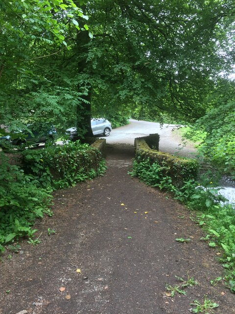
Bucket Pool is a serene body of water located in Somerset, England. It is a popular destination for locals and tourists alike, offering a variety of recreational activities and stunning natural beauty. Spanning an area of approximately 50 acres, Bucket Pool is a versatile water feature that can be classified as a lake, pool, pond, and freshwater marsh.

The pool's large size allows for a range of activities, including boating, fishing, and swimming. Its calm and clear waters are perfect for a leisurely paddle or a refreshing dip on a hot summer's day. Fishing enthusiasts flock to the pool to try their luck at catching a variety of fish species, such as roach, perch, and pike.

Surrounding the pool is a lush and vibrant landscape, consisting of reed beds, water lilies, and other aquatic plants. These create a habitat for a diverse range of wildlife, making it a haven for birdwatchers and nature lovers. Visitors can spot a variety of bird species, including herons, kingfishers, and various waterfowl.

The Bucket Pool is maintained and preserved by local authorities, ensuring its ecological integrity and providing a safe and clean environment for visitors. The site is equipped with parking facilities, picnic areas, and walking trails, making it accessible and enjoyable for people of all ages. Whether it's a family outing, a peaceful stroll, or a day of outdoor adventure, Bucket Pool offers a picturesque setting and a range of activities to suit every visitor's preferences.

If you have any feedback on the listing, please let us know in the comments section below.
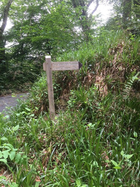
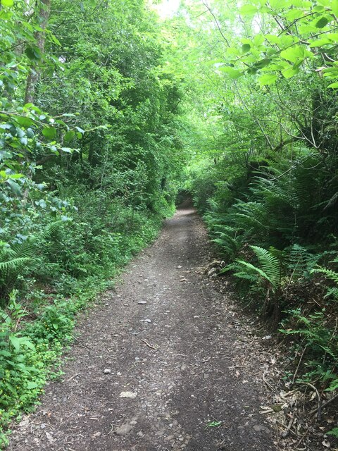
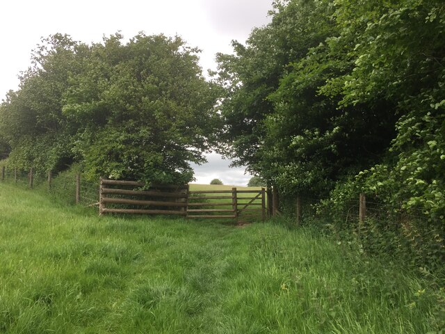
Bucket Pool Images

Images are sourced within 2km of 51.040674/-3.5536555 or Grid Reference SS9127. Thanks to Geograph Open Source API. All images are credited.

Country Lane near Marsh Bridge
Footpath Sign to Court Down
Right of Way to Court Down
Nearly there, path to Court Down
Court Down Trig Point Flush Bracket S3968
White nettles near Court Down Chalky soil spraying up onto plants, found this an odd sight
White nettles near Court Down
Chalky soil spraying up onto plants, found this an odd sight
Marsh Bridge
Marsh Bridge
Bridge over the River Barle at Dulverton
Chapel in Dulverton
Chapel in Dulverton
Church of All Saints, Dulverton
High Street, Dulverton
Bridge over the River Barle at Dulverton
Barle Bridge, Dulverton A Grade II Listed bridge over the River Barle. Mediaeval in origin, repaired 1624, subsequently widened 1819 by J Stone, repaired 1866 and 1952-3. Five arches in random rubble. Also a Scheduled Ancient Monument.
Barle Bridge, Dulverton
A Grade II Listed bridge over the River Barle. Mediaeval in origin, repaired 1624, subsequently widened 1819 by J Stone, repaired 1866 and 1952-3. Five arches in random rubble. Also a Scheduled Ancient Monument.
Northmoor Road, Dulverton The nearest house is No. 7 and the pump and black bollard seen in the background are Listed Grade II, primarily for historic interest.
Northmoor Road, Dulverton
The nearest house is No. 7 and the pump and black bollard seen in the background are Listed Grade II, primarily for historic interest.
1-5 Church Lane, Dulverton Terrace of 5 houses circa early to mid-19th century, although the two closest (1 and 2) are earlier. Painted stole rubble. Listed Grade II.
1-5 Church Lane, Dulverton
Terrace of 5 houses circa early to mid-19th century, although the two closest (1 and 2) are earlier. Painted stole rubble. Listed Grade II.
Dulverton: footbridge over stream On the public footpath between Dulverton and Waddicombe, looking east
Dulverton: footbridge over stream
On the public footpath between Dulverton and Waddicombe, looking east
Dulverton: below Chilcott Looking east in the direction of Lower Chilcott Wood, in a hidden valley, with pussy willow by a stream
Dulverton: below Chilcott
Looking east in the direction of Lower Chilcott Wood, in a hidden valley, with pussy willow by a stream
Dulverton: towards Higher Chilcott Looking south west. Higher Chilcott - beyond the square - has smoke rising from a chimney and Lower Chilcott is to the left of this farm
Dulverton: towards Higher Chilcott
Looking south west. Higher Chilcott - beyond the square - has smoke rising from a chimney and Lower Chilcott is to the left of this farm
Show me another place!

Bucket Pool is located at Grid Ref: SS9127 (Lat: 51.040674, Lng: -3.5536555)

Administrative County: Somerset

District: Somerset West and Taunton

Police Authority: Avon and Somerset

What 3 Words

///certainly.constrain.before. Near Dulverton, Somerset

Related Wikis

Barle Bridge

Barle Bridge is a five span stone arch bridge over the River Barle in Dulverton within the English county of Somerset, which is medieval in origin. It...

Dulverton Town Hall

Dulverton Town Hall is a municipal building in Fore Street in Dulverton, Somerset, England. The building, which is the meeting place of Dulverton Town...

Church of All Saints, Dulverton

The Anglican Church of All Saints in Dulverton, Somerset, England was built in the 15th century and largely rebuilt in the 1850s. It is a Grade II* listed...

Oldberry Castle

Oldberry Castle (sometimes called Oldbury Castle) is an Iron Age hill fort north west of Dulverton, Somerset, England. It lies approximately 0.5 miles...
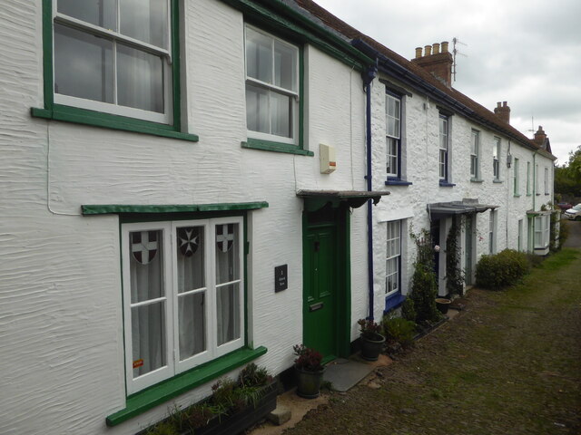
Dulverton

Dulverton is a town and civil parish in west Somerset, England, near the border with Devon. The town had a population of 1,408 at the 2011 Census. The...

Dulverton Rural District

Dulverton was a rural district in Somerset, England, from 1894 to 1974. It was created in 1894 under the Local Government Act 1894. In 1974 it was abolished...

Northmoor, Dulverton

Northmoor is an historic estate in the parish of Dulverton in Somerset, England. The Victorian mansion house known as Northmoor House is set amongst steep...

Combe, Dulverton

Combe is a historic estate in Somerset, England, situated between the town of Dulverton and the village of Brushford. == Descent == === Taunton Priory... ===

Nearby Amenities

Located within 500m of 51.040674,-3.5536555
Dulverton
Is In: Somerset, England, UK
Place: town
Postal Code: TA22
Wikidata: Q749338
Wikipedia: en:Dulverton
Lat/Long: 51.0401391/-3.5501607
Direction: forward
Maxspeed: 30 mph
Maxspeed Type: GB:nsl_restricted
Source Maxspeed: sign
Traffic Sign: maxspeed
Lat/Long: 51.0363549/-3.5526097
Whitehall House
Addr City: Dulverton
Addr Postcode: TA22 9HB
Addr Street: High Street
Tourism: guest_house
Website: http://www.whitehallhouse.f9.co.uk/
Lat/Long: 51.0397838/-3.5512741
Library
Dulverton Library
Addr City: Dulverton
Addr Housenumber: 7;9
Addr Postcode: TA22 9EX
Addr Street: Fore Street
Opening Hours: Tu,Th,Fr 10:00-13:00,13:30-16:00; Sa 10:00-12:30
Operator: Somerset Council
Operator Type: government
Operator Wikidata: Q6386270
Website: https://www.somerset.gov.uk/locations/dulverton-library/
Wikidata: Q55163622
Lat/Long: 51.0401219/-3.5509536
Waterway: weir
Lat/Long: 51.0442605/-3.5505986
Pharmacy
Dulverton Pharmacy
Addr City: Dulverton
Addr Country: GB
Addr Housenumber: 21
Addr Postcode: TA22 9EX
Addr Street: High Street
Fhrs Authority: West Somerset
Fhrs Id: 160702
Fhrs Local Authority Id: PI/000000491
Healthcare: pharmacy
Opening Hours: Mo-Fr 09:00-18:00; Sa 09:00-17:00
Lat/Long: 51.0398419/-3.5507496
Exmoor National Park Centre
Information: office
Tourism: information
Lat/Long: 51.0401581/-3.5510204
Bench
Lat/Long: 51.0390262/-3.5472726
Cafe
Tantivy Cafe
Addr City: Dulverton
Addr Country: GB
Addr Housenumber: 12-16
Addr Postcode: TA22 9EX
Addr Street: Fore Street
Fhrs Authority: West Somerset
Fhrs Id: 161307
Fhrs Local Authority Id: PI/000001293
Lat/Long: 51.0401372/-3.550258
Lion Hotel
Addr City: Dulverton
Addr Country: GB
Addr Housenumber: 2
Addr Postcode: TA22 9BU
Addr Street: Bank Square
Fhrs Authority: West Somerset
Fhrs Id: 161300
Fhrs Local Authority Id: PI/000001289
Tourism: hotel
Wikidata: Q26554627
Lat/Long: 51.040418/-3.5501962
Stop
Direction: forward
Lat/Long: 51.0371691/-3.5528
Give Way
Lat/Long: 51.0397537/-3.5508315
Bus Stop
Bus: yes
Naptan AtcoCode: 3600SOB20148
Naptan NaptanCode: sotadgdg
Public Transport: platform
Lat/Long: 51.0396789/-3.5512091
Bus Stop
Bus: yes
Departures Board: timetable
Naptan AtcoCode: 3600SOB20149
Naptan NaptanCode: sotadgdj
Public Transport: platform
Lat/Long: 51.0396435/-3.5511153
Post Box
Note: No visible reference
Operator: Royal Mail
Operator Wikidata: Q638098
Post Box Type: wall
Royal Cypher: no
Lat/Long: 51.0404292/-3.5504361
Fast Food
Exmoor Fish & Chips Shop
Addr City: Dulverton
Addr Country: GB
Addr Housenumber: 1
Addr Postcode: TA22 9EX
Addr Street: Fore Street
Cuisine: fish_and_chips
Fhrs Authority: West Somerset
Fhrs Id: 160503
Fhrs Local Authority Id: PI/000000195
Lat/Long: 51.0397926/-3.5510369
M&H Fruit & Veg
Shop: greengrocer
Lat/Long: 51.0398491/-3.550951
Restaurant
Tongdam
Addr City: Dulverton
Addr Country: GB
Addr Housenumber: 26
Addr Postcode: TA22 9DJ
Addr Street: High Street
Cuisine: thai
Fhrs Authority: West Somerset
Fhrs Id: 162832
Fhrs Local Authority Id: PI/000003735
Lat/Long: 51.0396889/-3.5505192
Pub
Tap Bar
Lat/Long: 51.0403086/-3.550137
Dulverton Delicatessen
Addr City: Dulverton
Addr Country: GB
Addr Housenumber: 3
Addr Postcode: TA22 9EX
Addr Street: Fore Street
Fhrs Authority: West Somerset
Fhrs Id: 161333
Fhrs Local Authority Id: PI/000001320
Shop: deli
Lat/Long: 51.0399334/-3.5510302
Telephone
Booth: KX100
Covered: booth
Lat/Long: 51.0404126/-3.5504632
Nimble Fingers
Addr City: Dulverton
Addr Housenumber: 23
Addr Postcode: TA22 9EX
Addr Street: Fore Street
Description: haberdashery and needlecraft supplies
Opening Hours: Mo-Fr 10:30-13:30,14:00-17:00; Th off
Phone: +44 4398 323688
Shop: craft
Lat/Long: 51.0404233/-3.5505393
Telephone
Booth: K6
Covered: booth
Listed Status: Grade II
Wikidata: Q26540338
Lat/Long: 51.0393271/-3.5519569
Hows the Hair
Addr City: Dulverton
Addr Housenumber: 49
Addr Street: High Street
Phone: +44 1398 323783
Shop: hairdresser
Unisex: yes
Lat/Long: 51.0404587/-3.5491285
Risdon Hosegood
Office: lawyer
Lat/Long: 51.0407471/-3.549795
Lorna Doone
Artwork Type: sculpture
Tourism: artwork
Lat/Long: 51.0403546/-3.552732
Clock
Date: no
Display: analog
Faces: 4
Start Date: 1708
Visibility: area
Lat/Long: 51.0411303/-3.5497851
Addr City: Dulverton
Addr Housenumber: 15
Addr Street: Lady Street
Lat/Long: 51.0420879/-3.5510784
Lloyd Maunder
Shop: butcher
Lat/Long: 51.040242/-3.5508292
Bicycle Parking
Access: yes
Bicycle Parking: stands
Capacity: 4
Covered: no
Lat/Long: 51.0400451/-3.5499664
Direction: forward
Maxspeed: 30 mph
Maxspeed Type: GB:nsl_restricted
Source Maxspeed: sign
Traffic Sign: maxspeed
Lat/Long: 51.0394258/-3.5533825
Bench
Backrest: yes
Lat/Long: 51.0395885/-3.5530144
Generator Method: photovoltaic
Generator Output Electricity: yes
Generator Source: solar
Generator Type: solar_photovoltaic_panel
Location: roof
Power: generator
Lat/Long: 51.0386542/-3.551879
Generator Method: photovoltaic
Generator Output Electricity: yes
Generator Source: solar
Generator Type: solar_photovoltaic_panel
Location: roof
Power: generator
Lat/Long: 51.0384839/-3.5515303
Generator Method: photovoltaic
Generator Output Electricity: yes
Generator Source: solar
Generator Type: solar_photovoltaic_panel
Location: roof
Power: generator
Lat/Long: 51.0384915/-3.551651
Generator Method: photovoltaic
Generator Output Electricity: yes
Generator Source: solar
Generator Type: solar_photovoltaic_panel
Location: roof
Power: generator
Lat/Long: 51.0390843/-3.5514002
Generator Method: photovoltaic
Generator Output Electricity: yes
Generator Source: solar
Generator Type: solar_photovoltaic_panel
Location: roof
Power: generator
Lat/Long: 51.039808/-3.5515732
Car Sharing
Lat/Long: 51.0405071/-3.5521364
Exmoor Wellness Clinic
Addr City: Dulverton
Addr Country: GB
Addr Housenumber: 36
Addr Postcode: TA22 9DJ
Addr Street: High Street
Contact Phone: +44 7980 059807
Healthcare: clinic
Healthcare Speciality: chiropractic
Lat/Long: 51.039873/-3.550391
Bench
Backrest: yes
Lat/Long: 51.0395726/-3.5529715
Bench
Backrest: yes
Lat/Long: 51.0395435/-3.5529487
Bench: yes
Leisure: picnic_table
Lit: no
Lat/Long: 51.0396691/-3.5530895
Waste Basket
Lat/Long: 51.0396869/-3.5529645
Waste Basket
Lat/Long: 51.0394731/-3.5528338
Waste Basket
Lat/Long: 51.0396511/-3.5530276
Historic: memorial
Material: stone
Memorial: cenotaph
Lat/Long: 51.040122/-3.5528043
Bench
Backrest: yes
Material: wood
Lat/Long: 51.0401254/-3.5527647
Bench
Backrest: yes
Material: wood
Lat/Long: 51.040372/-3.5527426
Great Wall
Shop: car_repair
Lat/Long: 51.0393316/-3.5527464
Addr Housenumber: 1
Addr Street: Jury Road
Shop: musical_instrument
Lat/Long: 51.0407393/-3.5481916
Dulverton Heritage Centre
Tourism: museum
Lat/Long: 51.0402475/-3.5511491
Webbers
Addr City: Dulverton
Addr Housenumber: 37
Addr Street: High Street
Brand: Webbers
Brand Wikidata: Q81068176
Office: estate_agent
Lat/Long: 51.0402128/-3.5500429
The data included in this document is from www.openstreetmap.org. The data is made available under ODbL.

Have you been to Bucket Pool?

Leave your review of Bucket Pool below (or comments, questions and feedback).