Battleton

Settlement in Somerset Somerset West and Taunton

England

Battleton

Country Lane near Marsh Bridge
Country Lane near Marsh Bridge Credit: thejackrustles

Battleton is a small village located in the county of Somerset, in the southwest of England. Situated approximately 7 miles east of the town of Taunton, Battleton is nestled amidst picturesque countryside and offers residents and visitors a peaceful and idyllic setting.

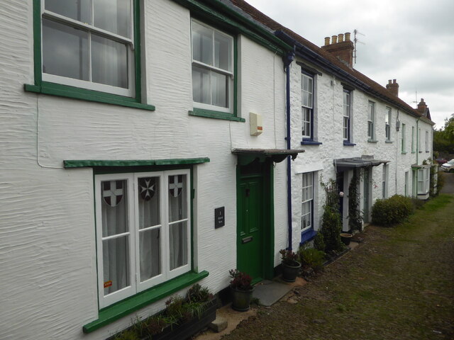
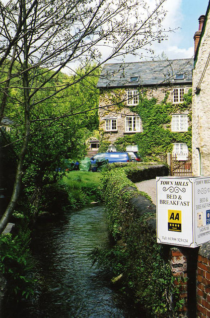
The village is home to a close-knit community, with a population of around 500 people. The area is predominantly residential, characterized by charming cottages and traditional houses, which provide a glimpse into the village's rich history. The architecture reflects a mix of architectural styles, ranging from Tudor to Georgian.

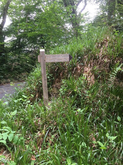
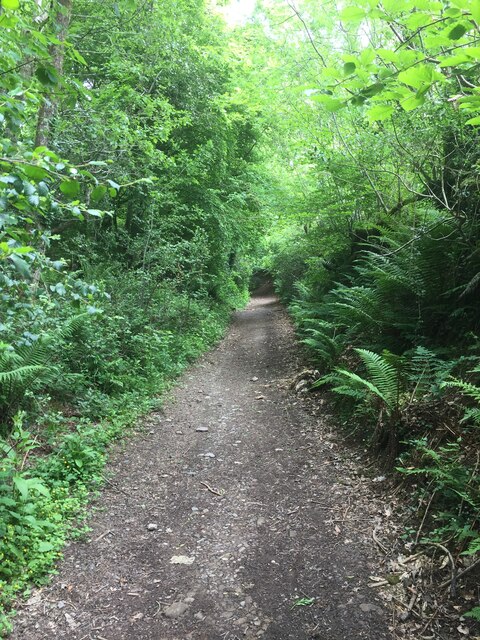
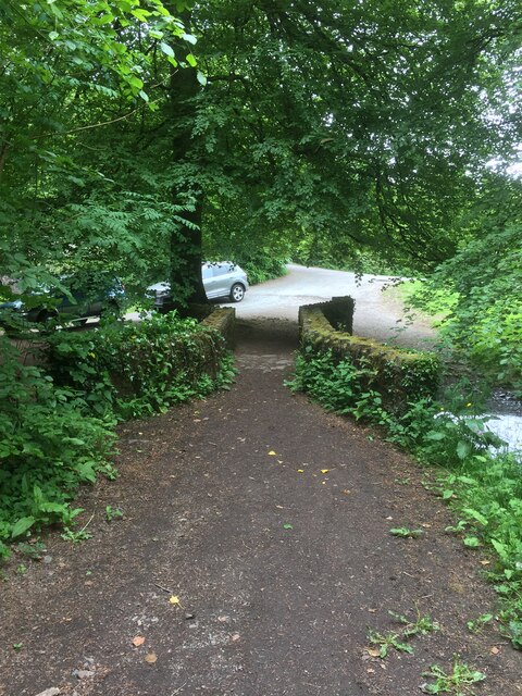
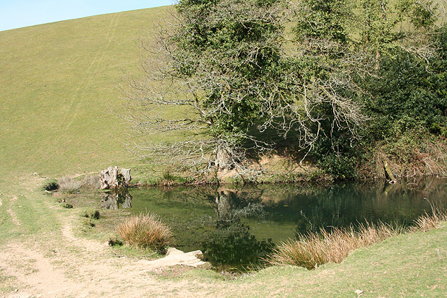
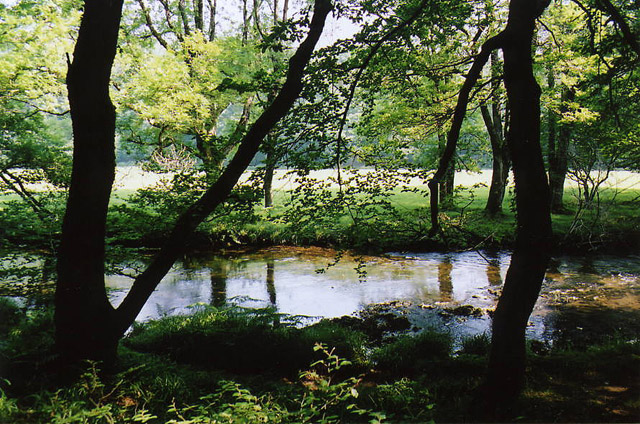
Battleton is surrounded by rolling hills and lush green fields, making it a haven for nature enthusiasts and outdoor lovers. The village boasts several walking and cycling trails, allowing visitors to explore the beautiful countryside. Additionally, there are various nature reserves and parks in the vicinity, providing opportunities for birdwatching and wildlife spotting.

Despite its rural location, Battleton benefits from good transportation links, with regular bus services connecting the village to nearby towns and villages. The village also has a community center, a primary school, and a small convenience store, catering to the daily needs of its residents.

Overall, Battleton offers a tranquil escape from the hustle and bustle of city life. With its scenic surroundings and strong sense of community, it is an ideal place for those seeking a serene and rural lifestyle.

If you have any feedback on the listing, please let us know in the comments section below.

Battleton Images

Images are sourced within 2km of 51.034691/-3.551681 or Grid Reference SS9127. Thanks to Geograph Open Source API. All images are credited.

Country Lane near Marsh Bridge
Footpath Sign to Court Down
Right of Way to Court Down
Marsh Bridge
Marsh Bridge
Bridge over the River Barle at Dulverton
Chapel in Dulverton
Chapel in Dulverton
Church of All Saints, Dulverton
High Street, Dulverton
Bridge over the River Barle at Dulverton
Barle Bridge, Dulverton A Grade II Listed bridge over the River Barle. Mediaeval in origin, repaired 1624, subsequently widened 1819 by J Stone, repaired 1866 and 1952-3. Five arches in random rubble. Also a Scheduled Ancient Monument.
Barle Bridge, Dulverton
A Grade II Listed bridge over the River Barle. Mediaeval in origin, repaired 1624, subsequently widened 1819 by J Stone, repaired 1866 and 1952-3. Five arches in random rubble. Also a Scheduled Ancient Monument.
Northmoor Road, Dulverton The nearest house is No. 7 and the pump and black bollard seen in the background are Listed Grade II, primarily for historic interest.
Northmoor Road, Dulverton
The nearest house is No. 7 and the pump and black bollard seen in the background are Listed Grade II, primarily for historic interest.
1-5 Church Lane, Dulverton Terrace of 5 houses circa early to mid-19th century, although the two closest (1 and 2) are earlier. Painted stole rubble. Listed Grade II.
1-5 Church Lane, Dulverton
Terrace of 5 houses circa early to mid-19th century, although the two closest (1 and 2) are earlier. Painted stole rubble. Listed Grade II.
Brushford: Knowle Farm
Dulverton: footbridge over stream On the public footpath between Dulverton and Waddicombe, looking east
Dulverton: footbridge over stream
On the public footpath between Dulverton and Waddicombe, looking east
Dulverton: pond By the footpath from Dulverton to Waddicombe, and clearly man made, with a dam height of 12 feet or more. Looking west
Dulverton: pond
By the footpath from Dulverton to Waddicombe, and clearly man made, with a dam height of 12 feet or more. Looking west
Dulverton: River Barle Seen from the footpath above Marsh Bridge, which runs through woods to Hawkridge and Tarr Steps
Dulverton: River Barle
Seen from the footpath above Marsh Bridge, which runs through woods to Hawkridge and Tarr Steps
Dulverton: Town Mills Now offering bread and breakfast, Town Mills was once one of four mills all powered by a single leat from the river Barle. One of its waterwheels can be seen turning at Bickleigh Mill, near Tiverton
Dulverton: Town Mills
Now offering bread and breakfast, Town Mills was once one of four mills all powered by a single leat from the river Barle. One of its waterwheels can be seen turning at Bickleigh Mill, near Tiverton
Dulverton: the leat from the Barle Here the leat runs past the old paper mill, now a private house. Seen from the public footpath
Dulverton: the leat from the Barle
Here the leat runs past the old paper mill, now a private house. Seen from the public footpath
Show me another place!

Battleton is located at Grid Ref: SS9127 (Lat: 51.034691, Lng: -3.551681)

Administrative County: Somerset

District: Somerset West and Taunton

Police Authority: Avon and Somerset

What 3 Words

///heat.foggy.structure. Near Dulverton, Somerset

Related Wikis

Barle Bridge

Barle Bridge is a five span stone arch bridge over the River Barle in Dulverton within the English county of Somerset, which is medieval in origin. It...

Combe, Dulverton

Combe is a historic estate in Somerset, England, situated between the town of Dulverton and the village of Brushford. == Descent == === Taunton Priory... ===

Dulverton Town Hall

Dulverton Town Hall is a municipal building in Fore Street in Dulverton, Somerset, England. The building, which is the meeting place of Dulverton Town...

Church of All Saints, Dulverton

The Anglican Church of All Saints in Dulverton, Somerset, England was built in the 15th century and largely rebuilt in the 1850s. It is a Grade II* listed...

Oldberry Castle

Oldberry Castle (sometimes called Oldbury Castle) is an Iron Age hill fort north west of Dulverton, Somerset, England. It lies approximately 0.5 miles...

Dulverton

Dulverton is a town and civil parish in west Somerset, England, near the border with Devon. The town had a population of 1,408 at the 2011 Census. The...

Dulverton Rural District

Dulverton was a rural district in Somerset, England, from 1894 to 1974. It was created in 1894 under the Local Government Act 1894. In 1974 it was abolished...

Barlynch Priory

Barlynch Priory (also known as St Nicholas's Priory and sometimes spelled Barlich Priory) in Brompton Regis, Somerset, England was an Augustinian priory...

Nearby Amenities

Located within 500m of 51.034691,-3.551681
Andrew's Hill Cross
Junction: yes
Lat/Long: 51.0357298/-3.558222
Direction: forward
Maxspeed: 30 mph
Maxspeed Type: GB:nsl_restricted
Source Maxspeed: sign
Traffic Sign: maxspeed
Lat/Long: 51.0363549/-3.5526097
Stop
Direction: forward
Lat/Long: 51.0371691/-3.5528
Winsbere
Addr City: Dulverton
Addr Country: GB
Addr Housenumber: 64
Addr Postcode: TA22 9HU
Addr Street: Battleton
Fhrs Authority: West Somerset
Fhrs Id: 161269
Fhrs Local Authority Id: PI/000001260
Tourism: guest_house
Lat/Long: 51.0334466/-3.5462344
Bar
Dulverton Sports And Social Club
Addr City: Dulverton
Addr Country: GB
Addr Postcode: TA22 9HQ
Addr Street: Millham Lane
Fhrs Authority: West Somerset
Fhrs Id: 161278
Fhrs Local Authority Id: PI/000001269
Smoking: outside
Lat/Long: 51.0360728/-3.5490507
Direction: backward
Maxspeed: 30 mph
Maxspeed Type: GB:nsl_restricted
Source Maxspeed: sign
Traffic Sign: maxspeed
Lat/Long: 51.0334247/-3.5453868
Generator Method: photovoltaic
Generator Output Electricity: yes
Generator Source: solar
Generator Type: solar_photovoltaic_panel
Location: roof
Power: generator
Lat/Long: 51.0386542/-3.551879
Generator Method: photovoltaic
Generator Output Electricity: yes
Generator Source: solar
Generator Type: solar_photovoltaic_panel
Location: roof
Power: generator
Lat/Long: 51.0384839/-3.5515303
Generator Method: photovoltaic
Generator Output Electricity: yes
Generator Source: solar
Generator Type: solar_photovoltaic_panel
Location: roof
Power: generator
Lat/Long: 51.0384915/-3.551651
Generator Method: photovoltaic
Generator Output Electricity: yes
Generator Source: solar
Generator Type: solar_photovoltaic_panel
Location: roof
Power: generator
Lat/Long: 51.0390843/-3.5514002
Power: pole
Source: bing
Transformer: distribution
Lat/Long: 51.0353728/-3.5489836
Power: pole
Source: bing
Transformer: distribution
Lat/Long: 51.0343482/-3.54629
Power: pole
Source: bing
Lat/Long: 51.0302484/-3.5522868
Post Box
Operator: Royal Mail
Operator Wikidata: Q638098
Post Box Type: wall
Ref: TA22 82D
Royal Cypher: EIIR
Royal Cypher Wikidata: Q33102113
Lat/Long: 51.0360197/-3.5515331
The data included in this document is from www.openstreetmap.org. The data is made available under ODbL.

Have you been to Battleton?

Leave your review of Battleton below (or comments, questions and feedback).