Church End

Settlement in Hertfordshire St. Albans

England

Church End

Matrix gantry M1 northbound
Matrix gantry M1 northbound Credit: Dave Thompson

Church End is a small village located in the county of Hertfordshire, England. Situated near the town of Ware, it is surrounded by picturesque countryside and boasts a tranquil and idyllic setting. With a population of around 500 residents, Church End is known for its close-knit community and friendly atmosphere.

The village is characterized by its charming historic buildings, many of which date back to the 16th and 17th centuries. These include the Church of St. Mary, a beautiful Grade II listed building featuring intricate stained glass windows and a striking spire. Additionally, there are several traditional thatched cottages that add to the village's quaint and traditional appeal.

Despite its small size, Church End offers a range of amenities to its residents. The village has a local pub, The Black Swan, which provides a gathering place for locals and visitors alike. There is also a village hall that hosts various community events throughout the year, fostering a strong sense of community spirit.

Surrounded by stunning countryside, Church End offers plenty of opportunities for outdoor activities. The village is located near various walking and cycling routes, allowing residents to explore the scenic surroundings. Additionally, the nearby River Lea provides opportunities for fishing and boating enthusiasts.

Church End is well-connected to other towns and cities in Hertfordshire, with good transport links to Ware and Hertford. It is approximately 25 miles north of London and easily accessible via road and rail.

Overall, Church End, Hertfordshire, is a picturesque and welcoming village that offers a peaceful retreat and a strong sense of community.

If you have any feedback on the listing, please let us know in the comments section below.

Church End Images

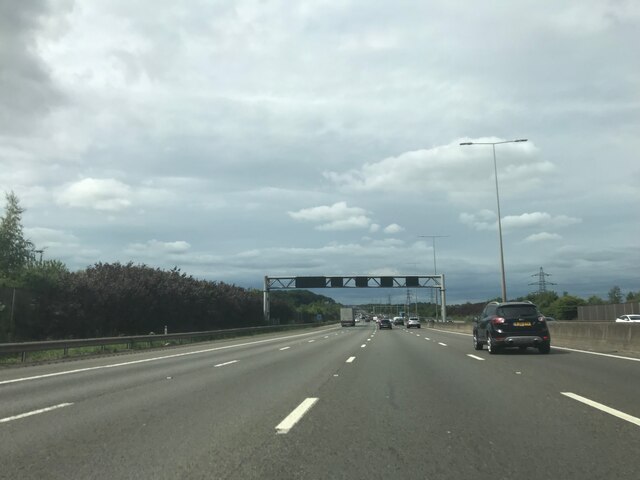
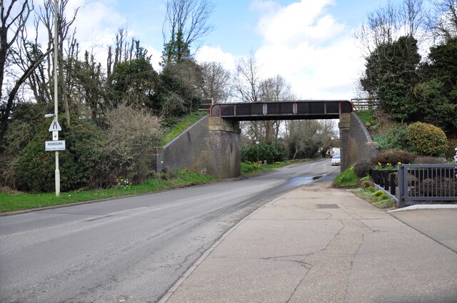
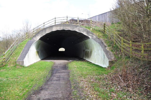
Images are sourced within 2km of 51.790782/-0.40782751 or Grid Reference TL0911. Thanks to Geograph Open Source API. All images are credited.

Matrix gantry M1 northbound
Footbridge crossing M1 northbound
Aubrey Park Hotel, Hemel Hempstead Road
Bridge over Redbourn High Street The disused railway bridge crossing Redbourn High Street, once the A5.  The single line ran from Harpenden to Hemel Hempstead and was built by the Midland Railway.  Passenger services ceased in 1947, but the full length of the line was not closed and removed until 1982.  Nowadays a large part of the line is used as a cycleway and footpath, known as the 'Nickey Line'.
Bridge over Redbourn High Street
The disused railway bridge crossing Redbourn High Street, once the A5. The single line ran from Harpenden to Hemel Hempstead and was built by the Midland Railway. Passenger services ceased in 1947, but the full length of the line was not closed and removed until 1982. Nowadays a large part of the line is used as a cycleway and footpath, known as the 'Nickey Line'.
Nickey Line M1 tunnel Since the widening of the M1, the Nickey Line path goes through this concrete tunnel, far less photogenic than the old 'original M1 style' bridge which is now encased beneath the roadway above.
Nickey Line M1 tunnel
Since the widening of the M1, the Nickey Line path goes through this concrete tunnel, far less photogenic than the old 'original M1 style' bridge which is now encased beneath the roadway above.
Nickey Line tunnel The south end of the new Nickey Line tunnel beneath the widened M1 motorway.  During the widening the old original railway bridge was lined and extended with this less elegant concrete tunnel.
Nickey Line tunnel
The south end of the new Nickey Line tunnel beneath the widened M1 motorway. During the widening the old original railway bridge was lined and extended with this less elegant concrete tunnel.
Southbound M1 near to Redbourn The M1 is a north–south motorway connecting London to Leeds, where it joins the A1(M) near Aberford. It was the first motorway to be completed in the United Kingdom.
The motorway is 193 miles long and was constructed in four phases. Most of the motorway was opened between 1959 and 1968 but the southern end was extended in 1977 and the northern end was extended in 1999.
Southbound M1 near to Redbourn
The M1 is a north–south motorway connecting London to Leeds, where it joins the A1(M) near Aberford. It was the first motorway to be completed in the United Kingdom. The motorway is 193 miles long and was constructed in four phases. Most of the motorway was opened between 1959 and 1968 but the southern end was extended in 1977 and the northern end was extended in 1999.
Clump of Trees in Gaddesden Lane. Thank goodness the farmer hasn't seen fit to chop down and fill the hollow to ease passage of the combine harvester
Clump of Trees in Gaddesden Lane.
Thank goodness the farmer hasn't seen fit to chop down and fill the hollow to ease passage of the combine harvester
House at entrance to Great Revell's Farm is this a Farmworkers cottage perhaps?
House at entrance to Great Revell's Farm
is this a Farmworkers cottage perhaps?
Factory Farming at Little Revel end The hens don't even have roof lights for comfort.
Factory Farming at Little Revel end
The hens don't even have roof lights for comfort.
Little Revelend Farm Good vibrations despite the factory farm next door.
Little Revelend Farm
Good vibrations despite the factory farm next door.
House near to junction with Little Revelend and Hemel road House shows signs of improvements and builders junk in the garden
House near to junction with Little Revelend and Hemel road
House shows signs of improvements and builders junk in the garden
Bungalows at end of Gaddesden Lane When the road became a river these bungalows were flooded and had to be protected by sandbag barricades
Bungalows at end of Gaddesden Lane
When the road became a river these bungalows were flooded and had to be protected by sandbag barricades
M1 Motorway near Redbourn Viewed looking north from the Flamsteadbury Farm overbridge, this section of the motorway, between Junctions 8 and 9, is about to be widened to four lanes in each direction. Two wide swathes of land on either side have already been cleared of vegetation. The motorway currently carries an average of 160,000 vehicles per day between these junctions and is often subject to delays. The total cost of the improvement works is estimated to be about £214 million.
M1 Motorway near Redbourn
Viewed looking north from the Flamsteadbury Farm overbridge, this section of the motorway, between Junctions 8 and 9, is about to be widened to four lanes in each direction. Two wide swathes of land on either side have already been cleared of vegetation. The motorway currently carries an average of 160,000 vehicles per day between these junctions and is often subject to delays. The total cost of the improvement works is estimated to be about £214 million.
M1 Motorway near Redbourn The southbound carriageway looking northwards from the Flamsteadbury Farm overbridge, with the outside lane coned off, and the swathe of land to the right for the widening already cleared of vegetation.
M1 Motorway near Redbourn
The southbound carriageway looking northwards from the Flamsteadbury Farm overbridge, with the outside lane coned off, and the swathe of land to the right for the widening already cleared of vegetation.
M1 Motorway near Redbourn The northbound carriageway looking northwards from the Flamsteadbury Farm overbridge, with the outside lane coned off, and the swathe of land to the left for the widening already cleared of vegetation.
M1 Motorway near Redbourn
The northbound carriageway looking northwards from the Flamsteadbury Farm overbridge, with the outside lane coned off, and the swathe of land to the left for the widening already cleared of vegetation.
The Hertfordshire Way near Flamsteadbury Farm Possibly the most tedious grid square in Hertfordshire, redeemed only by the singing of the skylarks.
The Hertfordshire Way near Flamsteadbury Farm
Possibly the most tedious grid square in Hertfordshire, redeemed only by the singing of the skylarks.
Show me another place!

Church End is located at Grid Ref: TL0911 (Lat: 51.790782, Lng: -0.40782751)

Administrative County: Hertfordshire

District: St. Albans

Police Authority: Hertfordshire

What 3 Words

///shovels.void.jacket. Near Redbourn, Hertfordshire

Related Wikis

Beaumont's Halt railway station

Beaumont's Halt railway station was in Hertfordshire, England from 1905 to 1963 on the Nickey Line. == History == The station opened on 9 August 1905...

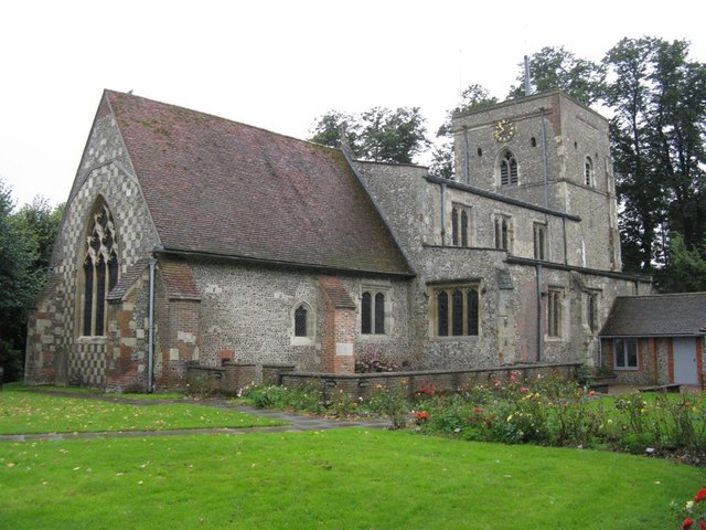
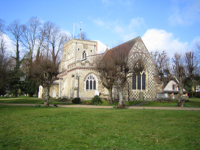
St Mary's Church, Redbourn

St Mary's Church is an active Grade I listed parish church in the Church of England in Redbourn, Hertfordshire, England. The building is Grade I listed...
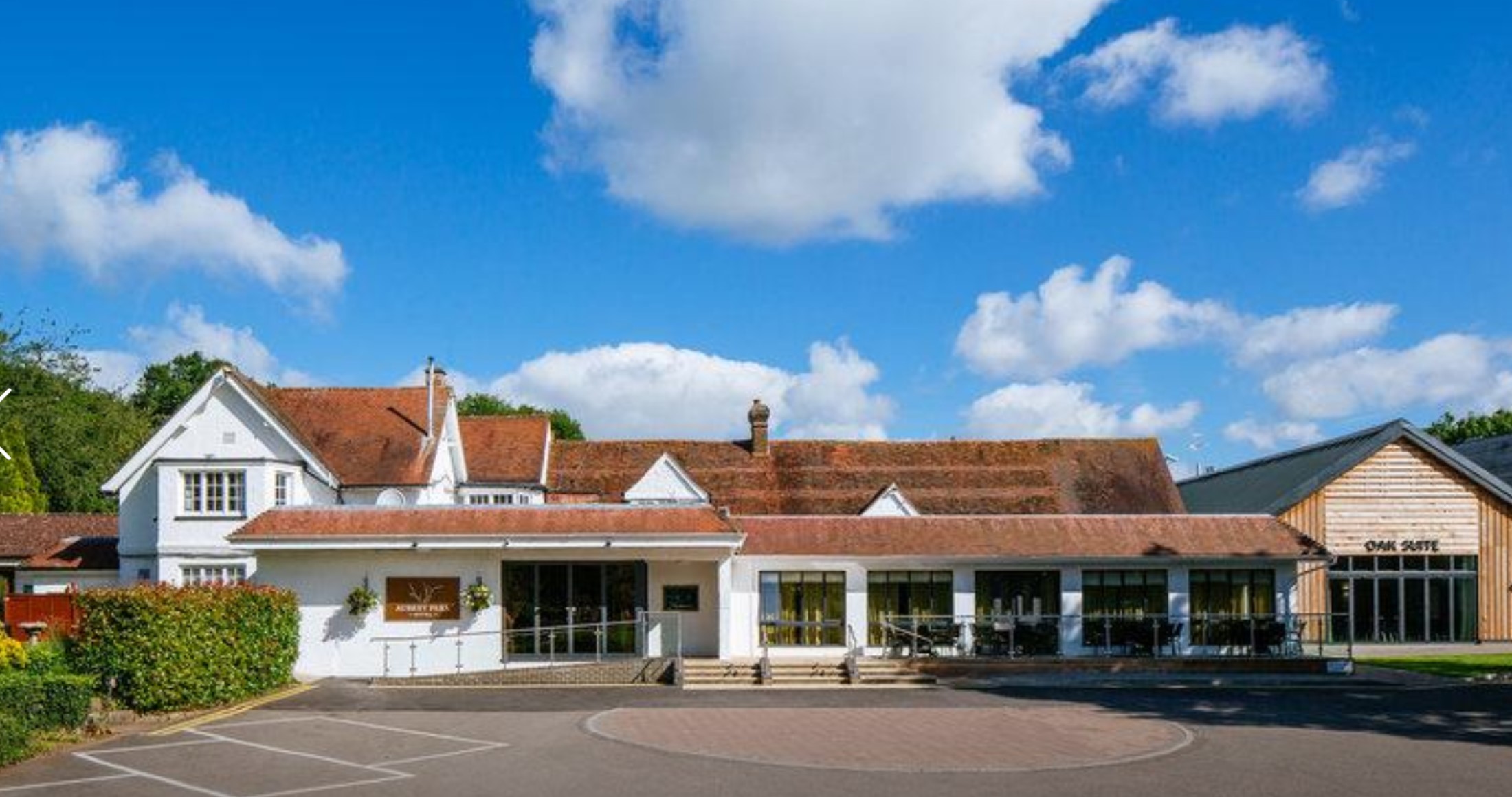
Aubrey Park Hotel

Aubrey Park, Redbourn in Hertfordshire is a building of historical significance and is listed on the English Heritage Register. Parts of the building date...

Redbourn railway station

Redbourn railway station served the village of Redbourn, Hertfordshire, England from 1887 to 1964 on the Nickey Line. == History == The station opened...

Redbourn

Redbourn is a village and civil parish in Hertfordshire, England, three miles (4.8 km) from Harpenden, four miles (6.4 km) from St Albans and five miles...

Redbournbury Mill

Redbournbury Mill, is a Grade II* listed flour mill in Redbournbury, Hertfordshire, England, which is thought to have been first built in the early 11th...

Redbournbury

Redbournbury is a hamlet in the county of Hertfordshire. It is located near the A5 road in between the city of St Albans and the large village of Redbourn...

Harpenden RFC

Harpenden Rugby Football Club is a rugby club based in Harpenden. They play in Regional 1 South East - a league at tier 5 of the English rugby union system...

Nearby Amenities

Located within 500m of 51.790782,-0.40782751
Crossing
Crossing: unmarked
Crossing Island: yes
Crossing Markings: no
Tactile Paving: yes
Lat/Long: 51.7896719/-0.4082165
Crossing
Crossing: unmarked
Crossing Markings: no
Lat/Long: 51.7893246/-0.4086166
Beaumont's Halt
Historic Railway: halt
Railway: site
Wikidata: Q104869523
Wikipedia: en:Beaumont's Halt railway station
Lat/Long: 51.7904678/-0.4066895
Crossing
Lat/Long: 51.7935062/-0.4034617
Flowers Farm
Landuse: farm
Note Retag: CS #48756035
Wikidata: Q26630665
Lat/Long: 51.7872362/-0.4070436
Ele: 118.1268311
Lat/Long: 51.7881886/-0.4050138
Line Management: branch
Power: tower
Lat/Long: 51.7940409/-0.4111976
Power: tower
Lat/Long: 51.7875736/-0.4101526
Power: tower
Lat/Long: 51.7901016/-0.4102546
Bus Stop
Church End
Bus: yes
Local Ref: NR
Naptan AtcoCode: 210021502520
Naptan Bearing: NE
Naptan CommonName: Church End
Naptan Crossing: St Marys Church
Naptan Indicator: nr
Naptan Landmark: St Marys Church
Naptan NaptanCode: hrtdadga
Naptan PlusbusZoneRef: HRPNDN;STALBCY
Naptan ShortCommonName: NA
Naptan Street: Hemel Hempstead Road
Naptan Verified: no
Public Transport: platform
Source: naptan_import
Lat/Long: 51.7923915/-0.4040755
Bus Stop
Gaddesden Lane
Bus: yes
Naptan AtcoCode: 210021502540
Naptan Bearing: SW
Naptan CommonName: Gaddesden Lane
Naptan Crossing: opp Gaddesden Lane
Naptan Indicator: opp
Naptan Landmark: opp Gaddesden Lane
Naptan NaptanCode: hrtdadgd
Naptan PlusbusZoneRef: HRPNDN;STALBCY
Naptan ShortCommonName: NA
Naptan Street: Hemel Hempstead Road
Naptan Verified: no
Public Transport: platform
Source: naptan_import
Lat/Long: 51.7910455/-0.4070712
Bus Stop
Gaddesden Lane
Bus: yes
Naptan AtcoCode: 210021509160
Naptan Bearing: NE
Naptan CommonName: Gaddesden Lane
Naptan Crossing: Gaddesden Lane
Naptan Indicator: adj
Naptan Landmark: Gaddesden Lane
Naptan NaptanCode: hrtatpmt
Naptan PlusbusZoneRef: HRPNDN;STALBCY
Naptan ShortCommonName: NA
Naptan Street: Hemel Hempstead Road
Naptan Verified: no
Public Transport: platform
Shelter: no
Source: naptan_import
Lat/Long: 51.7906057/-0.4082757
Bus Stop
Church End
Bus: yes
Naptan AtcoCode: 210021509180
Naptan Bearing: SW
Naptan CommonName: Church End
Naptan Crossing: opp St Mary's Church
Naptan Indicator: opp
Naptan Landmark: opp St Mary's Church
Naptan NaptanCode: hrtatpmw
Naptan PlusbusZoneRef: HRPNDN;STALBCY
Naptan ShortCommonName: NA
Naptan Street: Hemel Hempstead Road
Naptan Verified: no
Public Transport: platform
Source: naptan_import
Lat/Long: 51.7920185/-0.4048899
Power: pole
Lat/Long: 51.7913859/-0.4011646
Power: pole
Lat/Long: 51.7904336/-0.4045281
Power: pole
Lat/Long: 51.7897883/-0.4068529
Power: pole
Lat/Long: 51.7910657/-0.4023019
Power: pole
Lat/Long: 51.7900709/-0.4058346
Speed Camera
Maxspeed: 70 mph
Maxspeed Type: GB:motorway
Lat/Long: 51.7915214/-0.411349
Power: tower
Lat/Long: 51.7925637/-0.4108273
The Aubreys
Historic: archaeological_site
Lat/Long: 51.7892972/-0.4140549
Speed Camera
Maxspeed: 70 mph
Maxspeed Type: GB:motorway
Lat/Long: 51.7886688/-0.4111625
Barrier: kissing_gate
Foot: yes
Source: GPS, observation
Lat/Long: 51.7924034/-0.4082195
Street Lamp
Lamp Model: CU Phosco P860
Lamp Type: LED
Source: Survey of 2019-02-22
Lat/Long: 51.7941035/-0.4120287
Street Lamp
Lamp Model: CU Phosco P860
Lamp Type: LED
Source: Survey of 2019-02-22
Lat/Long: 51.7937306/-0.4119493
Street Lamp
Lamp Model: CU Phosco P860
Lamp Type: LED
Source: Survey of 2019-02-22
Lat/Long: 51.7933358/-0.4118669
Street Lamp
Lamp Model: CU Phosco P860
Lamp Type: LED
Source: Survey of 2019-02-22
Lat/Long: 51.792952/-0.4117846
Street Lamp
Lamp Model: CU Phosco P860
Lamp Type: LED
Source: Survey of 2019-02-22
Lat/Long: 51.7925882/-0.4117022
Street Lamp
Lamp Model: CU Phosco P860
Lamp Type: LED
Source: Survey of 2019-02-22
Lat/Long: 51.7921934/-0.4116199
Street Lamp
Lamp Model: CU Phosco P860
Lamp Type: LED
Source: Survey of 2019-02-22
Lat/Long: 51.7917659/-0.4115405
Street Lamp
Lamp Model: CU Phosco P860
Lamp Type: LED
Source: Survey of 2019-02-22
Lat/Long: 51.7913547/-0.4114463
Street Lamp
Lamp Model: CU Phosco P860
Lamp Type: LED
Source: Survey of 2019-02-22
Lat/Long: 51.7909454/-0.411361
Street Lamp
Lamp Model: CU Phosco P860
Lamp Type: LED
Source: Survey of 2019-02-22
Lat/Long: 51.7905324/-0.4112816
Street Lamp
Lamp Model: CU Phosco P860
Lamp Type: LED
Source: Survey of 2019-02-22
Lat/Long: 51.7901503/-0.4112199
Street Lamp
Lamp Model: CU Phosco P860
Lamp Type: LED
Source: Survey of 2019-02-22
Lat/Long: 51.7897756/-0.4111552
Street Lamp
Lamp Model: CU Phosco P860
Lamp Type: LED
Source: Survey of 2019-02-22
Lat/Long: 51.789419/-0.4111022
Street Lamp
Lamp Model: CU Phosco P860
Lamp Type: LED
Source: Survey of 2019-02-22
Lat/Long: 51.7890551/-0.4110551
Street Lamp
Lamp Model: CU Phosco P860
Lamp Type: LED
Source: Survey of 2019-02-22
Lat/Long: 51.7886785/-0.4110022
Street Lamp
Lamp Model: CU Phosco P860
Lamp Type: LED
Source: Survey of 2019-02-22
Lat/Long: 51.7882691/-0.410964
Street Lamp
Lamp Model: CU Phosco P860
Lamp Type: LED
Source: Survey of 2019-02-22
Lat/Long: 51.787847/-0.4109287
Street Lamp
Lamp Model: CU Phosco P860
Lamp Type: LED
Source: Survey of 2019-02-22
Lat/Long: 51.7874177/-0.4109022
Street Lamp
Lamp Model: CU Phosco P860
Lamp Type: LED
Source: Survey of 2019-02-22
Lat/Long: 51.7869937/-0.4108757
Direction: 50
Generator Method: photovoltaic
Generator Output Electricity: yes
Generator Solar Modules: 11
Generator Source: solar
Generator Type: solar_photovoltaic_panel
Location: roof
Power: generator
Lat/Long: 51.7914812/-0.4057287
Direction: 140
Generator Method: photovoltaic
Generator Output Electricity: yes
Generator Solar Modules: 3
Generator Source: solar
Generator Type: solar_photovoltaic_panel
Location: roof
Power: generator
Lat/Long: 51.7915119/-0.4057788
Direction: 150
Generator Method: photovoltaic
Generator Output Electricity: yes
Generator Solar Modules: 6
Generator Source: solar
Generator Type: solar_photovoltaic_panel
Location: roof
Power: generator
Lat/Long: 51.7911571/-0.4072939
Power: pole
Lat/Long: 51.7895863/-0.4076136
Power: pole
Lat/Long: 51.7897664/-0.4087071
Direction: 225
Generator Method: photovoltaic
Generator Output Electricity: yes
Generator Solar Modules: 6
Generator Source: solar
Generator Type: solar_photovoltaic_panel
Location: roof
Power: generator
Lat/Long: 51.7929139/-0.4066529
Turning Circle
Lat/Long: 51.7925765/-0.4073506
Direction: 145
Generator Method: photovoltaic
Generator Output Electricity: yes
Generator Solar Modules: 18
Generator Source: solar
Generator Type: solar_photovoltaic_panel
Location: roof
Power: generator
Lat/Long: 51.794917/-0.4058941
Traffic Calming: island
Lat/Long: 51.7895704/-0.4089116
Material: steel
Power: pole
Lat/Long: 51.7892716/-0.4097355
Material: steel
Power: pole
Lat/Long: 51.7901966/-0.4099473
Material: steel
Power: pole
Lat/Long: 51.7911546/-0.4101724
Line Management: branch
Power: pole
Lat/Long: 51.7883491/-0.4085378
Power: pole
Lat/Long: 51.7891928/-0.4085557
Material: steel
Power: pole
Lat/Long: 51.7874355/-0.4085335
Speed Camera
Maxspeed: 70 mph
Maxspeed Type: GB:motorway
Lat/Long: 51.7932817/-0.4117071
Power: pole
Lat/Long: 51.7907563/-0.4033774
Colour: white
Marker: aerial
Utility: oil
Lat/Long: 51.7909663/-0.4085437
Colour: white
Marker: post
Material: concrete
Utility: oil
Lat/Long: 51.790966/-0.4085198
Colour: white
Marker: post
Material: plastic
Utility: oil
Lat/Long: 51.7908872/-0.4085265
Colour: white
Inscription: TOTAL HIGH PRESSURE PIPELINE
Marker: sign
Utility: oil
Lat/Long: 51.7909057/-0.4085265
Colour: white
Marker: post
Material: concrete
Utility: oil
Lat/Long: 51.7909064/-0.4085154
Colour: white
Inscription: TOTAL HIGH PRESSURE PIPELINE
Marker: sign
Utility: oil
Lat/Long: 51.7889583/-0.4094077
Colour: white
Marker: post
Material: concrete
Utility: oil
Lat/Long: 51.7893031/-0.4096601
Colour: white
Inscription: TOTAL HIGH PRESSURE PIPELINE
Marker: sign
Utility: oil
Lat/Long: 51.7893077/-0.4096636
Aubrey Park Hotel helipad
Aeroway: helipad
Surface: grass
Lat/Long: 51.7880966/-0.4132473
Redbourn
Board Type: welcome_sign
Information: board
Tourism: information
Lat/Long: 51.7896953/-0.4086291
The data included in this document is from www.openstreetmap.org. The data is made available under ODbL.

Have you been to Church End?

Leave your review of Church End below (or comments, questions and feedback).