Bury Wood

Wood, Forest in Hertfordshire Dacorum

England

Bury Wood

Matrix gantry M1 northbound
Matrix gantry M1 northbound Credit: Dave Thompson

Bury Wood is a beautiful woodland located in Hertfordshire, England. Covering an area of approximately 100 acres, it is a diverse and ancient forest that has been preserved for centuries. The wood is situated near the village of Colney Heath, offering a peaceful escape from the hustle and bustle of nearby towns and cities.

The wood is predominantly composed of broadleaf trees, including oak, beech, and ash, which create a stunning canopy during the summer months. It also features a wide variety of wildflowers and plants, adding to its natural charm and beauty. Bury Wood is home to a rich array of wildlife, including deer, foxes, badgers, and an abundance of bird species, making it an ideal spot for nature enthusiasts and birdwatchers.

The forest is crisscrossed by a network of well-maintained footpaths, allowing visitors to explore the wood at their own pace. These paths lead to various points of interest, including a small pond and a clearing that offers breathtaking views of the surrounding countryside. In addition, there are several picnic areas scattered throughout the wood, providing a perfect spot to relax and enjoy the tranquil surroundings.

Bury Wood is managed by the local authorities, who ensure its preservation and accessibility to the public. The wood is open year-round and is free to visit, making it a popular destination for families, walkers, and those seeking a peaceful retreat in nature. Its proximity to other attractions, such as St Albans Cathedral and Verulamium Park, also makes it a convenient stop for tourists exploring the area.

If you have any feedback on the listing, please let us know in the comments section below.
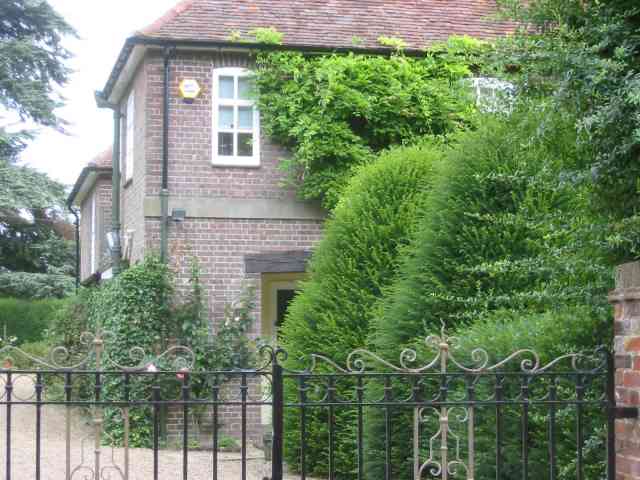
Bury Wood Images

Images are sourced within 2km of 51.795784/-0.41469907 or Grid Reference TL0911. Thanks to Geograph Open Source API. All images are credited.

Matrix gantry M1 northbound
Footbridge crossing M1 northbound
Matrix gantry M1 northbound
Conifers by Luton Lane, Redbourn
House on Luton Lane, Redbourn
Aubrey Park Hotel, Hemel Hempstead Road
Bridge over Redbourn High Street The disused railway bridge crossing Redbourn High Street, once the A5.  The single line ran from Harpenden to Hemel Hempstead and was built by the Midland Railway.  Passenger services ceased in 1947, but the full length of the line was not closed and removed until 1982.  Nowadays a large part of the line is used as a cycleway and footpath, known as the 'Nickey Line'.
Bridge over Redbourn High Street
The disused railway bridge crossing Redbourn High Street, once the A5. The single line ran from Harpenden to Hemel Hempstead and was built by the Midland Railway. Passenger services ceased in 1947, but the full length of the line was not closed and removed until 1982. Nowadays a large part of the line is used as a cycleway and footpath, known as the 'Nickey Line'.
Nickey Line M1 tunnel Since the widening of the M1, the Nickey Line path goes through this concrete tunnel, far less photogenic than the old 'original M1 style' bridge which is now encased beneath the roadway above.
Nickey Line M1 tunnel
Since the widening of the M1, the Nickey Line path goes through this concrete tunnel, far less photogenic than the old 'original M1 style' bridge which is now encased beneath the roadway above.
Nickey Line tunnel The south end of the new Nickey Line tunnel beneath the widened M1 motorway.  During the widening the old original railway bridge was lined and extended with this less elegant concrete tunnel.
Nickey Line tunnel
The south end of the new Nickey Line tunnel beneath the widened M1 motorway. During the widening the old original railway bridge was lined and extended with this less elegant concrete tunnel.
Southbound M1 near to Redbourn The M1 is a north–south motorway connecting London to Leeds, where it joins the A1(M) near Aberford. It was the first motorway to be completed in the United Kingdom.
The motorway is 193 miles long and was constructed in four phases. Most of the motorway was opened between 1959 and 1968 but the southern end was extended in 1977 and the northern end was extended in 1999.
Southbound M1 near to Redbourn
The M1 is a north–south motorway connecting London to Leeds, where it joins the A1(M) near Aberford. It was the first motorway to be completed in the United Kingdom. The motorway is 193 miles long and was constructed in four phases. Most of the motorway was opened between 1959 and 1968 but the southern end was extended in 1977 and the northern end was extended in 1999.
Farmhouse at Holtsmere End This farm is obviously a profitable concern
Farmhouse at Holtsmere End
This farm is obviously a profitable concern
Farm Buildings at Holtsmere End These are located to the left of the house
Farm Buildings at Holtsmere End
These are located to the left of the house
Greenacre Farm, Green Lane This farm displays an sign offering help with animal manipulation.  Horse whispering perhaps?
Greenacre Farm, Green Lane
This farm displays an sign offering help with animal manipulation. Horse whispering perhaps?
Clump of Trees in Gaddesden Lane. Thank goodness the farmer hasn't seen fit to chop down and fill the hollow to ease passage of the combine harvester
Clump of Trees in Gaddesden Lane.
Thank goodness the farmer hasn't seen fit to chop down and fill the hollow to ease passage of the combine harvester
House at entrance to Great Revell's Farm is this a Farmworkers cottage perhaps?
House at entrance to Great Revell's Farm
is this a Farmworkers cottage perhaps?
Factory Farming at Little Revel end The hens don't even have roof lights for comfort.
Factory Farming at Little Revel end
The hens don't even have roof lights for comfort.
Little Revelend Farm Good vibrations despite the factory farm next door.
Little Revelend Farm
Good vibrations despite the factory farm next door.
Show me another place!

Bury Wood is located at Grid Ref: TL0911 (Lat: 51.795784, Lng: -0.41469907)

Administrative County: Hertfordshire

District: Dacorum

Police Authority: Hertfordshire

What 3 Words

///voting.dimes.town. Near Redbourn, Hertfordshire

Related Wikis

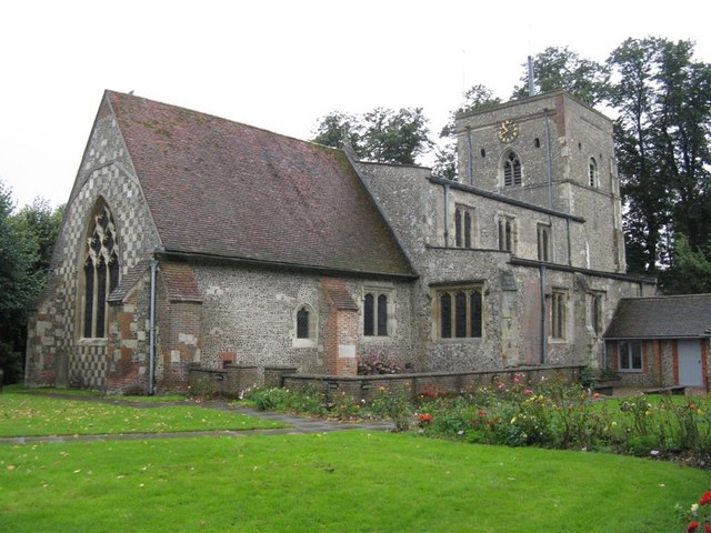
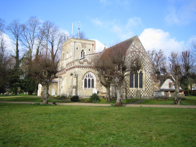
St Mary's Church, Redbourn

St Mary's Church is an active Grade I listed parish church in the Church of England in Redbourn, Hertfordshire, England. The building is Grade I listed...

Beaumont's Halt railway station

Beaumont's Halt railway station was in Hertfordshire, England from 1905 to 1963 on the Nickey Line. == History == The station opened on 9 August 1905...
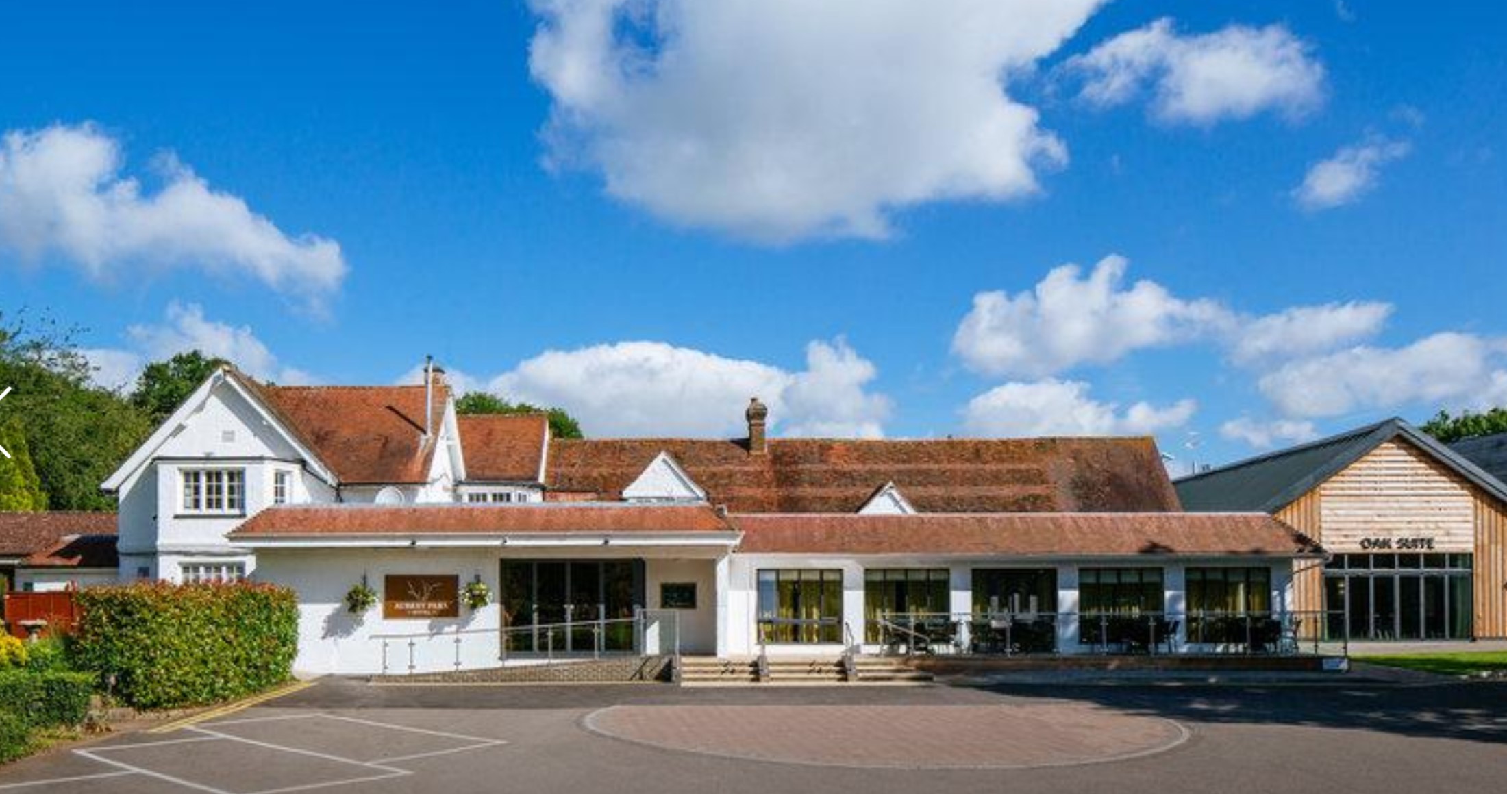
Aubrey Park Hotel

Aubrey Park, Redbourn in Hertfordshire is a building of historical significance and is listed on the English Heritage Register. Parts of the building date...

Redbourn

Redbourn is a village and civil parish in Hertfordshire, England, three miles (4.8 km) from Harpenden, four miles (6.4 km) from St Albans and five miles...

Redbourn railway station

Redbourn railway station served the village of Redbourn, Hertfordshire, England from 1887 to 1964 on the Nickey Line. == History == The station opened...

Redbournbury Mill

Redbournbury Mill, is a Grade II* listed flour mill in Redbournbury, Hertfordshire, England, which is thought to have been first built in the early 11th...

Redbournbury

Redbournbury is a hamlet in the county of Hertfordshire. It is located near the A5 road in between the city of St Albans and the large village of Redbourn...

Flamstead

Flamstead is a village and civil parish in north-west Hertfordshire, England, close to the junction of the A5 and the M1 motorway at junction 9. The name...

Nearby Amenities

Located within 500m of 51.795784,-0.41469907
Power: tower
Lat/Long: 51.7984171/-0.4121055
Line Management: branch
Power: tower
Lat/Long: 51.7940409/-0.4111976
Power: tower
Lat/Long: 51.7932108/-0.4192861
Power: tower
Lat/Long: 51.7937539/-0.4141752
Power: tower
Lat/Long: 51.7962709/-0.4117118
Speed Camera
Maxspeed: 70 mph
Maxspeed Type: GB:motorway
Lat/Long: 51.7946708/-0.4123053
Speed Camera
Maxspeed: 70 mph
Maxspeed Type: GB:motorway
Lat/Long: 51.7998141/-0.4130665
Power: tower
Lat/Long: 51.7925637/-0.4108273
Street Lamp
Lamp Model: CU Phosco P860
Lamp Type: LED
Source: Survey of 2019-02-22
Lat/Long: 51.8000972/-0.413267
Street Lamp
Lamp Model: CU Phosco P860
Lamp Type: LED
Source: Survey of 2019-02-22
Lat/Long: 51.7997043/-0.4131787
Street Lamp
Lamp Model: CU Phosco P860
Lamp Type: LED
Source: Survey of 2019-02-22
Lat/Long: 51.7992987/-0.4130846
Street Lamp
Lamp Model: CU Phosco P860
Lamp Type: LED
Source: Survey of 2019-02-22
Lat/Long: 51.7988713/-0.4130052
Street Lamp
Lamp Model: CU Phosco P860
Lamp Type: LED
Source: Survey of 2019-02-22
Lat/Long: 51.7984656/-0.4129287
Street Lamp
Lamp Model: CU Phosco P860
Lamp Type: LED
Source: Survey of 2019-02-22
Lat/Long: 51.7980436/-0.4128405
Street Lamp
Lamp Model: CU Phosco P860
Lamp Type: LED
Source: Survey of 2019-02-22
Lat/Long: 51.7976253/-0.4127611
Street Lamp
Lamp Model: CU Phosco P860
Lamp Type: LED
Source: Survey of 2019-02-22
Lat/Long: 51.7972123/-0.4126846
Street Lamp
Lamp Model: CU Phosco P860
Lamp Type: LED
Source: Survey of 2019-02-22
Lat/Long: 51.796814/-0.4125993
Street Lamp
Lamp Model: CU Phosco P860
Lamp Type: LED
Source: Survey of 2019-02-22
Lat/Long: 51.796412/-0.412517
Street Lamp
Lamp Model: CU Phosco P860
Lamp Type: LED
Source: Survey of 2019-02-22
Lat/Long: 51.7960409/-0.4124405
Street Lamp
Lamp Model: CU Phosco P860
Lamp Type: LED
Source: Survey of 2019-02-22
Lat/Long: 51.7956407/-0.4123552
Street Lamp
Lamp Model: CU Phosco P860
Lamp Type: LED
Source: Survey of 2019-02-22
Lat/Long: 51.7952368/-0.4122611
Street Lamp
Lamp Model: CU Phosco P860
Lamp Type: LED
Source: Survey of 2019-02-22
Lat/Long: 51.7948476/-0.4121846
Street Lamp
Lamp Model: CU Phosco P860
Lamp Type: LED
Source: Survey of 2019-02-22
Lat/Long: 51.7944692/-0.4120993
Street Lamp
Lamp Model: CU Phosco P860
Lamp Type: LED
Source: Survey of 2019-02-22
Lat/Long: 51.7941035/-0.4120287
Street Lamp
Lamp Model: CU Phosco P860
Lamp Type: LED
Source: Survey of 2019-02-22
Lat/Long: 51.7937306/-0.4119493
Street Lamp
Lamp Model: CU Phosco P860
Lamp Type: LED
Source: Survey of 2019-02-22
Lat/Long: 51.7933358/-0.4118669
Street Lamp
Lamp Model: CU Phosco P860
Lamp Type: LED
Source: Survey of 2019-02-22
Lat/Long: 51.792952/-0.4117846
Street Lamp
Lamp Model: CU Phosco P860
Lamp Type: LED
Source: Survey of 2019-02-22
Lat/Long: 51.7925882/-0.4117022
Street Lamp
Lamp Model: CU Phosco P860
Lamp Type: LED
Source: Survey of 2019-02-22
Lat/Long: 51.7921934/-0.4116199
Street Lamp
Lamp Model: CU Phosco P860
Lamp Type: LED
Source: Survey of 2019-02-22
Lat/Long: 51.7917659/-0.4115405
Generator Method: wind_turbine
Generator Source: wind
Generator Type: horizontal_axis
Power: generator
Lat/Long: 51.8001854/-0.4151983
Speed Camera
Maxspeed: 70 mph
Maxspeed Type: GB:motorway
Lat/Long: 51.7932817/-0.4117071
Power: pole
Lat/Long: 51.79901/-0.4170553
Power: pole
Lat/Long: 51.7996099/-0.4167224
The data included in this document is from www.openstreetmap.org. The data is made available under ODbL.

Have you been to Bury Wood?

Leave your review of Bury Wood below (or comments, questions and feedback).