Efford Warren

Wood, Forest in Devon

England

Efford Warren

Old Boundary Marker on Old Laira Road, Plymouth Municipal Boundary Marker facing east against the front garden wall of No.369 Old Laira Road, Plymouth, close to the junction with Manor Lane. Inscribed J.T. BOND / 1896 for John Thomas Bond, mayor.

Milestone Society National ID: DV_PCBS48pb
Old Boundary Marker on Old Laira Road, Plymouth Credit: T Jenkinson

Efford Warren is a small woodland area located in Devon, England. Situated in the region known as the South Hams, this forested area covers approximately 100 acres of land. Efford Warren is known for its diverse range of trees, including oak, beech, and ash, which create a picturesque and serene environment.

The woodland is home to a variety of wildlife, making it popular among nature enthusiasts and bird watchers. Visitors may catch glimpses of deer, foxes, badgers, and a wide array of bird species, including woodpeckers and owls. The peaceful atmosphere and natural beauty of Efford Warren make it an ideal spot for leisurely walks, picnics, and photography.

Efford Warren is also of historical significance, with evidence of ancient human habitation dating back to the Bronze Age. Archaeological finds in the area include flint tools, pottery fragments, and burial sites. These discoveries provide insight into the early inhabitants' way of life and add an extra layer of intrigue to the woodland's allure.

The forest is easily accessible, located near the village of Aveton Gifford and within driving distance of other popular tourist destinations in Devon, such as the coastal towns of Salcombe and Dartmouth. Efford Warren offers ample parking and well-maintained footpaths, allowing visitors to explore the forest at their own pace.

Whether one seeks tranquility in nature, an opportunity to spot wildlife, or a glimpse into the past, Efford Warren provides a captivating and enriching experience for all who visit.

If you have any feedback on the listing, please let us know in the comments section below.

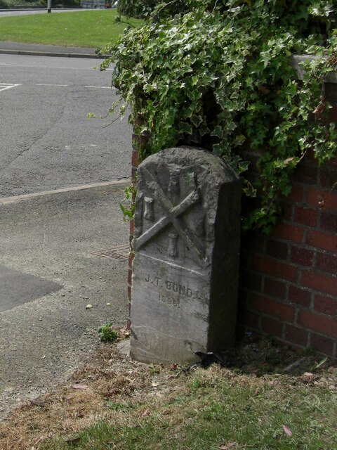
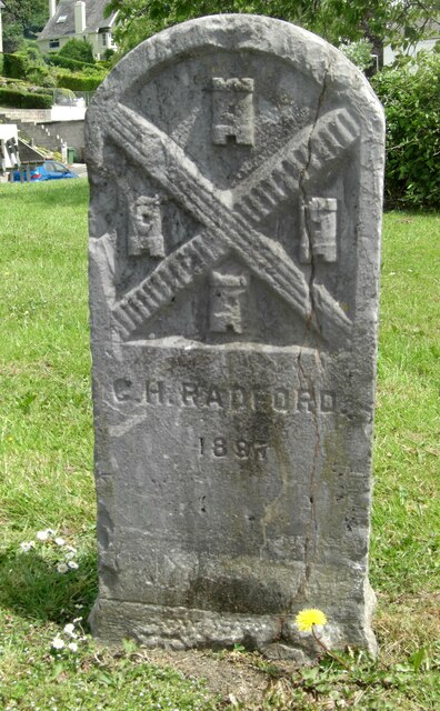
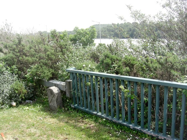
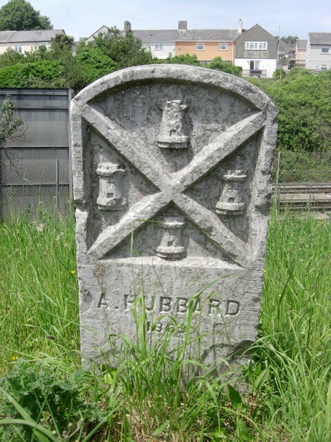
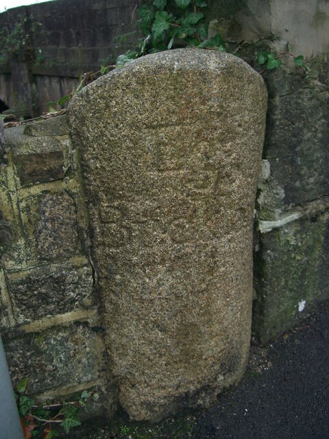
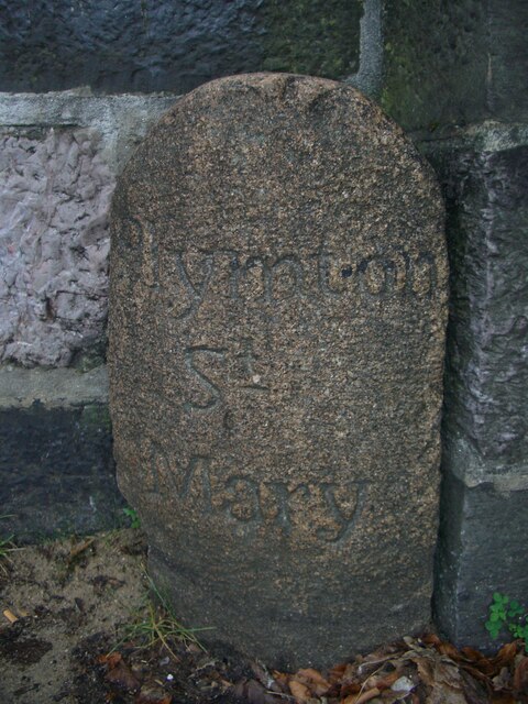
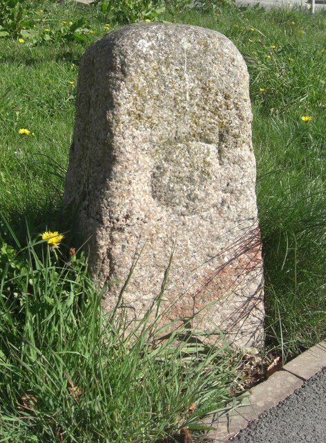
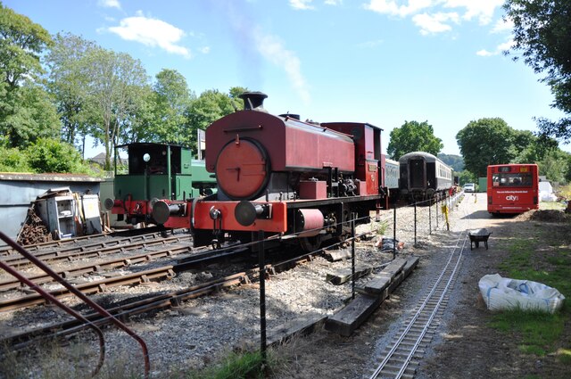
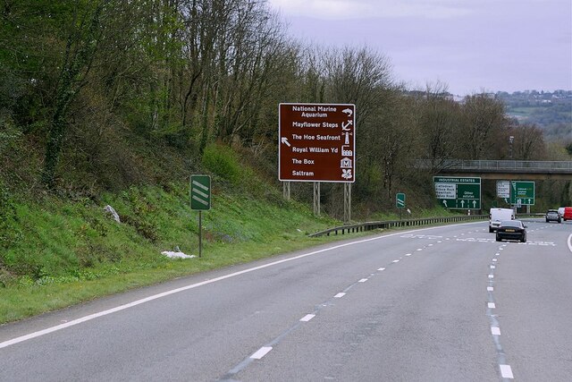
Efford Warren Images

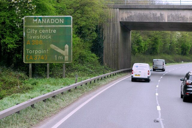
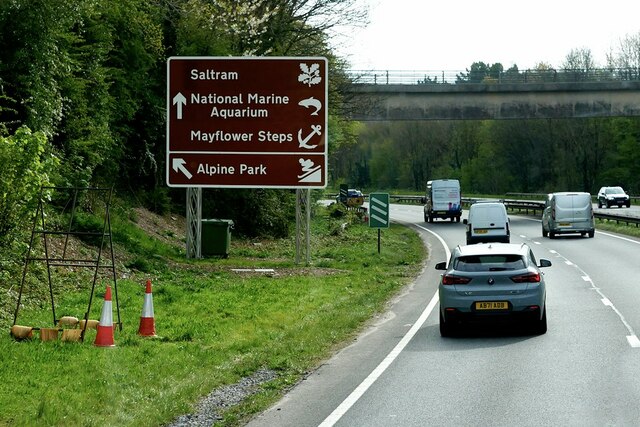
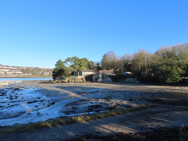
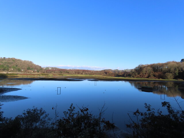
Images are sourced within 2km of 50.390033/-4.0938559 or Grid Reference SX5156. Thanks to Geograph Open Source API. All images are credited.

Old Boundary Marker on Old Laira Road, Plymouth Municipal Boundary Marker facing east against the front garden wall of No.369 Old Laira Road, Plymouth, close to the junction with Manor Lane. Inscribed J.T. BOND / 1896 for John Thomas Bond, mayor.

Milestone Society National ID: DV_PCBS48pb
Old Boundary Marker on Old Laira Road, Plymouth
Municipal Boundary Marker facing east against the front garden wall of No.369 Old Laira Road, Plymouth, close to the junction with Manor Lane. Inscribed J.T. BOND / 1896 for John Thomas Bond, mayor. Milestone Society National ID: DV_PCBS48pb
Old Boundary Marker on Old Laira Road, Plymouth Municipal Boundary Marker on the east side of the junction of the B3214 Old Laira Road and the A374 Embankment Road, Plymouth. Inscribed C.H. RADFORD / 1897 for Charles H Radford, mayor.

Milestone Society National ID: DV_PCBS49pb
Old Boundary Marker on Old Laira Road, Plymouth
Municipal Boundary Marker on the east side of the junction of the B3214 Old Laira Road and the A374 Embankment Road, Plymouth. Inscribed C.H. RADFORD / 1897 for Charles H Radford, mayor. Milestone Society National ID: DV_PCBS49pb
Old Boundary Marker on Embankment Road, Plymouth Municipal Boundary Marker in front of a crash barrier where it meets metal railings on the southeast side of the A374 Embankment Road opposite the junction with Old Laira Road, Plymouth. Inscribed J.T. BOND / (1896) for John Thomas Bond, mayor.

Milestone Society National ID: DV_PCBS50pb
Old Boundary Marker on Embankment Road, Plymouth
Municipal Boundary Marker in front of a crash barrier where it meets metal railings on the southeast side of the A374 Embankment Road opposite the junction with Old Laira Road, Plymouth. Inscribed J.T. BOND / (1896) for John Thomas Bond, mayor. Milestone Society National ID: DV_PCBS50pb
Old Boundary Marker on Lanhydrock Road, Plymouth Municipal Boundary Marker behind a wire mesh fence in Embankment Road allotments, on the north side of Lanhydrock Road, Plymouth. Inscribed A. HUBBARD / 1869 for Alexander Hubbard, mayor.

Milestone Society National ID: DV_PCBS51pb
Old Boundary Marker on Lanhydrock Road, Plymouth
Municipal Boundary Marker behind a wire mesh fence in Embankment Road allotments, on the north side of Lanhydrock Road, Plymouth. Inscribed A. HUBBARD / 1869 for Alexander Hubbard, mayor. Milestone Society National ID: DV_PCBS51pb
Old Boundary Marker on Longridge Road, Plymouth Parish Boundary Marker between the west end of the parapet of Long Bridge and a stone wall on the east side of Longbridge Road, just off the B3416 Plymouth Road. Inscribed Egg / Buckland. Until 1939 this marked the boundary of Egg Buckland and Plympton St Mary parishes, after which Egg Buckland became part of Plymouth parish and borough.

Milestone Society National ID: DV_PLEX02apb
Old Boundary Marker on Longridge Road, Plymouth
Parish Boundary Marker between the west end of the parapet of Long Bridge and a stone wall on the east side of Longbridge Road, just off the B3416 Plymouth Road. Inscribed Egg / Buckland. Until 1939 this marked the boundary of Egg Buckland and Plympton St Mary parishes, after which Egg Buckland became part of Plymouth parish and borough. Milestone Society National ID: DV_PLEX02apb
Old Boundary Marker on Plymouth Road, Plympton St Mary Parish Boundary Marker at the east end of the parapet of Long Bridge on the north side of the B3416 Plymouth Road. Inscribed Plympton / St / Mary. Until 1939 this marked the boundary of Egg Buckland and Plympton St Mary parishes, after which Egg Buckland became part of Plymouth parish and borough. See also <a title="https://www.geograph.org.uk/photo/1526519" href="https://www.geograph.org.uk/photo/1526519">Link</a>.

Milestone Society National ID: DV_PLEX02bpb
Old Boundary Marker on Plymouth Road, Plympton St Mary
Parish Boundary Marker at the east end of the parapet of Long Bridge on the north side of the B3416 Plymouth Road. Inscribed Plympton / St / Mary. Until 1939 this marked the boundary of Egg Buckland and Plympton St Mary parishes, after which Egg Buckland became part of Plymouth parish and borough. See also Link. Milestone Society National ID: DV_PLEX02bpb
Old Bridge Marker on Plymouth Road, Lee Mill County Bridge Marker in Lee Mill on the northwest side of the junction of Plymouth Road and New Park Road, 96 metres west of Leemill Bridge, River Yealm. Sparkwell parish. The stone marks the extent of roadway adjoining the bridge that the County was obliged to maintain.

Milestone Society National ID: DV_PLEX08br
Old Bridge Marker on Plymouth Road, Lee Mill
County Bridge Marker in Lee Mill on the northwest side of the junction of Plymouth Road and New Park Road, 96 metres west of Leemill Bridge, River Yealm. Sparkwell parish. The stone marks the extent of roadway adjoining the bridge that the County was obliged to maintain. Milestone Society National ID: DV_PLEX08br
Saltram House Saltram House, near Plymouth, a National Trust property.
Saltram House
Saltram House, near Plymouth, a National Trust property.
The Plym Valley Railway Locomotives in the yard at the Plym Valley Railway.  This was a non operational day, and the insurance company Boiler Inspector was testing 'Albert', the red engine in the picture.  Steam locomotive boilers have to be regularly tested for safety before they can be used.
The Plym Valley Railway
Locomotives in the yard at the Plym Valley Railway. This was a non operational day, and the insurance company Boiler Inspector was testing 'Albert', the red engine in the picture. Steam locomotive boilers have to be regularly tested for safety before they can be used.
A38 Devon Expressway near Saltram Park The A38 is a major A-class trunk route. When first designated in 1922, it ran from Derby to Plymouth but it was later extended at both ends so that it now runs for 292 miles from Mansfield in Nottinghamshire to Bodmin in Cornwall.

Prior to the opening of the M5 motorway in the 1960s and 1970s, the A38 formed the main "holiday route" from the Midlands to Somerset, Devon and Cornwall and the south-western section was notorious at holiday times for the congestion. Nowadays, for most of the southern section, the A38 is a fairly quiet road shadowing the M5 extremely closely; often running alongside the motorway as a single carriageway road. The section between Exeter and Plymouth is, however, a busy dual carriageway which serves as the southern extension of the M5 and is known as “the Devon Expressway”.

More information at <span class="nowrap"><a title="http://en.wikipedia.org/wiki/A38_road" rel="nofollow ugc noopener" href="http://en.wikipedia.org/wiki/A38_road">Link</a><img style="margin-left:2px;" alt="External link" title="External link - shift click to open in new window" src="https://s1.geograph.org.uk/img/external.png" width="10" height="10"/></span>  (Wikipedia) and <span class="nowrap"><a title="http://www.sabre-roads.org.uk/wiki/index.php?title=A38" rel="nofollow ugc noopener" href="http://www.sabre-roads.org.uk/wiki/index.php?title=A38">Link</a><img style="margin-left:2px;" alt="External link" title="External link - shift click to open in new window" src="https://s1.geograph.org.uk/img/external.png" width="10" height="10"/></span>  (SABRE).
A38 Devon Expressway near Saltram Park
The A38 is a major A-class trunk route. When first designated in 1922, it ran from Derby to Plymouth but it was later extended at both ends so that it now runs for 292 miles from Mansfield in Nottinghamshire to Bodmin in Cornwall. Prior to the opening of the M5 motorway in the 1960s and 1970s, the A38 formed the main "holiday route" from the Midlands to Somerset, Devon and Cornwall and the south-western section was notorious at holiday times for the congestion. Nowadays, for most of the southern section, the A38 is a fairly quiet road shadowing the M5 extremely closely; often running alongside the motorway as a single carriageway road. The section between Exeter and Plymouth is, however, a busy dual carriageway which serves as the southern extension of the M5 and is known as “the Devon Expressway”. More information at LinkExternal link (Wikipedia) and LinkExternal link (SABRE).
A38 at Marsh Mills Junction The A38 is a major A-class trunk route. When first designated in 1922, it ran from Derby to Plymouth but it was later extended at both ends so that it now runs for 292 miles from Mansfield in Nottinghamshire to Bodmin in Cornwall.

Prior to the opening of the M5 motorway in the 1960s and 1970s, the A38 formed the main "holiday route" from the Midlands to Somerset, Devon and Cornwall and the south-western section was notorious at holiday times for the congestion. Nowadays, for most of the southern section, the A38 is a fairly quiet road shadowing the M5 extremely closely; often running alongside the motorway as a single carriageway road. The section between Exeter and Plymouth is, however, a busy dual carriageway which serves as the southern extension of the M5 and is known as “the Devon Expressway”.

More information at <span class="nowrap"><a title="http://en.wikipedia.org/wiki/A38_road" rel="nofollow ugc noopener" href="http://en.wikipedia.org/wiki/A38_road">Link</a><img style="margin-left:2px;" alt="External link" title="External link - shift click to open in new window" src="https://s1.geograph.org.uk/img/external.png" width="10" height="10"/></span>  (Wikipedia) and <span class="nowrap"><a title="http://www.sabre-roads.org.uk/wiki/index.php?title=A38" rel="nofollow ugc noopener" href="http://www.sabre-roads.org.uk/wiki/index.php?title=A38">Link</a><img style="margin-left:2px;" alt="External link" title="External link - shift click to open in new window" src="https://s1.geograph.org.uk/img/external.png" width="10" height="10"/></span>  (SABRE).
A38 at Marsh Mills Junction
The A38 is a major A-class trunk route. When first designated in 1922, it ran from Derby to Plymouth but it was later extended at both ends so that it now runs for 292 miles from Mansfield in Nottinghamshire to Bodmin in Cornwall. Prior to the opening of the M5 motorway in the 1960s and 1970s, the A38 formed the main "holiday route" from the Midlands to Somerset, Devon and Cornwall and the south-western section was notorious at holiday times for the congestion. Nowadays, for most of the southern section, the A38 is a fairly quiet road shadowing the M5 extremely closely; often running alongside the motorway as a single carriageway road. The section between Exeter and Plymouth is, however, a busy dual carriageway which serves as the southern extension of the M5 and is known as “the Devon Expressway”. More information at LinkExternal link (Wikipedia) and LinkExternal link (SABRE).
Devon Expressway, Marsh Mills Flyover The A38 is a major A-class trunk route. When first designated in 1922, it ran from Derby to Plymouth but it was later extended at both ends so that it now runs for 292 miles from Mansfield in Nottinghamshire to Bodmin in Cornwall.

Prior to the opening of the M5 motorway in the 1960s and 1970s, the A38 formed the main "holiday route" from the Midlands to Somerset, Devon and Cornwall and the south-western section was notorious at holiday times for the congestion. Nowadays, for most of the southern section, the A38 is a fairly quiet road shadowing the M5 extremely closely; often running alongside the motorway as a single carriageway road. The section between Exeter and Plymouth is, however, a busy dual carriageway which serves as the southern extension of the M5 and is known as “the Devon Expressway”.

More information at <span class="nowrap"><a title="http://en.wikipedia.org/wiki/A38_road" rel="nofollow ugc noopener" href="http://en.wikipedia.org/wiki/A38_road">Link</a><img style="margin-left:2px;" alt="External link" title="External link - shift click to open in new window" src="https://s1.geograph.org.uk/img/external.png" width="10" height="10"/></span>  (Wikipedia) and <span class="nowrap"><a title="http://www.sabre-roads.org.uk/wiki/index.php?title=A38" rel="nofollow ugc noopener" href="http://www.sabre-roads.org.uk/wiki/index.php?title=A38">Link</a><img style="margin-left:2px;" alt="External link" title="External link - shift click to open in new window" src="https://s1.geograph.org.uk/img/external.png" width="10" height="10"/></span>  (SABRE).
Devon Expressway, Marsh Mills Flyover
The A38 is a major A-class trunk route. When first designated in 1922, it ran from Derby to Plymouth but it was later extended at both ends so that it now runs for 292 miles from Mansfield in Nottinghamshire to Bodmin in Cornwall. Prior to the opening of the M5 motorway in the 1960s and 1970s, the A38 formed the main "holiday route" from the Midlands to Somerset, Devon and Cornwall and the south-western section was notorious at holiday times for the congestion. Nowadays, for most of the southern section, the A38 is a fairly quiet road shadowing the M5 extremely closely; often running alongside the motorway as a single carriageway road. The section between Exeter and Plymouth is, however, a busy dual carriageway which serves as the southern extension of the M5 and is known as “the Devon Expressway”. More information at LinkExternal link (Wikipedia) and LinkExternal link (SABRE).
A38 at Forder Valley Interchange The A38 is a major A-class trunk route. When first designated in 1922, it ran from Derby to Plymouth but it was later extended at both ends so that it now runs for 292 miles from Mansfield in Nottinghamshire to Bodmin in Cornwall.

Prior to the opening of the M5 motorway in the 1960s and 1970s, the A38 formed the main "holiday route" from the Midlands to Somerset, Devon and Cornwall and the south-western section was notorious at holiday times for the congestion. Nowadays, for most of the southern section, the A38 is a fairly quiet road shadowing the M5 extremely closely; often running alongside the motorway as a single carriageway road. The section between Exeter and Plymouth is, however, a busy dual carriageway which serves as the southern extension of the M5 and is known as “the Devon Expressway”.

More information at <span class="nowrap"><a title="http://en.wikipedia.org/wiki/A38_road" rel="nofollow ugc noopener" href="http://en.wikipedia.org/wiki/A38_road">Link</a><img style="margin-left:2px;" alt="External link" title="External link - shift click to open in new window" src="https://s1.geograph.org.uk/img/external.png" width="10" height="10"/></span>  (Wikipedia) and <span class="nowrap"><a title="http://www.sabre-roads.org.uk/wiki/index.php?title=A38" rel="nofollow ugc noopener" href="http://www.sabre-roads.org.uk/wiki/index.php?title=A38">Link</a><img style="margin-left:2px;" alt="External link" title="External link - shift click to open in new window" src="https://s1.geograph.org.uk/img/external.png" width="10" height="10"/></span>  (SABRE).
A38 at Forder Valley Interchange
The A38 is a major A-class trunk route. When first designated in 1922, it ran from Derby to Plymouth but it was later extended at both ends so that it now runs for 292 miles from Mansfield in Nottinghamshire to Bodmin in Cornwall. Prior to the opening of the M5 motorway in the 1960s and 1970s, the A38 formed the main "holiday route" from the Midlands to Somerset, Devon and Cornwall and the south-western section was notorious at holiday times for the congestion. Nowadays, for most of the southern section, the A38 is a fairly quiet road shadowing the M5 extremely closely; often running alongside the motorway as a single carriageway road. The section between Exeter and Plymouth is, however, a busy dual carriageway which serves as the southern extension of the M5 and is known as “the Devon Expressway”. More information at LinkExternal link (Wikipedia) and LinkExternal link (SABRE).
Devon Expressway near Plymouth The A38 is a major A-class trunk route. When first designated in 1922, it ran from Derby to Plymouth but it was later extended at both ends so that it now runs for 292 miles from Mansfield in Nottinghamshire to Bodmin in Cornwall.

Prior to the opening of the M5 motorway in the 1960s and 1970s, the A38 formed the main "holiday route" from the Midlands to Somerset, Devon and Cornwall and the south-western section was notorious at holiday times for the congestion. Nowadays, for most of the southern section, the A38 is a fairly quiet road shadowing the M5 extremely closely; often running alongside the motorway as a single carriageway road. The section between Exeter and Plymouth is, however, a busy dual carriageway which serves as the southern extension of the M5 and is known as “the Devon Expressway”.

More information at <span class="nowrap"><a title="http://en.wikipedia.org/wiki/A38_road" rel="nofollow ugc noopener" href="http://en.wikipedia.org/wiki/A38_road">Link</a><img style="margin-left:2px;" alt="External link" title="External link - shift click to open in new window" src="https://s1.geograph.org.uk/img/external.png" width="10" height="10"/></span>  (Wikipedia) and <span class="nowrap"><a title="http://www.sabre-roads.org.uk/wiki/index.php?title=A38" rel="nofollow ugc noopener" href="http://www.sabre-roads.org.uk/wiki/index.php?title=A38">Link</a><img style="margin-left:2px;" alt="External link" title="External link - shift click to open in new window" src="https://s1.geograph.org.uk/img/external.png" width="10" height="10"/></span>  (SABRE).
Devon Expressway near Plymouth
The A38 is a major A-class trunk route. When first designated in 1922, it ran from Derby to Plymouth but it was later extended at both ends so that it now runs for 292 miles from Mansfield in Nottinghamshire to Bodmin in Cornwall. Prior to the opening of the M5 motorway in the 1960s and 1970s, the A38 formed the main "holiday route" from the Midlands to Somerset, Devon and Cornwall and the south-western section was notorious at holiday times for the congestion. Nowadays, for most of the southern section, the A38 is a fairly quiet road shadowing the M5 extremely closely; often running alongside the motorway as a single carriageway road. The section between Exeter and Plymouth is, however, a busy dual carriageway which serves as the southern extension of the M5 and is known as “the Devon Expressway”. More information at LinkExternal link (Wikipedia) and LinkExternal link (SABRE).
Eastbound A38 near Plymouth The A38 is a major A-class trunk route. When first designated in 1922, it ran from Derby to Plymouth but it was later extended at both ends so that it now runs for 292 miles from Mansfield in Nottinghamshire to Bodmin in Cornwall.

Prior to the opening of the M5 motorway in the 1960s and 1970s, the A38 formed the main "holiday route" from the Midlands to Somerset, Devon and Cornwall and the south-western section was notorious at holiday times for the congestion. Nowadays, for most of the southern section, the A38 is a fairly quiet road shadowing the M5 extremely closely; often running alongside the motorway as a single carriageway road. The section between Exeter and Plymouth is, however, a busy dual carriageway which serves as the southern extension of the M5 and is known as “the Devon Expressway”.

More information at <span class="nowrap"><a title="http://en.wikipedia.org/wiki/A38_road" rel="nofollow ugc noopener" href="http://en.wikipedia.org/wiki/A38_road">Link</a><img style="margin-left:2px;" alt="External link" title="External link - shift click to open in new window" src="https://s1.geograph.org.uk/img/external.png" width="10" height="10"/></span>  (Wikipedia) and <span class="nowrap"><a title="http://www.sabre-roads.org.uk/wiki/index.php?title=A38" rel="nofollow ugc noopener" href="http://www.sabre-roads.org.uk/wiki/index.php?title=A38">Link</a><img style="margin-left:2px;" alt="External link" title="External link - shift click to open in new window" src="https://s1.geograph.org.uk/img/external.png" width="10" height="10"/></span>  (SABRE).
Eastbound A38 near Plymouth
The A38 is a major A-class trunk route. When first designated in 1922, it ran from Derby to Plymouth but it was later extended at both ends so that it now runs for 292 miles from Mansfield in Nottinghamshire to Bodmin in Cornwall. Prior to the opening of the M5 motorway in the 1960s and 1970s, the A38 formed the main "holiday route" from the Midlands to Somerset, Devon and Cornwall and the south-western section was notorious at holiday times for the congestion. Nowadays, for most of the southern section, the A38 is a fairly quiet road shadowing the M5 extremely closely; often running alongside the motorway as a single carriageway road. The section between Exeter and Plymouth is, however, a busy dual carriageway which serves as the southern extension of the M5 and is known as “the Devon Expressway”. More information at LinkExternal link (Wikipedia) and LinkExternal link (SABRE).
Saltram Point
Saltram Point
Wetlands at Saltram
Wetlands at Saltram
A38 Flyover
A38 Flyover
Show me another place!

Efford Warren is located at Grid Ref: SX5156 (Lat: 50.390033, Lng: -4.0938559)

Unitary Authority: Plymouth

Police Authority: Devon and Cornwall

What 3 Words

///much.ruins.remote. Near Plympton, Devon

Related Wikis

Crabtree, Plymouth

Crabtree is a suburb of Plymouth in the English county of Devon. Originally, it was a small village beside the coaching route around the top of the Plym...

Plymouth Coliseum

Plymouth Coliseum, formerly known as St Boniface Arena, is a rugby field and speedway venue in Plymouth, Devon. It is situated adjacent to the River Plym...

Plym Valley Railway

The Plym Valley Railway is a 1 mile 14 chains (1.9 km) heritage railway based on part of the now-closed South Devon and Tavistock Railway, a branch line...

Fort Efford

Fort Efford is a former 19th-century Fort, built as a result of the Royal Commission on National Defence of 1859. It was built to defend the landward approaches...

Nearby Amenities

Located within 500m of 50.390033,-4.0938559
Motorway Junction
Marsh Mills Roundabout
Lat/Long: 50.394282/-4.0941218
Source: PGS
Lat/Long: 50.387421/-4.0888521
Crossing
Button Operated: yes
Crossing: traffic_signals
Crossing Ref: pelican
Tactile Paving: yes
Traffic Signals Sound: yes
Traffic Signals Vibration: no
Lat/Long: 50.3918006/-4.088894
Traffic Signals
Traffic Signals: signal
Lat/Long: 50.3916102/-4.0872649
Traffic Signals
Traffic Signals: signal
Lat/Long: 50.3908975/-4.0877105
Motorway Junction
Forder Valley Interchange
Lat/Long: 50.3936666/-4.0933402
Restaurant
Beefeater
Air Conditioning: yes
Brand: Beefeater
Brand Wikidata: Q4879766
Cuisine: british
Diet Vegan: yes
Diet Vegetarian: yes
Indoor Seating: yes
Opening Hours: Mo-Sa 11:30-23:00; Su 12:00-22:30
Outdoor Seating: garden
Payment Cash: yes
Smoking: outside
Website: https://www.beefeater.co.uk/en-gb/locations/devon/marsh-mills
Wheelchair: yes
Wheelchair Description: toilets are awkward, also tight ailes to manouver
Lat/Long: 50.3910127/-4.0890014
Disused: yes
Leisure: bird_hide
Lat/Long: 50.387703/-4.0883046
Traffic Signals
Traffic Signals: signal
Lat/Long: 50.390893/-4.0875445
Turning Circle
Lat/Long: 50.3897131/-4.0993171
Turning Circle
Lat/Long: 50.3872998/-4.0942359
Bus Stop
Marsh Mills Superstore
Bench: yes
Bin: yes
Bus: yes
Lit: yes
Naptan AtcoCode: 1180PLC30044
Naptan Bearing: SW
Naptan CommonName: Plymouth Road Superstore
Naptan Indicator: SW-bound
Naptan NaptanCode: plymdwp
Naptan PlusbusZoneRef: PLYMTH
Naptan Verified: no
Public Transport: platform
Shelter: yes
Tactile Paving: yes
Lat/Long: 50.3887825/-4.088563
Bus Stop
Crabtree
Bench: yes
Bin: yes
Bus: yes
Lit: yes
Naptan AtcoCode: 1180PLB11991
Naptan Bearing: N
Naptan CommonName: Crabtree
Naptan Indicator: N-bound
Naptan NaptanCode: plymdtw
Naptan PlusbusZoneRef: PLYMTH
Naptan Street: Plymouth Road
Naptan Verified: no
Public Transport: platform
Shelter: yes
Tactile Paving: yes
Lat/Long: 50.3894246/-4.0890172
Traffic Signals
Traffic Signals: signal
Lat/Long: 50.3909768/-4.0878675
Post Office
Pike Road Post Office
Addr Postcode: PL3 6HJ
Branch: Pike Road
Brand: Post Office
Brand Wikidata: Q1783168
Check Date: 2020-02-20
Contact Website: https://www.postoffice.co.uk/branch-finder/2485397/pike-road
Ref Pol Id: 9762
Lat/Long: 50.388016/-4.098438
Bicycle Parking
Bicycle Parking: stands
Capacity: 12
Check Date Capacity: 2022-03-28
Covered: yes
Lat/Long: 50.3896064/-4.0869506
Bicycle Parking
Bicycle Parking: stands
Capacity: 12
Check Date Capacity: 2022-03-28
Covered: yes
Lat/Long: 50.3895535/-4.0868917
Co-operative Food
Shop: supermarket
Lat/Long: 50.3879765/-4.0983538
Railway: switch
Lat/Long: 50.387575/-4.0882036
Animal Shelter
Ponderosa Pony Rescue
Lat/Long: 50.3885021/-4.0941115
Entrance: shop
Lat/Long: 50.3895058/-4.0871304
Crossing
Crossing: zebra
Lat/Long: 50.3896708/-4.0871564
Generator Method: photovoltaic
Generator Output Electricity: yes
Generator Source: solar
Generator Type: solar_photovoltaic_panel
Location: roof
Power: generator
Lat/Long: 50.3867596/-4.0909736
Generator Method: photovoltaic
Generator Output Electricity: yes
Generator Source: solar
Generator Type: solar_photovoltaic_panel
Location: roof
Power: generator
Lat/Long: 50.3870007/-4.095701
Generator Method: photovoltaic
Generator Output Electricity: yes
Generator Source: solar
Generator Type: solar_photovoltaic_panel
Location: roof
Power: generator
Lat/Long: 50.3870332/-4.0957332
Generator Method: photovoltaic
Generator Output Electricity: yes
Generator Source: solar
Generator Type: solar_photovoltaic_panel
Location: roof
Power: generator
Lat/Long: 50.387188/-4.0963179
Generator Method: photovoltaic
Generator Output Electricity: yes
Generator Source: solar
Generator Type: solar_photovoltaic_panel
Location: roof
Power: generator
Lat/Long: 50.3873094/-4.099279
Generator Method: photovoltaic
Generator Output Electricity: yes
Generator Source: solar
Generator Type: solar_photovoltaic_panel
Location: roof
Power: generator
Lat/Long: 50.3929441/-4.0990537
Generator Method: photovoltaic
Generator Output Electricity: yes
Generator Source: solar
Generator Type: solar_photovoltaic_panel
Location: roof
Power: generator
Lat/Long: 50.3925166/-4.0978253
Generator Method: photovoltaic
Generator Output Electricity: yes
Generator Source: solar
Generator Type: solar_photovoltaic_panel
Location: roof
Power: generator
Lat/Long: 50.3925286/-4.0979353
Generator Method: photovoltaic
Generator Output Electricity: yes
Generator Source: solar
Generator Type: solar_photovoltaic_panel
Location: roof
Power: generator
Lat/Long: 50.3915778/-4.0990028
Generator Method: photovoltaic
Generator Output Electricity: yes
Generator Source: solar
Generator Type: solar_photovoltaic_panel
Location: roof
Power: generator
Lat/Long: 50.3915504/-4.0990913
Generator Method: photovoltaic
Generator Output Electricity: yes
Generator Source: solar
Generator Type: solar_photovoltaic_panel
Location: roof
Power: generator
Lat/Long: 50.3915231/-4.0991664
Generator Method: photovoltaic
Generator Output Electricity: yes
Generator Source: solar
Generator Type: solar_photovoltaic_panel
Location: roof
Power: generator
Lat/Long: 50.3871453/-4.0941614
Generator Method: photovoltaic
Generator Output Electricity: yes
Generator Source: solar
Generator Type: solar_photovoltaic_panel
Location: roof
Power: generator
Lat/Long: 50.3874394/-4.0942955
Generator Method: photovoltaic
Generator Output Electricity: yes
Generator Source: solar
Generator Type: solar_photovoltaic_panel
Location: roof
Power: generator
Lat/Long: 50.3873607/-4.0948454
Generator Method: photovoltaic
Generator Output Electricity: yes
Generator Source: solar
Generator Type: solar_photovoltaic_panel
Location: roof
Power: generator
Lat/Long: 50.3871538/-4.0985549
Generator Method: photovoltaic
Generator Output Electricity: yes
Generator Source: solar
Generator Type: solar_photovoltaic_panel
Location: roof
Power: generator
Lat/Long: 50.3875574/-4.099566
Generator Method: photovoltaic
Generator Output Electricity: yes
Generator Source: solar
Generator Type: solar_photovoltaic_panel
Location: roof
Power: generator
Lat/Long: 50.3875659/-4.0994588
Generator Method: photovoltaic
Generator Output Electricity: yes
Generator Source: solar
Generator Type: solar_photovoltaic_panel
Location: roof
Power: generator
Lat/Long: 50.3878515/-4.0998852
Generator Method: photovoltaic
Generator Output Electricity: yes
Generator Source: solar
Generator Type: solar_photovoltaic_panel
Location: roof
Power: generator
Lat/Long: 50.3878567/-4.0997404
Generator Method: photovoltaic
Generator Output Electricity: yes
Generator Source: solar
Generator Type: solar_photovoltaic_panel
Location: roof
Power: generator
Lat/Long: 50.3878909/-4.0991288
Generator Method: photovoltaic
Generator Output Electricity: yes
Generator Source: solar
Generator Type: solar_photovoltaic_panel
Location: roof
Power: generator
Lat/Long: 50.3875642/-4.0992898
Generator Method: photovoltaic
Generator Output Electricity: yes
Generator Source: solar
Generator Type: solar_photovoltaic_panel
Location: roof
Power: generator
Lat/Long: 50.3875848/-4.0988982
Generator Method: photovoltaic
Generator Output Electricity: yes
Generator Source: solar
Generator Type: solar_photovoltaic_panel
Location: roof
Power: generator
Lat/Long: 50.3876224/-4.0986434
Generator Method: photovoltaic
Generator Output Electricity: yes
Generator Source: solar
Generator Type: solar_photovoltaic_panel
Location: roof
Power: generator
Lat/Long: 50.3876326/-4.0984798
Generator Method: photovoltaic
Generator Output Electricity: yes
Generator Source: solar
Generator Type: solar_photovoltaic_panel
Location: roof
Power: generator
Lat/Long: 50.3877541/-4.0975168
Generator Method: photovoltaic
Generator Output Electricity: yes
Generator Source: solar
Generator Type: solar_photovoltaic_panel
Location: roof
Power: generator
Lat/Long: 50.3879131/-4.098917
Generator Method: photovoltaic
Generator Output Electricity: yes
Generator Source: solar
Generator Type: solar_photovoltaic_panel
Location: roof
Power: generator
Lat/Long: 50.3880414/-4.0978441
Generator Method: photovoltaic
Generator Output Electricity: yes
Generator Source: solar
Generator Type: solar_photovoltaic_panel
Location: roof
Power: generator
Lat/Long: 50.3880927/-4.0974686
Generator Method: photovoltaic
Generator Output Electricity: yes
Generator Source: solar
Generator Type: solar_photovoltaic_panel
Location: roof
Power: generator
Lat/Long: 50.3881012/-4.0972272
Generator Method: photovoltaic
Generator Output Electricity: yes
Generator Source: solar
Generator Type: solar_photovoltaic_panel
Location: roof
Power: generator
Lat/Long: 50.3881149/-4.0971333
Generator Method: photovoltaic
Generator Output Electricity: yes
Generator Source: solar
Generator Type: solar_photovoltaic_panel
Location: roof
Power: generator
Lat/Long: 50.3884398/-4.0973371
Generator Method: photovoltaic
Generator Output Electricity: yes
Generator Source: solar
Generator Type: solar_photovoltaic_panel
Location: roof
Power: generator
Lat/Long: 50.3881423/-4.0969938
Generator Method: photovoltaic
Generator Output Electricity: yes
Generator Source: solar
Generator Type: solar_photovoltaic_panel
Location: roof
Power: generator
Lat/Long: 50.3881731/-4.0967363
Generator Method: photovoltaic
Generator Output Electricity: yes
Generator Source: solar
Generator Type: solar_photovoltaic_panel
Location: roof
Power: generator
Lat/Long: 50.3885082/-4.0968007
Generator Method: photovoltaic
Generator Output Electricity: yes
Generator Source: solar
Generator Type: solar_photovoltaic_panel
Location: roof
Power: generator
Lat/Long: 50.3885219/-4.0966961
Generator Method: photovoltaic
Generator Output Electricity: yes
Generator Source: solar
Generator Type: solar_photovoltaic_panel
Location: roof
Power: generator
Lat/Long: 50.3885493/-4.0965217
Generator Method: photovoltaic
Generator Output Electricity: yes
Generator Source: solar
Generator Type: solar_photovoltaic_panel
Location: roof
Power: generator
Lat/Long: 50.3885801/-4.0962857
Generator Method: photovoltaic
Generator Output Electricity: yes
Generator Source: solar
Generator Type: solar_photovoltaic_panel
Location: roof
Power: generator
Lat/Long: 50.3882397/-4.0961677
Generator Method: photovoltaic
Generator Output Electricity: yes
Generator Source: solar
Generator Type: solar_photovoltaic_panel
Location: roof
Power: generator
Lat/Long: 50.3880089/-4.0953067
Generator Method: photovoltaic
Generator Output Electricity: yes
Generator Source: solar
Generator Type: solar_photovoltaic_panel
Location: roof
Power: generator
Lat/Long: 50.3888229/-4.0951324
Generator Method: photovoltaic
Generator Output Electricity: yes
Generator Source: solar
Generator Type: solar_photovoltaic_panel
Location: roof
Power: generator
Lat/Long: 50.3888947/-4.0951511
Generator Method: photovoltaic
Generator Output Electricity: yes
Generator Source: solar
Generator Type: solar_photovoltaic_panel
Location: roof
Power: generator
Lat/Long: 50.3888845/-4.0959612
Generator Method: photovoltaic
Generator Output Electricity: yes
Generator Source: solar
Generator Type: solar_photovoltaic_panel
Location: roof
Power: generator
Lat/Long: 50.3888229/-4.096503
Generator Method: photovoltaic
Generator Output Electricity: yes
Generator Source: solar
Generator Type: solar_photovoltaic_panel
Location: roof
Power: generator
Lat/Long: 50.3888229/-4.0966451
Generator Method: photovoltaic
Generator Output Electricity: yes
Generator Source: solar
Generator Type: solar_photovoltaic_panel
Location: roof
Power: generator
Lat/Long: 50.3888041/-4.0969858
Generator Method: photovoltaic
Generator Output Electricity: yes
Generator Source: solar
Generator Type: solar_photovoltaic_panel
Location: roof
Power: generator
Lat/Long: 50.3887921/-4.097085
Generator Method: photovoltaic
Generator Output Electricity: yes
Generator Source: solar
Generator Type: solar_photovoltaic_panel
Location: roof
Power: generator
Lat/Long: 50.388734/-4.0973371
Generator Method: photovoltaic
Generator Output Electricity: yes
Generator Source: solar
Generator Type: solar_photovoltaic_panel
Location: roof
Power: generator
Lat/Long: 50.3886946/-4.0976375
Generator Method: photovoltaic
Generator Output Electricity: yes
Generator Source: solar
Generator Type: solar_photovoltaic_panel
Location: roof
Power: generator
Lat/Long: 50.3886758/-4.0977904
Generator Method: photovoltaic
Generator Output Electricity: yes
Generator Source: solar
Generator Type: solar_photovoltaic_panel
Location: roof
Power: generator
Lat/Long: 50.3885441/-4.0986031
Generator Method: photovoltaic
Generator Output Electricity: yes
Generator Source: solar
Generator Type: solar_photovoltaic_panel
Location: roof
Power: generator
Lat/Long: 50.3886143/-4.0986326
Generator Method: photovoltaic
Generator Output Electricity: yes
Generator Source: solar
Generator Type: solar_photovoltaic_panel
Location: roof
Power: generator
Lat/Long: 50.3887015/-4.0986943
Generator Method: photovoltaic
Generator Output Electricity: yes
Generator Source: solar
Generator Type: solar_photovoltaic_panel
Location: roof
Power: generator
Lat/Long: 50.3886502/-4.0980989
Generator Method: photovoltaic
Generator Output Electricity: yes
Generator Source: solar
Generator Type: solar_photovoltaic_panel
Location: roof
Power: generator
Lat/Long: 50.3887716/-4.0982625
Generator Method: photovoltaic
Generator Output Electricity: yes
Generator Source: solar
Generator Type: solar_photovoltaic_panel
Location: roof
Power: generator
Lat/Long: 50.3888349/-4.0982947
Generator Method: photovoltaic
Generator Output Electricity: yes
Generator Source: solar
Generator Type: solar_photovoltaic_panel
Location: roof
Power: generator
Lat/Long: 50.3891153/-4.0971065
Generator Method: photovoltaic
Generator Output Electricity: yes
Generator Source: solar
Generator Type: solar_photovoltaic_panel
Location: roof
Power: generator
Lat/Long: 50.3891358/-4.0969563
Generator Method: photovoltaic
Generator Output Electricity: yes
Generator Source: solar
Generator Type: solar_photovoltaic_panel
Location: roof
Power: generator
Lat/Long: 50.3891769/-4.0965727
Generator Method: photovoltaic
Generator Output Electricity: yes
Generator Source: solar
Generator Type: solar_photovoltaic_panel
Location: roof
Power: generator
Lat/Long: 50.3893582/-4.09749
Generator Method: photovoltaic
Generator Output Electricity: yes
Generator Source: solar
Generator Type: solar_photovoltaic_panel
Location: roof
Power: generator
Lat/Long: 50.3893359/-4.0978146
Generator Method: photovoltaic
Generator Output Electricity: yes
Generator Source: solar
Generator Type: solar_photovoltaic_panel
Location: roof
Power: generator
Lat/Long: 50.3893/-4.0979379
Generator Method: photovoltaic
Generator Output Electricity: yes
Generator Source: solar
Generator Type: solar_photovoltaic_panel
Location: roof
Power: generator
Lat/Long: 50.389288/-4.0980372
Generator Method: photovoltaic
Generator Output Electricity: yes
Generator Source: solar
Generator Type: solar_photovoltaic_panel
Location: roof
Power: generator
Lat/Long: 50.3901858/-4.1008616
Generator Method: photovoltaic
Generator Output Electricity: yes
Generator Source: solar
Generator Type: solar_photovoltaic_panel
Location: roof
Power: generator
Lat/Long: 50.3889734/-4.0994802
Generator Method: photovoltaic
Generator Output Electricity: yes
Generator Source: solar
Generator Type: solar_photovoltaic_panel
Location: roof
Power: generator
Lat/Long: 50.3889819/-4.0994373
Generator Method: photovoltaic
Generator Output Electricity: yes
Generator Source: solar
Generator Type: solar_photovoltaic_panel
Location: roof
Power: generator
Lat/Long: 50.3891666/-4.0989491
Generator Method: photovoltaic
Generator Output Electricity: yes
Generator Source: solar
Generator Type: solar_photovoltaic_panel
Location: roof
Power: generator
Lat/Long: 50.3904577/-4.0994829
Generator Method: photovoltaic
Generator Output Electricity: yes
Generator Source: solar
Generator Type: solar_photovoltaic_panel
Location: roof
Power: generator
Lat/Long: 50.3899806/-4.0977019
Generator Method: photovoltaic
Generator Output Electricity: yes
Generator Source: solar
Generator Type: solar_photovoltaic_panel
Location: roof
Power: generator
Lat/Long: 50.3902897/-4.097311
Generator Method: photovoltaic
Generator Output Electricity: yes
Generator Source: solar
Generator Type: solar_photovoltaic_panel
Location: roof
Power: generator
Lat/Long: 50.3902899/-4.097139
Generator Method: photovoltaic
Generator Output Electricity: yes
Generator Source: solar
Generator Type: solar_photovoltaic_panel
Location: roof
Power: generator
Lat/Long: 50.3896301/-4.0958351
Generator Method: photovoltaic
Generator Output Electricity: yes
Generator Source: solar
Generator Type: solar_photovoltaic_panel
Location: roof
Power: generator
Lat/Long: 50.3892162/-4.0951243
Generator Method: photovoltaic
Generator Output Electricity: yes
Generator Source: solar
Generator Type: solar_photovoltaic_panel
Location: roof
Power: generator
Lat/Long: 50.389353/-4.0951994
Generator Method: photovoltaic
Generator Output Electricity: yes
Generator Source: solar
Generator Type: solar_photovoltaic_panel
Location: roof
Power: generator
Lat/Long: 50.3894659/-4.0952423
Generator Method: photovoltaic
Generator Output Electricity: yes
Generator Source: solar
Generator Type: solar_photovoltaic_panel
Location: roof
Power: generator
Lat/Long: 50.389524/-4.095245
Generator Method: photovoltaic
Generator Output Electricity: yes
Generator Source: solar
Generator Type: solar_photovoltaic_panel
Location: roof
Power: generator
Lat/Long: 50.3899823/-4.0954328
Generator Method: photovoltaic
Generator Output Electricity: yes
Generator Source: solar
Generator Type: solar_photovoltaic_panel
Location: roof
Power: generator
Lat/Long: 50.3898336/-4.0952235
Generator Method: photovoltaic
Generator Output Electricity: yes
Generator Source: solar
Generator Type: solar_photovoltaic_panel
Location: roof
Power: generator
Lat/Long: 50.3890059/-4.090586
Ford: yes
Lat/Long: 50.3929662/-4.0931429
Charging Station
Nissan Charging Station
Capacity: 1
Lat/Long: 50.393048/-4.0893001
Bench
Backrest: no
Material: wood
Lat/Long: 50.3929129/-4.0935818
Bench
Backrest: no
Material: wood
Lat/Long: 50.3929166/-4.0936254
Bench
Backrest: no
Material: wood
Lat/Long: 50.3929366/-4.0936841
Bench
Backrest: yes
Material: wood
Lat/Long: 50.39355/-4.0962282
Crabtree
Place: locality
Lat/Long: 50.3887267/-4.0895679
Speed Camera
Maxspeed: 40 mph
Lat/Long: 50.3883324/-4.0888822
Speed Camera
Ref: 40
Lat/Long: 50.3884706/-4.0890775
Bus Stop
Crabtree Close
Bench: yes
Bin: no
Bus: yes
Departures Board: timetable
Lit: yes
Naptan AtcoCode: 118000012
Naptan Bearing: N
Naptan CommonName: Crabtree Close
Naptan Indicator: N-bound
Naptan NaptanCode: plypjpa
Naptan PlusbusZoneRef: PLYMTH
Naptan Verified: no
Public Transport: platform
Shelter: no
Tactile Paving: no
Lat/Long: 50.3886791/-4.0891848
Artwork Type: sculpture
Material: metal
Tourism: artwork
Lat/Long: 50.3922905/-4.0940919
Bench
Backrest: yes
Material: wood
Lat/Long: 50.3922005/-4.0944545
Bench
Backrest: yes
Material: wood
Lat/Long: 50.3916399/-4.0926831
Bench
Backrest: yes
Material: wood
Lat/Long: 50.3918252/-4.09158
Bus Stop
Axe Close
Bench: no
Bus: yes
Naptan AtcoCode: 1180PLB11605
Naptan Bearing: NW
Naptan CommonName: Axe Close
Naptan Indicator: NW-bound
Naptan NaptanCode: plyjwmd
Naptan PlusbusZoneRef: PLYMTH
Naptan Street: Axe Close
Naptan Verified: no
Public Transport: platform
Ref: 526
Shelter: yes
Lat/Long: 50.3916159/-4.09935
Bench
Backrest: yes
Lat/Long: 50.3929625/-4.0950952
Bench
Backrest: no
Lat/Long: 50.3925693/-4.0951907
Bus Stop
Manifold Gardens
Bus: yes
Naptan AtcoCode: 1180PLB11652
Naptan Bearing: W
Naptan CommonName: Manifold Gardens
Naptan Indicator: W-bound
Naptan NaptanCode: plyjwpa
Naptan PlusbusZoneRef: PLYMTH
Naptan Street: Pike Road
Naptan Verified: no
Public Transport: platform
Lat/Long: 50.3877192/-4.0989978
Bus Stop
Pike Road Shops
Bench: no
Bin: no
Bus: yes
Lit: yes
Naptan AtcoCode: 1180PLB11651
Naptan Bearing: E
Naptan CommonName: Pike Road Shops
Naptan Indicator: E-bound
Naptan NaptanCode: plyjwta
Naptan PlusbusZoneRef: PLYMTH
Naptan Street: Pike Road
Naptan Verified: no
Public Transport: platform
Shelter: no
Tactile Paving: no
Lat/Long: 50.3879094/-4.0980187
Bus Stop
Thames Gardens
Bench: no
Bin: no
Bus: yes
Lit: yes
Naptan AtcoCode: 1180PLB11650
Naptan Bearing: S
Naptan CommonName: Thames Gardens
Naptan Indicator: S-bound
Naptan NaptanCode: plymama
Naptan PlusbusZoneRef: PLYMTH
Naptan Verified: no
Public Transport: platform
Shelter: no
Tactile Paving: no
Lat/Long: 50.3887913/-4.0953326
Bus Stop
Blandford Road East
Bench: no
Bin: no
Bus: yes
Lit: yes
Naptan AtcoCode: 1180PLB11648
Naptan Bearing: SE
Naptan CommonName: Blandford Road East
Naptan Indicator: SE-bound
Naptan NaptanCode: plymadj
Naptan PlusbusZoneRef: PLYMTH
Naptan Verified: no
Public Transport: platform
Shelter: no
Tactile Paving: no
Lat/Long: 50.3901827/-4.0973972
Bus Stop
Blandford Road East
Bench: no
Bin: no
Bus: yes
Lit: yes
Naptan AtcoCode: 1180PLB11647
Naptan Bearing: NW
Naptan CommonName: Blandford Road East
Naptan Indicator: NW-bound
Naptan NaptanCode: plyjwtp
Naptan PlusbusZoneRef: PLYMTH
Naptan Street: Blandford Road
Naptan Verified: no
Public Transport: platform
Shelter: no
Tactile Paving: no
Lat/Long: 50.3901116/-4.0977291
Bus Stop
Plym View Primary School
Bench: no
Bin: no
Bus: yes
Lit: yes
Naptan AtcoCode: 1180PLB11646
Naptan Bearing: NE
Naptan CommonName: Plym View Primary School
Naptan Indicator: NE-bound
Naptan NaptanCode: plyjwdm
Naptan PlusbusZoneRef: PLYMTH
Naptan Street: Blandford Road
Naptan Verified: no
Public Transport: platform
Shelter: no
Tactile Paving: yes
Lat/Long: 50.3901024/-4.10058
Bus Stop
Plym View Primary School
Bench: yes
Bin: no
Bus: yes
Departures Board: timetable
Lit: yes
Naptan AtcoCode: 1180PLB11645
Naptan Bearing: SW
Naptan CommonName: Plym View Primary School
Naptan Indicator: SW-bound
Naptan NaptanCode: plyjwda
Naptan PlusbusZoneRef: PLYMTH
Naptan Street: Blandford Road
Naptan Verified: no
Public Transport: platform
Shelter: yes
Tactile Paving: no
Lat/Long: 50.3899298/-4.1008841
Bus Stop
Thames Gardens
Bench: yes
Bus: yes
Departures Board: timetable
Lit: yes
Naptan AtcoCode: 1180PLB11649
Naptan Bearing: N
Naptan CommonName: Thames Gardens
Naptan Indicator: N-bound
Naptan NaptanCode: plymajp
Naptan PlusbusZoneRef: PLYMTH
Naptan Street: Blandford Road
Naptan Verified: no
Public Transport: platform
Shelter: yes
Tactile Paving: no
Lat/Long: 50.3889279/-4.0955031
Post Box
Inside Sainsbury's
Collection Times: Mo-Fr 16:15; Sa 11:30
Ref: PL3 143
Royal Cypher: no
Survey Date: 2021-12-10
Lat/Long: 50.3893739/-4.0870485
Waste Basket
Survey Date: 2021-12-10
Lat/Long: 50.3893727/-4.0869381
Street Lamp
Survey Date: 2022-03-11
Lat/Long: 50.3878523/-4.0978821
Street Lamp
Ref: 10
Survey Date: 2022-03-11
Lat/Long: 50.3873088/-4.0980811
Street Lamp
Ref: 5
Survey Date: 2022-03-11
Lat/Long: 50.3894199/-4.1000074
Fire Hydrant
Emergency: fire_hydrant
Fire Hydrant Type: underground
Survey Date: 2022-03-11
Lat/Long: 50.3896128/-4.0996267
Street Lamp
Survey Date: 2022-03-11
Lat/Long: 50.3896446/-4.0994945
Street Lamp
Survey Date: 2022-03-11
Lat/Long: 50.3895973/-4.0994399
Man Made: utility_pole
Survey Date: 2022-03-11
Lat/Long: 50.3881069/-4.0987403
Street Lamp
Ref: 5
Survey Date: 2022-03-11
Lat/Long: 50.3879556/-4.0986898
Atm
Survey Date: 2022-03-11
Lat/Long: 50.387961/-4.0982815
Street Lamp
Survey Date: 2022-03-11
Lat/Long: 50.3878985/-4.0982728
Fire Hydrant
Emergency: fire_hydrant
Fire Hydrant Type: underground
Survey Date: 2022-03-11
Lat/Long: 50.3873153/-4.0979925
Street Lamp
Survey Date: 2022-03-11
Lat/Long: 50.387354/-4.097565
Street Lamp
Ref: 4
Survey Date: 2022-03-11
Lat/Long: 50.3874499/-4.0973579
Street Lamp
Ref: 2
Survey Date: 2022-03-11
Lat/Long: 50.387536/-4.0964816
Man Made: utility_pole
Survey Date: 2022-03-11
Lat/Long: 50.3864235/-4.0967774
Man Made: utility_pole
Survey Date: 2022-03-11
Lat/Long: 50.386461/-4.0972958
Man Made: utility_pole
Survey Date: 2022-03-11
Lat/Long: 50.3863667/-4.0972758
Street Lamp
Survey Date: 2022-03-11
Lat/Long: 50.3871805/-4.0959718
Street Lamp
Ref: 15
Survey Date: 2022-03-11
Lat/Long: 50.3866191/-4.0962066
Man Made: utility_pole
Survey Date: 2022-03-11
Lat/Long: 50.3865292/-4.0962179
Man Made: utility_pole
Survey Date: 2022-03-11
Lat/Long: 50.3865561/-4.0965053
Fire Hydrant
Emergency: fire_hydrant
Fire Hydrant Diameter: 4"
Fire Hydrant Position: sidewalk
Fire Hydrant Type: underground
Survey Date: 2022-03-11
Lat/Long: 50.3894971/-4.1006062
Street Lamp
Ref: 4
Survey Date: 2022-03-11
Lat/Long: 50.389371/-4.1004311
Man Made: utility_pole
Survey Date: 2022-03-11
Lat/Long: 50.3893909/-4.100242
Street Lamp
Ref: 8
Survey Date: 2022-03-11
Lat/Long: 50.3890918/-4.0993129
Street Lamp
Survey Date: 2022-03-11
Lat/Long: 50.3883324/-4.0987804
Post Box
Collection Times: Mo-Fr 17:15; Sa 11:30
Post Box Type: pillar
Ref: PL3 265
Royal Cypher: GVIR
Royal Cypher Wikidata: Q33102169
Survey Date: 2022-03-11
Lat/Long: 50.3879521/-4.0983515
Street Lamp
Survey Date: 2022-03-11
Lat/Long: 50.3874942/-4.0955421
Street Lamp
Ref: 9
Survey Date: 2022-03-11
Lat/Long: 50.3894462/-4.0993893
Man Made: utility_pole
Survey Date: 2022-03-11
Lat/Long: 50.389339/-4.0994383
Man Made: utility_pole
Survey Date: 2022-03-11
Lat/Long: 50.3889645/-4.0992433
Street Lamp
Ref: 7
Survey Date: 2022-03-11
Lat/Long: 50.388679/-4.0990849
Waste Basket
Survey Date: 2022-03-11
Lat/Long: 50.3878616/-4.0985448
Street Lamp
Survey Date: 2022-03-11
Lat/Long: 50.3877186/-4.0981698
Street Lamp
Ref: 9
Survey Date: 2022-03-11
Lat/Long: 50.3874758/-4.0981658
Street Lamp
Survey Date: 2022-03-11
Lat/Long: 50.3874477/-4.0969506
Street Lamp
Survey Date: 2022-03-11
Lat/Long: 50.3872515/-4.0955885
Man Made: street_cabinet
Survey Date: 2022-03-11
Lat/Long: 50.3872016/-4.0958726
Fire Hydrant
Emergency: fire_hydrant
Fire Hydrant Type: underground
Survey Date: 2022-03-11
Lat/Long: 50.3867388/-4.0957431
Man Made: utility_pole
Survey Date: 2022-03-11
Lat/Long: 50.3885803/-4.0990287
Street Lamp
Survey Date: 2022-03-11
Lat/Long: 50.3895715/-4.0995375
Fire Hydrant
Emergency: fire_hydrant
Fire Hydrant Type: underground
Survey Date: 2022-03-11
Lat/Long: 50.3873045/-4.0955547
Man Made: utility_pole
Survey Date: 2022-03-11
Lat/Long: 50.3871664/-4.0955516
Street Lamp
Survey Date: 2022-03-11
Lat/Long: 50.3866411/-4.0956946
Grit Bin
Survey Date: 2022-03-11
Lat/Long: 50.3867054/-4.0959281
Street Lamp
Ref: 1
Survey Date: 2022-03-11
Lat/Long: 50.3869444/-4.0959064
Man Made: utility_pole
Survey Date: 2022-03-11
Lat/Long: 50.386728/-4.0956831
Man Made: street_cabinet
Survey Date: 2022-03-11
Lat/Long: 50.3867081/-4.0958434
Street Lamp
Ref: 14
Survey Date: 2022-03-11
Lat/Long: 50.3864555/-4.0965469
Street Lamp
Ref: 13
Survey Date: 2022-03-11
Lat/Long: 50.3864044/-4.0969692
Street Lamp
Survey Date: 2022-03-11
Lat/Long: 50.3860204/-4.0918937
Street Lamp
Ref: 12
Survey Date: 2022-03-11
Lat/Long: 50.386449/-4.0975096
Street Lamp
Survey Date: 2022-03-11
Lat/Long: 50.3856189/-4.0934795
Street Lamp
Survey Date: 2022-03-11
Lat/Long: 50.3857197/-4.0929398
Street Lamp
Survey Date: 2022-03-11
Lat/Long: 50.3861891/-4.0913954
Fire Hydrant
Emergency: fire_hydrant
Fire Hydrant Diameter: 225
Fire Hydrant Position: sidewalk
Fire Hydrant Type: underground
Survey Date: 2022-03-11
Lat/Long: 50.3864334/-4.0913033
Street Lamp
Survey Date: 2022-03-11
Lat/Long: 50.3870629/-4.0897921
Fire Hydrant
Emergency: fire_hydrant
Fire Hydrant Diameter: 9"
Fire Hydrant Position: green
Fire Hydrant Type: underground
Survey Date: 2022-03-11
Lat/Long: 50.3879123/-4.0893896
Fire Hydrant
Emergency: fire_hydrant
Fire Hydrant Diameter Signed: no
Fire Hydrant Position: sidewalk
Fire Hydrant Type: underground
Survey Date: 2022-03-11
Lat/Long: 50.3856329/-4.0943555
Street Lamp
Survey Date: 2022-03-11
Lat/Long: 50.3857245/-4.0938548
Street Lamp
Survey Date: 2022-03-11
Lat/Long: 50.3858675/-4.0923522
Street Lamp
Survey Date: 2022-03-11
Lat/Long: 50.3868244/-4.0901322
Street Lamp
Survey Date: 2022-03-11
Lat/Long: 50.3873529/-4.0894926
Street Lamp
Survey Date: 2022-03-11
Lat/Long: 50.3880302/-4.0891099
Street Lamp
Survey Date: 2022-03-11
Lat/Long: 50.3886984/-4.0891749
Fire Hydrant
Emergency: fire_hydrant
Fire Hydrant Diameter Signed: no
Fire Hydrant Position: sidewalk
Fire Hydrant Type: underground
Survey Date: 2022-03-11
Lat/Long: 50.3861604/-4.092093
Bus Stop
Crabtree Riversleigh
Bench: yes
Bin: no
Bus: yes
Lit: yes
Naptan AtcoCode: 1180PLB11990
Naptan Bearing: NE
Naptan CommonName: Riversleigh
Naptan Indicator: NE-bound
Naptan NaptanCode: plymdjp
Naptan PlusbusZoneRef: PLYMTH
Naptan Street: Plymouth Road
Public Transport: platform
Shelter: yes
Survey Date: 2022-03-11
Tactile Paving: no
Lat/Long: 50.3863808/-4.0914689
Street Lamp
Survey Date: 2022-03-11
Lat/Long: 50.3863937/-4.0909341
Street Lamp
Survey Date: 2022-03-11
Lat/Long: 50.3866419/-4.0904609
Street Lamp
Survey Date: 2022-03-11
Lat/Long: 50.3876419/-4.0892944
Street Lamp
Survey Date: 2022-03-11
Lat/Long: 50.3883549/-4.0889781
Post Box
Collection Times: Mo-Fr 09:00; Sa 07:00
Post Box Type: lamp
Ref: PL3 219D
Royal Cypher: EIIR
Royal Cypher Wikidata: Q33102113
Survey Date: 2022-03-11
Lat/Long: 50.3895115/-4.0891944
Telephone
Booth: KX100
Covered: booth
Survey Date: 2022-03-11
Lat/Long: 50.3895279/-4.0891772
Street Lamp
Survey Date: 2022-03-11
Lat/Long: 50.3889337/-4.0884971
Waste Basket
Survey Date: 2022-03-11
Lat/Long: 50.3888106/-4.0885777
Street Lamp
Ref: 50
Survey Date: 2022-03-11
Lat/Long: 50.3882757/-4.0887787
Street Lamp
Ref: 44
Survey Date: 2022-03-11
Lat/Long: 50.3873318/-4.089321
Man Made: street_cabinet
Survey Date: 2022-03-11
Lat/Long: 50.3872935/-4.0893555
Street Lamp
Ref: 32
Survey Date: 2022-03-11
Lat/Long: 50.3859398/-4.0917823
Street Lamp
Survey Date: 2022-03-11
Lat/Long: 50.3886154/-4.0889
Street Lamp
Ref: 38
Survey Date: 2022-03-11
Lat/Long: 50.3865347/-4.0903373
Street Lamp
Ref: 30
Survey Date: 2022-03-11
Lat/Long: 50.3857614/-4.0923019
Street Lamp
Ref: 28
Survey Date: 2022-03-11
Lat/Long: 50.3856383/-4.0928145
Street Lamp
Ref: 48
Survey Date: 2022-03-11
Lat/Long: 50.387976/-4.0889568
Street Lamp
Ref: 46
Survey Date: 2022-03-11
Lat/Long: 50.3876573/-4.0890711
Street Lamp
Ref: 42
Survey Date: 2022-03-11
Lat/Long: 50.387037/-4.0896308
Street Lamp
Ref: 40
Survey Date: 2022-03-11
Lat/Long: 50.3867796/-4.0899091
Street Lamp
Ref: 34
Survey Date: 2022-03-11
Lat/Long: 50.3861167/-4.0912975
Street Lamp
Survey Date: 2022-03-11
Lat/Long: 50.3855419/-4.0939501
Street Lamp
Ref: 36
Survey Date: 2022-03-11
Lat/Long: 50.3863272/-4.0907677
Street Lamp
Ref: 24
Survey Date: 2022-03-28
Lat/Long: 50.3943878/-4.0938625
Man Made: street_cabinet
Survey Date: 2022-03-28
Lat/Long: 50.393657/-4.0925218
Street Lamp
Survey Date: 2022-03-28
Lat/Long: 50.3934179/-4.0926302
Street Lamp
Ref: 16
Survey Date: 2022-03-28
Lat/Long: 50.3933916/-4.0919206
Street Lamp
Survey Date: 2022-03-28
Lat/Long: 50.3929614/-4.0915597
Man Made: street_cabinet
Survey Date: 2022-03-28
Lat/Long: 50.3929547/-4.0908877
Street Lamp
Survey Date: 2022-03-28
Lat/Long: 50.3925388/-4.0905045
Street Lamp
Survey Date: 2022-03-28
Lat/Long: 50.3923764/-4.0898214
Street Lamp
Ref: 6
Survey Date: 2022-03-28
Lat/Long: 50.392425/-4.0893201
Street Lamp
Survey Date: 2022-03-28
Lat/Long: 50.391914/-4.0889583
Street Lamp
Ref: 22
Survey Date: 2022-03-28
Lat/Long: 50.3941409/-4.0933598
Street Lamp
Ref: 20
Survey Date: 2022-03-28
Lat/Long: 50.3938611/-4.0928876
Street Lamp
Survey Date: 2022-03-28
Lat/Long: 50.3936926/-4.0931651
Street Lamp
Survey Date: 2022-03-28
Lat/Long: 50.394208/-4.094142
Street Lamp
Survey Date: 2022-03-28
Lat/Long: 50.389711/-4.0870486
Waste Basket
Survey Date: 2022-03-28
Lat/Long: 50.3895896/-4.0871573
Waste Basket
Survey Date: 2022-03-28
Lat/Long: 50.3894684/-4.0870218
Street Lamp
Ref: 63B
Survey Date: 2022-03-28
Lat/Long: 50.3904418/-4.0874003
Street Lamp
Survey Date: 2022-03-28
Lat/Long: 50.3927626/-4.0916979
Street Lamp
Survey Date: 2022-03-28
Lat/Long: 50.3926689/-4.0899944
Street Lamp
Ref: 8
Survey Date: 2022-03-28
Lat/Long: 50.3925598/-4.0896931
Street Lamp
Survey Date: 2022-03-28
Lat/Long: 50.3920926/-4.0895633
Street Lamp
Ref: 18
Survey Date: 2022-03-28
Lat/Long: 50.3935975/-4.092394
Street Lamp
Survey Date: 2022-03-28
Lat/Long: 50.3932036/-4.0921149
Street Lamp
Survey Date: 2022-03-28
Lat/Long: 50.3929991/-4.0922669
Street Lamp
Ref: 12
Survey Date: 2022-03-28
Lat/Long: 50.3929457/-4.0908362
Street Lamp
Survey Date: 2022-03-28
Lat/Long: 50.3927445/-4.0910583
Street Lamp
Survey Date: 2022-03-28
Lat/Long: 50.3925584/-4.0911853
Street Lamp
Ref: 10
Survey Date: 2022-03-28
Lat/Long: 50.3927528/-4.0903583
Street Lamp
Survey Date: 2022-03-28
Lat/Long: 50.3923521/-4.0906525
Street Lamp
Survey Date: 2022-03-28
Lat/Long: 50.3922258/-4.089943
Street Lamp
Survey Date: 2022-03-28
Lat/Long: 50.3922531/-4.0894487
Street Lamp
Survey Date: 2022-03-28
Lat/Long: 50.3920589/-4.0888493
Street Lamp
Ref: 14
Survey Date: 2022-03-28
Lat/Long: 50.3931612/-4.0913739
Street Lamp
Survey Date: 2022-03-28
Lat/Long: 50.3920024/-4.0896348
Street Lamp
Survey Date: 2022-03-28
Lat/Long: 50.3922395/-4.0887445
Street Lamp
Survey Date: 2022-03-28
Lat/Long: 50.3921368/-4.0882192
Street Lamp
Ref: 63A
Survey Date: 2022-03-28
Lat/Long: 50.3903612/-4.0877591
Street Lamp
Survey Date: 2022-03-28
Lat/Long: 50.3905838/-4.0874869
Street Lamp
Survey Date: 2022-03-28
Lat/Long: 50.392153/-4.0882487
Man Made: utility_pole
Survey Date: 2022-04-13
Lat/Long: 50.3883741/-4.0942485
Fire Hydrant
Emergency: fire_hydrant
Fire Hydrant Diameter: 100
Fire Hydrant Position: sidewalk
Fire Hydrant Type: underground
Survey Date: 2022-04-13
Lat/Long: 50.3887698/-4.0908866
Street Lamp
Ref: 4
Survey Date: 2022-04-13
Lat/Long: 50.3887397/-4.0899172
Street Lamp
Ref: 22
Survey Date: 2022-04-13
Lat/Long: 50.3912832/-4.1002795
Street Lamp
Survey Date: 2022-05-25
Lat/Long: 50.390267/-4.0998061
Street Lamp
Ref: 58
Survey Date: 2022-05-25
Lat/Long: 50.3903343/-4.0994591
Street Lamp
Survey Date: 2022-04-13
Lat/Long: 50.3901274/-4.0982493
Street Lamp
Survey Date: 2022-04-13
Lat/Long: 50.389853/-4.0955893
Street Lamp
Survey Date: 2022-04-13
Lat/Long: 50.3915606/-4.1003198
Street Lamp
Survey Date: 2022-04-13
Lat/Long: 50.3895041/-4.0953857
Fire Hydrant
Emergency: fire_hydrant
Fire Hydrant Diameter Signed: no
Fire Hydrant Position: green
Fire Hydrant Type: underground
Survey Date: 2022-04-13
Lat/Long: 50.389209/-4.0953331
Street Lamp
Ref: 72
Survey Date: 2022-05-25
Lat/Long: 50.3888658/-4.0953325
Street Lamp
Ref: 56
Survey Date: 2022-04-13
Lat/Long: 50.390289/-4.0998988
Street Lamp
Survey Date: 2022-04-13
Lat/Long: 50.3903216/-4.0990956
Street Lamp
Survey Date: 2022-04-13
Lat/Long: 50.3903149/-4.09864
Waste Basket
Survey Date: 2022-04-13
Lat/Long: 50.3897443/-4.0981466
Street Lamp
Ref: 63
Survey Date: 2022-04-13
Lat/Long: 50.3900901/-4.0972859
Street Lamp
Ref: 64
Survey Date: 2022-04-13
Lat/Long: 50.3901139/-4.096796
Fire Hydrant
Emergency: fire_hydrant
Fire Hydrant Diameter: 100
Fire Hydrant Position: sidewalk
Fire Hydrant Type: underground
Survey Date: 2022-04-13
Lat/Long: 50.3899707/-4.0963375
Street Lamp
Survey Date: 2022-04-13
Lat/Long: 50.3900834/-4.0963299
Street Lamp
Survey Date: 2022-04-13
Lat/Long: 50.3892356/-4.0953701
Street Lamp
Ref: 11
Survey Date: 2022-04-13
Lat/Long: 50.3908517/-4.1004153
Fire Hydrant
Emergency: fire_hydrant
Fire Hydrant Diameter Signed: no
Fire Hydrant Position: sidewalk
Fire Hydrant Type: underground
Survey Date: 2022-04-13
Lat/Long: 50.3902128/-4.10007
Street Lamp
Ref: 66
Survey Date: 2022-05-25
Lat/Long: 50.3900093/-4.0960013
Street Lamp
Ref: 68
Survey Date: 2022-04-13
Lat/Long: 50.3896312/-4.0955881
Street Lamp
Ref: 40
Survey Date: 2022-04-13
Lat/Long: 50.3882369/-4.0951503
Street Lamp
Survey Date: 2022-04-13
Lat/Long: 50.3881251/-4.094393
Street Lamp
Survey Date: 2022-04-13
Lat/Long: 50.3883893/-4.0923049
Street Lamp
Ref: 71
Survey Date: 2022-04-13
Lat/Long: 50.3890265/-4.095477
Man Made: street_cabinet
Survey Date: 2022-04-13
Lat/Long: 50.3882742/-4.0952574
Street Lamp
Ref: 73
Survey Date: 2022-05-25
Lat/Long: 50.388665/-4.095316
Street Lamp
Ref: 74
Survey Date: 2022-05-25
Lat/Long: 50.3884674/-4.0953885
Man Made: street_cabinet
Survey Date: 2022-04-13
Lat/Long: 50.388225/-4.0953727
Man Made: utility_pole
Material: wood
Survey Date: 2022-04-13
Lat/Long: 50.3882497/-4.0950733
Street Lamp
Ref: 41
Survey Date: 2022-04-13
Lat/Long: 50.3881938/-4.0947249
Man Made: utility_pole
Survey Date: 2022-04-13
Lat/Long: 50.3883258/-4.0946289
Street Lamp
Survey Date: 2022-04-13
Lat/Long: 50.3884853/-4.0913811
Street Lamp
Ref: 4
Survey Date: 2022-04-13
Lat/Long: 50.3888318/-4.091462
Street Lamp
Ref: 3
Survey Date: 2022-04-13
Lat/Long: 50.3887876/-4.0909324
Street Lamp
Ref: 2
Survey Date: 2022-04-13
Lat/Long: 50.3883572/-4.0907756
Man Made: utility_pole
Material: wood
Survey Date: 2022-04-13
Lat/Long: 50.389006/-4.0897316
Street Lamp
Survey Date: 2022-04-13
Lat/Long: 50.3891961/-4.0897391
Street Lamp
Survey Date: 2022-04-13
Lat/Long: 50.3903186/-4.0895656
Street Lamp
Ref: 1
Survey Date: 2022-04-13
Lat/Long: 50.3887962/-4.0903324
Street Lamp
Ref: 5
Survey Date: 2022-04-13
Lat/Long: 50.3889435/-4.0899756
Street Lamp
Ref: 6
Survey Date: 2022-04-13
Lat/Long: 50.3890963/-4.0896533
Man Made: street_cabinet
Survey Date: 2022-04-13
Lat/Long: 50.3891294/-4.0896363
Inside Sainsbury's
Defibrillator
Defibrillator Location: Inside Sainsbury's, Next to customer toilets
Emergency: defibrillator
Indoor: yes
Survey Date: 2022-05-15
Lat/Long: 50.389332/-4.0869836
Street Lamp
Survey Date: 2022-05-25
Lat/Long: 50.3881137/-4.0958555
Street Lamp
Ref: 75
Survey Date: 2022-05-25
Lat/Long: 50.3882367/-4.0956193
Fire Hydrant
Emergency: fire_hydrant
Fire Hydrant Diameter: 150
Fire Hydrant Position: sidewalk
Fire Hydrant Type: underground
Survey Date: 2022-05-25
Lat/Long: 50.3887154/-4.0954902
Street Lamp
Survey Date: 2022-05-25
Lat/Long: 50.3887739/-4.0956661
Street Lamp
Survey Date: 2022-05-25
Lat/Long: 50.3902034/-4.0997495
Street Lamp
Ref: 54
Survey Date: 2022-05-25
Lat/Long: 50.3900862/-4.1002502
Street Lamp
Survey Date: 2022-05-25
Lat/Long: 50.3881266/-4.0955268
Man Made: street_cabinet
Survey Date: 2022-05-25
Lat/Long: 50.3887676/-4.0954972
Man Made: street_cabinet
Survey Date: 2022-05-25
Lat/Long: 50.3901244/-4.0976695
Street Lamp
Ref: 53
Survey Date: 2022-05-25
Lat/Long: 50.3900719/-4.1006683
Man Made: utility_pole
Survey Date: 2022-05-25
Lat/Long: 50.3902831/-4.0998218
Bicycle Parking
Bicycle Parking: stands
Capacity: 8
Covered: no
Survey Date: 2022-07-28
Lat/Long: 50.3940093/-4.0915434
Waste Basket
Survey Date: 2022-07-28
Lat/Long: 50.3939379/-4.0913721
Grit Bin
Seasonal: no
Survey Date: 2022-07-28
Lat/Long: 50.3939266/-4.0913279
Bicycle Parking
Bicycle Parking: stands
Capacity: 6
Covered: no
Survey Date: 2022-07-28
Lat/Long: 50.3933907/-4.09112
Waste Basket
Survey Date: 2022-07-28
Lat/Long: 50.3894825/-4.0889151
Street Lamp
Ref: 61A
Survey Date: 2022-07-28
Lat/Long: 50.390281/-4.0887788
Grit Bin
Seasonal: no
Survey Date: 2022-07-28
Lat/Long: 50.3941468/-4.0919701
Waste Basket
Survey Date: 2022-07-28
Lat/Long: 50.3940972/-4.0918127
Waste Basket
Survey Date: 2022-07-28
Lat/Long: 50.3939077/-4.0912852
Grit Bin
Seasonal: no
Survey Date: 2022-07-28
Lat/Long: 50.3938298/-4.0910743
Fire Hydrant
Emergency: fire_hydrant
Fire Hydrant Position: sidewalk
Fire Hydrant Type: underground
Survey Date: 2022-07-28
Lat/Long: 50.3936768/-4.0906942
Street Lamp
Ref: 58
Survey Date: 2022-07-28
Lat/Long: 50.3896/-4.0888825
Bicycle Parking
Bicycle Parking: stands
Capacity: 12
Covered: no
Survey Date: 2022-07-28
Lat/Long: 50.3941796/-4.0920316
Power: substation
Survey Date: 2022-07-28
Lat/Long: 50.3898308/-4.0890742
Fire Hydrant
Emergency: fire_hydrant
Fire Hydrant Position: sidewalk
Fire Hydrant Type: underground
Survey Date: 2022-07-28
Lat/Long: 50.3914666/-4.0885071
Addr Housenumber: 16
Addr Street: Crabtree Close
Lat/Long: 50.3882308/-4.0898836
Fire Hydrant
Emergency: fire_hydrant
Fire Hydrant Position: sidewalk
Fire Hydrant Type: underground
Survey Date: 2023-09-21
Lat/Long: 50.3896775/-4.089176
Barrier: cycle_barrier
Lat/Long: 50.3901973/-4.0878567
Addr Housenumber: 214
Addr Street: Pike Road
Lat/Long: 50.3881852/-4.0946095
Addr Housenumber: 6
Addr Street: Medway Place
Lat/Long: 50.3894921/-4.1001565
Addr Housenumber: 29
Addr Street: Medway Place
Lat/Long: 50.389366/-4.1005119
Fire Hydrant
Emergency: fire_hydrant
Fire Hydrant Position: lane
Fire Hydrant Type: underground
Survey Date: 2023-09-29
Lat/Long: 50.3875009/-4.091568
Fire Hydrant
Emergency: fire_hydrant
Fire Hydrant Position: sidewalk
Fire Hydrant Type: underground
Survey Date: 2023-09-29
Lat/Long: 50.3882092/-4.0948329
Fire Hydrant
Emergency: fire_hydrant
Fire Hydrant Position: sidewalk
Fire Hydrant Type: underground
Survey Date: 2023-09-29
Lat/Long: 50.3880693/-4.0960975
Addr Housename: Biernfuls
Addr Street: Military Road
Lat/Long: 50.386202/-4.0938892
Addr Housenumber: 5
Addr Street: Medway Place
Lat/Long: 50.3894878/-4.1003207
Addr Housename: Westcliffe
Addr Street: Military Road
Lat/Long: 50.3870364/-4.0915051
Addr Housenumber: 28
Addr Street: Medway Place
Lat/Long: 50.3893605/-4.1003959
Addr Housenumber: 438
Addr Street: Pike Road
Lat/Long: 50.3884551/-4.0955663
Addr Housenumber: 7
Addr Street: Medway Place
Lat/Long: 50.3895256/-4.1000055
Addr Housenumber: 2
Addr Street: Military Road
Lat/Long: 50.3880675/-4.0943299
Addr Housenumber: 32
Addr Street: Medway Place
Lat/Long: 50.3893929/-4.1008215
Addr Housenumber: 176
Addr Street: Pike Road
Lat/Long: 50.3878583/-4.097259
Timpson
Shop: locksmith
Survey Date: 2024-05-03
Lat/Long: 50.3892422/-4.0869217
The data included in this document is from www.openstreetmap.org. The data is made available under ODbL.

Have you been to Efford Warren?

Leave your review of Efford Warren below (or comments, questions and feedback).