Warren Plantations

Wood, Forest in Devon South Hams

England

Warren Plantations

Turning to Shutecombe off Hensbury Lane Minor public road to Shutecombe (ahead), while Hensbury Lane continues (right) above the estuary.  In the C19, the fields above Hensbury Lane and the road to Shutecombe were planted as orchards, some of which survived into the post-war period.
Turning to Shutecombe off Hensbury Lane Credit: Hugh Craddock

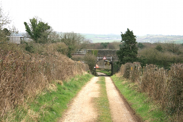
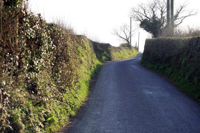
Warren Plantations, located in Devon, is a sprawling woodland area known for its stunning natural beauty and rich biodiversity. Covering a vast expanse, this forest is a significant part of Devon's ecological landscape and plays a crucial role in maintaining the region's environmental balance.

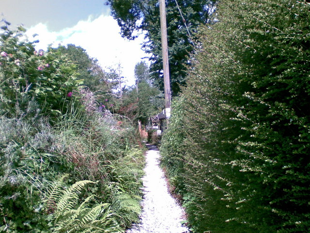
The plantations are primarily composed of a diverse range of tree species, including oak, beech, and pine, which create a dense canopy, providing shade and shelter to numerous animal species. The forest floor is covered in a thick carpet of mosses, ferns, and wildflowers, adding to the enchanting ambiance of the area.

Warren Plantations is also home to a variety of wildlife, making it a popular destination for nature enthusiasts and wildlife photographers. Visitors can spot deer, foxes, badgers, and a plethora of bird species, including woodpeckers, owls, and various songbirds. The forest's serene atmosphere provides a peaceful retreat for both humans and animals alike.

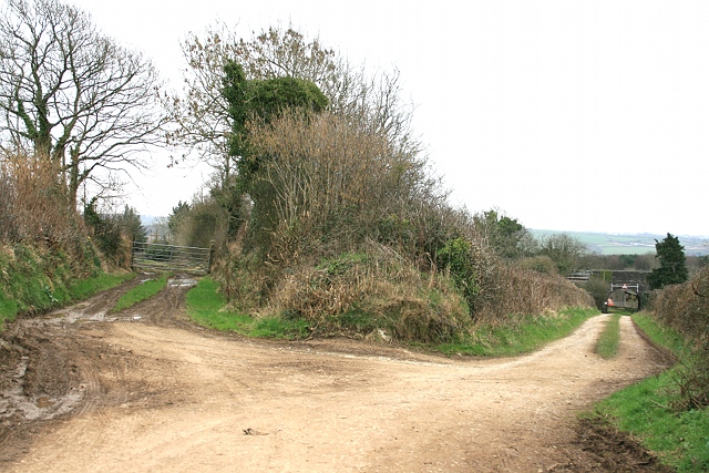
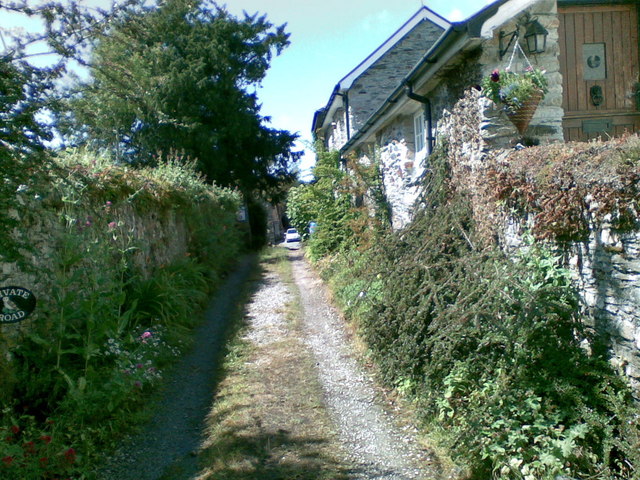
The plantations are well-maintained with designated walking trails that allow visitors to explore the area while preserving the delicate ecosystem. These trails guide visitors through the forest, offering breathtaking views of ancient trees, babbling brooks, and hidden clearings.

Additionally, Warren Plantations serves as an important resource for the local community. The timber harvested from the forest is used sustainably, supporting the local economy and providing materials for construction and woodworking.

Overall, Warren Plantations in Devon offers a captivating natural experience, showcasing the beauty and diversity of the region's woodlands. Whether it is for a leisurely stroll, wildlife observation, or simply connecting with nature, this forest provides a magical escape for all who venture into its enchanting embrace.

If you have any feedback on the listing, please let us know in the comments section below.

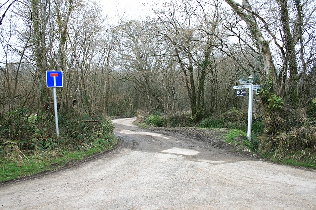
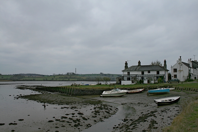
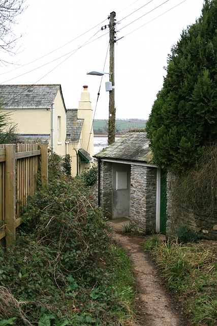
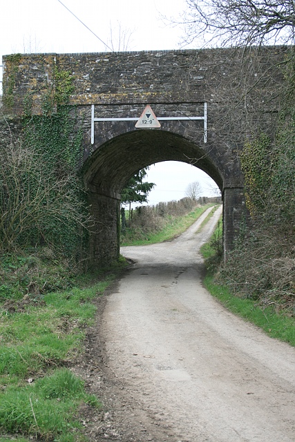
Warren Plantations Images

Images are sourced within 2km of 50.438496/-4.1673827 or Grid Reference SX4662. Thanks to Geograph Open Source API. All images are credited.

Turning to Shutecombe off Hensbury Lane Minor public road to Shutecombe (ahead), while Hensbury Lane continues (right) above the estuary.  In the C19, the fields above Hensbury Lane and the road to Shutecombe were planted as orchards, some of which survived into the post-war period.
Turning to Shutecombe off Hensbury Lane
Minor public road to Shutecombe (ahead), while Hensbury Lane continues (right) above the estuary. In the C19, the fields above Hensbury Lane and the road to Shutecombe were planted as orchards, some of which survived into the post-war period.
Bere Ferrers: the quay From Hensbury Lane above the foreshore, Riverside dwellings centre. Seen here in brighter weather in July: <a href="https://www.geograph.org.uk/photo/1958368">SX4663 : Bere Ferrers: towards the old quay</a>.
Bere Ferrers: the quay
From Hensbury Lane above the foreshore, Riverside dwellings centre. Seen here in brighter weather in July: SX4663 : Bere Ferrers: towards the old quay.
Public convenience, Silver Street This small block appears to be a public convenience (and is marked as such on the OS map), although, tucked down an alleyway known as Silver Street, to the side of the Olde Plough, one might mistake it for the pub toilets. A streetmap helpfully illuminates the block.
Public convenience, Silver Street
This small block appears to be a public convenience (and is marked as such on the OS map), although, tucked down an alleyway known as Silver Street, to the side of the Olde Plough, one might mistake it for the pub toilets. A streetmap helpfully illuminates the block.
Railway bridge south of Bere Ferrers station Bridge under railway on track leading (ahead) to Thorn Point, and (left, under bridge) to New Barn Farm.
Railway bridge south of Bere Ferrers station
Bridge under railway on track leading (ahead) to Thorn Point, and (left, under bridge) to New Barn Farm.
Towards Bere Ferrers station A farm track, accommodating Bere Ferrers public footpath 87, approaches the railway bridge leading to Station Road and the village.
Towards Bere Ferrers station
A farm track, accommodating Bere Ferrers public footpath 87, approaches the railway bridge leading to Station Road and the village.
Old New Lane Before the construction of the Plymouth, Devonport and South Western Junction Railway Company line through Bere Ferrers in 1890, New Lane headed straight for what is now Station Road along the track on the left. The railway necessitated a diversion to the right, to pass under the railway south of the railway station, before hooking round to the left to rejoin the old New Lane and continue on to the junction with Station Road.
Old New Lane
Before the construction of the Plymouth, Devonport and South Western Junction Railway Company line through Bere Ferrers in 1890, New Lane headed straight for what is now Station Road along the track on the left. The railway necessitated a diversion to the right, to pass under the railway south of the railway station, before hooking round to the left to rejoin the old New Lane and continue on to the junction with Station Road.
Footpath, Bere Ferrers
Track, Bere Ferrers
Track, Bere Ferrers
Seven Stars Lane and pub - Tamerton Foliot
Upstream of Tamerton Foliot Stream
Downstream Tamerton Foliot Stream
St Mary's Church - Tamerton Foliot
Tamerton Foliot stream Station Road Tamerton Foliot stream as it flows towards Tamerton Creek.
Tamerton Foliot stream Station Road
Tamerton Foliot stream as it flows towards Tamerton Creek.
Stream, Milford Lane Stream at Milford Lane, Tamerton Foliot.
Stream, Milford Lane
Stream at Milford Lane, Tamerton Foliot.
Roborough Lane Looking towards Tamerton Foliot.
Roborough Lane
Looking towards Tamerton Foliot.
City and Countryside A view across the valley , Southway part of Plymouth meets the countryside as seen from the Tamerton Road.
City and Countryside
A view across the valley , Southway part of Plymouth meets the countryside as seen from the Tamerton Road.
Crossing the Tavy Once the main LSWR railway line from Plymouth to Waterloo via Tavistock North and Crediton this is now the single line branch from Plymouth to Gunnislake. Crossing the river Tavy seen in the evening light at low tide.
Crossing the Tavy
Once the main LSWR railway line from Plymouth to Waterloo via Tavistock North and Crediton this is now the single line branch from Plymouth to Gunnislake. Crossing the river Tavy seen in the evening light at low tide.
Tavy viaduct An evening view of the river Tavy from Warleigh point . The 1729 Gunnislake to Plymouth train is on the viaduct.
Tavy viaduct
An evening view of the river Tavy from Warleigh point . The 1729 Gunnislake to Plymouth train is on the viaduct.
Show me another place!

Warren Plantations is located at Grid Ref: SX4662 (Lat: 50.438496, Lng: -4.1673827)

Administrative County: Devon

District: South Hams

Police Authority: Devon and Cornwall

What 3 Words

///rally.handy.behind. Near Bere Alston, Devon

Related Wikis

Warleigh, Bickleigh

Warleigh is an historic estate within the parish of Bickleigh (formerly Tamerton Foliot) in Devon, about 6 miles from Plymouth. Warleigh House, the manor...
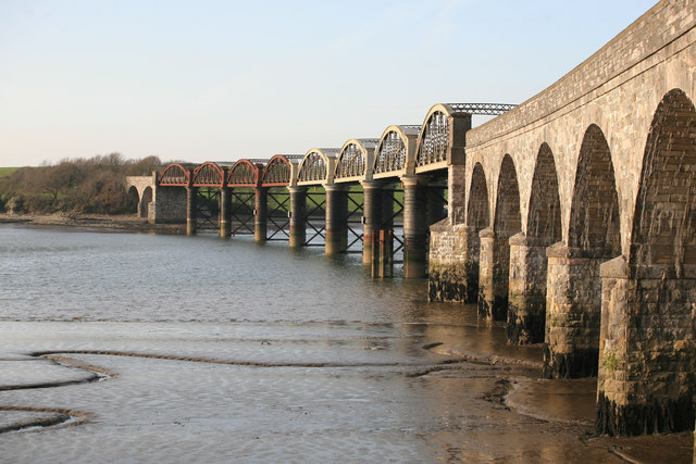
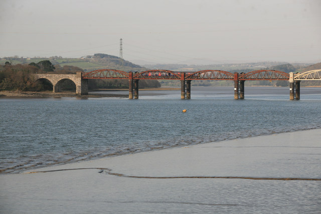
Tavy Bridge

Tavy Bridge is a railway bridge across the mouth of the River Tavy just east of its confluence with the River Tamar. It was built by the Plymouth, Devonport...

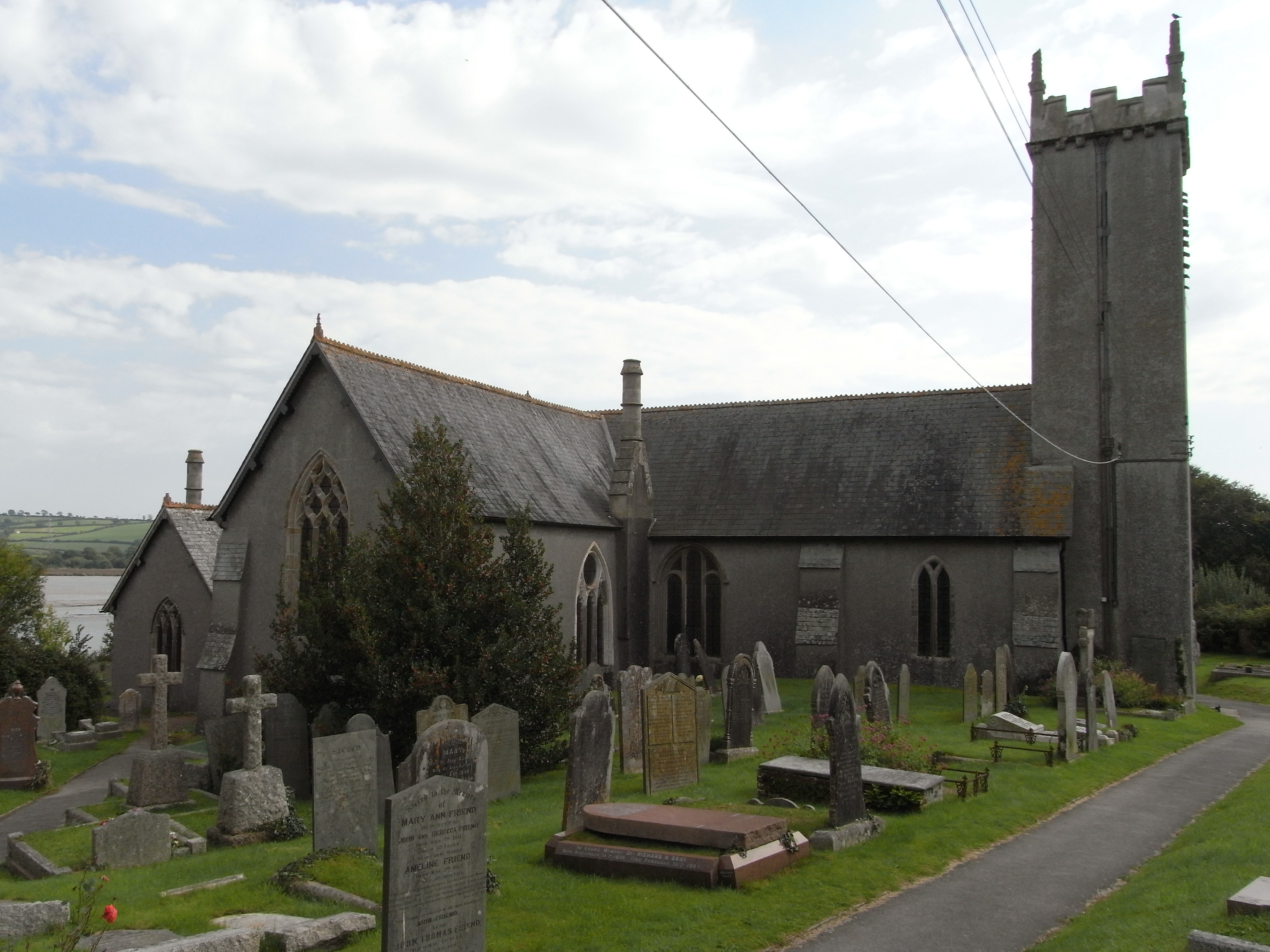
St Andrew's Church, Bere Ferrers

St Andrew's Church in Bere Ferrers, Devon, is a parish church in the Church of England The church contains the oldest stained-glass window in Devon (excluding...

Tamerton Foliot

Tamerton Foliot is a village and former civil parish situated in the north of Plymouth, in the Plymouth district, in the ceremonial county of Devon, England...

Nearby Amenities

Located within 500m of 50.438496,-4.1673827
Source: PGS
Lat/Long: 50.4426945/-4.1653766
Source: PGS
Lat/Long: 50.4423772/-4.1655825
Source: PGS
Lat/Long: 50.4423097/-4.1657461
Source: PGS
Lat/Long: 50.4423043/-4.1665888
Source: PGS
Lat/Long: 50.4414862/-4.168284
Source: PGS
Lat/Long: 50.4413689/-4.1688285
Source: PGS
Lat/Long: 50.4411375/-4.1691476
Source: PGS
Lat/Long: 50.4408882/-4.1697112
Source: PGS
Lat/Long: 50.4403797/-4.1701556
Created By: almien_coastlines
Source: PGS
Lat/Long: 50.4400389/-4.1700994
Source: PGS
Lat/Long: 50.439328/-4.170319
Source: PGS
Lat/Long: 50.4389836/-4.1706435
Source: PGS
Lat/Long: 50.4381114/-4.1716823
Created By: almien_coastlines
Source: PGS
Lat/Long: 50.4378741/-4.1719447
Created By: almien_coastlines
Source: PGS
Lat/Long: 50.437423/-4.17223
Created By: almien_coastlines
Source: PGS
Lat/Long: 50.436907/-4.172619
Source: PGS
Lat/Long: 50.4360978/-4.1729451
Power: tower
Lat/Long: 50.4412922/-4.1688609
Power: tower
Lat/Long: 50.4406232/-4.1651049
The data included in this document is from www.openstreetmap.org. The data is made available under ODbL.

Have you been to Warren Plantations?

Leave your review of Warren Plantations below (or comments, questions and feedback).