Beech Wood
Wood, Forest in Cornwall
England
Beech Wood

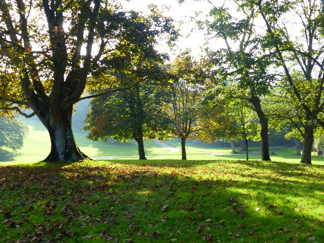
Beech Wood is a picturesque and enchanting forest located in the county of Cornwall, England. Spread across an area of approximately 100 acres, this woodland is known for its dense growth of beech trees, giving it its name.
The forest boasts a rich and diverse ecosystem, with a variety of flora and fauna that call this woodland their home. The towering beech trees provide a dense canopy, allowing only dappled sunlight to filter through, creating a serene and tranquil atmosphere. The forest floor is covered with a thick carpet of moss and fallen leaves, adding to its natural beauty.
Walking through Beech Wood, visitors are treated to a symphony of sounds, with birds chirping, leaves rustling, and the occasional scurrying of small animals. The forest is also home to a diverse range of wildlife, including squirrels, deer, foxes, and numerous species of birds.
The wood is a popular destination for nature enthusiasts and hikers, with well-marked trails that wind through the forest, offering breathtaking views at every turn. These trails cater to different levels of difficulty, making it accessible for people of all ages and abilities.
Beech Wood, with its natural beauty and peaceful ambiance, provides the perfect escape from the hustle and bustle of daily life. It is a place where one can immerse oneself in nature's embrace, taking in the sights, sounds, and scents of a truly remarkable woodland.
If you have any feedback on the listing, please let us know in the comments section below.
Beech Wood Images
Images are sourced within 2km of 50.354562/-4.1730885 or Grid Reference SX4552. Thanks to Geograph Open Source API. All images are credited.


Beech Wood is located at Grid Ref: SX4552 (Lat: 50.354562, Lng: -4.1730885)
Unitary Authority: Cornwall
Police Authority: Devon and Cornwall
What 3 Words
///zooms.patch.dollar. Near Torpoint, Cornwall
Related Wikis
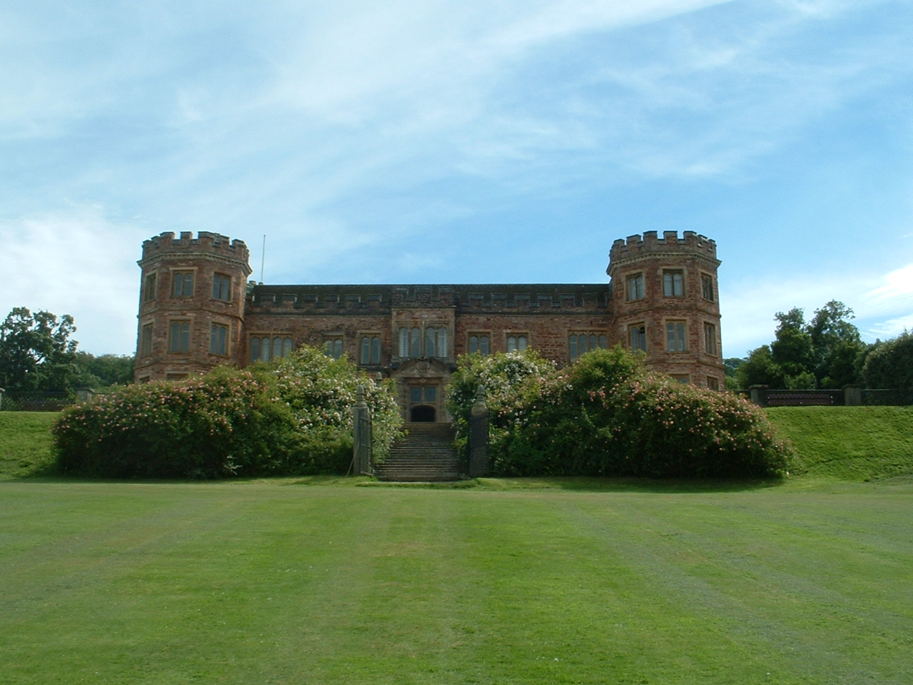
Mount Edgcumbe House
Mount Edgcumbe House is a stately home in south-east Cornwall and is a Grade II listed building, whilst its gardens and parkland are listed as Grade I...

River Tamar
The Tamar (; Cornish: Dowr Tamar) is a river in south west England that forms most of the border between Devon (to the east) and Cornwall (to the west...
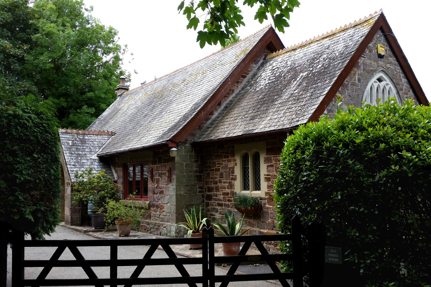
Cremyll School and Chapel
Cremyll School and Chapel is a former schoolroom and chapel in Cremyll, Cornwall, England. It was erected in 1867 and is now a private residence, known...

Cremyll
Cremyll (pronounced ) is a small coastal village in south-east Cornwall, England, United Kingdom. Cremyll is on the Rame Peninsula facing Plymouth Sound...
Nearby Amenities
Located within 500m of 50.354562,-4.1730885Have you been to Beech Wood?
Leave your review of Beech Wood below (or comments, questions and feedback).