Middle Westdown Wood

Wood, Forest in Cornwall

England

Middle Westdown Wood

Footbridge at Wivelscombe This bridge lies on the footpath between Shillingham and Wivelscombe, that runs along the top of Wivelscombe creek.
Footbridge at Wivelscombe Credit: Kevin Hale

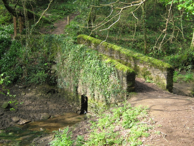
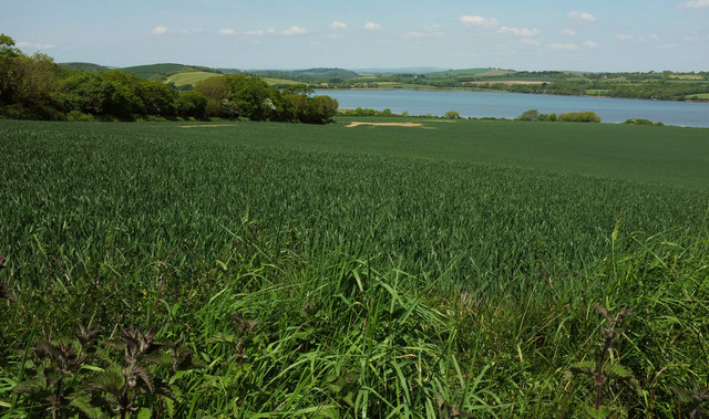
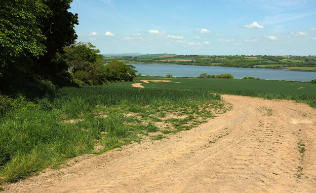
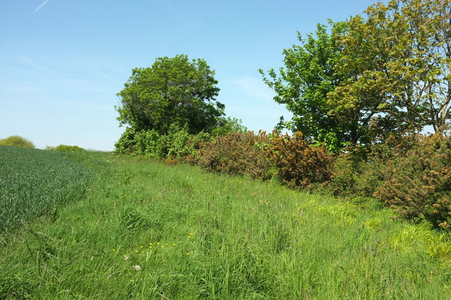
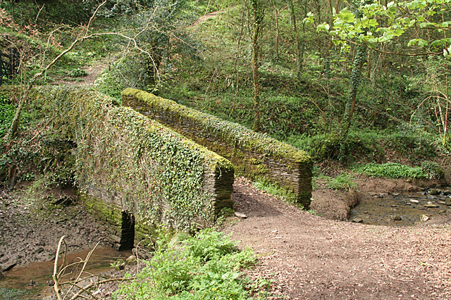
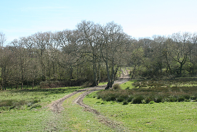
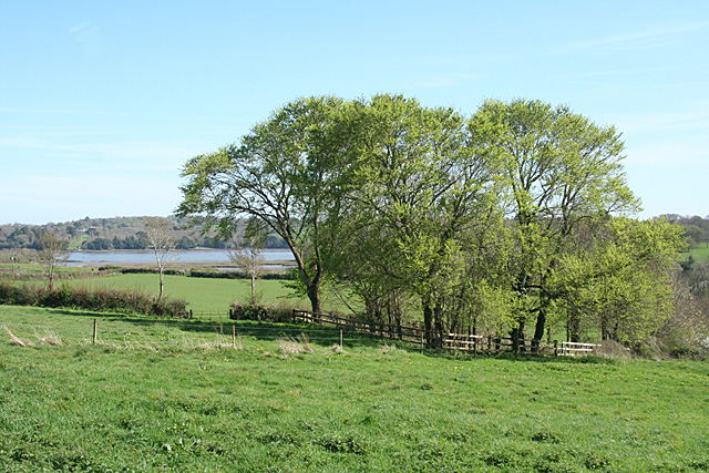
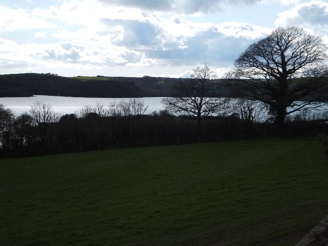
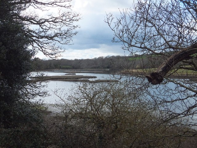
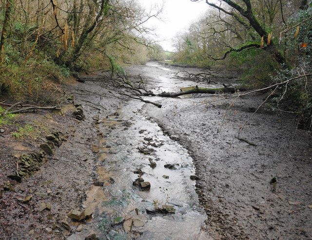
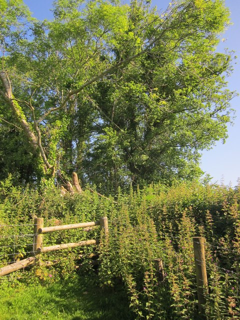
Middle Westdown Wood is a picturesque woodland located in Cornwall, England. It covers an area of approximately 100 acres and is known for its natural beauty and diverse range of flora and fauna. The wood is situated in a remote location, surrounded by rolling hills and countryside, providing a peaceful and tranquil environment for visitors.

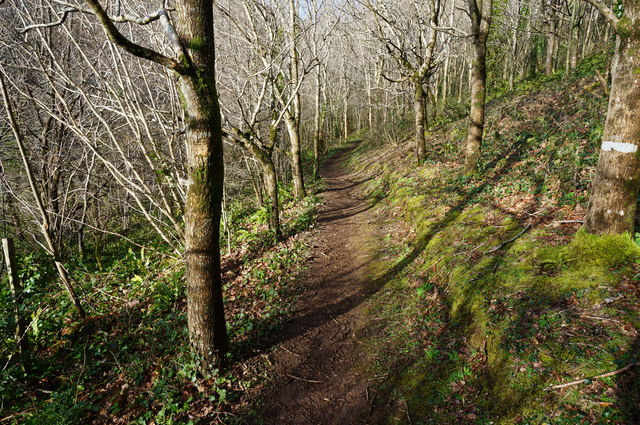
The woodland consists primarily of broadleaf trees such as oak, beech, and ash, which create a dense canopy and provide shade during the summer months. The forest floor is covered in a carpet of wildflowers, including bluebells, primroses, and wood anemones, adding bursts of color to the landscape.

Middle Westdown Wood is home to a variety of wildlife, including deer, badgers, foxes, and a wide range of bird species. Nature enthusiasts and bird watchers often visit the wood to observe and appreciate the diverse birdlife, which includes woodpeckers, owls, and various songbirds.

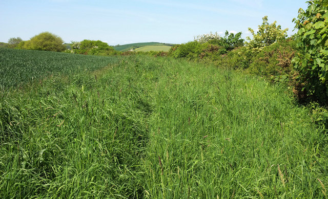
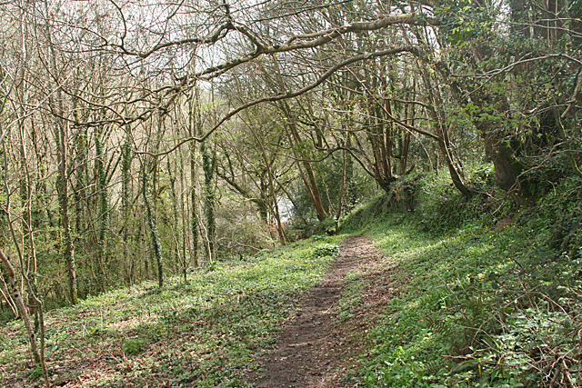
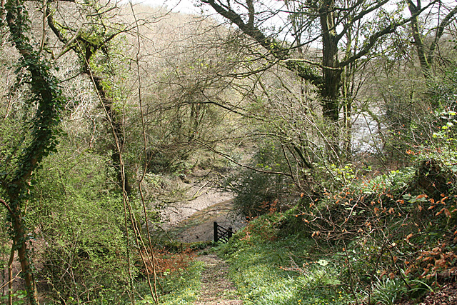
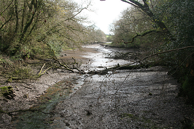
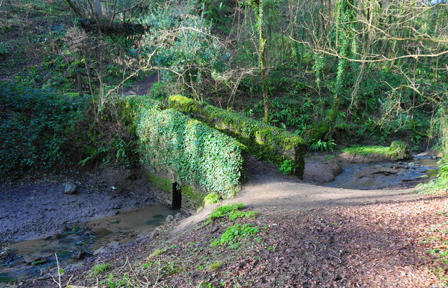
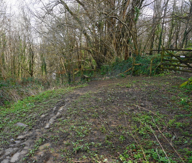
The wood is crisscrossed by a network of walking trails, allowing visitors to explore and immerse themselves in the natural surroundings. The trails lead through peaceful glades, alongside babbling brooks, and up to breathtaking viewpoints overlooking the countryside.

Middle Westdown Wood is managed by a local conservation group, ensuring the protection and preservation of its natural habitat. The wood is open to the public year-round, and visitors are encouraged to respect the environment and follow designated paths to minimize their impact on the delicate ecosystem.

Overall, Middle Westdown Wood is a hidden gem in Cornwall, offering a peaceful retreat for nature lovers and a chance to experience the beauty of an ancient woodland.

If you have any feedback on the listing, please let us know in the comments section below.

Middle Westdown Wood Images

Images are sourced within 2km of 50.384433/-4.2333542 or Grid Reference SX4156. Thanks to Geograph Open Source API. All images are credited.

Footbridge at Wivelscombe This bridge lies on the footpath between Shillingham and Wivelscombe, that runs along the top of Wivelscombe creek.
Footbridge at Wivelscombe
This bridge lies on the footpath between Shillingham and Wivelscombe, that runs along the top of Wivelscombe creek.
Field by the St Germans River A view from Abbotscourt Lane, looking towards and up the estuary also referred to as the Lynher River.
Field by the St Germans River
A view from Abbotscourt Lane, looking towards and up the estuary also referred to as the Lynher River.
Field by the St Germans River The estuary is just over the hedge on the right.
Field by the St Germans River
The estuary is just over the hedge on the right.
Field by the St Germans River A view from Abbotscourt Lane, looking down a track parallel to the tree-lined field boundary, with the St Germans River beyond.
Field by the St Germans River
A view from Abbotscourt Lane, looking down a track parallel to the tree-lined field boundary, with the St Germans River beyond.
Hedge by St Germans River A little further east than <a href="https://www.geograph.org.uk/photo/5782884">SX3955 : Field by the St Germans River</a>.
Hedge by St Germans River
A little further east than SX3955 : Field by the St Germans River.
Saltash: path from Elm Gate A public footpath leading to a creek, an arm of Wiveliscombe Lake. In Saltash parish
Saltash: path from Elm Gate
A public footpath leading to a creek, an arm of Wiveliscombe Lake. In Saltash parish
Saltash: nearing a creek Descending to an arm of Wiveliscombe Lake, in Saltash parish. Quite steep, but with steps cut in the public footpath
Saltash: nearing a creek
Descending to an arm of Wiveliscombe Lake, in Saltash parish. Quite steep, but with steps cut in the public footpath
Saltash: creek below railway An arm of Wiveliscombe Lake, by the edge of the Wiveliscombe estate. With the tide out
Saltash: creek below railway
An arm of Wiveliscombe Lake, by the edge of the Wiveliscombe estate. With the tide out
Saltash: bridge at head of creek Now used to carry a public footpath. The bridge stands at the normal tide limit, at the north west end of Wiveliscombe Lake, in Saltash parish
Saltash: bridge at head of creek
Now used to carry a public footpath. The bridge stands at the normal tide limit, at the north west end of Wiveliscombe Lake, in Saltash parish
Saltash: below Greeps Farm track crossing the route of the old Cornwall Railway, which was active between 1859 and 1908. The course of the railway is indicated by the line of trees running across the image. In Saltash parish
Saltash: below Greeps
Farm track crossing the route of the old Cornwall Railway, which was active between 1859 and 1908. The course of the railway is indicated by the line of trees running across the image. In Saltash parish
Saltash: towards the Lynher With trees in new leaf and the grounds of Antony House in the distance, on the far side of the Lynher estuary, well beyond the square. In Saltash parish
Saltash: towards the Lynher
With trees in new leaf and the grounds of Antony House in the distance, on the far side of the Lynher estuary, well beyond the square. In Saltash parish
St Germans River north of Antony from Ince Castle
Inlet north of Ince This inlet on the north, and the St Germans River on the south and east, create a peninsula over one kilometre long
Inlet north of Ince
This inlet on the north, and the St Germans River on the south and east, create a peninsula over one kilometre long
Path through young woodland The trees here are mostly young Oak and Beech.
Path through young woodland
The trees here are mostly young Oak and Beech.
Small footbridge Notice how small the exit for the stream is under the bridge, in times of heavy rain the stream comes over the bank on this side of the bridge. The bridge is in a small steep sided valley at the head of one arm of Wivelscombe Lake on the path between Shillingford Manor and Elm Gate.
Small footbridge
Notice how small the exit for the stream is under the bridge, in times of heavy rain the stream comes over the bank on this side of the bridge. The bridge is in a small steep sided valley at the head of one arm of Wivelscombe Lake on the path between Shillingford Manor and Elm Gate.
Footpath to near Shillingham Manor Seen here just entering woodland above Wivelscombe Lake. Through the gate on right is private.
Footpath to near Shillingham Manor
Seen here just entering woodland above Wivelscombe Lake. Through the gate on right is private.
Part of Wivelscombe Lake Taken from the small bridge in a previous photo by me, looking up one arm of the tidal Wivelscombe Lake.
Part of Wivelscombe Lake
Taken from the small bridge in a previous photo by me, looking up one arm of the tidal Wivelscombe Lake.
Dead end, Greeps My map has let me down. Or, rather, the line of footpath 636/28/4 has shifted to the other side of this field boundary since it was published. According to it, I should be able to follow the path here, but clearly I can't. Time to retrace my steps.
Dead end, Greeps
My map has let me down. Or, rather, the line of footpath 636/28/4 has shifted to the other side of this field boundary since it was published. According to it, I should be able to follow the path here, but clearly I can't. Time to retrace my steps.
Show me another place!

Middle Westdown Wood is located at Grid Ref: SX4156 (Lat: 50.384433, Lng: -4.2333542)

Unitary Authority: Cornwall

Police Authority: Devon and Cornwall

What 3 Words

///oxidation.ended.bulk. Near Saltash, Cornwall

Related Wikis

Antony Passage

Antony Passage is a hamlet in south-east Cornwall, England, UK. It stands beside the tidal section of the River Lynher (a tributary of the River Tamar...

Maryfield, Cornwall

Maryfield is a hamlet north of Torpoint and east of Antony House in southeast Cornwall, England. == References ==

A374 road

The A374 is a main road in the United Kingdom, one of six A-roads making the border crossing between Devon and Cornwall. It is the most southerly of the...

HMS Raleigh (shore establishment)

HMS Raleigh is a stone frigate (shore establishment), serving as the basic training facility of the Royal Navy at Torpoint, Cornwall, United Kingdom. It...

Related Videos

Walking tour, Thanckes Lake, Torpoint, Cornwall, UK

Thanckes Lake is a water feature in Torpoint, Cornwall.

A trip on the “old” but not “oldest”TORPOINT FERRY 1999

A trip on the “old” but not “oldest”TORPOINT FERRY 1999.

Into the place where Alice on wonderland was been directed # #nationaltrust #aliceinwonderland

Just a half hour away from plymouth , a bit journey by ferry National Trust - Antony Location - Ferry Ln, Torpoint PL11 2QA.

A Walk Around the Grounds of Antony House - Torpoint

At the time of this video being filmed the UK was on lockdown to try and stop the spread of the Covid-19 Corona Virus.

Nearby Amenities

Located within 500m of 50.384433,-4.2333542
Created By: almien_coastlines
Source: PGS
Lat/Long: 50.3888813/-4.2327053
Created By: almien_coastlines
Source: PGS
Lat/Long: 50.3887433/-4.2330459
Created By: almien_coastlines
Source: PGS
Lat/Long: 50.3888168/-4.233406
Created By: almien_coastlines
Source: PGS
Lat/Long: 50.3886201/-4.2335686
Created By: almien_coastlines
Source: PGS
Lat/Long: 50.3884266/-4.2336353
Created By: almien_coastlines
Source: PGS
Lat/Long: 50.3883433/-4.23389
Created By: almien_coastlines
Source: PGS
Lat/Long: 50.3881129/-4.2343129
Created By: almien_coastlines
Source: PGS
Lat/Long: 50.3878637/-4.234549
Created By: almien_coastlines
Source: PGS
Lat/Long: 50.3876866/-4.2351752
Created By: almien_coastlines
Source: PGS
Lat/Long: 50.3874125/-4.2354236
Created By: almien_coastlines
Source: PGS
Lat/Long: 50.386079/-4.2351227
Created By: almien_coastlines
Source: PGS
Lat/Long: 50.3849666/-4.2349077
Created By: almien_coastlines
Source: PGS
Lat/Long: 50.3847258/-4.2350113
Created By: almien_coastlines
Source: PGS
Lat/Long: 50.3837796/-4.2352659
Created By: almien_coastlines
Source: PGS
Lat/Long: 50.3836183/-4.2359842
Created By: almien_coastlines
Source: PGS
Lat/Long: 50.3835547/-4.2364093
Created By: almien_coastlines
Source: PGS
Lat/Long: 50.3833408/-4.2371516
Created By: almien_coastlines
Source: PGS
Lat/Long: 50.3829919/-4.2374435
Created By: almien_coastlines
Source: PGS
Lat/Long: 50.3826223/-4.2373766
Created By: almien_coastlines
Source: PGS
Lat/Long: 50.3823659/-4.2374857
Created By: almien_coastlines
Source: PGS
Lat/Long: 50.3818514/-4.2374561
Created By: almien_coastlines
Source: PGS
Lat/Long: 50.3817186/-4.2369074
Created By: almien_coastlines
Source: PGS
Lat/Long: 50.3814528/-4.2369697
Created By: almien_coastlines
Source: PGS
Lat/Long: 50.3814102/-4.2373638
Created By: almien_coastlines
Source: PGS
Lat/Long: 50.3812712/-4.238038
Horson Farm
Place: hamlet
Lat/Long: 50.3801069/-4.2318833
Antony House (NT)
Place: locality
Lat/Long: 50.3850807/-4.2269303
Cafe
Antony House (NT) Cafe
Lat/Long: 50.3852122/-4.2265836
Toilets
Access: customers
Male: yes
Lat/Long: 50.3849358/-4.2272348
Toilets
Access: customers
Female: yes
Lat/Long: 50.3849319/-4.2272251
The data included in this document is from www.openstreetmap.org. The data is made available under ODbL.

Have you been to Middle Westdown Wood?

Leave your review of Middle Westdown Wood below (or comments, questions and feedback).