Wilderness

Wood, Forest in Cornwall

England

Wilderness

Footbridge at Wivelscombe This bridge lies on the footpath between Shillingham and Wivelscombe, that runs along the top of Wivelscombe creek.
Footbridge at Wivelscombe Credit: Kevin Hale

Wilderness, Cornwall, also known as Wood or Forest, is a stunning natural area located in the southwestern region of England. Stretching across approximately 15 square miles, this wilderness is a haven for nature enthusiasts and outdoor adventurers alike.

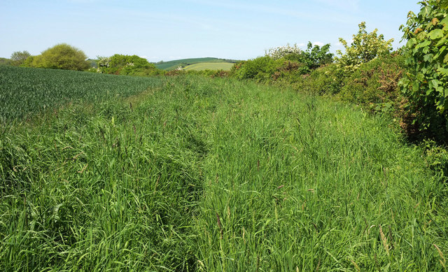
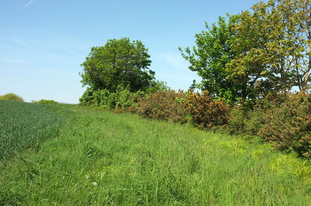
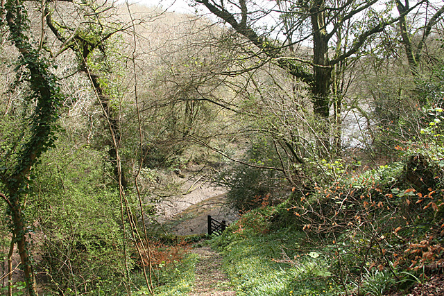
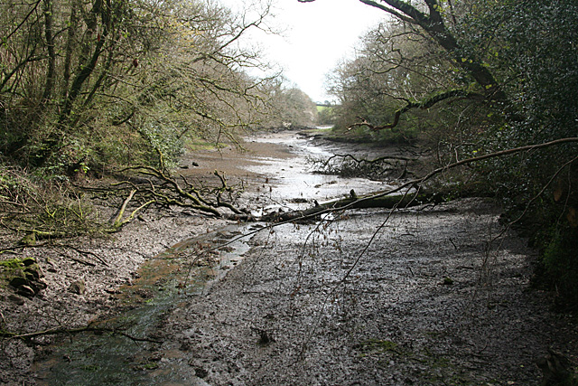
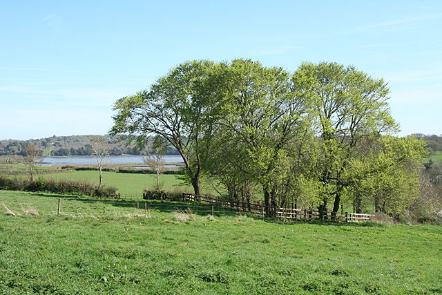
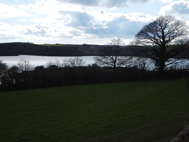
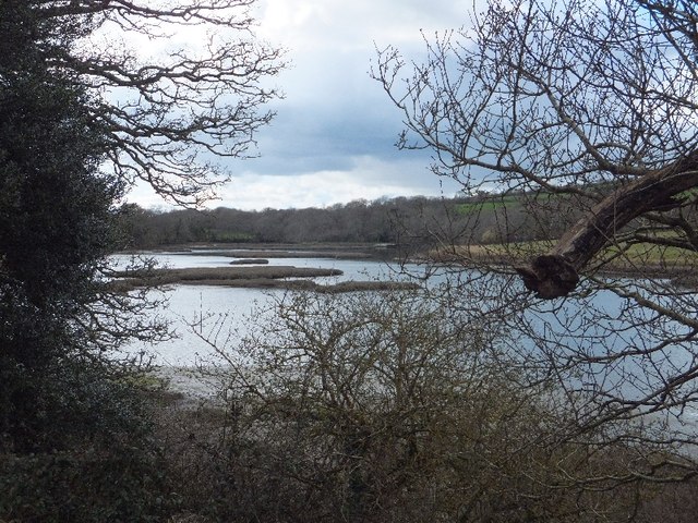
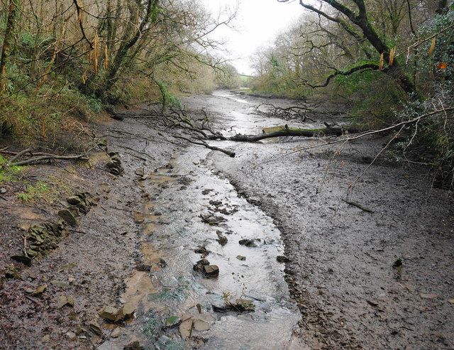
The landscape of Wilderness, Cornwall is characterized by its dense woodlands, rolling hills, and meandering rivers. The area is inhabited by an array of wildlife, including deer, foxes, badgers, and a variety of bird species, making it a popular spot for birdwatching and wildlife photography.

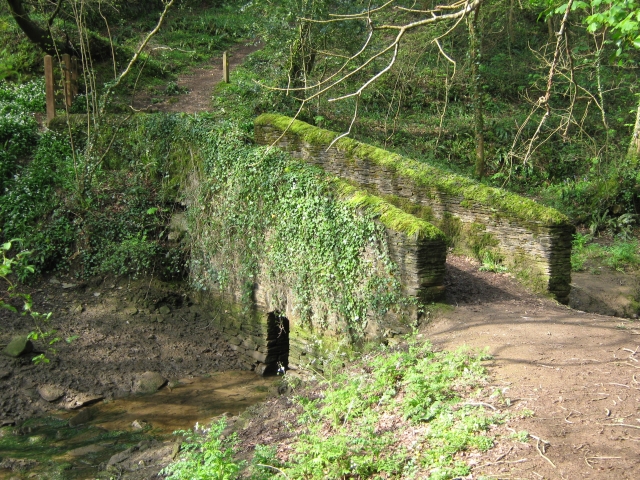
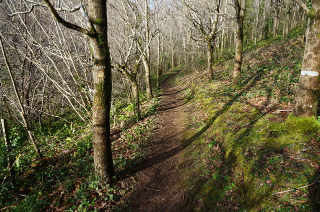
One of the key features of this wilderness is its ancient woodland, which is home to a diverse range of tree species, including oak, beech, ash, and chestnut trees. The woodlands are carpeted with vibrant wildflowers during the spring and summer months, creating a picturesque scene.

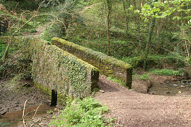
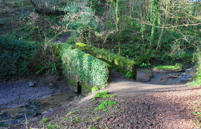
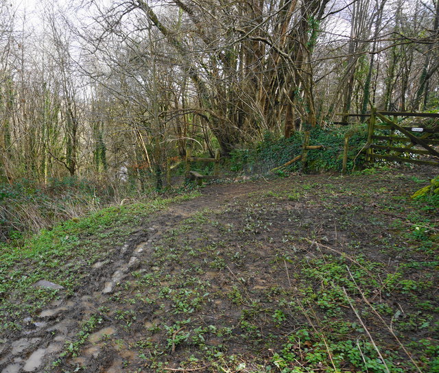
For those seeking outdoor activities, Wilderness, Cornwall offers numerous hiking and walking trails that wind through the woodlands and provide breathtaking views of the surrounding countryside. The area is also crisscrossed with streams and rivers, making it an ideal spot for fishing and canoeing.

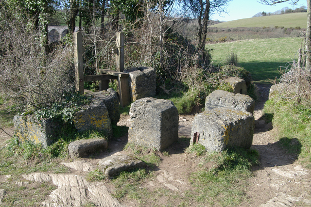
Wilderness, Cornwall is not only a natural gem but also holds historical significance. The woodlands are dotted with remnants of ancient settlements and archaeological sites, showcasing the area's rich cultural heritage.

With its enchanting beauty and abundant recreational opportunities, Wilderness, Cornwall is a must-visit destination for nature lovers and those seeking a tranquil escape from the hustle and bustle of everyday life.

If you have any feedback on the listing, please let us know in the comments section below.
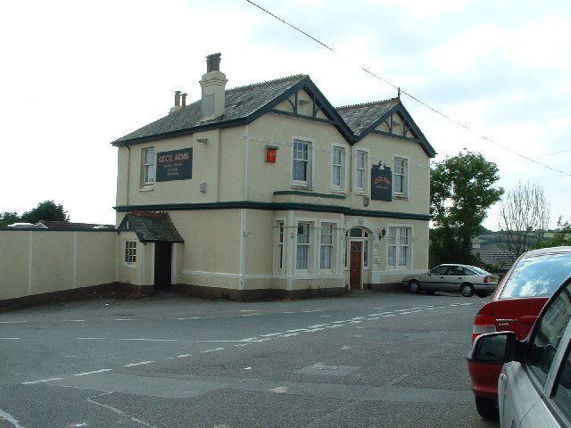
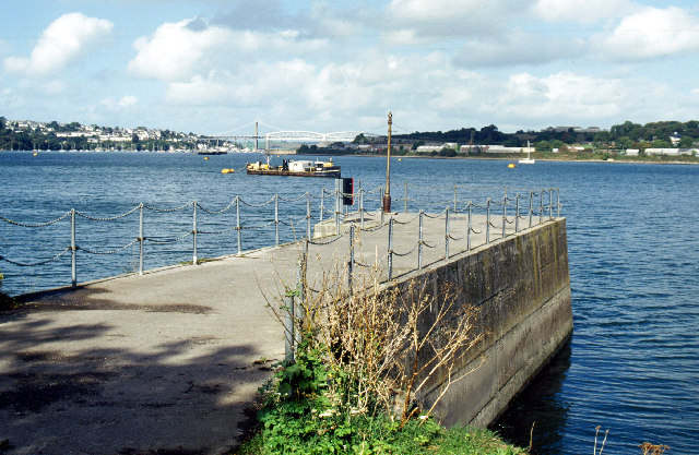
Wilderness Images

Images are sourced within 2km of 50.386967/-4.2311239 or Grid Reference SX4156. Thanks to Geograph Open Source API. All images are credited.

Footbridge at Wivelscombe This bridge lies on the footpath between Shillingham and Wivelscombe, that runs along the top of Wivelscombe creek.
Footbridge at Wivelscombe
This bridge lies on the footpath between Shillingham and Wivelscombe, that runs along the top of Wivelscombe creek.
Field by the St Germans River The estuary is just over the hedge on the right.
Field by the St Germans River
The estuary is just over the hedge on the right.
Hedge by St Germans River A little further east than <a href="https://www.geograph.org.uk/photo/5782884">SX3955 : Field by the St Germans River</a>.
Hedge by St Germans River
A little further east than SX3955 : Field by the St Germans River.
Saltash: nearing a creek Descending to an arm of Wiveliscombe Lake, in Saltash parish. Quite steep, but with steps cut in the public footpath
Saltash: nearing a creek
Descending to an arm of Wiveliscombe Lake, in Saltash parish. Quite steep, but with steps cut in the public footpath
Saltash: creek below railway An arm of Wiveliscombe Lake, by the edge of the Wiveliscombe estate. With the tide out
Saltash: creek below railway
An arm of Wiveliscombe Lake, by the edge of the Wiveliscombe estate. With the tide out
Saltash: bridge at head of creek Now used to carry a public footpath. The bridge stands at the normal tide limit, at the north west end of Wiveliscombe Lake, in Saltash parish
Saltash: bridge at head of creek
Now used to carry a public footpath. The bridge stands at the normal tide limit, at the north west end of Wiveliscombe Lake, in Saltash parish
Saltash: towards the Lynher With trees in new leaf and the grounds of Antony House in the distance, on the far side of the Lynher estuary, well beyond the square. In Saltash parish
Saltash: towards the Lynher
With trees in new leaf and the grounds of Antony House in the distance, on the far side of the Lynher estuary, well beyond the square. In Saltash parish
St Germans River north of Antony from Ince Castle
Inlet north of Ince This inlet on the north, and the St Germans River on the south and east, create a peninsula over one kilometre long
Inlet north of Ince
This inlet on the north, and the St Germans River on the south and east, create a peninsula over one kilometre long
Path through young woodland The trees here are mostly young Oak and Beech.
Path through young woodland
The trees here are mostly young Oak and Beech.
Small footbridge Notice how small the exit for the stream is under the bridge, in times of heavy rain the stream comes over the bank on this side of the bridge. The bridge is in a small steep sided valley at the head of one arm of Wivelscombe Lake on the path between Shillingford Manor and Elm Gate.
Small footbridge
Notice how small the exit for the stream is under the bridge, in times of heavy rain the stream comes over the bank on this side of the bridge. The bridge is in a small steep sided valley at the head of one arm of Wivelscombe Lake on the path between Shillingford Manor and Elm Gate.
Footpath to near Shillingham Manor Seen here just entering woodland above Wivelscombe Lake. Through the gate on right is private.
Footpath to near Shillingham Manor
Seen here just entering woodland above Wivelscombe Lake. Through the gate on right is private.
Part of Wivelscombe Lake Taken from the small bridge in a previous photo by me, looking up one arm of the tidal Wivelscombe Lake.
Part of Wivelscombe Lake
Taken from the small bridge in a previous photo by me, looking up one arm of the tidal Wivelscombe Lake.
Barrage Balloon Mountings World War 2 Concrete Barrage Balloon Mountings, Point Field, Wearde, Saltash. The site now forms part of the Churchtown Farm Nature Reserve.
Barrage Balloon Mountings
World War 2 Concrete Barrage Balloon Mountings, Point Field, Wearde, Saltash. The site now forms part of the Churchtown Farm Nature Reserve.
St Stephen's Church, Saltash St Stephen's Church, Saltash, Cornwall.
St Stephen's Church, Saltash
St Stephen's Church, Saltash, Cornwall.
Trematon Castle, Trematon, Saltash Trematon Castle, Trematon, Saltash, Cornwall, viewed from the West. This is a Norman castle of the Motte & Bailey design.
Trematon Castle, Trematon, Saltash
Trematon Castle, Trematon, Saltash, Cornwall, viewed from the West. This is a Norman castle of the Motte & Bailey design.
Cecil Arms, St Stephens, Saltash Cecil Arms, St Stephens, Saltash, Cornwall. Built circa 1904, replacing a previous Cecil Arms close to the same site.
Cecil Arms, St Stephens, Saltash
Cecil Arms, St Stephens, Saltash, Cornwall. Built circa 1904, replacing a previous Cecil Arms close to the same site.
Jetty at Wilcove Looking across the Hamoaze with the Tamar rail and road bridges in the distance.
Jetty at Wilcove
Looking across the Hamoaze with the Tamar rail and road bridges in the distance.
Show me another place!

Wilderness is located at Grid Ref: SX4156 (Lat: 50.386967, Lng: -4.2311239)

Unitary Authority: Cornwall

Police Authority: Devon and Cornwall

What 3 Words

///breezes.servicing.manliness. Near Saltash, Cornwall

Related Wikis

Antony Passage

Antony Passage is a hamlet in south-east Cornwall, England, UK. It stands beside the tidal section of the River Lynher (a tributary of the River Tamar...

Maryfield, Cornwall

Maryfield is a hamlet north of Torpoint and east of Antony House in southeast Cornwall, England. == References ==

Churchtown Farm

Churchtown Farm is a community nature reserve one mile south of Saltash, Cornwall, England. It is leased from Antony Estate and managed by Cornwall Wildlife...
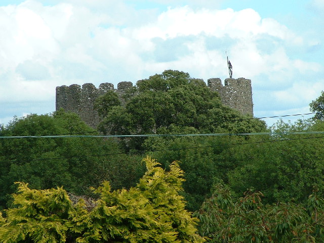
Trematon Castle

Trematon Castle (Cornish: Kastel Tremen) is situated near Saltash in Cornwall, England, United Kingdom. It was the caput of the feudal barony of Trematon...

Nearby Amenities

Located within 500m of 50.386967,-4.2311239
Created By: almien_coastlines
Source: PGS
Lat/Long: 50.3895224/-4.2254443
Created By: almien_coastlines
Source: PGS
Lat/Long: 50.3892624/-4.2266555
Created By: almien_coastlines
Source: PGS
Lat/Long: 50.3893934/-4.2270141
Created By: almien_coastlines
Source: PGS
Lat/Long: 50.3894006/-4.2279538
Created By: almien_coastlines
Source: PGS
Lat/Long: 50.3896331/-4.2286381
Source: PGS
Lat/Long: 50.3899032/-4.229231
Source: PGS
Lat/Long: 50.3902504/-4.2300816
Source: PGS
Lat/Long: 50.3905254/-4.2302673
Created By: almien_coastlines
Source: PGS
Lat/Long: 50.3902496/-4.23133
Created By: almien_coastlines
Source: PGS
Lat/Long: 50.3898631/-4.2319973
Created By: almien_coastlines
Source: PGS
Lat/Long: 50.3888813/-4.2327053
Created By: almien_coastlines
Source: PGS
Lat/Long: 50.3887433/-4.2330459
Created By: almien_coastlines
Source: PGS
Lat/Long: 50.3888168/-4.233406
Created By: almien_coastlines
Source: PGS
Lat/Long: 50.3886201/-4.2335686
Created By: almien_coastlines
Source: PGS
Lat/Long: 50.3884266/-4.2336353
Created By: almien_coastlines
Source: PGS
Lat/Long: 50.3883433/-4.23389
Created By: almien_coastlines
Source: PGS
Lat/Long: 50.3881129/-4.2343129
Created By: almien_coastlines
Source: PGS
Lat/Long: 50.3878637/-4.234549
Created By: almien_coastlines
Source: PGS
Lat/Long: 50.3876866/-4.2351752
Created By: almien_coastlines
Source: PGS
Lat/Long: 50.3874125/-4.2354236
Created By: almien_coastlines
Source: PGS
Lat/Long: 50.386079/-4.2351227
Created By: almien_coastlines
Source: PGS
Lat/Long: 50.3849666/-4.2349077
Created By: almien_coastlines
Source: PGS
Lat/Long: 50.3847258/-4.2350113
Created By: almien_coastlines
Source: PGS
Lat/Long: 50.3837796/-4.2352659
Antony House (NT)
Place: locality
Lat/Long: 50.3850807/-4.2269303
Cafe
Antony House (NT) Cafe
Lat/Long: 50.3852122/-4.2265836
Toilets
Access: customers
Male: yes
Lat/Long: 50.3849358/-4.2272348
Toilets
Access: customers
Female: yes
Lat/Long: 50.3849319/-4.2272251
The data included in this document is from www.openstreetmap.org. The data is made available under ODbL.

Have you been to Wilderness?

Leave your review of Wilderness below (or comments, questions and feedback).