Chelmondiston

Settlement in Suffolk Babergh

England

Chelmondiston

Farmland north of Brick Kiln Lane
Farmland north of Brick Kiln Lane Credit: Robin Webster

Chelmondiston is a charming village located in the county of Suffolk, England. Situated on the Shotley Peninsula, it is approximately 8 miles south of the town of Ipswich. With a population of around 1,200 residents, Chelmondiston offers a peaceful and picturesque setting for its inhabitants.

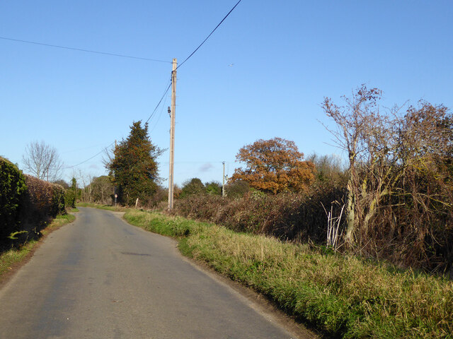
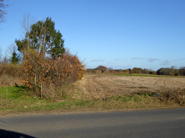
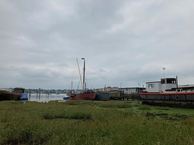
The village is well-known for its beautiful natural surroundings, with the River Orwell flowing nearby, providing scenic views and opportunities for outdoor activities. The area is also characterized by rolling countryside, lush green fields, and woodland, making it an ideal destination for nature enthusiasts.

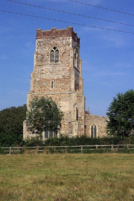
Chelmondiston has a rich history, with evidence of human habitation dating back to the Roman period. The village boasts several historic buildings, including the 12th-century St. Andrew's Church, which is a notable architectural landmark. The church is known for its impressive stained glass windows and intricate stone carvings.

Despite its small size, Chelmondiston offers a range of amenities for its residents. These include a local primary school, a village hall, a post office, and a convenience store, ensuring that the basic needs of the community are met. Additionally, the village has a pub, The Butt and Oyster, which is renowned for its traditional British cuisine and scenic riverside location.

Chelmondiston benefits from its proximity to Ipswich, which provides additional amenities, employment opportunities, and transportation links. The village is well-connected by road, with the A137 running through it, making it easily accessible for visitors and commuters alike.

Overall, Chelmondiston is a small yet vibrant village, offering a peaceful rural lifestyle amidst stunning natural landscapes and a strong sense of community.

If you have any feedback on the listing, please let us know in the comments section below.

Chelmondiston Images

Images are sourced within 2km of 51.989171/1.209019 or Grid Reference TM2037. Thanks to Geograph Open Source API. All images are credited.

Farmland north of Brick Kiln Lane
Lovers Lane North of Harkstead Hall.
Lovers Lane
North of Harkstead Hall.
Power lines crossing above Lings Lane They look like 11 kV and 33 kV lines.
Power lines crossing above Lings Lane
They look like 11 kV and 33 kV lines.
Field east of Lings Lane
Power lines crossing above Lings Lane They look like 11 kV and 33 kV lines.
Power lines crossing above Lings Lane
They look like 11 kV and 33 kV lines.
Footpath leaving Lings Lane It follows the near side of the sparse hedge.
Footpath leaving Lings Lane
It follows the near side of the sparse hedge.
Field north of Lings Lane
Footpath leaving Lings Lane
Lings Lane, Chelmondiston Heading north.
Lings Lane, Chelmondiston
Heading north.
B1456 Main Road, Chelmondiston
Field north of B1456
Wrecks on the foreshore at Pin Mill Compare with <a href="https://www.geograph.org.uk/photo/5917649">TM2138 : Wrecks near Pin Mill</a> taken in 2018
Wrecks on the foreshore at Pin Mill
Compare with TM2138 : Wrecks near Pin Mill taken in 2018
Houseboats and barge "Melissa" at Pin Mill "Melissa" is a steel hulled Thames Barge built by J.G. Fay at Southampton 1899: <span class="nowrap"><a title="https://thamesbarge.org.uk/boats/melissa/" rel="nofollow ugc noopener" href="https://thamesbarge.org.uk/boats/melissa/">Link</a><img style="margin-left:2px;" alt="External link" title="External link - shift click to open in new window" src="https://s1.geograph.org.uk/img/external.png" width="10" height="10"/></span>
Houseboats and barge "Melissa" at Pin Mill
"Melissa" is a steel hulled Thames Barge built by J.G. Fay at Southampton 1899: LinkExternal link
Harry King's boatyard, Pin Mill
View towards Butterman's Bay
St. Mary, Harkstead
St. Mary, Harkstead
A long drive Woolverstone Hall Woolverstone Suffolk.Now a school. More info see <span class="nowrap"><a title="http://en.wikipedia.org/wiki/Woolverstone_Hall" rel="nofollow ugc noopener" href="http://en.wikipedia.org/wiki/Woolverstone_Hall">Link</a><img style="margin-left:2px;" alt="External link" title="External link - shift click to open in new window" src="https://s1.geograph.org.uk/img/external.png" width="10" height="10"/></span>
A long drive
Woolverstone Hall Woolverstone Suffolk.Now a school. More info see LinkExternal link
The lodge at the entrance to Woolverstone Park
Show me another place!

Chelmondiston is located at Grid Ref: TM2037 (Lat: 51.989171, Lng: 1.209019)

Administrative County: Suffolk

District: Babergh

Police Authority: Suffolk

What 3 Words

///shall.regulator.protects. Near Holbrook, Suffolk

Related Wikis

Chelmondiston

Chelmondiston is a small village and civil parish in Suffolk, England located on the Shotley Peninsula, five miles south-east of Ipswich. The hamlet of...

Pin Mill

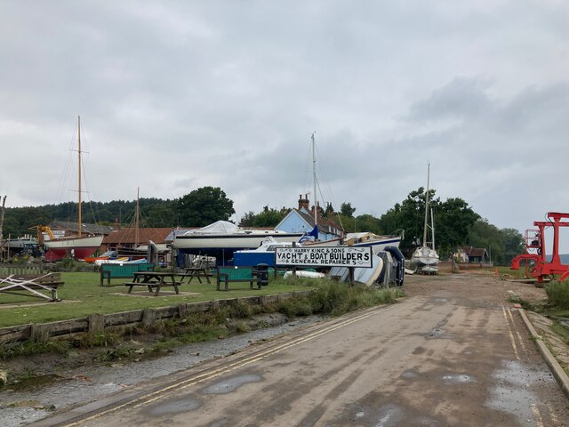
Pin Mill is a hamlet on the south bank of the tidal River Orwell, on the outskirts of the village of Chelmondiston, on the Shotley peninsula in southern...

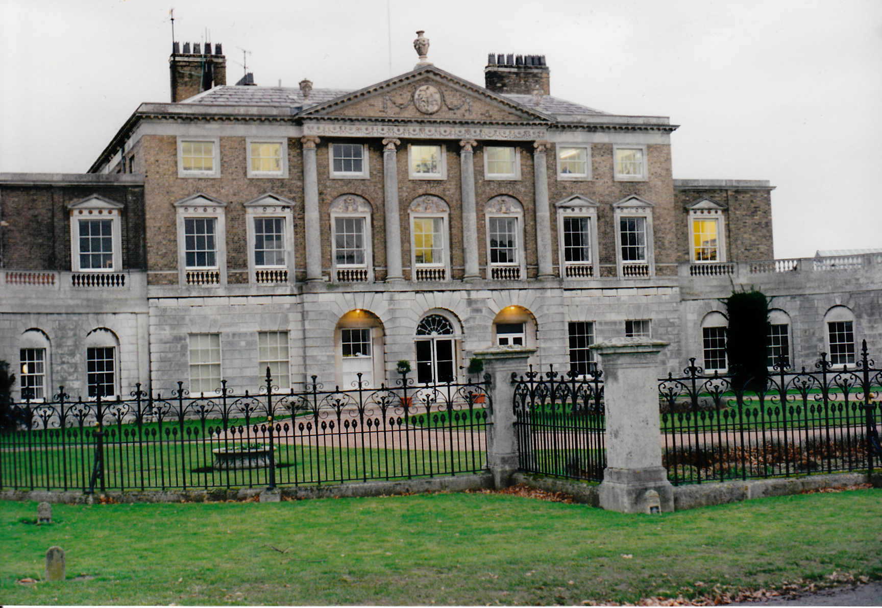
Woolverstone Hall School

In the early 1950s the London County Council obtained use of Woolverstone Hall near Ipswich, Suffolk, and some 50 acres (200,000 m2) of adjoining land...

Ipswich High School, Suffolk

Ipswich High School is a co-educational private school at Woolverstone Hall near Ipswich, England. Formerly an exclusive school for girls, it was converted...

Nearby Amenities

Located within 500m of 51.989171,1.209019
Chelmondiston
Place: village
Wikidata: Q2158011
Wikipedia: en:Chelmondiston
Lat/Long: 51.989904/1.2087457
Bus Stop
Hill Farm Lane
Bus: yes
Local Ref: adj
Naptan AtcoCode: 390010025
Naptan Bearing: E
Naptan CommonName: Hill Farm Lane
Naptan Landmark: Hill Farm Lane
Naptan NaptanCode: sufadamj
Naptan Street: Main Road
Naptan Verified: no
Public Transport: platform
Source: naptan_import
Lat/Long: 51.9893452/1.2132044
Hill Farm Lane
Local Ref: opp
Naptan AtcoCode: 390010026
Naptan Bearing: W
Naptan BusStopType: CUS
Naptan CommonName: Hill Farm Lane
Naptan Landmark: Hill Farm Lane
Naptan NaptanCode: sufadamp
Naptan Street: Main Road
Naptan Verified: no
Source: naptan_import
Lat/Long: 51.9892999/1.2132158
Bus Stop
Forresters Arms
Bus: yes
Local Ref: adj
Naptan AtcoCode: 390010027
Naptan Bearing: E
Naptan CommonName: Forresters Arms
Naptan Landmark: Forresters Arms
Naptan NaptanCode: sufadamt
Naptan Street: Main Road
Naptan Verified: no
Public Transport: platform
Source: naptan_import
Lat/Long: 51.9894062/1.2113003
Bus Stop
Forresters Arms
Bus: yes
Local Ref: opp
Naptan AtcoCode: 390010028
Naptan Bearing: W
Naptan CommonName: Forresters Arms
Naptan Landmark: Forresters Arms
Naptan NaptanCode: sufadamw
Naptan Street: Main Road
Naptan Verified: no
Public Transport: platform
Source: naptan_import
Lat/Long: 51.9892813/1.2112622
Bus Stop
Red Lion
Alt Name: The Lion
Bus: yes
Local Ref: opp
Naptan AltCommonName: The Lion
Naptan AtcoCode: 390010029
Naptan Bearing: E
Naptan CommonName: Red Lion
Naptan Landmark: Red Lion
Naptan NaptanCode: sufadapa
Naptan Street: Main Road
Naptan Verified: no
Public Transport: platform
Shelter: yes
Source: naptan_import
Lat/Long: 51.9893008/1.2085685
Bus Stop
Red Lion
Alt Name: The Lion
Bus: yes
Local Ref: adj
Naptan AltCommonName: The Lion
Naptan AtcoCode: 390010030
Naptan Bearing: W
Naptan CommonName: Red Lion
Naptan Landmark: Red Lion
Naptan NaptanCode: sufadapd
Naptan Street: Main Road
Naptan Verified: no
Public Transport: platform
Source: naptan_import
Lat/Long: 51.9891644/1.2086082
Bus Stop
Woodlands
Bus: yes
Local Ref: adj
Naptan AtcoCode: 390010031
Naptan Bearing: E
Naptan CommonName: Woodlands
Naptan Landmark: Woodlands
Naptan NaptanCode: sufadapg
Naptan Street: B1456
Naptan Verified: no
Public Transport: platform
Source: naptan_import
Lat/Long: 51.9897645/1.2047555
Bus Stop
Woodlands
Bus: yes
Local Ref: opp
Naptan AtcoCode: 390010032
Naptan Bearing: W
Naptan CommonName: Woodlands
Naptan Landmark: Woodlands
Naptan NaptanCode: sufadapj
Naptan Street: B1456
Naptan Verified: no
Public Transport: platform
Source: naptan_import
Lat/Long: 51.9896318/1.2046732
Place Of Worship
Chelmondiston Methodist Church
Denomination: methodist
Religion: christian
Lat/Long: 51.989027/1.2097955
Power: pole
Lat/Long: 51.9885612/1.2083954
Power: pole
Lat/Long: 51.987429/1.2081555
Power: pole
Lat/Long: 51.9871333/1.2064362
Power: pole
Lat/Long: 51.9862397/1.2047235
Power: pole
Lat/Long: 51.9863784/1.206227
Power: pole
Lat/Long: 51.9878568/1.2024558
Power: pole
Lat/Long: 51.9873629/1.2051219
Power: pole
Lat/Long: 51.9880385/1.2082735
Power: pole
Lat/Long: 51.9868194/1.2104005
Power: pole
Lat/Long: 51.9865138/1.2076485
Power: pole
Lat/Long: 51.9866667/1.2090796
Power: pole
Lat/Long: 51.987604/1.2038505
Power: pole
Lat/Long: 51.9868954/1.2078416
Power: pole
Lat/Long: 51.9866477/1.2090781
Power: pole
Lat/Long: 51.9869771/1.2116881
Power: pole
Lat/Long: 51.9872802/1.2143542
Power: pole
Lat/Long: 51.9881904/1.2147163
Power: pole
Lat/Long: 51.9873199/1.2143729
Hollingsworth's Butchers & Grocers
Shop: butcher
Lat/Long: 51.9893929/1.2090866
Pub
The Red Lion
Addr City: Ipswich
Addr Postcode: IP9 1DX
Addr Street: Main Road
Addr Village: Chelmondiston
Fhrs Id: 649175
Phone: +44 1473780400
Source Addr: FSA Food Hygiene Ratings Database
Website: https://www.redlionchelmondiston.co.uk/
Lat/Long: 51.9890578/1.2087566
Power: pole
Lat/Long: 51.9872703/1.2142662
Post Box
Operator: Royal Mail
Operator Type: private
Operator Wikidata: Q638098
Post Box Design: type_k
Post Box Type: pillar
Ref: IP9 1186
Royal Cypher: EIIR
Royal Cypher Wikidata: Q33102113
Lat/Long: 51.9892697/1.2083893
Historic: memorial
Memorial: war_memorial
Lat/Long: 51.9893062/1.2080636
Defibrillator
Defibrillator Location: On outside of building facing road, to right of memorial
Emergency: defibrillator
Ref GB The Circuit: 86D92A65-24B4-46BD-A382-AEF800B41083
Lat/Long: 51.9893137/1.2081097
The data included in this document is from www.openstreetmap.org. The data is made available under ODbL.

Have you been to Chelmondiston?

Leave your review of Chelmondiston below (or comments, questions and feedback).